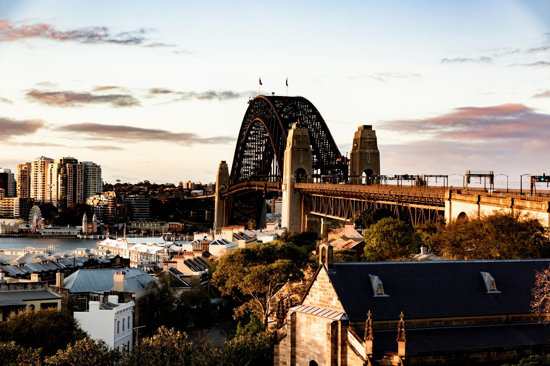
The Rocks to the Opera House: The Town Sydney Kept Trying to Knock Down
4.44·10 Stops·120 minutes·3.7 km
The Rocks is where Sydney began, and for most of the twentieth century the city kept trying to clear it away: plague resumptions, the Harbour Bridge, an expressway and a plan for office towers. Ten stops round Sydney Cove, from Cadmans Cottage, under the Harbour Bridge, up Observatory Hill, through the Argyle Cut and the lanes where residents and builders' labourers made their stand in October 1973, to the Opera House, which Queen Elizabeth II opened four days before police cleared their protest on Playfair Street. Your pace, your order, no group and no schedule.
Start · Cadmans Cottage: The House That Lost Its Harbour
DirectionsStops
- 1
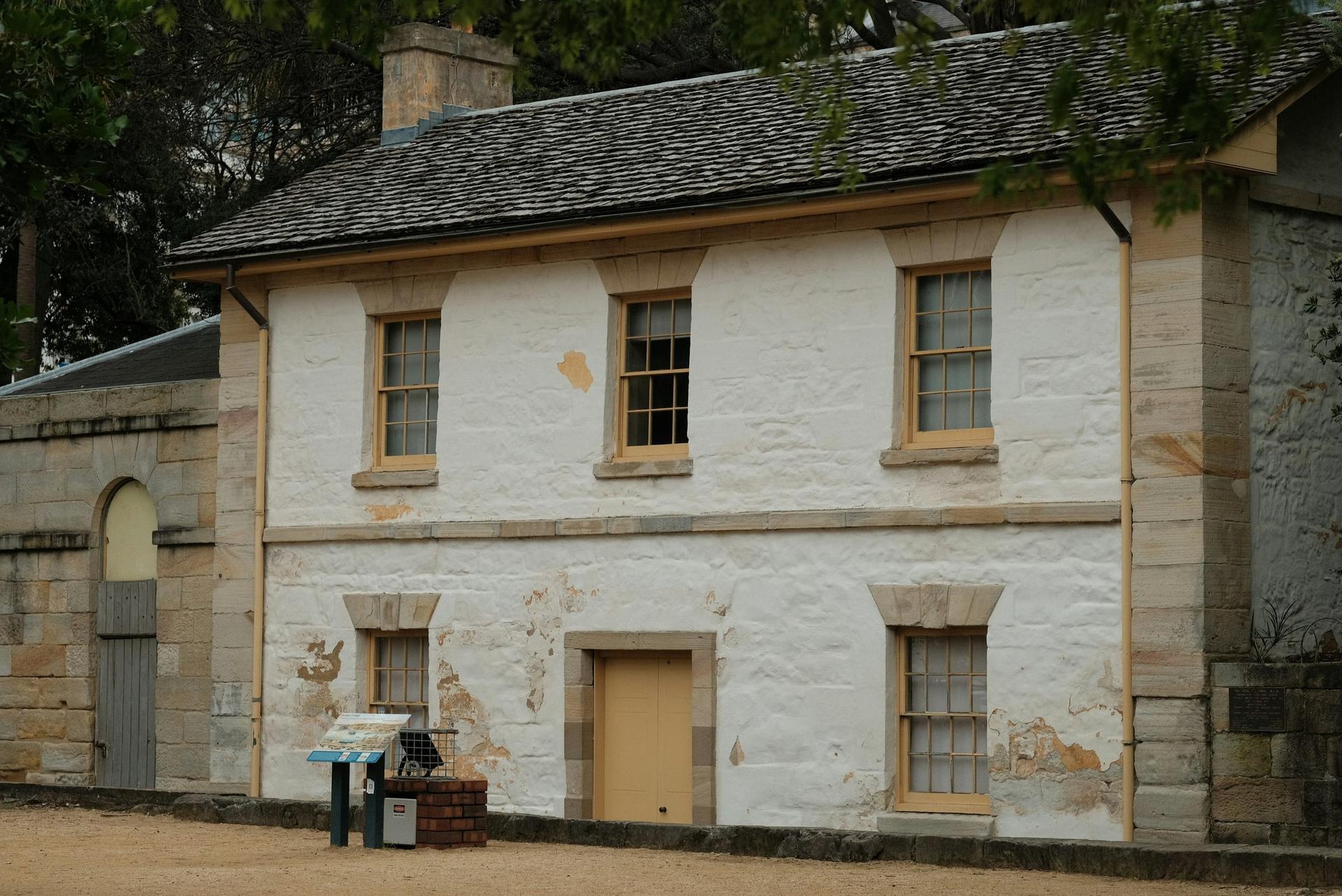
Cadmans Cottage: The House That Lost Its Harbour
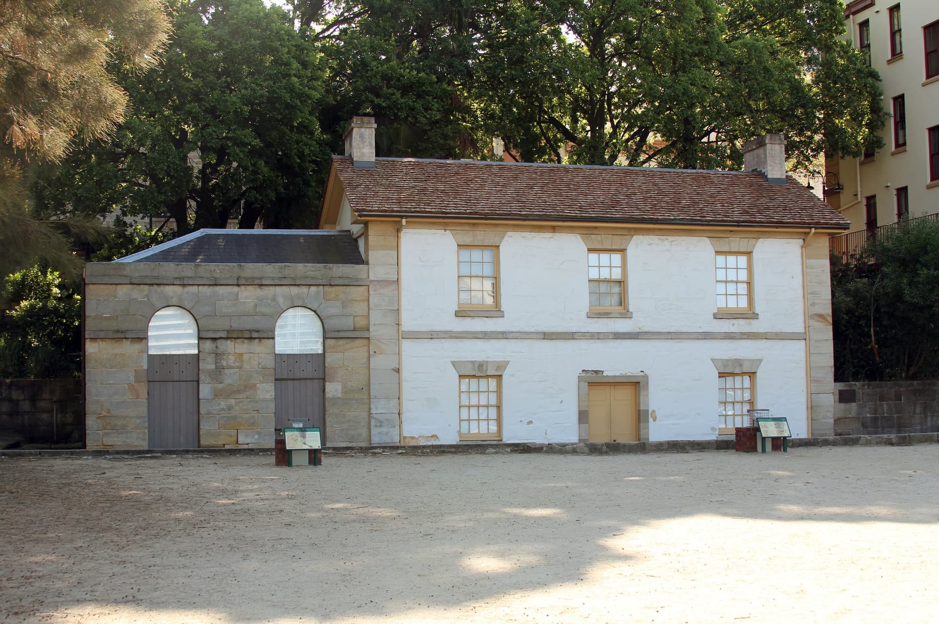
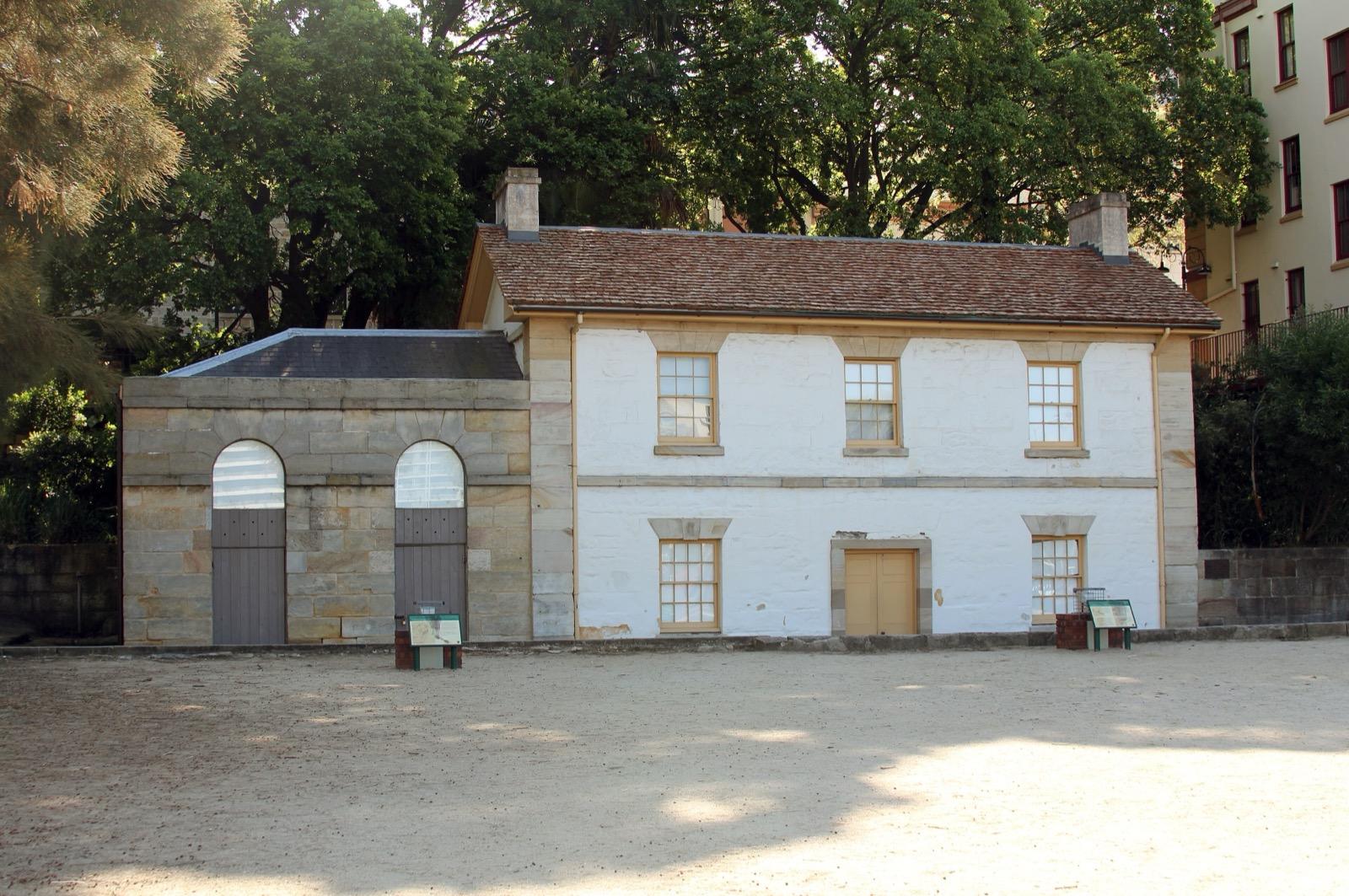
The cottage that once stood on the water's edge. Built about 1816 for the government boat crews on the west shore of Warrane, Sydney Cove, it now stands some 100 m from the water, since the foreshore in front of it was filled in.
- 2
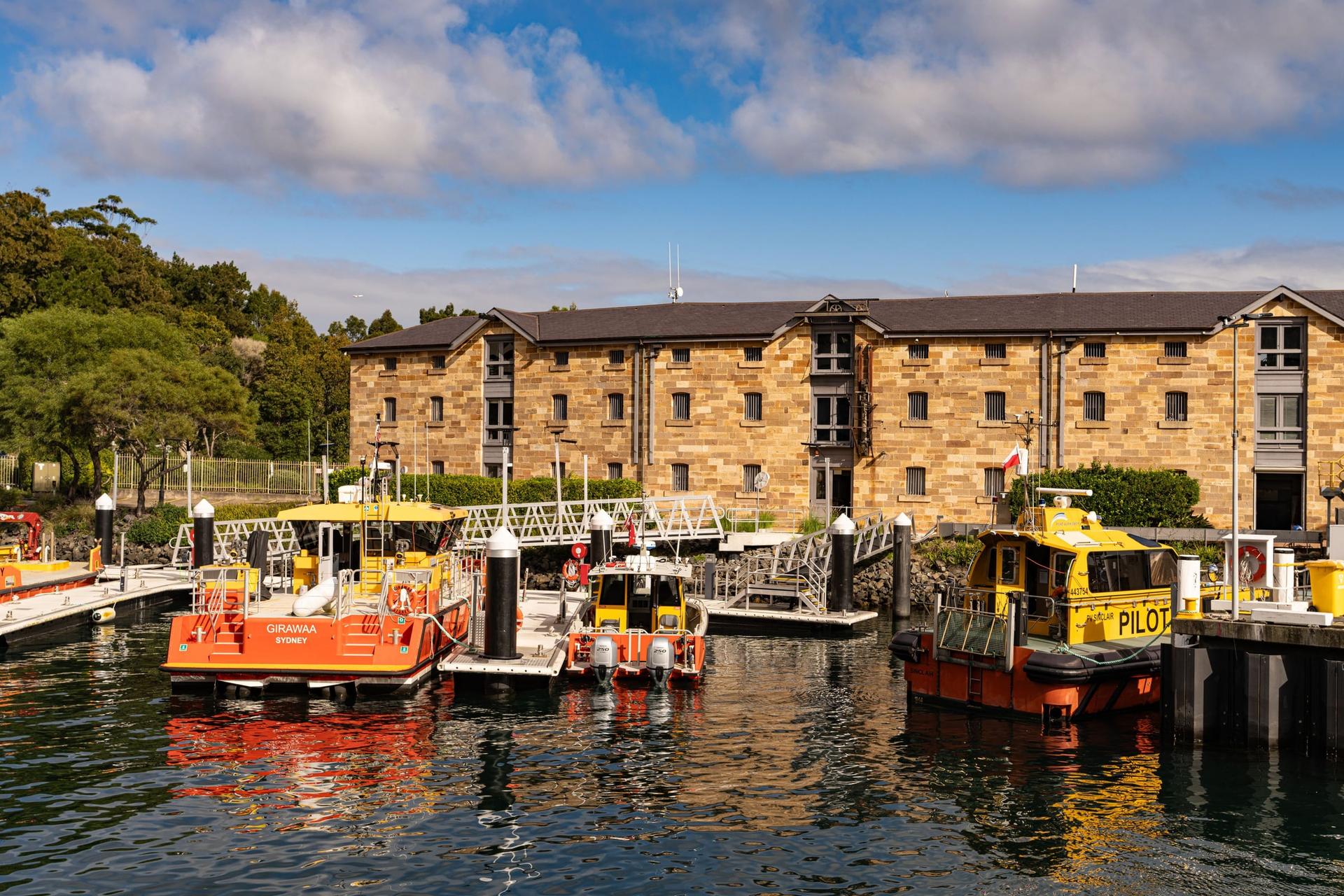
Campbells Cove: The Merchant's Stores He Never Saw
Sandstone and brick warehouses on the cove's west shore. Campbell's Stores carry the name of the merchant Robert Campbell, though his son built them in the 1850s gold rush; across the water, the first clear view of the Opera House.
- 3
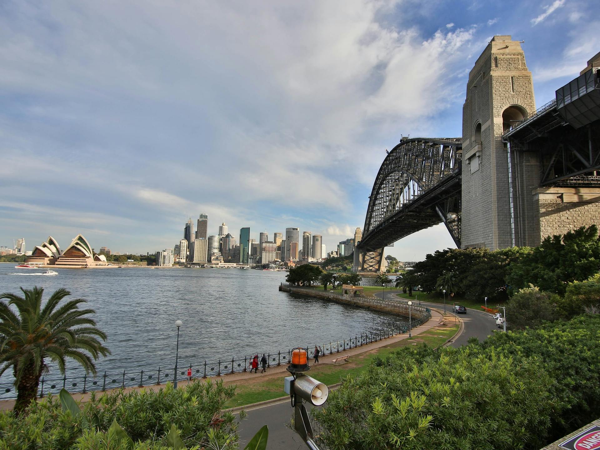
Dawes Point: Where a Language Was Written Down
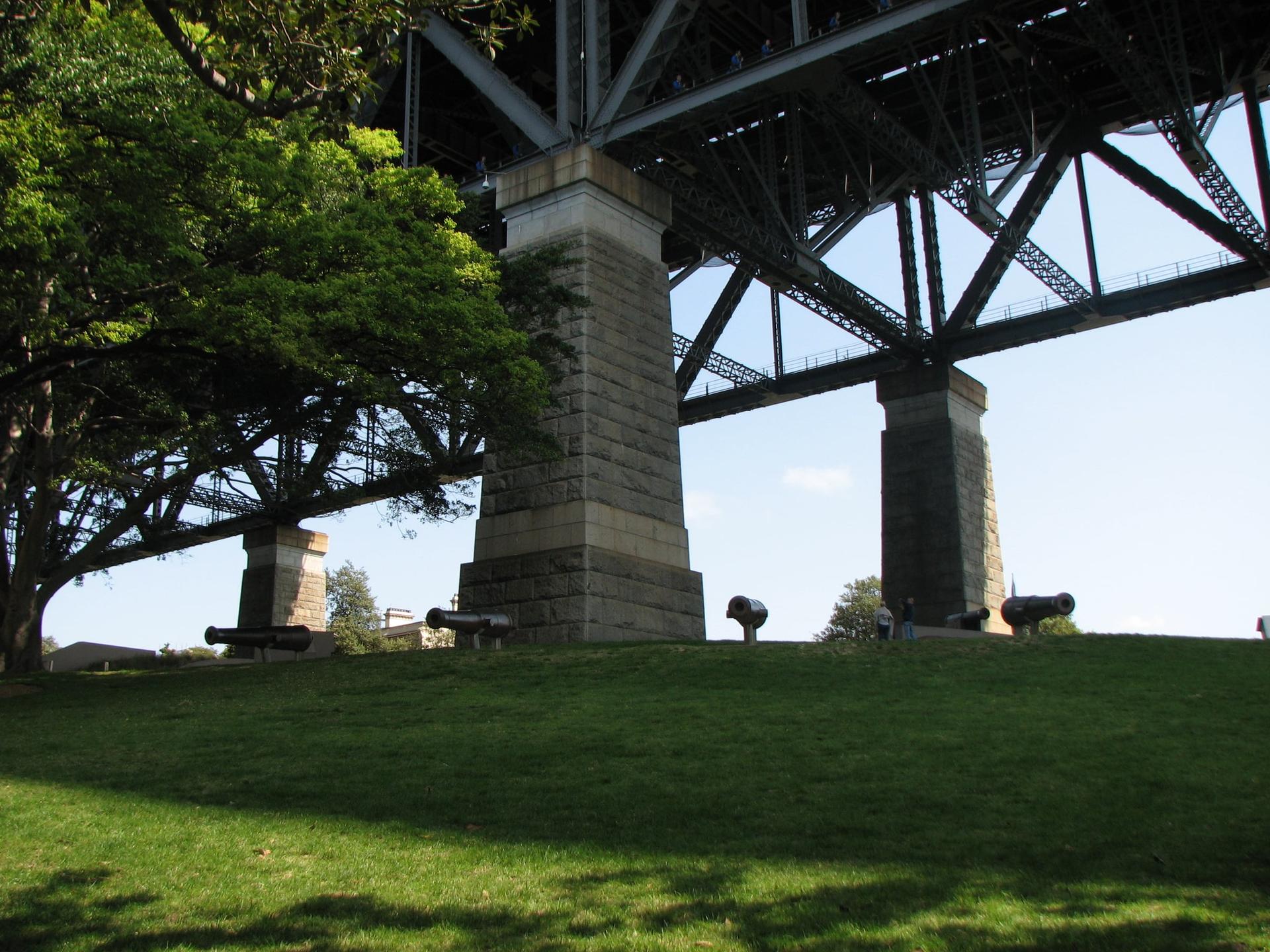
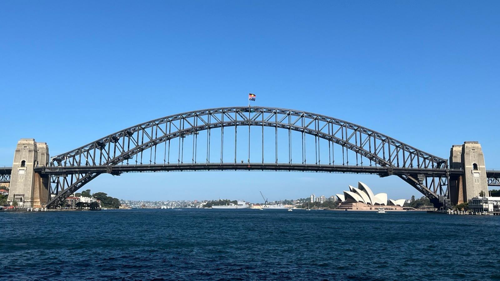
The old battery point under the Harbour Bridge. Tar-ra, where William Dawes, taught mainly by a young woman, Patyegarang, wrote down the Sydney language in 1790 and 1791.
- 4
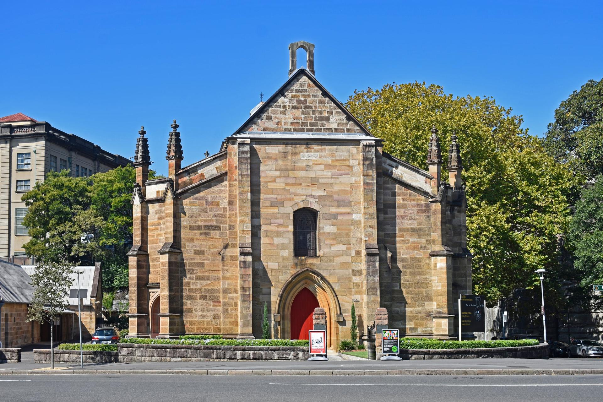
Argyle Place: The Village That Worked the Wharves
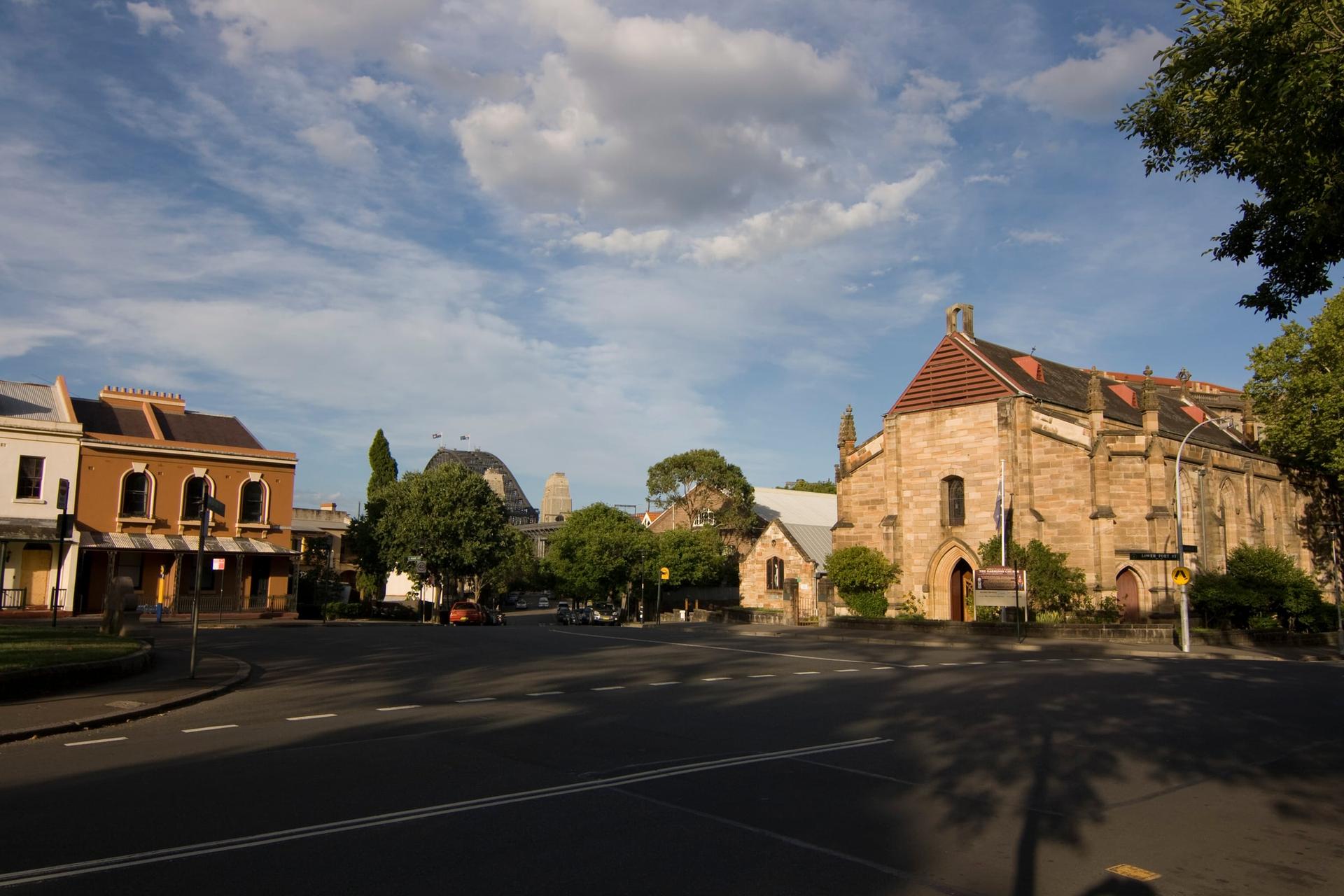
An unfinished church on a village green. Holy Trinity, the Garrison Church, faces Argyle Place, the square of the old maritime quarter of Millers Point, where the state became the landlord after 1900.
- 5
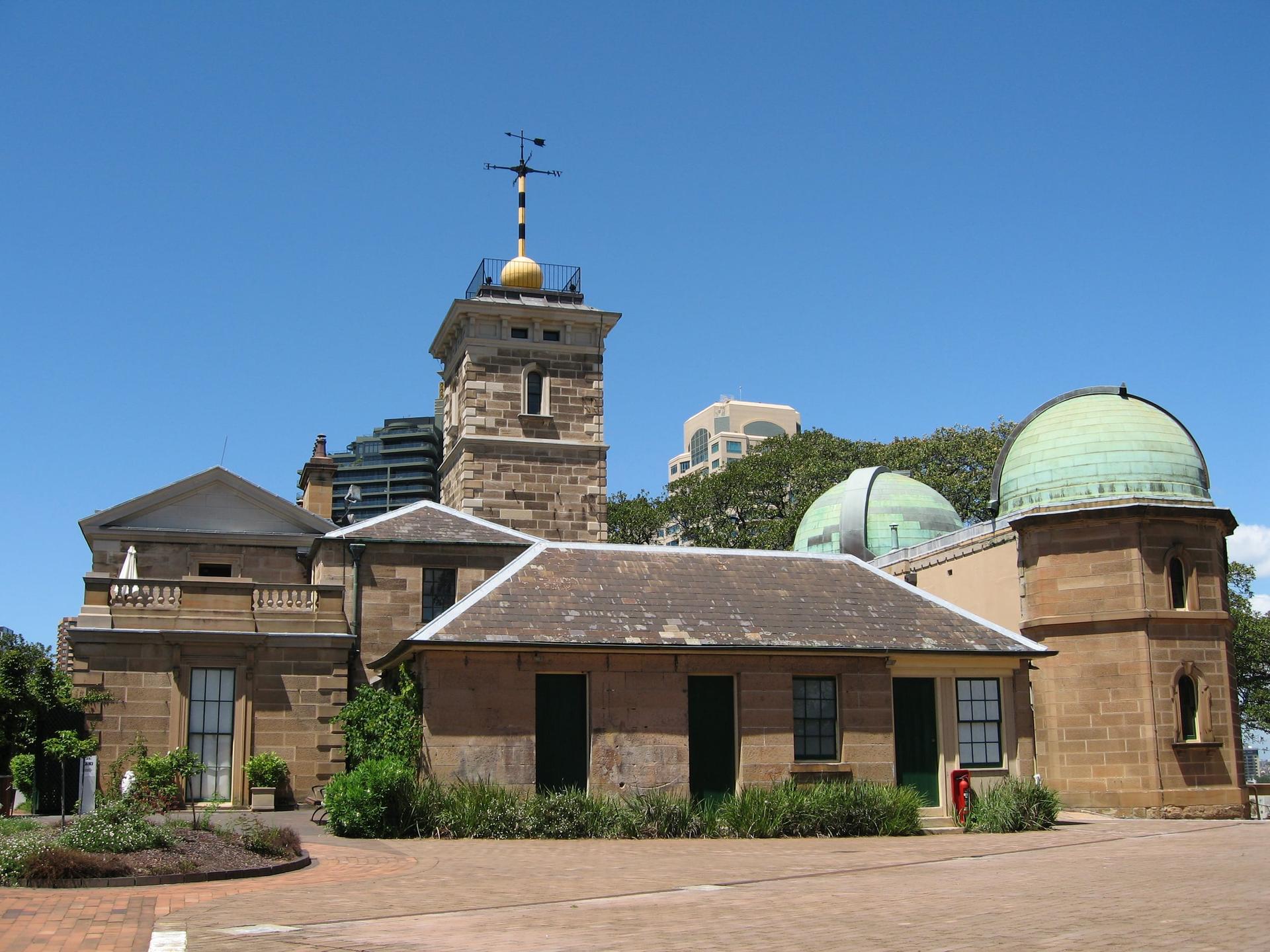
Observatory Hill: Where Sydney Kept Its Time
The high ground where Sydney once kept its time. A windmill, an unfinished fort and an 1850s observatory with its time-ball tower, above a wide view of the harbour and the bridge.
- 6
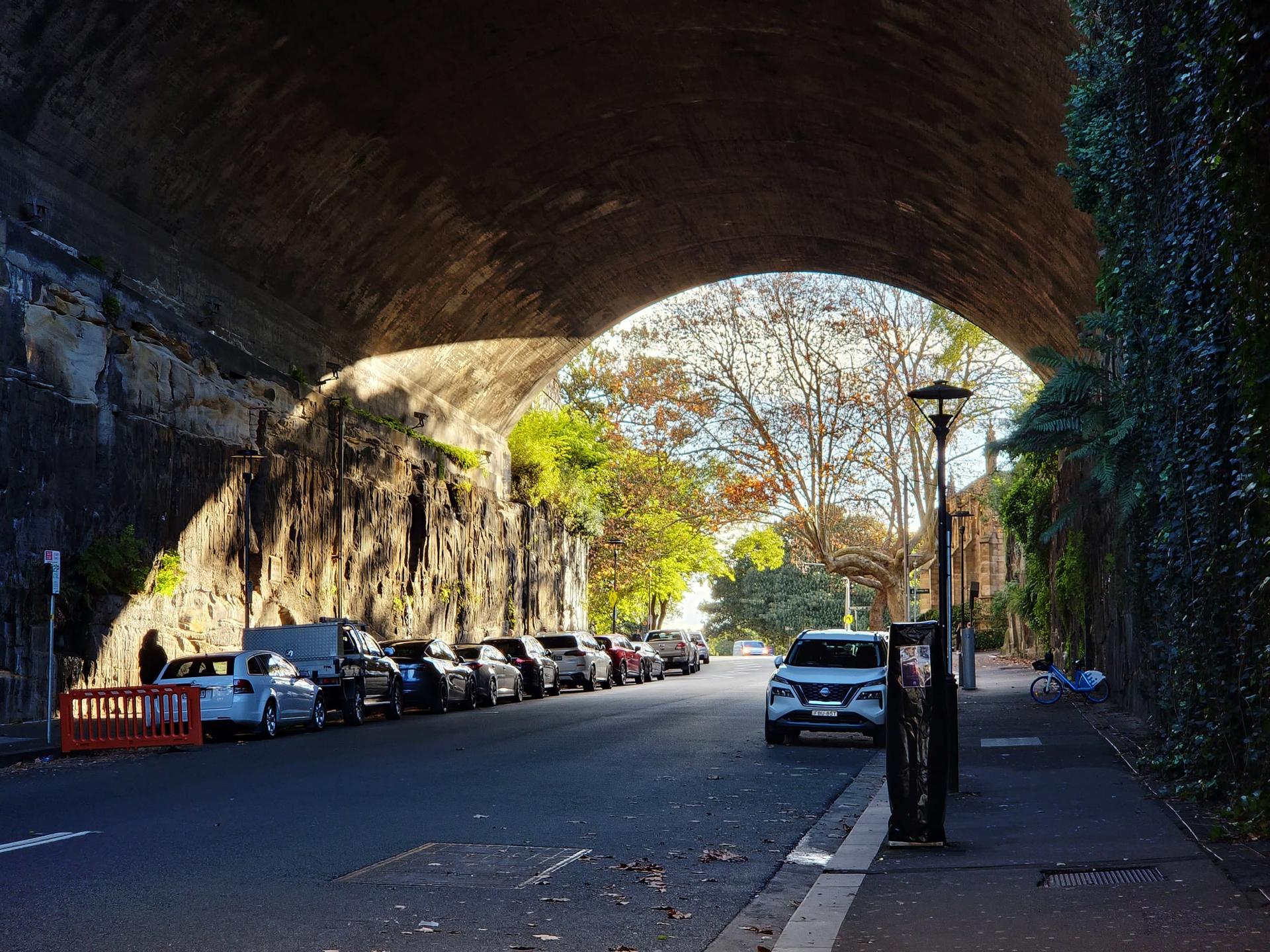
The Argyle Cut: A Street Carved Through the Ridge
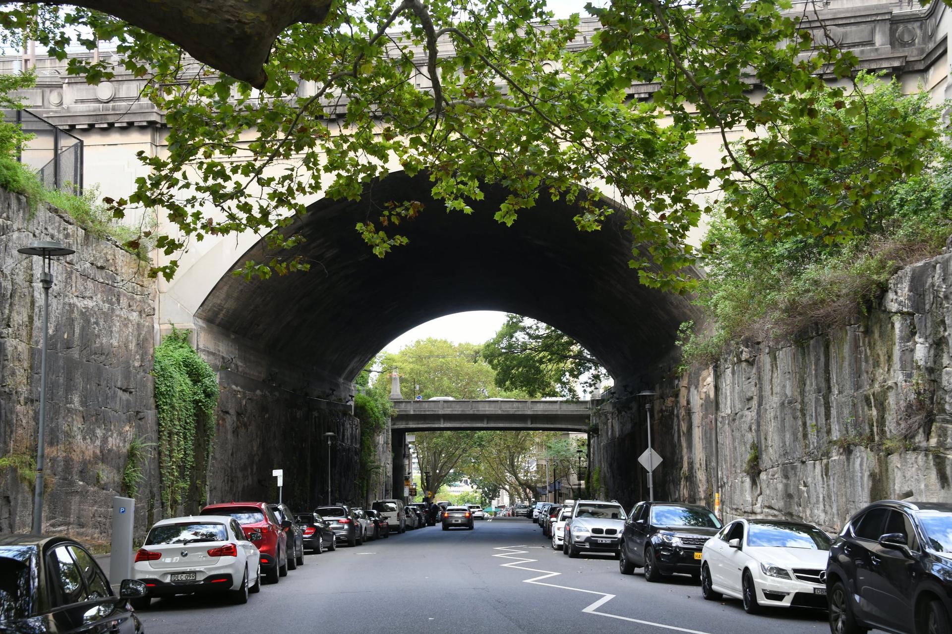
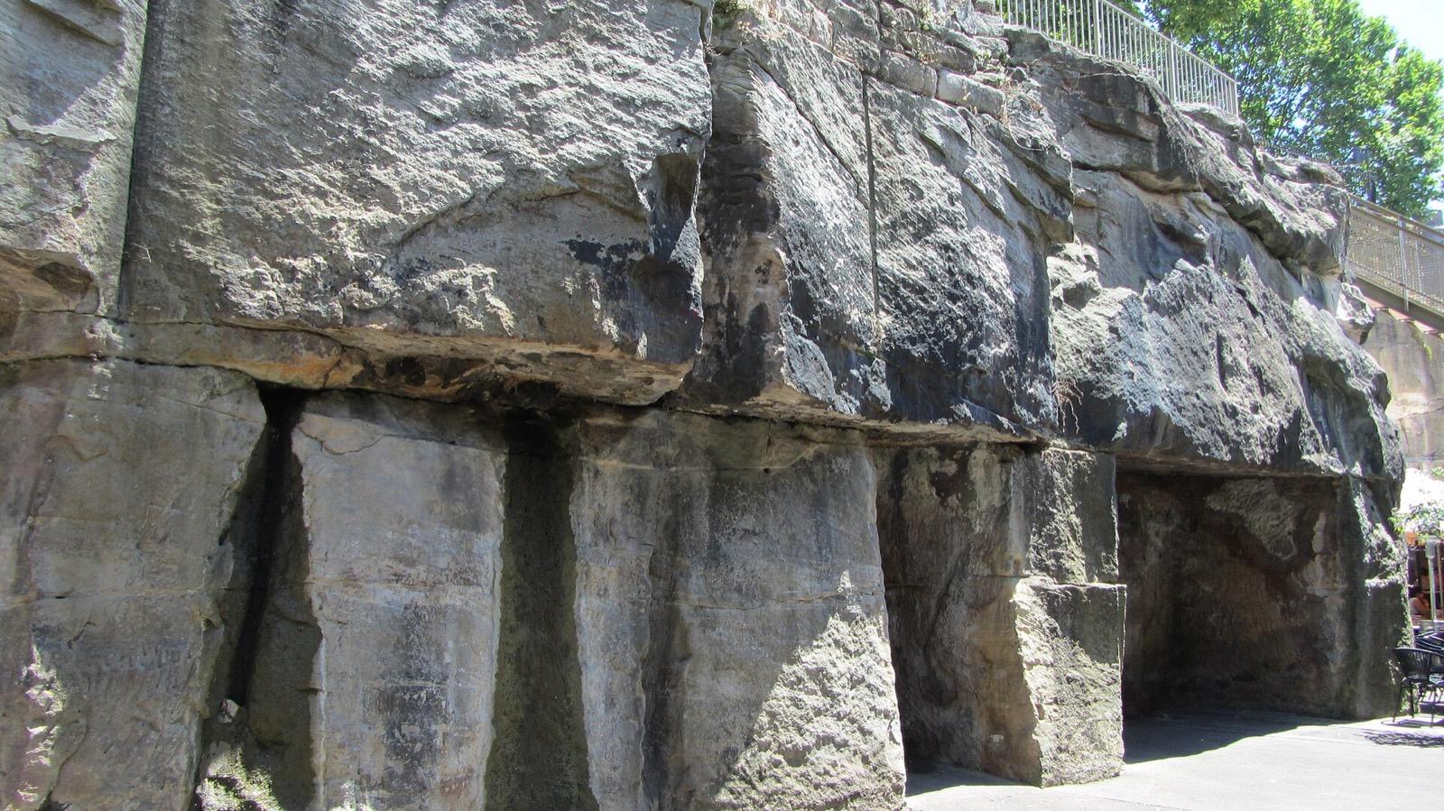
A street dug through a sandstone ridge by hand. Begun by convict chain gangs in the early 1840s and finished by the city council in 1859, reportedly with explosives.
- 7
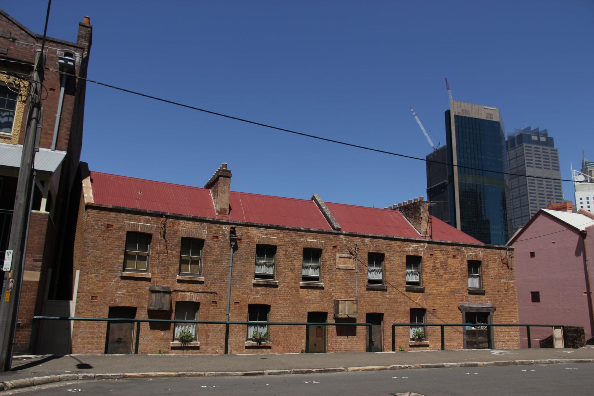
Susannah Place: Four Houses That Outlasted Every Plan
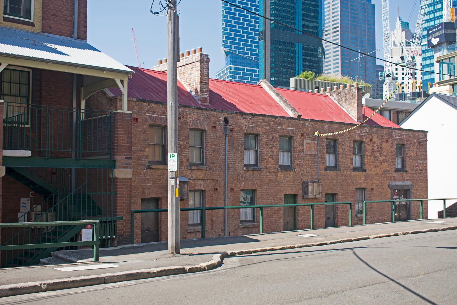
Four houses that survived every plan to clear them. A brick terrace of 1844 with its corner shop, home to more than 100 working families until 1990, now a museum that conserves rather than restores.
- 8
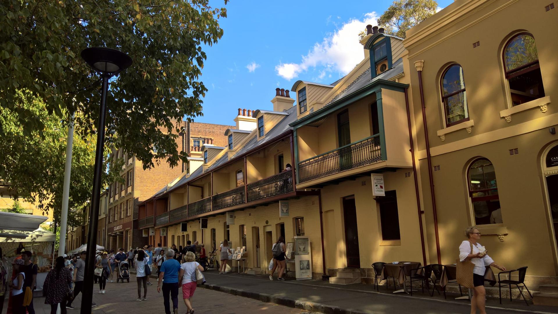
Playfair Street: Where The Rocks Fought Back
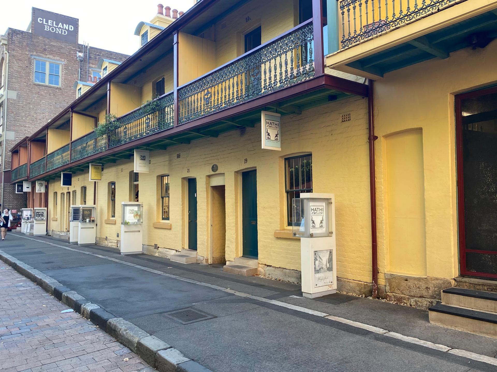
Where residents and builders' labourers made their stand in 1973. On 24 October that year police cleared a green-banned demolition site on this street, and the fight saved The Rocks from a plan for towers.
- 9
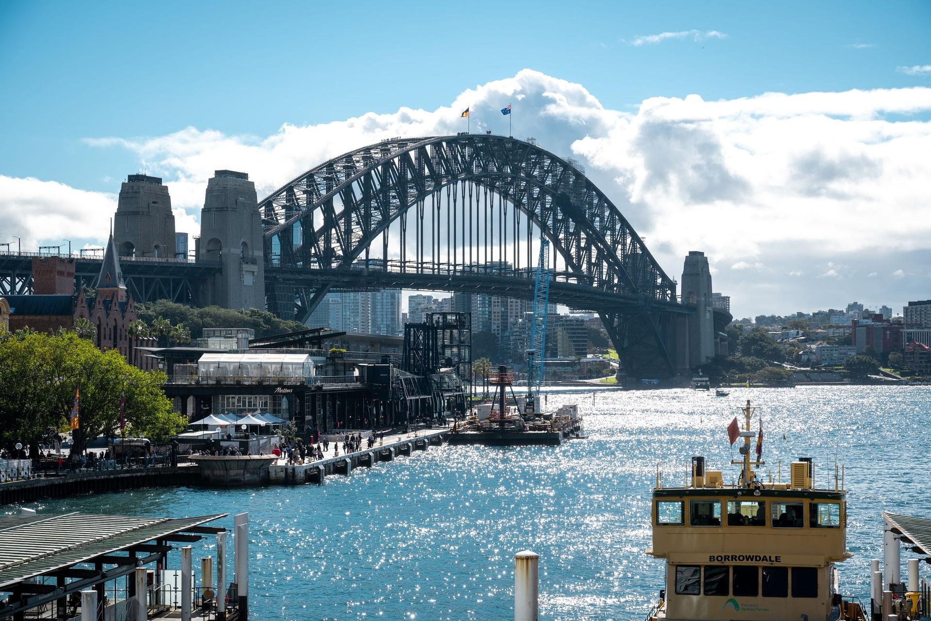
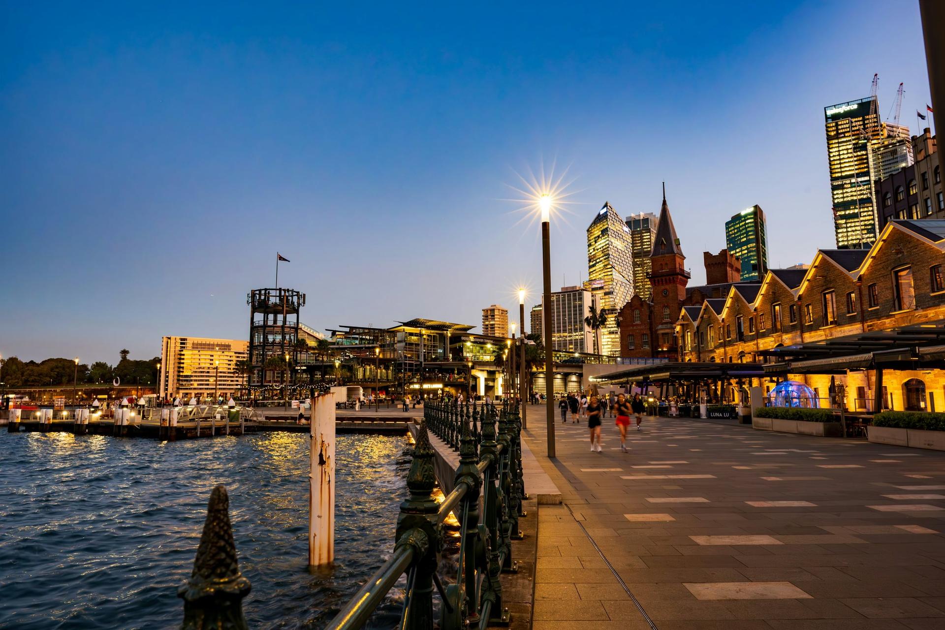
Circular Quay: A Convict Quay on a Mudflat
The convict-built quay at the head of the cove. Where the Tank Stream, the colony's first water supply, met the harbour, and where the ferries now come and go in the shadow of the Cahill Expressway.
- 10
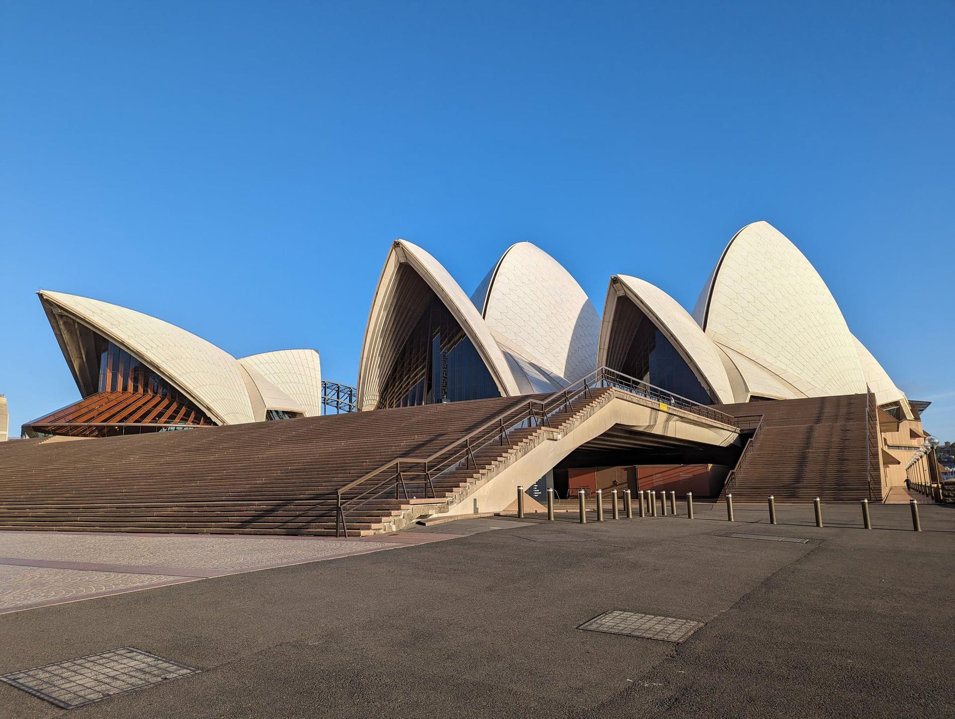
Sydney Opera House: The Building Its Architect Never Saw
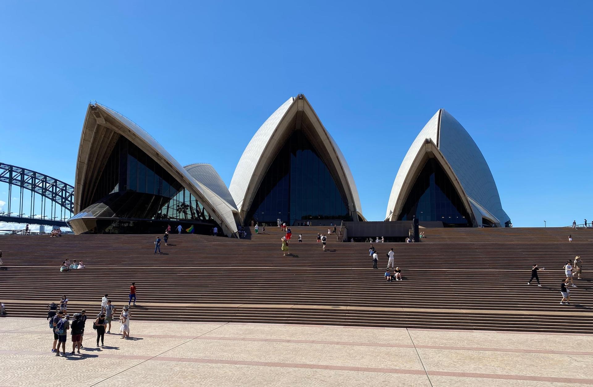
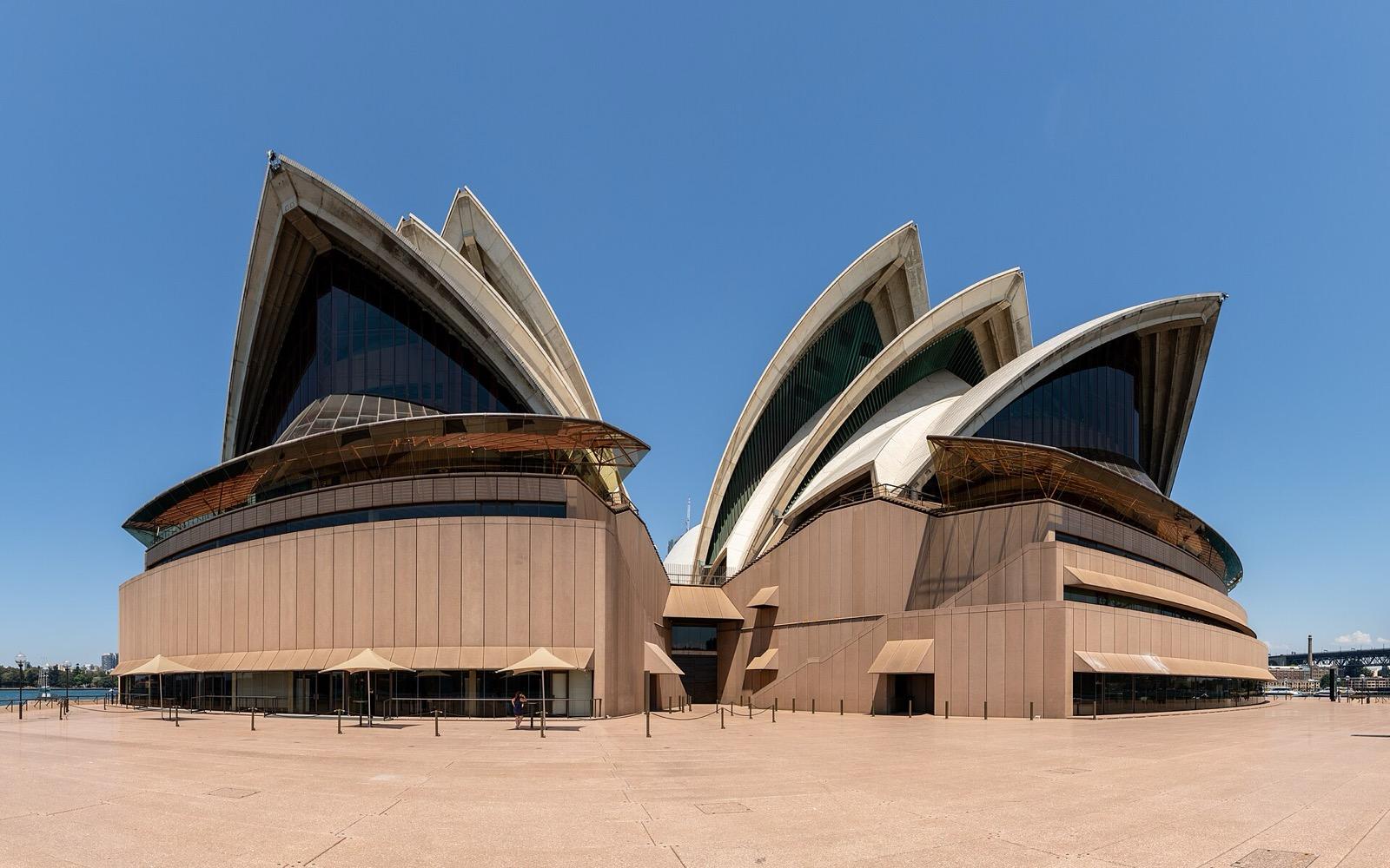
The building its architect never saw finished. Utzon's shells on Tubowgule, Bennelong Point, opened by Queen Elizabeth II on 20 October 1973, the same week The Rocks was fighting to survive.
Details
Best Time to Visit
Morning, from about eight to ten, is the calmest time in the lanes and along the waterfront, before the day's crowds build at Circular Quay. Late afternoon is the other good choice: the sandstone glows, and you reach the Opera House as the light goes, with its sails lit after dark. To look inside Susannah Place and the observatory grounds as you pass, walk on a Thursday, Friday or Saturday and start around eleven: Susannah Place opens at ten, the observatory grounds at midday.
Pro Tips
- •Cadmans Cottage is closed for conservation works, with no reopening date announced, so stop 1 is heard from outside. Checked 18 September 2026 on therocks.com.
- •Susannah Place Museum (58-64 Gloucester Street) opens Thursday to Saturday, 10:00 to 17:00. The houses are shown by one-hour guided tour only, at most eight people, 20 AUD general, card only; book at mhnsw.au. The corner shop and the 20-minute welcome talks are free. Checked 18 September 2026.
- •Sydney Observatory's grounds and exhibition are free, Thursday to Sunday from 12:00 to 18:00 (to 19:30 during daylight saving); guided tours (36 AUD standard, 32 concession, 24 child) run Wednesday to Sunday by booking. Heritage conservation works are under way. We could not confirm whether the time ball still drops each weekday at 13:00, so check with the observatory on (02) 9217 0222. Checked 18 September 2026 on powerhouse.com.au.
- •To walk onto the Harbour Bridge, take the Bridge Stairs off Cumberland Street, just above the Argyle Cut; the footway runs along the bridge's eastern side. The BridgeMuseum in the south-east pylon (formerly the Pylon Lookout) is entered from that footway, not from Dawes Point: adult 39.95 AUD online, more than 200 stairs, no lift. Checked 18 September 2026 on bridgemuseum.com.au.
- •The Rocks Discovery Museum on Kendall Lane, which you pass between stops 7 and 8, is free and open daily from 10:00 to 17:00 (closed Good Friday and Christmas Day). Checked 18 September 2026.
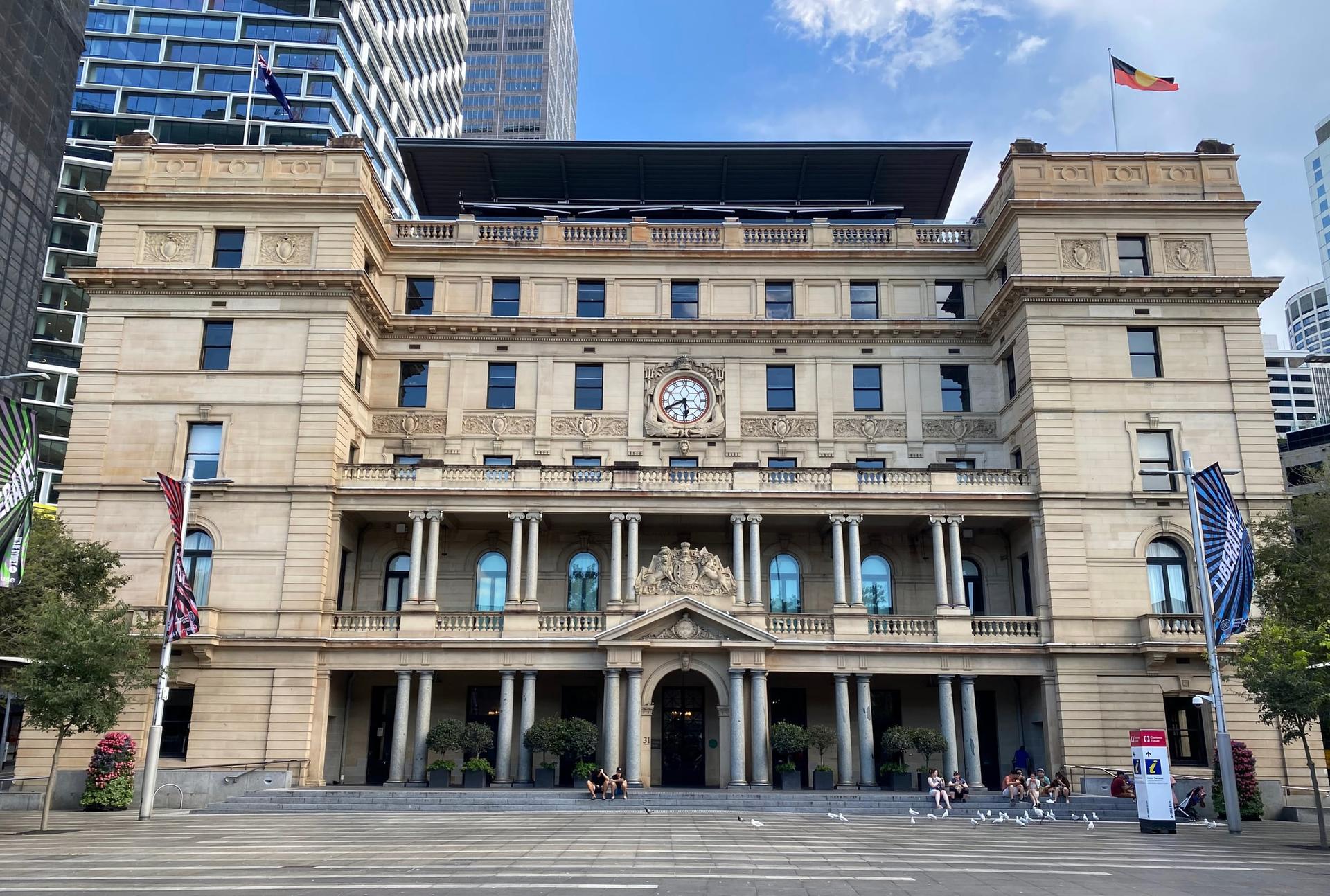
- •Customs House, at the back of Circular Quay, is free to enter; a 1:500 model of central Sydney lies under a glass floor on the ground level. Open Monday to Friday 8:00 to midnight, Saturday 9:00 to midnight, Sunday 9:00 to 17:00. Checked 18 September 2026 on cityofsydney.nsw.gov.au.
- •Sydney Opera House tours: the one-hour Sydney Opera House Tour is 50 AUD for adults booked ahead (55 AUD on the day); the Architectural Tour and the early-morning Backstage Tour cost more. Checked 18 September 2026 on sydneyoperahouse.com.
- •Badu Gili, a free six-minute First Nations projection on the Opera House's eastern Bennelong sails, runs in the evenings from sunset; the Opera House suggests watching from the podium at the top of the Monumental Steps. Check the day's screening times on sydneyoperahouse.com.
- •To keep walking after the Opera House, the path round Farm Cove leads into the Royal Botanic Garden.
Safety & Precautions
- •There is one real climb, from Argyle Place up to Observatory Hill, and there are steps at Dawes Point, the Watson Road Reserve (up and back down), Cambridge Street, Cumberland Place and the edge of First Fleet Park, and the Suez Canal lane ends in a passage under a building less than a metre wide, so the full route is not step-free. The old paving in the lanes is uneven and slippery when wet.
- •Sydney Water is repairing the Tank Stream under First Fleet Park until about mid-2027, and temporary fencing may close parts of the park; if your way from George Street down to the water is fenced off, follow the fencing round to the quay. Checked 18 September 2026.
- •The Opera House forecourt hosts concerts and events, and its summer concert season brings shows on many evenings between 28 November and 12 December 2026. If the foot of the steps is closed or busy, stop wherever you can see the sails. Checked 10 November 2026.
- •On New Year's Eve, 31 December 2026, much of this walk becomes fireworks viewing areas: Dawes Point, Campbells Cove and West and East Circular Quay are free but close once full, the Opera House forecourt needs a free booking with entry between noon and 3 pm, no trains, ferries, light rail or buses run to Circular Quay after 3 pm, and Opera House tours do not run that day, so walk it on another day if you can. Checked 10 November 2026.
- •Circular Quay and the Opera House forecourt are among the busiest places in Sydney, and Circular Quay West is a road used by cars and delivery vans, so keep to the footpath. Keep bags closed and watch for vehicles and cyclists.
- •The waterfront and the Opera House forecourt have little shade. Carry water and sun protection, especially from October to March.
Travel advisory: Exercise Normal Precautions (Level 1).
Gallery
Related Reading
Go deeper on what you'll see, hear, and walk through.
Overview
Best Self-Guided Walking Tours in Sydney (2026)
5 min
Overview
One Day in Sydney: A Walkable Morning-to-Evening Itinerary
9 min
Overview
Sydney Travel Guide: Days, Transport, Safety, and Budget
9 min
Thematic
Best History Walking Tours in Sydney (2026)
2 min
Thematic
Sydney in Sandstone: Reading a Convict City From Cove to Harbour
8 min
Companion
The Sydney Opera House and the Struggle Behind the Postcard
8 min
Companion
Warrane and The Rocks: Reading the First Town Beneath Sydney's Sandstone Quarter
8 min
Deep dive
Cadmans Cottage: Sydney's Little House by the Water
7 min
Deep dive
The Sydney Harbour Bridge: Why the Coathanger Opened With a Sword
6 min
Read
What to Eat in Sydney: Pies, Oysters, Banh Mi and the Flat White
8 min
Read the walk
The full story of The Rocks to the Opera House: The Town Sydney Kept Trying to Knock Down, in words. Prefer to listen? Play it narrated, from home or on location.
Introduction
Sydney, Australia, began around Sydney Cove, and its western shore, the rocky quarter that became known as The Rocks, is where the convicts were put. Convicts, sailors and their families built a town there on the sandstone, and for most of the twentieth century the city kept trying to clear it away. Plague clearances, a bridge, an expressway and a plan for office towers each took their turn.
This walk goes once round the cove. It starts at one of the oldest houses in the city, passes under the Harbour Bridge, climbs Observatory Hill, walks through a street that convicts began cutting through the rock, and follows the lanes where, in October nineteen seventy three, residents and builders' labourers made their stand. It ends at the Opera House, which Queen Elizabeth the Second opened four days before police cleared the protesters from a street in The Rocks.
Ten stops, just under four kilometres, and around two hours at an easy pace, with one short climb and some steps. No group, no schedule, and every stop can be seen for free, though a few places charge for a look inside.
When you arrive at Cadmans Cottage, on Circular Quay West, begin with stop one.
1. Cadmans Cottage: The House That Lost Its Harbour
Welcome to Cadmans Cottage: the small sandstone house in front of you, set down below the level of George Street. Behind you, beyond the road and the cruise terminal, is the water. When this house was built, the harbour came almost to its door.
This cove is Warrane, the name the Gadigal gave it, and since two thousand and five its official second name. The City of Sydney's history records the men spearing fish from the shore here, and the women fishing from bark canoes out on the water.
In late January seventeen eighty eight the First Fleet sailed in and made camp. David Collins, one of its officers, wrote down how they arranged themselves: the marines at the head of the cove, beside the fresh water, the governor's canvas house on the east side, and here, on the west side, the main body of the convicts. You are standing on the convicts' shore. Two eyewitness accounts suggest the British flag was first raised on this side, too, on the twenty sixth of January, though no one can point to the exact spot.
For the people of the harbour, what followed was catastrophe. In April seventeen eighty nine, people were found dead of smallpox in different parts of the harbour. Governor Phillip wrote that the number could not be known, but that, going by what Bennelong told him, about half of the local people had died. Collins recorded that Arabanoo, a man then held at the settlement, was taken down the harbour, saw the empty coves, and said: all dead, all dead.
The cottage came later, in about eighteen sixteen, as a base for the government's boat crews, built right on the water's edge. Its best-known resident, John Cadman, had been transported for stealing a horse, and rose to run the government boats as coxswain for eighteen years, living here with his wife, Elizabeth Mortimer, also a former convict, and her two daughters.
Then the harbour moved away. The shore in front of the house was filled in during the eighteen seventies, and today the water is about a hundred metres off. The heritage register counts it the third oldest building in the city, and the national parks service calls it the only building left that shows where the original shoreline ran.
When you are ready, walk north along Circular Quay West, with the cruise terminal on your right, to the open plaza at the water's edge at Campbells Cove.
2. Campbells Cove: The Merchant's Stores He Never Saw
Stop at the edge of the water, in the open plaza at Campbells Cove. The long row of sandstone and brick warehouses on your left, back along the way you came, is Campbell's Stores. Now look right, across the water. That is the Opera House, where this walk ends.
The stores carry the name of Robert Campbell, a Scottish merchant from a trading house in Calcutta, who first came to Sydney in seventeen ninety eight. He bought land on this shore, and by eighteen oh one he had storehouses, a stone wall and a small wharf here. The Australian Dictionary of Biography says his name became synonymous with fair trading, reduced prices and generous credit. In eighteen oh four, two hundred settlers signed a letter to thank him. But for you, they wrote, we had still been a prey to the mercenary, unsparing hand of avarice and extortion. He was secretary of a savings bank whose Sydney branch became known simply as Campbell's Bank.
Here is the twist. Robert Campbell never saw these warehouses. He died in eighteen forty six, and the stores standing here were built by his son John, between eighteen fifty one and eighteen sixty one, in the boom years of the gold rush. A third storey was added in the eighteen eighties. And in nineteen fifty eight, one bay at the southern end was knocked down to make room for the cruise terminal: one more piece of The Rocks cleared away for something new. The heritage register calls them the only warehouses of their kind left on the shores of Sydney Cove.
Behind the stores, in the colony's first years, there was a small burial ground. As late as eighteen seventy five, the headstone of a marine who died in seventeen ninety two could still be read there.
When you are ready, follow the waterfront path north past the hotel, round the point, and up into the park under the Harbour Bridge, to the old cannons.
3. Dawes Point: Where a Language Was Written Down
Stop by the old cannons, and face the way they point, out over the water. The great stone pylons of the Sydney Harbour Bridge rise beside you on your left. Ahead and to the right, across the cove, is the Opera House again.
This point is Tar-ra. A notebook from the first years of the colony lists it as the west point of Sydney Cove, and on the same page names the east point, where the Opera House stands, as Tubowgule. The City of Sydney's history says the flat rocks here were a place to cook fish.
In seventeen eighty eight a young marine officer and astronomer, William Dawes, built an observatory on this point, and lived and worked in a hut here. In that hut, in seventeen ninety and seventeen ninety one, he wrote down the language of the people of Sydney. His main teacher was a young woman of about fifteen, Patyegarang. His notebooks keep fragments of what they said to each other. On one page she tells him to put out the candle. On another he asks why she is not asleep, and she answers: because of the candle. One word he recorded, putuwa, means to warm your hand by the fire, and then gently squeeze another person's fingers.
Dawes did something else that set him apart. In December seventeen ninety he was ordered to join a punishment raid against Aboriginal people, and he refused. He went in the end, under pressure, and said publicly that he was sorry he had. He sailed home a year later, and his notebooks lay in London, their importance unrecognised, until nineteen seventy two.
The point became a battery from seventeen ninety one. These cannons are mid nineteenth century guns, and for decades a gun here fired at one o'clock, in step with the time ball on Observatory Hill. Then, between nineteen twenty five and nineteen thirty two, every building on the point was levelled for the bridge.
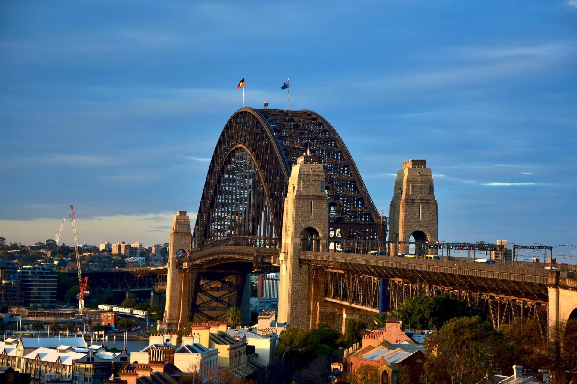
The bridge opened in March nineteen thirty two, and sixteen men died building it. Its southern approach cut straight through The Rocks. The Rocks Discovery Museum says that in nineteen twenty eight a grand hotel and some two hundred and eighty houses around it were demolished to clear the way.
When you are ready, walk west across the park, under the bridge approach, to Lower Fort Street, and follow it all the way to Argyle Place, past its old terraces and, on your right, the Hero of Waterloo hotel.
4. Argyle Place: The Village That Worked the Wharves
Stop at the bottom of Lower Fort Street, where it meets Argyle Place. The sandstone church on your left is Holy Trinity, better known as the Garrison Church. Ahead and to your right, under the big fig trees, is the green of Argyle Place. This is Millers Point, named after the…
Full narration for this stop unlocks with the tour.
5. Observatory Hill: Where Sydney Kept Its Time
Stop by the round bandstand on the lawn. Ahead of you and a little to the left, inside its fence, is Sydney Observatory: the Italianate building with two domes and a tall time-ball tower. This is the highest point overlooking the harbour, and it has worn several crowns. The…
Full narration for this stop unlocks with the tour.
6. The Argyle Cut: A Street Carved Through the Ridge
You are walking into the Argyle Cut. Walk on slowly, under the bridge approach road, to the concrete bridge ahead that carries Cumberland Street over the gap, and stop beneath it. The rock walls rise on both sides. Before this cut existed, Argyle Street came in two halves, with…
Full narration for this stop unlocks with the tour.
7. Susannah Place: Four Houses That Outlasted Every Plan
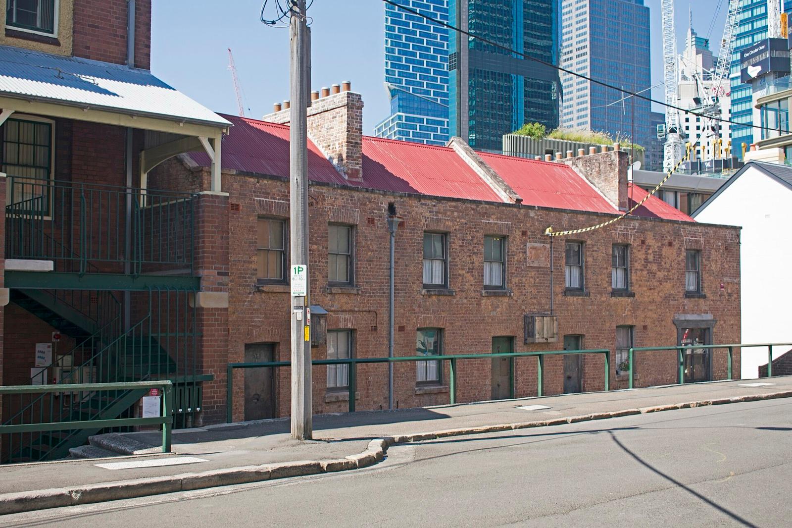
Just ahead on your left, the plain two-storey terrace running down to the corner is Susannah Place: four small houses built in eighteen forty four. The last house, at the corner by the steps, has two big shop windows and an angled door. Across the street on your right, a modern…
Full narration for this stop unlocks with the tour.
8. Playfair Street: Where The Rocks Fought Back
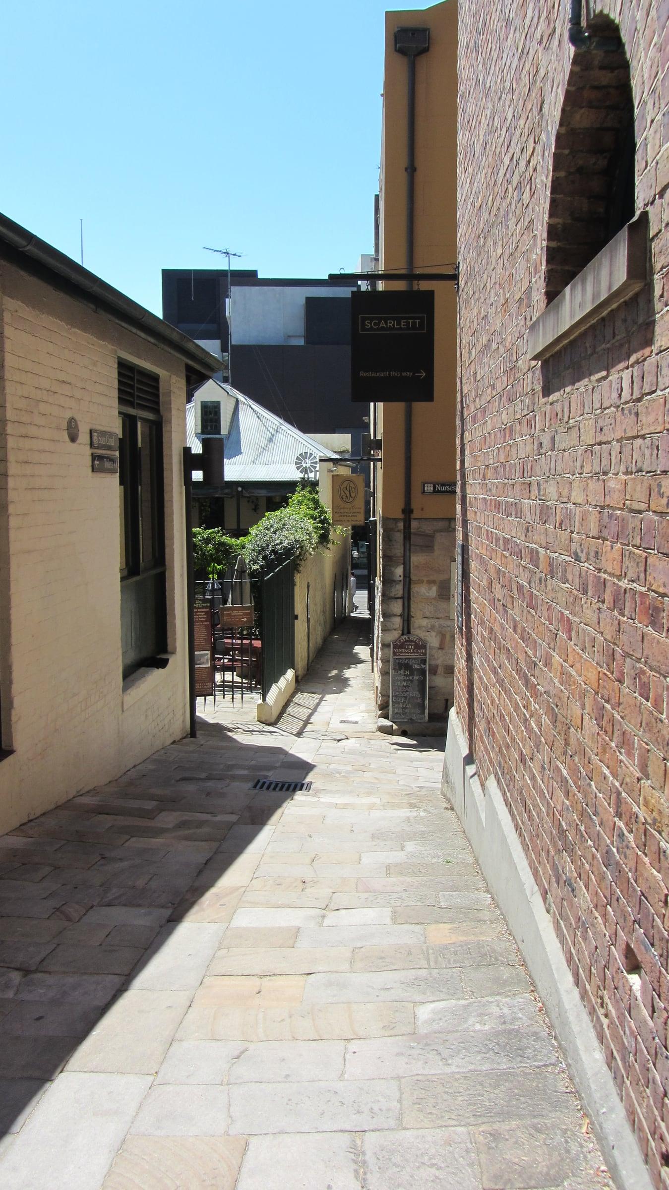
Walk down Playfair Street and stop beside The Rocks Square, on your left. First, the narrow lane you came down, the Suez Canal. The Rocks Discovery Museum says the nickname comes from the real Suez Canal, opened in eighteen sixty nine; the state's walking guide says it was…
Full narration for this stop unlocks with the tour.
9. Circular Quay: A Convict Quay on a Mudflat
Stop near the end of the ferry wharves, where the promenade turns up toward the Opera House. Under your feet are the brass plaques of Sydney's Writers Walk, each naming a writer, from Mark Twain to Kenneth Slessor. When the First Fleet sailed in, there were no wharves here.…
Full narration for this stop unlocks with the tour.
10. Sydney Opera House: The Building Its Architect Never Saw
Walk out onto the forecourt and stop at the foot of the great staircase, the Monumental Steps, on your left. The shells of the Sydney Opera House rise above them. Before any of this, the point was Tubowgule, a tidal island at the end of a ridge. The Opera House itself says the…
Full narration for this stop unlocks with the tour.
- Cadmans Cottage, front — Julioenrekei, Public domain · source
- Dawes Point battery cannons under the Harbour Bridge — Collywolly, CC BY-SA 4.0 · source
- Garrison Church (Holy Trinity), west front — Ymblanter, CC BY-SA 4.0 · source
- Argyle Place and the Garrison Church — Maksym Kozlenko, CC BY-SA 3.0 · source
- Sydney Observatory with its time-ball tower — Photograph by Greg O'Beirne, CC BY 2.5 · source
- The Argyle Cut — Sardaka, CC BY-SA 4.0 · source
- Susannah Place, Gloucester Street — Rangasyd, CC BY-SA 4.0 · source
- Susannah Place from the north-west — Ymblanter, CC BY-SA 4.0 · source
- Playfair Street terraces — Collywolly, CC BY-SA 4.0 · source
- Argyle Terrace, Playfair Street — -wuppertaler, CC BY 4.0 · source
- The Suez Canal lane — Robert Linsdell from St. Andrews, Canada, CC BY 2.0 · source
- Customs House, Circular Quay — -wuppertaler, CC BY 4.0 · source
- Sydney Opera House and the Monumental Steps — -wuppertaler, CC BY 4.0 · source
Images may be cropped or resized. Other photos via Unsplash and Pexels.