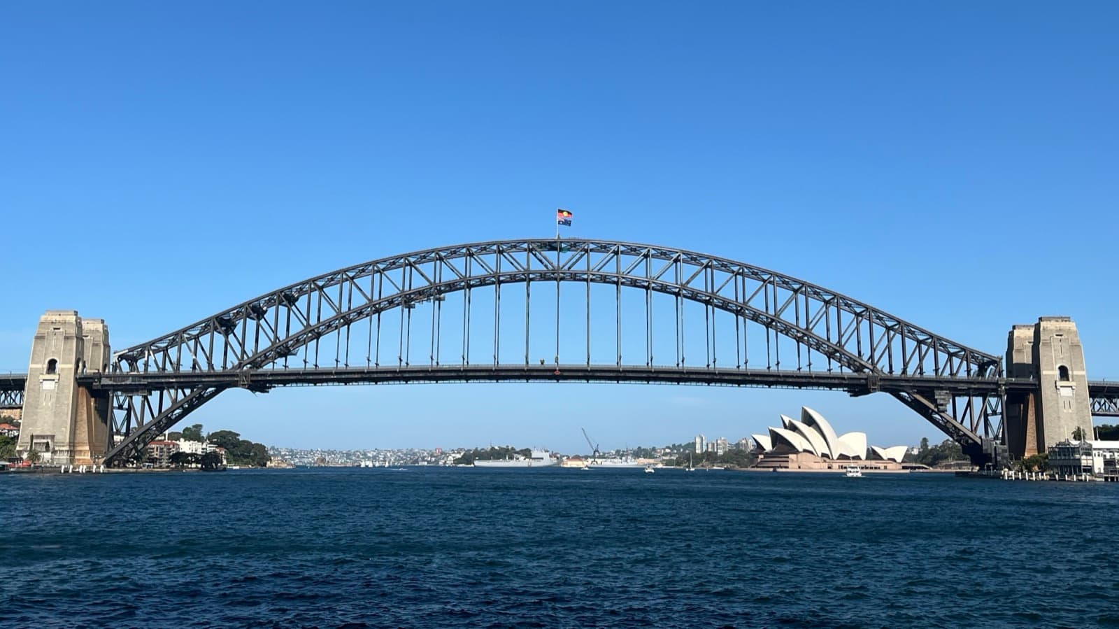
Sydney Cove was Warrane long before it was a penal colony, and standing on its western shore is the way into reading The Rocks as three towns stacked on one another: unceded Gadigal Country, the convict quarter cut from sandstone by hand, and the picturesque tourist lane on top. The pubs and cobbled steps are lovely, and they are also the surface of something harder. If you begin where Sydney began, at the cove itself, the rest of the walk stops being a stroll past old buildings and becomes an act of reading the first town underneath.
Begin at the cove, not the charm
The western shore of Sydney Cove is where the Gadigal, a clan of the coastal Eora nation, had fished for tens of thousands of years, paddling nawi, the bark canoes of the harbour. In January seventeen eighty-eight, eleven ships carrying roughly one thousand people arrived in Port Jackson under Governor Arthur Phillip. He had reached Botany Bay in the Supply on the eighteenth of January, judged it poor and poorly watered, and moved north to this deeper cove. On the twenty-sixth of January seventeen eighty-eight his party raised the British flag on its shore, most likely on this western side, going by two eyewitness letters. The colony of New South Wales was formally proclaimed in February, once everyone had landed. The cove took its English name from Thomas Townshend, Viscount Sydney, the Home Secretary of the day.
What the founding accounts usually skim past is what came next for the Gadigal. In April seventeen eighty-nine a smallpox epidemic swept through the Eora. Governor Phillip wrote that the number of dead could not be known, but going on what Bennelong told him, he put it at about half the people of this part of the country. Bennelong also reported that his friend Colebee's clan had been left with three people. Those are real dead, not a footnote. This is unceded Country, taken without treaty. And yet the Gadigal are still here, their culture continuing as part of one of the oldest living cultures on earth. Holding those two truths at once, the founding of a colony and the ground it was founded on, is the argument the whole walk makes. Every stop after this one is a variation on it.
The convict town, cut from stone by hand
Hear a stop from this walk
Playfair Street: Where The Rocks Fought Back
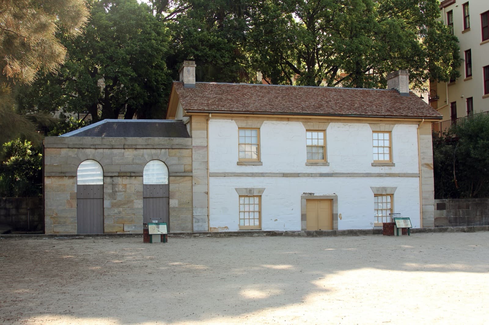
On this same shore the founding story hands off to the people who actually lived here. Cadmans Cottage, built in eighteen fifteen and eighteen sixteen as quarters for the governor's boat crews, is one of the very oldest surviving houses in Sydney. It is named for John Cadman, transported as a convict in seventeen ninety-eight for horse theft, pardoned, and risen to government coxswain from eighteen twenty-seven to eighteen forty-five. A convict past was not a dead end in The Rocks. It was where most people started. Notice how far the water sits now: the shore in front of the cottage was filled in between eighteen seventy and eighteen seventy-five, and the NSW Government puts the harbour about one hundred metres from a building that once stood at its edge.
Behind George Street the lanes tighten. Nurses Walk follows the convict-era street pattern almost exactly and marks the ground where the naval surgeon John White set up the colony's first hospital in tents in late January seventeen eighty-eight, within days of the landing. Nearby runs the Suez Canal, a slip so narrow two people can barely pass. The Rocks Discovery Museum says its nickname dates from the opening of the real Suez Canal in eighteen sixty-nine; the state's own walking guide calls it supposedly a pun on sewers. These are the arteries of the first town. It is easy to make a ghost-tour thrill of them at night; the more honest picture is the daytime one, water carried up by hand, washing strung between walls, the sick moved to tents on the hill.
Susannah Place is the quiet counterweight to governors and fleets. This terrace of four small brick houses, built in eighteen forty-four on Gloucester Street by Edward and Mary Riley, was home to more than one hundred working-class families between then and nineteen ninety, when the last tenants left: Irish immigrants, Greek shopkeepers, Norwegian sailors. It is now a house museum that conserves rather than restores, keeping the worn paint and patched walls visible so you read every era at once. It survived every attempt to clear the ground around it: the state's resumption of The Rocks after the plague of nineteen hundred, the Harbour Bridge approaches of the nineteen twenties, the Cahill Expressway that cut Gloucester Street in two, and a nineteen seventies plan for towers, when union green bans helped save much of The Rocks from the wrecking ball. Museums of History NSW, which runs the museum, is honest about the price: the buildings were saved, but the working-class community was lost.
The stone, and who cut it
The Argyle Cut is the tour's clearest lesson in reading the stone, and in reading it carefully. This canyon driven straight through the sandstone ridge was begun around eighteen forty-three by convict chain gangs, three years after transportation to New South Wales had ceased in eighteen forty. The work was brutally slow, and the government abandoned it half finished. Sydney Municipal Council completed it in eighteen fifty-nine, reportedly with explosives, and bridges were added over it between eighteen sixty-two and eighteen sixty-eight. Convicts began it by hand; council labour finished it. Do not look for their pick marks, though: the walls were cut again around nineteen twelve and widened and straightened in nineteen thirty-one, so a tool mark you spot could date from any of those years.
The walk's one real climb is Observatory Hill, the highest point overlooking the harbour. The sandstone observatory here was built between eighteen fifty-seven and eighteen fifty-nine; its time ball first fell at noon on the fifth of June eighteen fifty-eight and was soon moved to one o'clock, so ships could set their clocks. The hill wore other crowns first: a convict-built windmill from about seventeen ninety-six that gave it the name Windmill Hill, and the never-completed Fort Phillip, begun in January eighteen oh four, two months before the Castle Hill convict rebellion sharpened the fears behind it.
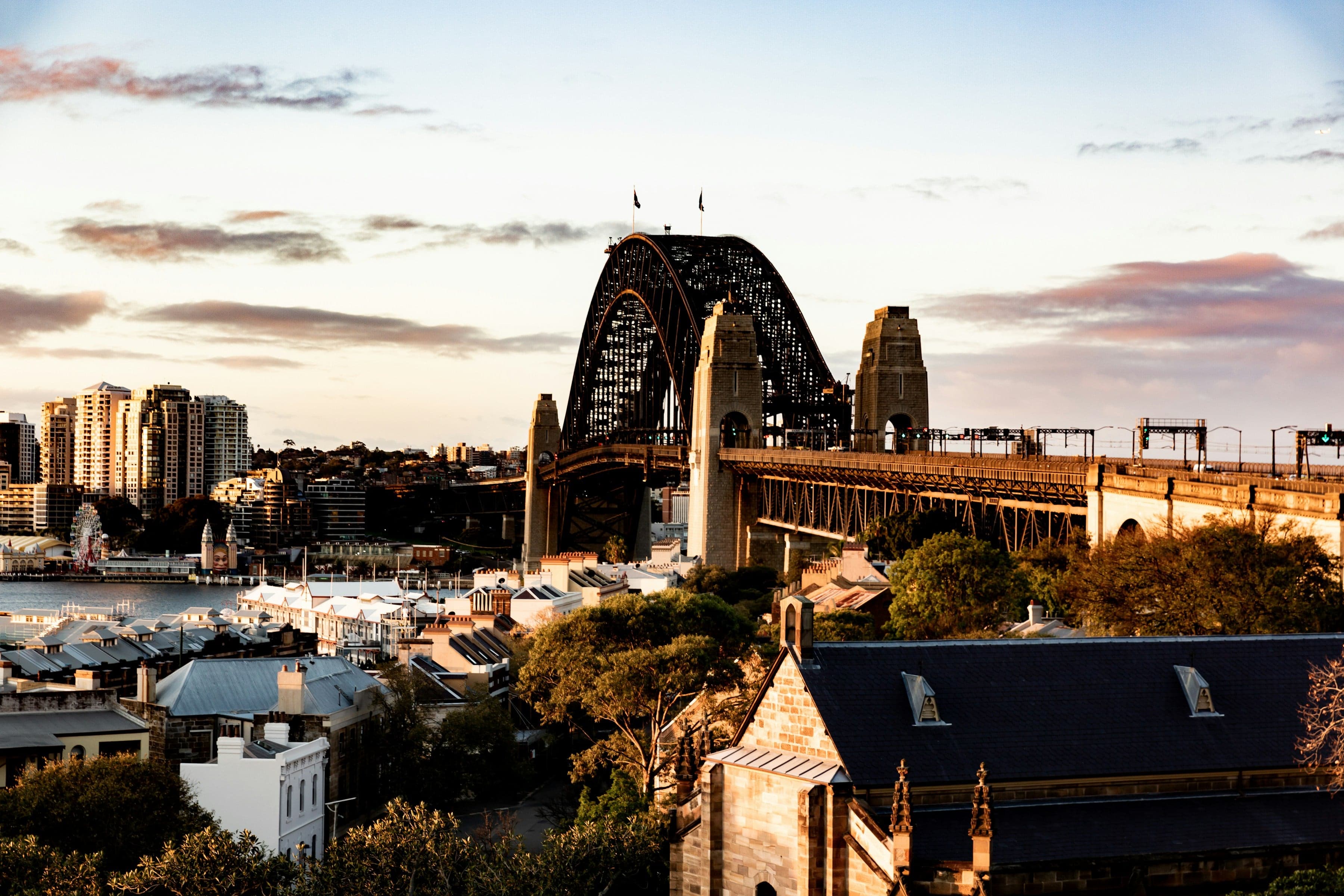
Early in the walk you pass beneath the southern end of the Sydney Harbour Bridge at Dawes Point, whose Gadigal name is Tar-ra. Museums of History NSW gives the steel arch a span of five hundred and three metres; it opened on the nineteenth of March nineteen thirty-two. Here in seventeen ninety and seventeen ninety-one, the marine astronomer William Dawes, working with a young Aboriginal woman named Patyegarang, recorded the Sydney language in notebooks now held at a university library in London and digitised for anyone to read. A soldier and a young Aboriginal woman sat down together, and words that might have been lost were kept.
Walk it at your own clock
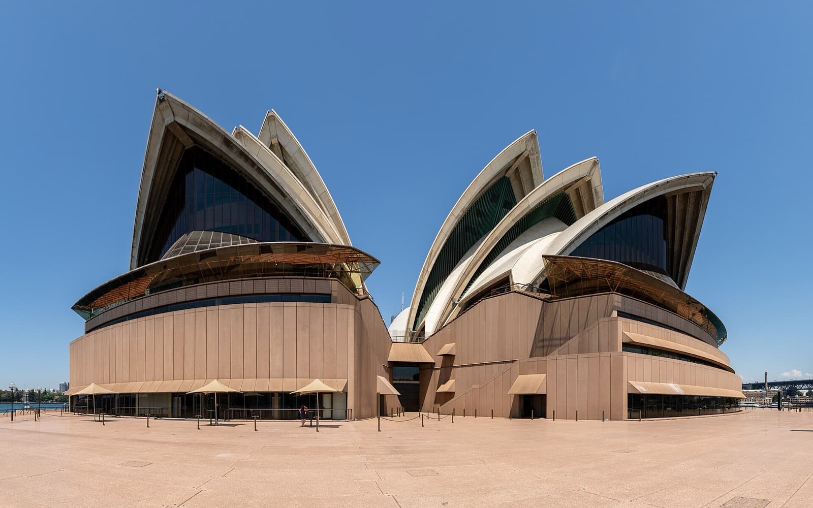
The Rocks to the Opera House is ten stops, just under four kilometres, around two hours, with one short uphill to the harbour view as its reward. It goes once round the cove, from Cadmans Cottage to the Opera House, which the Queen opened on the twentieth of October nineteen seventy-three. Four days later police cleared residents and builders' labourers from a green-banned demolition site on Playfair Street, one of the walk's later stops. No group, no schedule, no tip at the end. You linger on the sandstone steps as long as the light holds, or move straight through. For more Sydney routes, see our guide to Sydney walking tours, and browse the rest of Sydney when you plan the day. Start at Circular Quay West, at Warrane, and let the first town rise up through the charm.
Sources
- David Collins, An Account of the English Colony in New South Wales (1798), and Governor Phillip's despatch of 13 February 1790: the arrival at Botany Bay and Sydney Cove, the 1788 camp, and the 1789 smallpox epidemic.
- "Governor Phillip and the Eora" (Dictionary of Sydney): the epidemic and its toll on the Gadigal.
- Cadmans Cottage (NSW National Parks and Wildlife Service plan of management; NSW Government) and Susannah Place (Museums of History NSW): one of the city's oldest houses and the reclamation of its foreshore, the working-class terrace and what it survived.
- Argyle Cut and Sydney Observatory (NSW State Heritage Register, The Rocks Discovery Museum, Dictionary of Sydney, Powerhouse): the convict-begun cutting, Fort Phillip, and the time ball.
- The Rocks Discovery Museum: the Suez Canal lane and the Battle for The Rocks of October 1973.
- Museums of History NSW: the Harbour Bridge's span and opening.
- William Dawes' Notebooks (SOAS Digital Collections): the Sydney language recorded with Patyegarang at Dawes Point.
Ready to experience it?
The Rocks to the Opera House: The Town Sydney Kept Trying to Knock Down
120 min · 3.7 km · moderate
More from Sydney
Explore more at your own pace.
One Day in Sydney: A Walkable Morning-to-Evening Itinerary
Hyde Park Barracks: The Building That Explains Convict Sydney
The Sydney Opera House and the Struggle Behind the Postcard
Cadmans Cottage: Sydney's Little House by the Water
Hyde Park and the ANZAC Memorial: Australia's Oldest Park and Its War Memory