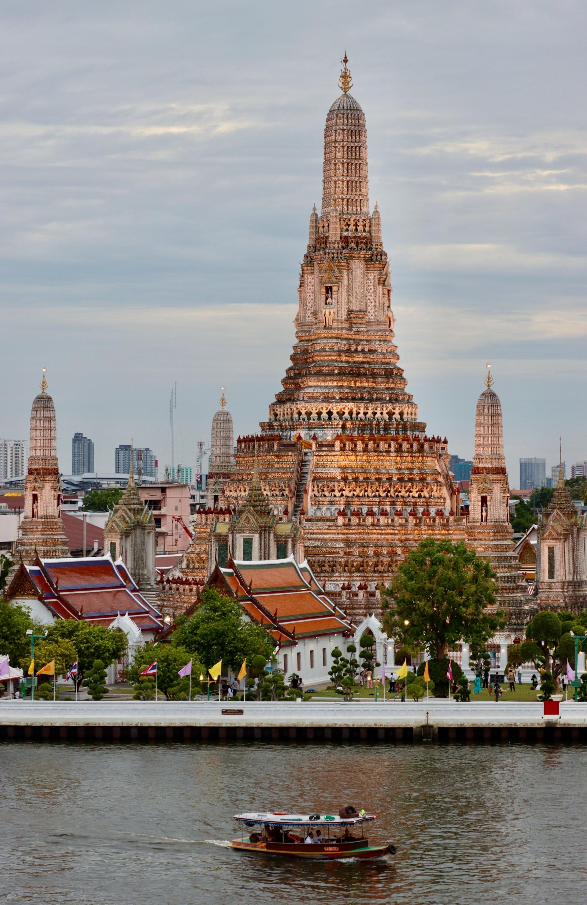
From the Wat Arun pier along the temple's north wall, past the walls of Taksin's old palace and over his city moat, through Wat Kalayanamit and the Portuguese and Chinese lanes of Kudi Chin to the foot of the Memorial Bridge.
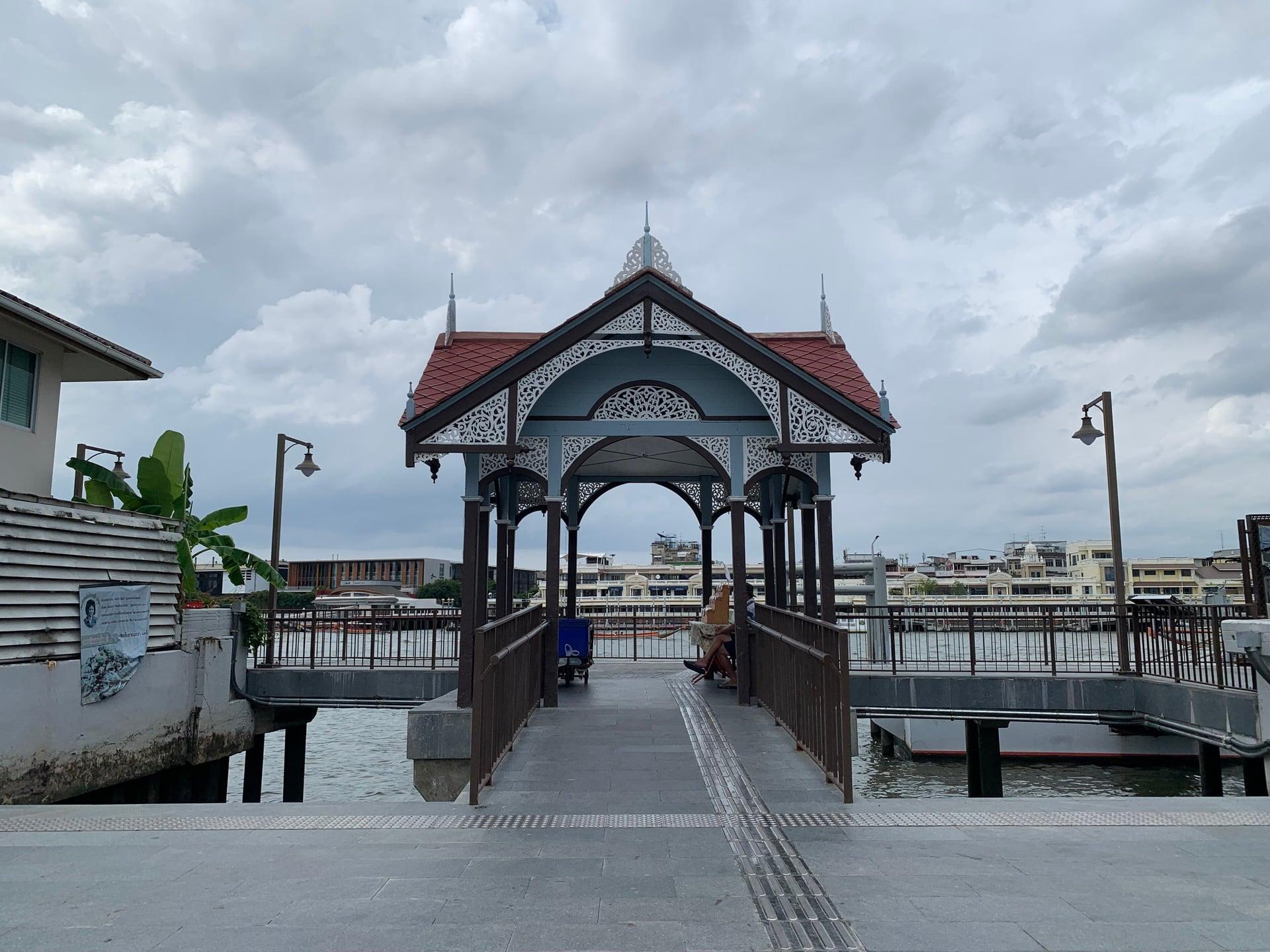
Start · Wat Arun Pier: Arriving by Water
DirectionsStops
- 1
Wat Arun Pier: Arriving by Water
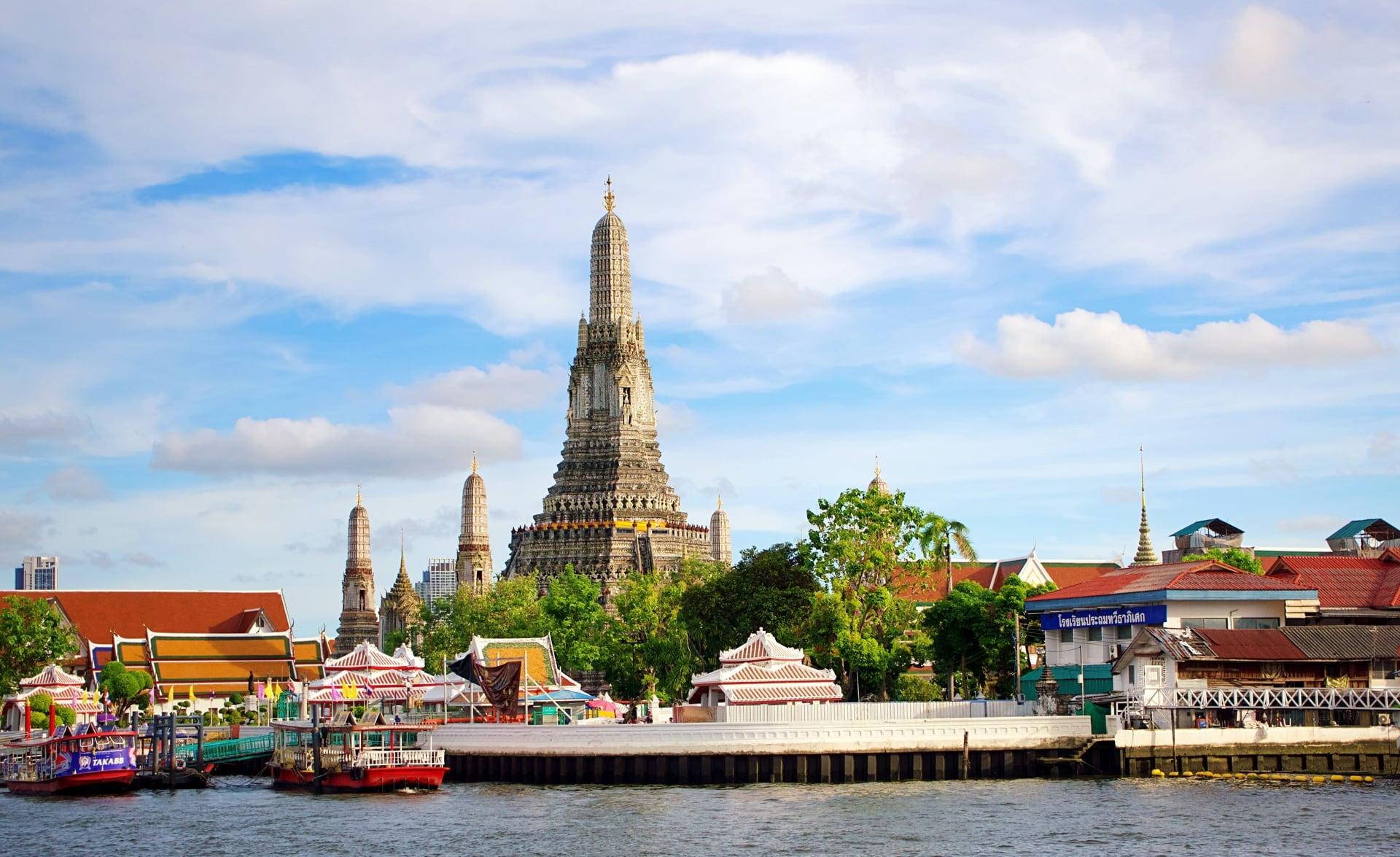
A ferry landing that faces Wat Pho. The landing of the Tha Tien ferry on the Thonburi bank, where King Taksin's capital faced the river from 1767 to 1782.
- 2
Wat Arun's North Wall: Temple of Dawn
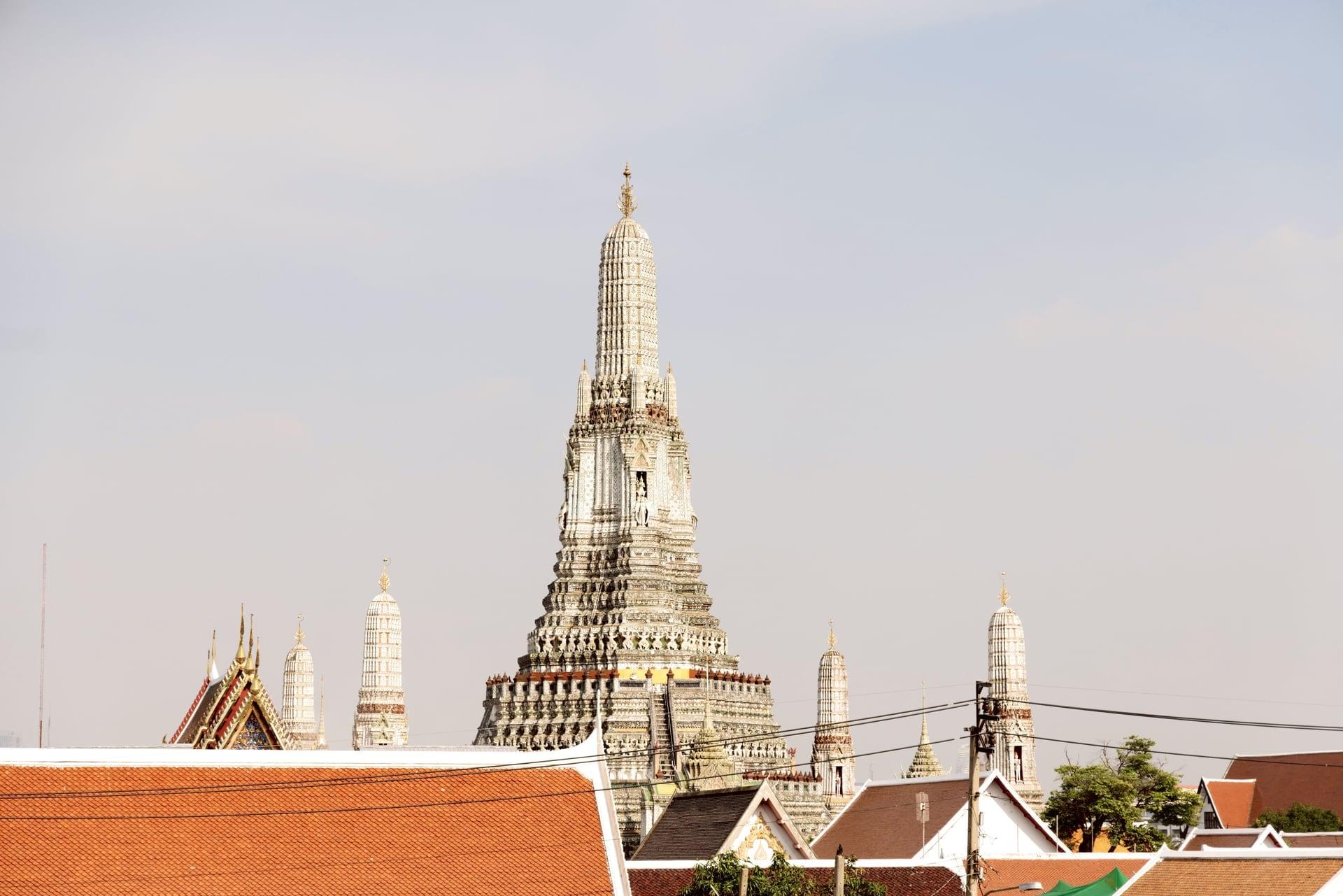
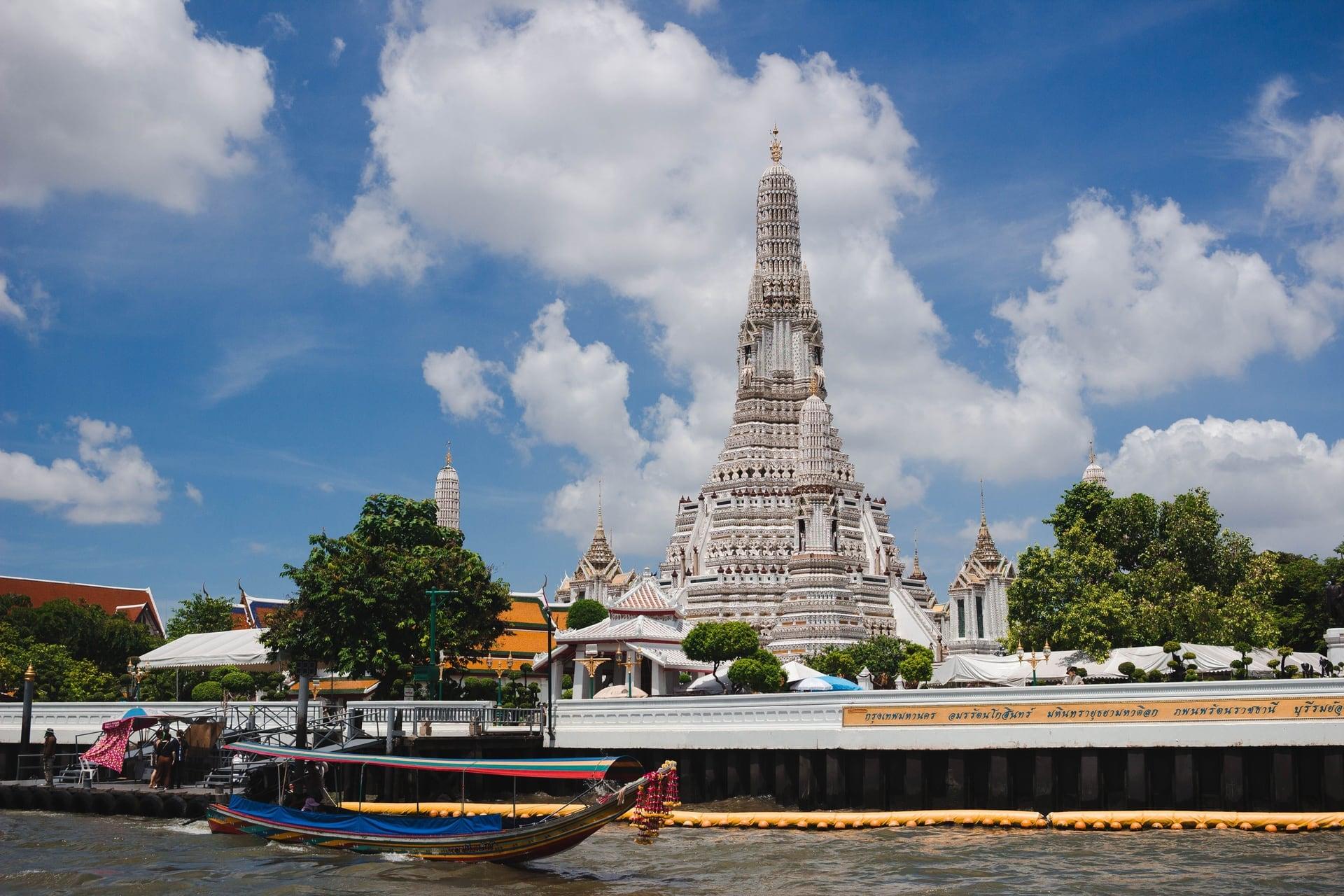
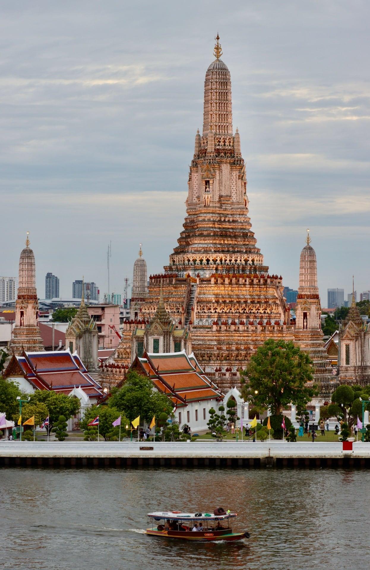
The prang over the temple fence. From the public lane along Wat Arun's north side, the great ceramic-clad prang rises beyond the cloister's gate pavilion; the grounds are ticketed.
- 3
Ordination Hall: The Working Temple
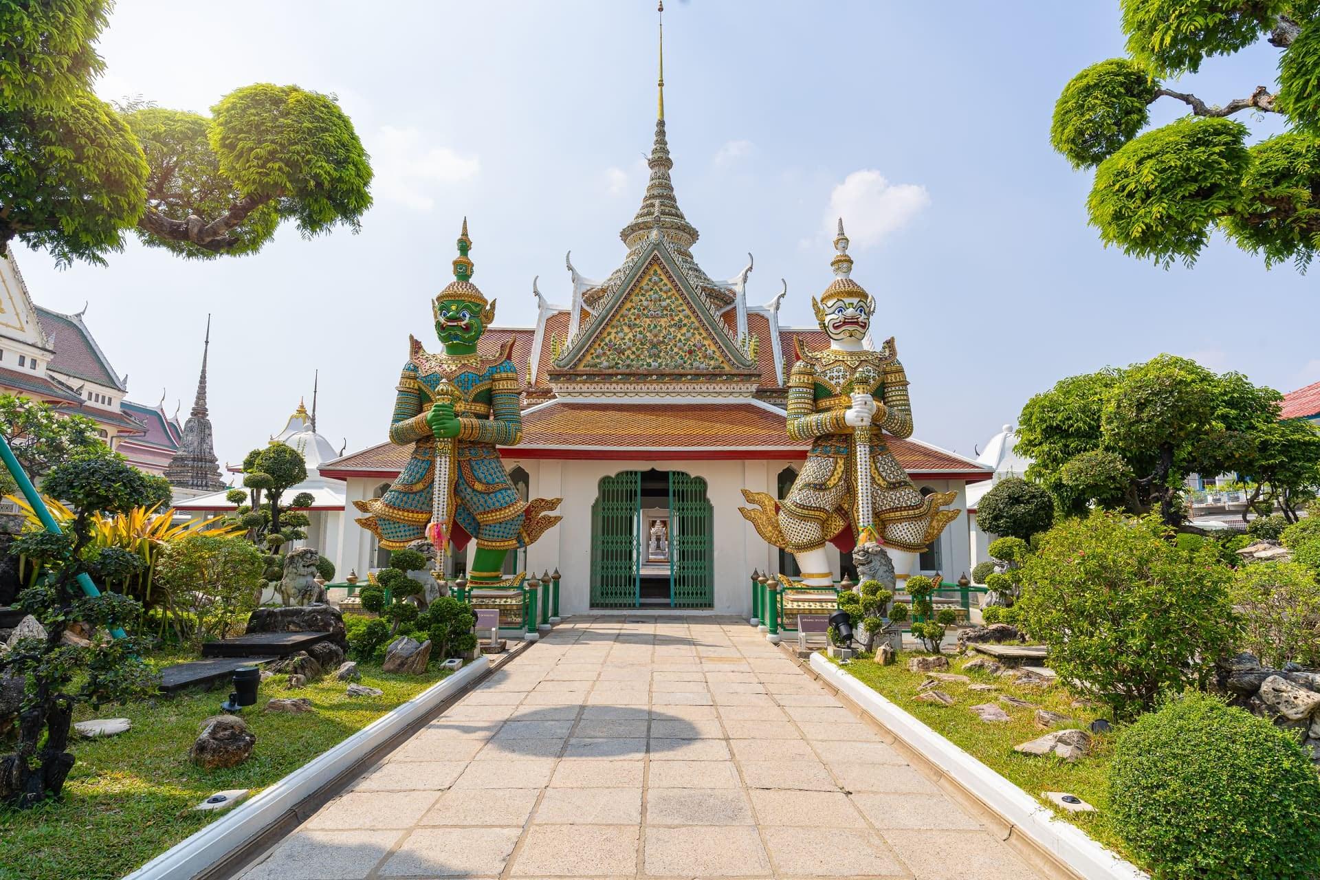
The hall behind the famous tower. Wat Arun's ordination hall, its roof over the cloister galleries, once kept the Emerald Buddha while Thonburi was the capital.
- 4
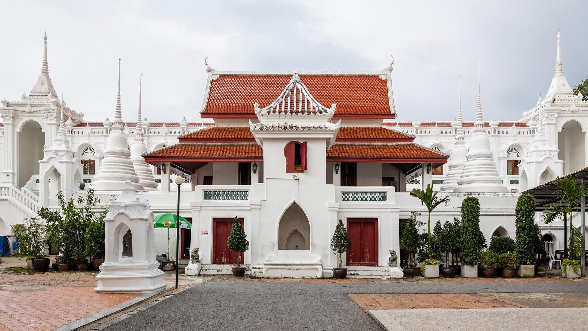
Wat Moli Lokkayaram: Inside the Palace
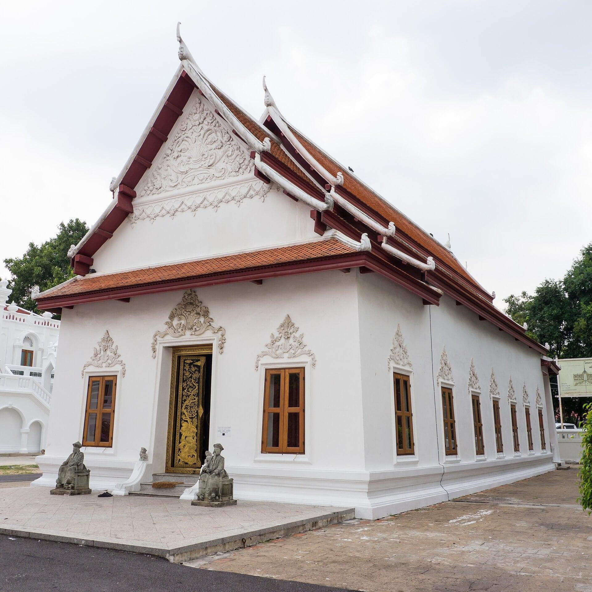
A temple inside the palace walls. Wat Moli Lokkayaram, an Ayutthaya-period temple King Taksin drew inside his palace boundary with Wat Arun, now a school for monks.
- 5
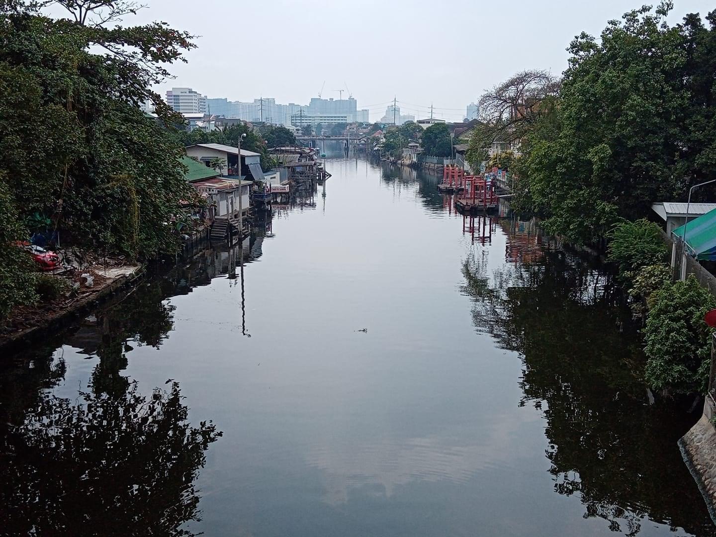
Khlong Bangkok Yai: The Moat
The little canal that was a moat. Below the Arun Amarin Road bridge, Khlong Ban Khamin, which Fine Arts Department archaeologists identify as Thonburi's city moat, meets Khlong Bangkok Yai.
- 6
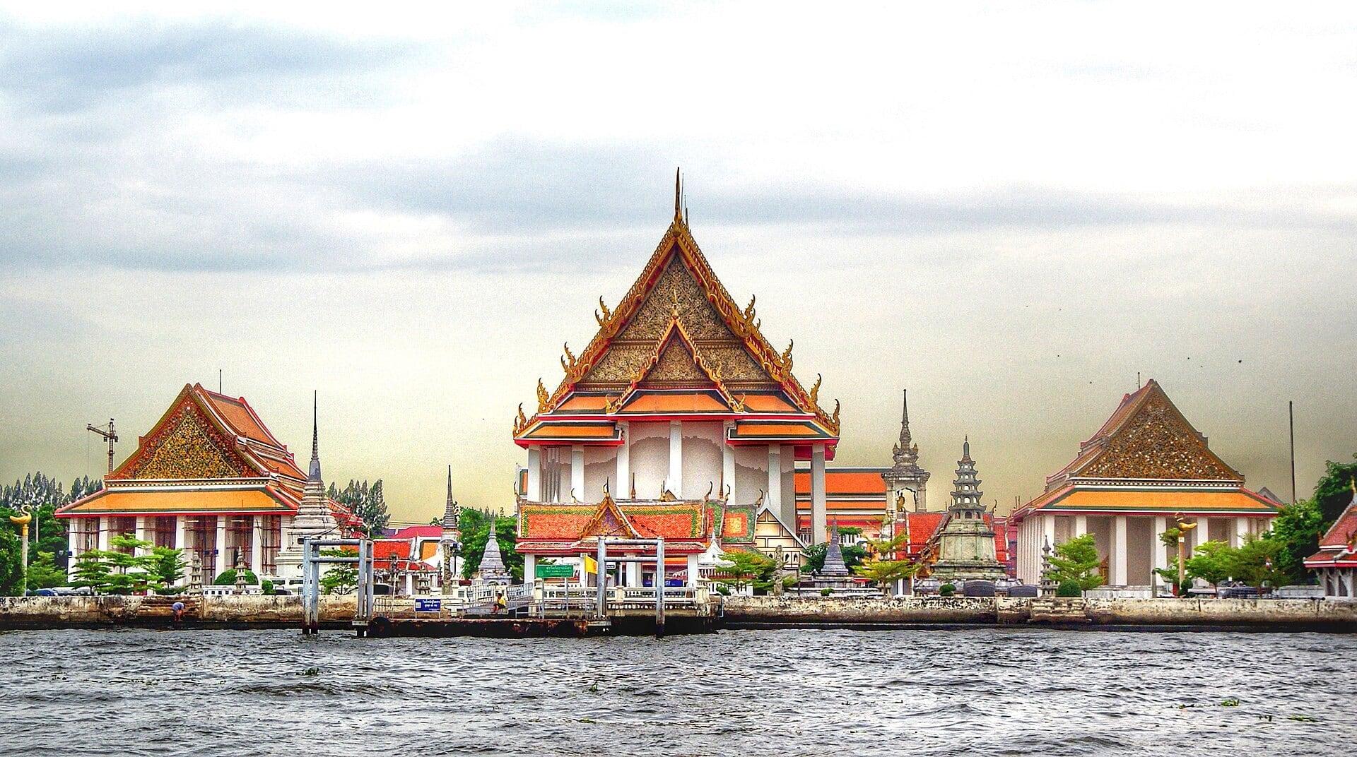
Wat Kalayanamit: The Great Buddha Hall
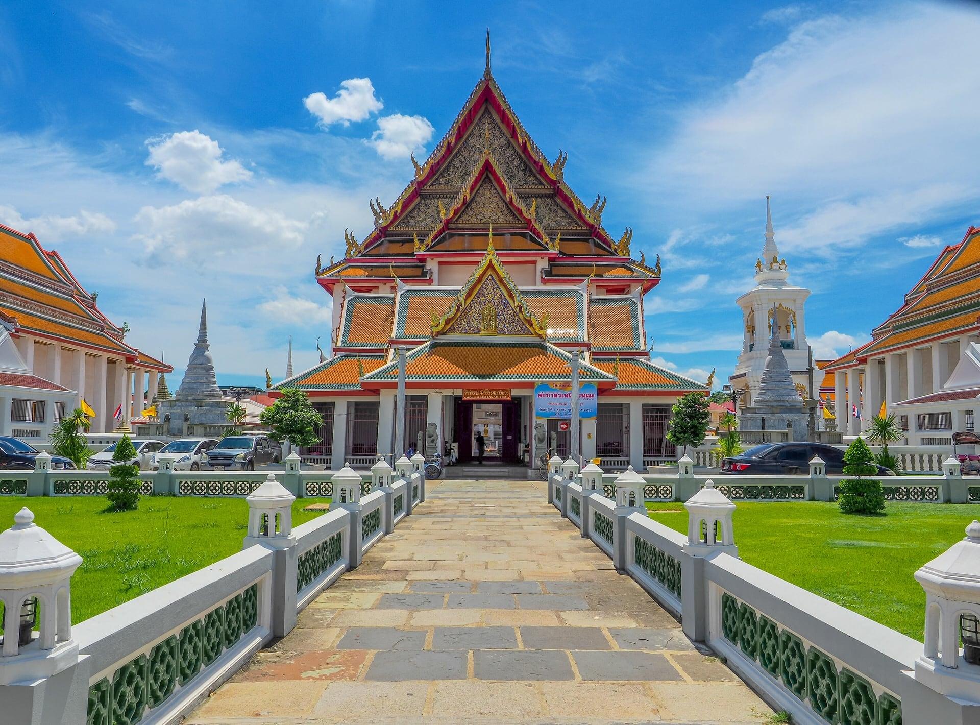
A great Buddha for two traditions. Wat Kalayanamit, built under King Rama III, whose tall image hall holds a huge seated Buddha revered by Thai and Chinese worshippers.
- 7
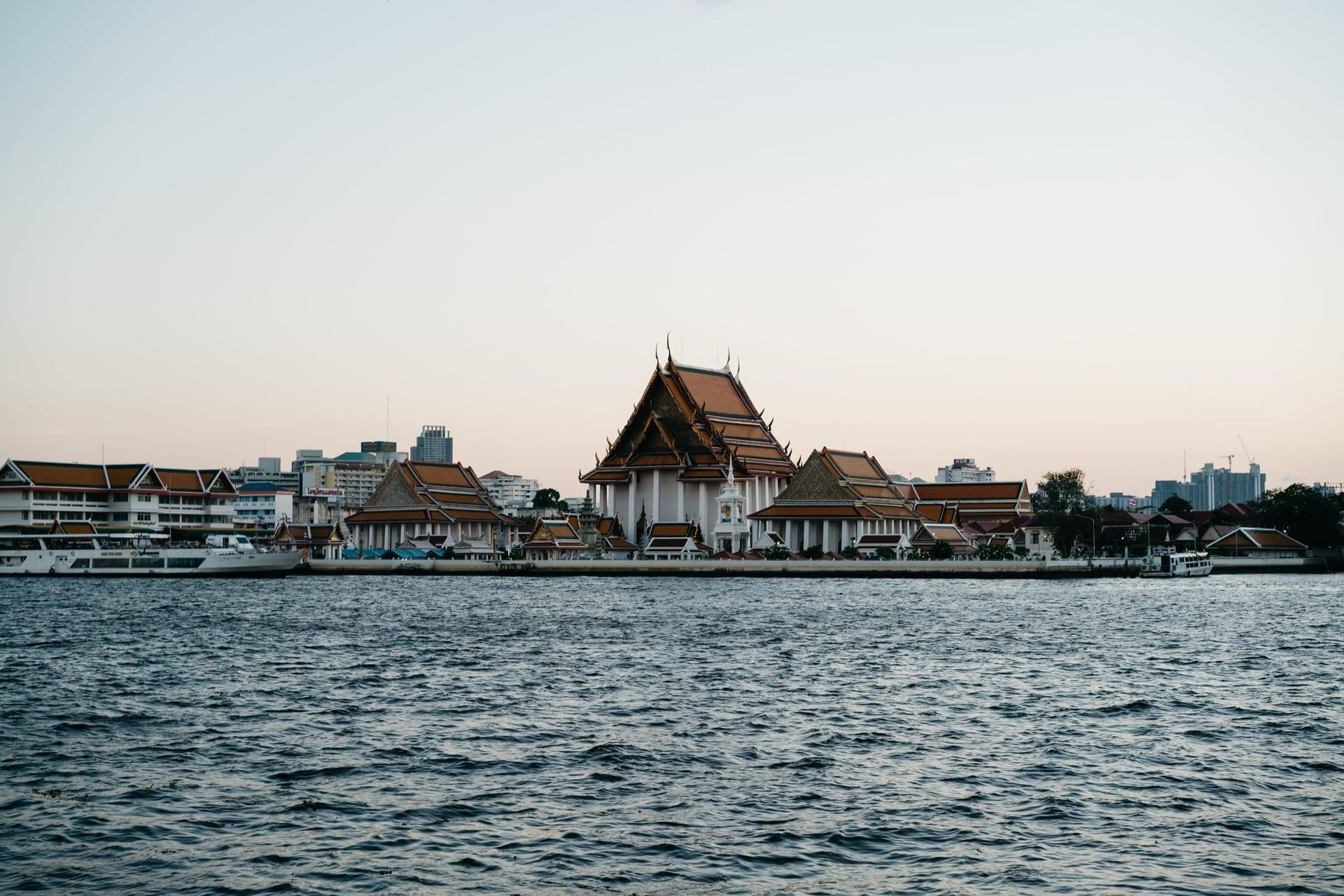
Wat Kalayanamit Pier: The River Fort
A river fort seen across the water. From Wat Kalayanamit's pier, Wichai Prasit Fort, still in use when Thonburi was the capital, stands across the canal mouth on Navy ground.
- 8
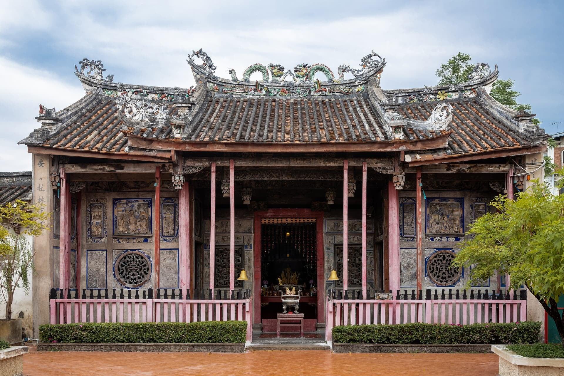
Kian Un Keng Shrine: The Chinese Strand
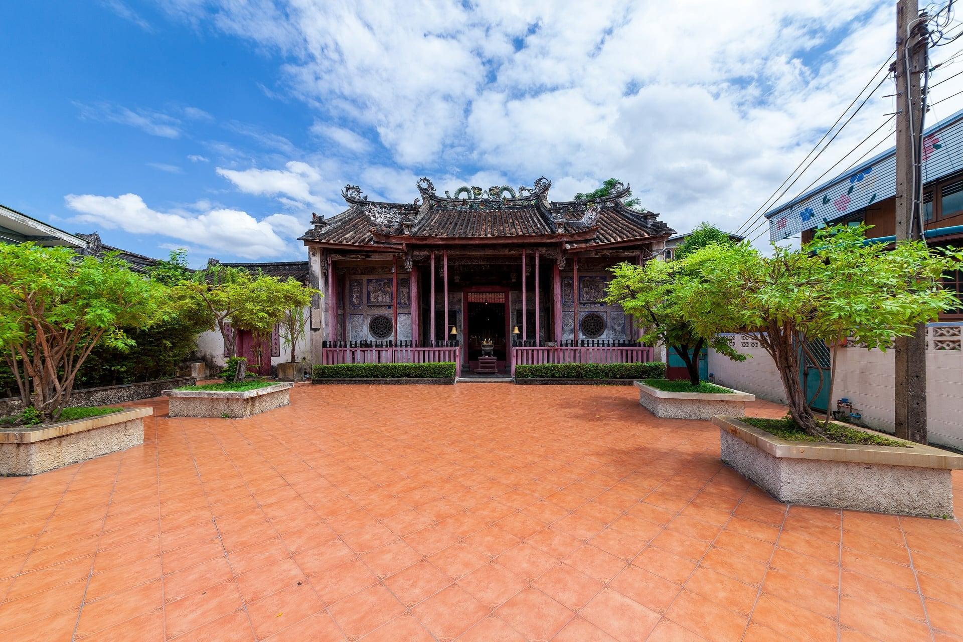
A Chinese shrine among the lanes. Kian Un Keng, a working Chinese shrine at the edge of Kudi Chin, the community Chinese migrants settled first, before the Portuguese came in 1769.
- 9
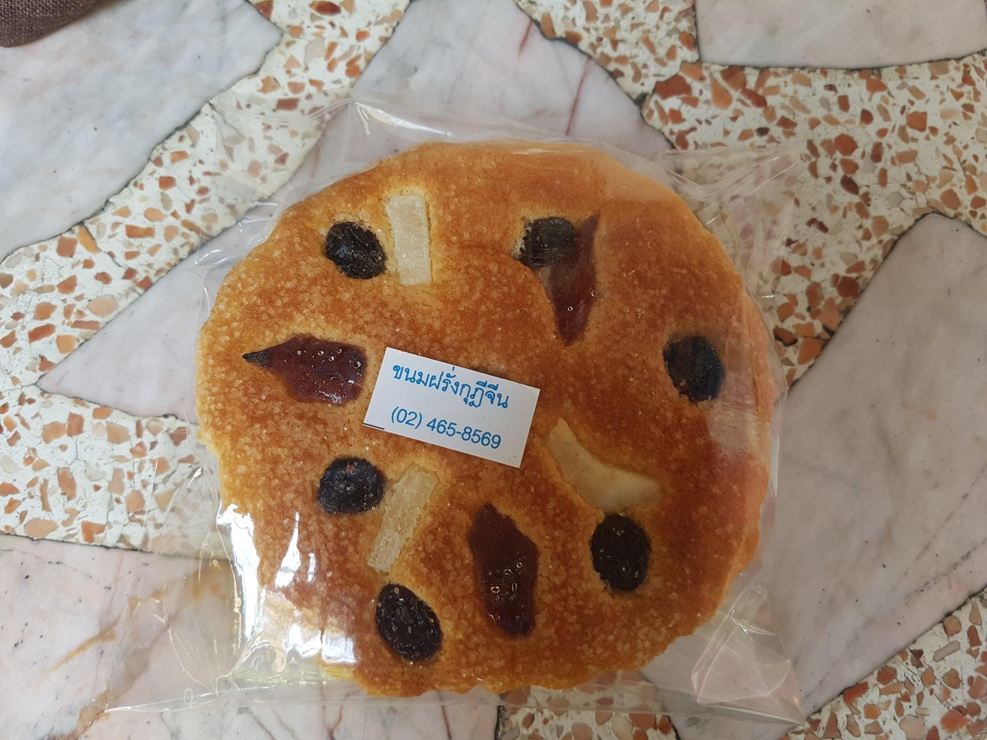
Baan Kudichin Museum: The Portuguese Lanes
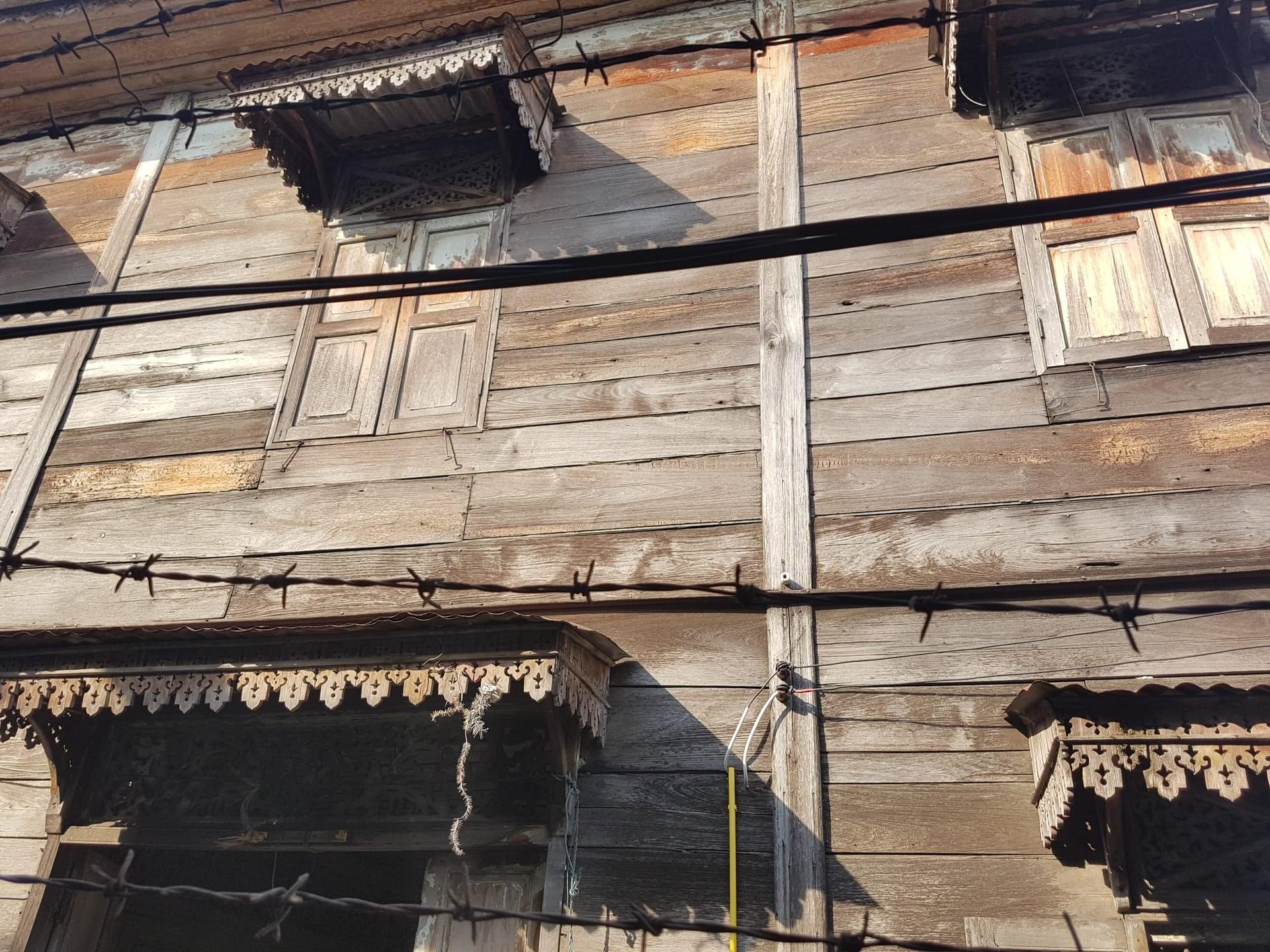
Portuguese lanes and a famous cake. The Kudi Chin lanes where the Portuguese settled in 1769, a small private house museum, and khanom farang, a cake City Hall counts among Bangkok's local wisdoms.
- 10
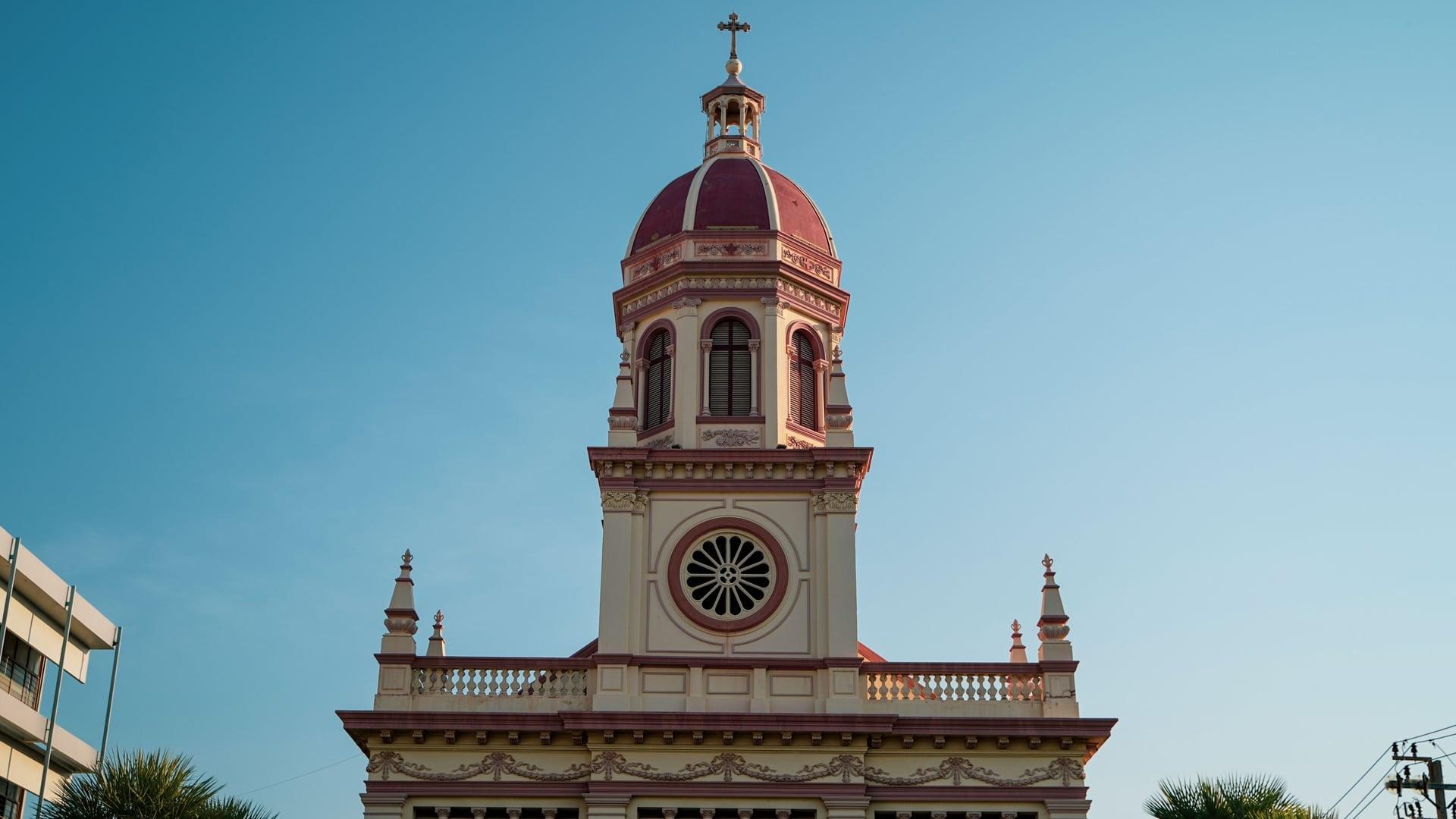
Santa Cruz Church: The Catholic Heart
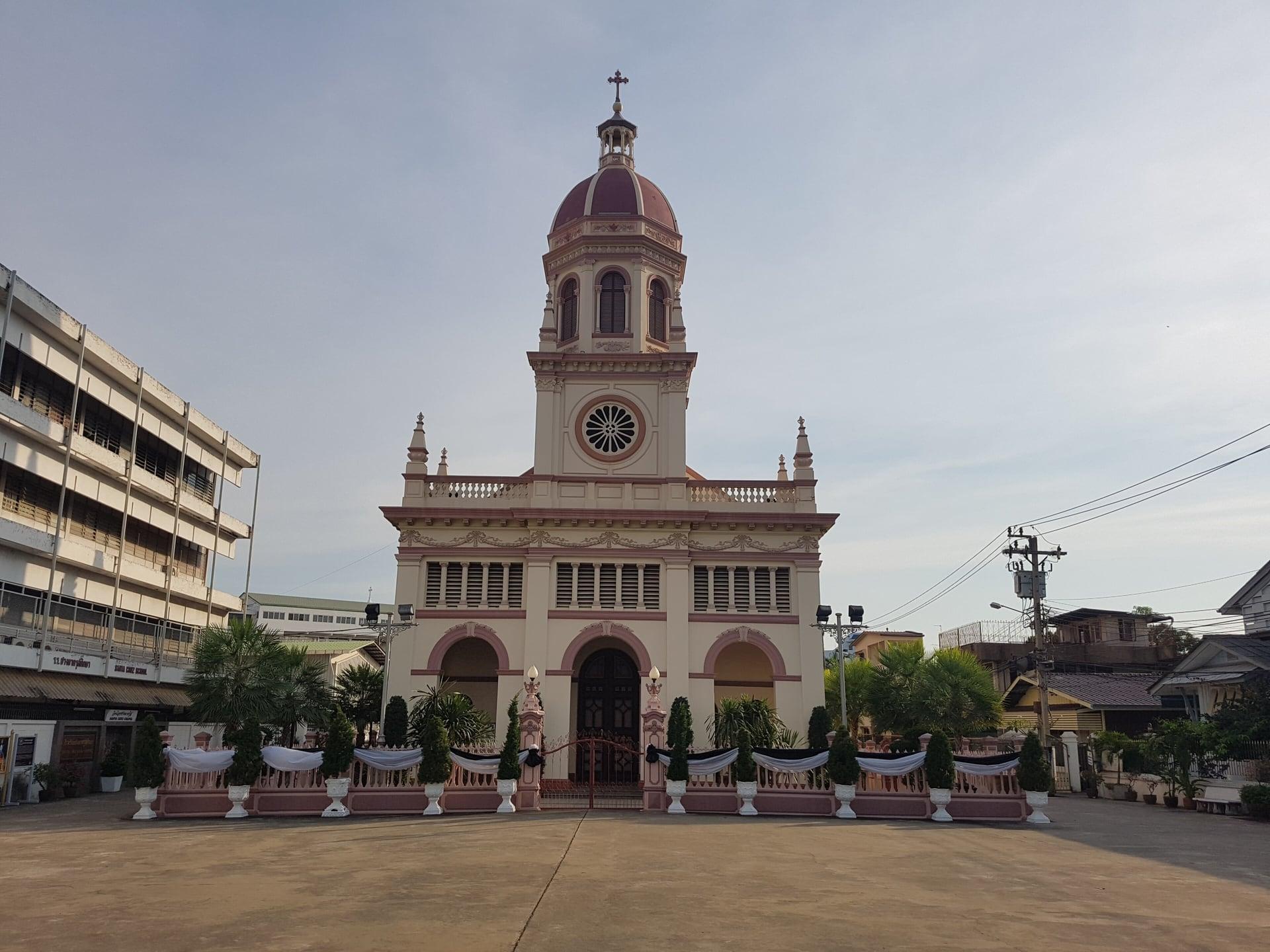
A domed church of the Portuguese. Santa Cruz, called the second Catholic church built in the country, its present building finished in 1916 by most accounts, still an active parish.
- 11
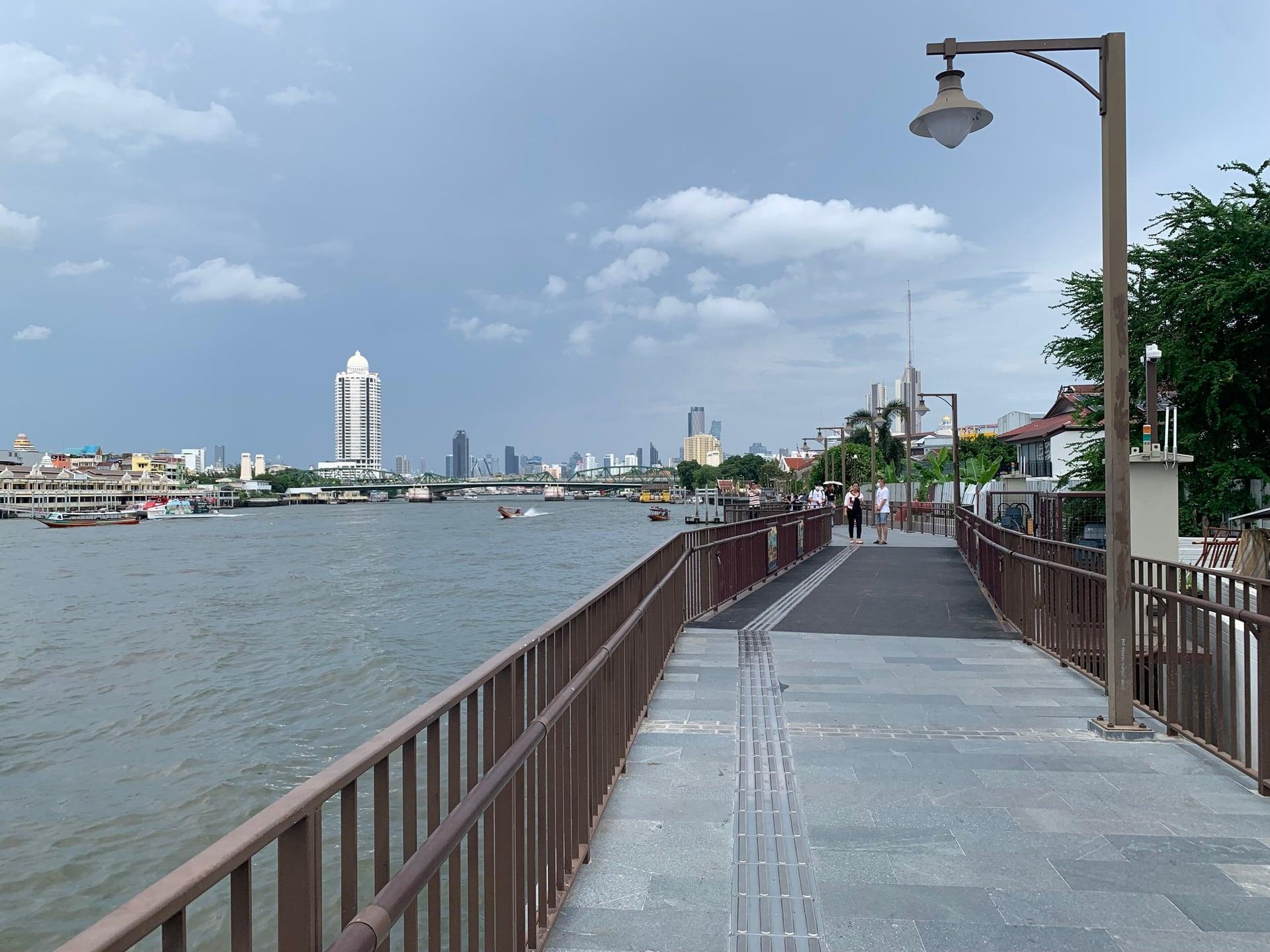
Riverside Walk: The River as Main Street
The river as the old main street. The Kudi Chin riverside walkway, with the Memorial Bridge and Phra Pokklao Bridge ahead and Pak Khlong Talat across the water.
- 12
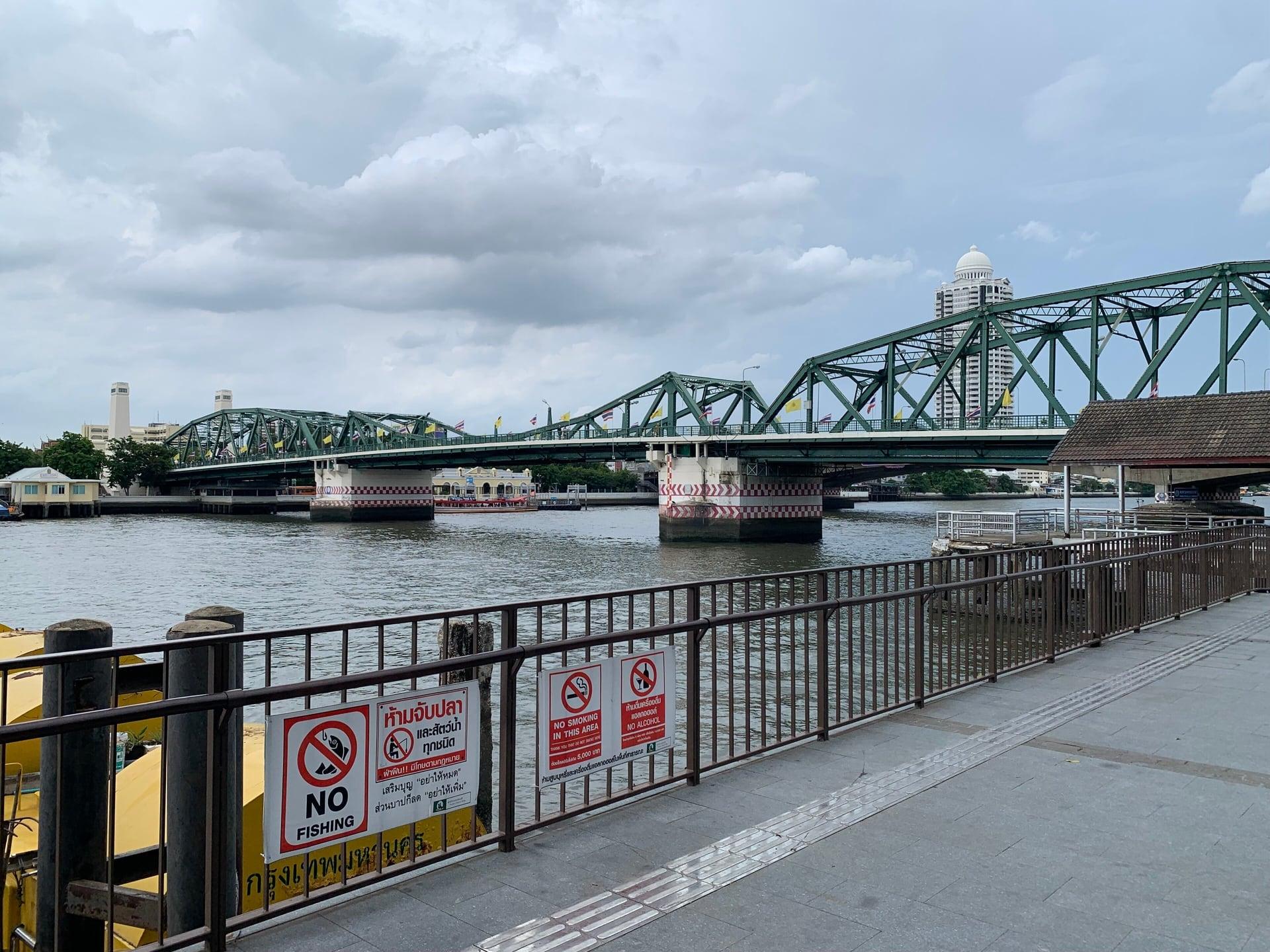
Memorial Bridge: Joining the Banks
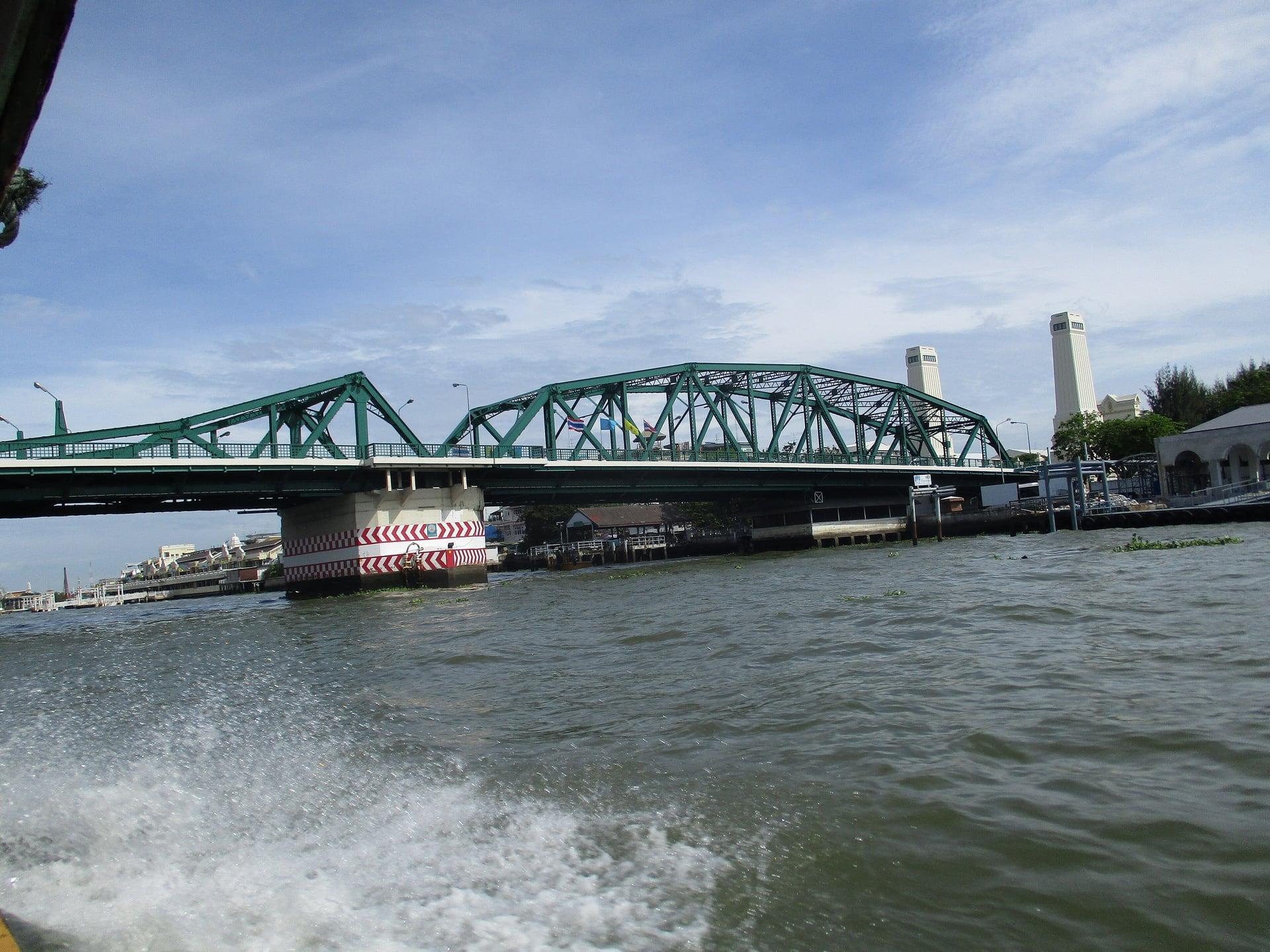
Steel spans joining the two banks. The Memorial Bridge, opened on 6 April 1932, commonly called Saphan Phut after King Rama I, with a footway across to Pak Khlong Talat and Chinatown.
Details
Best Time to Visit
Mid-afternoon into dusk in the cool season, November to February: start about 15:00 to 15:30 so Wat Arun's grounds are still open (daily 08:00 to 18:00, TAT, Wayback capture of 22 October 2026) and Wat Kalayanamit's court is reached before about 16:00 (its hours differ between sources: 07:00 to 17:00 or 08:00 to 16:00); the riverside walkway is shaded by the houses from mid-afternoon, and the end at the Memorial Bridge meets sunset (about 17:48 on 11 November, 17:53 in mid-December, 18:22 in mid-February, computed). Mornings from 08:00 also work, with sun on the walkway. TMD normals: highs about 32 to 34 °C November to February; haze is common December to February. Checked 11 November 2026.
Pro Tips
- •Start at the Wat Arun pier, where the ferry from Tha Tien pier lands. For Tha Tien: MRT Blue Line, Sanam Chai station, Exit 1, then walk to the pier. Pay the fare posted there.
- •Our Bangkok Old Town walk ends at Tha Tien. No operator page lists the cross-river ferry's fare or hours: pay the fare posted at the pier. On the Thonburi bank, MRT Blue Line Itsaraphap station is about 800 m by road south-west of stop 1 (the exit to use was not confirmed); a taxi can drop you at Wat Arun. Checked 11 November 2026.
- •To go inside Wat Arun (200 baht, daily 08:00 to 18:00, TAT, Wayback capture of 22 October 2026), start earlier and allow an extra hour; buy the ticket at the temple's own entrance (OpenStreetMap maps a ticket point at its west entrance). Shoulders and knees covered, shoes off before any hall. Checked 11 November 2026.
- •Wat Kalayanamit's pier (stop 7) has a cross-river ferry to Pak Khlong Talat (the Atsadang ferry, OpenStreetMap); its hours were not found. The walk itself ends at the Memorial Bridge, whose public footway crosses to the same flower market.
- •Wat Prayurawongsawat, with its large round white chedi built under Rama III, is a short way south-west of the Memorial Bridge's foot, off the route; TAT listed it as open daily 08:00 to 17:00 (Wayback capture of 15 June 2025).
- •The Kudi Chin bakeries keep their own hours; if one is open, khanom farang is the thing to try.
Safety & Precautions
- •Wat Arun's grounds are ticketed: 200 baht, daily 08:00 to 18:00 (TAT, Wayback capture of 22 October 2026). The temple does not publish what the ticket covers. Stops 1 to 3 are on Soi Wang Doem 8, the public lane outside the fence, and work at any hour. Checked 11 November 2026.
- •About 1 km of the walk is on narrow lanes with no sidewalk (Soi Wang Doem 8, Wang Doem Road, Soi Wang Doem 6, Soi Arun Ammarin 8, Wat Kalayanamit's service lanes and parking aisles): keep to the edge; motorbikes come both ways. Wang Doem Road is one-way and the walk goes against the traffic: stay on the side Soi Wang Doem 8 and Soi Wang Doem 6 join, so you never cross it. Traffic drives on the left: look right first.
- •The long walls along Wang Doem Road and the fort seen from stop 7 are Royal Thai Navy ground: do not photograph them, stop at their gates or fly a drone. The walk keeps to public lanes.
- •Not step-free: the Arun Amarin Road bridge between stops 4 and 5 has 34 steps up with a handrail at its north end and a flight down at its south end. At the foot of the south stair the route crosses a lane under the bridge: watch for motorbikes. A step-free alternative is a taxi from Wat Arun to Wat Kalayanamit.
- •Wat Kalayanamit's opening hours differ between sources (07:00 to 17:00 or 08:00 to 16:00); stops 6 and 7 and the lanes to them are inside its grounds, so reach it by about 16:00. If the gates are shut, play stops 6 and 7 at the gate. No checked way around the temple to stop 8 exists: Soi Wat Kanlaya, off Arun Amarin Road, heads inland away from the river, so use a map app to reach Santa Cruz Church (stop 10) and pick up the walk there, or take a taxi to the Memorial Bridge. Checked 11 November 2026.
- •Temples: shoulders and knees covered, no see-through clothes, shoes off before entering a hall; never touch a monk (women especially) or a Buddha image, never climb on an image or point your feet at one; do not photograph people at prayer, and ask before photographing anyone.
- •Heat and air: cool-season highs are about 32 to 34 °C (TMD normals, November to February) and there is little shade on the lanes and the bridge: carry water and a hat. Haze is common from December to February: check the air quality on the day.
- •The riverside walkway (stops 8 to 12) is shared with bicycles; whether it is lit after dark was not confirmed. GPS is weaker in the narrow Kudi Chin lane at stop 9: if the stop does not start, start it by hand.
- •The national anthem is played at 8 am and 6 pm in many public places: if you hear it, stand still until it ends.
Travel advisory: Exercise Normal Precautions (Level 1).
Gallery
Related Reading
Go deeper on what you'll see, hear, and walk through.
Overview
Bangkok Travel Guide 2026: Days, Transport, Season, Safety, and Budget
8 min
Overview
One Day in Bangkok: A Walkable Itinerary from Temples to Chinatown
8 min
Thematic
Bangkok in Layers: A Capital Founded as a Copy, Still Open for Business
8 min
Thematic
Best Culture Walking Tours in Bangkok (2026)
2 min
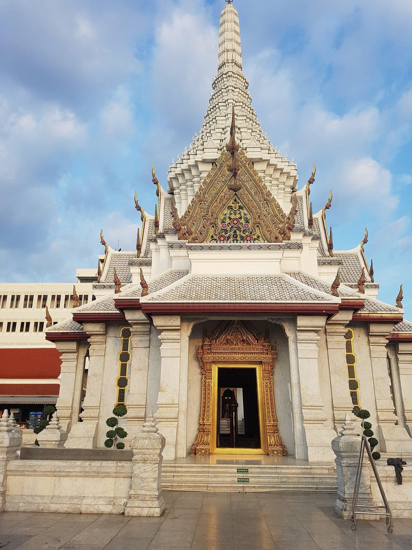
Companion
The Emerald Buddha and the Palace: How Bangkok Was Built to Replace a City That Burned
8 min
Companion
Thonburi and Kudi Chin: The Capital Before Bangkok and the Neighbors Who Stayed
8 min
Deep dive
Wat Arun: The Temple of Dawn and Its Porcelain Prang
6 min
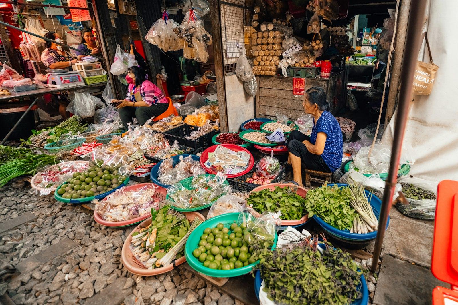
Read
What to Eat in Bangkok: The Dishes, Their Origins, and How to Order Like a Local
7 min
Read the walk
The full story of Wat Arun and Kudi Chin: The Capital Before Bangkok, in words. Prefer to listen? Play it narrated, from home or on location.
Introduction
Across the river from the Grand Palace lies an older capital. For fifteen years, from seventeen sixty seven to seventeen eighty two, this bank of the Chao Phraya, called Thonburi, was the seat of the kingdom. King Taksin built his palace on the water here, drew two temples inside its walls and dug a moat around his city. Then the capital moved across the river, and Bangkok grew up on the other side. This bank kept its temples, its canals and the neighbors who had settled here, Chinese, Portuguese and Thai, whose places of worship still stand side by side.
There are twelve stops over about two point four kilometers, about one and a half miles, and it takes about seventy five minutes. It is flat, with no busy road to cross. It is not step free: you climb thirty four steps onto a canal bridge and take a flight down the far side. About one kilometer runs along narrow lanes with no sidewalk, shared with motorbikes, so keep to the edge.
Wat Arun, the Temple of Dawn, is ticketed. The official tourism site gives the fee as two hundred baht and the hours as eight in the morning to six in the evening. This walk stays outside its grounds, so go in before you set off or come back afterward. Wat Kalayanamit, later on, may close its gates at four, so start in good time. Cover your shoulders and knees for the temples.
Even in the cool season, afternoons reach about thirty three degrees Celsius, so bring water and a hat, and from December to February check the air for haze. A mid afternoon start puts the riverside in shade and ends near sunset.
The walk ends at the foot of the Memorial Bridge, whose footway crosses the river to Chinatown. When you arrive at Wat Arun Pier, begin with stop one.
1. Wat Arun Pier: Arriving by Water
This is Wat Arun Pier. If you have come over on the ferry from Tha Tien, walk up off the landing and stop where the paved lane begins, clear of the pontoon and the people coming ashore. If you came by road, walk down the lane to the river and stop there.
Face the water. Straight across the river is Tha Tien, and above it the roofs of Wat Pho. The official tourism site says Wat Arun stands directly opposite Wat Pho, and that it has been here since the Ayutthaya period, the kingdom that ruled from upriver until its capital fell in seventeen sixty seven. Now find the great tower rising over the trees on this bank, a little downriver. That is the prang of Wat Arun. You will see it closer in a moment.
When Ayutthaya fell, King Taksin, the King of Thonburi, made his new capital here. Historical documents cited by the Bangkok Post describe how it began: a military camp built of wood, a moat dug, and the earth piled up as ramparts. A map believed to have been drawn by Burmese spies shows a city on both banks of the river, with a walled palace and cannons on this one. The palace stood just downriver from here, on the water. The river was the main street, and visitors came the way you just did, by boat.
The landing can be busy with vendors. A simple no thank you is enough. Please ask before you photograph anyone.
Follow the route along the lane beside the temple's fence. The next stop looks up at the prang.
2. Wat Arun's North Wall: Temple of Dawn
This is the north wall of Wat Arun. Stop in the lane where, over the temple's fence, you can see a cross shaped gate pavilion just beyond it, and beyond it, the great tower.
The temple grounds are ticketed. The official tourism site gives the fee as two hundred baht and the hours as eight in the morning to six in the evening. If you want to go in, buy your ticket at the temple's own entrance. Inside, cover your shoulders and knees, take your shoes off before entering any hall, and never touch or climb on a sacred image. This walk stays here, in the public lane, which works at any hour.
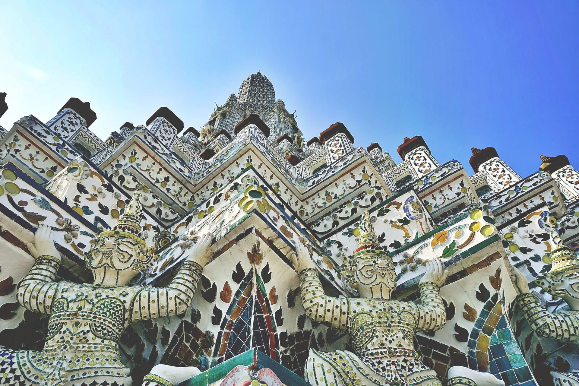
That tower is the prang, a tall, rounded shrine tower, and it gives the temple its English name. Arun means dawn: this is the Temple of Dawn. By the official account, the great prang was raised in the reign of King Rama the Third and completed in the reign after his. Look at its surface. It is set with thousands of pieces of ceramic and porcelain, laid in patterns that climb toward the top and catch the light.
Some of what you see is new. A major restoration began in twenty thirteen. The head of the Fine Arts Department told The Nation in twenty seventeen that as much as forty percent of the original designs had needed completely new decoration, made to the old patterns. The work drew criticism, and the department defended it, while admitting that cement had covered some of the ceramic details.
Follow the route on along the lane. The next stop is beside the temple's ordination hall.
3. Ordination Hall: The Working Temple
This is Wat Arun's ordination hall. Stop in the lane where the roof of a long hall rises just behind the temple's covered galleries, on the temple side of the lane.
The ordination hall is where monks are ordained, the ritual center of a Thai temple. Visitors come for the tower, but this hall is the working heart of the place. The official tourism site says the temple was restored so thoroughly in the second reign of the new Bangkok kings that it counts as a temple of that reign, and that when the work was finished it was given the royal name Wat Arun Ratchatharam.
The same site says the temple once kept the Emerald Buddha, the image brought from Vientiane. While Thonburi was the capital, this temple stood inside the palace walls. In seventeen eighty two the capital moved across the river, and King Rama the First moved the Emerald Buddha to the new palace temple he built on the far bank. It is still there today, behind the Grand Palace walls that our Bangkok Old Town walk follows.
So this hall marks the moment the capital moved. The tower beside it was raised later, under the Bangkok kings; the hall remembers the years when this side of the river was the royal one.
Follow the route along this lane and down Wang Doem Road, staying on the side this lane joins, at the edge, facing the oncoming cars.
4. Wat Moli Lokkayaram: Inside the Palace
This is Wat Moli Lokkayaram. Stop in the narrow lane where the temple's halls and roofs show over its wall.
For the last few minutes you have walked beside long walls. Behind them is what remains of King Taksin's palace, with the river fort beyond it. Today all of that is the Royal Thai Navy's ground, closed to the public, and this walk keeps to the public lanes.
This temple was part of that palace. The temple's own history says it was built in the Ayutthaya period, about three hundred years ago, and that Taksin brought it and Wat Arun within his palace boundary. Picture a royal compound on the river with two temples inside its walls. The Bangkok Post's report on the excavations says the palace had twenty one gates.
When the capital crossed the river, the palace temples changed with it. The temple's history says King Rama the First ordered this one restored, and that later kings restored it again and renamed it more than once. Since nineteen ninety one it has been a center for the education of monks.
The temple does not publish visiting hours, so this stop is told from the lane. If you do go in, dress as for any temple and take off your shoes before entering a hall.
Follow the route through the lanes and over the canal bridge, with a flight of steps at each end; watch for motorbikes in the lane at the bottom.
5. Khlong Bangkok Yai: The Moat
This is Khlong Bangkok Yai. You have come down off the bridge. Stop on the footway a little past the foot of the stairs, with the bridge behind you. Khlong means canal, and on that bridge you crossed two of them. The wider one, Khlong Bangkok Yai, runs on toward the river. By…
Full narration for this stop unlocks with the tour.
6. Wat Kalayanamit: The Great Buddha Hall
This is Wat Kalayanamit. Stop in the open court and turn to face the tall hall that rises over the temple's other buildings. That hall is a viharn, an image hall, and it houses one very large seated Buddha image. Thai worshippers call it Luang Pho To. Chinese worshippers come…
Full narration for this stop unlocks with the tour.
7. Wat Kalayanamit Pier: The River Fort
This is Wat Kalayanamit Pier. Stop at the river end of the court, by the pier, with the river ahead. Across the mouth of the canal, beside the river, you should see a white fort with a flagstaff. This is Wichai Prasit Fort. It guarded the river when Thonburi was the capital,…
Full narration for this stop unlocks with the tour.
8. Kian Un Keng Shrine: The Chinese Strand
This is Kian Un Keng. Stop in the lane where the front of a Chinese shrine faces you, a short way ahead. You have entered Kudi Chin, a neighborhood settled before Bangkok existed. The Bangkok Post's history of it says Chinese migrants were the first settlers here, followed by…
Full narration for this stop unlocks with the tour.
9. Baan Kudichin Museum: The Portuguese Lanes
This is Baan Kudichin Museum. Stop in the narrow lane beside the small house museum; baan means house. The Bangkok Post's account of this community says the Portuguese began settling in Kudi Chin in seventeen sixty nine, after the fall of Ayutthaya, in the first years of…
Full narration for this stop unlocks with the tour.
10. Santa Cruz Church: The Catholic Heart
This is Santa Cruz Church. Stop at the corner of the lane beside the church, where its front and its dome come into view. Santa Cruz is Portuguese for Holy Cross. The Bangkok Post calls this the second Catholic church to be built in the country. The building you see is not the…
Full narration for this stop unlocks with the tour.
11. Riverside Walk: The River as Main Street
This is the riverside walk. Stop on the walkway with the river beside you and the bridges ahead. The steel bridge is the Memorial Bridge, where this walk ends. The concrete bridge beside it is the Phra Pokklao Bridge. On the far bank, by the bridges, is Pak Khlong Talat, the…
Full narration for this stop unlocks with the tour.
12. Memorial Bridge: Joining the Banks
This is the Memorial Bridge. Stop at the end of the walkway, at the foot of the bridge, where its steel spans rise over the river. It opened on the sixth of April nineteen thirty two, a hundred and fifty years after the capital moved across the river, and it is commonly…
Full narration for this stop unlocks with the tour.
- Wat Moli Lokayaram, Bangkok, Thailand. — This Photo was taken by Supanut Arunoprayote. Feel free to use any of my images, CC BY 4.0 · source
- This is a photo of a monument in Thailand identified by the ID — CKasa, CC BY-SA 3.0 · source
- Khlong Bangkok Yai as seen from Anutin Sawat Bridge, the historic bridge Charoen Phat that carries Itsaraphap Road is distant — Phoebus 28, CC BY-SA 4.0 · source
- This is a photo of a monument in Thailand identified by the ID — Athichitra, CC BY-SA 4.0 · source
- Kuan An Keng Shrine, Wat Kanlaya Subdistrict, Thonburi District, Bangkok. — This Photo was taken by Supanut Arunoprayote. Feel free to use any of my images, CC BY 4.0 · source
- Kuan An Keng Shrine, Wat Kanlaya Subdistrict, Thonburi District, Bangkok. — This Photo was taken by Supanut Arunoprayote. Feel free to use any of my images, CC BY 4.0 · source
- Kadi Chin (Kudi Chin) Riverwalk is a riverside pathway along the Chao Phraya connecting Wat Kalayanamit Temple to the Memorial Bridge — Chainwit., CC BY 4.0 · source
- Kadi Chin (Kudi Chin) Riverwalk is a riverside pathway along the Chao Phraya connecting Wat Kalayanamit Temple to the Memorial Bridge — Chainwit., CC BY 4.0 · source
- Kadi Chin (Kudi Chin) Riverwalk is a riverside pathway along the Chao Phraya connecting Wat Kalayanamit Temple to the Memorial Bridge — Chainwit., CC BY 4.0 · source
- Jembatan Peringatan / Memorial di Bangkok, Thailand. — Cun Cun, CC BY-SA 4.0 · source
Images may be cropped or resized. Other photos via Unsplash and Pexels.