Lambton Quay: The Capital on the Old Shoreline
95 min · 4 km · easy
Wellington is a capital built on ground the sea gave up: the flat centre of New Zealand's government city sits on the head of the harbour Te Whanganui-a-Tara, on land lifted out of the water by a great earthquake in 1855 and reclaimed since, and you can read that fact stop by stop, at your own pace, on two short walks. The main shopping street is called a quay because it once ran along the beach. The national museum is built around a Maori meeting place. The parliament, the church, and the old government offices each answer the same question in a different material. Wellington is small enough to cross on foot in an afternoon and layered enough that the ground under your shoes keeps changing its story.
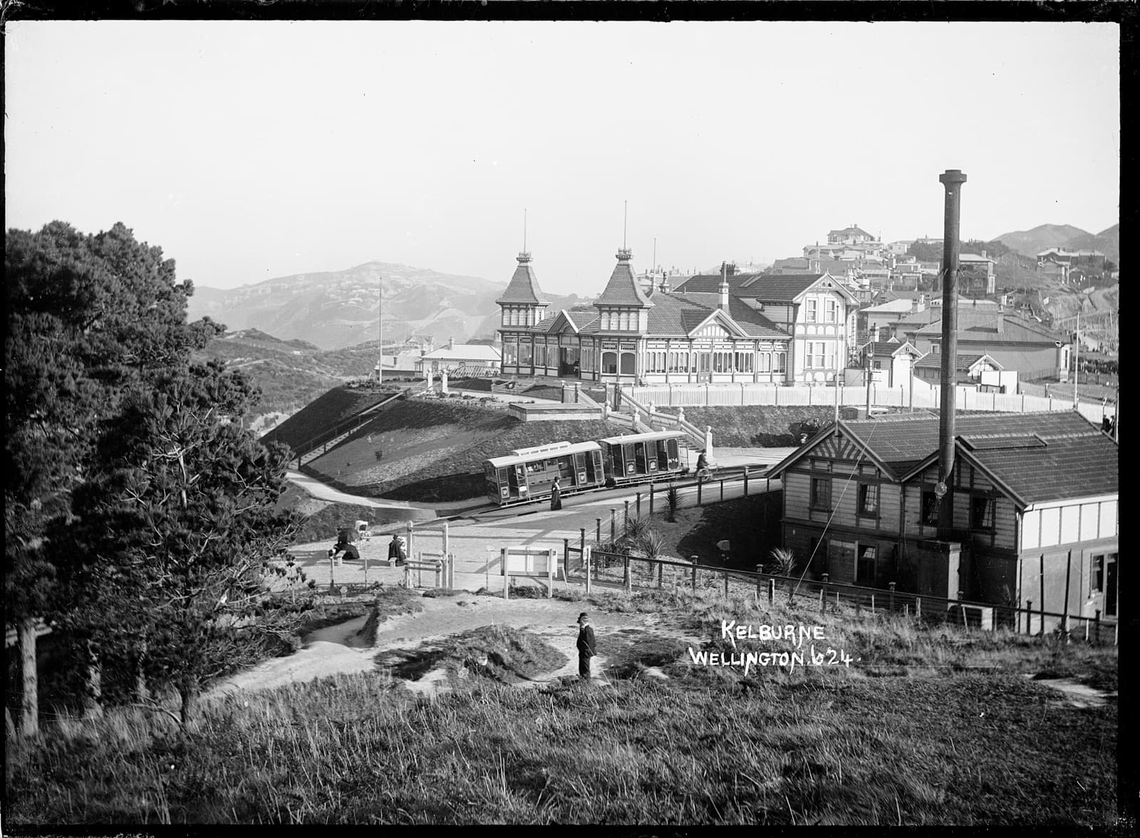
Start with the plainest evidence. Lambton Quay, the busy central shopping street, carries a word that means waterfront, and yet there is no water near it. That is not a naming error. When the settlement was laid out in 1840, this line was the beach, the high-water mark of the harbour. Brass plaques set into the footpath still mark that 1840 shoreline, so you can put your feet on the old waterline and look out over dry land where the sea used to break. Two forces pushed the water back. On the twenty-third of January, 1855, the Wairarapa earthquake struck, magnitude at least eight point two, and lifted the land by two to three metres in a single violent movement, raising part of the harbour floor out of the sea. Then, over the following decades, people reclaimed still more ground from the shallows. Today Lambton Quay lies about two hundred and fifty metres from the present shoreline. The Lambton Quay: The Capital on the Old Shoreline walk is built to make that legible: the ground rose by the height of a room in one afternoon, and the quay kept its name and lost its water.
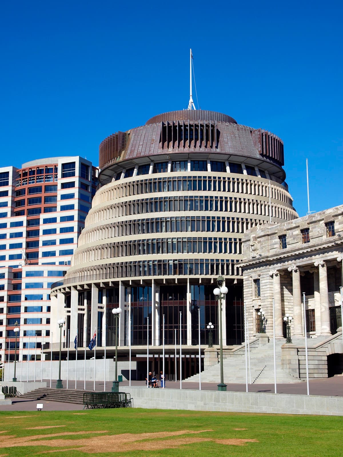
On that same reclaimed flat stands the whole grammar of the state, three buildings in a row that read like a lesson in how a young country pictured itself. In the middle is Parliament House, an Edwardian neoclassical block built between 1914 and 1922 and never finished, a capitol interrupted whose grand planned second half was never built. Beside it stands the Parliamentary Library, completed in 1899 in a soaring Gothic Revival style, whose iron fire-door helped save it and its collections in the fire of 1907 that destroyed the earlier assembly building next door. To the left is the Beehive, officially the Executive Wing, a round modernist tower designed by the Scottish architect Sir Basil Spence, opened in 1977 and rising about seventy-two metres, its stacked circular floors giving it the name. Entry to the grounds is free, and Parliament runs free guided tours if you want the interiors.
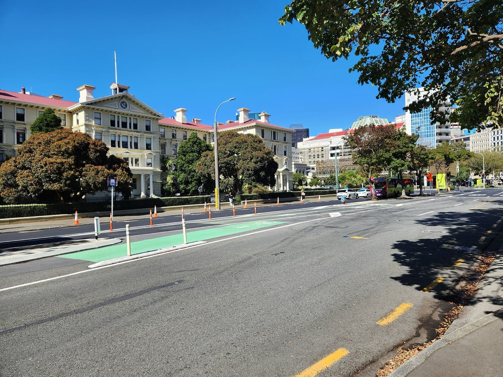
A short walk on brings the strangest building in the capital. The Old Government Buildings, completed in 1876 to the design of the Colonial Architect William Clayton, read from across the lawn as a heavy Italianate stone palazzo. The whole thing is wood. It is built of native kauri with Tasmanian hardwood framing, and every stone detail, the quoins, the cornices, the rusticated blocks, is timber shaped and painted to imitate carved stone. For over a century it was the second-largest wooden building in the world, after the temple of Todai-ji in Nara, Japan. A colonial administration wanted permanence, stone was scarce and slow, timber was near at hand, so they built in wood and dressed it as stone. It now houses the Victoria University of Wellington law faculty. The same instinct, native timber standing in for the stone of the old world, shaped Old St Paul's on Mulgrave Street: a Gothic Revival church consecrated on Trinity Sunday, the sixth of June, 1866, built of native rimu, totara, matai, and kauri, its interior warm and dark and glowing with grain where a stone church would be cool and grey.
The layering resolves at the Old Bank Arcade on the corner of Lambton Quay and Customhouse Quay. The building is the former Bank of New Zealand, completed in 1901, reopened as a shopping arcade in March 1999. Beneath its floor lie the timbers of a ship. A settler named John Plimmer bought the wrecked vessel Inconstant in 1851 and turned its hull into a warehouse and jetty on the beach, known as Plimmer's Ark. As the shoreline advanced, the hull was buried under the rising ground, forgotten until the late-1990s redevelopment dug it out. A section of that hull is now displayed inside. A grand bank, on a street that was once a beach, with the bones of a beached ship kept beneath it: the whole walk folds together in one place before the century-old cable car lifts you above it to the Botanic Garden, established in 1868, and the classic view of the little capital spread out on its reclaimed flats.
The second walk reads Wellington's creative life along the same descent from civic centre to water. The Cuba Street: Bohemian Wellington by the Bay route begins in Te Ngakau Civic Square under Neil Dawson's Ferns, a suspended aluminium sphere about three point four metres across, cut from eleven fern fronds, gold inside and silver out, a globe of the country's own bush hung over its capital. It turns up Cuba Street, named not for the country but for a New Zealand Company ship that reached the harbour on the third of January, 1840. The street survived the heavy central-city rebuilding of the 1960s through 1980s and holds the most complete collection of Victorian and Edwardian commercial architecture in the city. At its centre tips the Bucket Fountain, a kinetic sculpture erected in 1969, mocked as an engineering joke when it opened and beloved ever since, its stacked buckets filling and spilling, sailing the water sideways into passers-by on a windy day.
That descent also passes the honest counterweight to the bohemian delight. At thirty-nine to forty-three Taranaki Street stand the preserved remains of Te Aro Pa, a Maori settlement that covered about five acres and supported roughly one hundred and thirty people at the time of European colonisation, on the Country of Te Ati Awa and Taranaki Whanui, whose occupation of this flat long predates the colonial town. Three tree-fern house structures were uncovered during demolition in December 2005 and preserved where they were found. The walk ends at Te Papa Tongarewa, the national museum opened in 1998, structured biculturally around the Treaty of Waitangi, with a living marae, Rongomaraeroa, at its heart. That is the through-line of the little capital: a government city on ground the sea gave back, whose plainest street, oldest settlement, and national museum all reward the same slow, self-directed reading.
For the full set of routes, see Wellington walking tours.
Sources
- Heritage New Zealand Pouhere Taonga, listings for Wellington Railway Station, Old Government Buildings, Old St Paul's, the former Bank of New Zealand, Cuba Street historic area, and Te Aro Pa.
- Te Ara, the Encyclopedia of New Zealand, entries on Wellington as capital, the 1855 Wairarapa earthquake, and harbour reclamation.
- Museum of New Zealand Te Papa Tongarewa, institutional history and bicultural building description.
- Engineering New Zealand, records on the Wellington Cable Car funicular.
- Wellington Sculpture Trust, documentation of Neil Dawson's Ferns.
Frequently asked questions
- Why is Lambton Quay called a quay when there is no water near it?
- When Wellington was laid out in 1840, Lambton Quay ran along the beach at the harbour's high-water mark. The 1855 Wairarapa earthquake lifted the land by two to three metres and later reclamation pushed the sea back further, so the street now lies about two hundred and fifty metres from the present shoreline. Brass plaques set into the footpath mark the original 1840 waterline.
- What are the three buildings at the New Zealand Parliament in Wellington?
- Parliament House, an Edwardian neoclassical block built between 1914 and 1922 and never finished to its original design; the Parliamentary Library, completed in 1899 in Gothic Revival style; and the Beehive, the round modernist Executive Wing designed by Scottish architect Sir Basil Spence and opened in 1977. Entry to the grounds is free, and Parliament runs free guided tours.
- Why are the Old Government Buildings in Wellington made of wood but look like stone?
- The Old Government Buildings, completed in 1876, were built of native kauri with Tasmanian hardwood framing but detailed and painted to imitate an Italianate stone palazzo. A colonial administration wanted to project permanence, but stone was scarce and slow while timber was near at hand. For over a century the building was the second-largest wooden building in the world, after the temple of Todai-ji in Nara, Japan.
- Is Cuba Street in Wellington named after the country Cuba?
- No. Cuba Street was named by the first Surveyor-General, Captain William Mein Smith, after the New Zealand Company ship Cuba, which reached Wellington Harbour on the third of January, 1840. The street survived the heavy central-city rebuilding of the 1960s through 1980s and holds the most complete collection of Victorian and Edwardian commercial architecture in the city.
- What is at the heart of the Te Papa museum in Wellington?
- Te Papa Tongarewa, the national museum, opened in 1998 and is structured biculturally around the Treaty of Waitangi. At its heart is a living marae, a Maori meeting place called Rongomaraeroa, with a contemporary carved meeting house named Te Hono ki Hawaiki. General admission is free.
Ready to experience it?
Lambton Quay: The Capital on the Old Shoreline
95 min · 4 km · easy
More from Wellington
Explore more at your own pace.
One Day in Wellington: A Walking Itinerary
Wellington Travel Guide: Days, Transport, Cost, and Safety
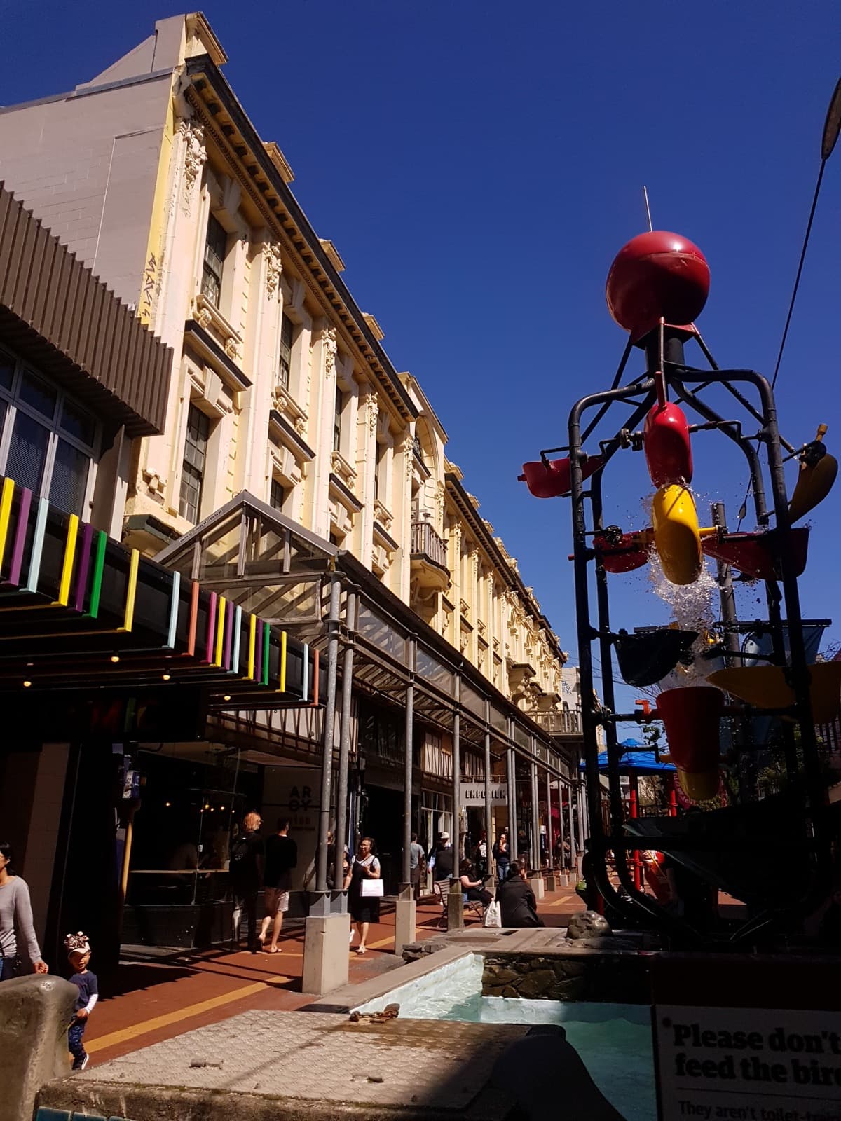
Cuba Street, Wellington: The Bohemian Spine Named for a Ship, Not the Country
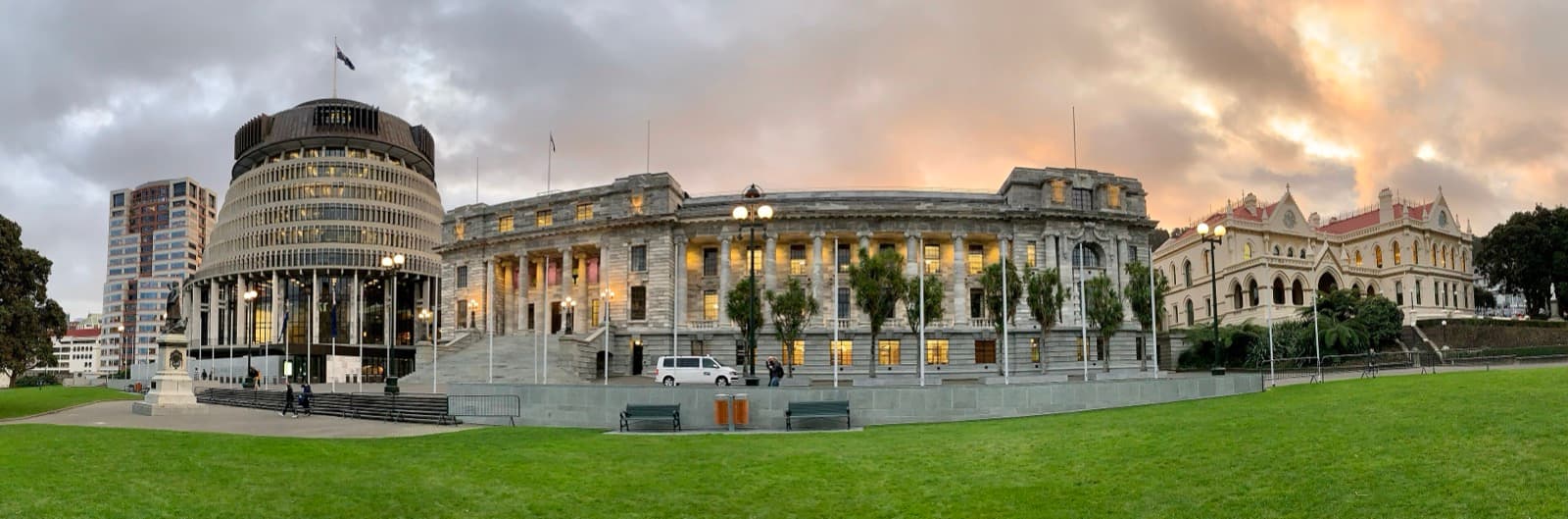
Reading Wellington's Parliament and the Beehive: Three Buildings, One Capital
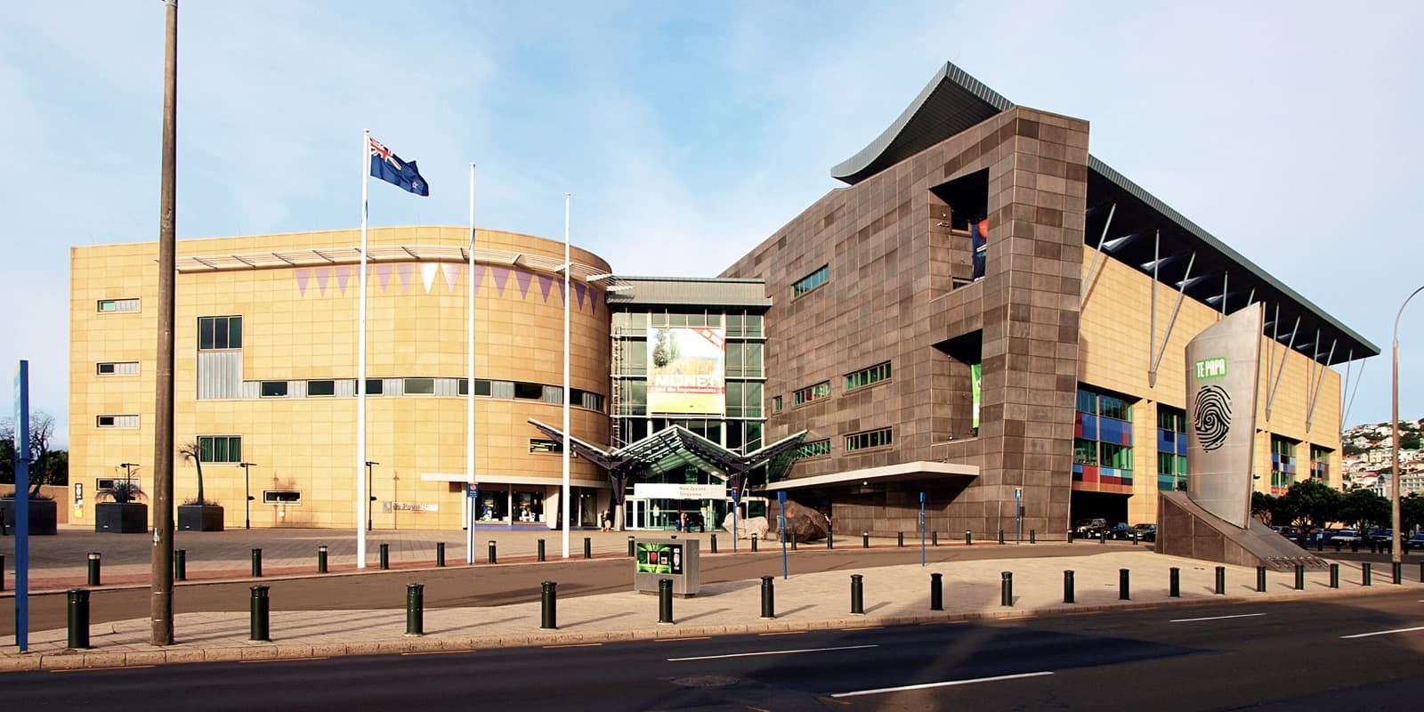
Te Papa Tongarewa: Why New Zealand's National Museum Is Built Around a Marae