Garrison Creek still runs under Trinity Bellwoods Park, in a brick storm sewer. The city approved burying it in 1884 and the creek went into the sewer in 1885. Its ravine was later filled with earth dug out for the Bloor-Danforth subway, and a 1915 concrete bridge was buried intact under Crawford Street. The bowl in the middle of the park is the last open piece of the ravine.
Trinity Bellwoods looks like a flat, friendly park: about fifteen hectares of lawn and old trees between Queen Street and Dundas Street in Toronto's west end. It is really a lid over a buried ravine. Under the grass runs Garrison Creek, in brick, through a valley that was filled with earth from the subway. A concrete bridge from 1915 is still down there too, under the street on the park's west side. Once you know this, the shape of the ground starts to make sense.
A valley cut by meltwater
About twelve thousand years ago a glacial lake, Lake Iroquois, stood over what is now Toronto. Its shoreline ran roughly where Davenport Road runs today. When the lake drained, it left a plain of sand and clay, and the water running off that plain cut valleys into it.
Garrison Creek was one of them. Lost Rivers traces it for about 7.7 kilometres, from north of Davenport Road down through Christie Pits, Bickford Park, Fred Hamilton Park and Trinity Bellwoods to the harbour near Fort York. Most of Trinity Bellwoods lies in its old ravine.
Fort York was built at the creek's mouth in 1793. At that time, the City of Toronto's Discovery Walk says, the creek ran clear and was famous for salmon.
Into the brick
Hear a stop from this walk
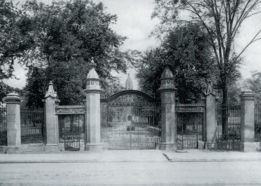
The Trinity Gates
In 1884 city council approved burying Garrison Creek, and in 1885 it went into a brick sewer. In 1912 the sewer was enlarged.
Burying the water did not remove the valley. For decades after the creek disappeared, the ravine stayed open: a deep fold in the land with nothing running along the bottom of it. Streets that wanted to cross it still needed bridges.
The bridge that was never taken down
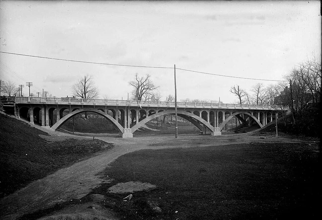
Crawford Street was one of them. From 1884 a wooden bridge carried it across the ravine. In 1914 and 1915 the city's works commissioner, R.C. Harris, replaced it with a three-span concrete bridge arching high over the valley. The cover photograph of this article shows it in 1915, with the full drop of the ravine still beneath it.
Then the valley was filled. When the Bloor-Danforth subway was dug, the earth from its tunnels had to go somewhere, and some of it was poured into the Garrison Creek ravine. The Heritage Toronto plaque on Crawford Street dates the filling to the 1960s. Nobody demolished the bridge. They buried it.
The plaque says the road deck was rebuilt in 2004 and that the rest of the bridge is intact underground. Drive or walk along Crawford Street beside the park today and you are crossing a 1915 bridge without seeing any of it: three concrete spans standing in a valley full of earth, over a creek that still runs in brick below. The City's Discovery Walk notes a second original bridge buried intact under Harbord Street, further up the creek's line.
Made ground
The subway fill changed the shape of the park. It raised the north end almost to the level of Dundas Street, which is why that end is high and flat. Where the fill stops, the land drops steeply to the south. In winter that drop is the park's toboggan run, so everyone sliding down it is sliding off the edge of the subway's spoil.
What you can still see
One piece of the ravine was never filled. In the middle of the park, east of the old St Hilda's building, the land falls away into a deep hollow that people call the bowl. On most days it is full of dogs, and it is easy to take it for landscaping. The Friends of Trinity Bellwoods Park describe it as the last remnant of the ravine inside the park. Stand at the rim and you are looking at the shape the creek carved after the ice left.
Just north of the bowl, inside a low stone wall, stands an old shagbark hickory, the tree whose grey bark peels away in long curling strips. The Friends say it may be the last survivor of the woodland that grew in the ravine. There is no planting record or ring count to prove it, so "may" is the honest word. But it stands right at the edge of the one part of the valley that was never buried, which is exactly where a survivor would be.
So the park has layers. A lawn on top. Under parts of it, the foundations of Trinity College, whose buildings stood here from 1852 until they were pulled down in the 1950s. Under that, subway earth. Under the earth, a ravine. And at the bottom, a creek still on its way to the lake.
Walk it at your own pace
The Trinity Bellwoods walk reads the park the way a naturalist would, in ten stops over about 1.3 kilometres and around an hour. It starts at the old college gates on Queen Street, comes to the rim of the bowl, the hickory and the made ground at the north end, and finishes at the Heritage Toronto plaque on Crawford Street, standing on the buried bridge. Every stop stands on its own, so you can start from whichever side of the park you arrive on. The same walk passes the trees where the park's white squirrels are most often seen. For every walk in the city, see the Toronto walking tours guide.
Cover photo: Crawford Street Bridge, west side, 16 November 1915, by James Salmon. City of Toronto Archives, Fonds 1231, Item 1615. Public domain, via Wikimedia Commons.

Frequently asked questions
- Is Garrison Creek still flowing under Trinity Bellwoods?
- Yes. The creek was put into a brick sewer in 1885 and still runs beneath the park as a buried storm sewer, on its way to the harbour near Fort York.
- What is the bowl in Trinity Bellwoods Park?
- The Friends of Trinity Bellwoods Park describe the bowl as the last remnant of the Garrison Creek ravine inside the park. The rest of the valley was filled in. Much of the bowl is now an off-leash dog area.
- Is there really a bridge buried under Crawford Street?
- Yes. A three-span concrete bridge built in 1914 and 1915 was buried when the ravine was filled with subway earth. According to the Heritage Toronto plaque on Crawford Street, the road deck was rebuilt in 2004 and the rest of the bridge is intact underground.
Ready to experience it?
Trinity Bellwoods: The River Under the Lawn
60 min · 1.3 km · easy
More from Toronto
Explore more at your own pace.
Royal Ontario Museum: What to See, Floor by Floor
The ROM Crystal: Daniel Libeskind's Shard on Bloor Street
The ROM's Totem Poles: Crest Poles Built Into the Building
Zuul: The ROM's Armoured Dinosaur, Skin and All
The White Squirrels of Trinity Bellwoods