Pink City: The Walled Bazaar Grid
90 min · 4 km · moderate
Most cities grow. Jaipur was drawn. In 1727 the Kachhwaha Rajput ruler Maharaja Sawai Jai Singh the Second, a warrior and an astronomer, moved his capital down from the hills of Amber and laid out a new city on a strict grid. His planner, Vidyadhar Bhattacharya, worked from ancient Indian texts of town planning, dividing the walled city into nine rectangular blocks with wide, straight bazaars running through them. A century and a half later the whole old city was painted terracotta pink, and the color stuck. To read Jaipur is to read a designed object twice over: the planned Pink City on the plain, and the hill-palace of Amber it was built to replace. Walk both and you have walked the Rajput capital, at your own pace.
A city built like a diagram
The founding logic is unusually explicit here. Jai Singh did not let the city sprawl. Before there was a stone laid, there was a plan: nine rectangular blocks, two reserved for state buildings and palaces, seven for the public, with bazaars about thirty-four metres wide cutting straight through, far broader than the tangled lanes of older Indian cities. The whole was ringed by a thick wall pierced by gates. The grid came from Vastu Shastra and Shilpa Shastra, the classical Indian texts on town planning, which makes Jaipur one of the first planned cities of the subcontinent.
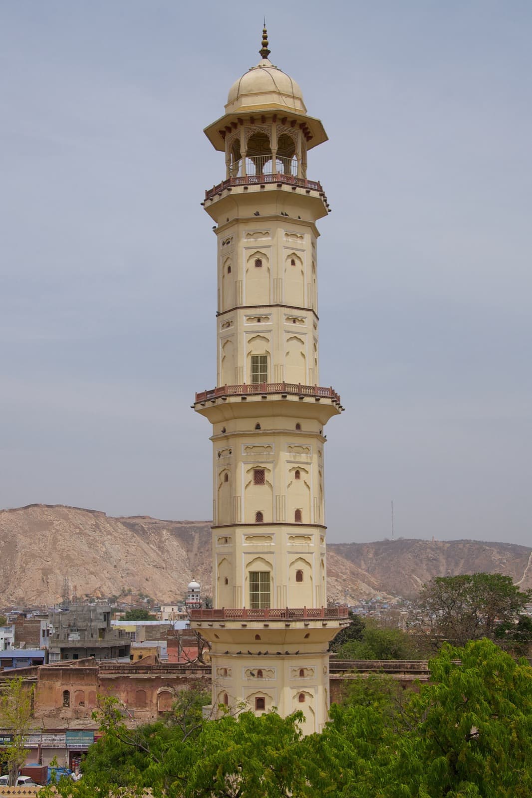
You can still read the plan at street level, and better still from above. The Pink City walk begins at the New Gate, a twentieth-century opening cut into an eighteenth-century wall, and moves across the grid one clause at a time. The clearest proof of the design is the Iswari Minar, a plastered tower raised about 1749 by Iswari Singh, a son of the founder, beside the ceremonial Tripolia Gate. Climb its interior spiral ramp and the maze of crowded lanes resolves into exactly the diagram the planner drew three centuries ago: the honeycomb of the Hawa Mahal, the sprawl of the City Palace, the straight bazaars running away in their grid, and, beyond the wall, the outline of Nahargarh Fort on its hill. The order did not kill the life inside it. The plan simply framed it.
Why the city is pink
Hear a stop from this walk
Johari Bazaar: The Street of Jewels That Proves the Plan
The color came later, and by decree. In 1876 the ruler of the day, Sawai Ram Singh the Second, ordered the old city painted pink to welcome Albert Edward, the Prince of Wales, who later became King Edward the Seventh. Pink was a color of welcome. Law kept it that way, and the nickname the Pink City stuck for good. UNESCO inscribed the walled city as a World Heritage Site in 2019, the second Indian city so honored.
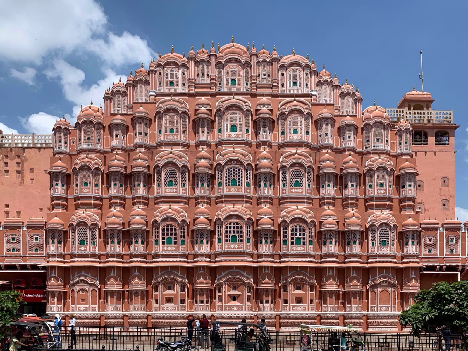
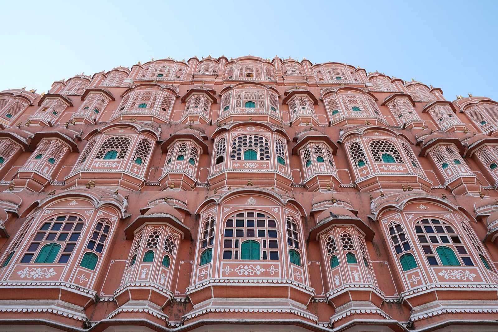
Behind the color sits the machinery of a court. The Hawa Mahal, the Palace of Winds, was built in 1799 by Maharaja Sawai Pratap Singh, designed by the architect Lal Chand Ustad. Its famous street-facing wall is not really a wall: it is a honeycomb of nine hundred and fifty-three small latticed windows called jharokhas, built so the royal women, who lived in seclusion under the custom of purdah, could watch the street and its processions without being seen. The lattice also pulled a cooling breeze through the building, which is where the name comes from. One quiet surprise: the celebrated facade is actually the back of the palace, with the real entrance around on the City Palace side.
The astronomer-king in stone
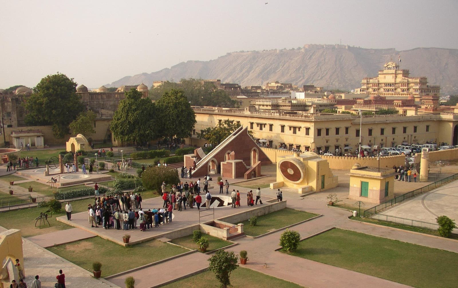
Jai Singh was a ruler and a soldier, but at heart an astronomer, and that mind is most visible at the Jantar Mantar. Between about 1728 and 1734 he built a field of nineteen astronomical instruments, made not of brass but of masonry, stone and plaster at enormous scale, to measure time, predict eclipses, and track the sun, moon, and stars. The centerpiece is the Vrihat Samrat Yantra, a sundial about twenty-seven metres tall, roughly an eight-storey building. By the observatory's own account its shadow tells Jaipur's local time to within about two seconds, moving roughly a hand's breadth every minute, so that time becomes something you can stand and watch cross the stone. Jai Singh built several such observatories, in Delhi, Ujjain, Varanasi, and Mathura, but UNESCO records the Jaipur site as the largest and best-preserved, inscribed as a World Heritage Site in 2010.
The grid has a center, and it is the City Palace, begun by the founder around 1729 and largely finished by 1732, laid out by the same Vidyadhar Bhattacharya who drew the city. Its core, the Chandra Mahal, rises seven floors and is still, to this day, the residence of the Jaipur royal family, so part of the complex is a museum and part a home. Look for the Pritam Niwas Chowk, an inner courtyard with four painted gateways, one for each season: the Peacock Gate for autumn, the Lotus Gate for summer, the green Leheriya Gate for spring, the Rose Gate for winter. The architecture blends Rajput, Mughal, and European ideas, all arranged by the same planning principles that shaped the streets outside.
The design even sorted the city by trade. UNESCO cites Jaipur's chattis karkhanas, the thirty-six industries, each historically assigned its own street within the grid. Johari Bazaar, one of the oldest markets, is the living proof: johri means jeweller, and the jewellers are still there, in the street named for jewellers, working kundan gem-setting and meenakari enamel with Mughal-era roots, exactly where the plan put them nearly three hundred years ago.
The hill-palace the grid replaced
To understand why Jai Singh built a new city at all, climb the one he left. Before 1727 the Kachhwahas ruled from Amber, a fortress-palace of pale sandstone and marble on a rocky hillside above a lake, about eleven kilometres north of the plain. The population outgrew the water, and the dynasty moved down to the grid. The Amber Fort walk reads that older capital across six stops.
It begins at the Suraj Pol, the Sun Gate, opening onto the Jaleb Chowk, the parade ground where the returning army once assembled above the Maota lake, with its saffron-garden island, the Kesar Kyari Bagh, floating in the water. Off the courtyard stands the Shila Devi temple, shrine of the family goddess, established by Raja Man Singh the First, its idol installed on the sixth day of Navratri in 1604. Higher up, the Diwan-i-Am is an open colonnade of twenty-seven bays, each column capped with a carved elephant, a Rajput reading of the Mughal audience hall left open to the wind and the Aravalli hills. The Ganesh Pol, a painted three-level gate attributed to Mirza Raja Jai Singh the First in the mid-seventeenth century, marks the threshold between the public fort and the private quarters, with a screened gallery above where secluded women watched unseen, the same purdah logic that would later shape the Hawa Mahal.
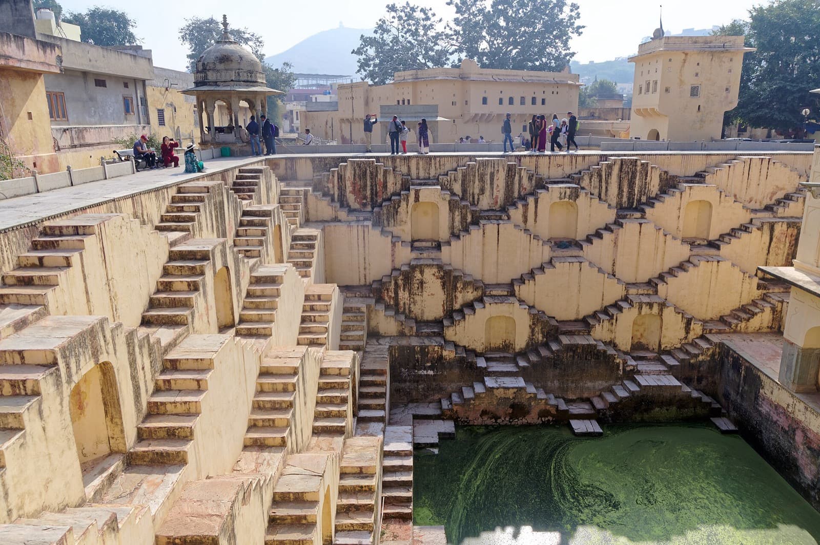
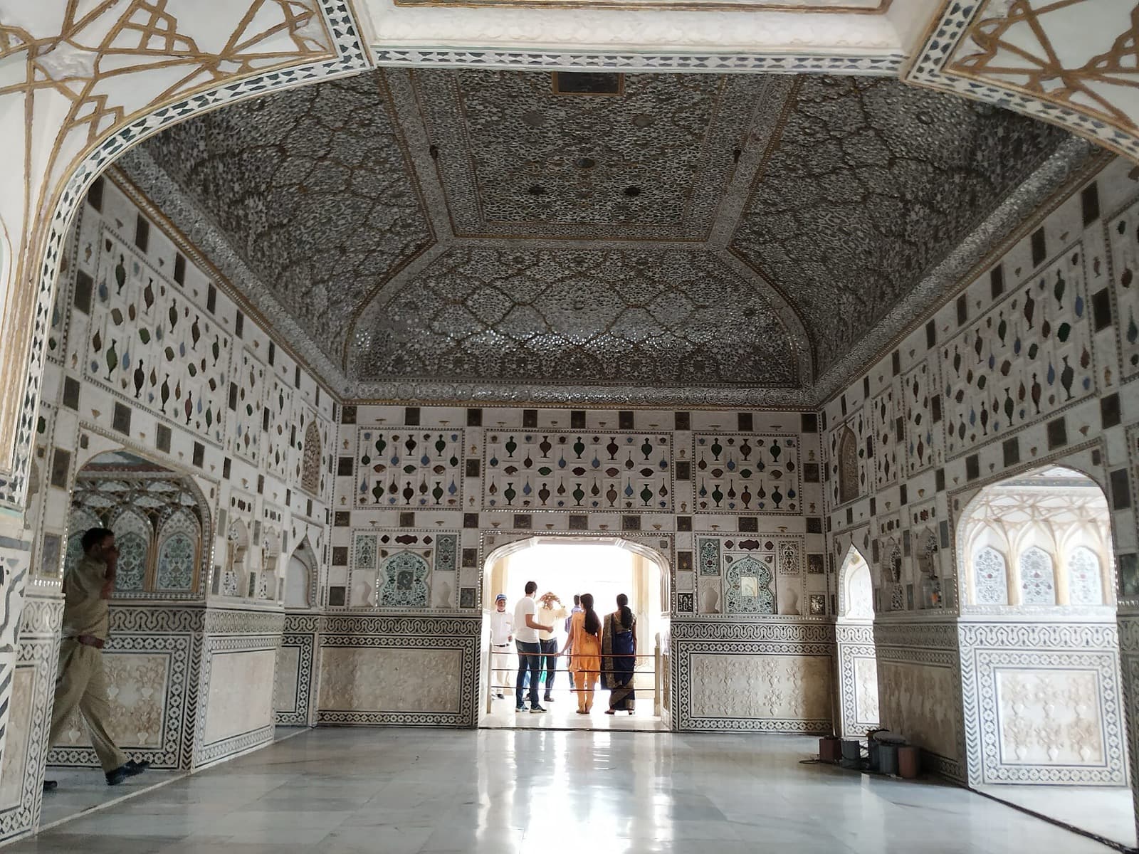
The climb pays off in the Sheesh Mahal, the Mirror Palace, whose walls and vaulted ceiling are covered in thousands of tiny convex mirrors in the technique called ainakari. Designed to be seen by a single flame, it scatters one candle into a whole sky of stars. Even here the theme holds: at the Sukh Niwas across the courtyard, an open channel of water cooled the room like early air-conditioning, and down in the town below, the symmetrical crossing stairs of the Panna Meena ka Kund stepwell catch rainwater in strict geometry. From a king's private galaxy of mirrors to a village well of crossing stairs, this hill and its town were, first and last, a masterpiece of catching water and light. UNESCO inscribed Amber in 2013 as one of the six Hill Forts of Rajasthan.
Read the planned Pink City and the hill-palace it replaced, and you have read the same Rajput mind twice: once on a hillside, working with the ground it was given, and once on a plain, drawing the ground it wanted. For more on both, see the full guide to Jaipur walking tours.
Sources
Frequently asked questions
- Why is Jaipur called the Pink City?
- In 1876 the ruler Sawai Ram Singh the Second ordered the old walled city painted terracotta pink to welcome Albert Edward, the Prince of Wales, who later became King Edward the Seventh. Pink was a color of welcome, and later law kept it that way, so the nickname stuck. The color applies to the historic walled city, not the whole modern metropolis.
- Who planned Jaipur and when?
- Jaipur was founded in 1727 by Maharaja Sawai Jai Singh the Second, a Kachhwaha Rajput ruler who was both a warrior and an astronomer. His planner, Vidyadhar Bhattacharya, laid out the city on a strict grid of nine rectangular blocks using ancient Indian town-planning texts, Vastu Shastra and Shilpa Shastra. It is considered one of the first planned cities of the subcontinent.
- What is the Jantar Mantar in Jaipur?
- The Jantar Mantar is a field of nineteen giant astronomical instruments built by Jai Singh the Second between about 1728 and 1734, made of masonry rather than metal. Its centerpiece, the Vrihat Samrat Yantra, is a sundial about twenty-seven metres tall. UNESCO records it as the largest and best-preserved of Jai Singh's observatories and inscribed it as a World Heritage Site in 2010.
- What is the difference between Amber Fort and Jaipur?
- Amber was the older hill-capital of the Kachhwaha Rajputs, a fortress-palace of sandstone and marble above a lake about eleven kilometres north of Jaipur. In 1727 the dynasty moved down to the plain and founded the planned city of Jaipur, because the Amber population had outgrown its water. Amber Fort was inscribed by UNESCO in 2013 as one of the six Hill Forts of Rajasthan.
- Why does the Hawa Mahal have so many windows?
- The Hawa Mahal, built in 1799, has a facade of nine hundred and fifty-three small latticed windows called jharokhas. Royal women who lived in seclusion under the custom of purdah could sit behind them and watch street life and processions without being seen. The many openings also pull a cooling breeze through the building, which is why it is called the Palace of Winds.
Ready to experience it?
Pink City: The Walled Bazaar Grid
90 min · 4 km · moderate
More from Jaipur
Explore more at your own pace.
Jaipur Travel Guide: Days, Transport, Costs, Timing, and Safety
One Day in Jaipur: A Walkable Pink City and Amber Fort Itinerary
Amber Fort's Sheesh Mahal: Why One Candle Becomes a Galaxy
Hawa Mahal: The Honeycomb Window Onto Jaipur's Grid
Jantar Mantar, Jaipur: The Astronomer-King's Instruments in Stone