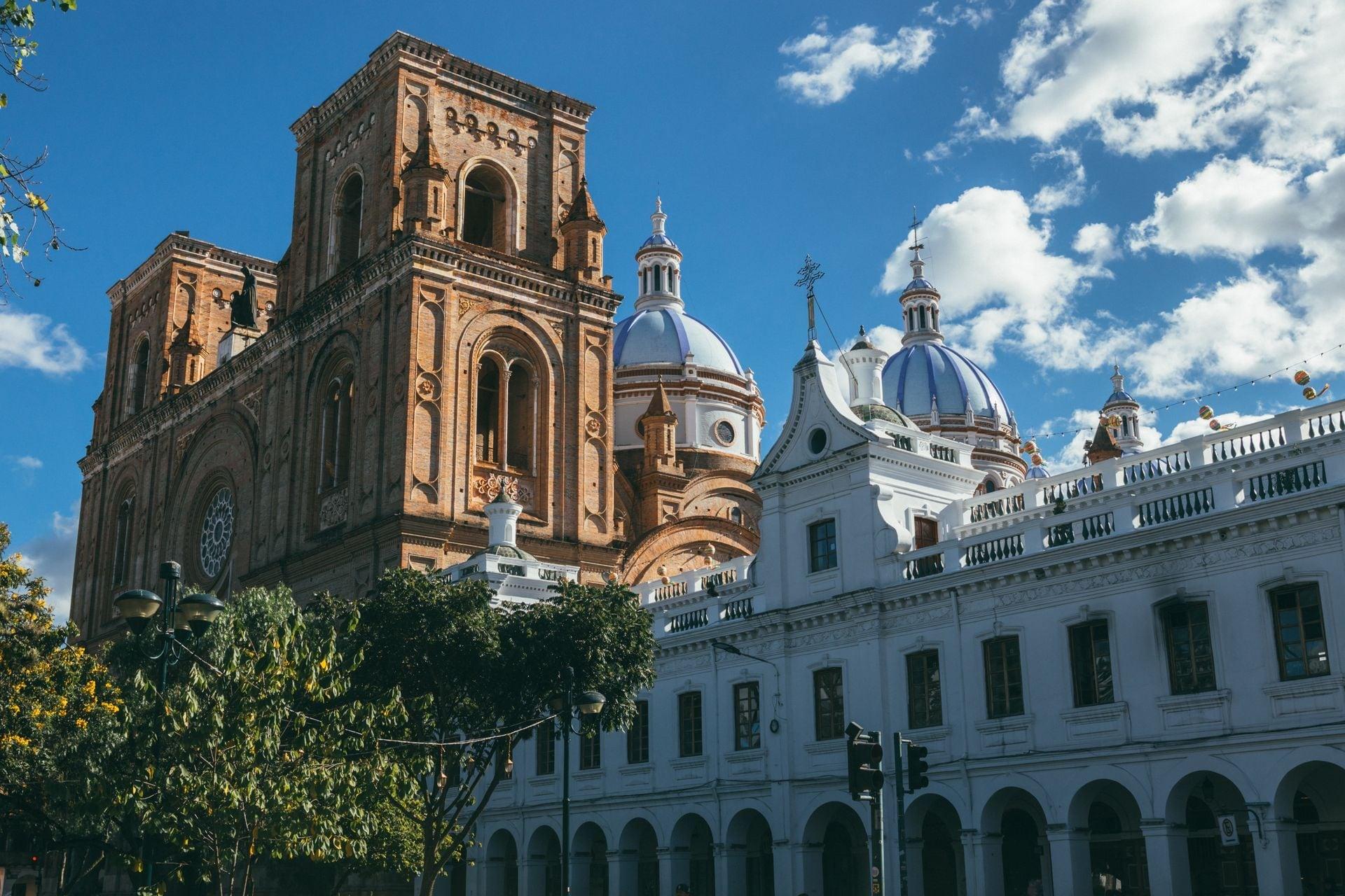
The barranco is a cross-section of Cuenca. Walk it from the cliff top down to the river and east to the Inca precinct, and one strip of ground shows you the hat-and-quinine fronts along the edge, the stairs and bridges that the flood of 1950 sorted into fallen and standing, and Spanish, Inca and Cañari layers stacked on a single plot. The old town above is a grid. The barranco is where the grid runs out of level ground, and where everything underneath it shows.
The El Barranco walk takes ten stops over about 1.8 kilometres, roughly eighty minutes, and most of it runs downhill. It is the companion to the Historic Center walk, which reads the same boom on the flat streets of the centre. Here the slope does the explaining.
The edge, and the stone that comes back
Stop 1 is El Vado, the ford, where the old road from the south climbed out of the river. Look at the terrace wall before you look at anything else. It is built of rounded river cobbles, stones the Tomebamba smoothed long before anyone laid them. The walk asks you to remember them, because at stop 9 the same kind of stone turns up in walls far older than this one. Beyond the white balustrade the ground drops. UNESCO names that drop, the barranco, as the line that closes the historic town on its south side.
Calle La Condamine, stop 2, carries the name of the French academician who came to the equator in 1735 to measure the shape of the Earth. The street opens wide here, the houses set back behind their own walkway, and the city now runs a row of them together as a cultural complex.
Straw on the outside, brick on the front
Hear a stop from this walk
Pumapungo: The Puma Gate
Stop 3 is the hat museum on Calle Larga, and it introduces the money behind the street. Toquilla straw grows on Ecuador's coast; the weaving happens in the towns of Azuay; Cuenca finishes, presses and ships. The hats left through the Isthmus of Panama, which is how, by the usual account, they got the wrong name. UNESCO listed the weaving as intangible heritage in 2012.
That trade, with quinine, is what the next stops show in masonry. The Remigio Crespo Toral house at stop 5 is the clearest example: a base of grey stone blocks, then bare brick with tall barred windows under brick arches and a cornice along the top. In Cuenca in the early 1900s a brick front like that was new. Most of it probably went up between 1910 and 1917 over an older colonial house. And the barranco plays a trick on the facade. From Calle Larga it is a two-storey house. Behind the front it steps down the cliff, five levels in all.
A stair, and bridges the flood sorted
Between those two houses, stop 4 shows you how sharply the cliff ends. The Bajada del Centenario falls straight off the level street to the Centenary Bridge, finished on 3 November 1925, Cuenca's independence day, five years after the centenary it was named for.
At stop 6 the walk goes over the edge, down the Escalinata, the great stone stair built between 1910 and 1920 and widened in the late 1940s. At its foot is a bridge with three names in a century: Tarqui, Mariano Moreno, and since 2020 Vivas Nos Queremos.
Stop 7 is the river itself, and the night it rose. On 3 April 1950 the Tomebamba flooded the riverside road, and El Mercurio, the city's newspaper, counted eleven bridges carried away, El Vado's among them. The damage was put at twenty million sucres, and people died. Two bridges on this stretch stood: the Centenary and the one at the foot of the stair.
Stop 8 is the one that broke. The Puente Roto was the Todos Santos bridge, built between 1840 and 1850, and you can read its construction at a glance: arches of rough stone rubble, each ringed in brick, under a brick parapet pierced with arched openings. Follow the deck toward the river and it ends in mid-air. Half the bridge went in 1950. The half that stayed is now a terrace for art and music.
Three cultures on one plot
Stop 9, Todos Santos, is the oldest ground on the walk so far. Low dry walls of rough blocks and those same river stones step down the slope in grassy terraces, and UNESCO names the site as one where archaeologists found Cañari, Inca and Spanish remains together. The Spanish layer gives the garden its name, Los Molinos, for the mills whose stone channels drew water from the river. The ruins surfaced in 1972, when work on a private house hit walls.
Stop 10, Pumapungo, closes the cross-section at the bottom layer. This was the heart of Tomebamba, the Inca city that stood here before Cuenca. Expreso describes it as the second Inca complex in importance after Cusco, with remains of the house of Huayna Capac on the left bank of the Tomebamba, and the Cañari present beside the Inca. A Spanish chronicler was told around 1550 that Huayna Capac was born in this province. The terraces, canals and hall foundations lie behind the museum, down toward the river.
Walk it in order and the barranco reads like a geological core: brick fronts on top, a stair cut through the cliff, a river that edited the bridges, Spanish mills, and Inca walls at the base. You can do it at your own pace, linger on the broken bridge, or skip a stop, from stop 1 at El Vado to stop 10 at Pumapungo on El Barranco: Panama Hats, a Broken Bridge and the Inca Gate. More of the city is on the Cuenca page.
Sources
- El Mercurio (Cuenca), the bridges and the flood of 1950: the night of 3 April 1950, eleven bridges swept away including El Vado and Todos Santos, damage of twenty million sucres, and the Todos Santos bridge built between 1840 and 1850.
- Expreso, Pumapungo, the second city of the Inca empire: Inca and Cañari remains, the house of Huayna Capac, the site's place after Cusco, and its position on the left bank of the Tomebamba.
- UNESCO Intangible Cultural Heritage, Traditional weaving of the Ecuadorian toquilla straw hat: the coastal toquilla palm and the 2012 inscription.
- The tour's own fact dossier and audited transcript (UNESCO World Heritage listing for the barranco boundary and Todos Santos, La Condamine's 1746 letter, Cieza de León on Tomebamba, the Escalinata and Centenary Bridge dates).
Ready to experience it?
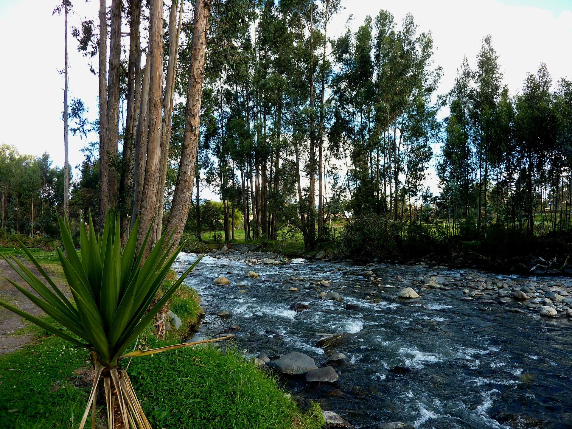
El Barranco: Panama Hats, a Broken Bridge and the Inca Gate
80 min · 1.8 km · moderate
More from Cuenca
Explore more at your own pace.
Best Self-Guided Walking Tours in Cuenca (2026)
Cuenca Travel Guide: How Many Days, Altitude, Getting Around, Safety (2026)
One Day in Cuenca: A Walkable UNESCO Itinerary (2026)
Why Cuenca Calls Itself the Athens of Ecuador
What to Eat in Cuenca: A Food Guide (2026)