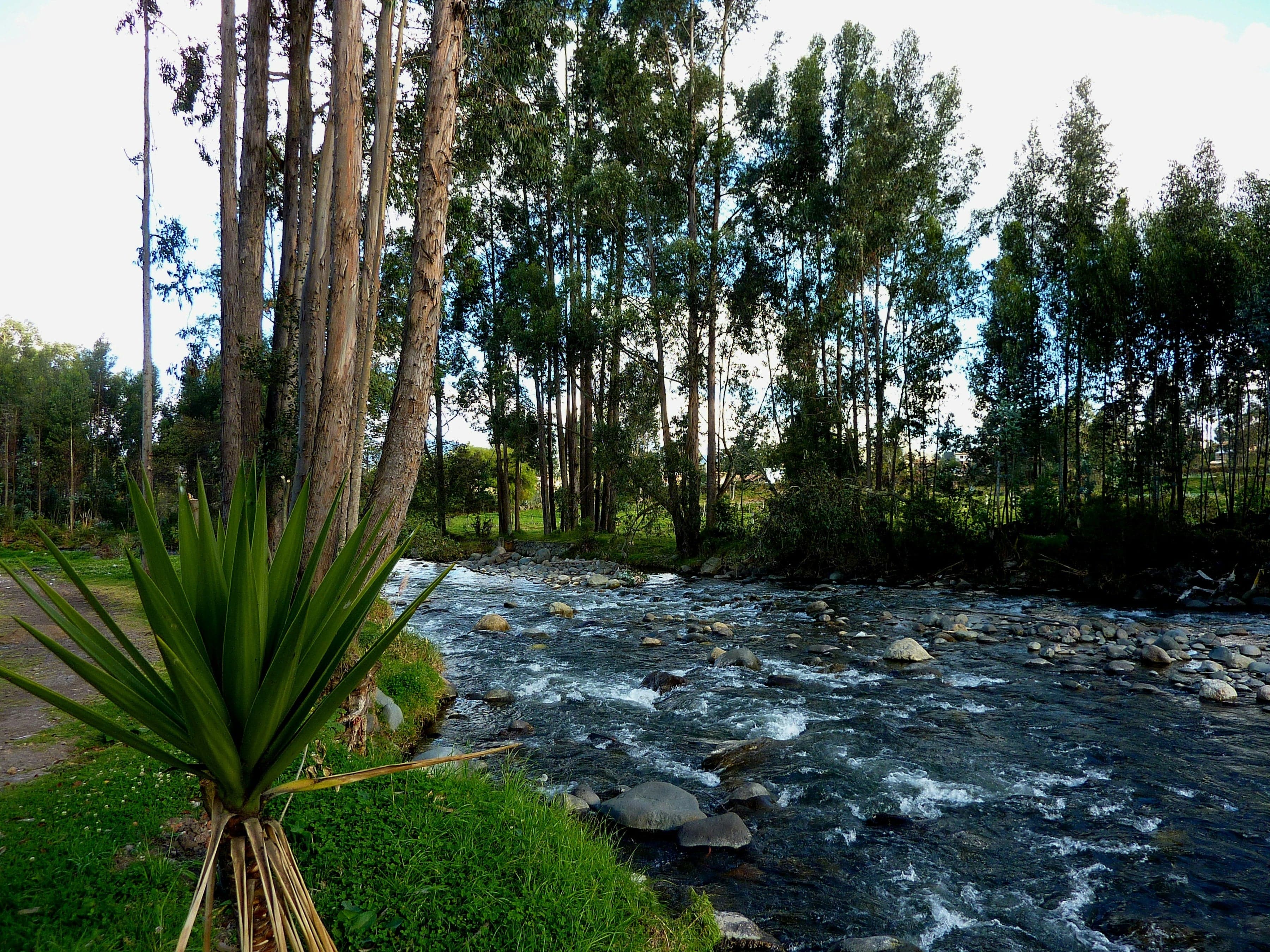
Walk Cuenca's cliff-top Calle Larga past the Panama hat museum and a poet's brick house, down the great stair to the river Tomebamba, under the broken bridge and past Spanish mills to the Inca Puma Gate.
Start · Plaza del Vado: The Old Way In
DirectionsStops
- 1
Plaza del Vado: The Old Way In
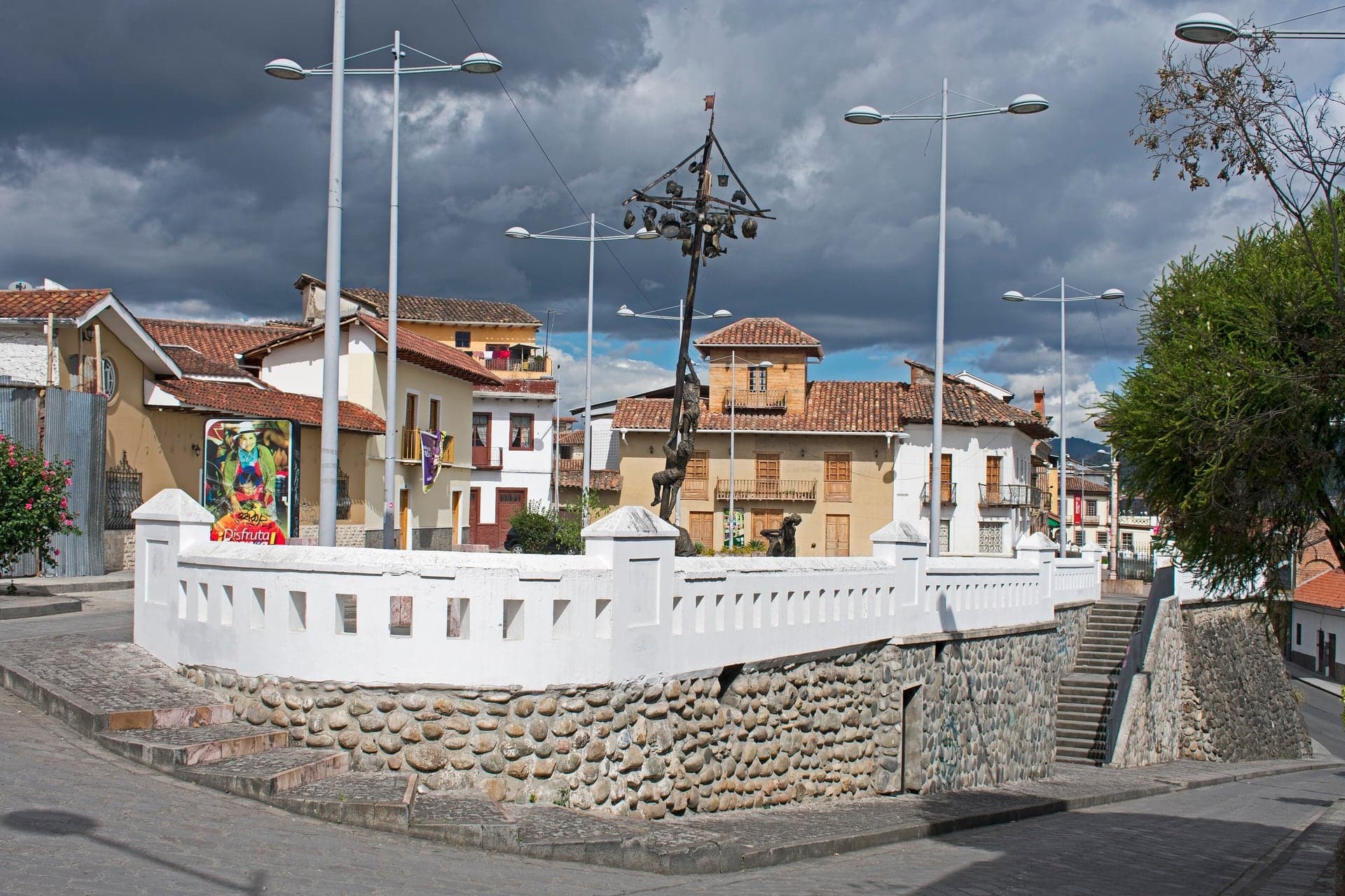
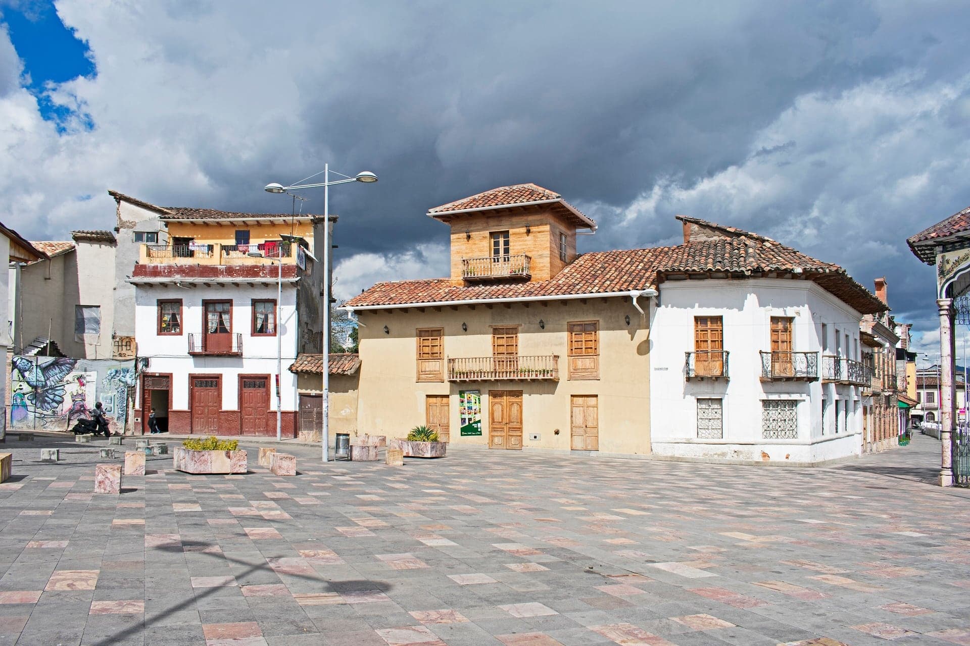
The old way into Cuenca from the south. A marble cross of 1881 stands on a walled terrace above the drop to the river.
- 2
Calle La Condamine: The Earth Measurers
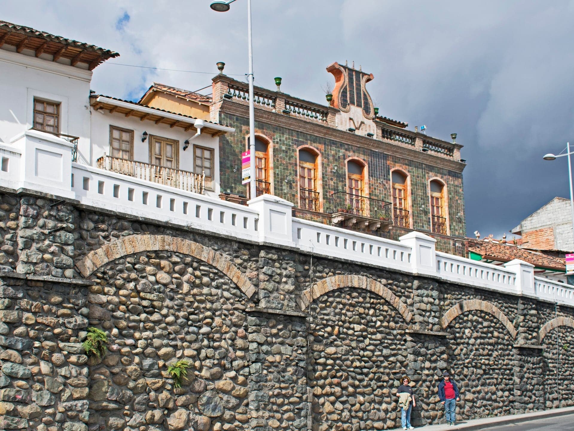
A street named for a French scientist who measured the Earth. Restored old houses line it, now a city cultural center.
- 3
Hat Museum: The Panama Hat
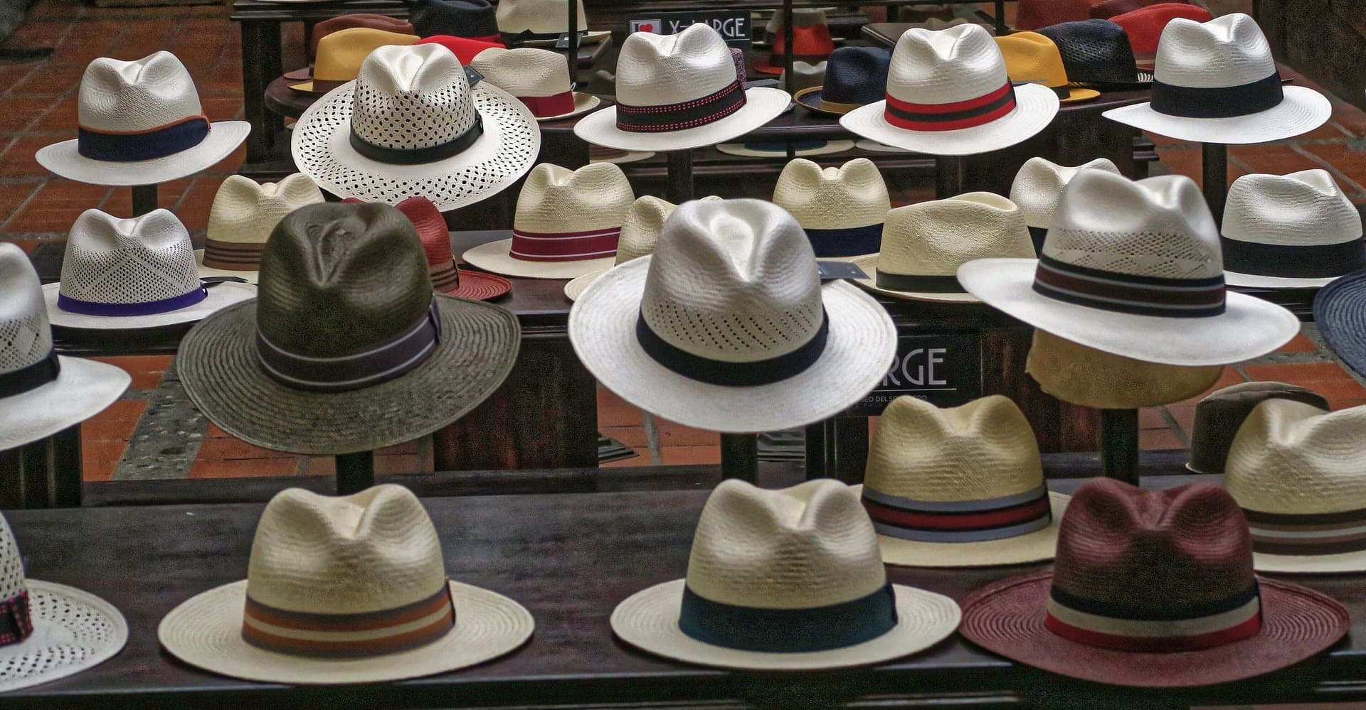
Where Cuenca finishes and ships the Panama hat. A family hat museum shows how toquilla straw becomes a hat.
- 4
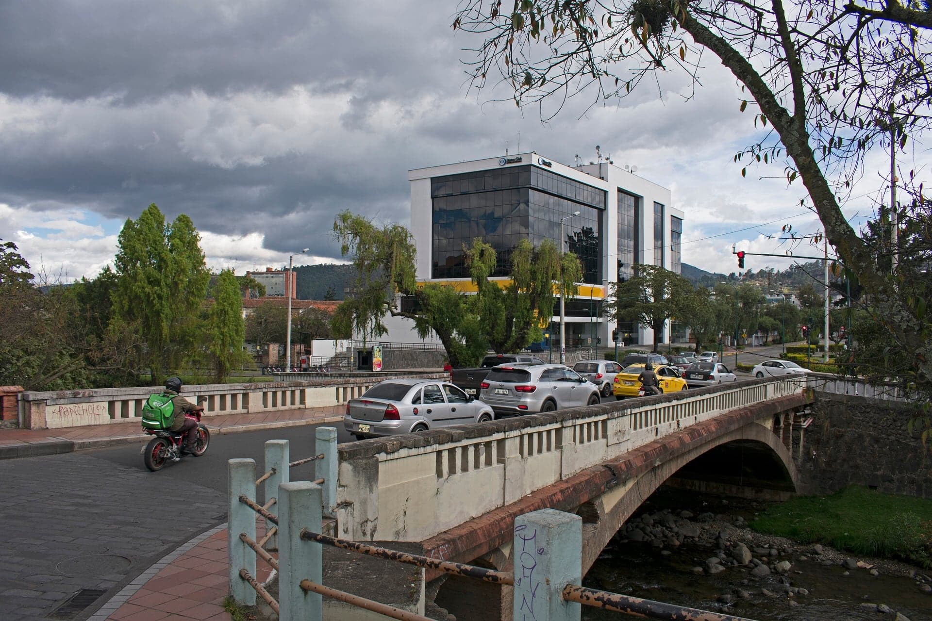
Bajada del Centenario: The Late Bridge
A ramp down the cliff to the Centenary Bridge. Finished in 1925, the bridge stood through the 1950 flood.
- 5
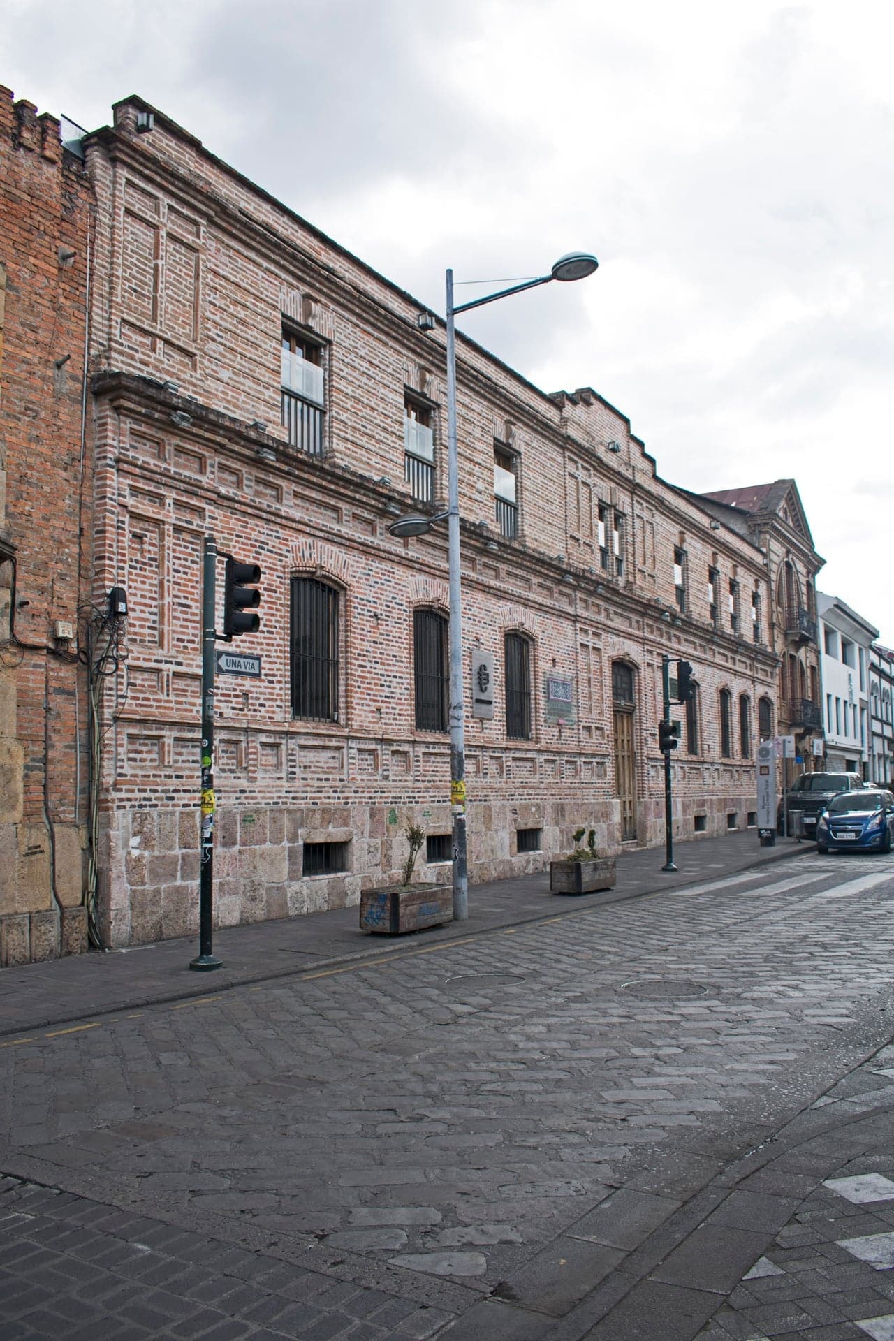
Remigio Crespo Toral House: A Brick Front
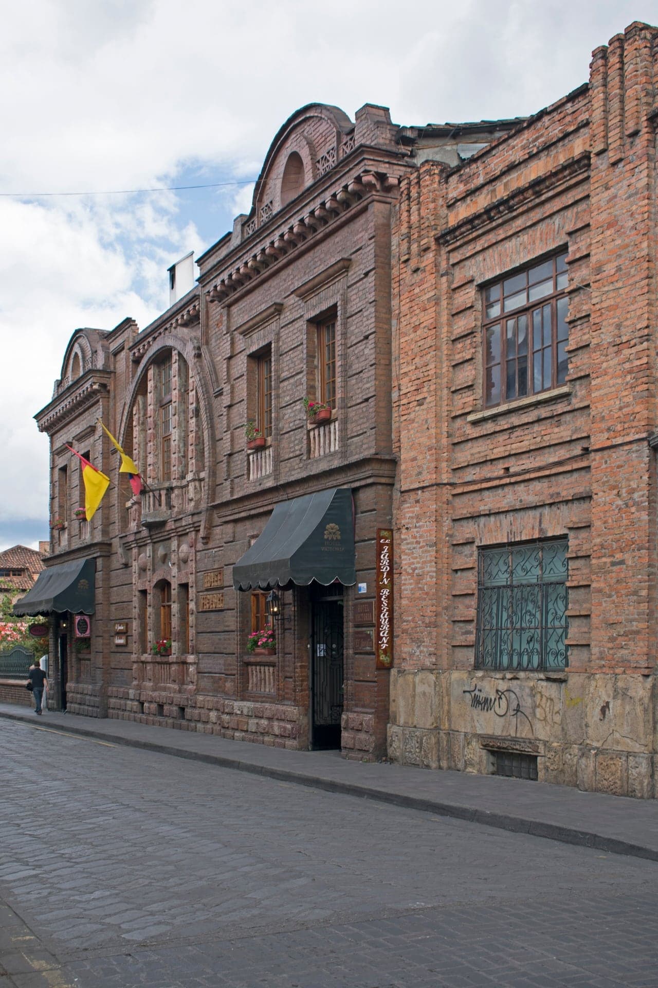
A poet's house with a new brick front. Now the free city museum, it steps down five levels behind the street.
- 6
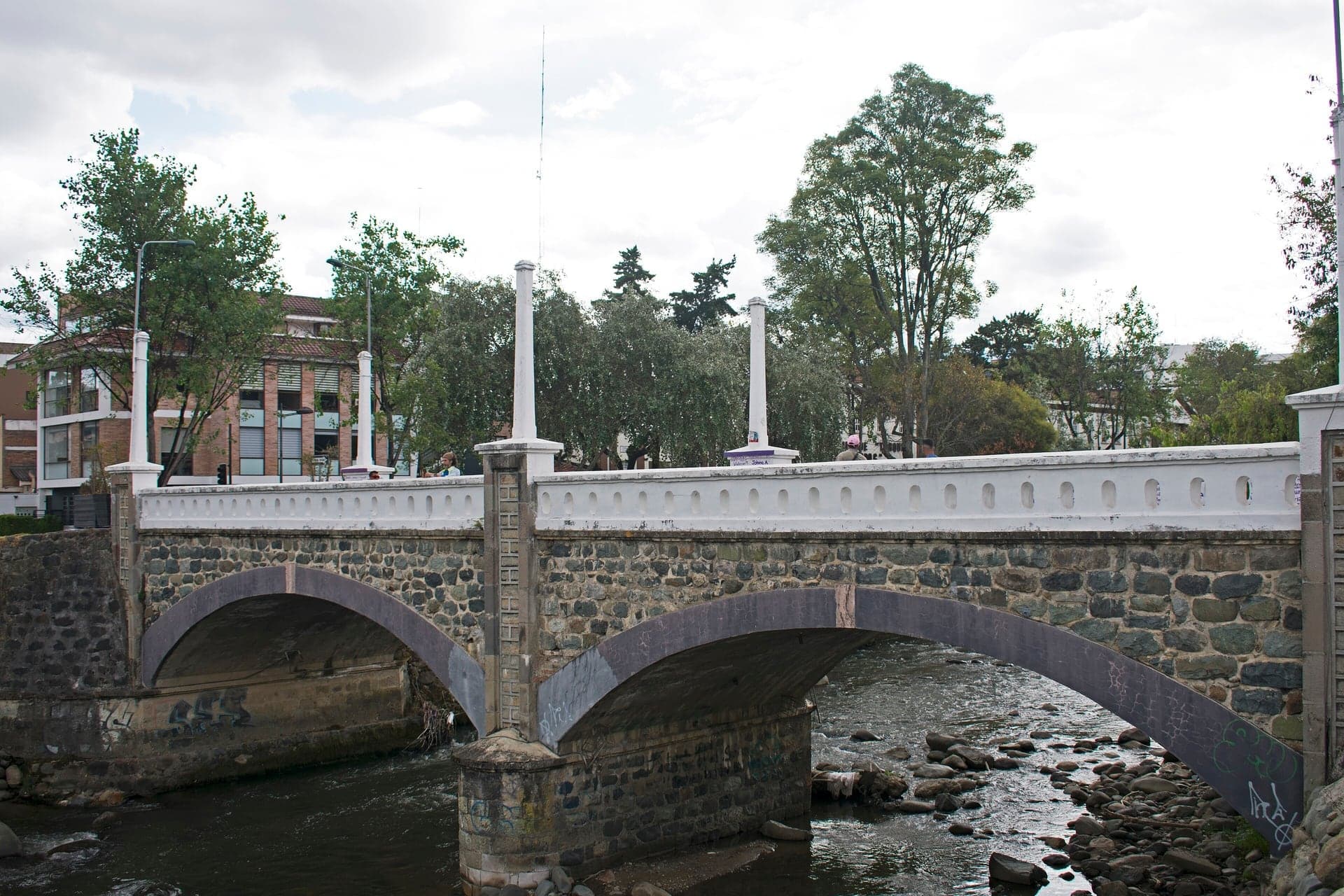
La Escalinata: Over the Edge
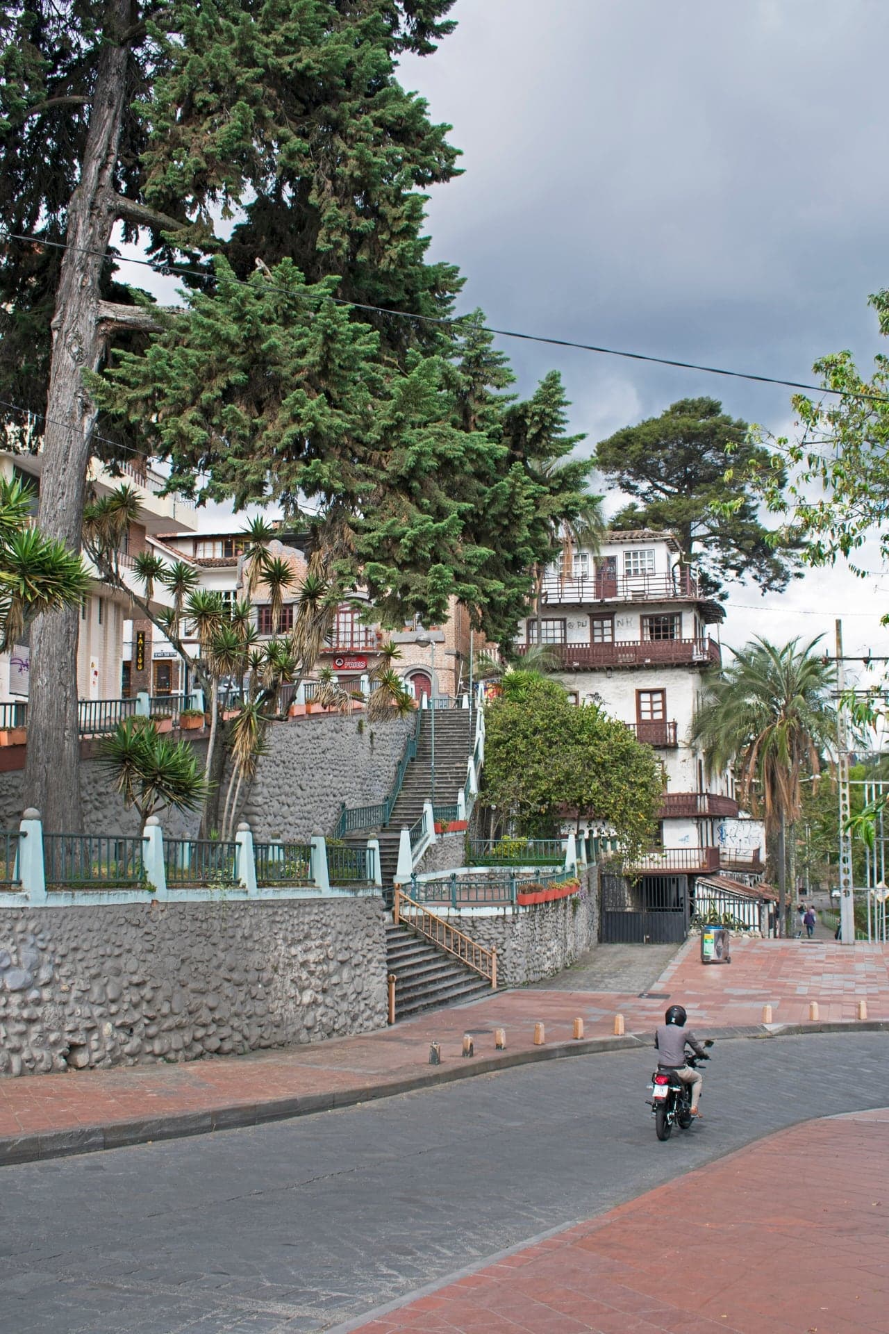
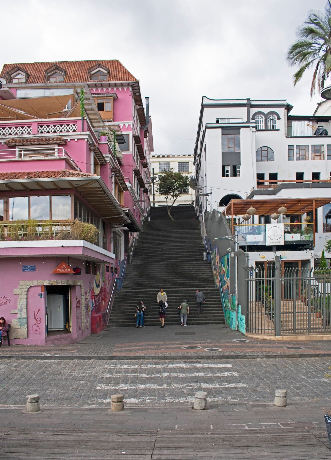
The great stair down the barranco to the river. Rebuilt in 2024, it leads to a bridge with three names.
- 7
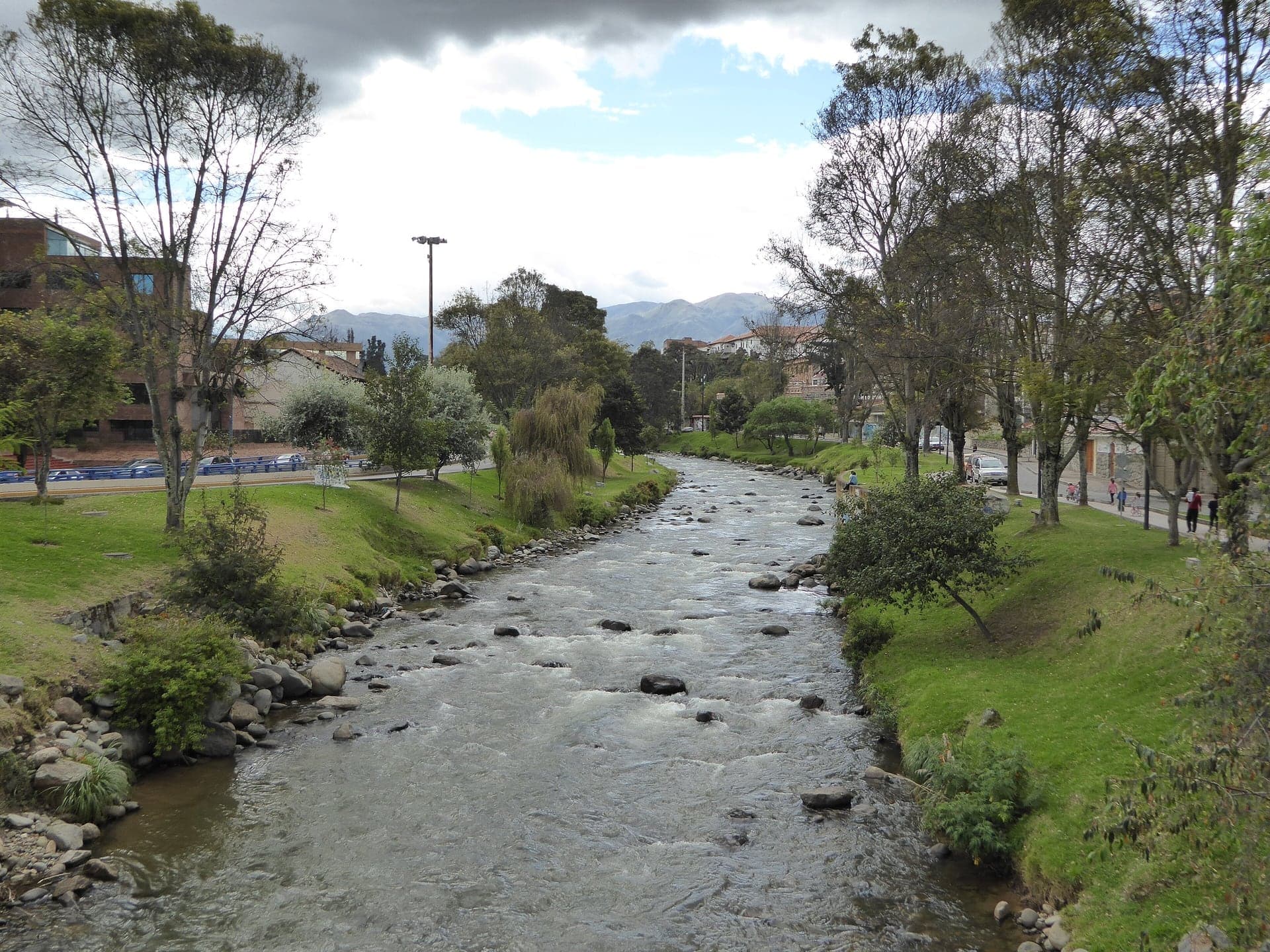
The Tomebamba: The Night of the Flood
The river along the foot of the old town's cliff. On the night of 3 April 1950 this road was under water.
- 8
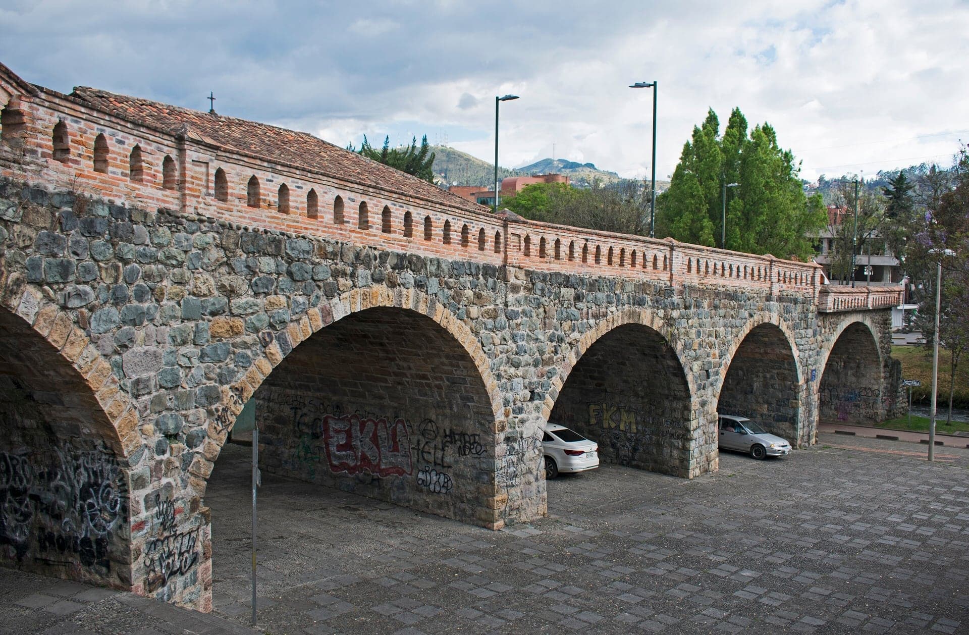
Puente Roto: Half a Bridge
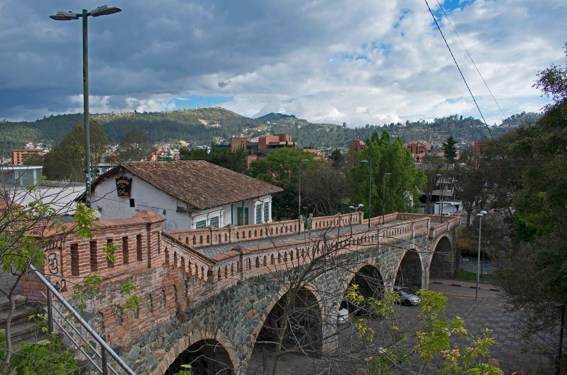
Half a bridge left standing by the 1950 flood. Built in the 1840s, its deck now stops in mid-air above the river.
- 9
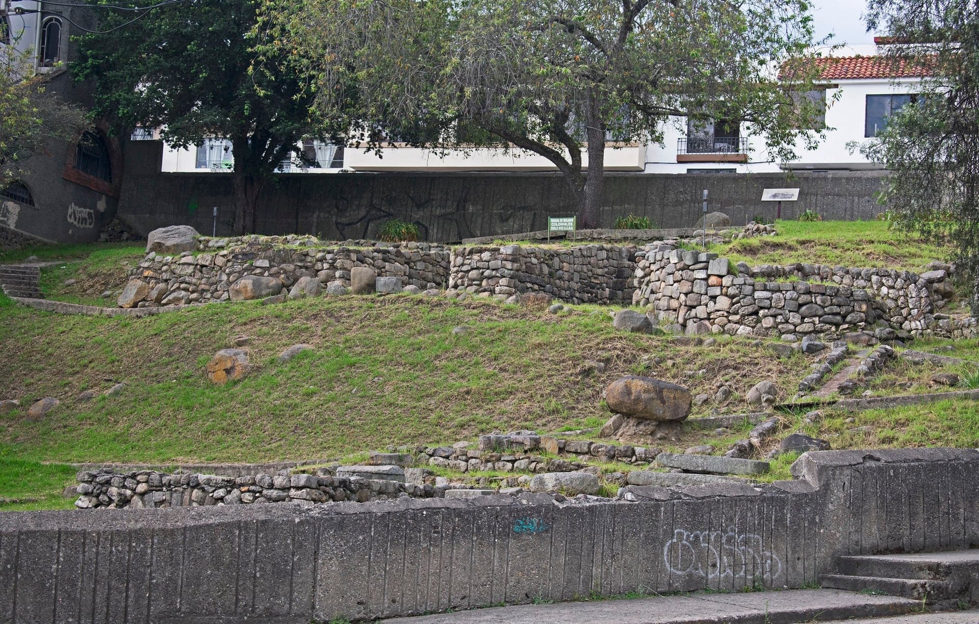
Todos Santos: Mills and Ruins
Spanish mills on Cañari and Inca ground. Low stone walls in the grass hold three layers of the city's past.
- 10
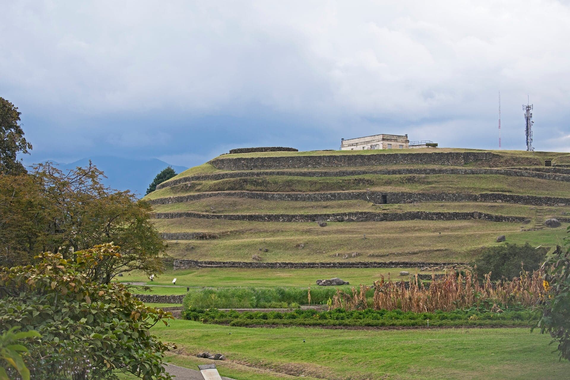
Pumapungo: The Puma Gate
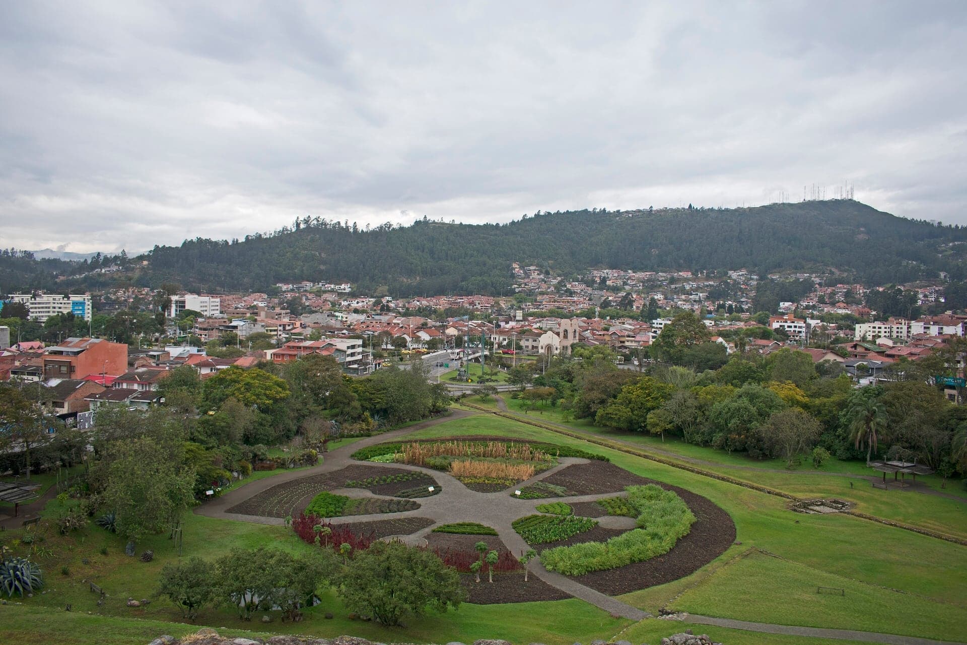
The Puma Gate in the heart of the Inca city. Its terraces lie behind the museum, free to visit except on Mondays.
Details
Best Time to Visit
Tuesday to Saturday, from mid-morning to mid-afternoon, so the hat museum, the city museum and Pumapungo are all open: Pumapungo is closed on Mondays, and on Sundays the hat museum closes at 15:00 and Pumapungo at 16:00. Walk it in daylight; the riverside path and the Puente Roto plaza empty after dark. Checked 5 October 2026.
Pro Tips
- •Getting to the start: take a taxi to the Cruz del Vado, at Calle La Condamine and the Bajada del Vado, or walk 10 to 15 minutes south from Parque Calderon. The tram does not run past the route.
- •The walk ends at Pumapungo, on the corner of Calle Larga and Avenida Huayna Capac, where there are taxis and buses.
- •Museo del Sombrero (hat museum, stop 3): one dollar, 50 cents for students; Monday to Friday 09:00 to 18:30, Saturday 09:00 to 17:00, Sunday 09:00 to 15:00. Checked 5 October 2026.
- •Museo Remigio Crespo Toral (stop 5): free; Monday to Friday 09:00 to 16:45, Saturday, Sunday and holidays 09:00 to 17:00. Checked 5 October 2026.
- •CIDAP, the Inter-American Center of Crafts and Folk Arts, is at the foot of the Escalinata on the riverside: free, Monday to Friday 08:00 to 17:00, Saturday 08:00 to 16:30. Checked 5 October 2026.
- •Museo Pumapungo and its Inca terraces (stop 10): free; Tuesday to Friday 08:00 to 17:00, weekends and holidays 10:00 to 16:00, closed on Mondays. Allow at least an hour. Checked 5 October 2026.
- •Need to avoid stairs? Stay on Calle Larga past the Escalinata as far as Todos Santos and go down the Bajada de Todos Santos to stop 9. You miss the river path and the Puente Roto plaza (stops 7 and 8).
- •The Oblate sisters' wood-fired oven at Todos Santos now bakes for the Santo Pan bakery in the Todos Santos neighborhood, near stop 8.
Safety & Precautions
- •The route is not step-free: the Escalinata down to the river (a wheelchair lift was installed in 2024, but whether it is running on a given day is not confirmed) and 19 steps with a handrail up from the Puente Roto plaza.
- •The Bajada de Todos Santos and the Bajada de los Molinos carry fast downhill traffic: keep to the pavements, and cross the Bajada de Todos Santos with care where you can see both ways, at the foot of the long stone stairway that comes down to it; there are no lights or markings there.
- •The pavements on Calle Larga are narrow in places, and the side-street crossings are busy: use the lights where there are any.
- •Cuenca is about 2,500 m above sea level. Take the stairs slowly and carry water.
- •The Museo Manuel Agustin Landivar above the Todos Santos ruins has opened only partially in recent years; do not count on getting in.
- •Works can close a stair or a lane; a rehabilitation of a Pasaje Hermano Miguel was planned for 2026. Follow the signs. Checked 5 October 2026.
Travel advisory: Exercise Increased Caution (Level 2).
Gallery
Related Reading
Go deeper on what you'll see, hear, and walk through.
Overview
Best Self-Guided Walking Tours in Cuenca (2026)
3 min
Overview
Cuenca Travel Guide: How Many Days, Altitude, Getting Around, Safety (2026)
5 min
Overview
One Day in Cuenca: A Walkable UNESCO Itinerary (2026)
6 min
Overview
Why Cuenca Calls Itself the Athens of Ecuador
7 min
Thematic
What to Eat in Cuenca: A Food Guide (2026)
4 min
Read
Cuenca: Ecuador's Best-Kept Secret
4 min
Read
The Art of the Panama Hat (Actually Made in Ecuador)
5 min
Read the walk
The full story of El Barranco: Panama Hats, a Broken Bridge and the Inca Gate, in words. Prefer to listen? Play it narrated, from home or on location.
Introduction
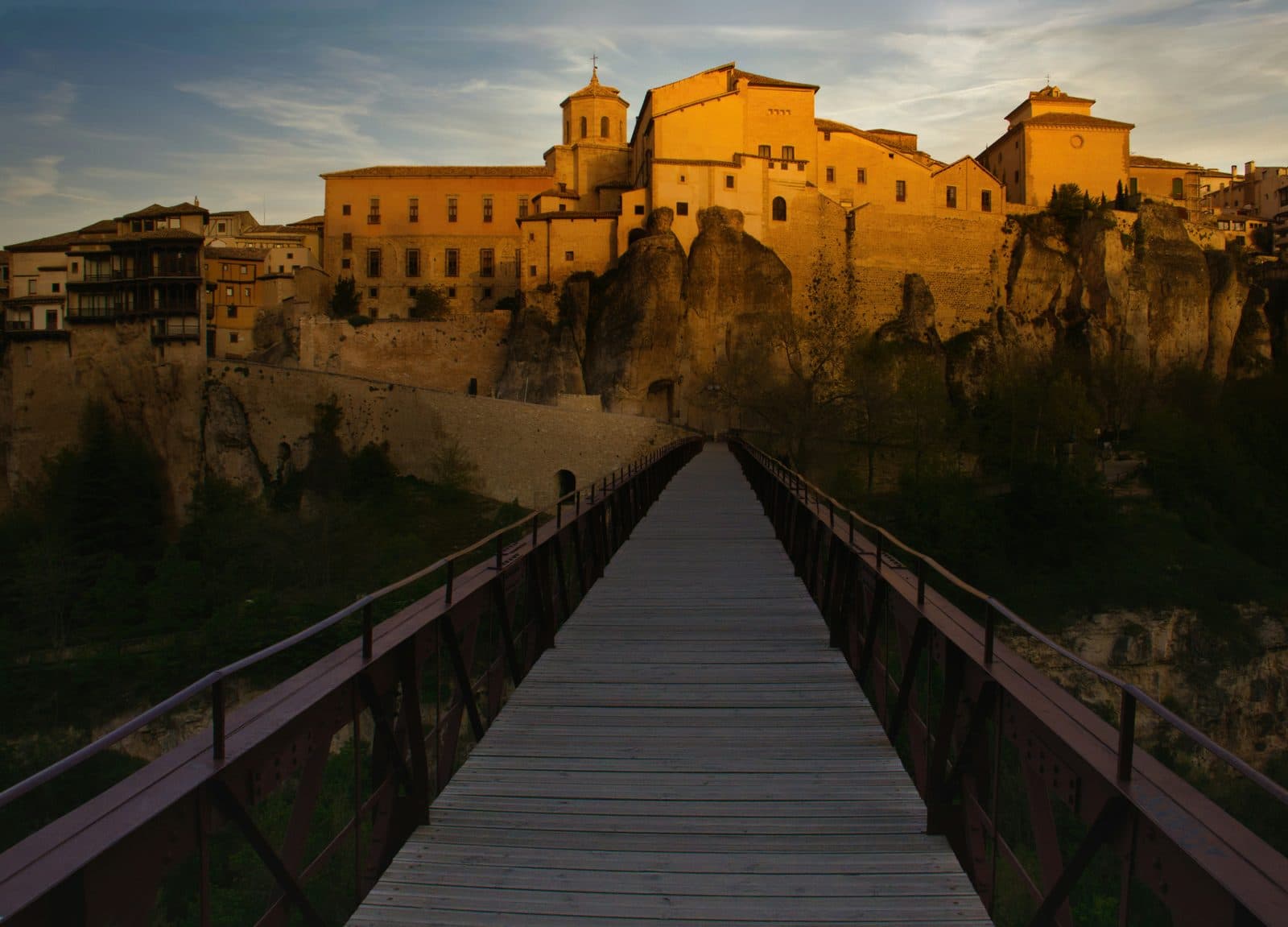
Cuenca, in Ecuador, ends at a cliff. Along the south side of the old town the ground drops away to the river Tomebamba, and UNESCO, which lists the historic center as World Heritage, names that drop, the barranco, as the town's southern boundary. This walk follows the edge, then goes over it.
Over ten stops and about one point eight kilometres, a little over a mile, in about eighty minutes, you start at the top of the old road up from the ford, follow Calle Larga along the top of the cliff past the hat museum and the houses that straw hats and quinine paid to remake, go down a great stair to the water, and finish on the oldest ground of all: Spanish mills over older ruins, and the Inca city that stood here before Cuenca. Most of it runs downhill. Cuenca sits about two thousand five hundred metres up, so take the few stairs slowly.
Three names come back along the way. Charles-Marie de La Condamine, a French scientist who came to these mountains to measure the Earth. Remigio Crespo Toral, a poet whose brick house stands on the cliff. And Huayna Capac, the Inca ruler a Spanish chronicler was told had been born in this province.
And one night to keep in mind: a night in April, nineteen fifty, when the river rose.
1. Plaza del Vado: The Old Way In
Welcome to El Vado, and to the little square of its cross. Walk on to the walled terrace and stop there, by the white balustrade.
El Vado means the ford. This was the old way into the city from the south: a steep street climbing up from the river Tomebamba. Where it reached the top stood a cross for the people crossing the river. The one here now is carved in marble. It went up in eighteen eighty-one, replacing an older colonial cross, and the little shelter around it was added early in the twentieth century. Look for it in its little shelter, close by.
The tall dark metal pole with figures climbing it is not the cross. It is a monument to the greasy pole, the palo encebado, a game of the city's fiestas.
Now look at what the terrace is built of. Its wall is made of rounded stones, smoothed by water: river cobbles. Keep them in mind, because at the far end of this walk you will meet the same kind of stone in walls far older than this one. Look, too, at the houses around the square: whitewash and ochre, wooden balconies, and roofs of red clay tile.
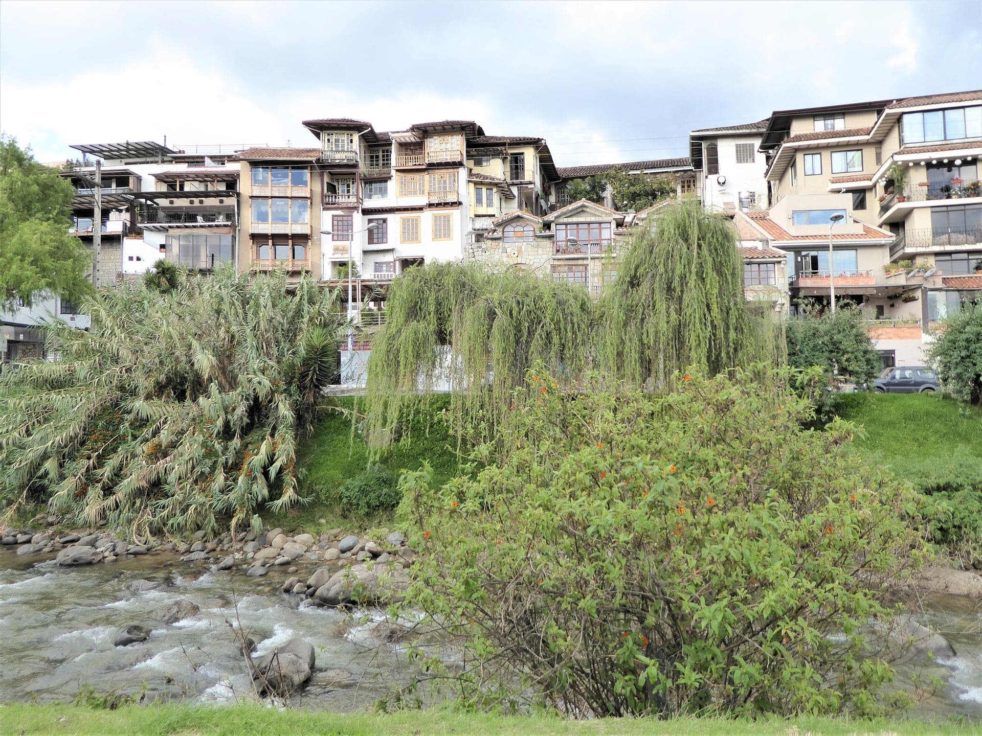
Beyond the balustrade the ground falls away toward the river. UNESCO describes this drop, the barranco, as the line that closes the historic town on its south side. Cuenca was founded in fifteen fifty-seven, and here the town ran out of level ground.
El Vado is one of Cuenca's oldest neighborhoods, and it had its own bridge over the river below. By the city newspaper's count, that bridge was one of eleven that a flood carried away on a single night in April, nineteen fifty. You will meet that night again by the water.
Follow the route along Calle La Condamine. Next, a street named for a man who came to measure the planet.
2. Calle La Condamine: The Earth Measurers
Walk on along La Condamine and stop on this side of the street, across from the row of old houses.
This street carries the name of Charles-Marie de La Condamine, of the French Academy of Sciences. In seventeen thirty-five he was one of three academicians sent to the equator to measure the Earth, to settle the shape of the planet. Their line ran for some eighty leagues through these mountains. At the end of August, seventeen thirty-nine, the whole company was in Cuenca, having just finished measuring a baseline two leagues long, just outside the city.
That same week a crowd in the city turned on them. On the twenty-ninth of August, at a bullfight in the square of San Sebastián, in another part of town, a riot broke out, and the expedition's surgeon was mortally wounded. He died four days later, in the house where La Condamine was staying, in La Condamine's own bed. La Condamine told the whole story in a letter he published in seventeen forty-six.
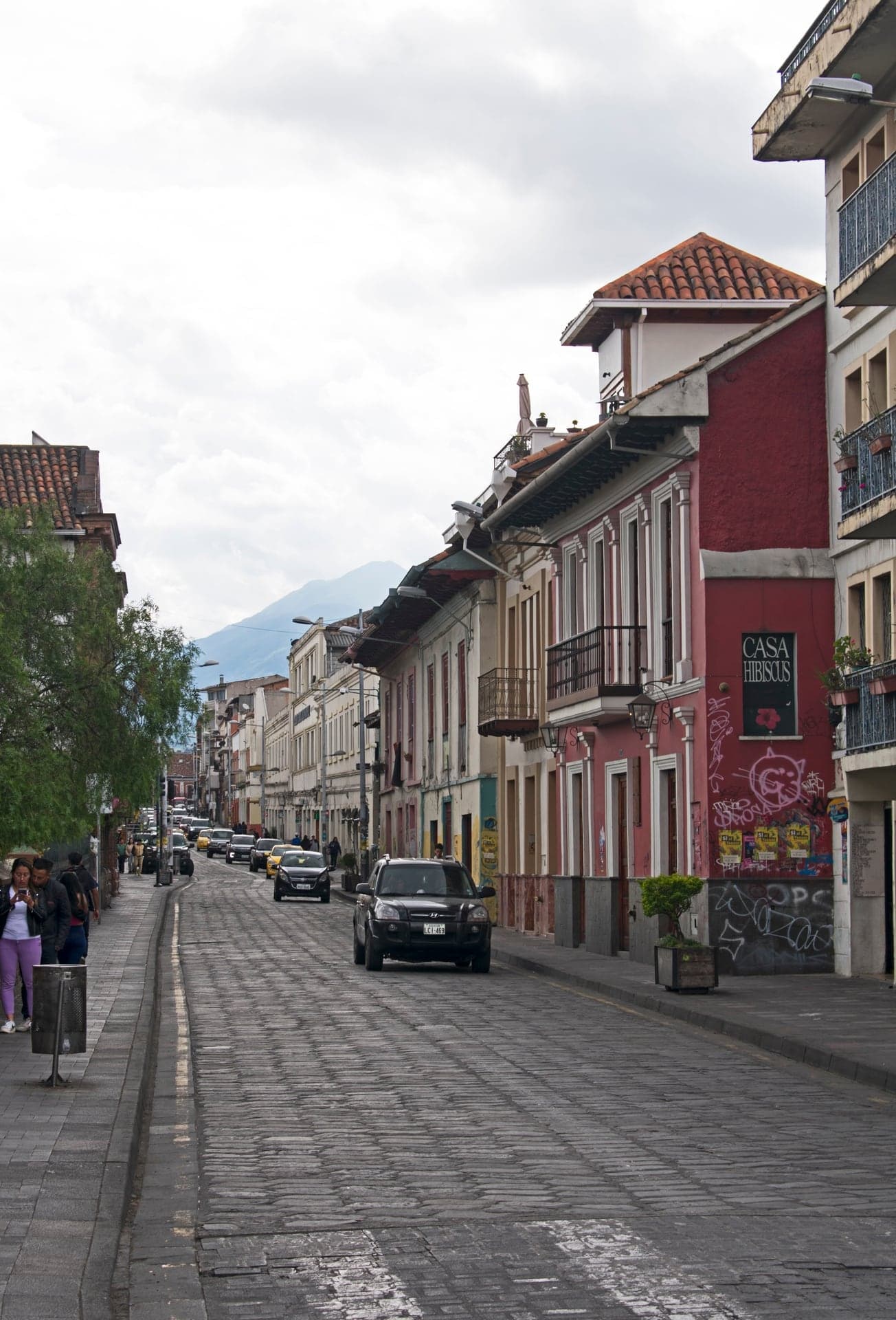
Now the houses across the street. The city owns a group of old houses along here and runs them together as a cultural complex. Among them is the Casa de la Lira, from eighteen forty-seven, once the home of a musician and now a place for exhibitions, performances and talks. Look at how the street opens out here, wide, with the houses set back behind their own walkway, and at the roofline running along the top of them.
This has long been a street of workshops too. In twenty twenty the city's newspaper still found copper workers, hat restorers, barbers and instrument makers along here.
Follow the route round the corner onto Calle Larga, the long street along the top of the cliff. At the first traffic lights, cross Calle Larga to the side away from the cliff, and keep to it for the next few stops. Next, the Panama hat.
3. Hat Museum: The Panama Hat
Walk on along Calle Larga and stop on this side of the street, across from the house with the hat shop at street level. That is the Museo del Sombrero, the hat museum, a family business with a small entry fee, one dollar when checked in twenty twenty-six. It is worth the dollar, and the details are on this stop's card. The stop works just as well from here.
The house is more than a hundred and fifty years old, and one family firm has made and sold hats in it for about sixty years. Inside you can follow the whole process, down to the steam presses.
The hat starts far from here. Toquilla straw comes from a palm-like plant grown on Ecuador's coast. Farmers cut the stems, strip the fiber from the green outer skin, boil it, dry it and bleach it with sulfur over a wood fire. Then it comes up into the mountains. In Azuay, the province around Cuenca, most of the weaving is done in towns and villages such as Sígsig and Chordeleg. A hat can take a day, or, for the finest weave, up to eight months. In twenty twenty-six, weavers near Cuenca were being paid about eight to twelve dollars a hat.
Cuenca's part is the finish and the sale: washing, bleaching, shaping, pressing, and shipping out. In the nineteenth century these hats traveled out through the Isthmus of Panama, and that, by the usual account, is how the world came to call them Panama hats. In twenty twelve UNESCO listed the weaving itself as intangible heritage.
UNESCO also names straw hats, together with quinine, as the trade that turned Cuenca's simple colonial houses into grander ones in the nineteenth century. Watch for that money on the next stops.
Follow the route on along Calle Larga. Next, a ramp down the cliff to a bridge.
4. Bajada del Centenario: The Late Bridge
Walk on to the corner and stop on this side of Calle Larga, where a ramp drops away across the street toward the river. There is no need to cross here. This is the Bajada del Centenario, one of the old ways down the cliff. Look at how suddenly the ground ends. Calle Larga runs…
Full narration for this stop unlocks with the tour.
5. Remigio Crespo Toral House: A Brick Front
Walk on and stop by the little park, across the street from the long front in red-brown brick. That is the Remigio Crespo Toral house, now the city museum, and it is free to go in, open every day. The details are on this stop's card. Remigio Crespo Toral was a poet and a…
Full narration for this stop unlocks with the tour.
6. La Escalinata: Over the Edge
Walk on, cross Calle Larga at the lights, and stop at the head of the wide stone stair that goes down toward the river. This is the Escalinata, the great stair. It was built between nineteen ten and nineteen twenty to join the historic center to the lower city below the cliff,…
Full narration for this stop unlocks with the tour.
7. The Tomebamba: The Night of the Flood
Walk on along the path by the water and stop there, with the river beside you. This is the Tomebamba. UNESCO describes Cuenca as set in a valley watered by four rivers, the Tomebamba, the Yanuncay, the Tarqui and the Machángara, and this is the one that runs along the foot of…
Full narration for this stop unlocks with the tour.
8. Puente Roto: Half a Bridge
Walk on into the little cobbled plaza and stop there, with the old arches of a bridge beside you. This is the Puente Roto, the broken bridge. It was the Todos Santos bridge, the link between the old city on the cliff and the lower town across the river. You may hear that it is…
Full narration for this stop unlocks with the tour.
9. Todos Santos: Mills and Ruins
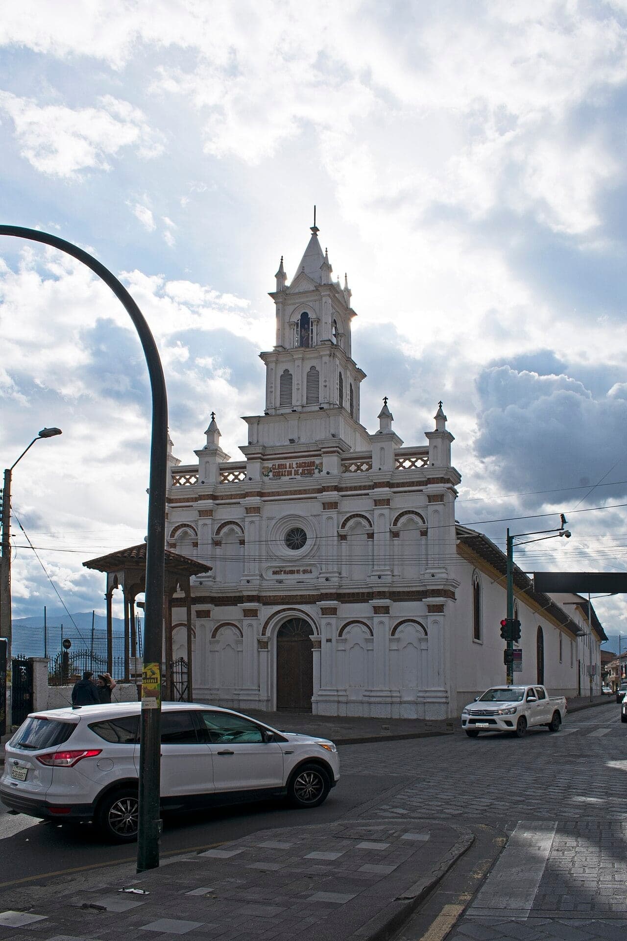
Walk on down this side of the road and stop beside the garden of low stone walls in the grass. This is Todos Santos, and UNESCO names it as a place where archaeologists have uncovered remains of three cultures on one plot: Cañari, Inca and Spanish. The Cañari were the people of…
Full narration for this stop unlocks with the tour.
10. Pumapungo: The Puma Gate
Walk on along Calle Larga, past the drive that leads into the park, and stop near the corner, by the museum entrance. This is Pumapungo, the Puma Gate. The museum and its archaeological park are free, run by the national government, and closed on Mondays. The details are on this…
Full narration for this stop unlocks with the tour.
- Plazoleta Cruz Del Vado seen from the northwest, Cuenca, Azuay, Ecuador — Ymblanter, CC BY-SA 4.0 · source
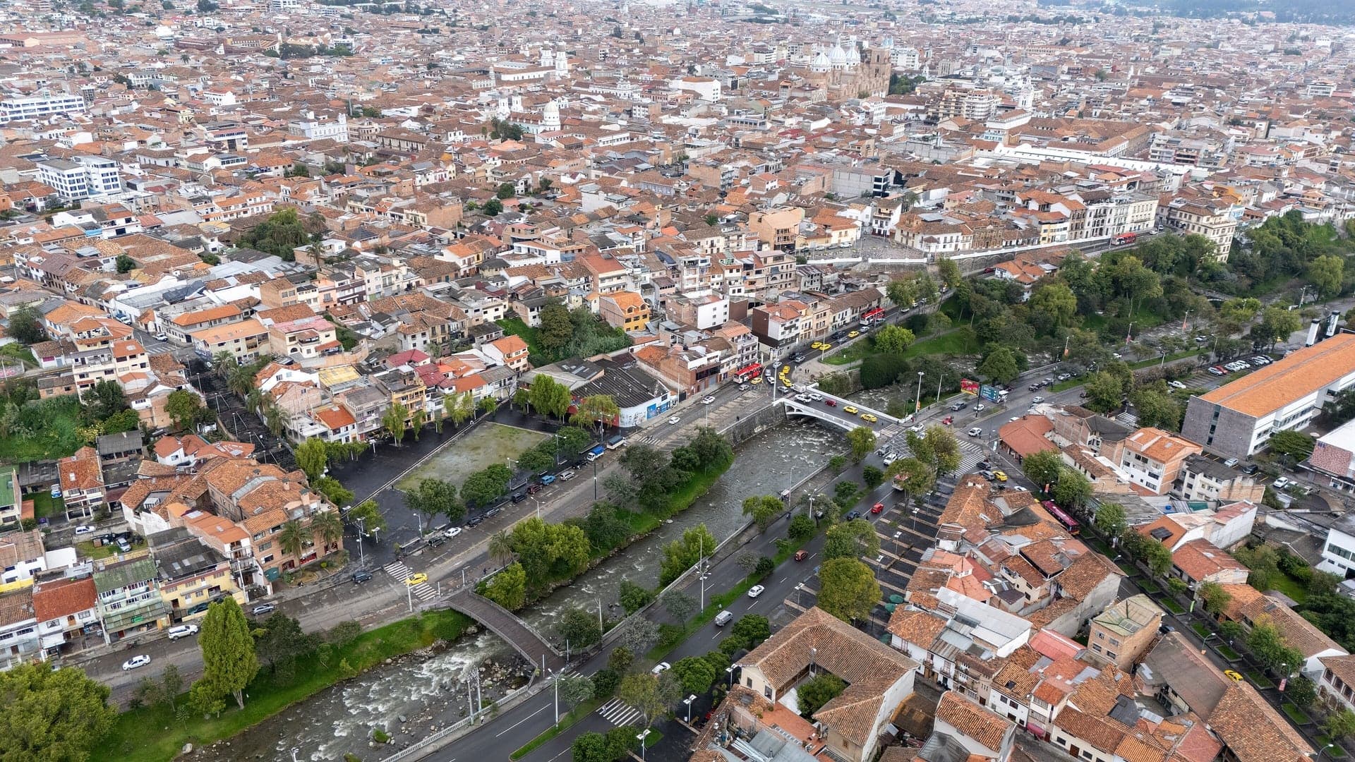
- Series of aerial photographs of the El Vado neighborhood, located in the city of Cuenca, Ecuador. The images were captured using a DJI drone — Pablo Zuñiga, CC BY 4.0 · source
- Casa de la Lira seen from La Condamine, Cuenca, Azuay, Ecuador — Ymblanter, CC BY-SA 4.0 · source
- Casa Marquez seen from the west, Cuenca, Azuay, Ecuador — Ymblanter, CC BY-SA 4.0 · source
- Panamahüte in Cuenca — Burkhard Mücke, CC BY-SA 4.0 · source
- Calle Larga 6-93 seen from the west, Cuenca, Azuay, Ecuador — Ymblanter, CC BY-SA 4.0 · source
- Puente del Centenario seen from the northwest, Cuenca, Azuay, Ecuador — Ymblanter, CC BY-SA 4.0 · source
- Staircase at Bajada del Centenario seen from the west, Cuenca, Azuay, Ecuador — Ymblanter, CC BY-SA 4.0 · source
- Museo Remigio Crespo Toral seen from the east, Cuenca, Azuay, Ecuador — Ymblanter, CC BY-SA 4.0 · source
- Escalinatas Juana de Oro seen from the bridge, Cuenca, Azuay, Ecuador — Ymblanter, CC BY-SA 4.0 · source
- Puente Mariano Moreno seen from the northeast, Cuenca, Azuay, Ecuador — Ymblanter, CC BY-SA 4.0 · source
- Calle Larga seen from Calle Hermano Miguel to the northwest, Cuenca, Azuay, Ecuador — Ymblanter, CC BY-SA 4.0 · source
- Rio Tomebamba — Arabsalam, CC BY-SA 4.0 · source
- Blick auf das Nordufer des Rio Tomebamba in Cuenca — Arabsalam, CC BY-SA 4.0 · source
- Puente Roto seen from the northwest, Cuenca, Azuay, Ecuador — Ymblanter, CC BY-SA 4.0 · source
- Puente Roto seen from above, Cuenca, Azuay, Ecuador — Ymblanter, CC BY-SA 4.0 · source
- Los Molinos, Cuenca, Azuay, Ecuador — Ymblanter, CC BY-SA 4.0 · source
- Pumapunku seen from Avenida Pumapungo, Cuenca, Azuay, Ecuador — Ymblanter, CC BY-SA 4.0 · source
- Plaza Agrícola seen from the top, Pumapunku, Cuenca, Azuay, Ecuador — Ymblanter, CC BY-SA 4.0 · source
- Iglesia de Todos Santos seen from the east, Cuenca, Azuay, Ecuador — Ymblanter, CC BY-SA 4.0 · source
Images may be cropped or resized. Other photos via Unsplash and Pexels.