Old City: The Moated Square
95 min · 3.5 km · moderate
Chiang Mai was designed, not settled. In the year twelve ninety-six King Mangrai dug a near-perfect square of moat and wall and called it the new city, the capital of Lanna, a northern Thai-Buddhist kingdom that kept its own script, its own dynasty, and its own temples for two and a half centuries before Burma and later Bangkok absorbed it. That is the through-line that unites the three Roamer walks in Chiang Mai walking tours: the city reads as a place Thailand still remembers as almost a separate country, and you can read it in three registers. Inside the moat, the founders' plan. Across the Ping River, the outsiders' teak money. Down one road to the south, a single hammered craft carried in by force. Walk all three and the map of a vanished kingdom reassembles itself.
The plan inside the moat
Start where the geometry is. The Moated Square treats the old city as a document you can read stop by stop, because it was placed on purpose rather than grown by accident. The moat still traces the exact line Mangrai's diggers cut in twelve ninety-six, a square more than a mile and a half on each side. The brick you see at Tha Phae Gate is recent, reconstructed between nineteen eighty-five and nineteen eighty-seven by the Fine Arts Department, but the shape underneath is seven hundred years old. As a small proof the old fabric survives, workers found a hidden Lanna-script inscription inside the gate in November of twenty twenty-three.
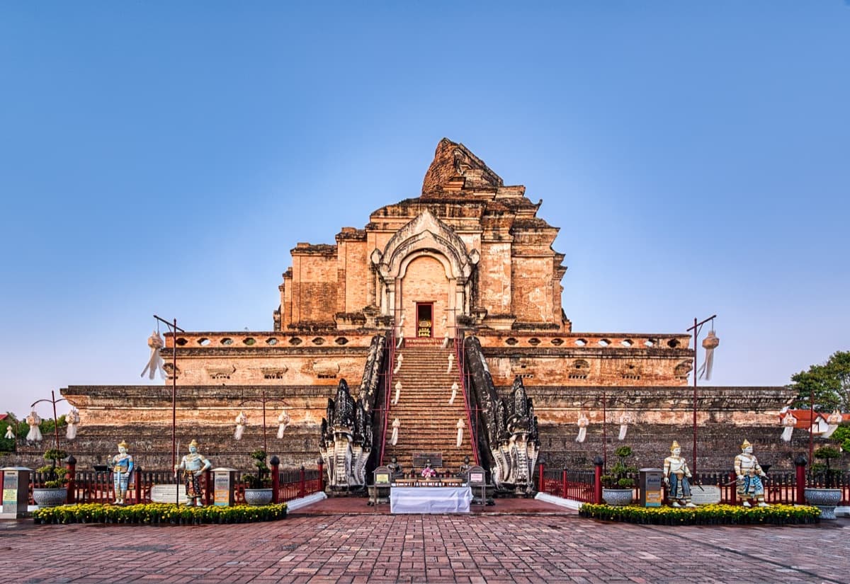
Everything inside that frame sits where the founders wanted it. Wat Chiang Man, regarded as the oldest temple in the city, stands on the exact ground where Mangrai camped while his capital rose around him, its Chang Lom chedi ringed by fifteen life-sized brick elephants. At the civic center, the Three Kings Monument casts the founding legend in modern bronze, opened in January of nineteen eighty-four, and the tour is honest that the three-king alliance is chronicle myth, not documented fact. The great chedi at Wat Chedi Luang, begun in the late fourteenth century under King Saen Muang Ma and completed in the mid-fifteenth under King Tilokaraj, once rose about eighty-two metres, the largest structure Lanna ever built, and held the Emerald Buddha from fourteen sixty-eight until the image left for Luang Prabang in fifteen fifty-one. An earthquake in fifteen forty-five sheared off its top. A few steps away, the city pillar Sao Inthakhin marks the spiritual axis, moved to these grounds by King Kawila in the year eighteen hundred. The walk closes in the west at Wat Phra Singh, founded in thirteen forty-five by King Phayu, where the Viharn Lai Kham preserves gilded Lanna murals of the Sang Thong and Suwannahong tales. You begin at a rebuilt gate holding an ancient shape and end in a room where the old kingdom's art survived intact.
The money across the river
Hear a stop from this walk
Three Kings Monument: the founding legend in bronze
The walled square is only one layer. The Chiang Mai that outsiders built lived across the Ping, where the money made from northern teak actually landed. The Other Bank follows that money through a polyglot trading world the guidebooks route around. In the nineteenth century logs floated down this river to a hungry British empire, and within a few streets British and Burmese logging firms, Chinese and Yunnanese Muslim merchants, and American missionaries all put down roots.
The engine room is Warorot Market, called Kad Luang, which grew into a market in nineteen ten under Princess Dara Rasmi. Beside it, Ton Lamyai Market sits on land that was once the rulers' elephant stables, later rented to keep the logging elephants that hauled teak for the Borneo Company and the Bombay Burmah Trading Corporation. The same century that filled these markets built Ban Ho Mosque, raised by the Chin Haw, Yunnanese Muslim caravan traders who linked Lanna to southern China by mule and horse. Cross at Nawarat Bridge, where a British visitor, Captain McLeod, recorded a good wooden bridge two hundred yards long on January twenty-third, eighteen thirty-seven, and the far bank opens up. Wat Ket Karam, traditionally dated to fourteen twenty-eight, keeps a volunteer community museum of the mixed neighborhood set up around nineteen ninety-nine. The First Church of Chiang Mai, a teak weatherboard building dedicated on August ninth, eighteen ninety-one, grew from the Presbyterian mission Daniel and Sophia McGilvary founded in eighteen sixty-seven on land the ruler Kawilorot Suriyawong granted a year later. The arc closes to the south at the Chiang Mai Gymkhana Club, founded in eighteen ninety-eight by employees of those same British teak firms, a place Somerset Maugham mentioned in his nineteen thirty travel book, The Gentleman in the Parlour. Note the material that runs through all of it: teak floated the fortunes, framed the mission church, and paid for the colonial cricket grounds.
The craft carried in by force
The third layer is the smallest in size and the sharpest in meaning. The Silver Road follows Wualai Road, running south from the Chiang Mai Gate, where one craft became a neighborhood's whole identity. The story is not a happy migration. After Chiang Mai stood largely emptied under Burmese pressure for roughly twenty years, King Kawila rebuilt it by resettling whole communities, a documented policy of forced relocation. In the year seventeen ninety-nine, according to the histories kept at the local temples, he brought people from Ban Nguai Lai, west of the Salween River, in what is now Shan territory. Among them were silversmiths, and the quarter took its name from their origin place.
The craft they carried is silver repousse, worked from behind so the hammer raises a relief out of flat metal. Two centuries on, it still clads temples and fills the pavement. Wat Muen San, first recorded in palm-leaf manuscripts in fourteen thirty-eight, became the community's restored heart, its silver Suttajitto Gallery worked by Wualai artisans between two thousand and two and two thousand and ten. Wat Sri Suphan, founded around fifteen hundred, carries the craft's grandest statement in an ordination hall sheathed in silver, nickel, and aluminium panelling, and its sharpest rule: women are barred from entering, a regional Lanna folk belief rather than a core Buddhist doctrine. Along the workshops the same hands still hammer the same lines, and every Saturday evening the whole road closes into a walking street from around five until ten. Beauty and coercion sit together here, because the silversmiths who seeded this place did not choose to come.
Read the three walks in sequence and Chiang Mai stops being a single serene temple-town. It becomes a capital that was drawn on purpose, a river that pulled in a wider Asian and colonial trade, and a road that carries the memory of people moved against their will. Thailand still speaks of the north as its own thing, and these three routes show you why.
Sources
- The Moated Square tour (Roamer), en.json for chiang-mai-old-city: founding, moat, Wat Chiang Man, Wat Chedi Luang, Sao Inthakhin, Wat Phra Singh.
- The Other Bank tour (Roamer), en.json for chiang-mai-wat-gate: Warorot and Ton Lamyai markets, Ban Ho Mosque, Nawarat Bridge, Wat Ket Karam, First Church, Gymkhana Club.
- The Silver Road tour (Roamer), en.json for chiang-mai-wualai-road: Wualai Road resettlement, Wat Muen San, Wat Sri Suphan, silver repousse, Saturday Walking Street.
- Fine Arts Department of Thailand, cited in the Moated Square tour for the Tha Phae Gate reconstruction dates.
- Somerset Maugham, The Gentleman in the Parlour (nineteen thirty), cited in the Other Bank tour for the Gymkhana Club reference.
Frequently asked questions
- What was the Lanna kingdom, and how does Chiang Mai fit into it?
- Lanna was a northern Thai-Buddhist kingdom with its own script, dynasty, and temples. King Mangrai founded Chiang Mai as its capital in the year twelve ninety-six, laying it out as a moated, walled square. Lanna held its independence for about two and a half centuries before Burma and later Bangkok absorbed it.
- Why is Chiang Mai's old city shaped like a square?
- The square is deliberate. King Mangrai dug the moat and raised the walls all at once in twelve ninety-six, so the city was born as a single designed object rather than a settlement that spread. The moat still traces the exact line his diggers cut, more than a mile and a half on each side.
- What is the connection between teak and Chiang Mai's riverside district?
- In the nineteenth century, northern teak logs floated down the Ping River to British buyers, and a trading world grew on the banks. British firms like the Borneo Company and the Bombay Burmah Trading Corporation, Chinese and Yunnanese Muslim merchants, and American missionaries all settled within a few streets. The teak money seeded the markets, the mission church, and the Gymkhana Club.
- Why is Wualai Road known as the silver road?
- Around the year seventeen ninety-nine, King Kawila resettled silversmiths from Ban Nguai Lai, west of the Salween River, into the area south of the old city, a documented forced relocation. The quarter took its name from their origin place, and the community has practiced silver repousse there for more than two hundred years, cladding two temples and filling a Saturday walking street.
- Can women enter the Silver Temple at Wat Sri Suphan?
- Women can view the silver-clad exterior in full but are barred from entering the ordination hall itself. The restriction comes from a regional Lanna folk belief that consecrated relics in the foundation would lose power in a woman's presence, not from core Buddhist doctrine. Women enter ordination halls freely at temples elsewhere in Thailand.
Ready to experience it?
Old City: The Moated Square
95 min · 3.5 km · moderate
More from Chiang Mai
Explore more at your own pace.
Chiang Mai Travel Guide: Days, Getting Around, Best Time, Safety, and Budget
One Day in Chiang Mai: A Walkable Morning-to-Evening Itinerary
Wat Chedi Luang: The Broken Giant at the Center of Chiang Mai's Moated Square
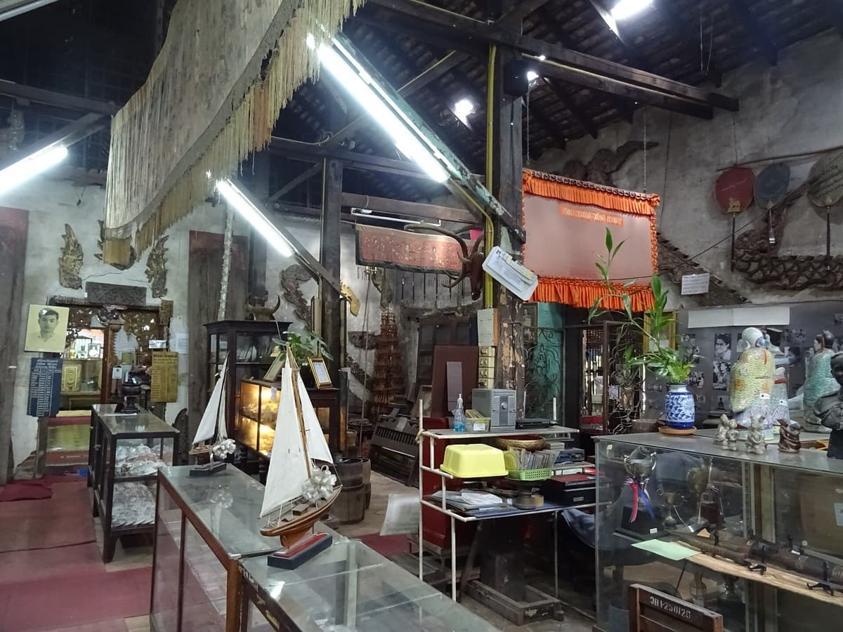
Wat Ket Karam and the Chiang Mai the Teak Boom Built Across the River
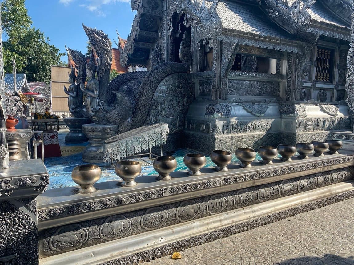
Wat Sri Suphan and the Silver Road of Wualai