Huinnyeoul Culture Village: The Cliff Path
60 min · 0.8 km · moderate
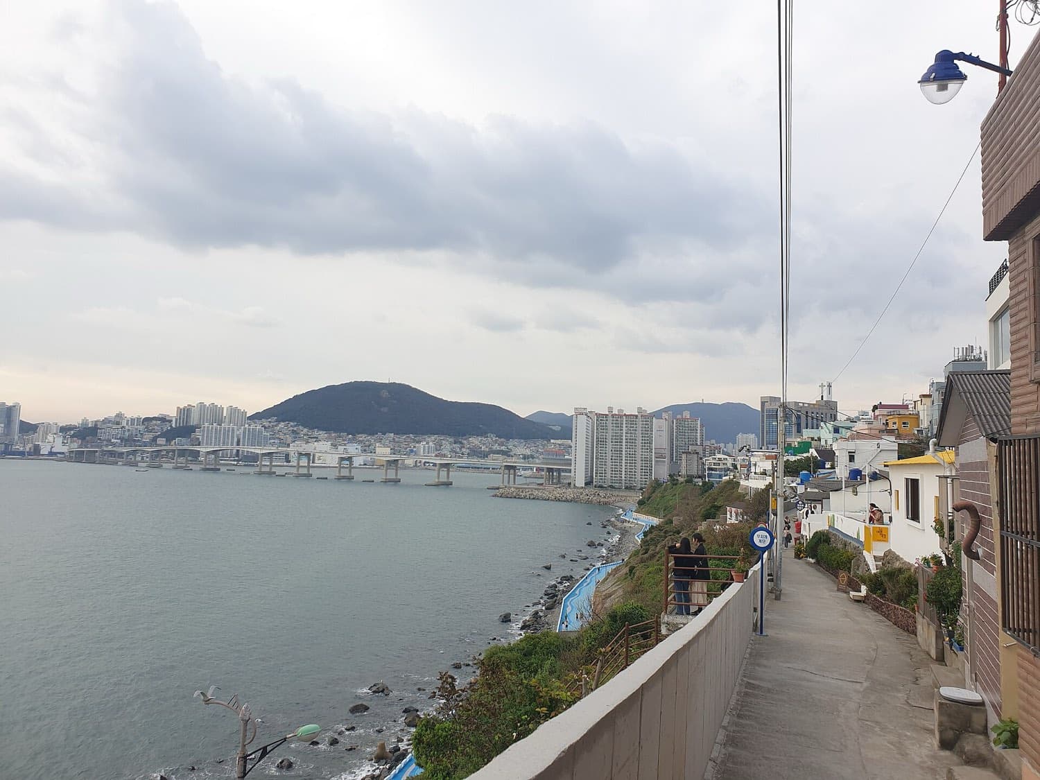
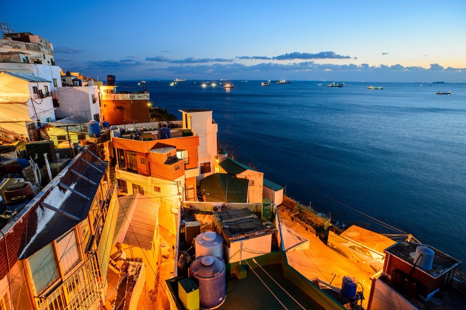
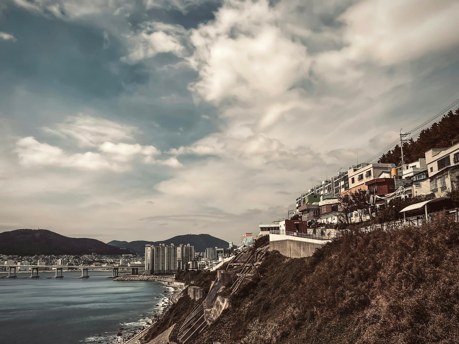
The stacked white houses of Huinnyeoul are both a postcard and a refugee settlement, and walking the cliff path shows you that the beauty and the hardship are the same walls. On the island of Yeongdo in Busan, South Korea, small white homes stand crowded on a narrow ledge between a high cliff and the open sea. From a certain angle, in a certain light, they photograph like a Greek island. That is exactly why the second stop of the walk, the stacked houses themselves, is the right way into the whole route. Once you understand what those walls actually are, every other stop reads differently.
What the name is telling you
Huinnyeoul means, roughly, white water, or white rapids. Huin is the Korean word for white. The story kept in the region's tourism records is that a stream once ran down from Bongnaesan, the mountain at the center of Yeongdo, and foamed white as it tumbled to the shore. So the name describes water, not architecture. The white you see today is paint and plaster on stacked homes, but the older white was a stream running to the sea. Holding both meanings at once is good practice for the rest of the walk, because this is a place where the obvious reading and the deeper one sit right on top of each other.
You will hear Huinnyeoul called the Santorini of Korea. Be careful with that phrase. It is a piece of marketing, a comment on how the place looks, and it says nothing about how it came to be. What it came to be from is harder. During the Korean War, from 1950 to 1953, refugees fled south with nowhere to settle, and they packed this steep coastal slope with makeshift homes because the flat land was already taken. A cliff was still ground. The same stacked houses that make the photograph are the ones a refugee family raised by hand. That is the quiet truth the anchor stop asks you to carry.
Why so many people came to a cliff
Hear a stop from this walk
The Cliff-Top Lane: Huinnyeoul Culture Village Entrance
To understand the density of Huinnyeoul, you have to look past the village to the city around it. During the war, Busan served as the temporary capital of the Republic of Korea for one thousand and twenty-three days. A city whose peacetime population was only a few hundred thousand swelled to around a million people as displaced families poured in, so that at times there were as many refugees in Busan as there were residents. People built where they could, and a sea cliff nobody wanted became somewhere to live.
Around 2010 and 2011, local artists and residents remade the village into a culture-and-art quarter, renovating houses and painting murals. That layer is real and worth seeing, but it sits on top of the older one, not in place of it. The most important thing to know before you go is that people still live here. This is a lived-in residential village, not a film set. Keep your voice low in the lanes, do not photograph into homes, and let the quiet be part of what you notice.
The path from lane to shore
The full walk is short, under a kilometer, and mostly linear, so you can move at your own pace and skip what you like. It begins high on the clifftop lane, called Huinnyeoul-gil, where the ground drops away to the water. From there, painted stairways fall toward the shore, including a well-known set often called the piano stairs.
Not everyone can manage steep steps, and that is where a small, kind detail becomes part of the story. The Huin-yeoul Coastal Tunnel is a pedestrian tunnel cut straight through the rock wall of the cliff. It is seventy meters long, it opened in December 2018, and its reason for being is simple: to let older residents and less mobile visitors bypass a steep stair section between the piano stairs and the open square on the coastal trail. It has become a photo spot, but its origin is accessibility, so the shore path would belong to more people, not fewer.
Down at the water, the shore below the village is part of Busan's South Port, called Namhang, used mainly by coastal and fishing vessels behind the Namhang breakwater. This is a working fishing community, not a scene arranged for visitors. The island also carries a heritage of haenyeo, women who free-dive for shellfish and seaweed without air tanks. The tradition on Yeongdo is rooted in divers from Jeju island who began settling here in the 1920s, and the wider Culture of Jeju Haenyeo was inscribed by UNESCO on its list of intangible cultural heritage in 2016. The sea below you has been worked by hand, and by breath, for a very long time.
Where the walk opens up
Beyond the shore, the route becomes the Jeoryeong Coastal Walk, a cliffside trail running roughly three kilometers along Yeongdo's rocky southern coast toward the Taejongdae area. Within living memory this was off-limits ground: according to the region's records, the coast was a military-protected zone, closed because the terrain was so steep and dangerous, and it was converted into a public walking trail beginning in 2001. It now carries tile murals, wave patterns worked into the flooring, natural rock left as it is, and a suspension bridge strung between rocks.
The tour rests at a cliff overlook where the sea opens fully. The ships crossing the water are heading into the Port of Busan, the largest and busiest port in South Korea and one of the busiest container ports in the world. It ranked sixth busiest globally in 2023, and in 2024 it handled twenty-four point four million containers, its busiest year on record, connecting Busan to more than five hundred ports across more than one hundred countries. Hold that scale against the small houses on the cliff behind you. The same working sea that made Busan a wartime refuge is the sea that now carries this traffic. The refugee village and the enormous port are the same water. The beauty and the hardship are the same shore.
If you want to walk it yourself, the tour is one of several routes across the city on the Busan walking tours hub, and you can find it alongside the wider set of routes for Busan. Give yourself about an hour, wear shoes with grip, and come in the late afternoon, when the light softens on the white houses and the exposed cliff cools down.
Sources
- Huinnyeoul Culture Village, Wikipedia: origin as a Korean War refugee settlement on Yeongdo and its later remaking as a culture-and-art village.
- Huin-yeoul Coastal Tunnel and Jeoryeong Coastal Walk, VisitKorea: tunnel length and 2018 opening, plus the coastal trail's conversion from a restricted zone.
- Culture of Jeju Haenyeo, UNESCO Intangible Cultural Heritage: the 2016 inscription of the women divers' tradition rooted in Jeju.
- Port of Busan, Wikipedia: the port's global ranking, container throughput, and network of connected ports.
- Sites of the Busan Wartime Capital, UNESCO tentative list: Busan's role as provisional capital during the Korean War.
Ready to experience it?
Huinnyeoul Culture Village: The Cliff Path
60 min · 0.8 km · moderate
More from Busan
Explore more at your own pace.
Busan Travel Guide: Days, Transport, Weather, Safety, Budget
Busan's War-Made City: How a Port Refuge Became a Painted Coast
Gamcheon's Refugee Origins: Reading Busan's Painted Hillside
Jagalchi Market: How Busan's Fish Market Explains the Whole Port City
The Gamcheon Panorama Viewpoint: Reading a Refugee Slope Two Ways at Once