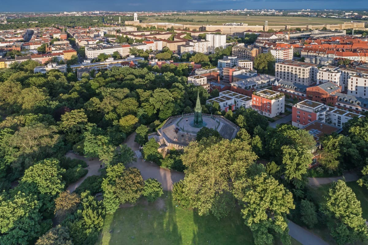
Kreuzberg, the district everyone in Berlin knows by name, took that name from a hill sixty-six metres high, and from a single cast-iron cross planted on its summit. Stand in Viktoriapark, look up the northern slope past the waterfall to the neo-Gothic spire at the top, and you are looking at the exact object that named a borough. The monument came first, in 1821. The hill borrowed its name from the cross. The park was laid out around both in 1894. And when the modern borough was drawn on the map after 1920, it reached up and took the hill's name for itself. This is where the whole district's identity is anchored, and it is the last stop on Roamer's self-guided Kreuzberg walk for a reason.
The cross that named a district
The spire you see at the summit is the Prussian National Monument for the Wars of Liberation, the wars fought against Napoleon. Karl Friedrich Schinkel, the leading Prussian architect of his time, designed it, and it was inaugurated in 1821. It is worth pausing on what that monument is made of and what it carries. At its very top sits an iron cross, the Eisernes Kreuz. That cross is the reason the hill is called the Kreuzberg, which translates plainly as cross hill. Berg means hill; the name is not poetic, it is descriptive.
Here is the chain that most visitors never trace. When the monument was inaugurated in 1821, King Frederick William III renamed the rise beneath it after the iron cross on its summit. So the cross named the hill. The hill named the park when Viktoriapark opened in 1894. And when the borough of Kreuzberg was formed through the Greater Berlin Act of 1920, it soon adopted the hill's name too. So every time you hear the word Kreuzberg, at the market on the Maybachufer, on the U-Bahn platform at Kottbusser Tor, in a conversation about punk clubs on Oranienstrasse, the word is quietly pointing back to this one iron cross on this one modest rise. It is a small object doing an enormous amount of work.
Schinkel's monument is not a neutral piece of decoration either. It is a memorial to a specific, hard national moment, the liberation wars of the early nineteenth century against Napoleon, and it was placed on high ground so it could be seen across a much smaller Berlin than the one that surrounds it today. When you climb to it now, you are standing where the city once looked up.
The highest point in inner Berlin, with an honest asterisk
Hear a stop from this walk
Oranienplatz: Where the Canal Widened
The Kreuzberg rises to sixty-six metres, and that makes it the highest natural point in inner Berlin. That phrase deserves care, because it is easy to mangle into something false. This is not the highest point in Berlin overall. A rubble hill built from wartime debris and some outer heights climb well above it. What the Kreuzberg holds is a narrower and more interesting title: within the dense inner city, this gentle sixty-six-metre rise is the top. It is a hill you can walk up without effort, and yet on a clear day it hands you a wide view over the flat inner districts precisely because everything around it is flatter still.
That combination, modest height and genuine prominence, is the thing to understand standing here. Berlin is a famously flat city. A rise of sixty-six metres, in a landscape with almost no natural relief, becomes a landmark far out of proportion to its size. The Prussians knew that when they chose the spot for a monument meant to be seen. The park designers knew it when they shaped the grounds around a summit view.
A waterfall engineered into the hillside
Look down the northern slope and you will find the park's other signature feature: an artificial waterfall that has been running since the summer of 1894, the same year the park opened. It is not a natural stream. It is a designed cascade, moving something like thirteen thousand litres of water a minute over its rocks when it runs. It falls in a long stepped line down toward the neighbourhood below, and it is deliberately theatrical, a piece of nineteenth-century park engineering meant to give a flat city a dramatic vertical.
Viktoriapark itself was later expanded to roughly sixteen hectares, wrapping the hill in lawns, wooded slopes and paths. The waterfall is the part people photograph, but it belongs to the same idea as the monument above it: both are attempts to make this small hill feel like an occasion. On a warm evening the grassed slopes fill with people, and the water at the top of the fall becomes a gathering point. It is a working public park, not a museum piece, which is exactly in keeping with a district that has spent a century turning ordinary ground into something used and loved.
Where the hill sits in the district's story
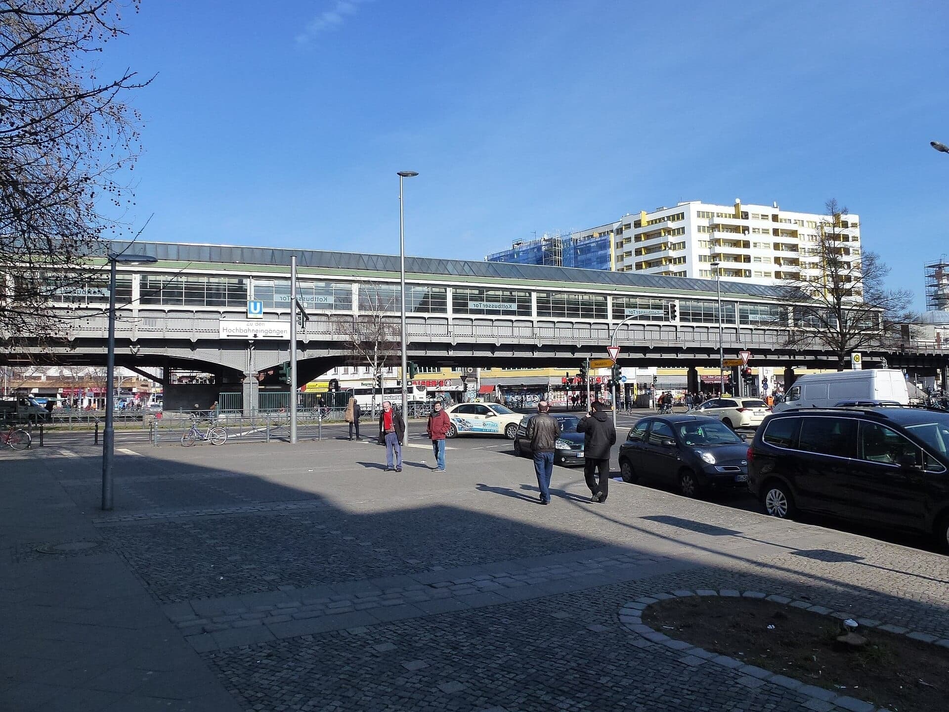
Roamer's Kreuzberg walk does not climb the hill. It stays a few kilometres to the north-east, in the old Luisenstadt around Oranienstrasse and Kottbusser Tor, where a filled-in canal, the Wall strip and a motorway plan that was never built shaped the streets. The hill is the other end of the same district, and the place that gave all of it a name.
That is the one thing to carry up the slope with you. The name Kreuzberg is not abstract. It is bolted to the top of Schinkel's monument in the shape of an iron cross, on the highest natural point of inner Berlin, in a park that engineered a waterfall into a flat city in 1894. Reach the summit, let the view settle, and the whole district falls into place behind you.
If you want to walk the district's streets in sequence, the Roamer app carries Kreuzberg: The Neighborhood That Nearly Became a Motorway, twelve stops that trigger as you arrive, so you can walk at your own pace and let the story unfold on foot. Explore more routes across the city on our Berlin walking tours hub, or start planning from the Berlin city page.
Sources
- Prussian National Monument for the Liberation Wars, Wikipedia. Details on Schinkel's 1821 monument, its iron cross, the wars against Napoleon it commemorates, and King Frederick William III renaming the hill after the cross on inauguration.
- Viktoriapark, Wikipedia. The park's 1894 opening, the sixty-six-metre Kreuzberg hill, the artificial waterfall running since summer 1894 at thirteen thousand litres per minute, and the later extension to sixteen hectares.
- Kreuzberg, Wikipedia. Background on the 1920 Greater Berlin Act creating the borough, its later adoption of the hill's name, and the hill as the highest natural elevation in inner Berlin.
Ready to experience it?
Kreuzberg: The Neighborhood That Nearly Became a Motorway
90 min · 3.1 km · easy
More from Berlin
Explore more at your own pace.
Berlin: The City That Reads Its Own Scar
Best Architecture Walking Tours in Berlin (2026)
Best Culture Walking Tours in Berlin (2026)
Little Istanbul at Kottbusser Tor: How Guest Workers Made Kreuzberg
The Memorial to the Murdered Jews of Europe: How Berlin Reads Its Own Reckoning