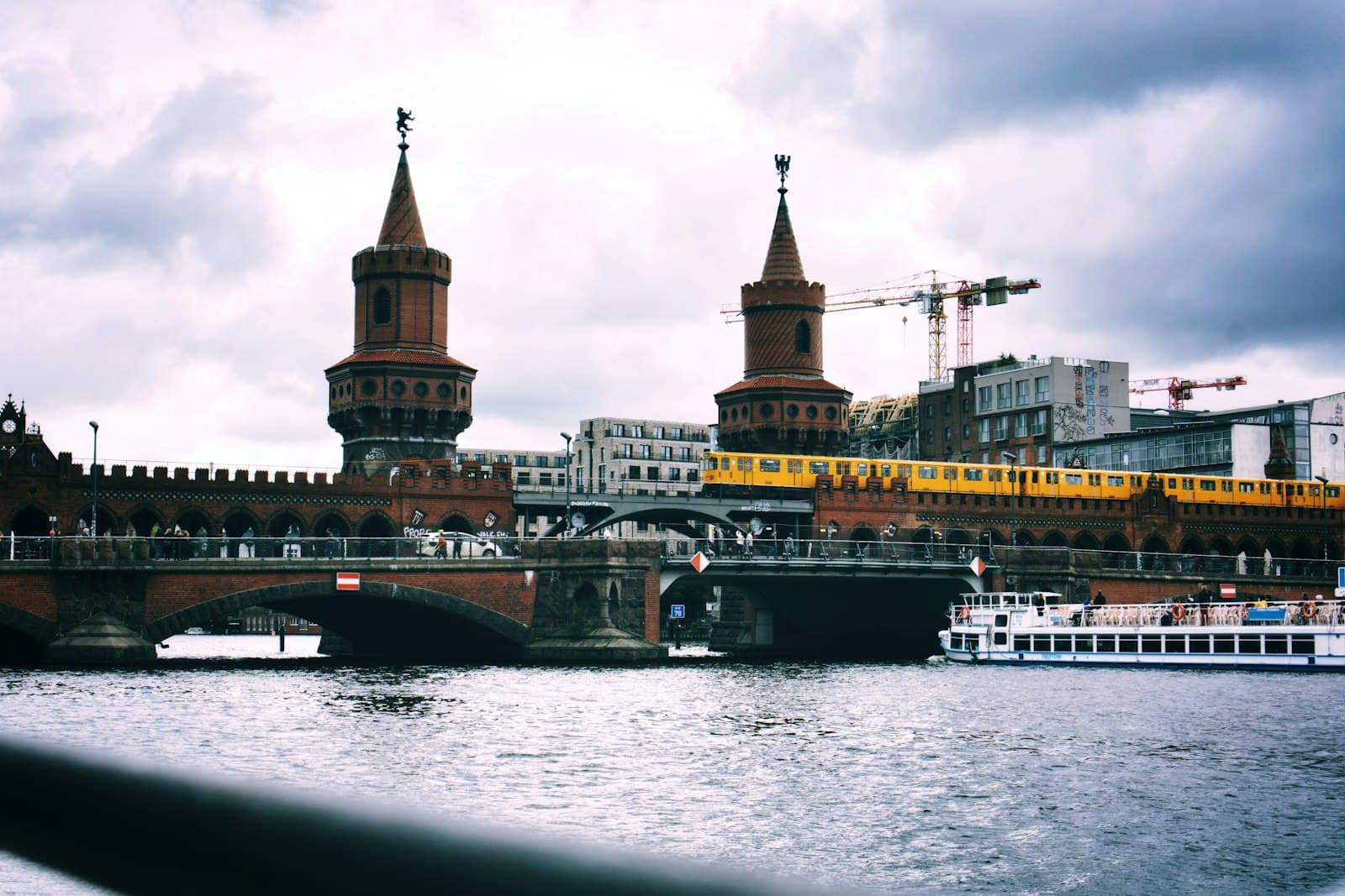
Walk the filled Luisenstadt canal through sunken gardens and the old Wall strip, past the Bethanien, along Oranienstrasse and under Kottbusser Tor to the Landwehrkanal and the Maybachufer market.
Start · Oranienplatz: Where the Canal Widened
DirectionsStops
- 1
Oranienplatz: Where the Canal Widened
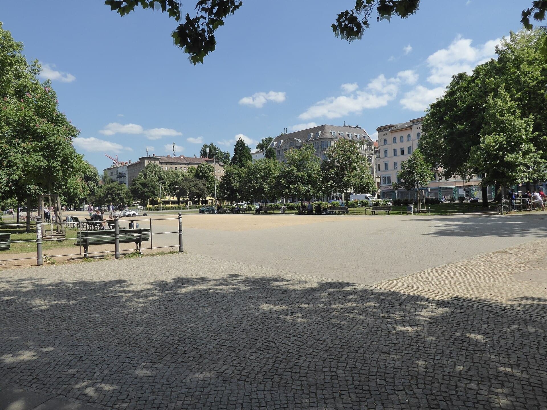
A green square laid out in a canal basin. The tree-lined path down its middle follows the line of a canal filled in from 1926, and in the 1960s a motorway interchange was planned right here.
- 2
Rose Garden: Down in the Canal Bed
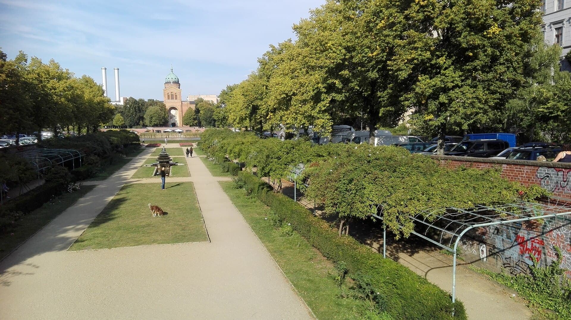
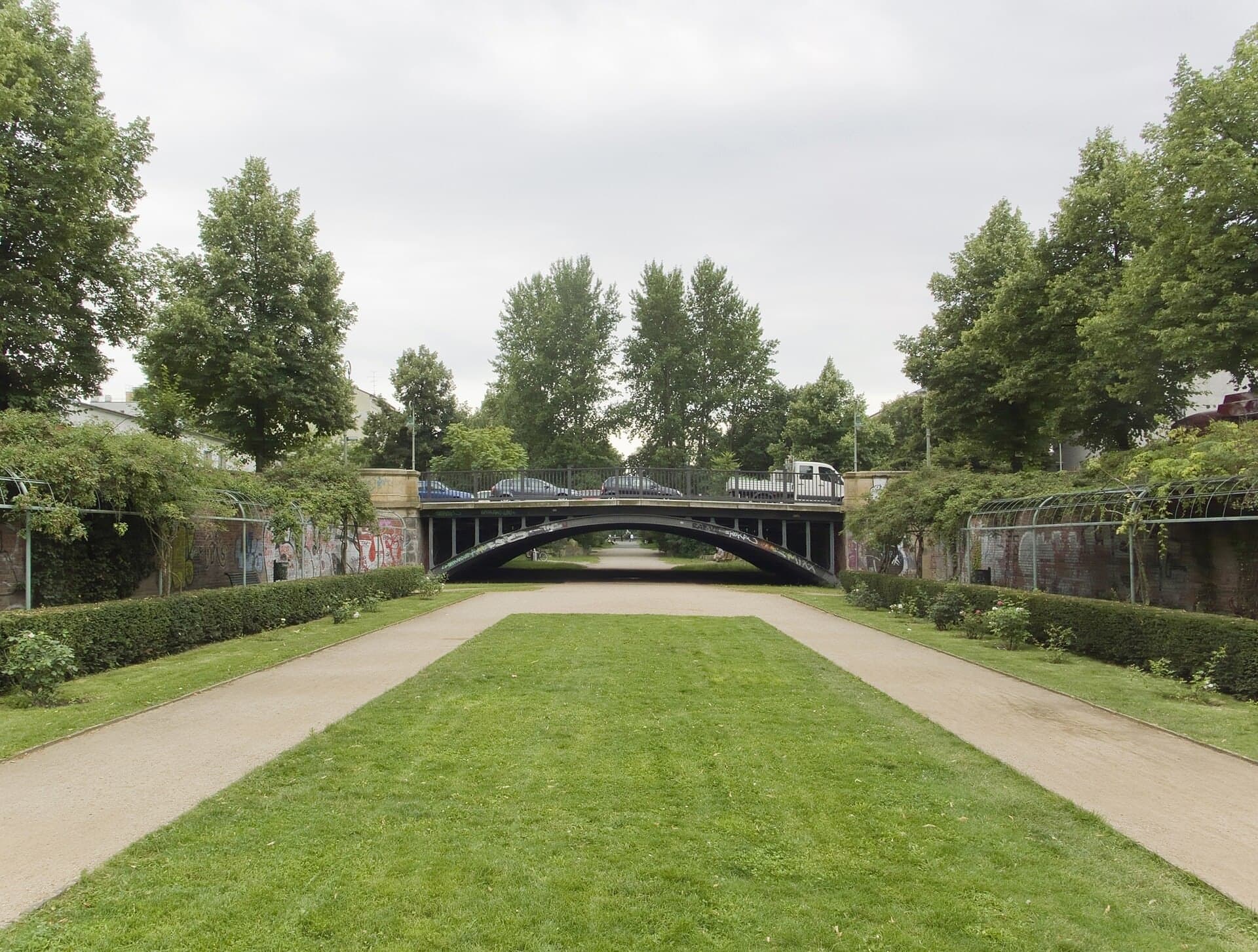
A rose garden sunk into the old canal bed. The canal was filled only part way, so its gardens sit below the street, and the low bridge on the way in is the one old bridge that was kept.
- 3
Engelbecken: A Pond in the Death Strip
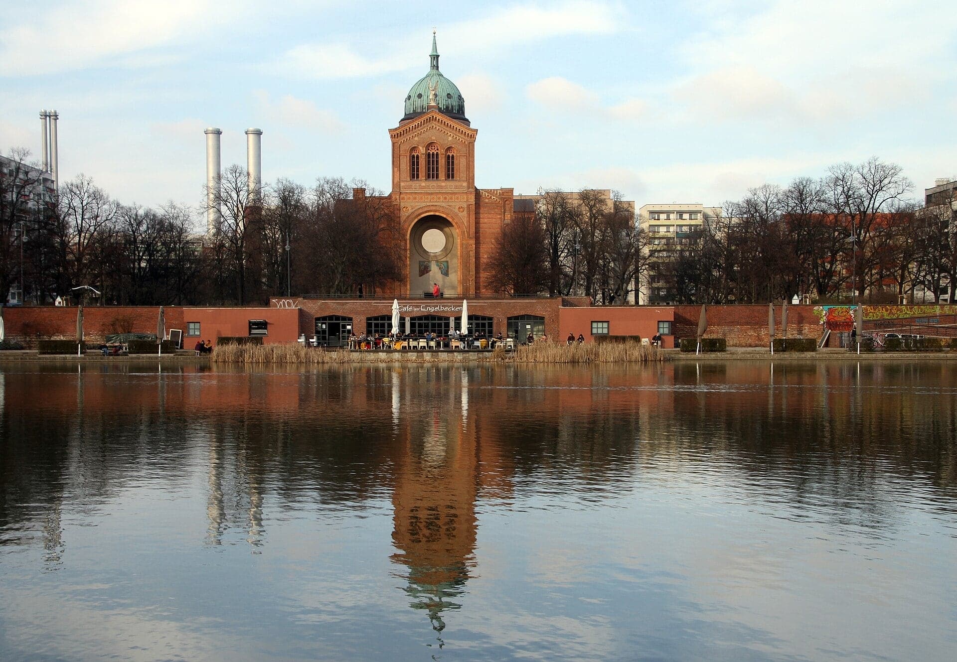
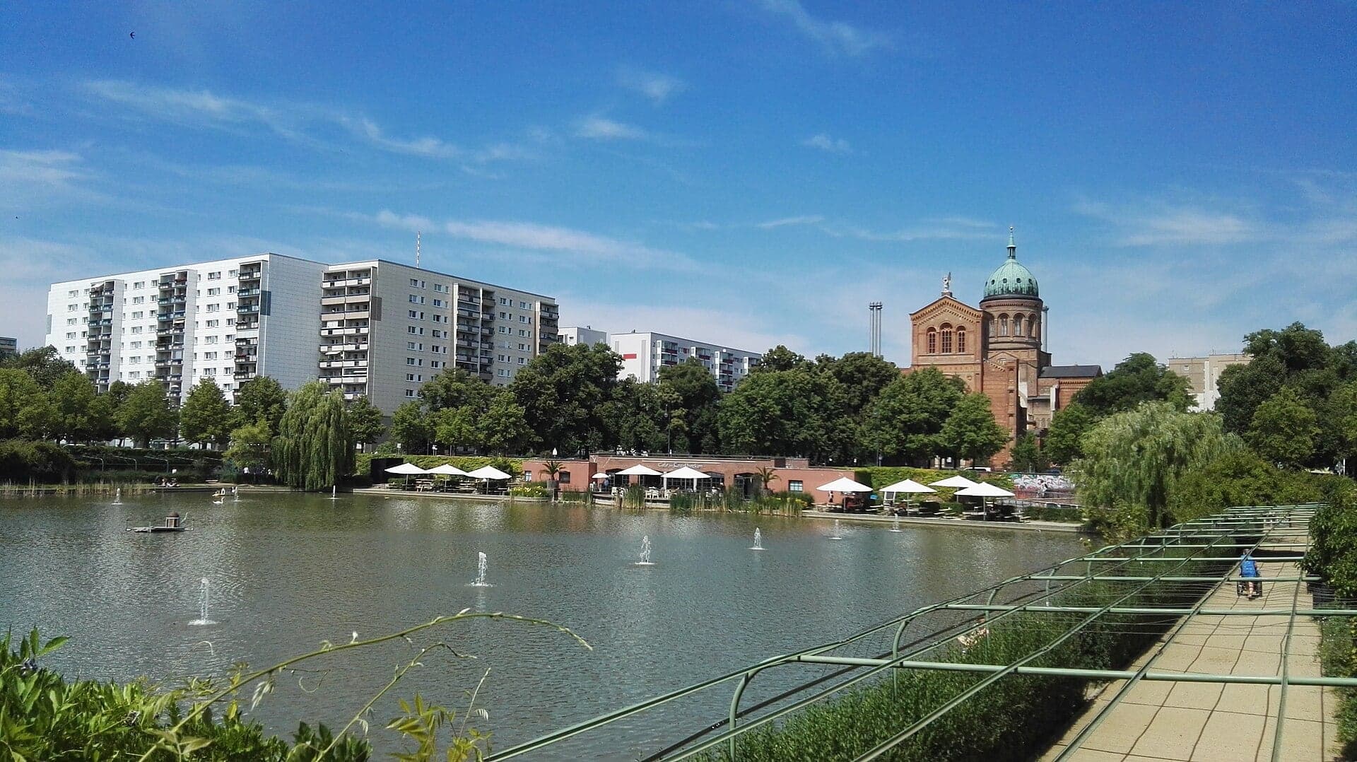
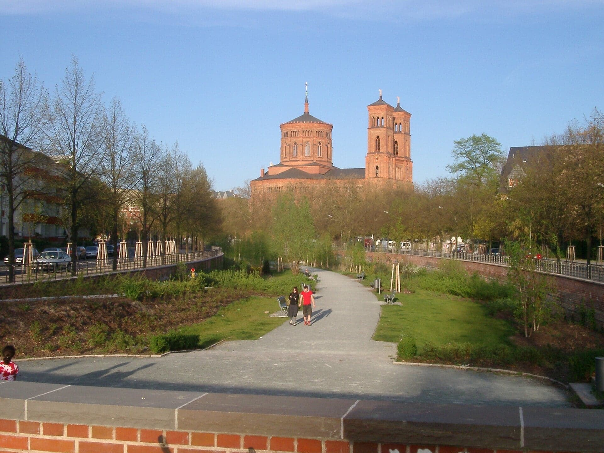
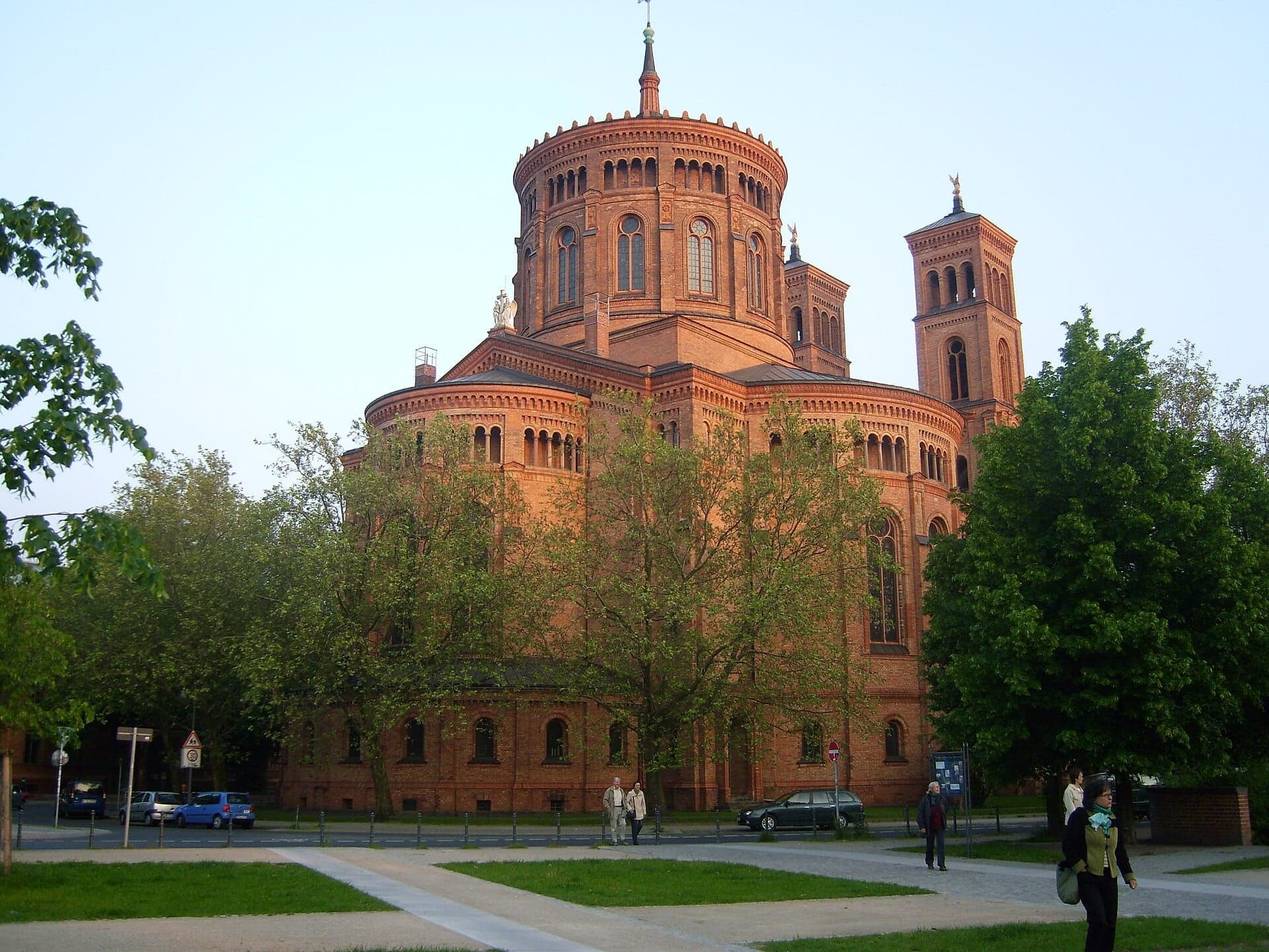
A pond filled with rubble under the Wall. It lay in the death strip after 1961 and was dug out again after 1990, below Saint Michael's church at the end of the old canal.
- 4
Canal Gardens: A Garden Below the Street
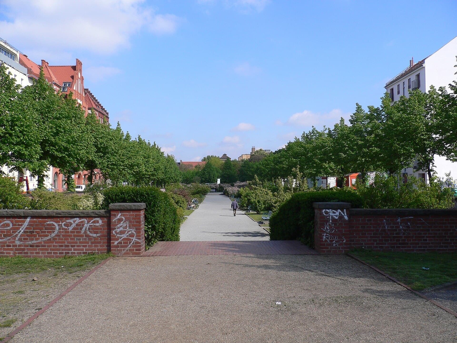
A woodland garden in the old canal bed. Three themed gardens follow one another here, sunk between walls below the streets on either side, rebuilt after the Wall on a 1920s idea.
- 5
Baumhaus an der Mauer: A Garden in No Man's Land
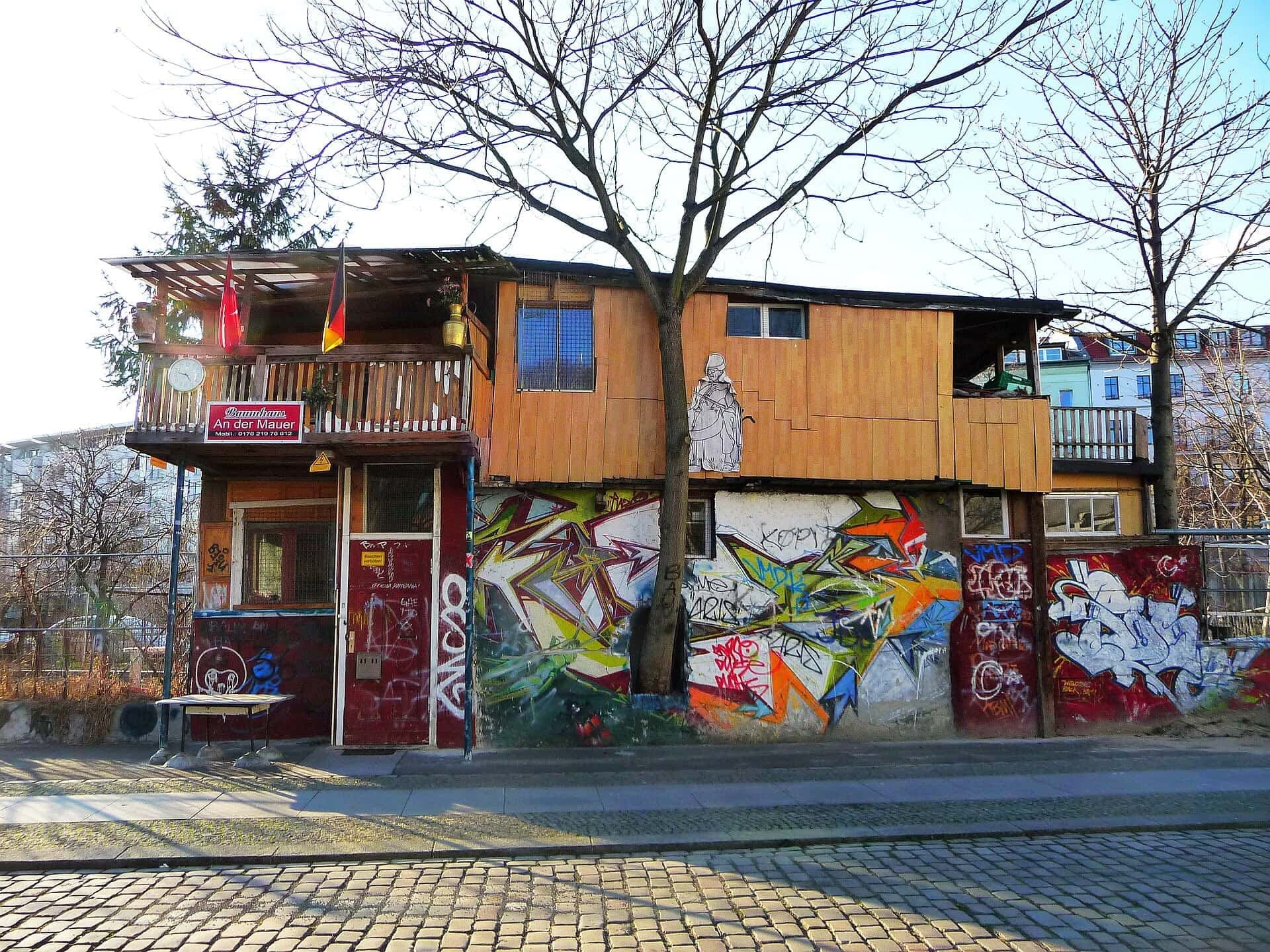
A so-called tree house on border land. The ground belonged to East Berlin but lay on the western side of the Wall, and in 1983 a guest worker from Anatolia began a vegetable garden on it.
- 6
Mariannenplatz: The Hospital That Started a District
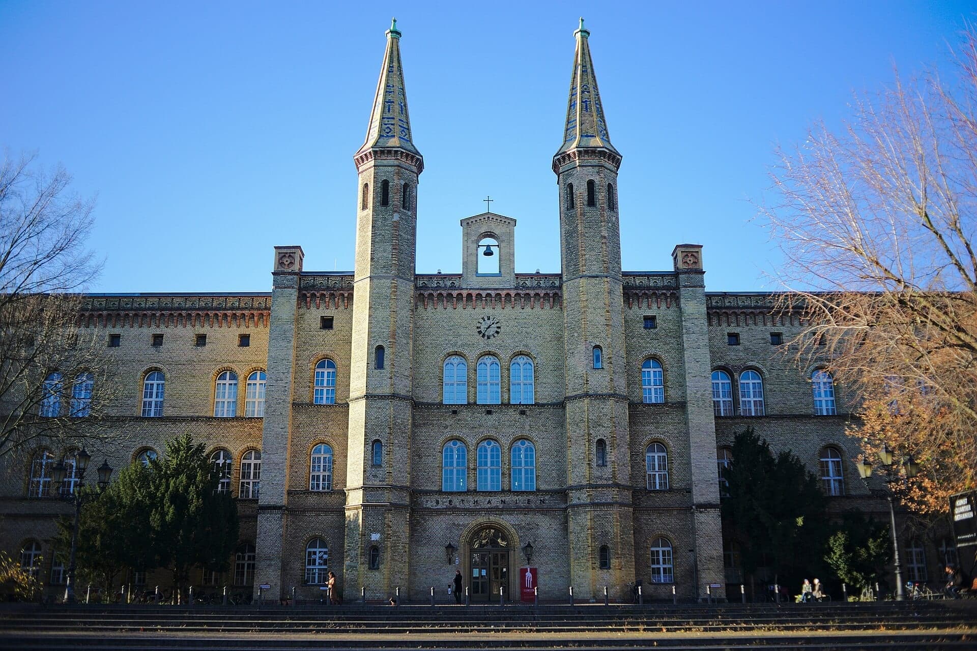
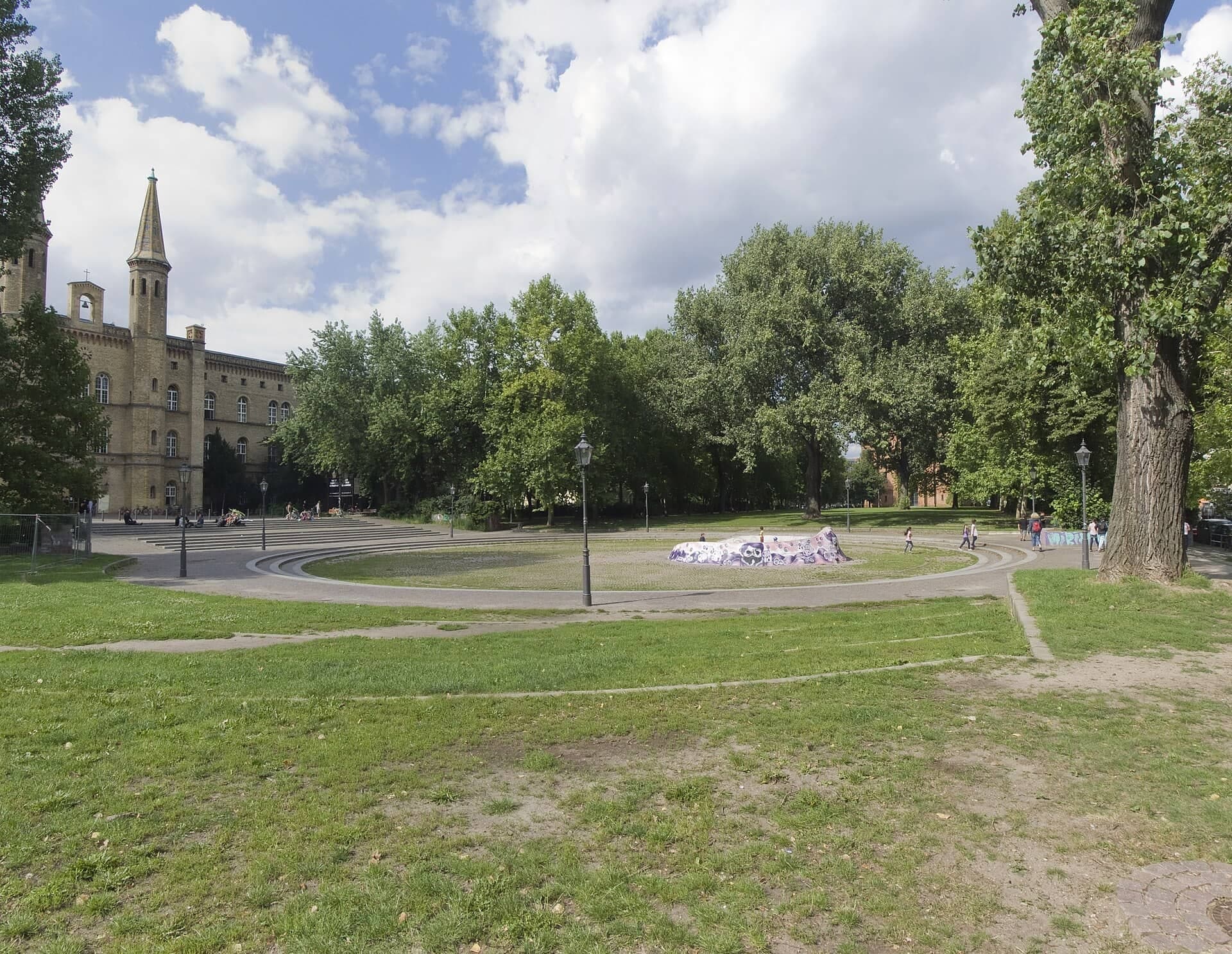
A long square before a yellow brick hospital. The Bethanien was founded in the 1840s to draw building into an empty district, closed in 1970 and was saved from demolition by protest.
- 7
Oranienstrasse: The Street Planned as a Motorway
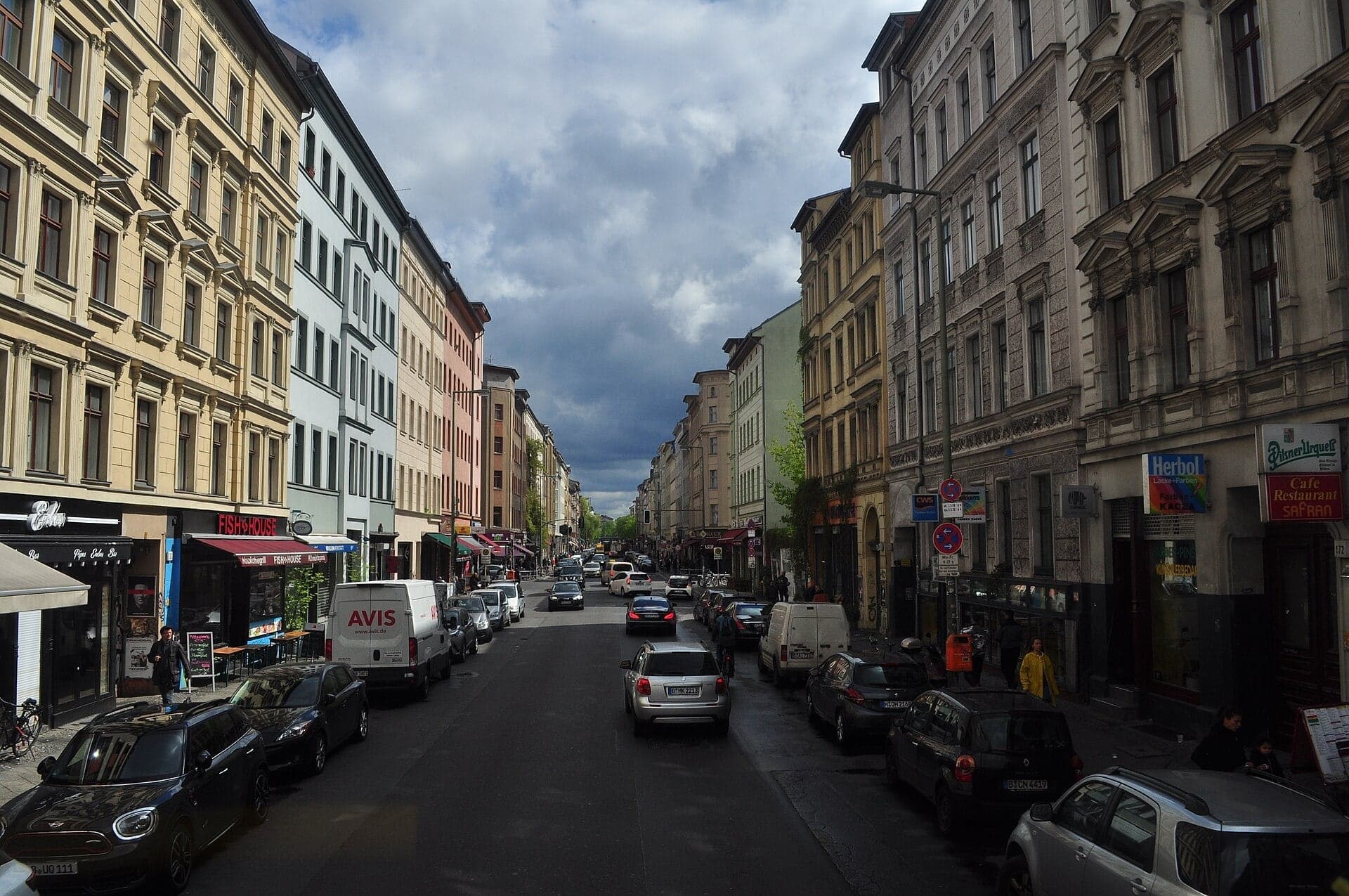
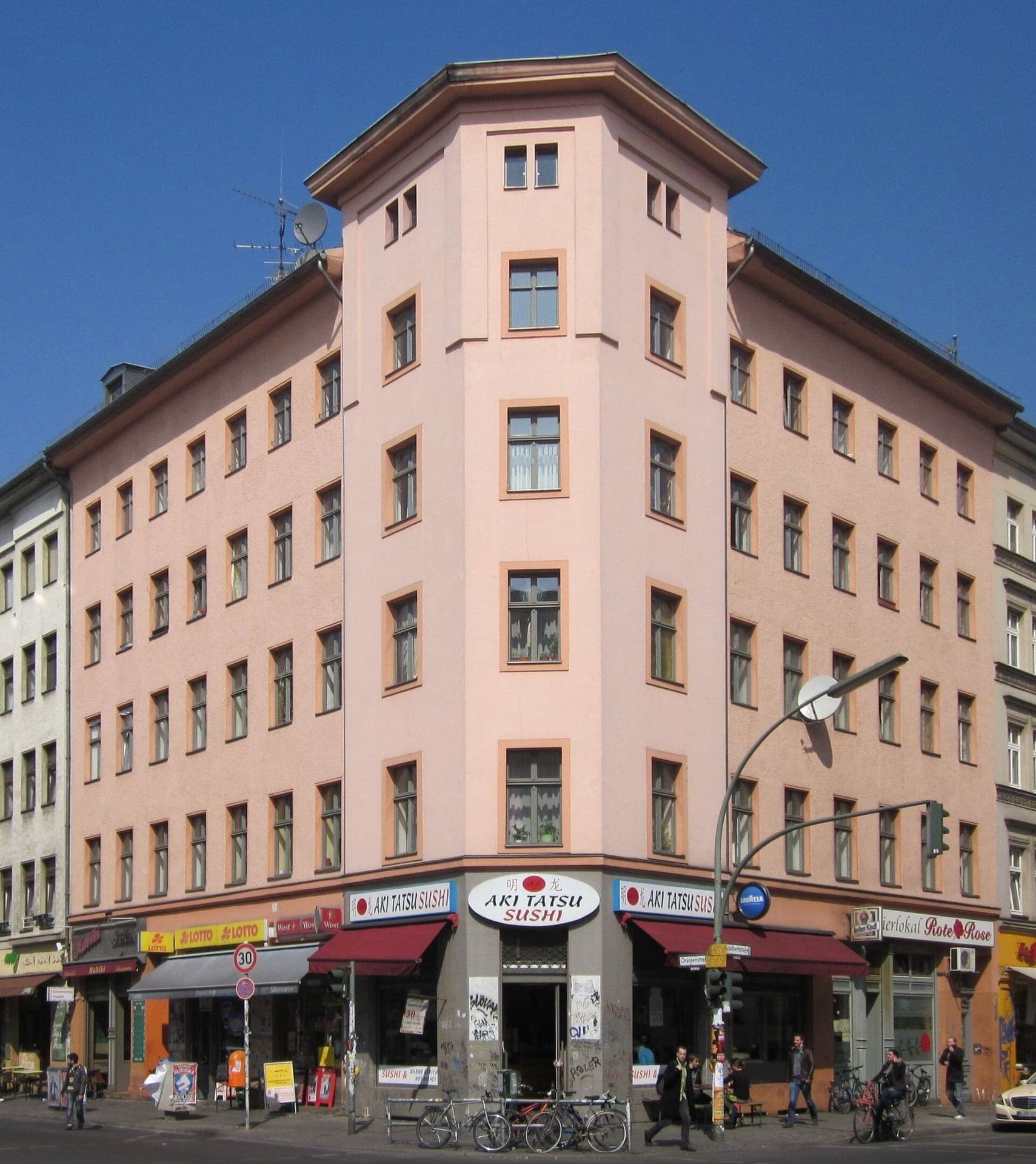
The main street of the old Luisenstadt. Its 1860s houses got their crowded courtyards later, a 1960s plan meant to clear them for a motorway, and from 1979 they were repaired instead.
- 8
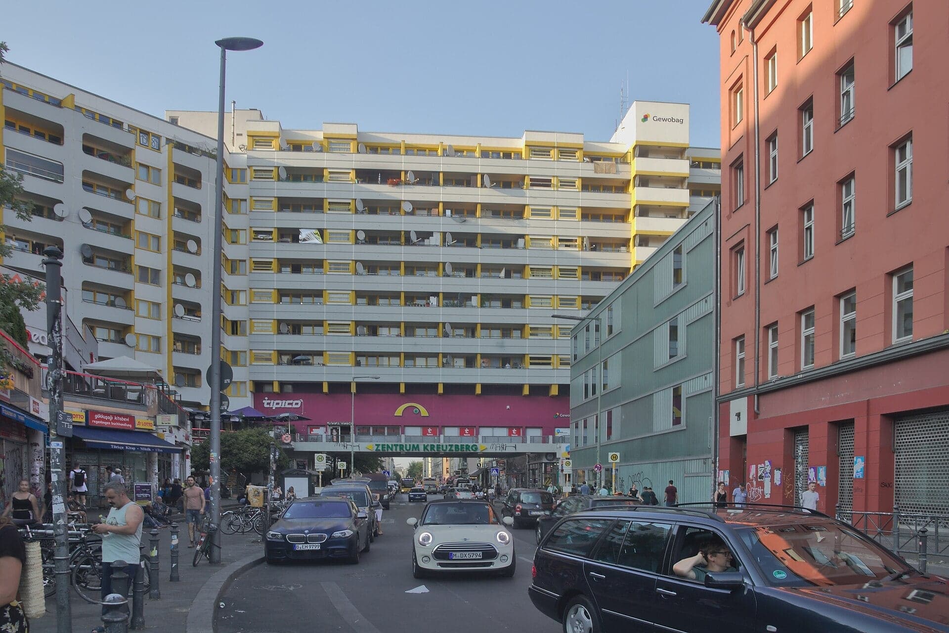
Adalbertstrasse: The Block Across the Street
A housing block built right across the street. The slab went up in the early 1970s on land cleared under the 1960s renewal plan, and the free district museum is in a courtyard on this street.
- 9
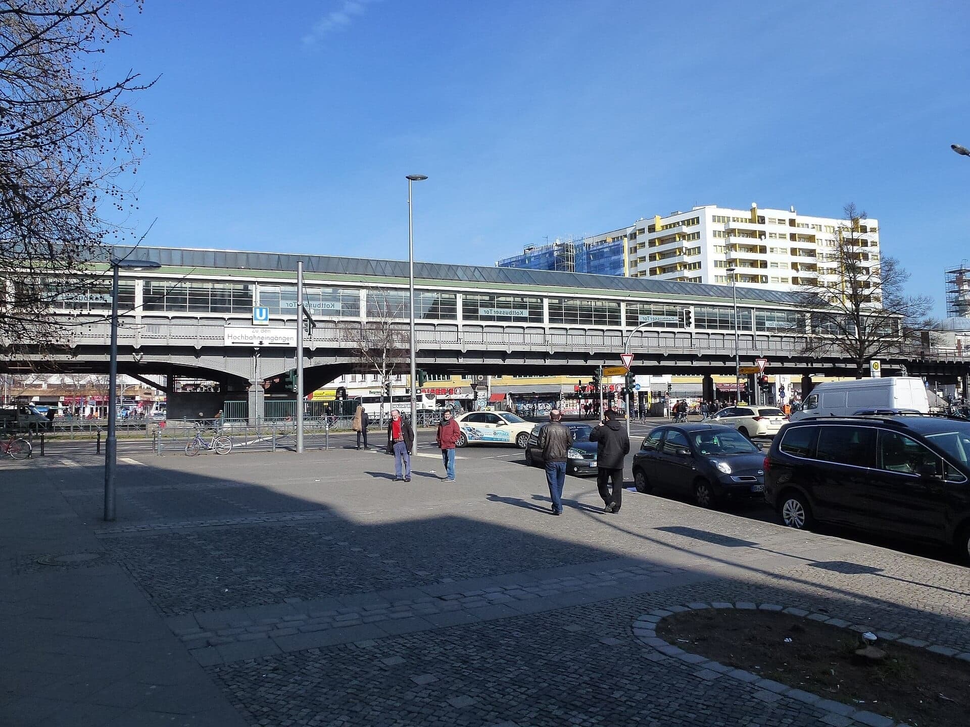
Kottbusser Tor: A Station Over a Square
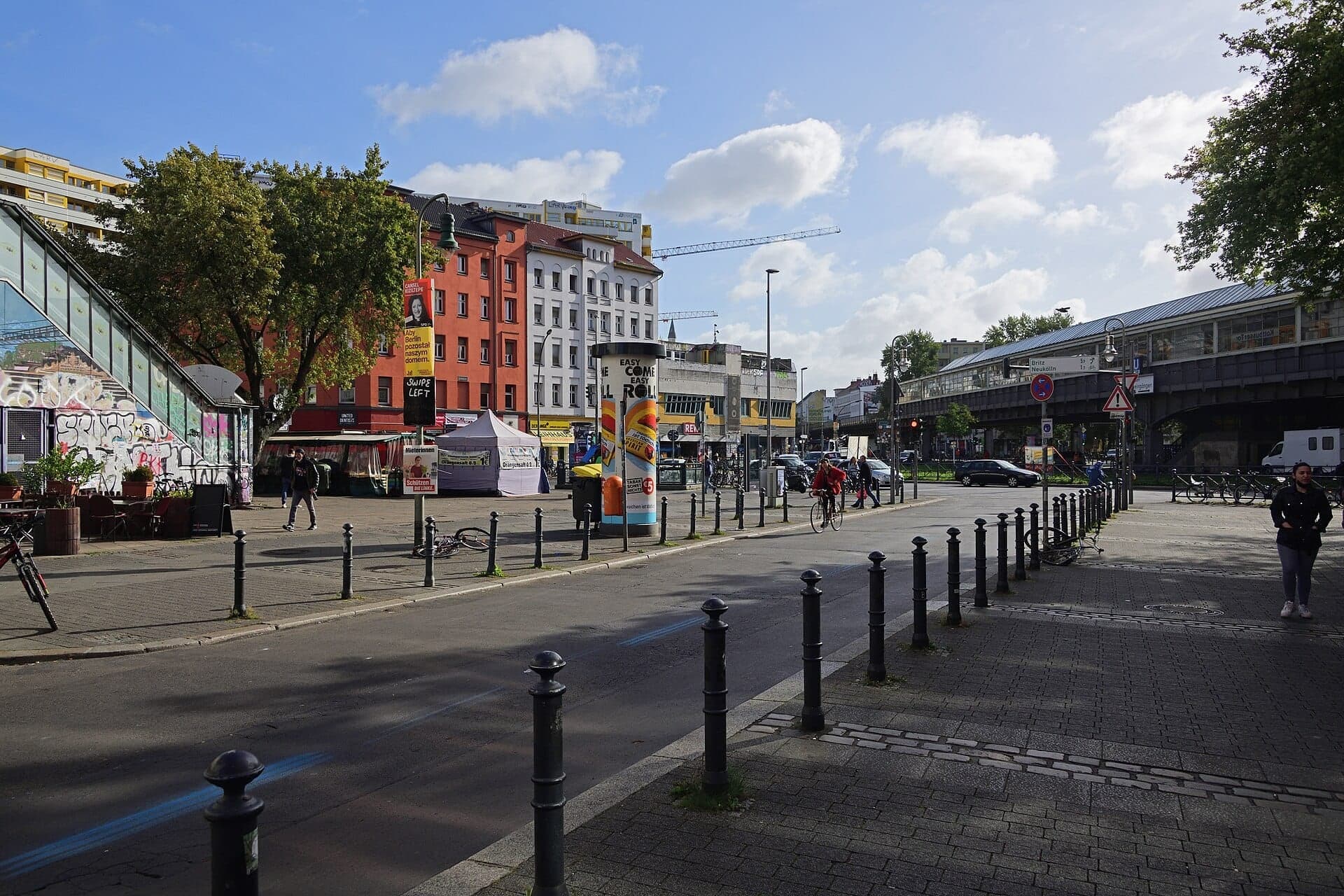
A steel and glass station above the square. Its 1920s hall stands on few supports to keep the square open, and guest workers from Turkey made their homes in the blocks around it.
- 10
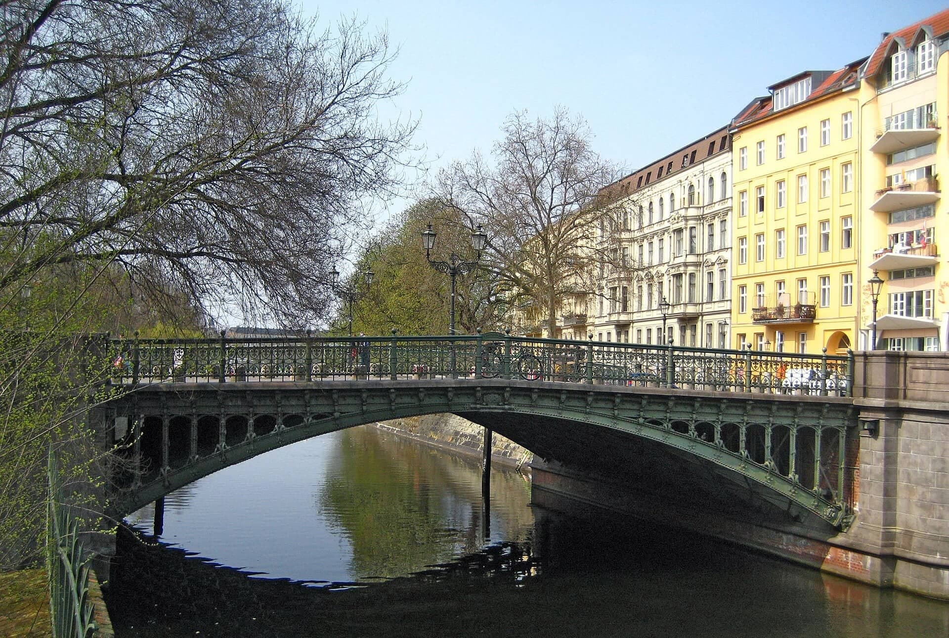
Admiralbrücke: The Canal's Oldest Wrought-Iron Bridge
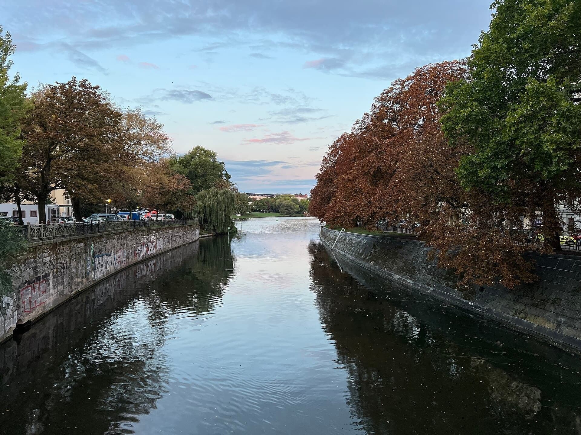
An ornate iron bridge over the Landwehrkanal. Built in 1880 to 1882, it is the oldest surviving wrought-iron bridge on the canal, whose two banks were finished in two different ways.
- 11
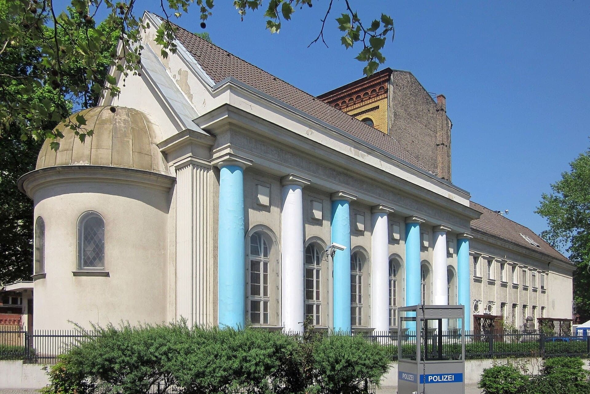
Fraenkelufer Synagogue: The Wing That Survived
A synagogue of which one wing survives. Alexander Beer's large synagogue of 1916 was badly damaged in 1938 and bombed in the war; its smaller wing by the canal is a synagogue again.
- 12
Kottbusser Brücke: The Market Across the Water
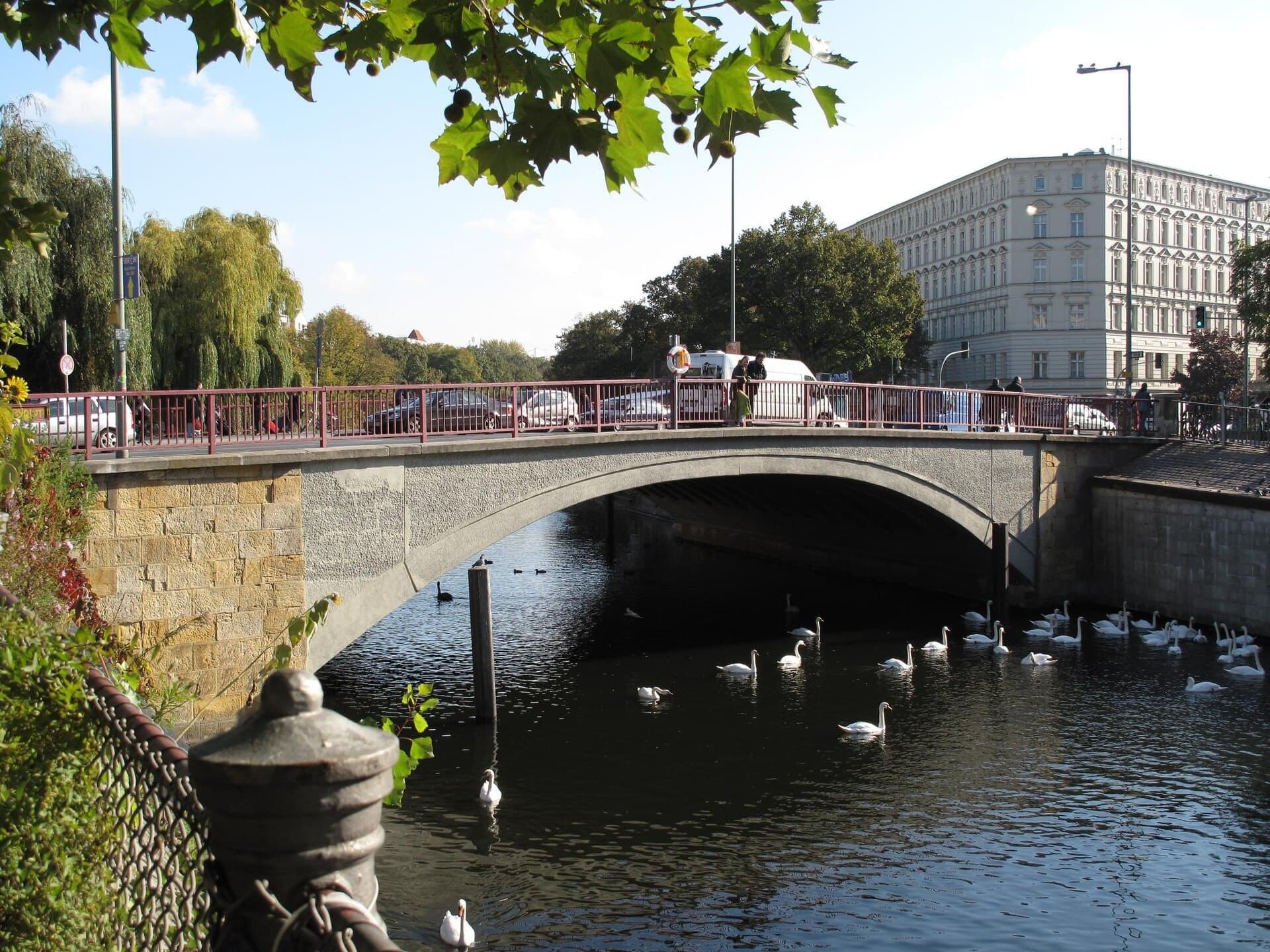
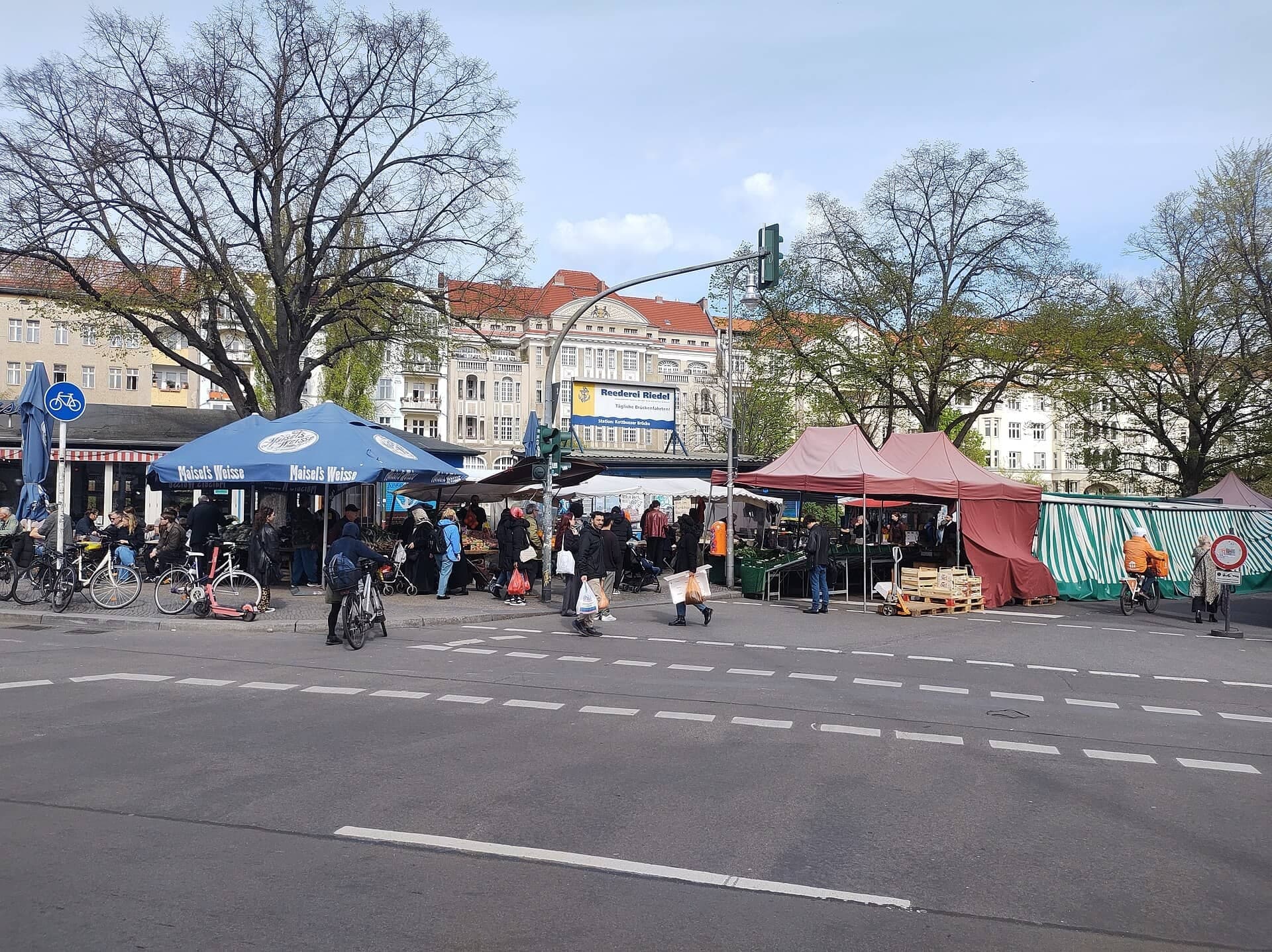
The canal bridge facing the Maybachufer market. Across the water is Neukölln, and on Tuesdays and Fridays a weekly market lines that bank with up to 180 traders.
Details
Best Time to Visit
Daytime, ideally on a Tuesday or Friday between 11:00 and 18:30, when the weekly market runs on the Maybachufer across the canal from the last stop. The park paths through the canal gardens are unlit, so start early enough to finish them in daylight; the clocks go back on 25 October. The Friedrichshain-Kreuzberg Museum is closed on Mondays, and the Kunstraum in the Bethanien is open daily 10:00 to 20:00. Saint Michael's church stands in full view across the Engelbecken; the longer view to it up the old canal from the first two stops opens only in winter, when the trees are bare. Kottbusser Tor is busiest in the evening. Checked 9 October 2026.
Pro Tips
- •Getting to the start: U8 to Moritzplatz, or U1, U3 or U8 to Kottbusser Tor, then a few minutes on foot to Oranienplatz. Bus M29 stops at Oranienplatz itself. Checked 9 October 2026 at bvg.de.
- •The walk ends at the north end of the Kottbusser Brücke. Schönleinstrasse (U8) is just across the bridge in Neukölln; Kottbusser Tor (U1, U3, U8, buses M29 and 140) is a few minutes north up Kottbusser Strasse. Checked 9 October 2026 at bvg.de.
- •The Friedrichshain-Kreuzberg Museum, Adalbertstrasse 95A (stop 8), is free: Tuesday to Thursday 12:00 to 18:00, Friday to Sunday 10:00 to 20:00, closed Mondays. It is in a courtyard; the main entrance is step-free. Checked 9 October 2026 at fhxb-museum.de.
- •The Kunstraum Kreuzberg/Bethanien (stop 6) is free and open daily 10:00 to 20:00. Only one of its two wooden entrance doors opens, by hand. Checked 9 October 2026 at kunstraumkreuzberg.de.
- •The Maybachufer market (seen from stop 12): Tuesday and Friday 11:00 to 18:30; the Neuköllner Stoff art, design and fabric market on Saturdays 11:00 to 17:00; the Nowkoelln Flowmarkt on 1 and 29 November 2026, 10:00 to 17:00. To visit, cross the bridge. Checked 9 October 2026 at berlin.de.
- •Step-free alternative for the canal gardens: from the Engelbecken (stop 3), follow the Engeldamm sidewalk to the Baumhaus (stop 5) instead of the garden paths and their steps. You miss the evergreen garden and stop 4's entrance.
Safety & Precautions
- •There are about fifty steps, in several flights, on the canal garden paths between stops 3 and 5; only one flight has a handrail. For a step-free way, follow the Engeldamm sidewalk instead (see the tips).
- •The crossings of Leuschnerdamm and Engeldamm after stop 3, and of Engeldamm again before stop 4, have no traffic lights, and cars can drive at 50 km/h there: look both ways.
- •At stop 5 the pin is beside a zebra crossing: step onto the sidewalk by the fence, not onto the crossing.
- •Since 15 February 2025 Kottbusser Tor and the south end of Adalbertstrasse are a weapons and knife ban zone: no knives at all, pocket knives included. Police may check without suspicion, and fines run up to 10,000 euros. Checked 9 October 2026 at berlin.de.
- •Kottbusser Tor is a busy, crowded junction with cycle tracks under the station: cross only at the lights and keep an eye on your bag. Avoid it late at night.
- •The synagogue at stop 11 is a working place of worship: listen from the canal side, do not approach or photograph the entrance or the people at it.
- •The Baumhaus (stop 5) and the courtyards behind the Oranienstrasse gateways (stop 7) are private: look from the sidewalk.
- •The park paths in the canal gardens are unlit: this is a daytime walk.
- •Admiralstrasse, between stops 9 and 10, is a narrow street lined with parked cars: keep to the sidewalk.
- •Please do not feed the birds on the Engelbecken; the district of Mitte asks visitors not to.
Travel advisory: Exercise Increased Caution (Level 2).
Gallery
Related Reading
Go deeper on what you'll see, hear, and walk through.
Overview
Berlin Travel Guide: Days, Transport, Safety and Budget
7 min
Overview
Best Self-Guided Walking Tours in Berlin (2026)
5 min
Overview
One Day in Berlin: A Walkable Itinerary
8 min
Thematic
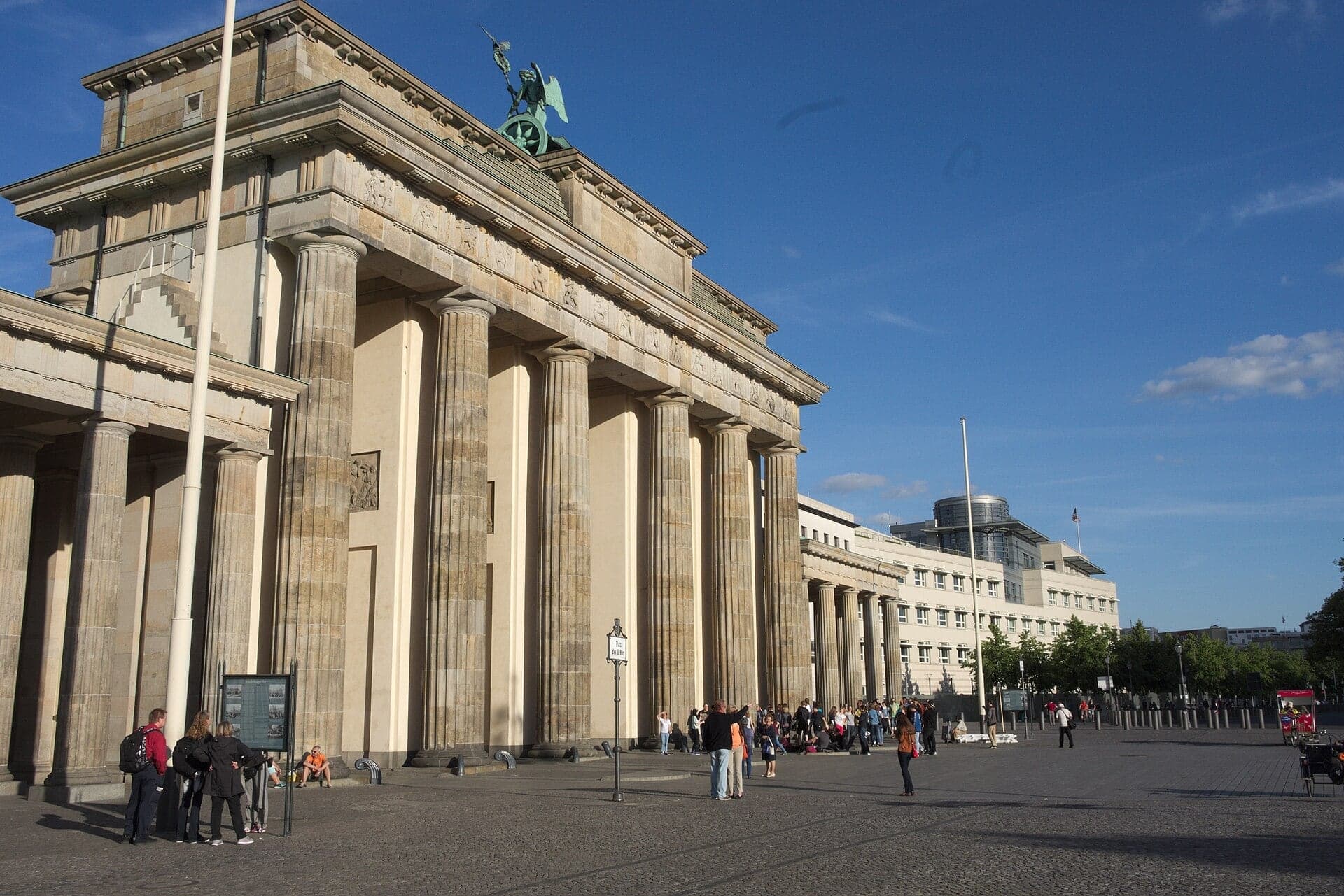
Berlin: The City That Reads Its Own Scar
7 min
Thematic
Best Culture Walking Tours in Berlin (2026)
2 min
Companion
Little Istanbul at Kottbusser Tor: How Guest Workers Made Kreuzberg
6 min
Deep dive
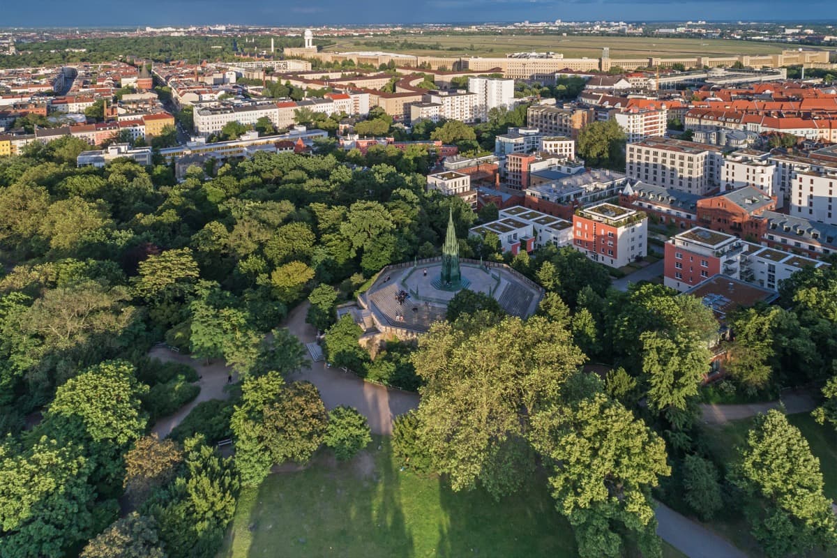
Viktoriapark and the Kreuzberg: The Hill That Named a District
6 min
Read
What to Eat in Berlin: Dishes, Origins, and How to Order
7 min
Read the walk
The full story of Kreuzberg: The Neighborhood That Nearly Became a Motorway, in words. Prefer to listen? Play it narrated, from home or on location.
Introduction
Berlin, the capital of Germany, is a city of almost four million people, and Kreuzberg is a district where the plans kept changing. This walk explores one corner of it, the old district called Luisenstadt, where three plans lie on top of each other.
The first is the original design. In the eighteen forties the garden designer Peter Joseph Lenné planned a canal, long squares and the streets around them here, with churches set at the ends of the long views and a great hospital on one of the squares. The second is a plan to undo it: in the nineteen sixties the city meant to clear much of the district and run a motorway down its main street. The third is the plan that won, to repair the old houses instead of knocking them down. And in between, the Berlin Wall cut straight through Lenné's canal.
Three people come up along the way. Lenné himself. Osman Kalin, a guest worker from Anatolia who planted a vegetable garden in no man's land. And Alexander Beer, the architect of a synagogue on the Landwehrkanal.
The walk has twelve stops over three point one kilometers, about two miles, and takes about an hour and a half. It is flat, with steps down into the sunken canal gardens, and it touches on the Wall and the Holocaust. It starts at Oranienplatz and ends on the Landwehrkanal, at the Kottbusser Bridge.
1. Oranienplatz: Where the Canal Widened
Welcome to Oranienplatz, in Kreuzberg.
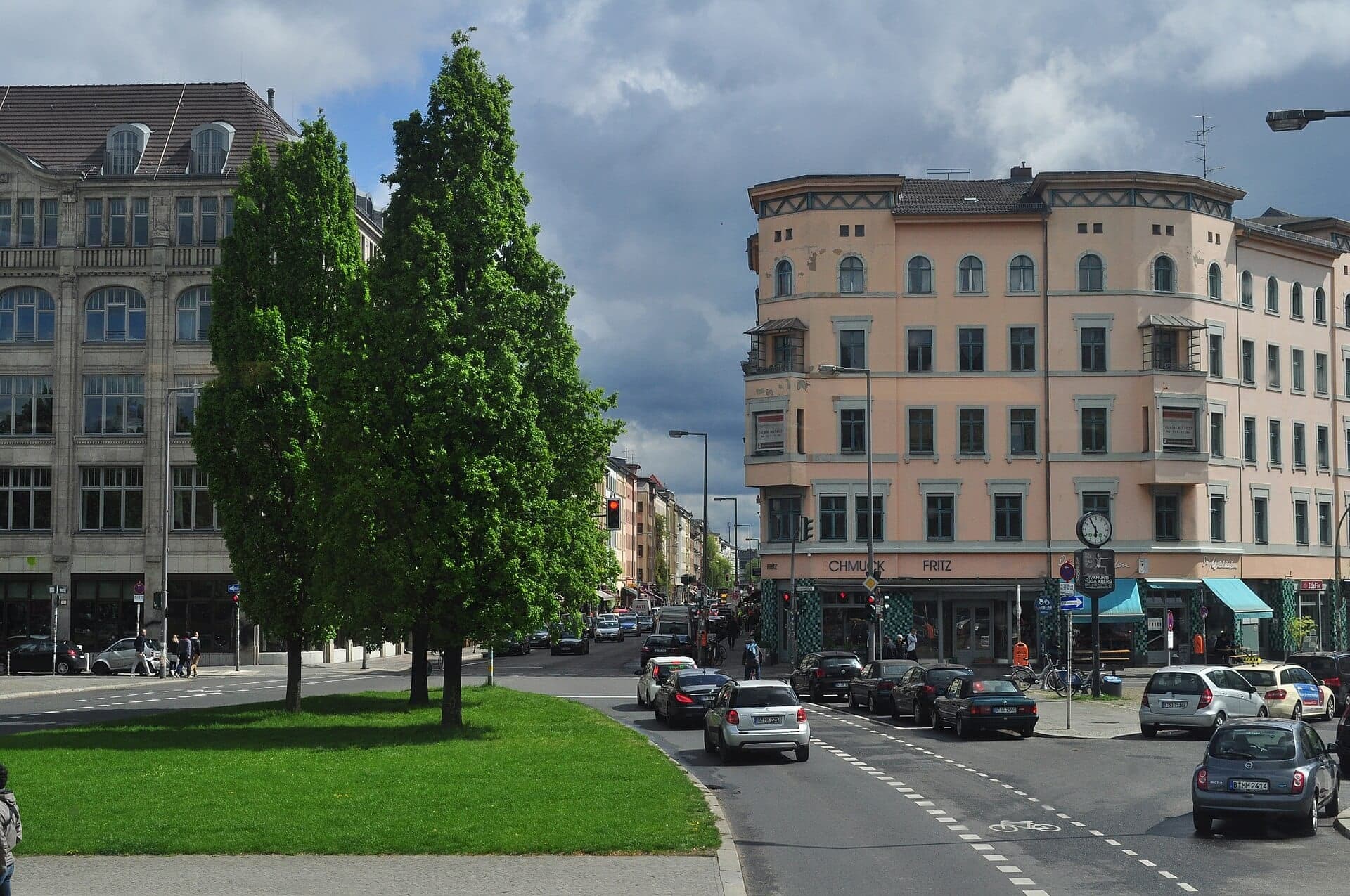
This long green square was once water. From eighteen fifty-two a canal ran through here, between the river Spree and the Landwehrkanal, and at this square it widened into a basin. Peter Joseph Lenné, the garden designer who planned this part of the city, made that canal its spine.
Look for the broad path down the middle of the square, between its rows of trees. It runs on the line of the old canal. Keep it in mind: the next four stops all lie along that line. The canal lost its barges and had problems with hygiene, so from nineteen twenty-six it was filled in, and the strip became a chain of gardens.
The square itself has been rebuilt at least six times since the eighteen nineties. In nineteen twenty-nine its gardens were dug up for a new subway line, and then the line was routed somewhere else. The dragon fountain nearby is from the late nineteen eighties.
And in the nineteen sixties, the city planned a motorway along Oranienstrasse, the street at the end of this square, with a large interchange right here. It was never built. Later on this walk you will stand on that street and see what was kept instead.
In winter, when the trees are bare, Berlin's heritage office says you can see a church straight up the old canal line from here. In leaf, the view is closed. You will meet that church across a pond, at the third stop.
Follow the route along the old canal line into the gardens.
2. Rose Garden: Down in the Canal Bed
The path runs under a low road bridge. Walk on under it into the rose garden, and stop.
That bridge is the Waldemar Bridge, and it is a survivor. When the canal was filled in, its old bridges were pulled down, all except this one.
Now look at the level you are standing on. You are below the street. The canal was not filled to the top. Berlin's heritage office records that it was filled to one point six meters below street level, about a person's height. The city's garden director then planned the old bed as a chain of ten sunken gardens, each with its own theme. The houses along the old banks look down into it, the way they once looked down onto water.
This rose garden, framed by pergolas, was one of the parts built to his design, by nineteen thirty-two. Much of the rest was built in a cheaper, simpler form, and he distanced himself from the result.
What you see now is not that garden either. The Second World War and the building of the Wall largely destroyed these gardens. In nineteen ninety their walls, steps, paths and fountains were dug out of the ground again, and the rose garden was restored in nineteen ninety-five on its old plan, with new stone and new plants.
The garden was laid out as a view. Its long line runs ahead to a pond, and beyond the pond to a church. When the trees are bare, the view carries all the way.
Follow the route on through the garden to the pond.
3. Engelbecken: A Pond in the Death Strip
Walk on along the shore path to the corner of the pond, and stop with the water beside you.
This is the Engelbecken, the Angel Basin. At the far end of the water stands the church of Saint Michael, in two colors of brick, with a tall dome over its middle. Lenné planned this as one long view: the canal, then the pond, then the church closing it.
The church was built between eighteen fifty-one and eighteen sixty-one, and on the Prussian king's wish it was meant to resemble a church in Venice. In February nineteen forty-five it was bombed down to its outer walls. Only the part under the dome and behind it was rebuilt as a church; the long nave in front of the dome is still a ruin. From here, across the pond, you cannot tell, as the state heritage office points out.
Then came the Wall. This pond lay in the death strip, filled with rubble and leveled; after the Wall fell it was dug out again. The street you will cross in a moment, Leuschnerdamm, belonged to East Berlin, sidewalks and all, right up to the house fronts, and so did Bethaniendamm beyond it. But the Wall was built a little set back, so West Berliners could still reach their own front doors. They had to cross East Berlin ground to get home, and West Berlin's police and mail carriers had no access to those addresses.
The Chronicle of the Wall says one trace survives on Leuschnerdamm: the post holes of the first wall, filled with a tar-like filler, visible in the cobbles. Look down as you cross; you may spot them.
Follow the route over the streets at the end of the pond, through the next garden and over the streets again at its far end. There are no traffic lights at the first crossings: look both ways each time.
4. Canal Gardens: A Garden Below the Street
Walk on into the next garden, and stop at its entrance, where the path comes down between the walls.
You have just come through the first of three gardens in a row along the old canal bed. Berlin's environment department lists them in order: an evergreen garden, then this woodland plant garden, then a garden of flowering shrubs. The evergreen garden behind you was rebuilt in nineteen ninety-three from what was dug up: a broad central walk, niches for benches, and enclosing walls covered in climbing plants.
Look at the walls on either side. This is how the whole strip works. The canal was filled only part way, so its bed became a long room with a floor below the street. The walls mark the edges of the old canal, and the steps are its doors. The streets and the houses stay up at the old level, and the garden sits down in the channel between them.
The heritage office describes the nineteen twenties design as a sequence of sunken, strictly architectural theme gardens. What you see here is a modern version of that idea, planted in this century. The rows of lime trees along the old canal were replanted in nineteen ninety-one.
For twenty-eight years this strip lay along the Wall. The heritage office records that the border cut the canal off from the square and the church beyond it, and that the war and the Wall largely destroyed these gardens. They came back only after nineteen ninety.
Follow the route on through the garden. The next stop is where the gardens meet Mariannenplatz.
5. Baumhaus an der Mauer: A Garden in No Man's Land
Walk on out of the garden and cross Bethaniendamm at the zebra. Then step off the crossing onto the sidewalk beside the fence, and stop there. Behind the fence, on a small triangle of green, is a little house among the trees. It is known as the Baumhaus an der Mauer, the tree…
Full narration for this stop unlocks with the tour.
6. Mariannenplatz: The Hospital That Started a District
Walk on down the path through the middle of the square, and stop. Turn to your right, back across the lawn, to face the long yellow brick building you have just walked past. That is the Bethanien, built between eighteen forty-five and eighteen forty-seven as a hospital for…
Full narration for this stop unlocks with the tour.
7. Oranienstrasse: The Street Planned as a Motorway
Walk on along the sidewalk of Oranienstrasse, and stop between two of the gateways in the house fronts. This is the main street of this part of Kreuzberg, and it carries a famous postcode: S O thirty-six. That was the old postal district, South East thirty-six. The small square…
Full narration for this stop unlocks with the tour.
8. Adalbertstrasse: The Block Across the Street
Walk on down Adalbertstrasse, and stop on the sidewalk with the big block ahead of you. Ahead, a long concrete slab of apartments stands across the whole street, and the street runs straight underneath it. You will walk under it in a minute. It went up in the early nineteen…
Full narration for this stop unlocks with the tour.
9. Kottbusser Tor: A Station Over a Square
Now that you are across, under the station, stop on the sidewalk near the corner where Admiralstrasse begins. This is Kottbusser Tor, Kotti for short, named after an old city gate. Look back at the station you just walked under. The elevated railway arrived in nineteen oh two;…
Full narration for this stop unlocks with the tour.
10. Admiralbrücke: The Canal's Oldest Wrought-Iron Bridge
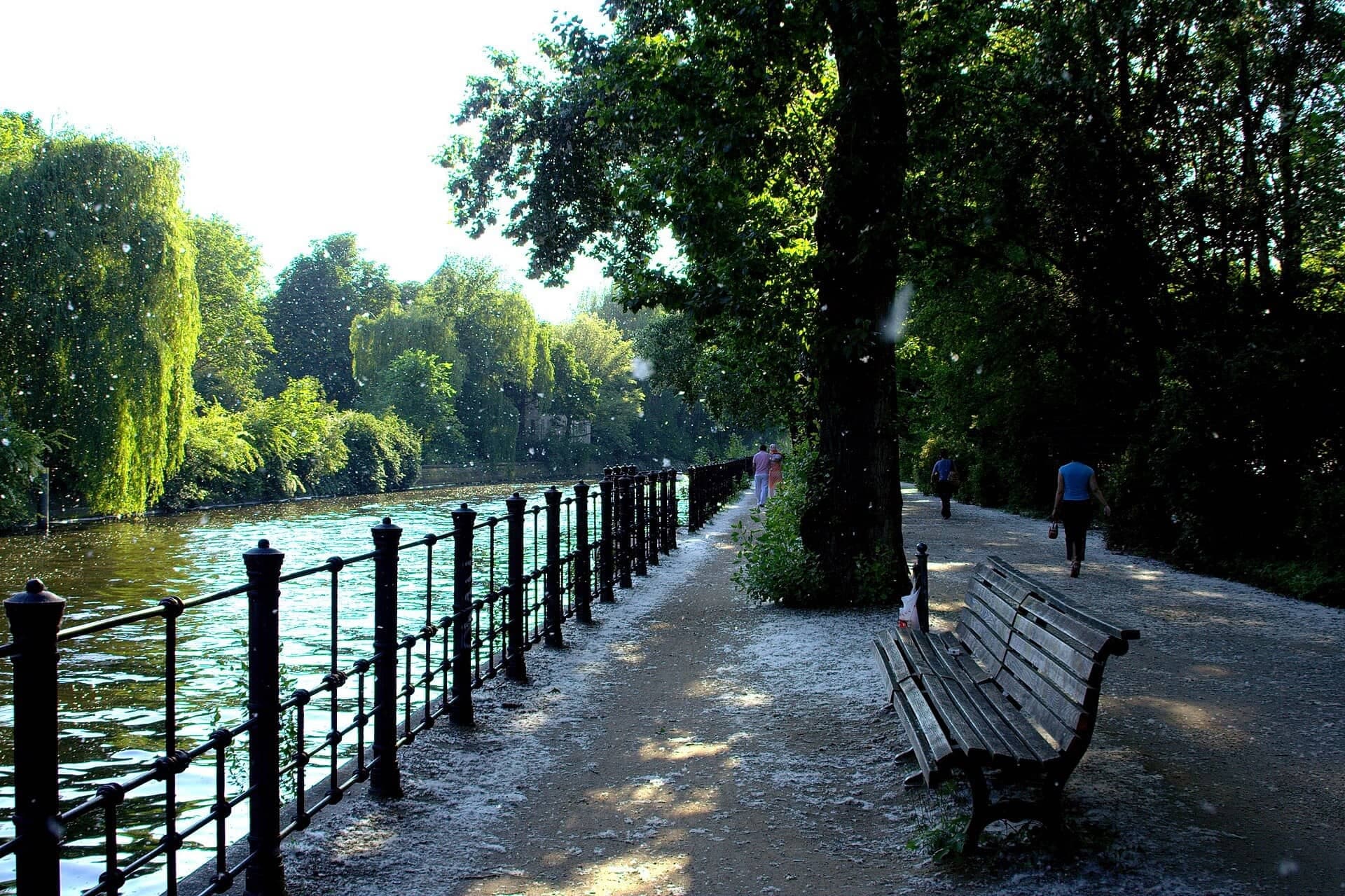
Walk on down Admiralstrasse to where it meets the canal, and stop on the sidewalk just short of the bridge. This is the Landwehrkanal, the canal the old Luisenstadt canal once joined. It is just under eleven kilometers long, and it was built between eighteen forty-five and…
Full narration for this stop unlocks with the tour.
11. Fraenkelufer Synagogue: The Wing That Survived
Walk on along the canal, and stop on the path by the water. Across the street, a little way back, is a low building with a pitched roof and a front of piers. This is the synagogue on the Fraenkelufer. It is a working synagogue: please listen from this side of the street, and do…
Full narration for this stop unlocks with the tour.
12. Kottbusser Brücke: The Market Across the Water
Walk on to the end of the bridge, and stop on the sidewalk before you step onto it. Look across the canal to the far bank. That bank is the Maybachufer, and it is not in Kreuzberg. The canal is the district line, and over there is Neukölln. Every Tuesday and Friday, from…
Full narration for this stop unlocks with the tour.
- Kreuzberg Oranienplatz — Fridolin freudenfett, CC BY-SA 4.0 · source
- This is a picture of the Berliner Kulturdenkmal (cultural monument) with the ID — Joe Mabel, CC BY-SA 4.0 · source
- This is a photograph of an architectural monument.It is on the list of cultural monuments of Berlin, no. 09010197. — SilkeKir, CC BY-SA 4.0 · source
- IBA-Projekt-Nr. 108: Ehemaliger Luisenstädtischer Kanal (nördlicher Teil/Mittelteil), Oranienplatz, Erkelenzdamm, Segitzdamm, Christof Luz/R — Gunnar Klack, CC BY-SA 4.0 · source
- Church in Berlin — Gerd Eichmann, CC BY-SA 4.0 · source
- Engelbecken in Berlin-Mitte — Z thomas, CC BY-SA 3.0 · source
- Berlin-Mitte, Germany – park at the former Luisenstädtischer Kanal, seen from the Engelbecken, on the left the houses at Engeldamm, on the r — Georg Slickers, CC BY-SA 3.0 · source
- St. Thomas-Kirche in Berlin-Kreuzberg — myself, CC BY-SA 3.0 · source
- Tree house in Berlin-Kreuzberg — Wikicookie Data, CC BY-SA 3.0 · source
- St. Thomas-Kirche , Berlin-Kreuzberg, Blick von Engeldamm — Berlinspaziergang, CC BY-SA 4.0 · source
- Künstlerhaus Bethanien — tian2992 from Guatemala, Guatemala, CC BY-SA 2.0 · source
- Mariannenplatz — Gunnar Klack, CC BY-SA 4.0 · source
- Oranienstraße, Berlin-Kreuzberg, Germany. — Joe Mabel, CC BY-SA 4.0 · source
- This is a picture of the Berliner Kulturdenkmal (cultural monument) with the ID — Jörg Zägel, CC BY-SA 3.0 · source
- 2018-08-07 DE Berlin-Friedrichshain-Kreuzberg, Kottbusser Tor, Adalbertstraße — Paul Korecky, CC BY-SA 2.0 · source
- Residential building Adalbertstraße No. 90, corner of Oranienstraße No. 30 (on the left), in Berlin-Kreuzberg. The house was built in 1863 b — Jörg Zägel, CC BY-SA 3.0 · source
- Berlin-Kreuzberg Kottbusser Tor — Fridolin freudenfett, CC BY-SA 4.0 · source
- Square with the U-bahn station in the background. — Dosseman, CC BY-SA 4.0 · source
- Admiralbrücke crossing Landwehrkanal in Berlin-Kreuzberg; the wrought-iron arch bridge was built 1880-1882 by Georg Pinkenburg; it is landma — Beek100, CC BY-SA 3.0 · source
- Blick von der Admiralbrücke in Berlin-Kreuzberg nach Westen auf den Landwehrkanal — Lukas Beck, CC BY-SA 4.0 · source
- The Jugend-Synagoge (Youth Synagogue) at Fraenkelufer No. 10-16 in Berlin-Kreuzberg. The building was constructed from 1913 to 1916 to desig — Jörg Zägel, CC BY-SA 3.0 · source
- What looks like snow are millions of seeds. They were difficult to capture, so I hope, I succeeded. You see them on the large version! See w — Till Krech from Berlin, Germany, CC BY 2.0 · source
- Kottbusser Brücke (bridge), crossing the Landwehrkanal (canal) in Berlin-Kreuzberg. — Lienhard Schulz, CC BY-SA 3.0 · source
- Markt am Maybachufer — Roy Zuo, CC BY-SA 4.0 · source
Images may be cropped or resized. Other photos via Unsplash and Pexels.