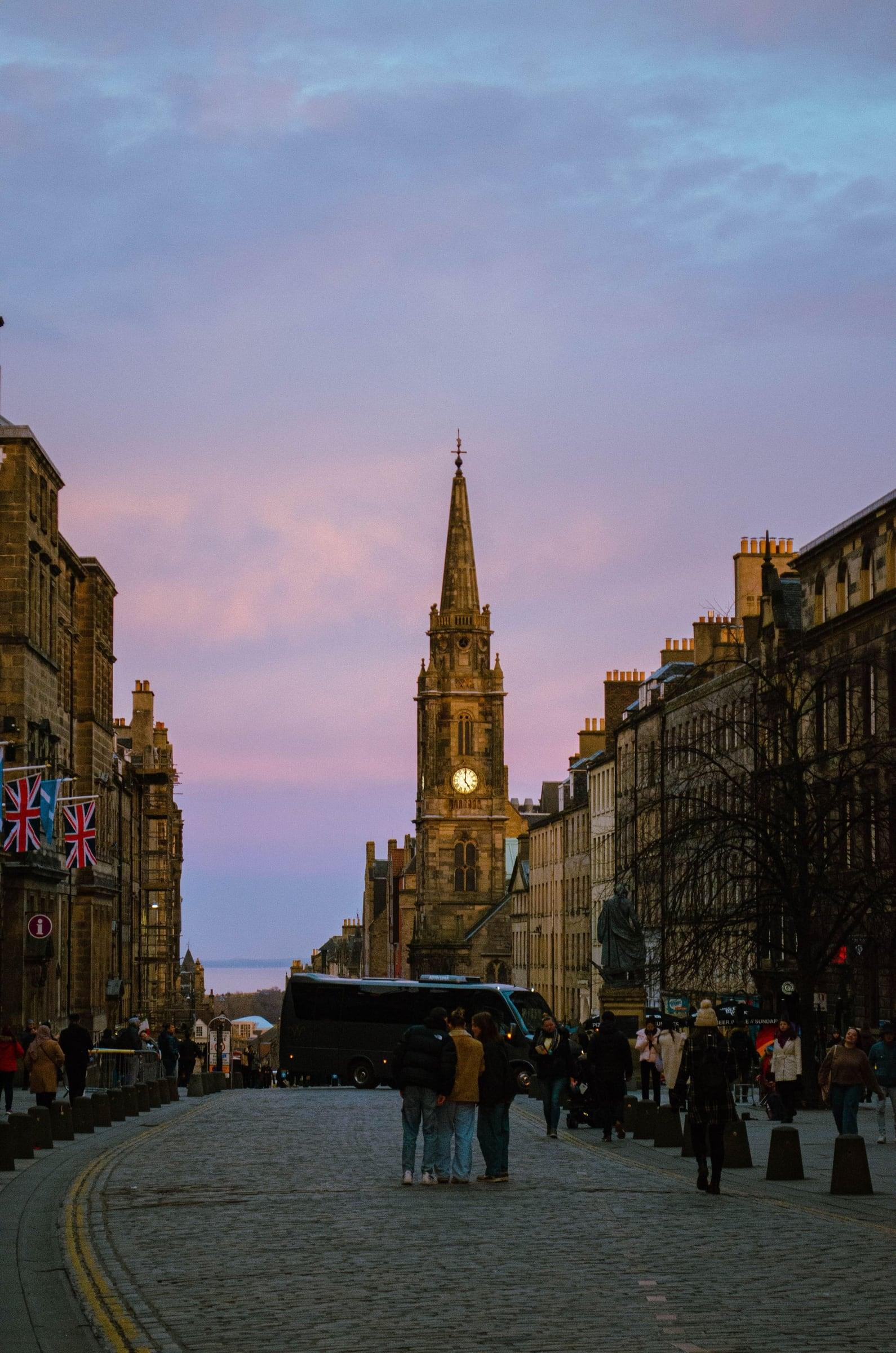
A street that runs from rock to palace. Twelve stops down Edinburgh's Royal Mile, from the Castle Esplanade past the Witches' Well, Gladstone's Land, St Giles' and the Heart of Midlothian, the Mercat Cross, the Tron Kirk, Paisley Close and the Netherbow, into the old burgh of the Canongate and on to the Scottish Parliament and the gates of the Palace of Holyroodhouse, all from the street.
Start · Castle Esplanade: The Rock and the Ridge
DirectionsStops
- 1
Castle Esplanade: The Rock and the Ridge
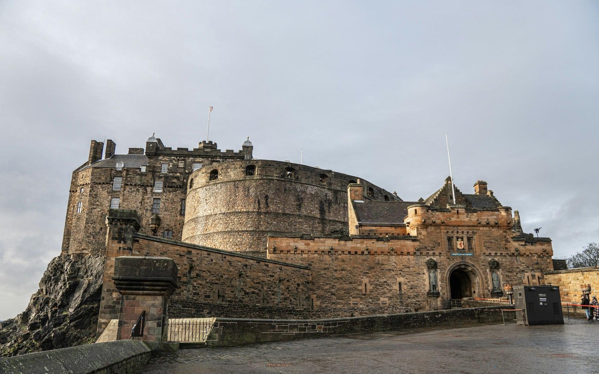
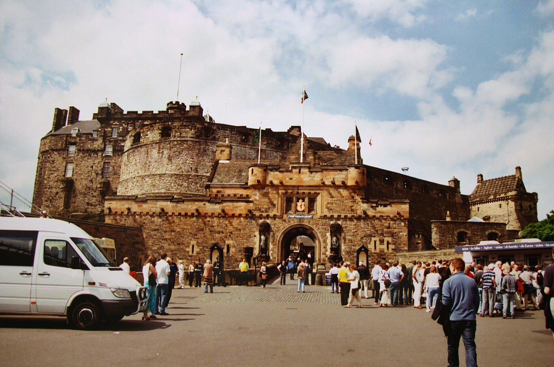
The city begins on this rock. The open parade ground before Edinburgh Castle's gatehouse, standing on a volcanic plug with the Royal Mile running away down the ridge behind it.
- 2
Witches' Well: A Memorial on Castlehill
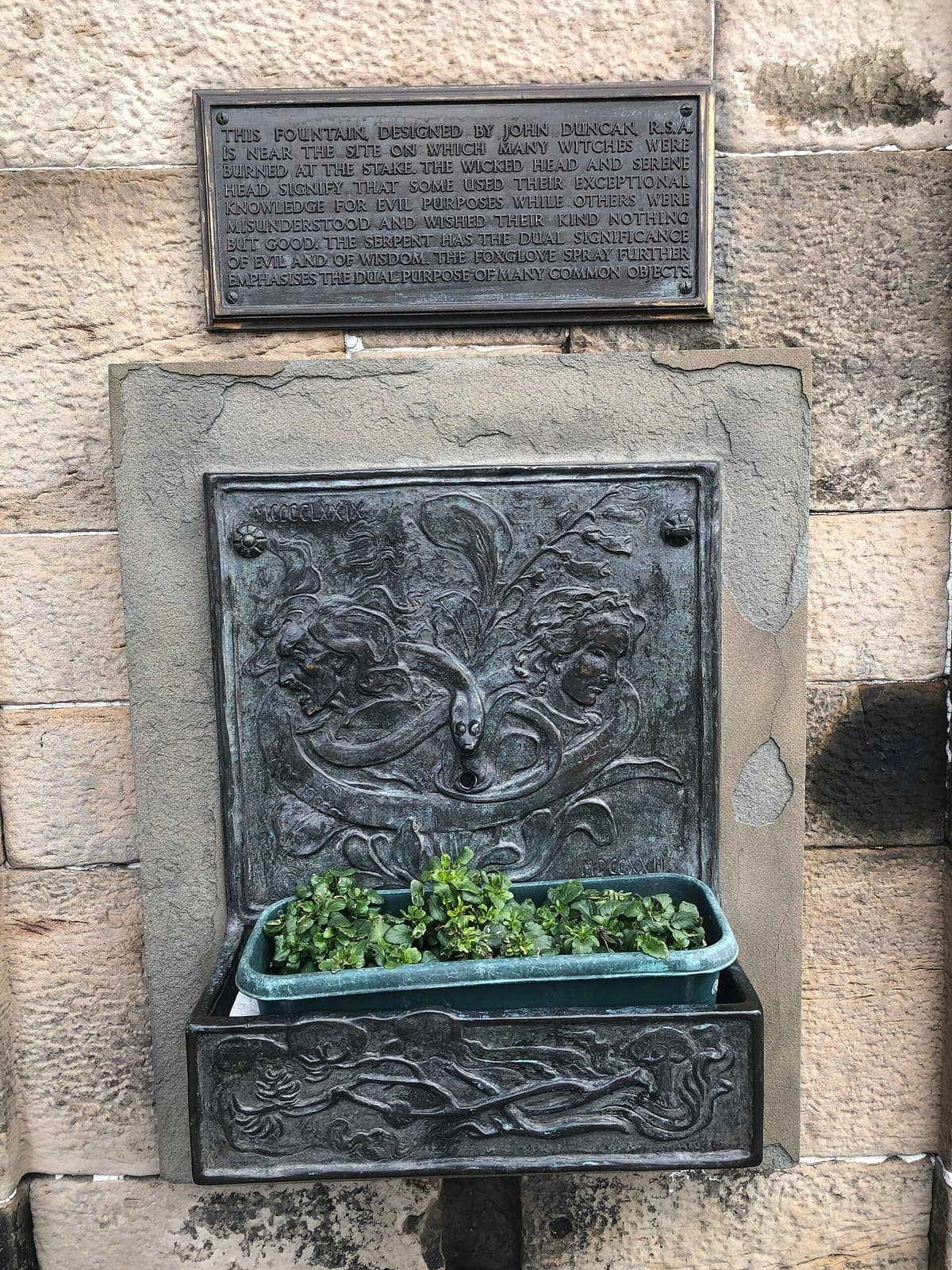
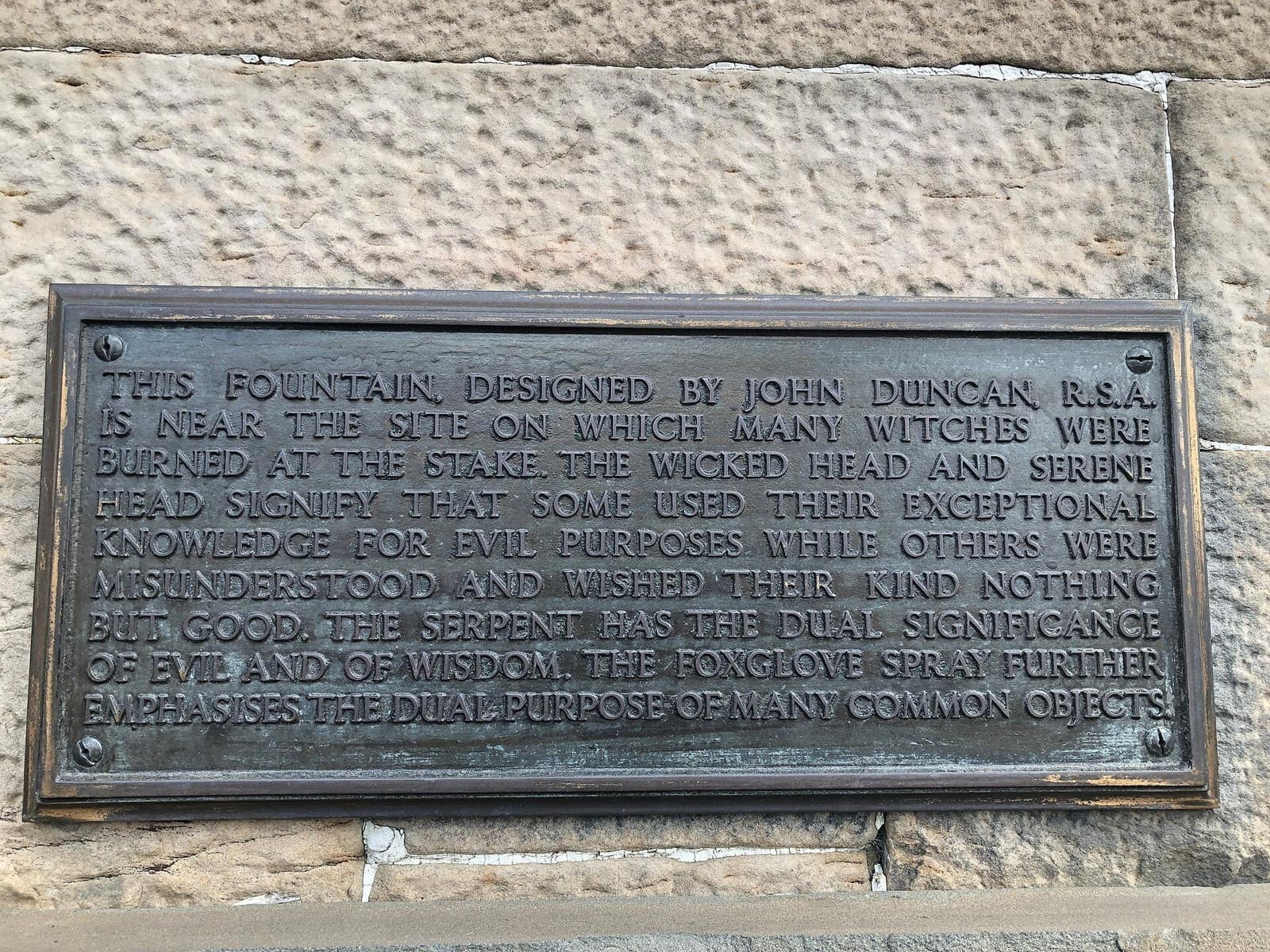
A fountain remembers the condemned. A small bronze relief on the old reservoir wall marks the ground where people accused of witchcraft were burned, beside the building that once held the town's water.
- 3
Gladstone's Land: A Merchant's Tenement
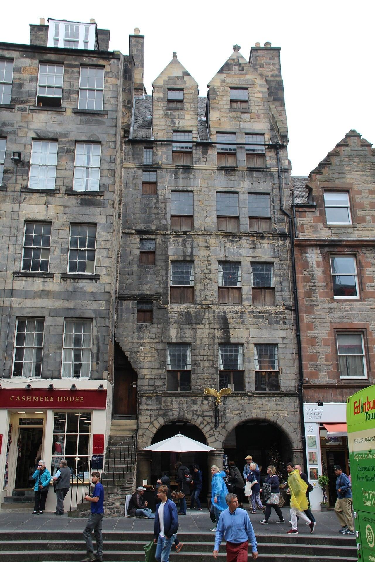
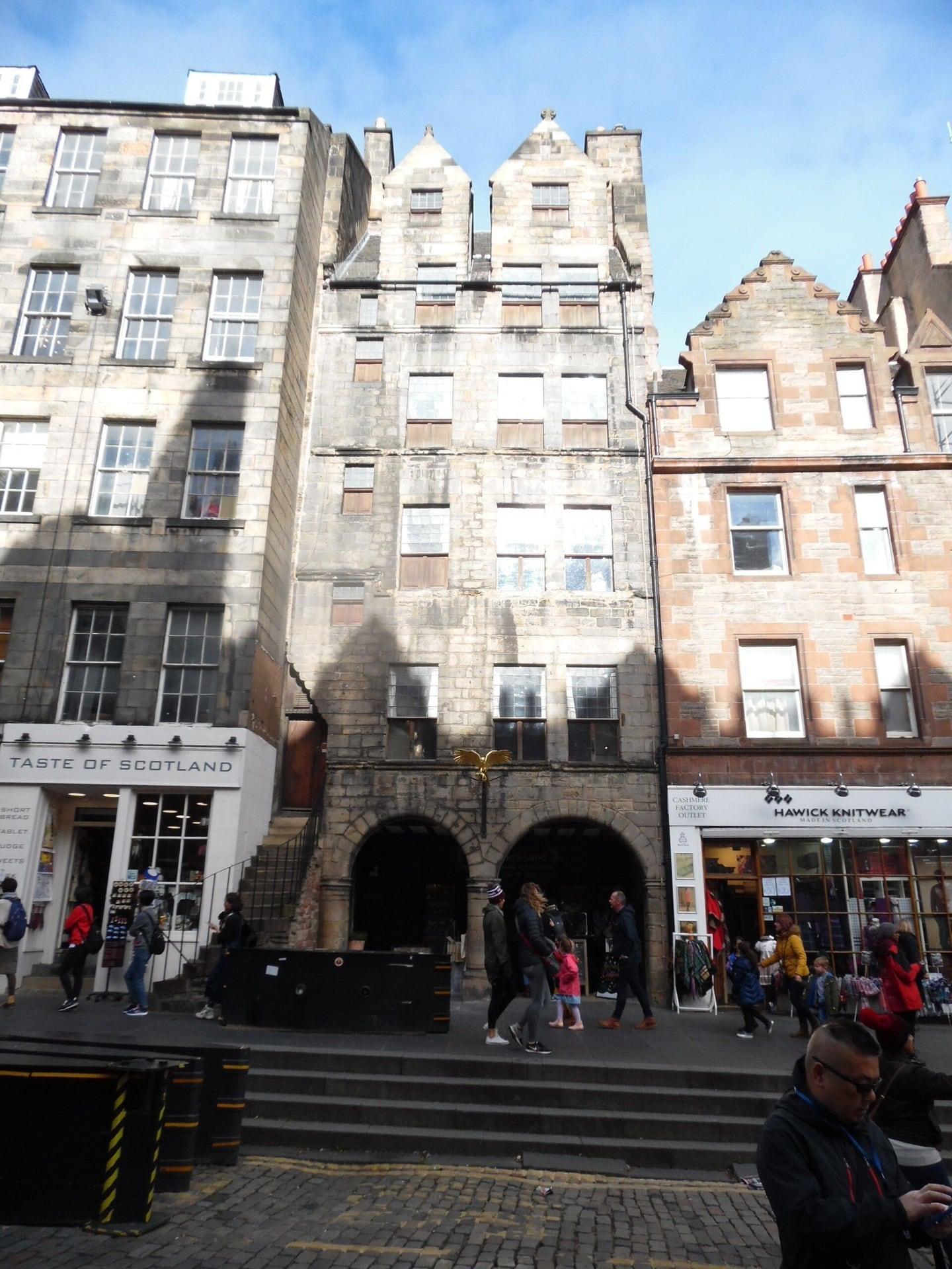
A merchant's house built upward. Gladstone's Land on the Lawnmarket, a 1621 stone front five storeys high with an arcaded shop at street level, the Old Town's tenement at arm's length.
- 4
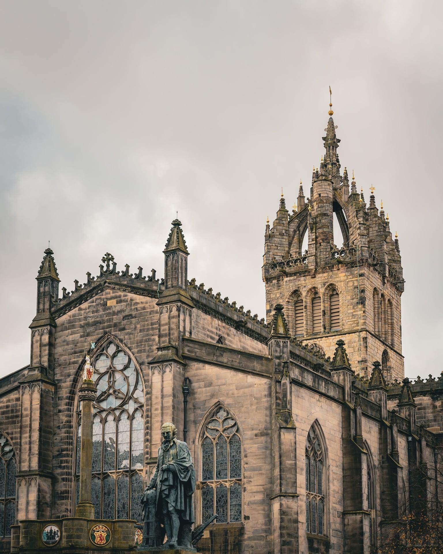
St Giles' Cathedral: The Heart of Midlothian
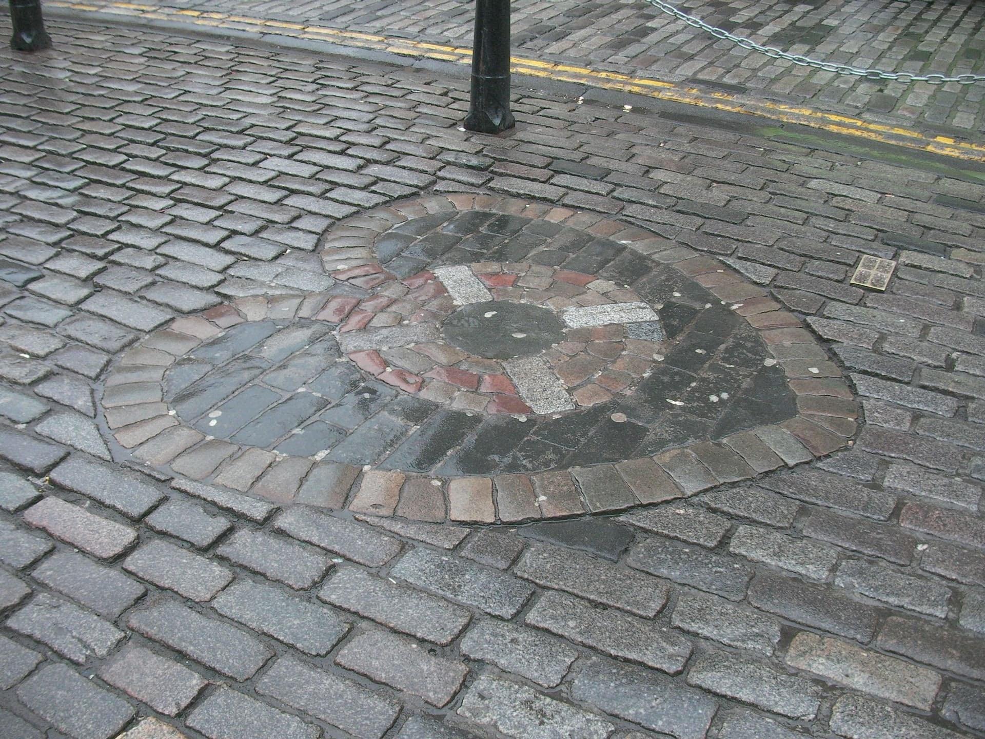
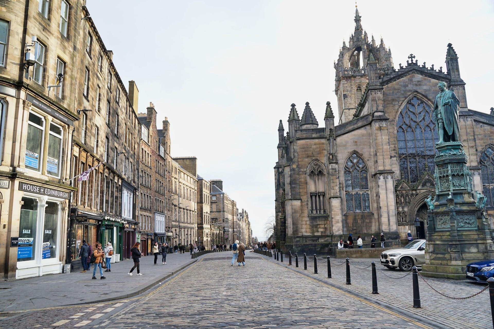
A heart in the setts marks a jail. Opposite St Giles' west door, the Heart of Midlothian marks the old Tolbooth's site, under the crown steeple of the High Kirk of Edinburgh.
- 5
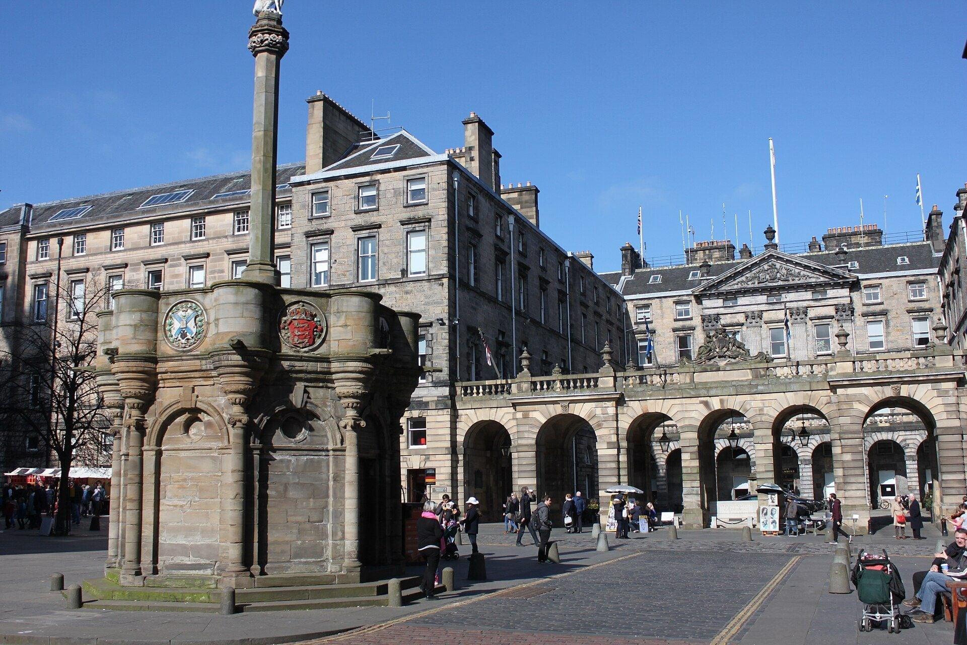
Mercat Cross: The Street Above a Street
The town's news was read out here. The Mercat Cross beside St Giles', the Adam Smith statue, and the City Chambers built over the closes, with Mary King's Close buried beneath them.
- 6
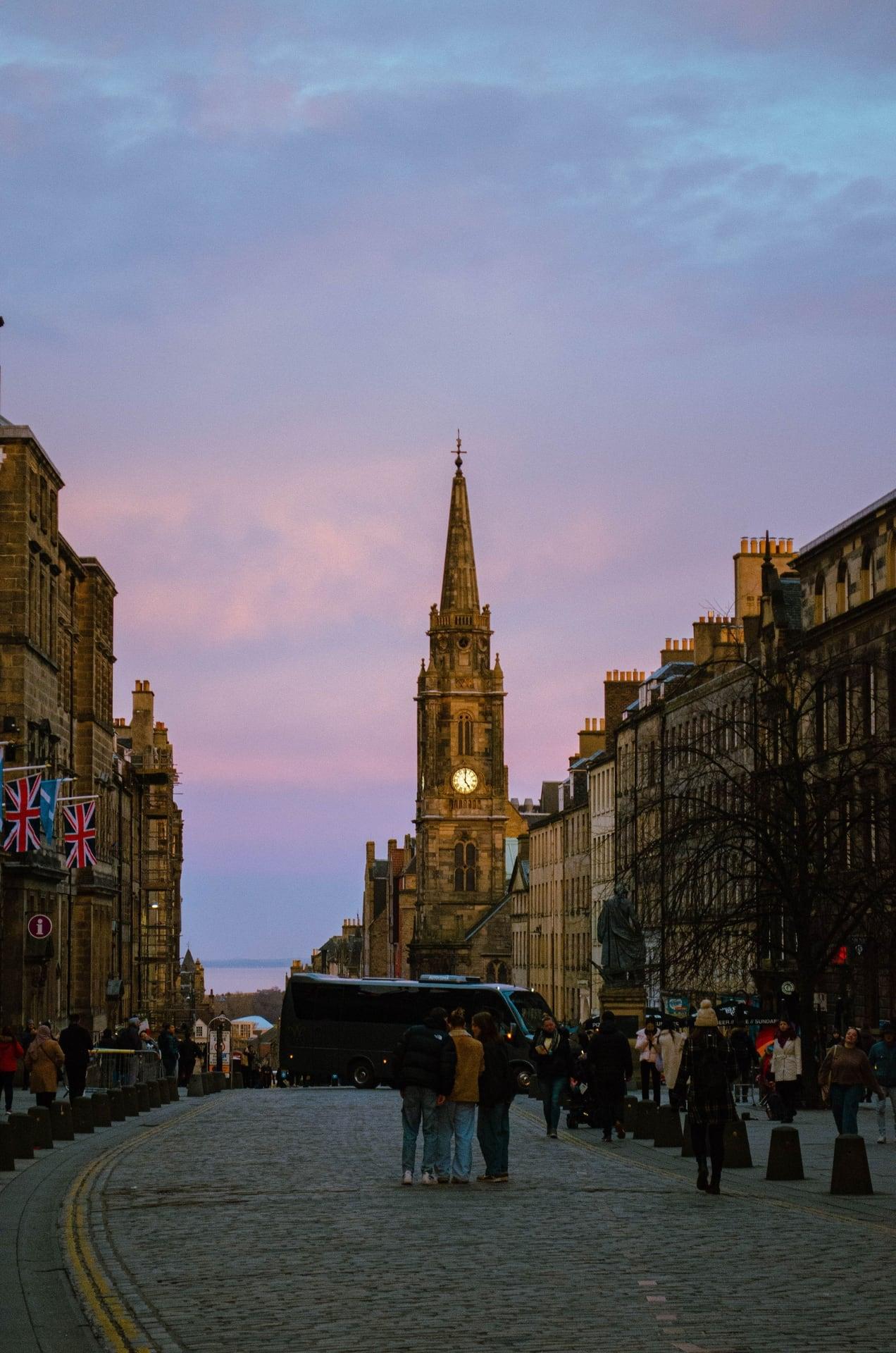
Tron Kirk: A Church Built for the Displaced
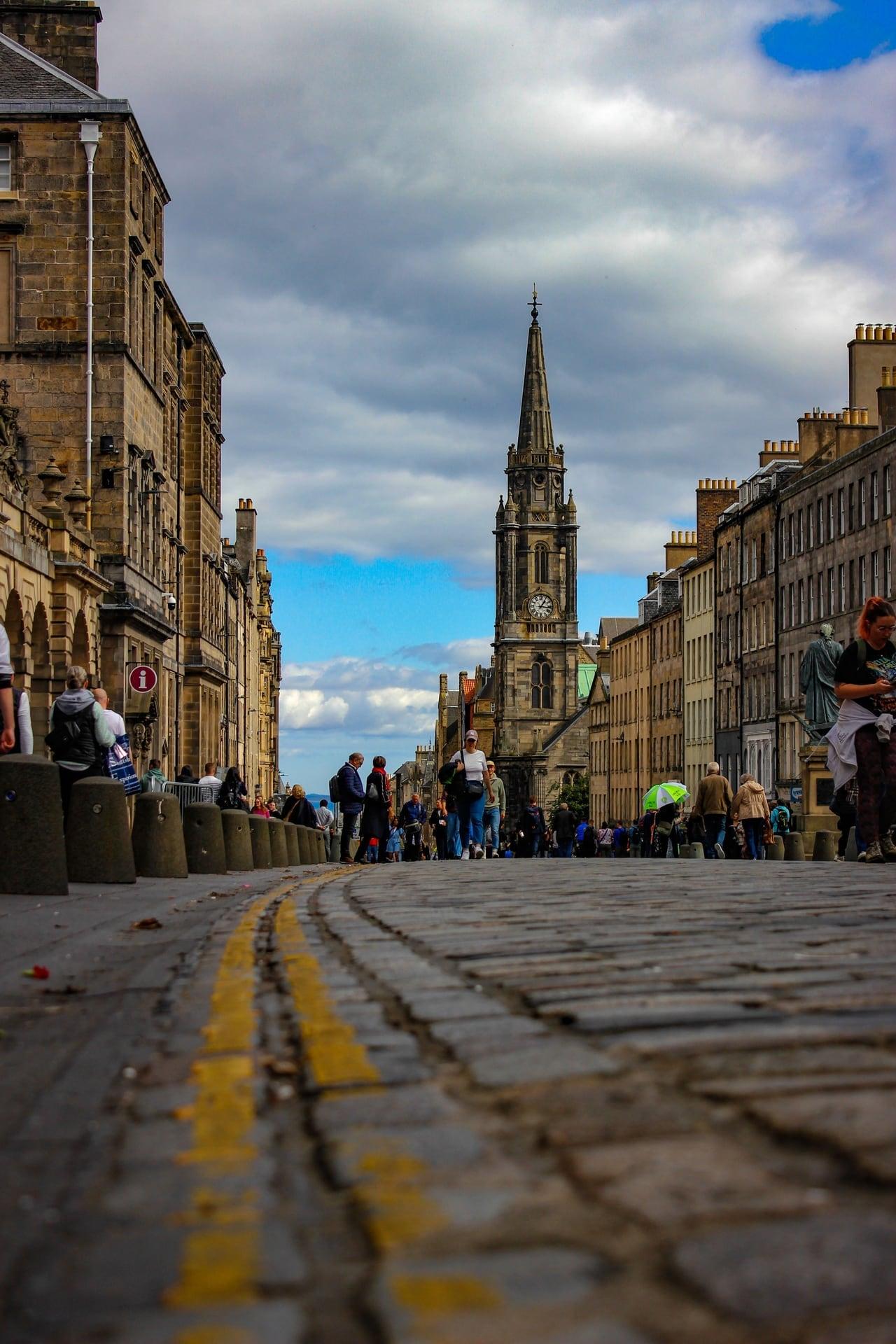
A king's decision built this church. The Tron Kirk, raised from 1636 for the congregation moved out of St Giles', with a buried sixteenth century lane under its floor and the Bridges junction ahead.
- 7
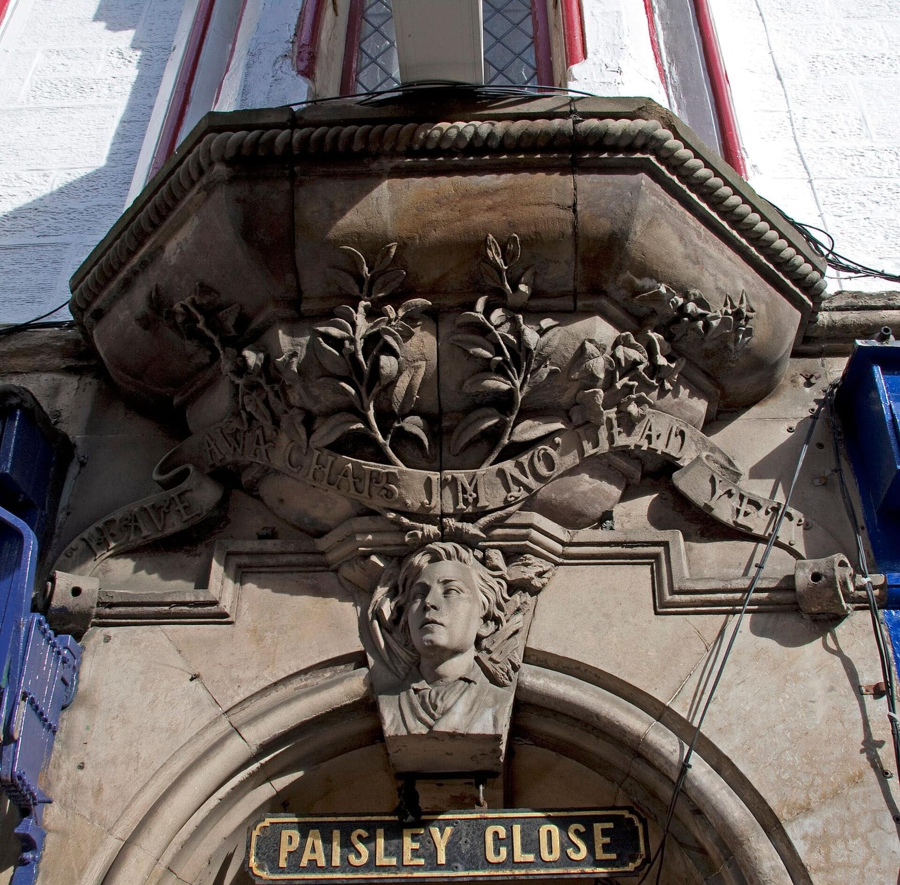
Paisley Close: The Boy in the Keystone
A carved boy recalls a collapse. Paisley Close, where an old tenement fell in November 1861; its 1862 replacement carries the face of a boy pulled from the ruins, and the closes show the old burgh plots.
- 8
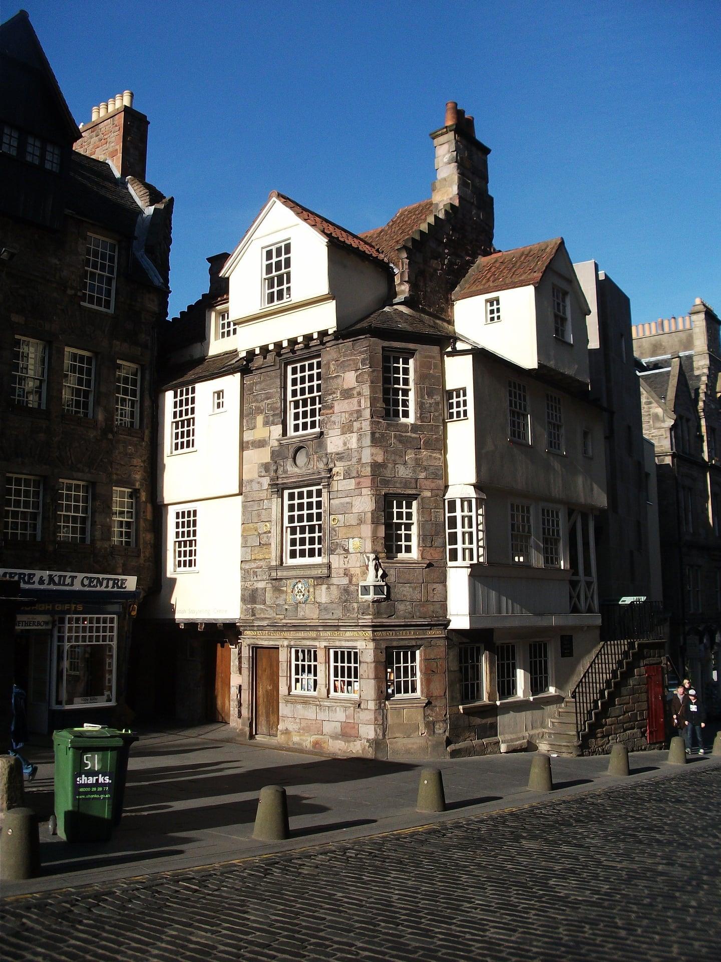
Netherbow Port: The Edge of Edinburgh
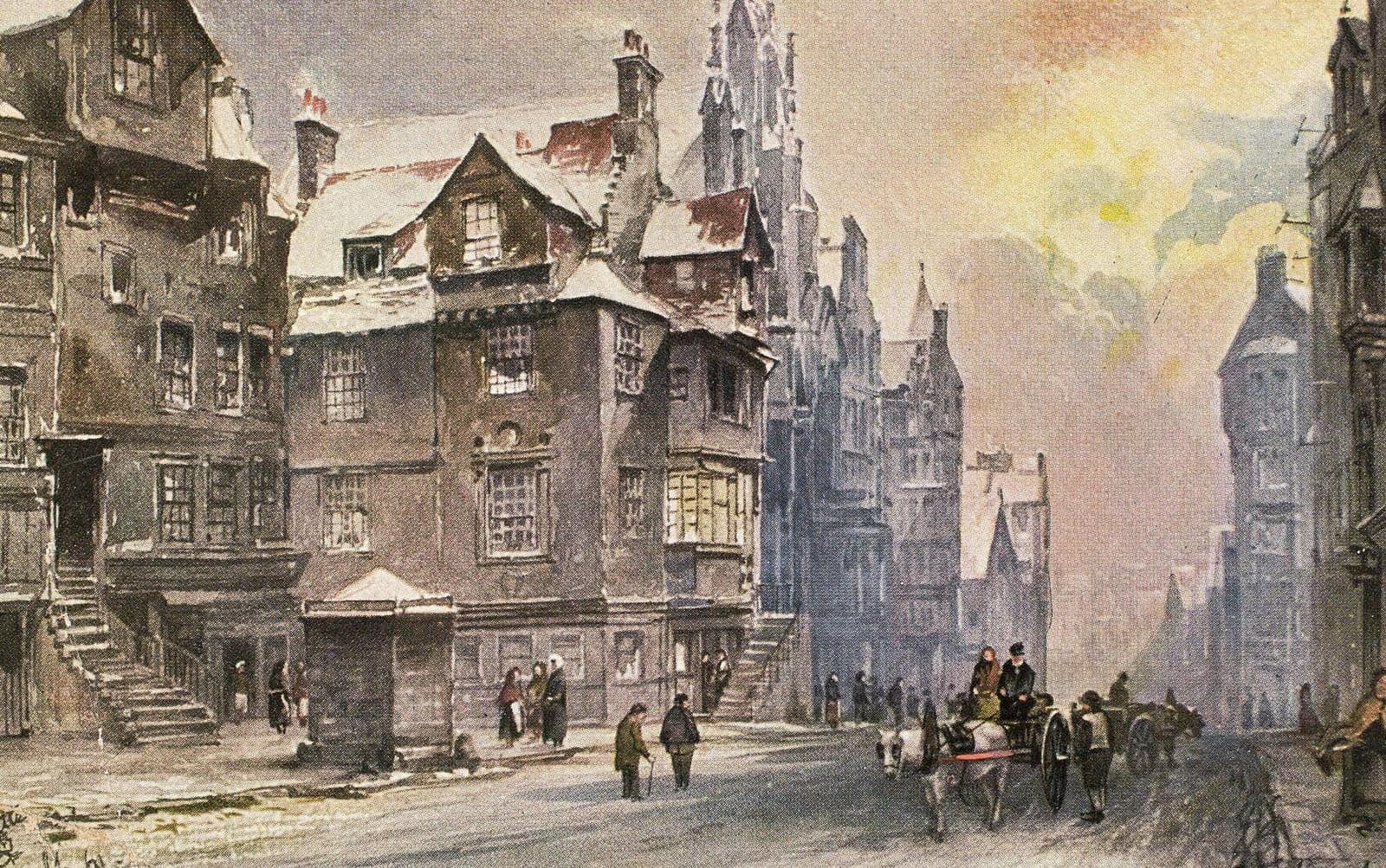
Here the town gate closed the street. The Netherbow Port, Edinburgh's gate until 1764, traced in brass in the road, with John Knox House jutting into the High Street behind.
- 9
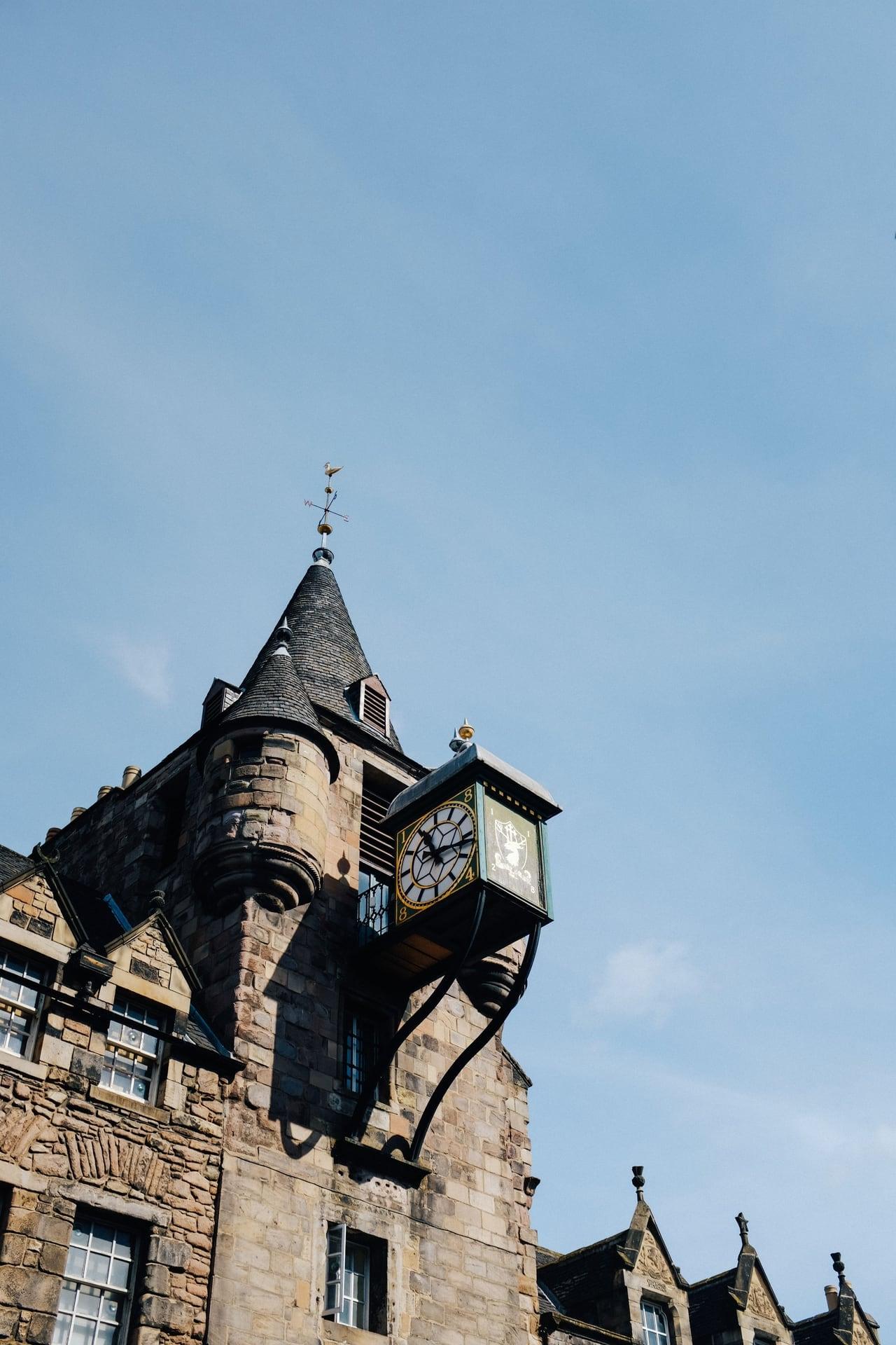
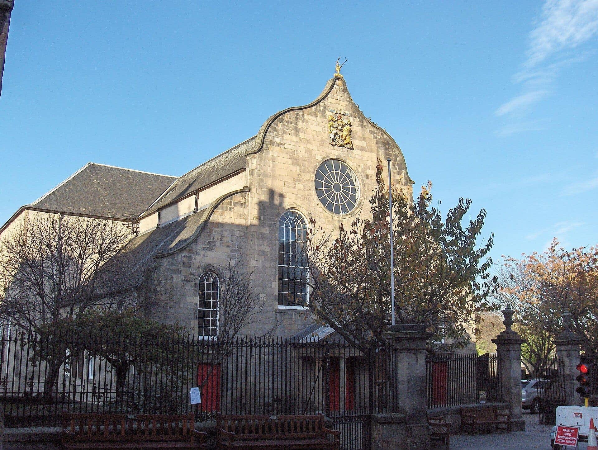
Canongate Tolbooth and Kirk: A Second Town
Another town's council met here. The Canongate Tolbooth of 1591, the separate burgh's courthouse, jail and council house, faces the Canongate Kirk's Dutch gable and its kirkyard.
- 10
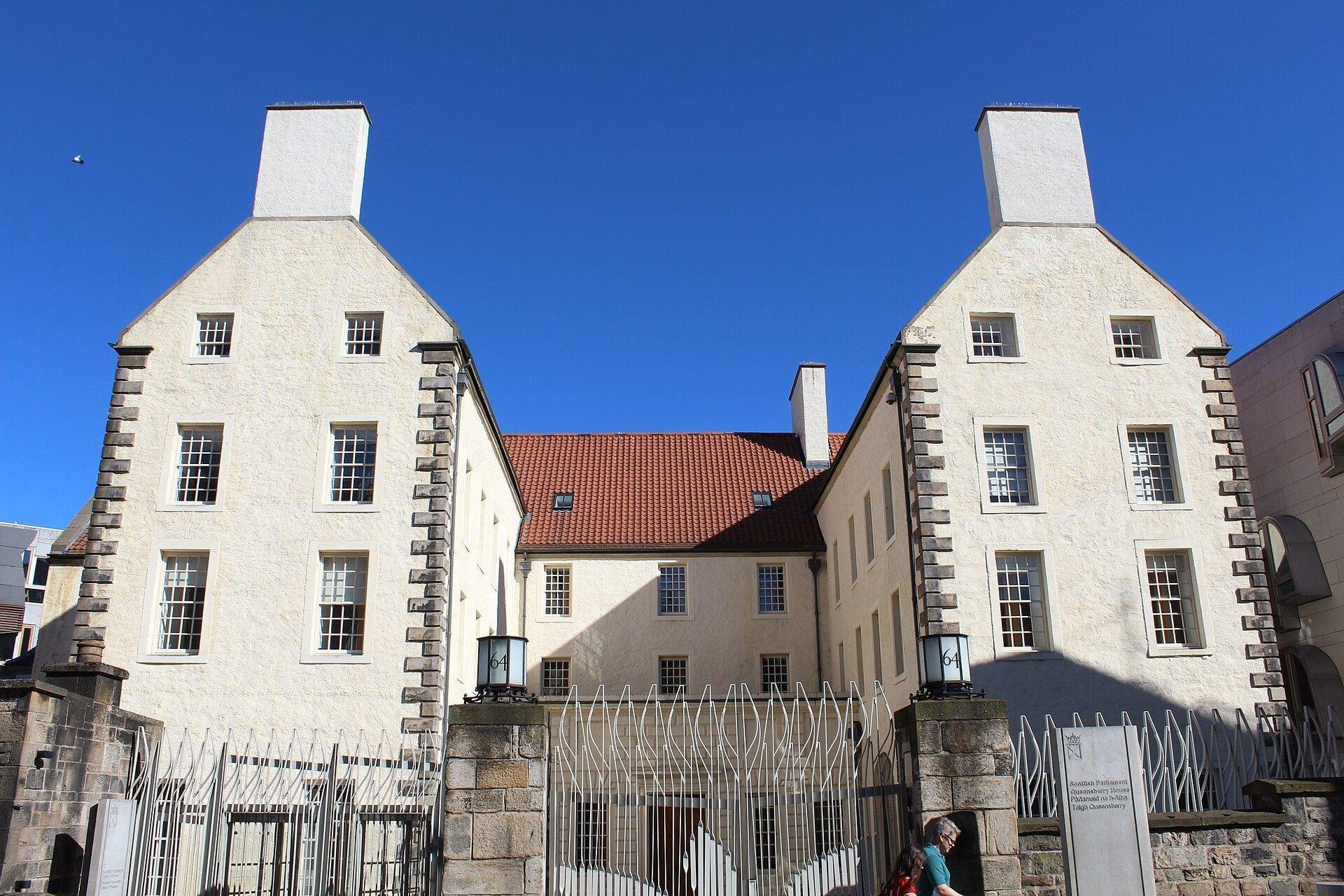
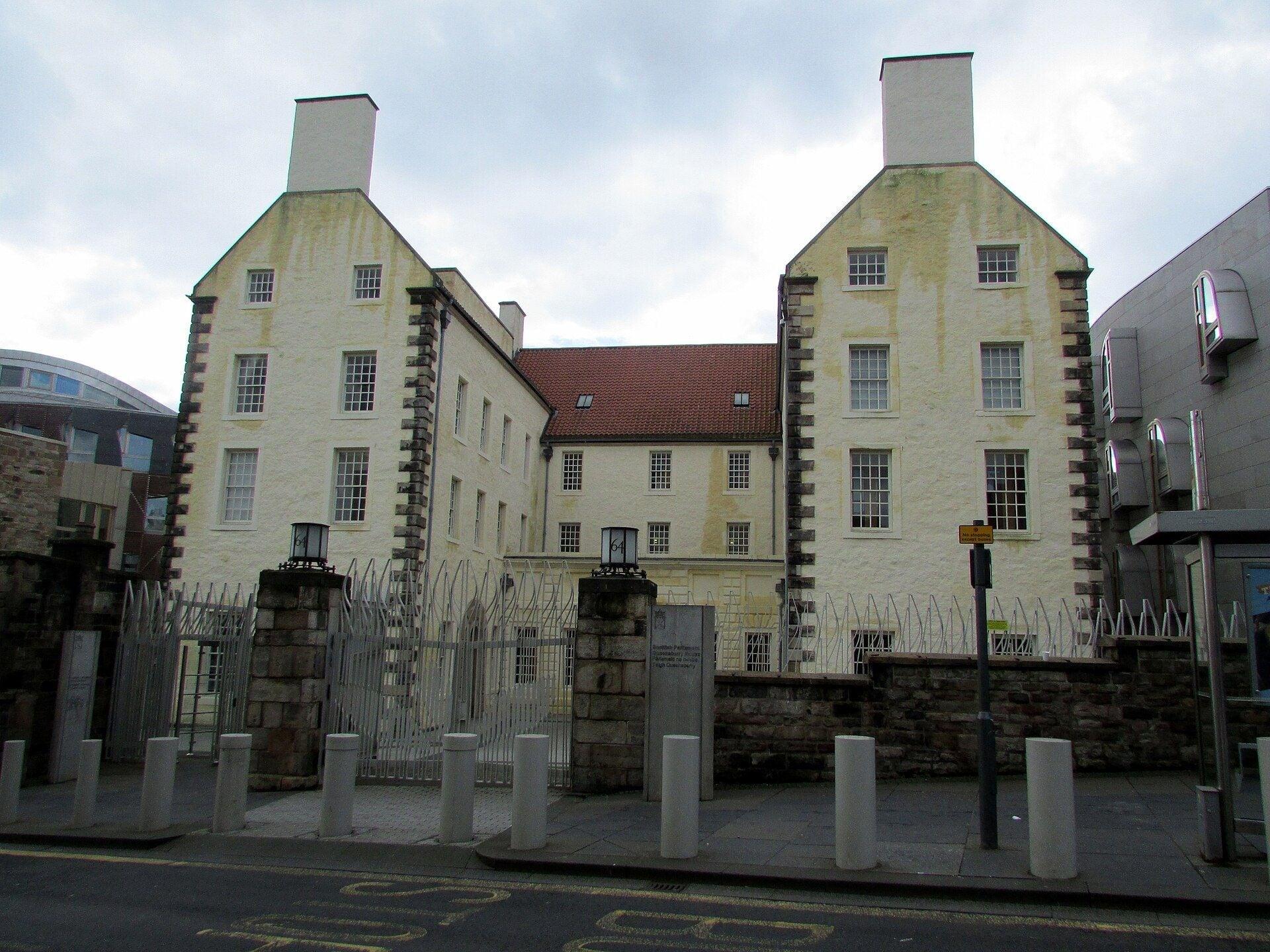
Queensberry House: Kept by the Parliament
An old mansion kept by the new. Queensberry House, a seventeenth century mansion on the lower Canongate, now folded into the Scottish Parliament's buildings instead of cleared away.
- 11

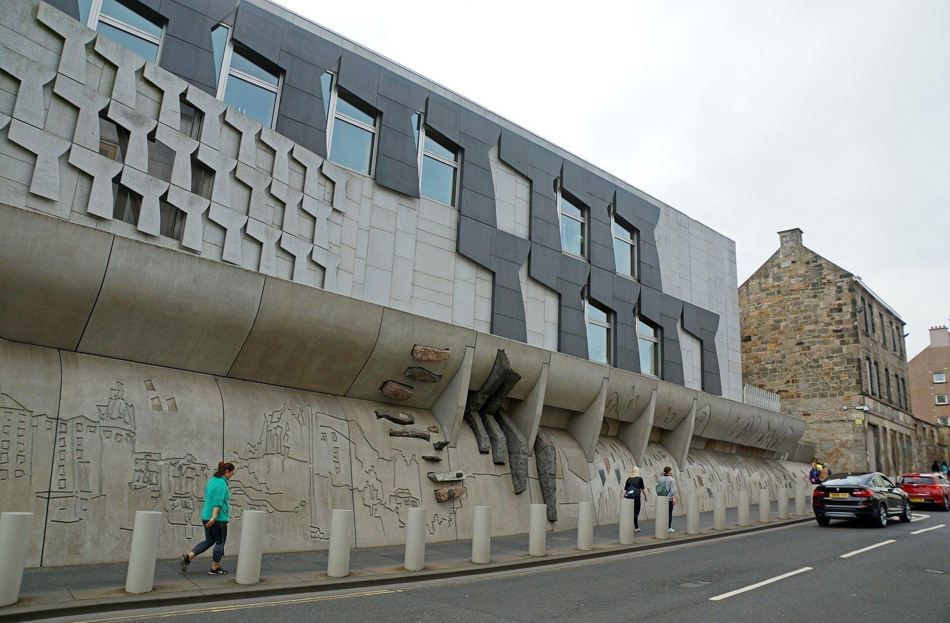
Scottish Parliament: Words in the Canongate Wall
Quotations are carved along this wall. The Scottish Parliament's Canongate Wall, twenty nine quotations cut into Scottish stones, open to read at any hour, with the palace gates just ahead.
- 12
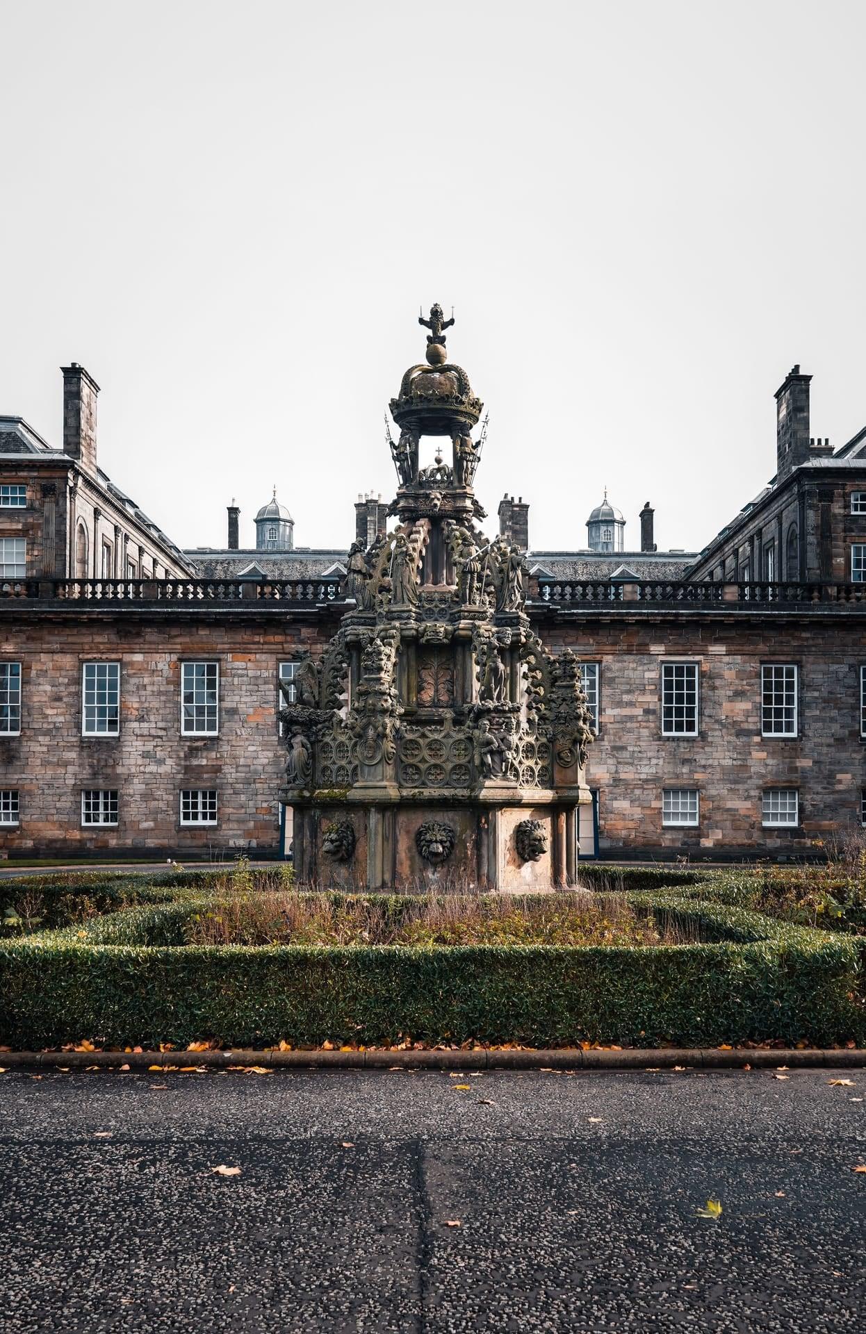
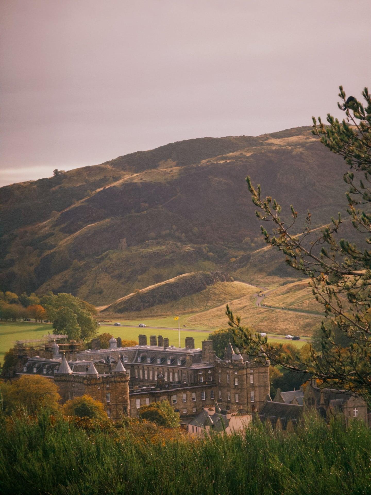
Palace of Holyroodhouse: The Sanctuary Lane
A palace grew from an abbey here. Abbey Strand runs to the Palace of Holyroodhouse's gates, past lodgings built for Mary, Queen of Scots' court and a debtors' sanctuary, under Arthur's Seat.
Details
Best Time to Visit
Early morning, before about 10:30, or late in the afternoon: the castle end fills with people from mid-morning, and tour groups gather at the Heart of Midlothian and the Mercat Cross. In December the sun rises at about 08:20 to 08:45 and sets at about 15:40 to 15:50 (computed for Edinburgh; 15:40 on 21 December), so a walk started after about 14:15 finishes in the dark; the Royal Mile is lit and busy, but the Castle Esplanade has no lamps of its own. December is short, cold and often wet: mean highs about 7 °C, lows about 2 °C (Met Office 1991 to 2020 averages for the Royal Botanic Garden No 2 station; the table loads by script, so these were read from search snippets, which disagree on rainfall). Edinburgh Castle 09:30 to 17:00, last entry 16:00 (closed 25 and 26 December); St Giles' from 10:00 on weekdays, 09:00 Saturdays, 13:00 Sundays; the Scottish Parliament Monday to Saturday, closed Sundays; the palace's hours vary, so check rct.uk. None of them needs to be open for the walk. Edinburgh's Christmas (from 14 November 2026; the official site gave no end date when checked) is off the Royal Mile. On 29 December 2026 the Torchlight Procession (from 18:30 at the Meadows) is led through the Old Town, with closures that evening, and on 31 December the street party on Princes Street (from 20:00, ticketed) closes the ways down to it: walk earlier on those days. Checked 11 November 2026.
Pro Tips
- •Start on the Castle Esplanade, the open forecourt in front of Edinburgh Castle's gatehouse at the very top of the Royal Mile, about 1 km uphill on foot from Waverley Station.
- •From Waverley Station to the Esplanade: about 1 km and 50 m of climb. Step-free: up Cockburn Street to the High Street, then up the Royal Mile, which is this walk in reverse. Shorter but stepped: the stairs of Fleshmarket Close or Advocate's Close. Checked 11 November 2026 (from the map).
- •By tram: Princes Street stop (Edinburgh Trams; adult fares from 2.40 GBP in the city zone), then up the Mound and Ramsay Lane to Castlehill, about 700 m and steep. Checked 11 November 2026.
- •Getting away from Holyrood: Lothian Buses service 35 stops at 'Scottish Parliament' on the Canongate, beside stop 11 (parliament.scot). On foot, the Royal Mile back to the top is about 1.6 km, uphill all the way. Checked 11 November 2026.
- •Edinburgh Castle: book online (adult 23.50 GBP, 26.00 at the gate); tickets often sell out, and then none are sold at the castle (edinburghcastle.scot). Checked 11 November 2026.
- •St Giles' Cathedral: 12 GBP for visitors aged 16 and over who do not live in Scotland; free for residents of Scotland with a Resident Pass and for under-16s with an adult (stgilescathedral.org.uk). Checked 11 November 2026.
- •The Real Mary King's Close (stop 5): guided underground tour from 2 Warriston's Close, hours vary by day (10:00 to 18:30, last entry 17:00, on weekdays in November; later on Fridays to Sundays), adult from 25.00 GBP, ages 5 and over (realmarykingsclose.com). Checked 11 November 2026.
- •The Scottish Parliament (stop 11) is free with no booking: Monday, Friday and Saturday 10:00 to 17:00, Tuesday to Thursday 09:00 to 18:30, closed Sundays; recess 19 December 2026 to 3 January 2027 (parliament.scot). Checked 11 November 2026.
- •Palace of Holyroodhouse (stop 12): adult 22.00 GBP in advance, 26.00 on the day; opening changes at short notice for royal visits, so check rct.uk on the day. Checked 11 November 2026.
- •Adam Smith's grave is in the Canongate Kirk's kirkyard, behind stop 9; go in daylight when the gates are open. The kirk opens weekdays 11:00 to 16:00 in summer, and when volunteers can in the rest of the year (canongatekirk.org.uk). Checked 11 November 2026.
- •John Knox House (stop 8) is closed for renovation from 9 to 27 November 2026; the Scottish Storytelling Centre beside it stays open (scottishstorytellingcentre.com). Checked 11 November 2026.
Safety & Precautions
- •The walk runs downhill all the way, about 65 m, much of it on setts (stone paving blocks) that are slippery when wet or icy; Castlehill is the steepest part. The closes either side are steep and stepped: the walk never goes down one.
- •Traffic drives on the left. Crossings: Bank Street's mouth at the George IV Bridge junction (no pedestrian crossing is mapped: use the green man if there is one, otherwise look right first), St Giles' Street's mouth just after (no signals), North Bridge at the lights, Jeffrey Street at the junction lights, the mouths of Cranston Street and New Street (no signals: take care), the Canongate at the zebra by St John Street, and Horse Wynd at the pedestrian lights. Vehicles may use the Lawnmarket from 19:00 to 10:30, and loading vans use the High Street by St Giles' in the early morning.
- •After dark: the Castle Esplanade has no street lamps of its own, and Abbey Strand at the end is not mapped as lit; the Royal Mile between them is lit. Do not go into the kirkyards or closes after dark.
- •Crowds: the castle's queue fills the Esplanade from mid-morning, tour groups gather at the Heart of Midlothian and the Mercat Cross, and the Real Mary King's Close queue stands on the pavement by Warriston's Close.
- •Hogmanay 2026: on 29 December the Torchlight Procession (from 18:30 at the Meadows) is led through the Old Town, so expect closures that evening (route maps are published nearer the date); on 31 December the street party on Princes Street (from 20:00, ticketed) closes the routes down from the Old Town. Check edinburghshogmanay.com before you go. Checked 11 November 2026.
- •St Giles' allows no filming or photography during services and no photographs of people; the Real Mary King's Close allows no photography on the tour; drones are not allowed anywhere in the Palace of Holyroodhouse.
- •Works: St Mary's Street, which meets the Royal Mile at the Netherbow junction (stop 8), is closed to traffic from 21 September 2026 for about six months while its setts are relaid (Edinburgh Evening News, 11 September 2026); expect barriers and changed signals around that junction. Checked 11 November 2026.
Travel advisory: Exercise Increased Caution (Level 2).
Gallery
Related Reading
Go deeper on what you'll see, hear, and walk through.
Overview
Best Self-Guided Walking Tours in Edinburgh (2026)
4 min
Overview
Edinburgh Travel Guide: How Many Days, Getting Around, Best Time, and Safety (2026)
7 min
Overview
One Day in Edinburgh: A Walkable Morning-to-Evening Itinerary
8 min
Thematic
Best History Walking Tours in Edinburgh (2026)
3 min
Thematic
Two Cities on Two Ridges: How to Read Edinburgh's Old and New Towns
7 min
Companion
Saint Giles' Cathedral: Where the Royal Mile's Whole Story Turns
7 min
Deep dive
The Real Mary King's Close: The Edinburgh Street That Was Buried Alive
6 min
Read
Best Audio Tour Apps for Europe (2026)
5 min
Read
What to Eat in Edinburgh: Scottish Dishes and How to Order Like a Local
7 min
Read the walk
The full story of Royal Mile: From the Castle Rock to the Palace, in words. Prefer to listen? Play it narrated, from home or on location.
Introduction
Edinburgh's Old Town hangs from a rock. A castle stands on a plug of hard volcanic stone, and one street runs down the long ridge behind it, all the way to a palace. That street is the Royal Mile, and almost everything about the Old Town of Scotland's capital, its tall tenements, its steep narrow closes, even its two separate towns, follows from the shape of the ground beneath it.
There are twelve stops over about one point seven kilometres, just over a mile, and the walk takes about an hour and a quarter. It runs downhill all the way, about sixty five metres from top to bottom, much of it on setts, the old stone paving blocks, which are slippery when wet or icy.
Edinburgh Castle, Saint Giles' Cathedral, the Scottish Parliament and the Palace of Holyroodhouse all keep opening hours, and the castle, the cathedral and the palace charge most visitors to go in. This walk stays on the street, and never needs any of them open.
In December the sun sets at about twenty to four in the afternoon, so many walkers will finish under street lights. The street is lit and busy after dark, but the Castle Esplanade, where the walk starts, has no lamps of its own. On the evening of the twenty ninth of December, the Torchlight Procession is led through the Old Town, and on the thirty first, the ways down to the street party on Princes Street are closed or ticketed.
The walk ends at the gates of the Palace of Holyroodhouse, with Arthur's Seat beyond. When you arrive at the Castle Esplanade, begin with stop one.
1. Castle Esplanade: The Rock and the Ridge
This is the Castle Esplanade, the open parade ground in front of Edinburgh Castle. Face the castle. The gatehouse and its drawbridge are straight ahead, and the great curved wall rising above them, to the left, is the Half Moon Battery.
The castle is ticketed. Historic Environment Scotland runs it, and through the winter it opens at half past nine, with last entry at four. Tickets often sell out online, so book ahead if you want to go in. One thing you will not find inside any more is the Stone of Destiny: it moved to Perth Museum, which opened in March twenty twenty four. This walk stays outside.
Now think about what the castle stands on. The British Geological Survey describes the rock as a plug of hard volcanic basalt. When the ice sheets moved across this land from the west, they could not shift it. The ice split round the rock and dug a deep valley on each side: on one side the valley where Princes Street Gardens lie now, on the other the hollow of the Grassmarket and the Cowgate. Behind the rock, sheltered from the ice, a long tail of softer ground survived. Geologists call it a crag and tail.
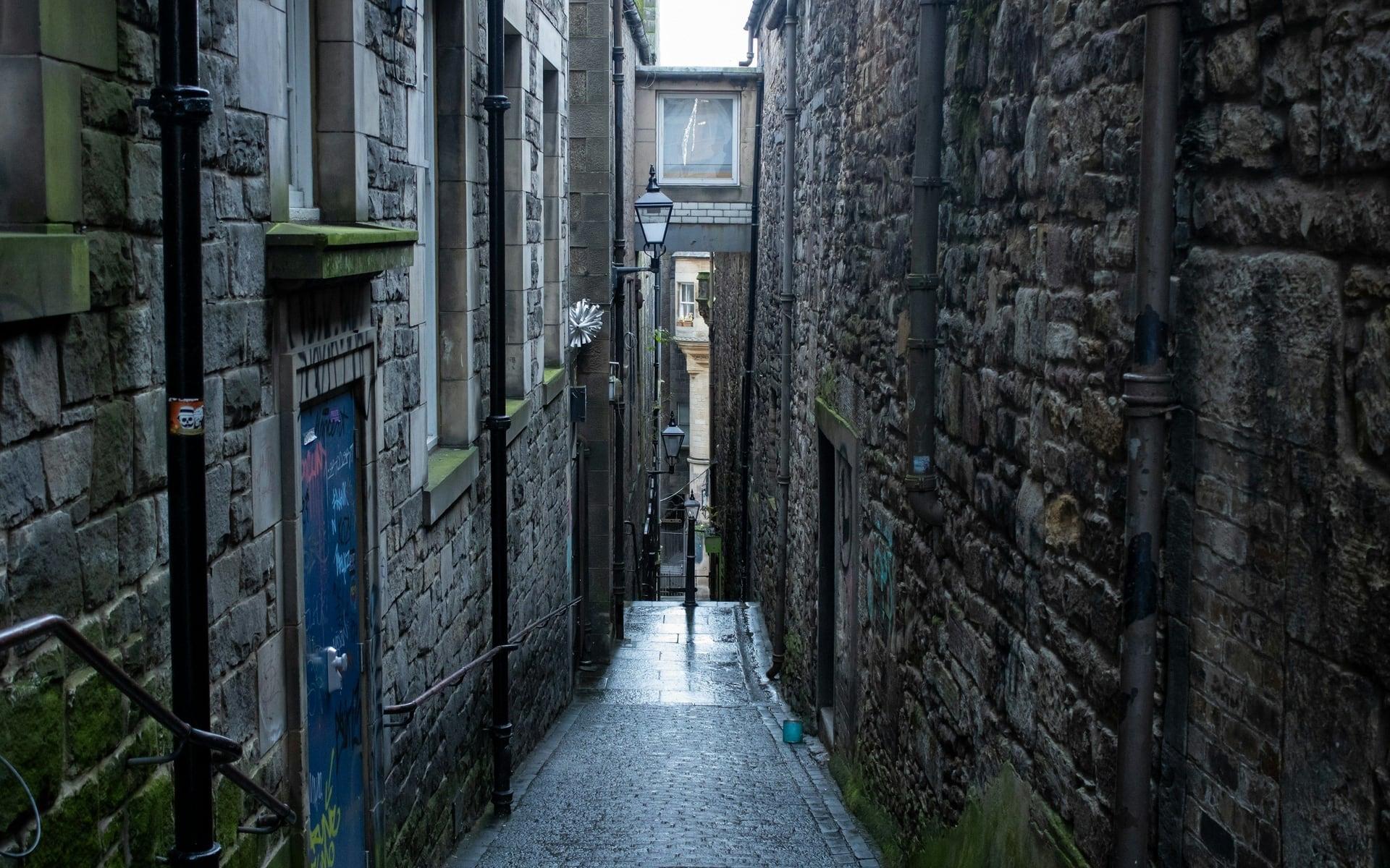
Turn round, so the castle is behind you. The street falling away ahead, the Royal Mile, runs down that tail, and the Old Town grew along it. It is a spine, with the ground dropping off on both sides, so every lane that leaves it falls steeply away, like the bones of a fish. That one shape explains most of what you will see on this walk.
The Esplanade has no street lamps of its own, so after dark, watch your footing here.
Follow the route down off the Esplanade. The next stop is a small bronze fountain, just where the street begins.
2. Witches' Well: A Memorial on Castlehill
Walk on to the small bronze fountain set into the wall of the large building at the top of the street, on the side that faces the castle, and stop there.
This is the Witches' Well, and it is a memorial. Historic Environment Scotland's record says it stands near the site where condemned witches were burned. People accused of witchcraft were put to death here on Castlehill, on the open ground in front of the castle. How many died here is not known. No reliable count has been found, and the large figures you may hear repeated are not backed by any record we could find.
Look at the bronze relief. It shows two heads, one evil and one serene, with foxgloves and a serpent twisted among them. The plaque beside it was made long after the burnings. Its words are worth reading for yourself, as a record of how the city later chose to remember the people who died here. Please treat it as the memorial it is.
The building it is set into was the town's reservoir. It was built in eighteen forty nine and eighteen fifty, on the site of a smaller reservoir from the seventeen fifties, which had itself replaced a chapel. The town's first piped water main, from the springs at Comiston, had been laid in sixteen eighty one, and the reservoir on this spot stored water to be piped to the town below. Today the old reservoir is a weaving mill and shop.
Follow the route on down Castlehill. The next stop is a tall merchant's house on the left hand side of the street, with two round arches at pavement level.
3. Gladstone's Land: A Merchant's Tenement
Walk on along the Lawnmarket to the tall grey stone house with two round arches at street level, and stop in front of them.
This is Gladstone's Land. In Edinburgh, a land is a tenement: a building of homes piled one above another. Count the floors. Five storeys and an attic, over a cellar, on a front just three windows wide.
Why so tall and so thin? The town sat on a narrow ridge, inside its walls, and every house plot was a long, thin strip running back from the street. The only way to add room was up.
The house is older than its face. In sixteen seventeen a merchant bought an older tenement here, whose front was timber galleries jutting out over the street. He extended it and gave it this stone front, which was there by sixteen twenty one, with a shop at street level behind an open arcade. That is what the two arches are. Look up to the top of the walls. The carved stones at the foot of the gable edges carry his initials and his wife's. The house still carries his name.
The National Trust for Scotland bought the building in nineteen thirty four and restored it. Inside, its rooms keep their painted decoration. It is ticketed, and this walk stays outside, with the arcade and the curved stone stair up its front.
Follow the route on down the Lawnmarket. Ahead, at the bottom of this stretch, the crown steeple of Saint Giles' rises over the street: this is the best view of it you will get. Keep to this side of the street. Where Bank Street comes in, cross its mouth at the green man if there is one; if there is not, look right first, then cross. Then cross the small Saint Giles' Street beyond it, and stop once you are over.
4. St Giles' Cathedral: The Heart of Midlothian
Stop here, across the street from the great west door of Saint Giles' Cathedral, with its carved figure of the saint above the doorway.
In the setts in front of that door, across the street, a heart is picked out in the paving stones. That is the Heart of Midlothian. It marks where the Old Tolbooth stood, out in the street itself: the town's jail. People still spit on the heart as they pass, so if you cross to see it, step round it.
Now look up at the church. Saint Giles' calls itself the High Kirk of Edinburgh, and kirk is the Scots word for church. It is a cathedral in name only. The Church of Scotland has no bishops, and a king made Saint Giles' a cathedral only briefly, in sixteen thirty three. Historic Environment Scotland says it was the only parish church inside the city walls through the whole of the Middle Ages. Most of what you see was rebuilt after a fire in thirteen eighty five, then refaced in smooth stone between eighteen twenty nine and eighteen thirty three.
The steeple is its badge: a stone crown carried on eight flying buttresses. Historic Environment Scotland records that the crown was rebuilt in sixteen forty eight.
During the Reformation, Saint Giles' was John Knox's parish church. You will meet his name again, further down the street, on a house that may never have been his.
Going in is free for people who live in Scotland, and for children with an adult. Other visitors aged sixteen and over pay twelve pounds. It opens at ten on weekdays, at nine on Saturdays and at one on Sundays, after the morning services.
Follow the route on along the cathedral's side. The next stop is the old market cross, beyond its far end.
5. Mercat Cross: The Street Above a Street
Walk on past the stone pillar with a unicorn on top, to the bronze statue standing in the middle of the street just beyond it, and stop there. The pillar, just behind you now, is the Mercat Cross. Mercat is Scots for market. Historic Environment Scotland calls it the centre of…
Full narration for this stop unlocks with the tour.
6. Tron Kirk: A Church Built for the Displaced
Walk on to the church with the tall steeple at the crossroads ahead, and stop in front of its door. Look up: the steeple rises right above you. This is the Tron Kirk, and its story begins back at Saint Giles'. When a king made Saint Giles' a cathedral, in sixteen thirty three,…
Full narration for this stop unlocks with the tour.
7. Paisley Close: The Boy in the Keystone
Walk on to the archway with a carved stone head above it, on this side of the street, and stop just in front of it, without going in. This is Paisley Close, and like every close on this street, it began as the line of a house plot. Historic Environment Scotland describes how…
Full narration for this stop unlocks with the tour.
8. Netherbow Port: The Edge of Edinburgh
Stop on this pavement, once you are across the junction and the small side street just after it. Now turn round, and look back up the street. The junction you just crossed was the edge of Edinburgh. The Netherbow Port, the town's gate, stood across the street there, where it…
Full narration for this stop unlocks with the tour.
9. Canongate Tolbooth and Kirk: A Second Town
Stop on this pavement, with the museum building at your back, and look across the street. You are now in the Canongate, which for more than seven hundred years was a separate burgh, a self governing town. Historic Environment Scotland records that the canons of Holyrood Abbey,…
Full narration for this stop unlocks with the tour.
10. Queensberry House: Kept by the Parliament
Stop on this pavement. Just ahead, on this side of the street, a long, plain house begins, finished in harling, the rough coat of lime render that Scottish builders spread over stone walls. That is Queensberry House, a mansion of the seventeenth century, and today it is part of…
Full narration for this stop unlocks with the tour.
11. Scottish Parliament: Words in the Canongate Wall
Stop beside the wall of carved stones, with the Parliament building rising beside you. This is the Scottish Parliament, and this is its Canongate Wall. Look closely at the stones set into it. They are many different Scottish stones, and each one carries a quotation cut into it,…
Full narration for this stop unlocks with the tour.
12. Palace of Holyroodhouse: The Sanctuary Lane
Walk on along the lane toward the iron gates ahead, and stop just short of them. Through the gates is the Palace of Holyroodhouse, in the Royal Collection Trust's words the King's official residence in Edinburgh. You are at the other end of the street from where you began: a…
Full narration for this stop unlocks with the tour.
- The Witches' Well, Castle Esplanade, Edinburgh — (Lila), CC BY-SA 4.0 · source
- The Witches' Well, Castle Esplanade, Edinburgh — (Lila), CC BY-SA 4.0 · source
- Haus mit für das Baujahr recht vielen Stockwerken und separatem Dienstboteneingang links. Lawnmarket, Edinburgh — GerritR, CC BY-SA 4.0 · source
- Gladstone's Land, Edinburgh — David Hillas, CC BY-SA 2.0 · source
- Ayuntamiento — carlos corzo, CC BY-SA 3.0 · source
- On the 24th of November, 1861, tenement number 99 and tenement number 103 on the Royal Mile, both 250 years old by then, collapsed without w — Tony Hisgett from Birmingham, UK, CC BY 2.0 · source
- Maison de Queensberry, Parlement d'Écosse. — Chabe01, CC BY-SA 4.0 · source
- IMG_3991 — Reading Tom from Reading, UK, CC BY 2.0 · source
- 2017-08-26 09-09 Schottland 048 Edinburgh, Scottish Parliament Building — Allie_Caulfield, CC BY 2.0 · source
Images may be cropped or resized. Other photos via Unsplash and Pexels.