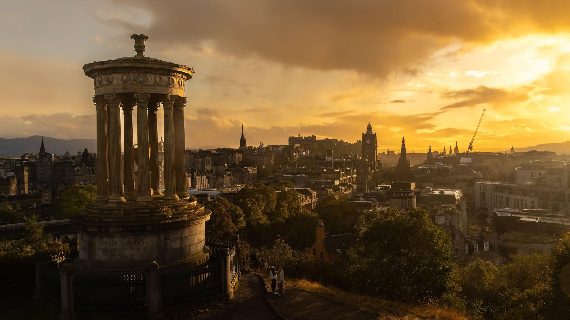
A city drawn on paper first. Thirteen stops through Edinburgh's Georgian New Town, from the view on Calton Hill past Register House, St Andrew Square and the Melville Monument, the Scott Monument and the Mound, Rose Street and George Street's statues, to Robert Adam's Charlotte Square and the dome that closes the plan, all from the street.
Start · Calton Hill: The Plan From Above
DirectionsStops
- 1
Calton Hill: The Plan From Above
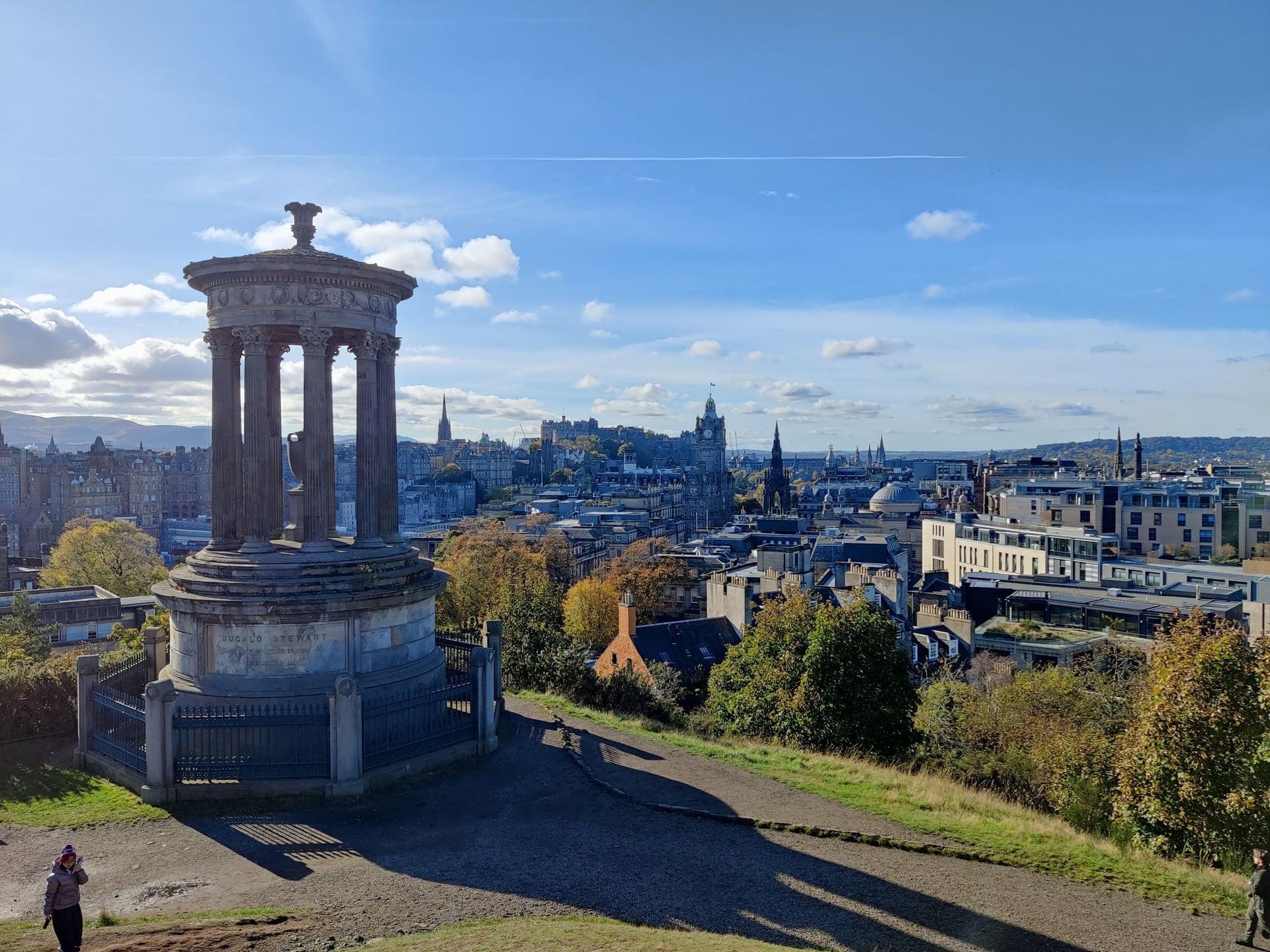
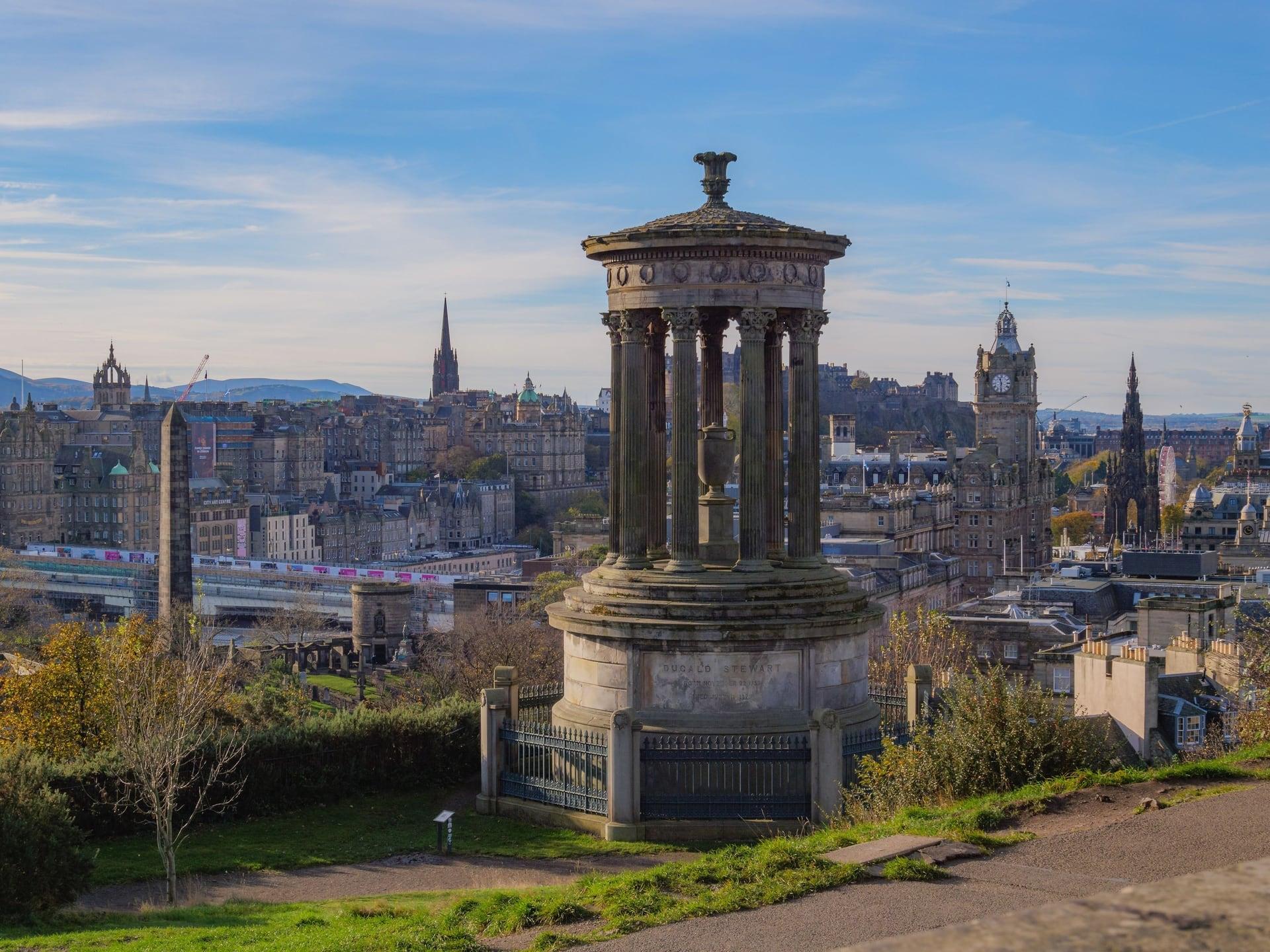
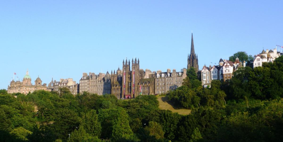
See the whole plan from here. A viewpoint on Calton Hill's western shoulder, beside the round temple of the Dugald Stewart Monument, looking over the New Town's grid to the castle on its rock.
- 2
Old Calton Burial Ground: A Street Through the Graves
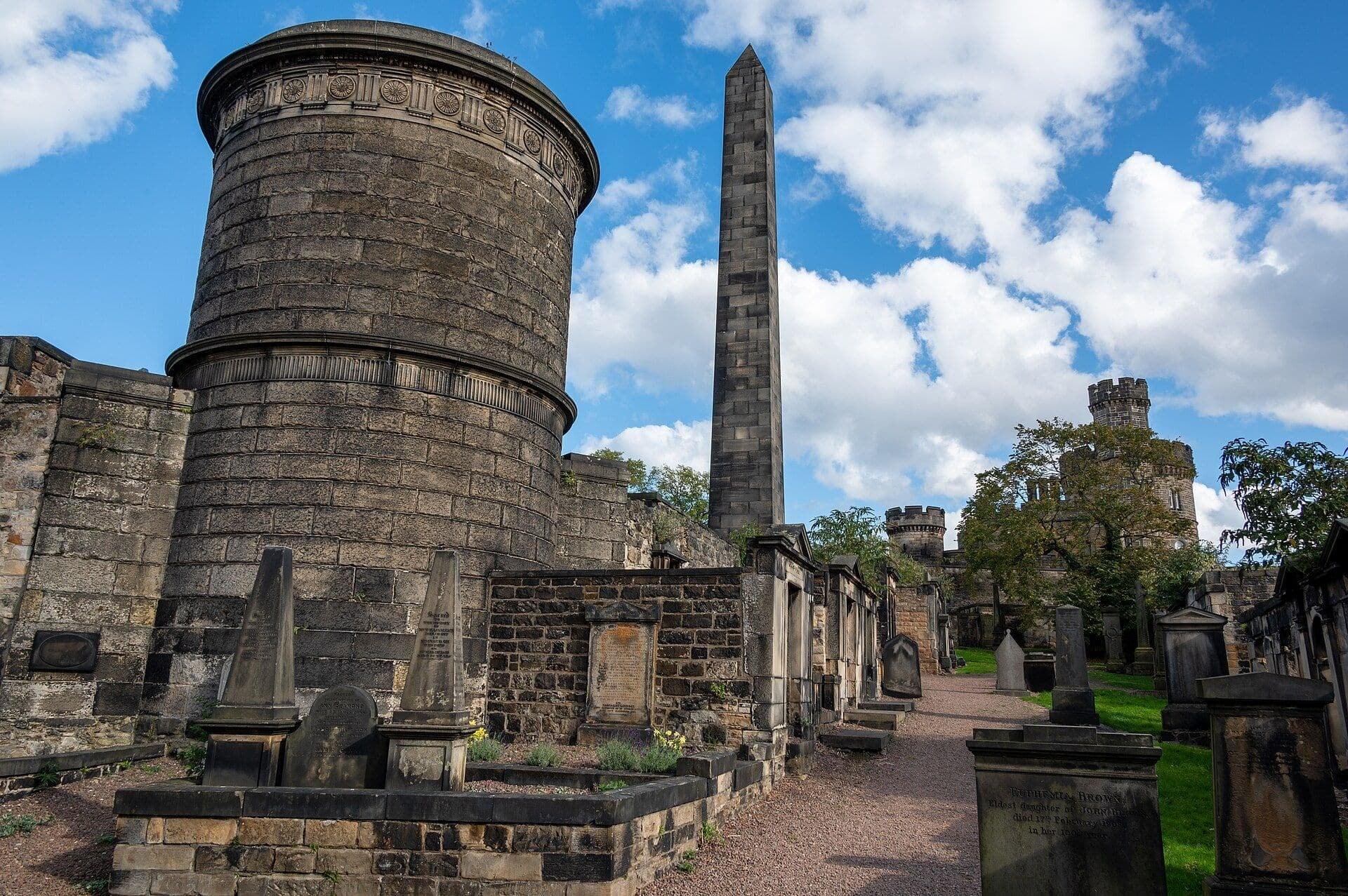
A new street cut through graves. Waterloo Place, built in one go as the city's grand east entrance, runs straight through an old burial ground, walled on both sides behind screens.
- 3
Register House: A Record Office as Bait
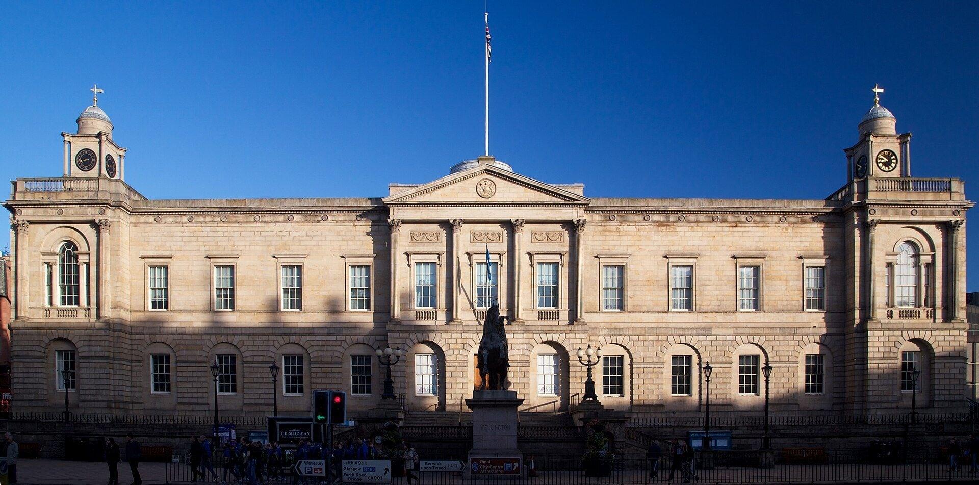
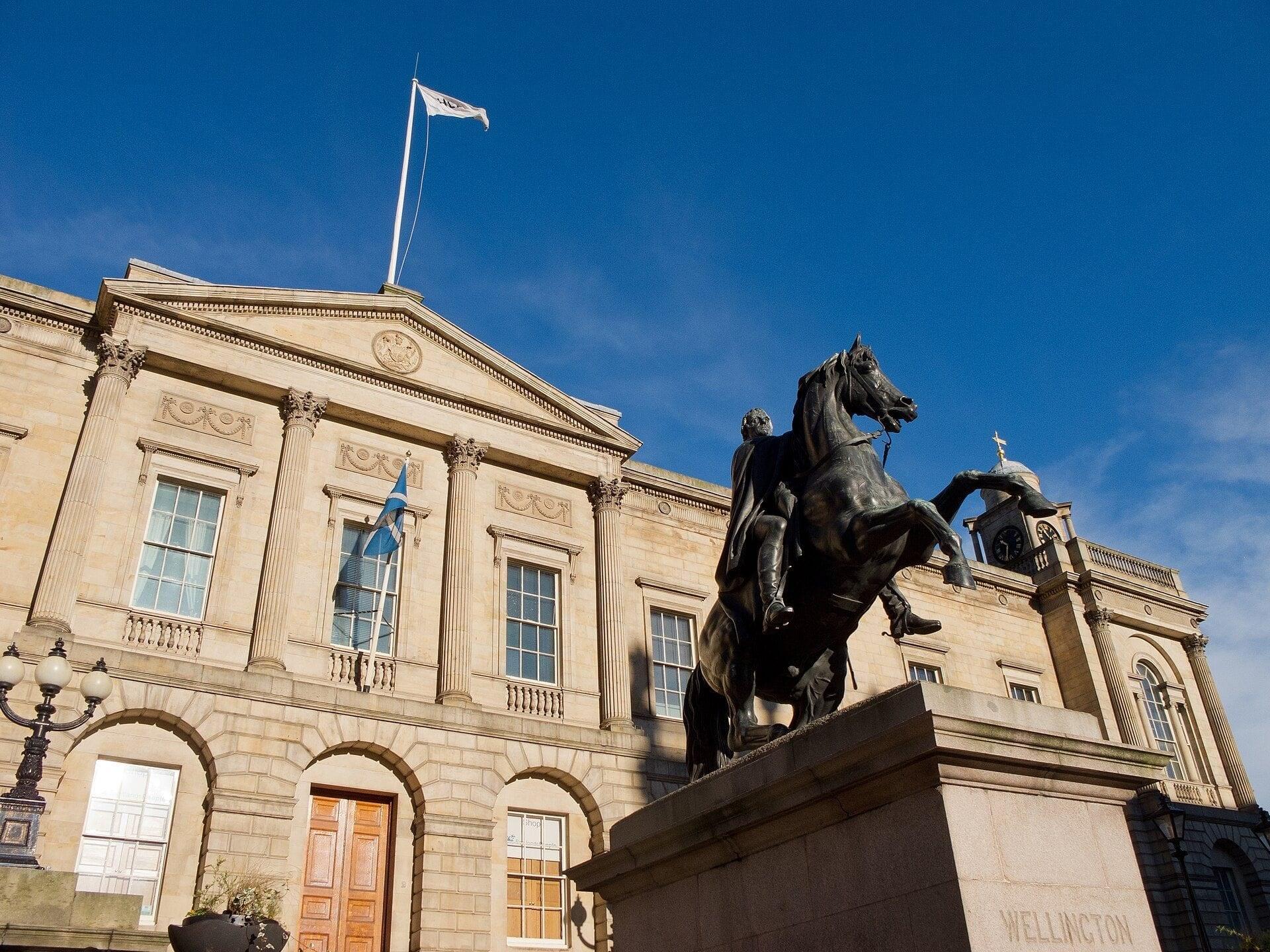
A record office built as bait. Robert Adam's General Register House, on land the city gave in 1769 to get the New Town moving, faces the bridge to the Old Town.
- 4
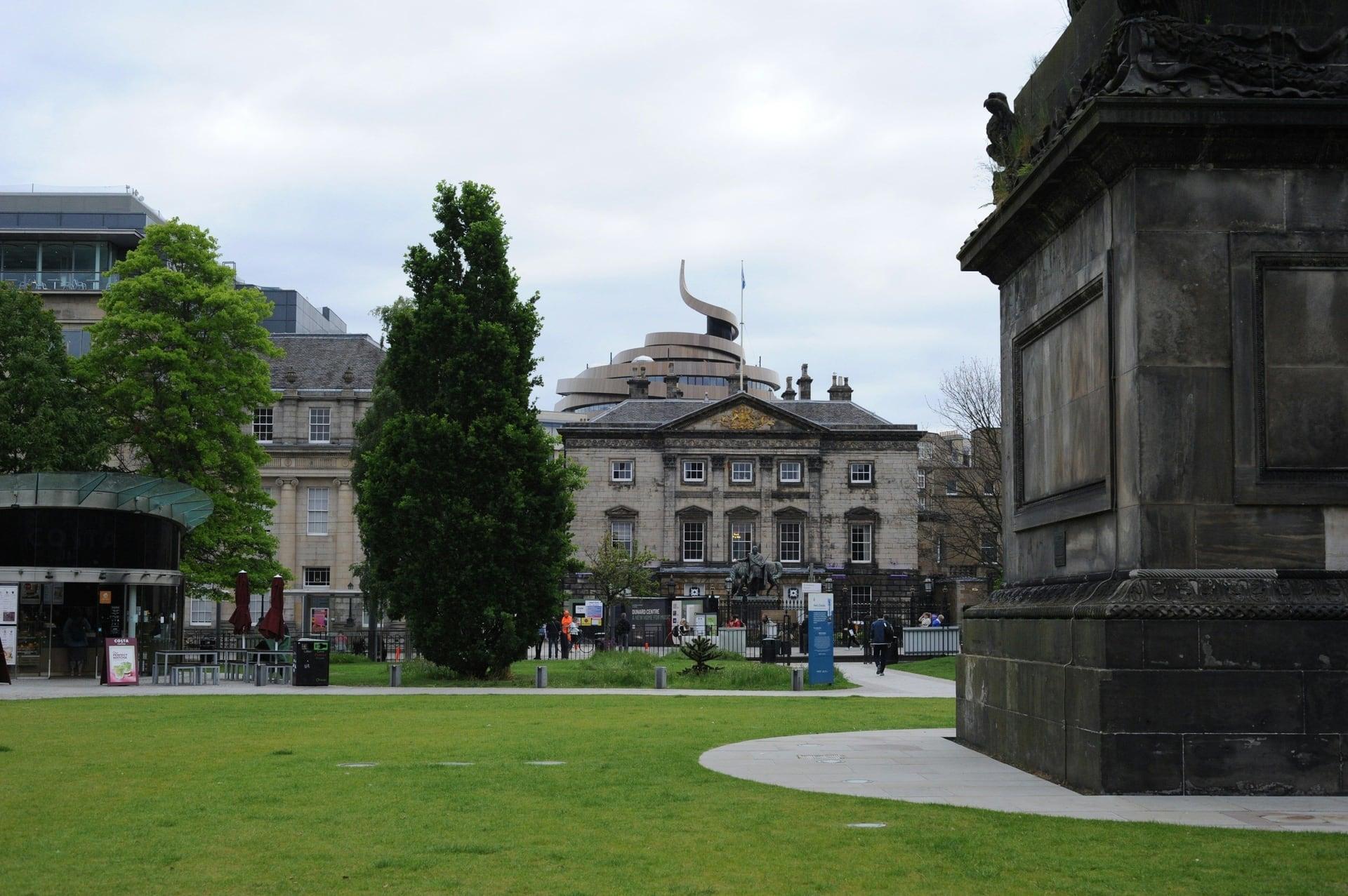
Dundas House: The Church That Never Came
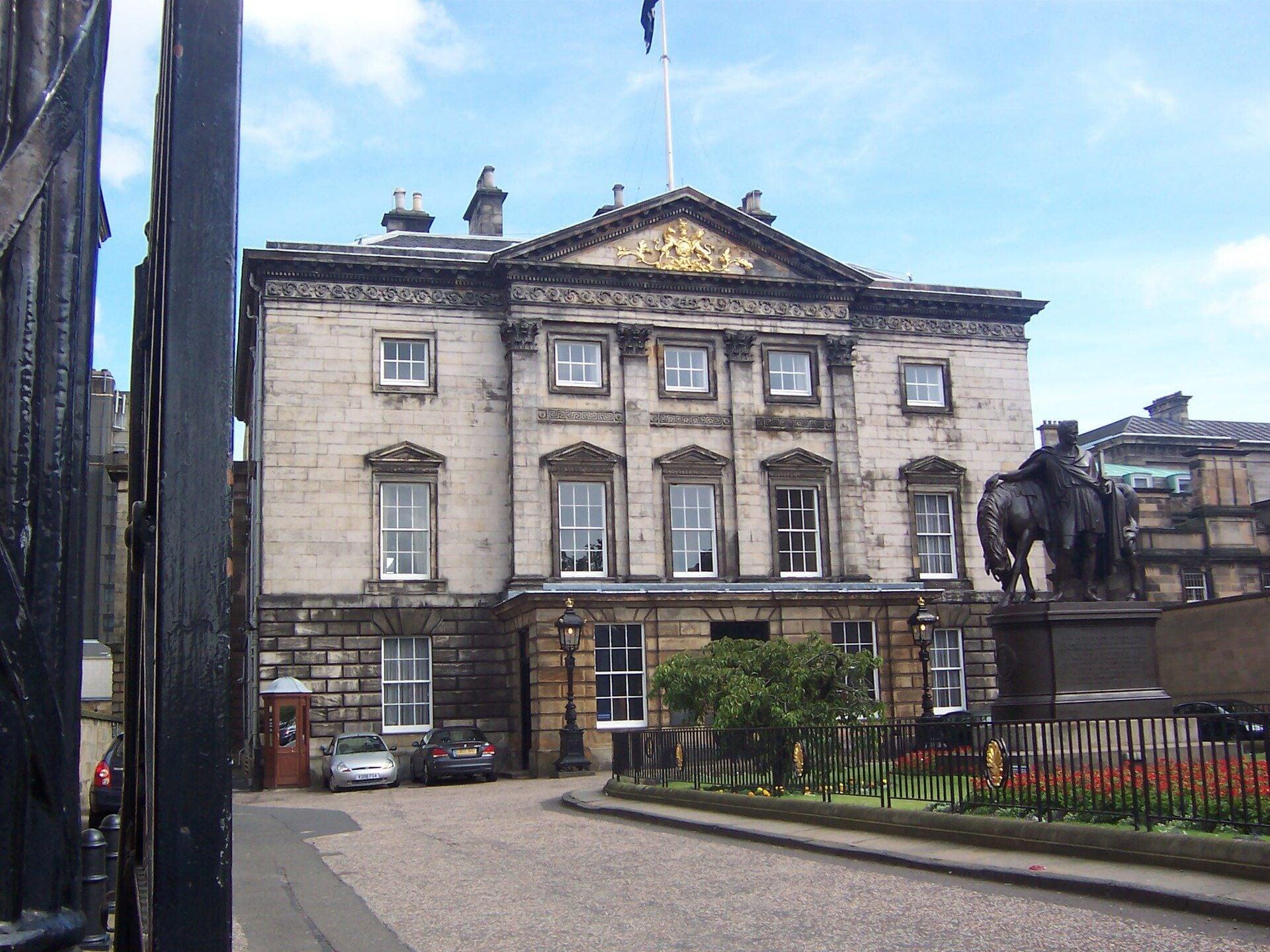
A villa took the church's place. Dundas House, a Palladian villa of 1771 on St Andrew Square, holds the site the plan meant for a church, and has been the Royal Bank since 1825.
- 5
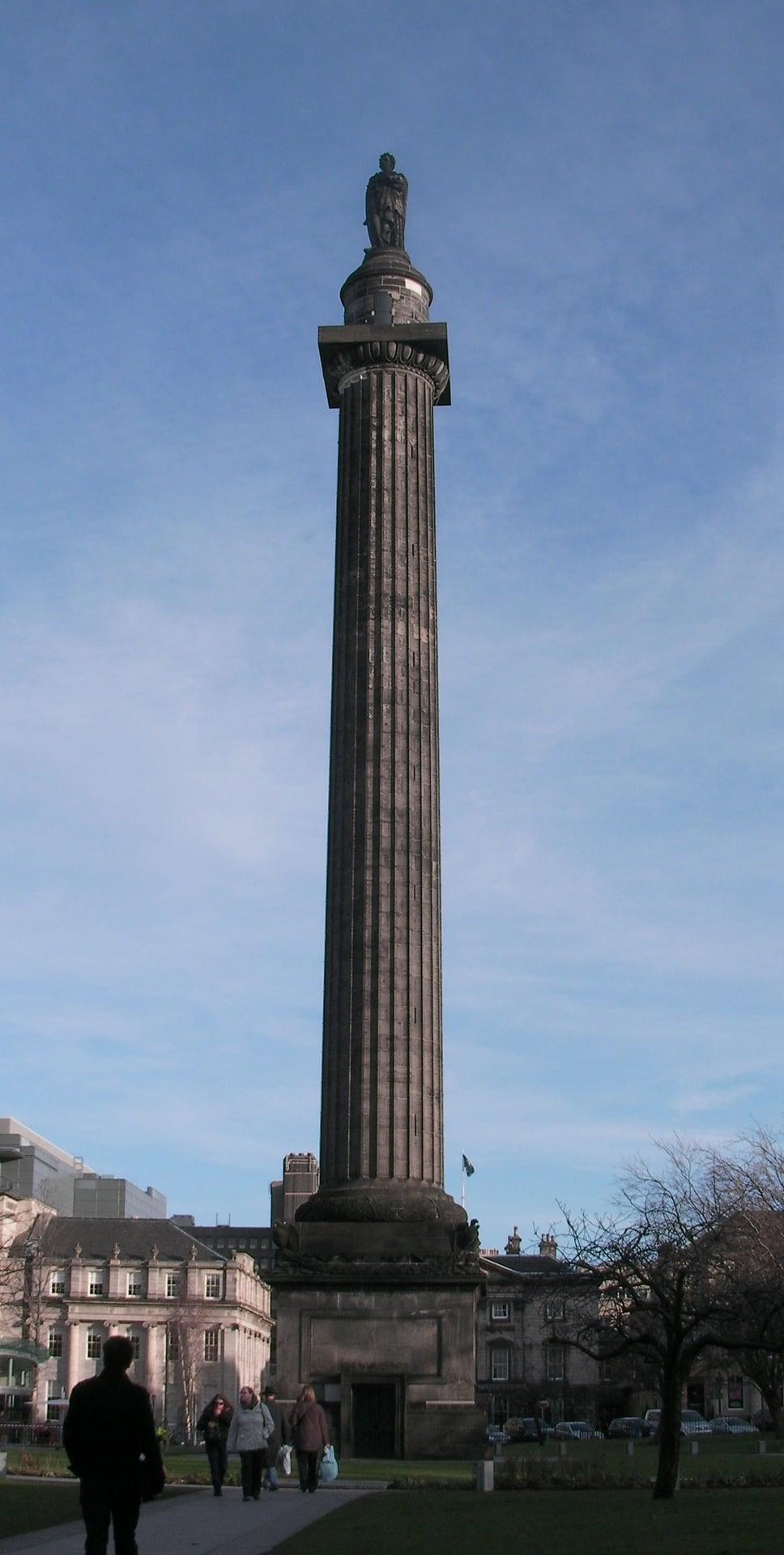
Melville Monument: A Column and a Contested Name
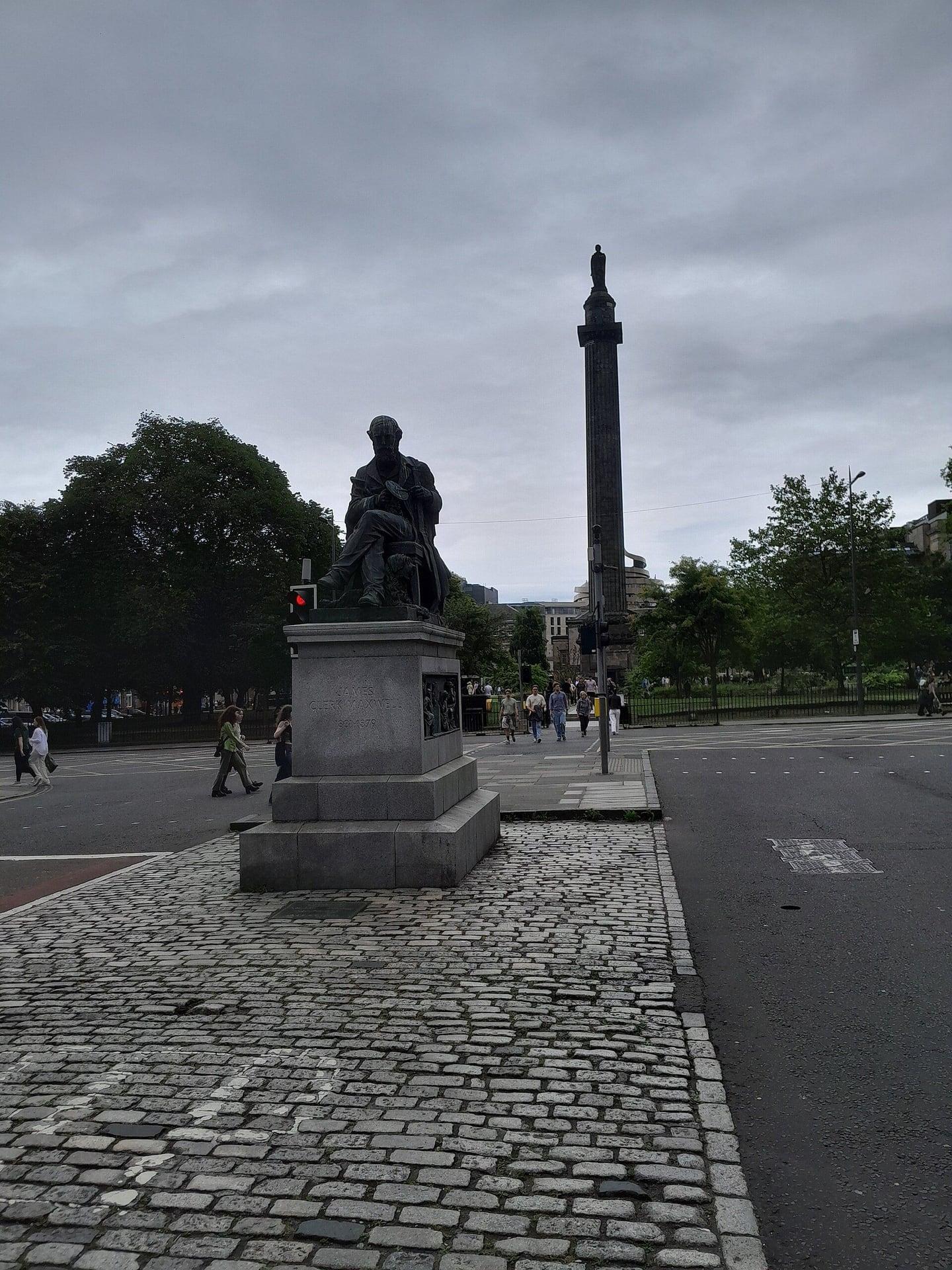
This column honours a contested man. A fluted Doric column over 150 feet tall, raised in 1821 to 1823 for Henry Dundas, with a plaque on his role in deferring the abolition of the slave trade.
- 6
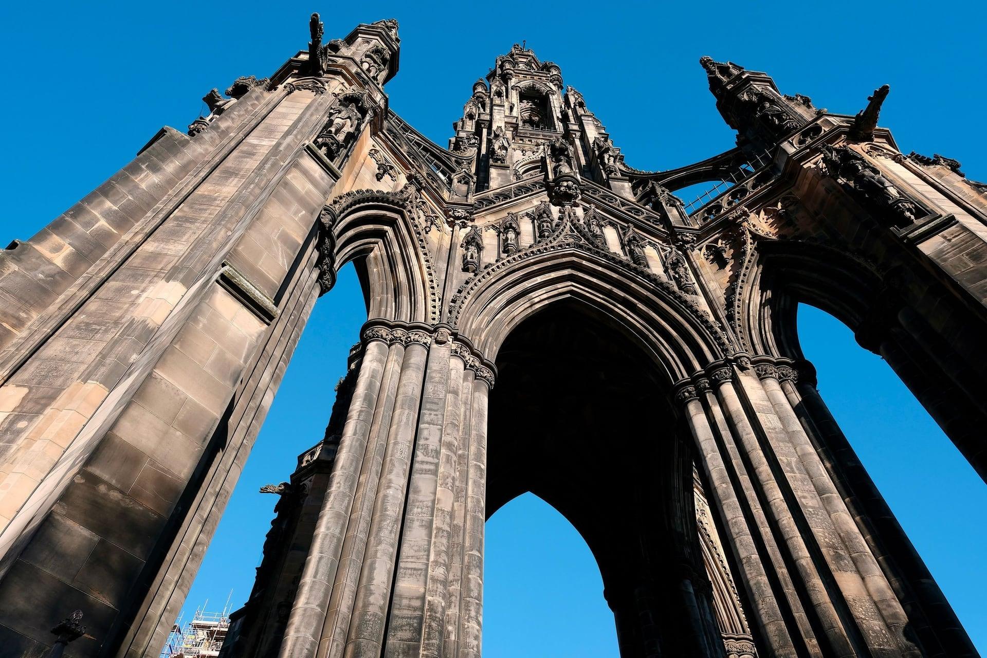
Scott Monument: A Gothic Spire on the Open Side
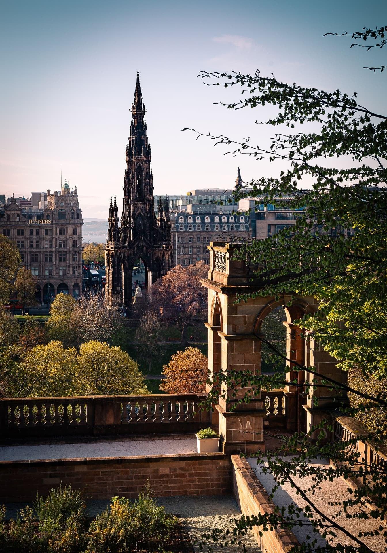
A novelist got a Gothic spire. The Scott Monument, 61 metres of dark sandstone begun in 1840, rises from the open side of Princes Street, which the plan left free of houses.
- 7
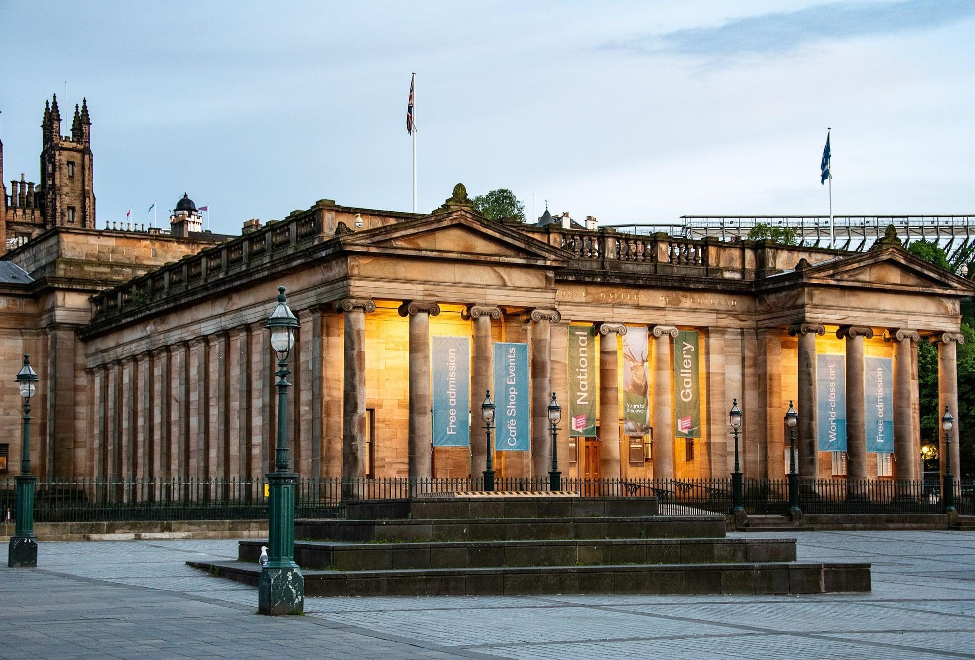
Mound and Galleries: A Road Made of Cellars
This road was built from cellars. The Mound, a causeway of earth dug from the New Town's foundations, climbs past William Playfair's two temple galleries to the Old Town.
- 8
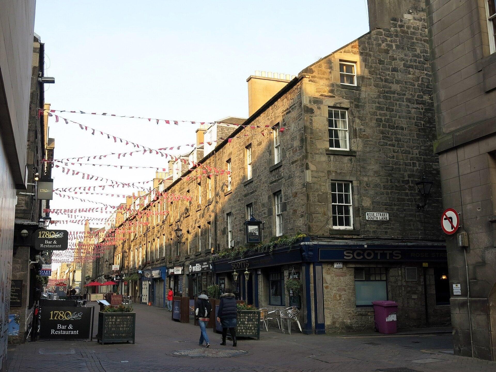
Rose Street: The Plan's Back Lane
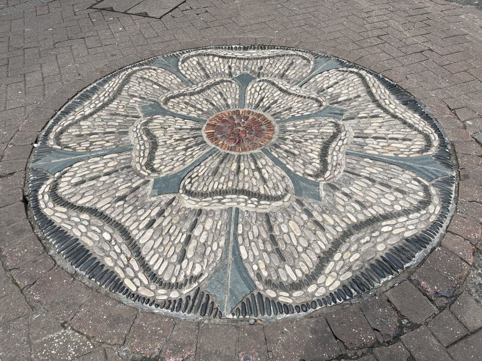
The plan kept a lane for trades. Rose Street, lower and plainer than the grand streets around it, shows James Craig's order of streets in one look, and its names read like a flag.
- 9
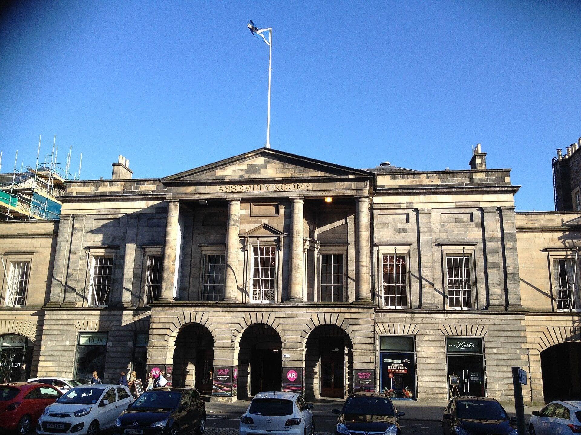
Assembly Rooms: The Main Street's Public Rooms
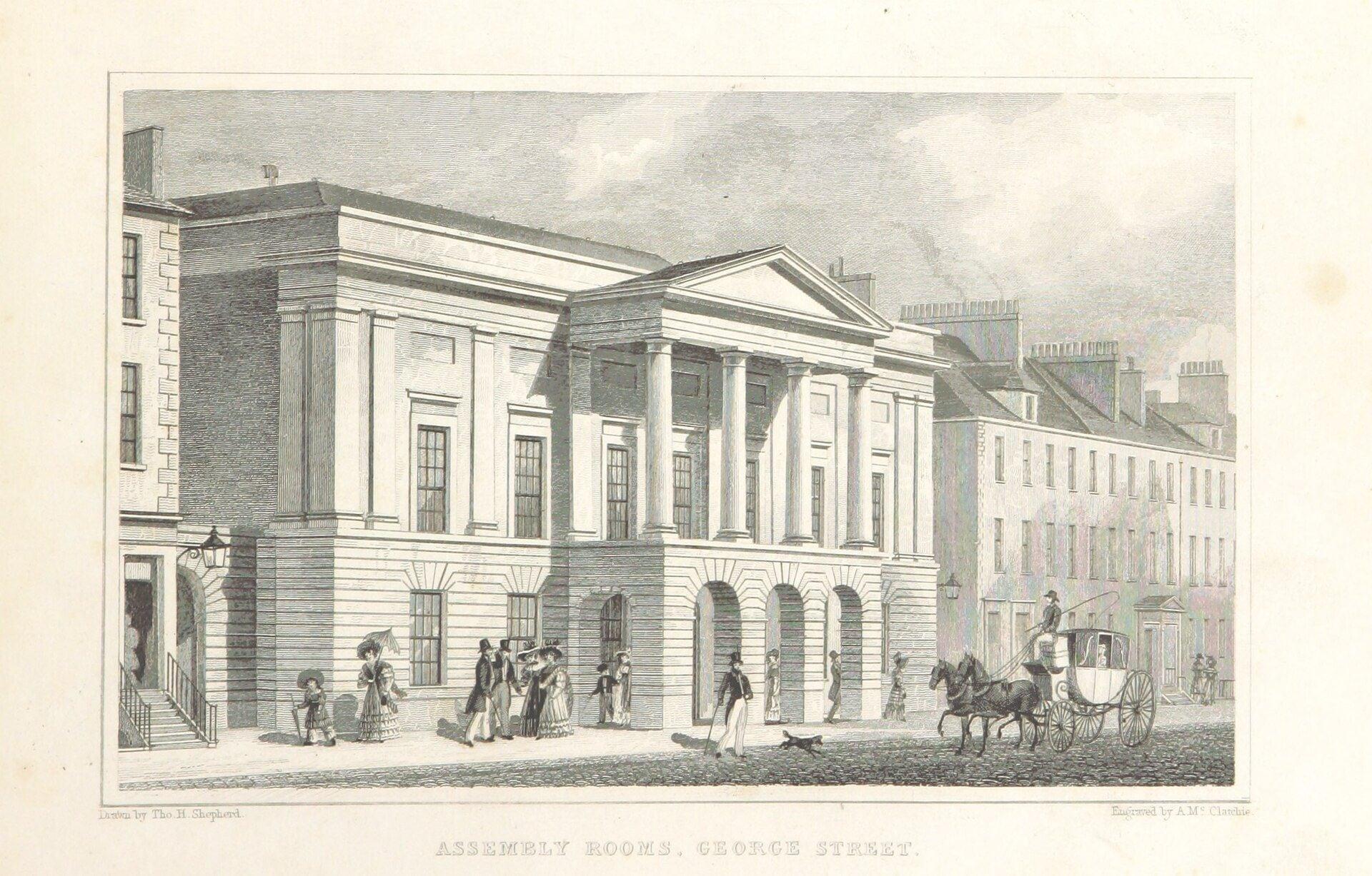
George Street kept its public rooms. The Assembly Rooms of 1784 to 1787, with a pillared porch added in 1817, still serve the purpose they were built for on the plan's widest street.
- 10
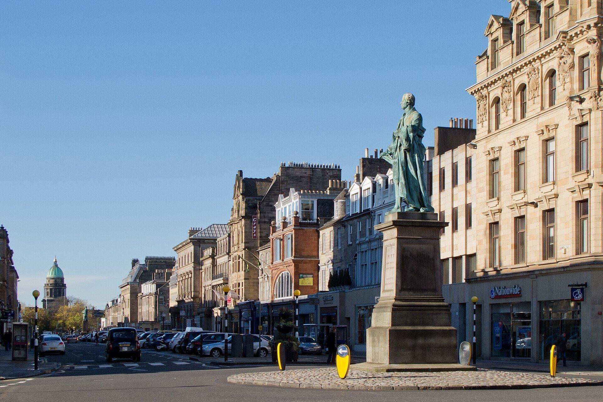
Pitt Statue: A View at Every Crossing
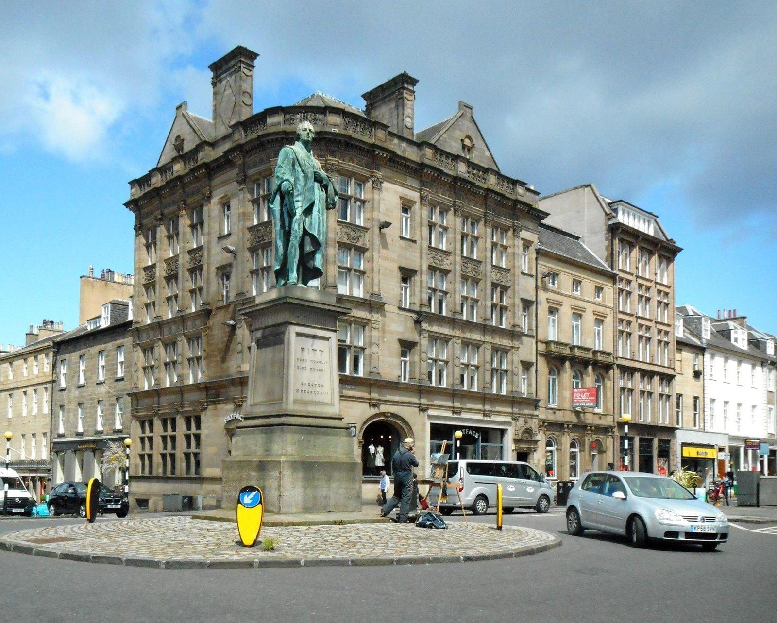
Every cross street frames a view. From the Frederick Street crossing, with William Pitt in bronze, the street drops to the castle rock one way and towards the Forth the other.
- 11
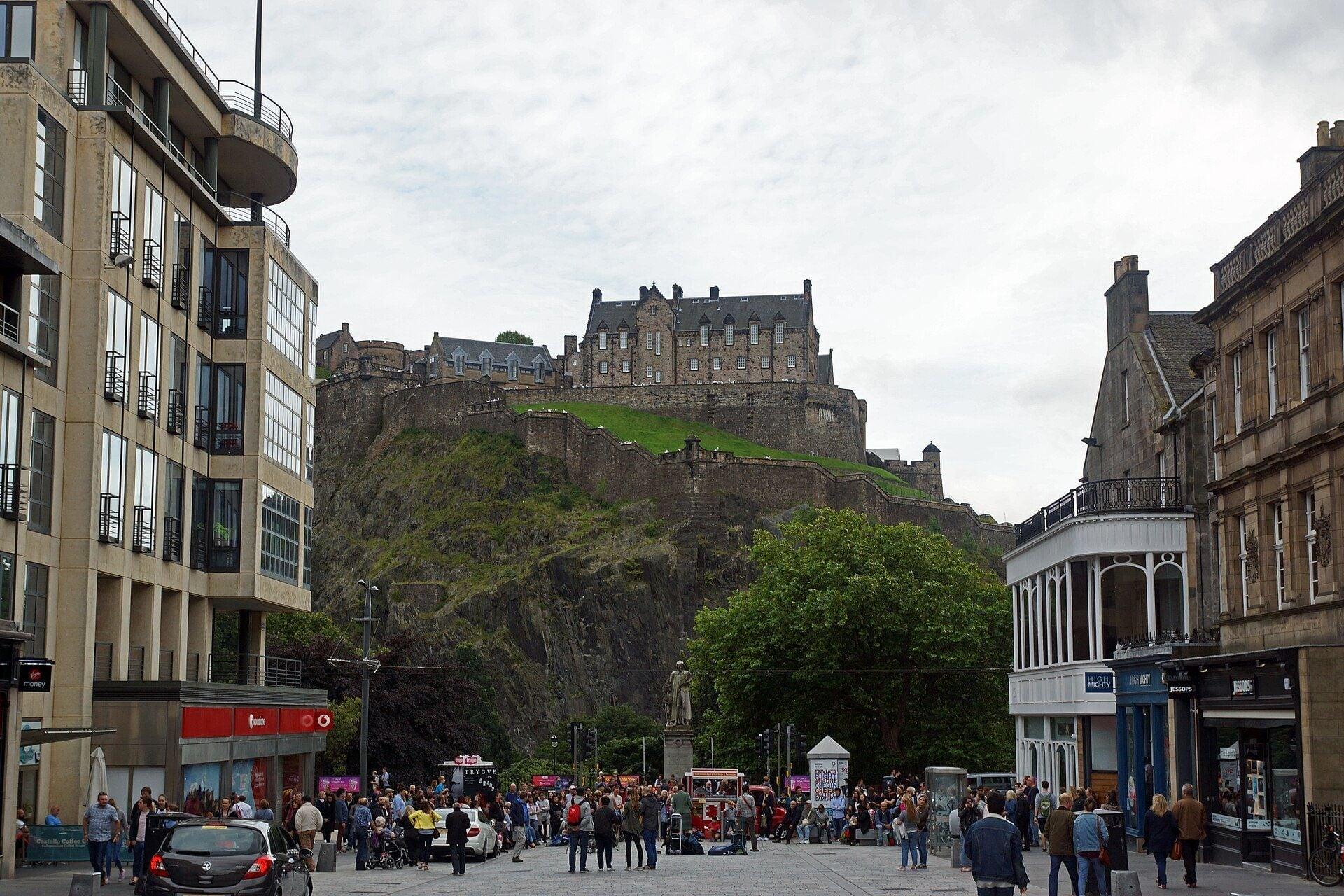
Castle Street: The Castle as Scenery
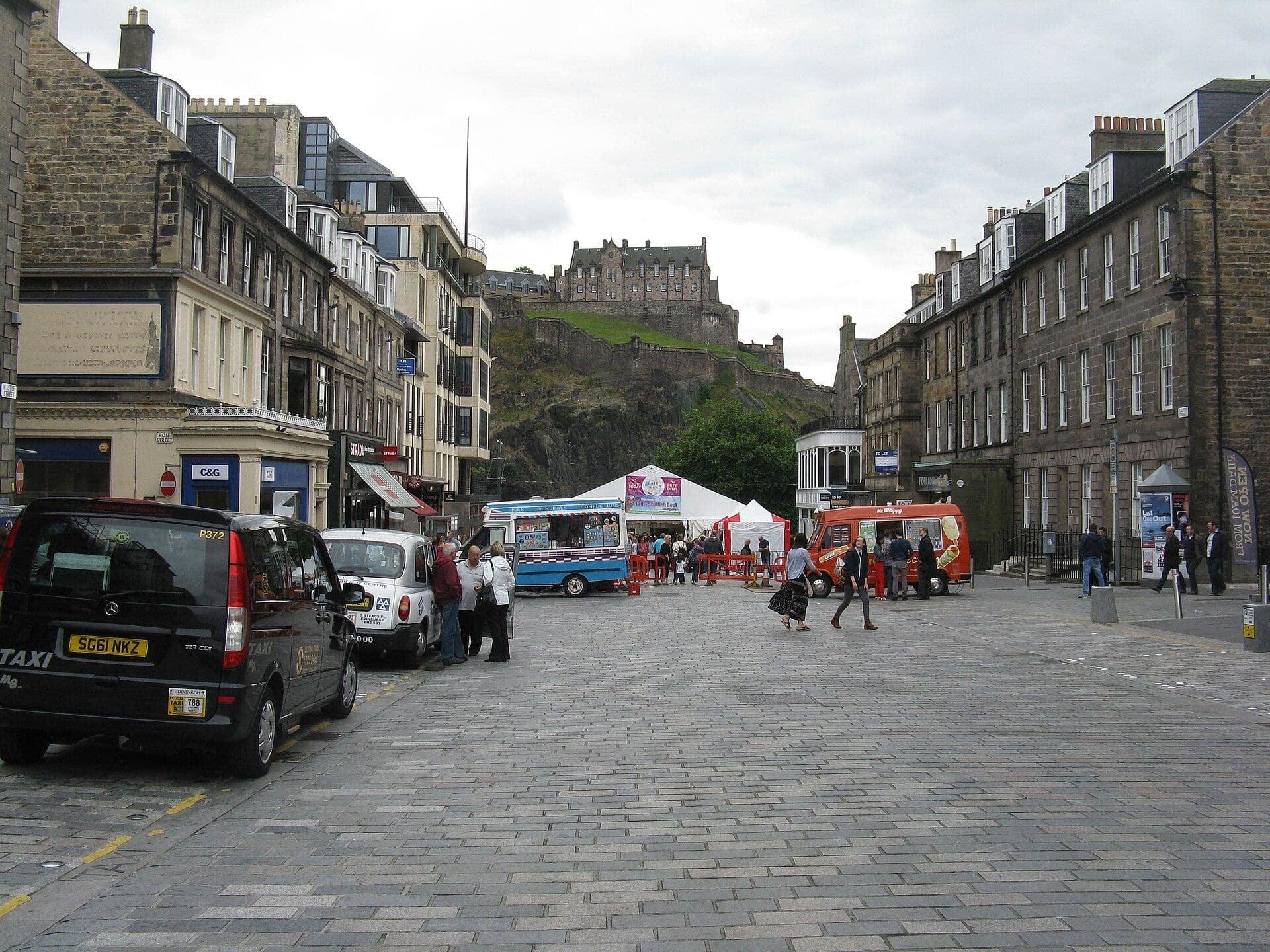
The castle closes this street's view. At the Castle Street crossing, with Thomas Chalmers in bronze, the castle rock fills the end of the street, and the building order runs west.
- 12
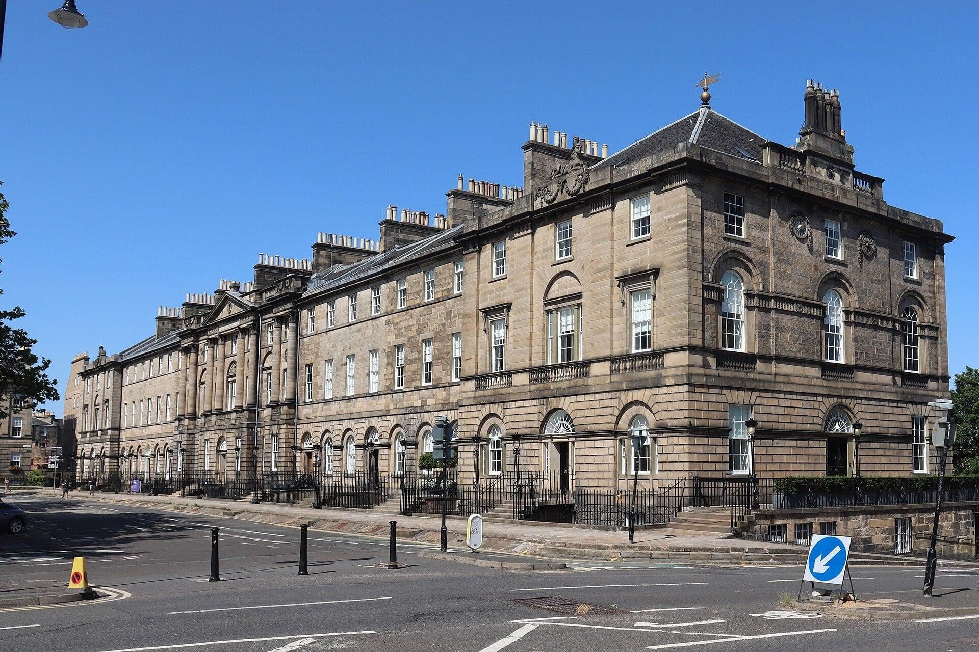
Charlotte Square: Eleven Houses, One Palace
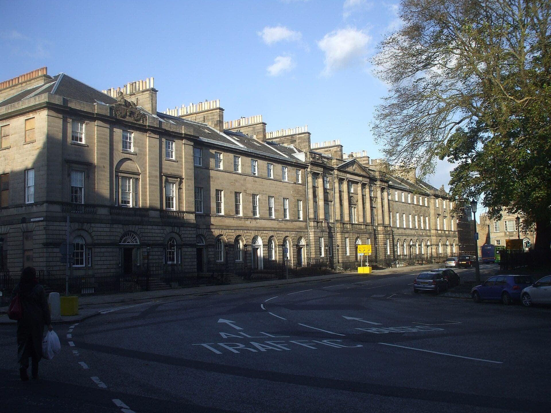
Eleven houses make one palace front. Robert Adam's north side of Charlotte Square, designed in 1791, was drawn in advance as a single front for every builder to follow.
- 13
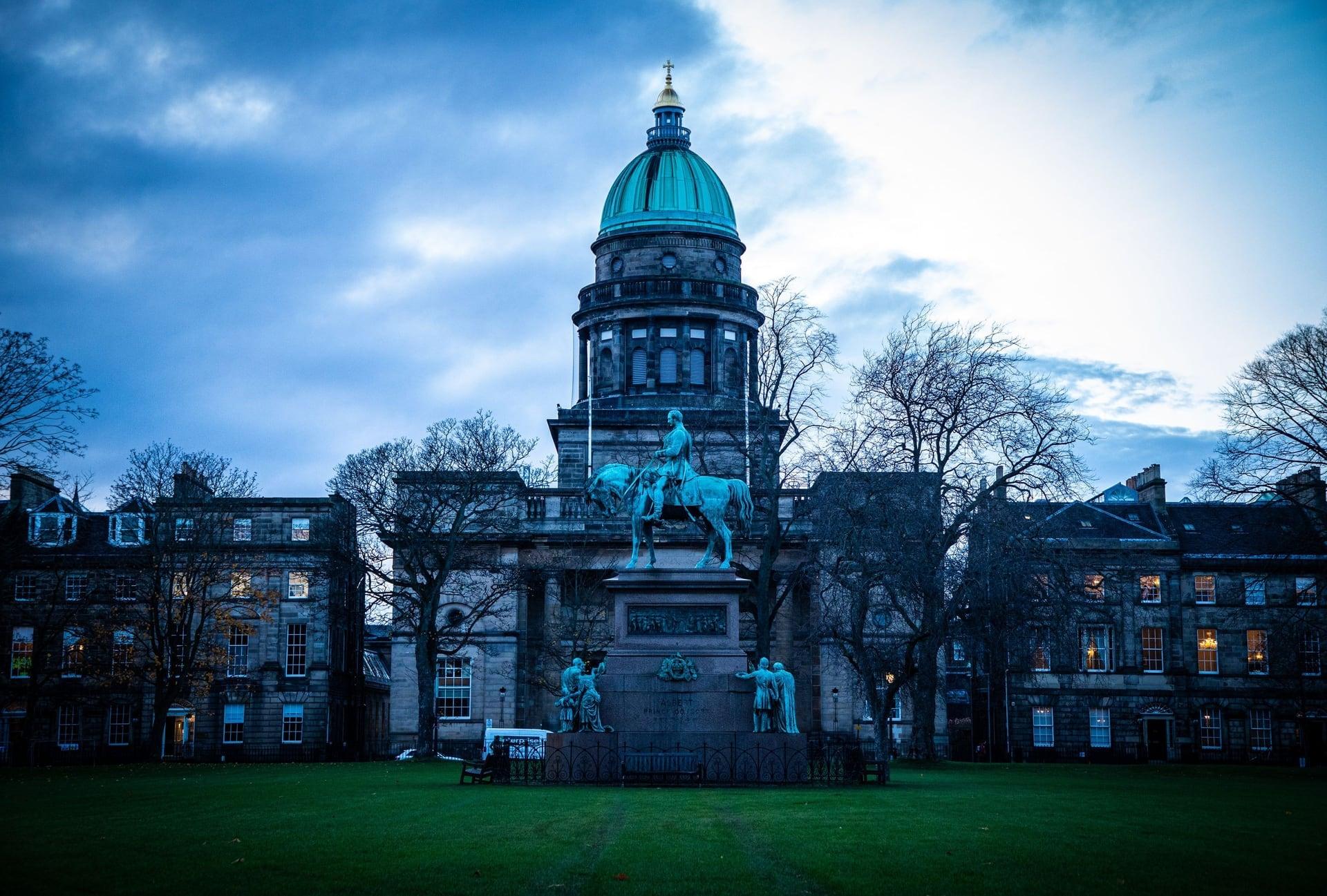
West Register House: The Church That Closed the View
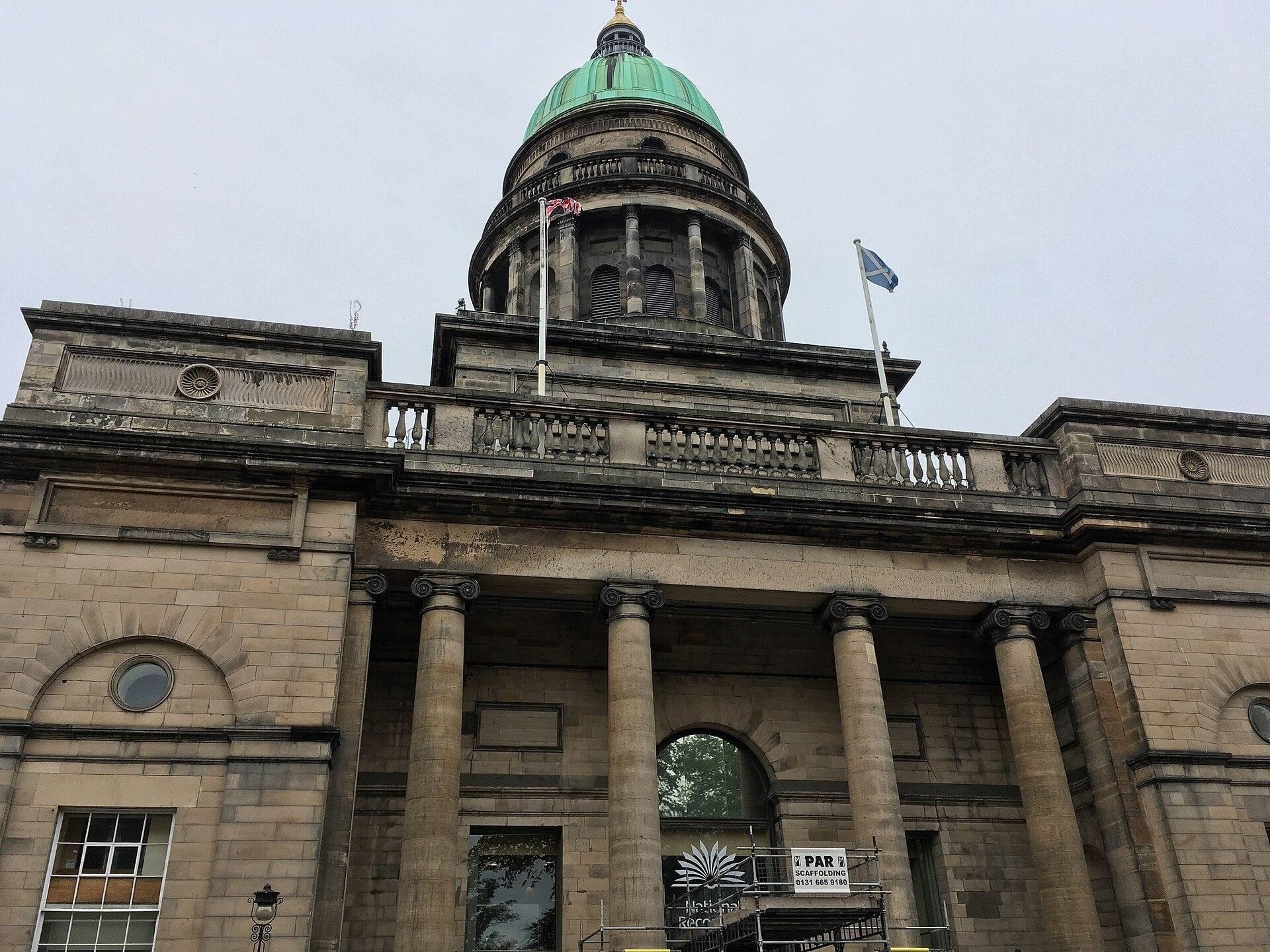
A church dome closes the axis. Robert Reid's St George's Church of 1811 to 1814, now West Register House, ends George Street where the plan meant a church to stand.
Details
Best Time to Visit
In daylight for stop 1: Calton Hill's 37-step stair is unlit. In December the sun rises at about 08:20 to 08:45 and sets at about 15:40 to 15:50 (computed for Edinburgh; 15:44 on 1 December, 15:40 on 21 December), so start by about 14:15 to see the view; after dark, begin at stop 2 on Waterloo Place. December is short, cold and often wet: mean highs about 7 °C, lows about 2 °C (Met Office 1991 to 2020, Royal Botanic Garden station, read from a search snippet), and Calton Hill is exposed to the wind. Edinburgh's Christmas runs from 14 November 2026 to 3 January 2027 (edwinterfest.com): the market in East Princes Street Gardens (about 10:00 to 22:00 most days, closed 25 December) and the funfair in West Princes Street Gardens crowd Princes Street's garden side, and the Polar Ice Bar stands on George Street from 19 November to 2 January. On 30 December the Night Afore Party fills Princes Street Gardens from 18:00; on 31 December the market closes at 17:00 and the ticketed Street Party takes Princes Street from 20:00: walk before about 16:00, or go from stop 5 straight along George Street to stop 9. None of the buildings on the walk needs to be open. Checked 11 November 2026.
Pro Tips
- •Start on Calton Hill, by the small round Dugald Stewart Monument at the top of the steps up from Waterloo Place, about 500 m and 65 steps from Waverley Station.
- •From Waverley Station to stop 1: east along Princes Street and Waterloo Place (past stops 3 and 2), then up Hume Walk's steps and the stair to the Dugald Stewart Monument, about 500 m and 65 steps; the walk comes back down the same way. Checked 11 November 2026 (from the map).
- •Step-free: the road over the summit (Calton Hill Drive) meets Regent Road about 240 m east of the foot of Hume Walk; going from stop 1 to stop 2 that way is about 900 m instead of 145 m. Or skip the hill and start at stop 2. Checked 11 November 2026 (from the map).
- •By tram: the St Andrew Square stop (Edinburgh Trams' stop for Waverley) is about 450 m from stop 1; the Princes Street stop is at the foot of Hanover Street, between stops 7 and 8; the West End stop is a few minutes south of Charlotte Square. Adult fares from 2.40 GBP in the city zone; trams run from every 7 minutes. Checked 11 November 2026.
- •Old Calton Burial Ground (stop 2) is usually open 09:00 to 17:00 (council listings). There is no crossing opposite its gate: cross Waterloo Place at the lights near the Leith Street junction and walk back. Checked 11 November 2026.
- •The Melville Monument's plaque, if in place, is on the north face of the pedestal, inside St Andrew Square Garden, which is open in the daytime (07:00 to 20:00 in OpenStreetMap; listings disagree). Checked 11 November 2026.
- •Scott Monument (stop 6): Culture Edinburgh runs guided tours that climb nearly to the top; times and prices were not printed on its pages, so check cultureedinburgh.com or at the monument. Checked 11 November 2026.
- •The Royal Scottish Academy and the National Gallery (stop 7) are open daily 10:00 to 17:00; the National Gallery is free, and exhibitions in the Academy building may charge. Check nationalgalleries.org on the day. Checked 11 November 2026.
- •The Georgian House, 7 Charlotte Square (stop 12), is closed for exterior and interior conservation work (National Trust for Scotland); when open, adult 15.00 GBP. Check nts.org.uk. Checked 11 November 2026.
- •The Nelson Monument on Calton Hill's summit, seen from stop 1, is open daily 10:00 to 15:30 (cultureedinburgh.com). Checked 11 November 2026.
- •Getting away from Charlotte Square: the West End tram stop on Princes Street is about 300 m south, and buses run along Princes Street; Waverley Station is about 1.3 km east on foot. Checked 11 November 2026 (from the map).
Safety & Precautions
- •Leg 1 to 2 goes down 65 steps (a 37-step stair, then Hume Walk's flights of 18 and 10) with handrails; they are slippery when wet or icy, and the 37-step stair has no lights. After that the walk is level and step-free on flagstone pavements; West Register Street (leg 3 to 4) is paved with setts, slippery when wet.
- •Traffic drives on the left. Crossings: the mouth of the cobbled side street called Calton Hill on leg 1 to 2 (no signals: look right first, and watch for cars turning in from behind); Leith Street at the lights; West Register Street at a marked crossing; St Andrew Square's east road and tram tracks at a marked crossing with no lights (trams are quiet and come from both directions: look both ways along the tracks); the square's south-west corner, the foot of South St David Street and Princes Street with its tram tracks, all at the lights; Princes Street and its tracks again by the Academy, at the lights; Hanover Street at Rose Street, at the lights; Frederick Street and Castle Street on zebras (wait for traffic to stop); and into Charlotte Square at the lights. Lane mouths without signals: Meuse Lane (leg 5 to 6) and service lanes.
- •After dark: Calton Hill's 37-step stair is unlit, so begin at stop 2 and play stop 1 there, or skip it. The rest of the route is on lit city streets. Calton Hill is exposed and windy in winter.
- •Edinburgh's Christmas, 14 November 2026 to 3 January 2027: the garden-side pavement of Princes Street by the Scott Monument and the Mound corner (stops 6 and 7) is the crowded way into the market and funfair. The Polar Ice Bar (19 November to 2 January) stands in a temporary venue outside 115 George Street, near Charlotte Square (north side; edwinterfest.com); the walk keeps to the south pavement (stops 9 to 11). If a structure blocks a corner, listen from the corner across the street. Checked 11 November 2026.
- •Hogmanay 2026: on 30 December the Night Afore Party fills Princes Street Gardens from 18:00, so pass stops 6 and 7 earlier that day; on 31 December the Christmas market closes at 17:00 and the ticketed Street Party takes Princes Street from 20:00, with access restricted before that (2026 closure times not yet published). That day, walk before about 16:00, or from stop 5 go straight along George Street to stop 9, skipping stops 6 to 8. Check edinburghshogmanay.com. Checked 11 November 2026.
- •Princes Street reopened on 29 August 2026 after the July fire at the former Debenhams building; one lane of the eastbound carriageway is still a temporary walkway beside the site (City of Edinburgh Council). That block is west of the walk's stretch of Princes Street. Checked 11 November 2026.
- •Old Calton Burial Ground is a place of rest; Charlotte Square's garden is private, and Bute House (No. 6) is the First Minister's official residence: look from the pavement. Rose Street's pubs are busy and loud at night.
Travel advisory: Exercise Increased Caution (Level 2).
Gallery
Related Reading
Go deeper on what you'll see, hear, and walk through.
Overview
Best Self-Guided Walking Tours in Edinburgh (2026)
4 min
Overview
Edinburgh Travel Guide: How Many Days, Getting Around, Best Time, and Safety (2026)
7 min
Overview
One Day in Edinburgh: A Walkable Morning-to-Evening Itinerary
8 min
Thematic
Best History Walking Tours in Edinburgh (2026)
3 min
Thematic
Two Cities on Two Ridges: How to Read Edinburgh's Old and New Towns
7 min
Companion
Charlotte Square: The Palace Front Where Edinburgh's Grid Resolves
7 min
Deep dive
The Scott Monument: Edinburgh's Gothic Spire for a Storyteller
7 min
Read
What to Eat in Edinburgh: Scottish Dishes and How to Order Like a Local
7 min
Read the walk
The full story of Edinburgh New Town: The Georgian Plan in Stone, in words. Prefer to listen? Play it narrated, from home or on location.
Introduction
Edinburgh's New Town was drawn on paper before a single house went up. In seventeen sixty seven the town council adopted the plan of a young architect, James Craig: one broad street along a ridge, a square at each end, a street on each edge built up on one side only, looking out over gardens, and narrow lanes in between for the trades. This walk reads that plan in the order it was built, from east to west.
There are thirteen stops over about two point one kilometres, about a mile and a quarter, and the walk takes about an hour and twenty minutes. It begins with the view from Calton Hill and sixty five steps down to the street, mostly with handrails. After that it is step free, with one gentle climb from Princes Street up to George Street.
Trams run along Princes Street and beside Saint Andrew Square. They are quiet, so look both ways along the tracks every time you cross.
In December the sun sets at about twenty to four in the afternoon. The steps down from Calton Hill have no lights, so after dark, skip the hill and begin at stop two, on Waterloo Place at its foot. The rest of the route is on lit city streets.
From the fourteenth of November twenty twenty six to the third of January, Edinburgh's Christmas fills the gardens below Princes Street with a market and a funfair. On the thirty first of December, Princes Street becomes a ticketed street party in the evening. That day, finish by about four in the afternoon, or after stop five go straight along George Street to stop nine.
Stop one is beside a small round temple above Waterloo Place. The walk ends on Charlotte Square, at the green dome that closes the far end of George Street. When you arrive at Calton Hill, begin with stop one.
1. Calton Hill: The Plan From Above
This is Calton Hill. Beside you stands a small round temple of columns, the Dugald Stewart Monument. Look out over the city, towards the dark castle rock on the far side of it.
The whole walk is in this view. To the left, the castle and the ridge running down from it carry the Old Town, the medieval city. Below that ridge lies a valley, now gardens and the railway. It once held a loch, the Nor Loch, and draining it began in seventeen fifty nine. And to the right of the valley, on the next ridge, the roofs fall into straight lines and right angles. That is the New Town.
In March seventeen sixty six the town announced a competition to design a new town on that ridge, and a young architect, James Craig, won it. His revised plan was adopted in July seventeen sixty seven. George Street is its broad central street, with a square at each end. The long straight street running away from the foot of this hill, past the hotel's clock tower, becomes Princes Street, the edge nearest the valley. Along it, the dark Gothic spire is the Scott Monument.
This hill came last. A plan of eighteen nineteen kept its top as public open space, and it still is; the temple beside you was designed in eighteen thirty one by the architect of that plan. Turn round, and up on the summit you can see the tall tower of the Nelson Monument, begun in eighteen oh seven, and a row of great columns: the National Monument, a copy of the Parthenon in Athens, begun in the eighteen twenties and never finished.
Follow the route back down the steps to Waterloo Place. At the bottom, turn towards the city, staying on this side of the road. You will cross the mouth of a cobbled side street, also called Calton Hill: look right first, and watch for cars turning in behind you. The next stop is opposite an arched gate in a long stone wall across the road.
2. Old Calton Burial Ground: A Street Through the Graves
Walk on along the pavement until you are opposite the arched gate in the long wall across the road, and stop there.
This street, Waterloo Place, was built as a front door. In eighteen fifteen the town began a bridge across the narrow Calton valley here, with an engineer and an architect in charge, and a single developer then built every property along the street. That is why the fronts match: in the city council's words, a grand entrance to the city, consistently executed. Just ahead, the street crosses the valley on that bridge, though from the pavement it looks like any other street.
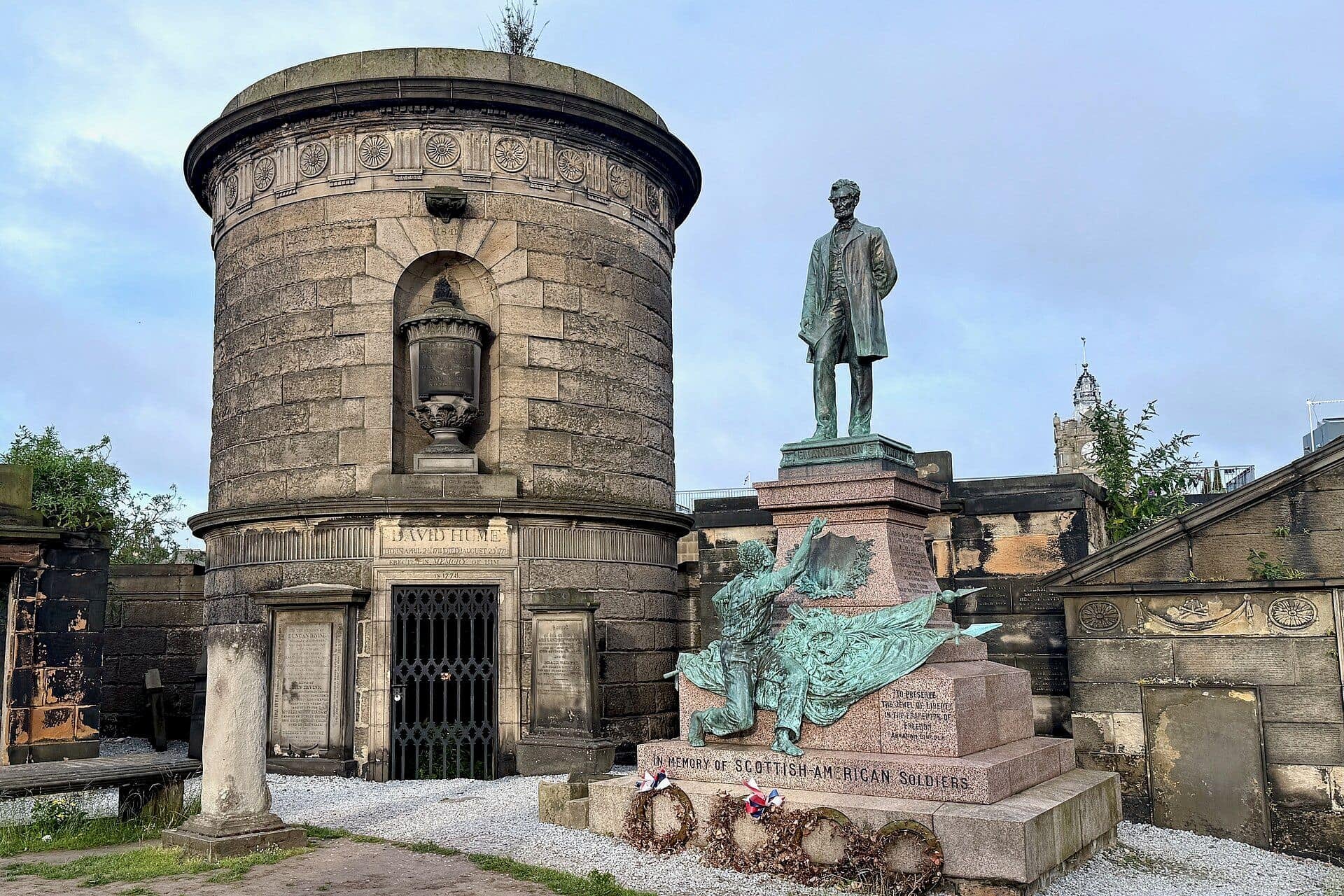
To make the road, the builders went straight through an old burial ground. Calton Old Burial Ground was established in seventeen eighteen, and the new street cut it in two. The long wall across the road, with its row of niches and its round arched gate, is the architect's screen of eighteen fifteen, one of a pair walling off the graves on both sides of the street.
Over the wall rises a tall stone obelisk. It was built in eighteen forty four and dedicated to the Political Martyrs of seventeen ninety three: men charged with sedition and transported to Australia for demanding political and parliamentary reform. That is the name of its dedication, as Historic Environment Scotland records it.
Also behind the wall stands a low round stone tower, designed by Robert Adam in seventeen seventy seven. It is the tomb of David Hume, whose name and dates are cut on its plaque, and the plaque says it was erected in his memory in seventeen seventy eight. If you can see its top over the wall, that is it. You will meet Adam's work twice more on this walk.
The burial ground is a place of rest, open in the daytime. There is no crossing opposite the gate, so stay on this side.
Follow the route on along this side of the street to the junction with Leith Street, and cross it at the lights. The next stop is a long building with a dome and a bronze rider on horseback.
3. Register House: A Record Office as Bait
Once across, walk on to the front of the long building with the dome, a bronze rider on horseback on its forecourt, and stop there.
This is Register House. Historic Environment Scotland calls it the first purpose built record office in Britain, and it is still used as one, by the National Records of Scotland.
Look across the road. The bridge running away over the valley is North Bridge, the road to the Old Town. The New Town only made sense once people could cross that valley, and the competition for its plan was announced while a bridge across it was being built.
Even then, building houses in fields beyond a valley needed a push. In seventeen sixty nine the city gave this site for a record office, in Historic Environment Scotland's words, to encourage the development of the New Town.
The architect was Robert Adam, and he had his design ready by seventeen seventy one. The foundation stone was laid in June seventeen seventy four, and even this front part took ten years. The back was postponed, and another architect finished it between eighteen twenty two and eighteen thirty four. So one building took about sixty years.
Read its front. A long, even facade; a centre with columns and the royal arms in its pediment; a small tower at each front corner, one with a clock and the other with a wind vane, both added in seventeen ninety; and behind it all, the dome over a round reading room. The building belongs to the Crown.
The rider is the Duke of Wellington. In eighteen forty nine the low wall in front of the building was pushed back to make room for him.
Follow the route along the front of the building and up the narrow street beside it, West Register Street, to the square at the top, crossing its end at the crossing there. It is paved with setts, old stone blocks that are slippery when wet. The next stop is a big villa set back behind railings, facing across the square.
4. Dundas House: The Church That Never Came
Walk on along the pavement to the railings in front of the big villa with the pediment, set back behind its forecourt, and stop there.
This is Saint Andrew Square, the first of the plan's two squares, and the corner where the New Town began. From about seventeen seventy, houses went up on this square's north and east sides, and at the east end of the streets beyond.
The plan meant this end of George Street to close on a church. Historic Environment Scotland records that this forecourt was the intended site of Saint Andrew's Church. Instead the site went to a rich politician who already owned the land and gardens behind it, and he built this villa in seventeen seventy one. The house still carries his family name, Dundas, though he is not the man on the column you will see next. Historic Environment Scotland says the site was supposedly snatched from under the eyes of the town council, but adds that the same man had pushed through the House of Commons the bill that let Edinburgh extend its bounds and build the New Town, and that this may have been his reward. The plan bent on day one.
So the church went round the corner, onto the first block of George Street, where it was completed in seventeen eighty four. It is still there, though this walk does not pass it.
The villa changed hands. In seventeen ninety four the Excise Office took it, and added the gilded royal arms in its pediment. In eighteen twenty five it became the Royal Bank's, and it is a working bank today, its great banking hall behind under a dome of glazed stars. The railings and lamps in front of you date from eighteen twenty seven.
Follow the route across the square's road and the tram tracks to the garden. There are no lights at this crossing. Trams are quiet and can come from either direction: look both ways along the tracks, and cross only at the marked crossing. The next stop is beside the garden, with the column in view.
5. Melville Monument: A Column and a Contested Name
Walk on along the garden railings until the tall column in the garden is level with you, and stop there. This is the Melville Monument. The fluted column is over a hundred and fifty feet tall, and on top stands a statue of Henry Dundas, the first Viscount Melville, a…
Full narration for this stop unlocks with the tour.
6. Scott Monument: A Gothic Spire on the Open Side
Walk on down the street, across the mouth of the little lane, watching for vans, and stop just short of Princes Street, with the dark Gothic spire straight ahead across the road. That spire is the Scott Monument, and it stands on the open side of Princes Street. Look at the…
Full narration for this stop unlocks with the tour.
7. Mound and Galleries: A Road Made of Cellars
Walk on along the pavement beside the gardens to the corner where the road climbs away up the hill, with the temple fronted gallery ahead, and stop there. The road climbing to the Old Town is the Mound, and the New Town built it out of its own basements. A writer describing the…
Full narration for this stop unlocks with the tour.
8. Rose Street: The Plan's Back Lane
Walk on up the street to the first lane opening on the right, and stop at its mouth. This lane is Rose Street, and it shows the plan's order of streets in one look. The city's appraisal of the New Town gives the plan's own figures: the central street, George Street, a hundred…
Full narration for this stop unlocks with the tour.
9. Assembly Rooms: The Main Street's Public Rooms
Walk on along George Street to the building with the pillared porch over three arches, and stop there. You are on George Street, the spine of the plan, and you can feel its width. It was drawn a hundred feet wide, the widest street in the plan, running between the two squares,…
Full narration for this stop unlocks with the tour.
10. Pitt Statue: A View at Every Crossing
Walk on to the corner of the next cross street, Frederick Street, and stop before you cross it. In the middle of the crossing stands William Pitt, the prime minister, in bronze, by the same sculptor, put up in eighteen thirty three. Now look down Frederick Street, the downhill…
Full narration for this stop unlocks with the tour.
11. Castle Street: The Castle as Scenery
Walk on to the corner of the next cross street, Castle Street, and stop before you cross it. Look down Castle Street. Of all the framed views on George Street, this is the one the name promises: the castle rock, with the walls on top, closing the end of the street. The grid…
Full narration for this stop unlocks with the tour.
12. Charlotte Square: Eleven Houses, One Palace
Once across, walk on along the garden railings until the long palace front across the road is beside you, its centre marked by columns and a pediment, and stop there. This is Charlotte Square, the plan's second square. Look across the road at the north side. It reads as one…
Full narration for this stop unlocks with the tour.
13. West Register House: The Church That Closed the View
Walk on round the railings, past the corner, and stop facing the green dome across the road. This is where the plan closes, and at this end the church got built. The dome belongs to the old Saint George's Church, built from eighteen eleven to eighteen fourteen by the architect…
Full narration for this stop unlocks with the tour.
- One of several interesting and attractive historical cemeteries in the Scottish capital. — Ralf Steinberger from Milan, Berlin + Munich, Italy + Germany, CC BY 2.0 · source
- This is a photo of listed building number — Zeete, CC BY-SA 4.0 · source
- This is a photo of listed building number — Tom Parnell, CC BY-SA 4.0 · source
- This is a photo of listed building number — Carlos Delgado, CC BY-SA 3.0 · source
- This is a photo of listed building number — Enric, CC BY-SA 4.0 · source
- A Rose in Rose Street Edinburgh — Jennifer Petrie, CC BY-SA 2.0 · source
- The Assembly Rooms, 54 George Street, Edinburgh — SylviaStanley, CC BY-SA 4.0 · source
- This is a photo of listed building number — Carlos Delgado, CC BY-SA 3.0 · source
- Junction of George Street and Frederick Street, Edinburgh — Richard Sutcliffe, CC BY-SA 2.0 · source
- 2017-08-26 09-09 Schottland 131 Edinburgh, Castle Street — Allie_Caulfield, CC BY 2.0 · source
- Castle Street, looking south — M J Richardson, CC BY-SA 2.0 · source
- Photograph of numbers 1 to 11 on the north side of Charlotte Square, Edinburgh. №6 is Bute House, the official residence of the First Minist — Mike Shaw, CC BY-SA 4.0 · source
- North side of Charlotte Square, Edinburgh — John Lord, CC BY-SA 2.0 · source
- This is a photo of listed building number — Marcok, CC BY-SA 4.0 · source
Images may be cropped or resized. Other photos via Unsplash and Pexels.