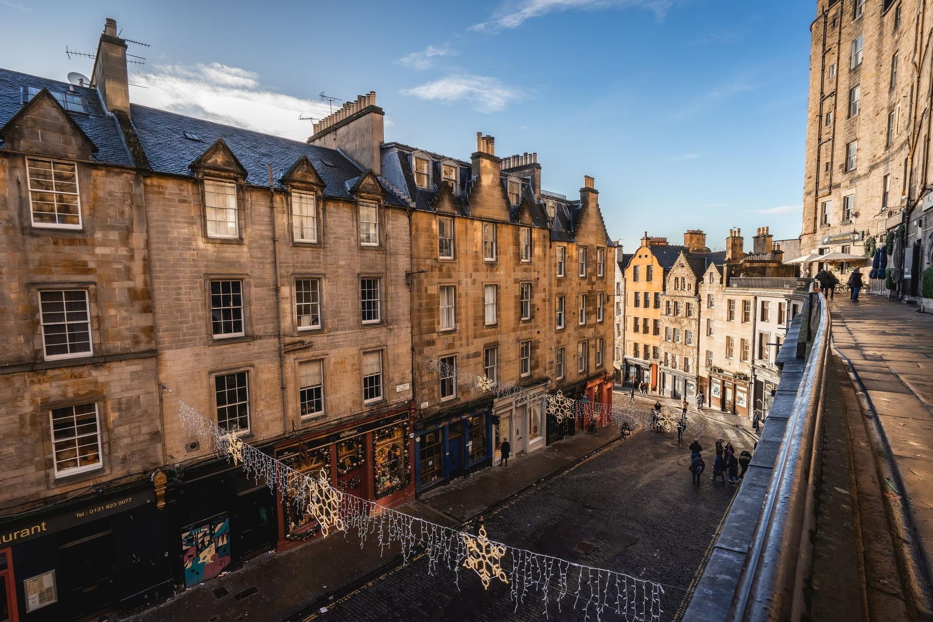
The town walled and bridged this hollow. Thirteen stops from Greyfriars Kirkyard and Greyfriars Bobby past George Heriot's School and the town walls, down the Vennel to the Grassmarket's gallows ground, and along the Cowgate under the bridges to South Bridge.
Start · Greyfriars Kirk: Where the Covenant Was Signed
DirectionsStops
- 1
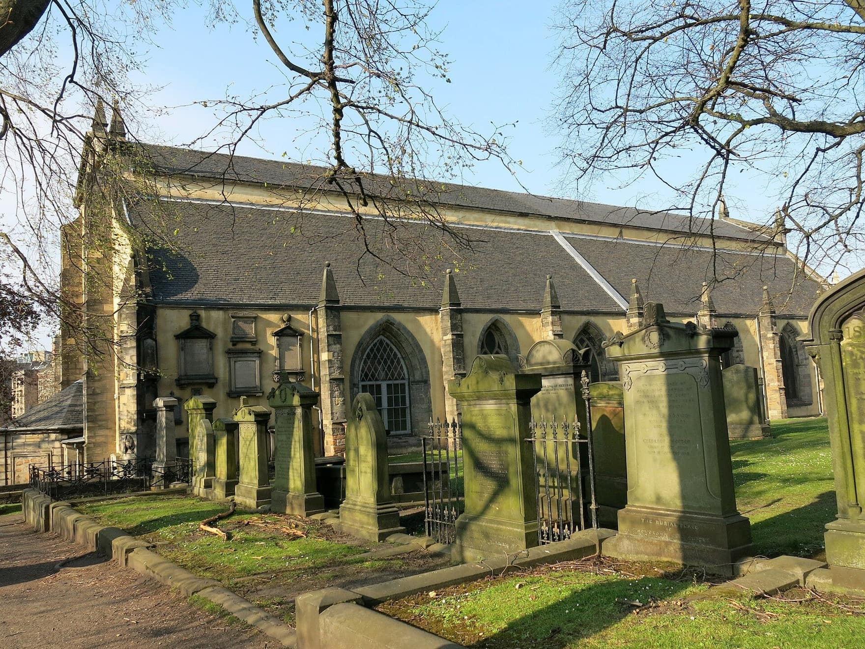
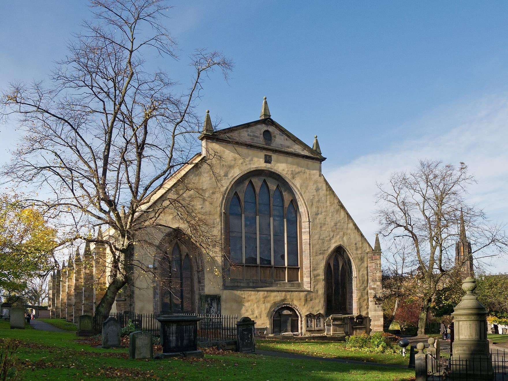
Greyfriars Kirk: Where the Covenant Was Signed
The Covenant was signed in this church. Greyfriars Kirk, opened in 1620 on the old friars' ground as the first church built in Edinburgh after the Reformation, seen from its kirkyard path.
- 2
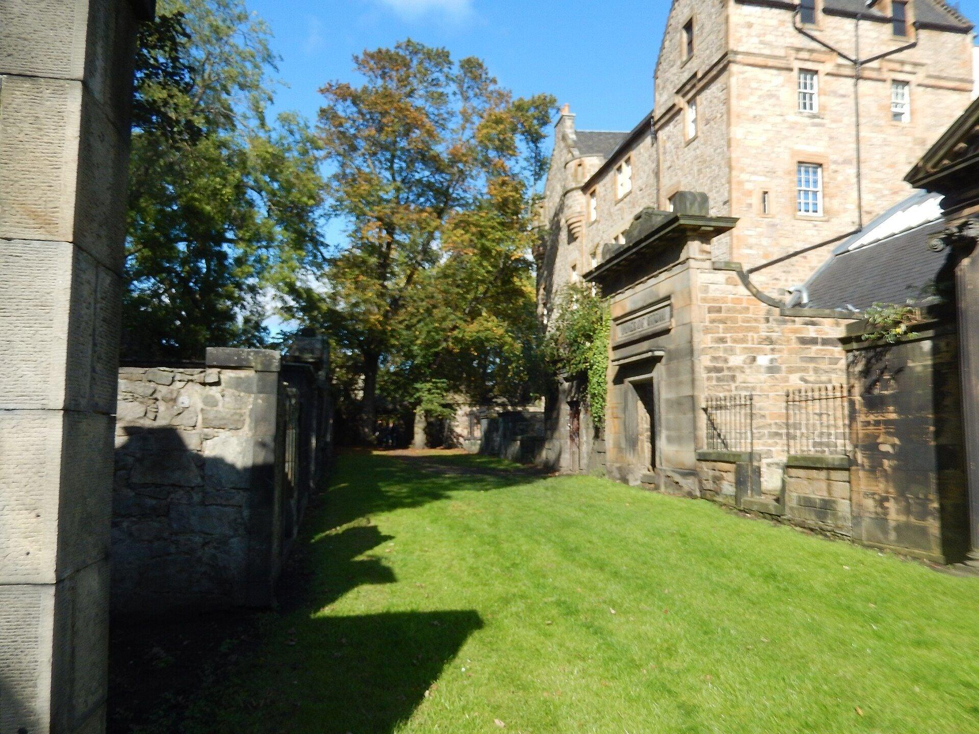
Covenanters' Prison: A Thousand Men in the Open
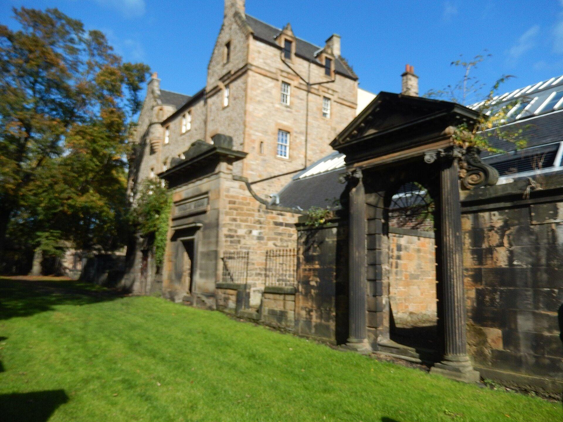
Prisoners were held on this ground. The locked gates of the Covenanters' Prison, where over a thousand men taken after Bothwell Brig in 1679 were held without shelter for more than four months.
- 3
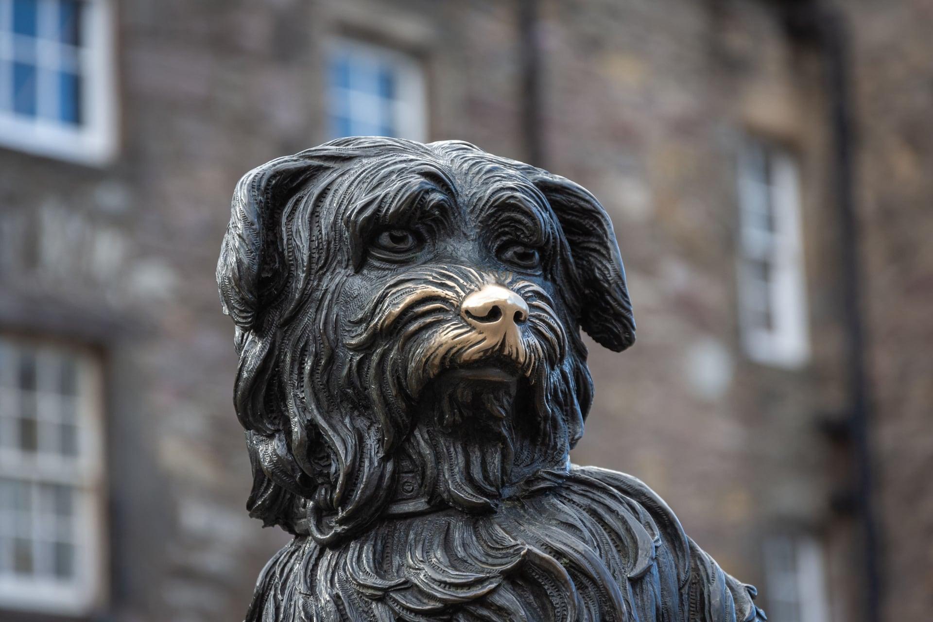
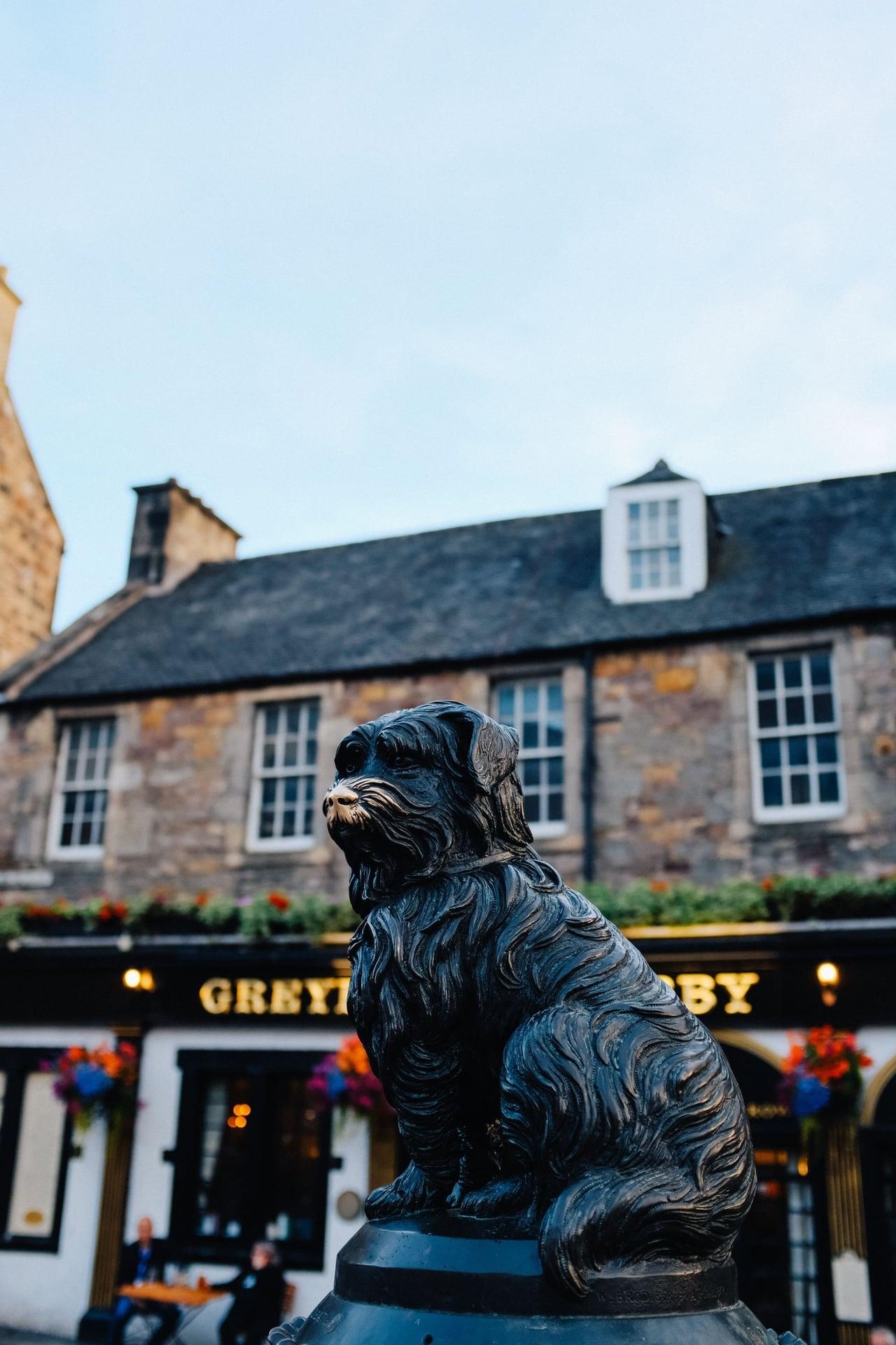
Greyfriars Bobby: The Record and the Legend
A small dog became a city's story. The 1873 bronze of Greyfriars Bobby on its granite fountain, and what the surviving records say about the dog and his famous vigil.
- 4
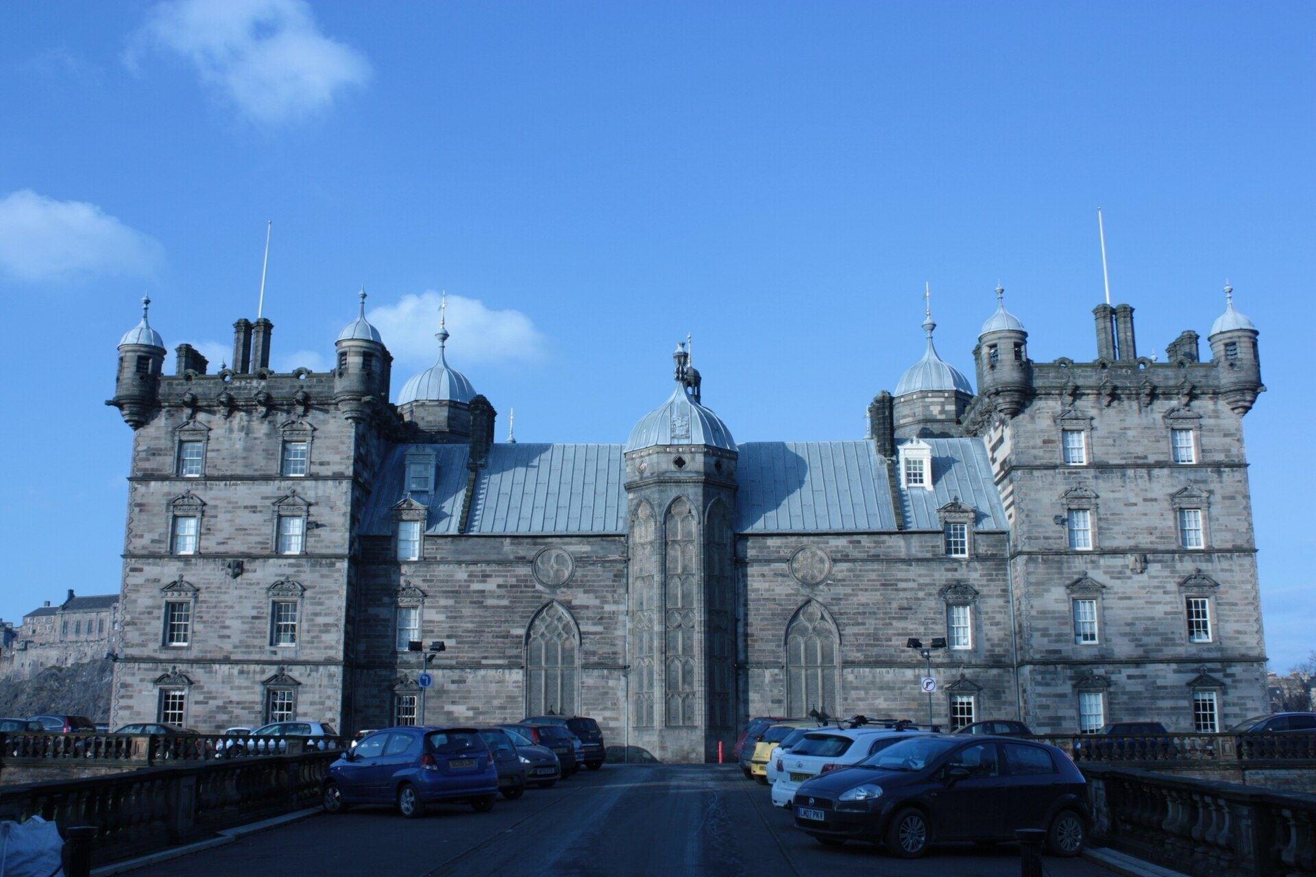
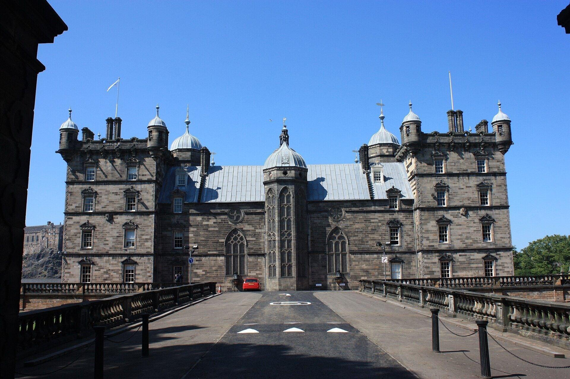
George Heriot's School: A Palace for Poor Bairns
A goldsmith's fortune built this school. George Heriot's, begun in 1628 for poor fatherless children, seen across its field from Lauriston Place, a road that follows a town wall.
- 5
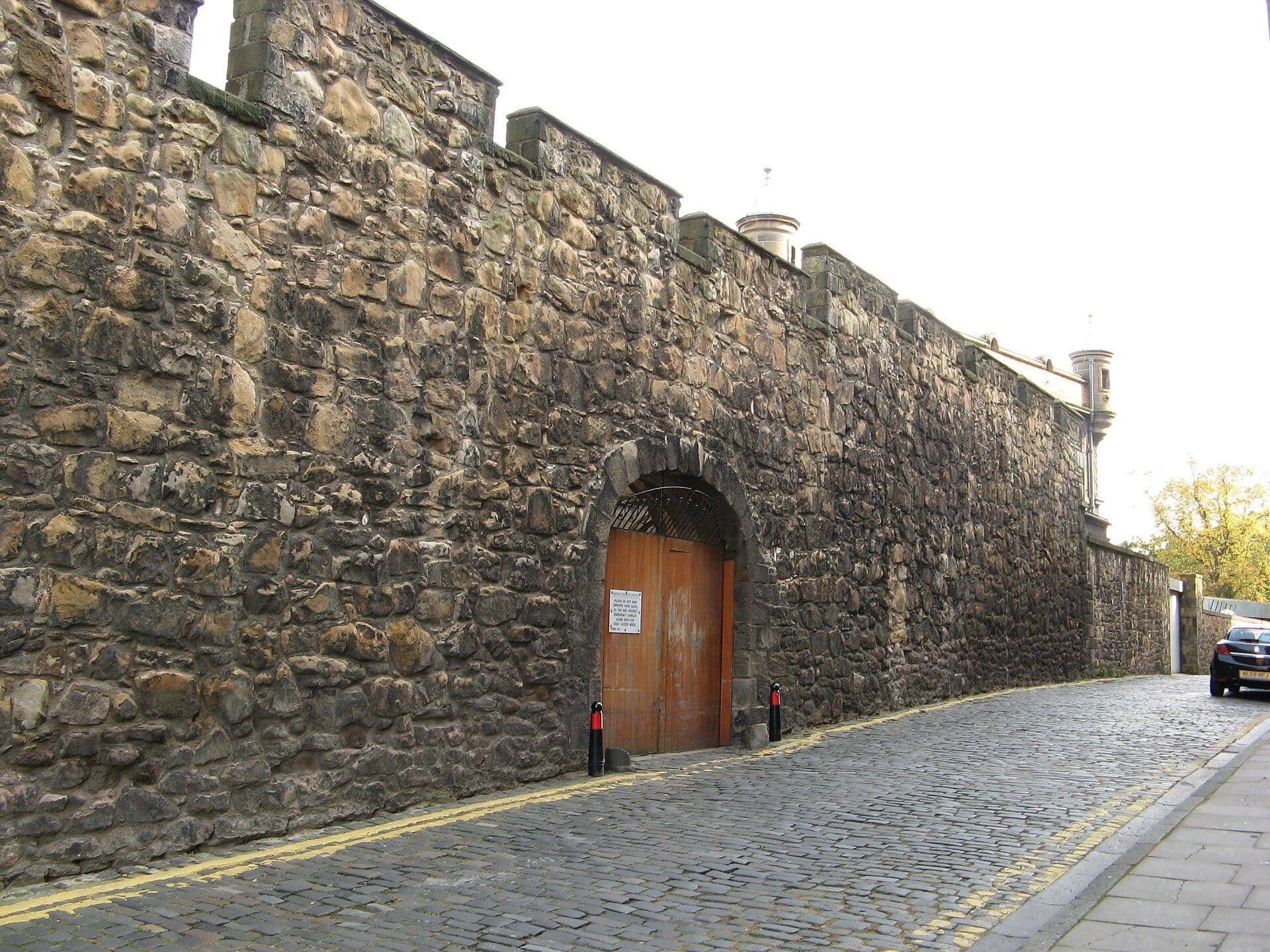
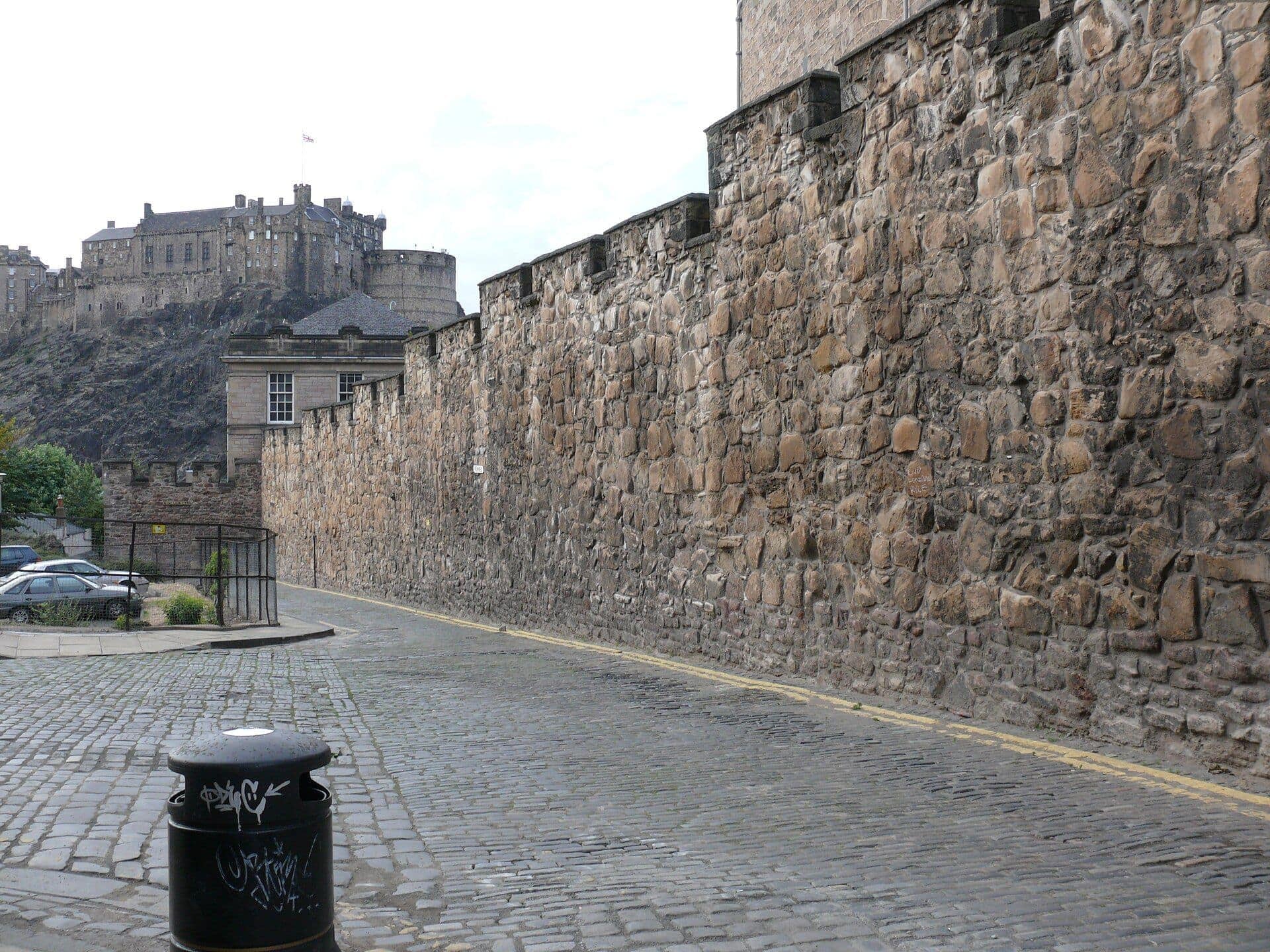
Telfer Wall: The Town's Second Wall
The town walled itself in again here. A stretch of the Telfer Wall, built 1628 to 1636 to take in new ground for Heriot's, along the narrow sett lane of Heriot Place.
- 6
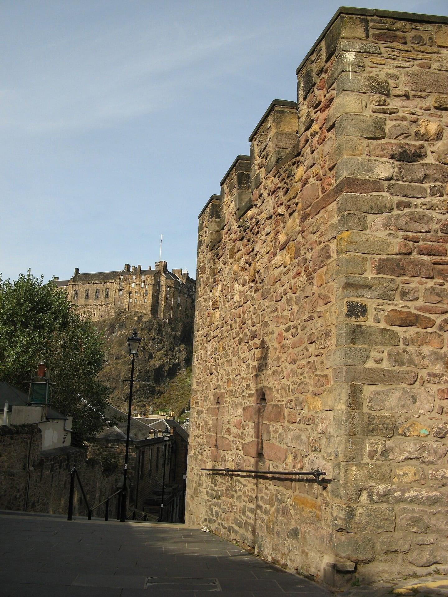
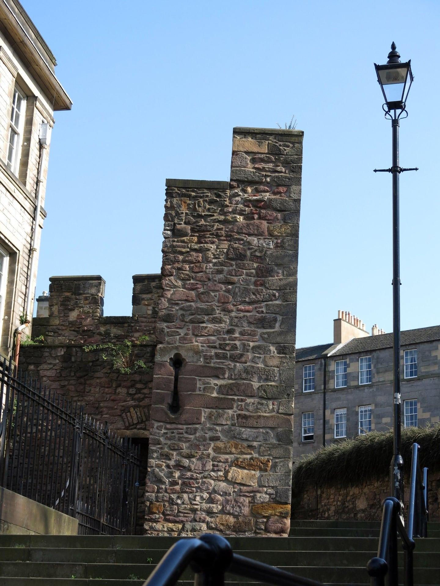
Flodden Wall Tower: Walled In After a Defeat
A town wall's lone tower stands here. The Flodden Wall's south west tower at the head of the Vennel, begun after the defeat of 1513, with the castle rising beyond the steps.
- 7
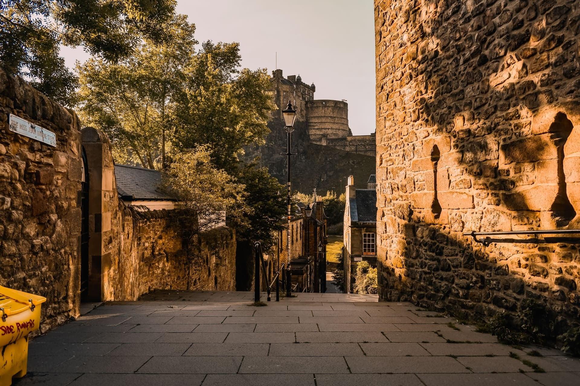
West Port and the Vennel: The Town Gate
The town's west gate stood here. The foot of the Vennel steps, where the West Port gate stood until the 1780s, on the street that gave its name to the West Port murders of 1828.
- 8
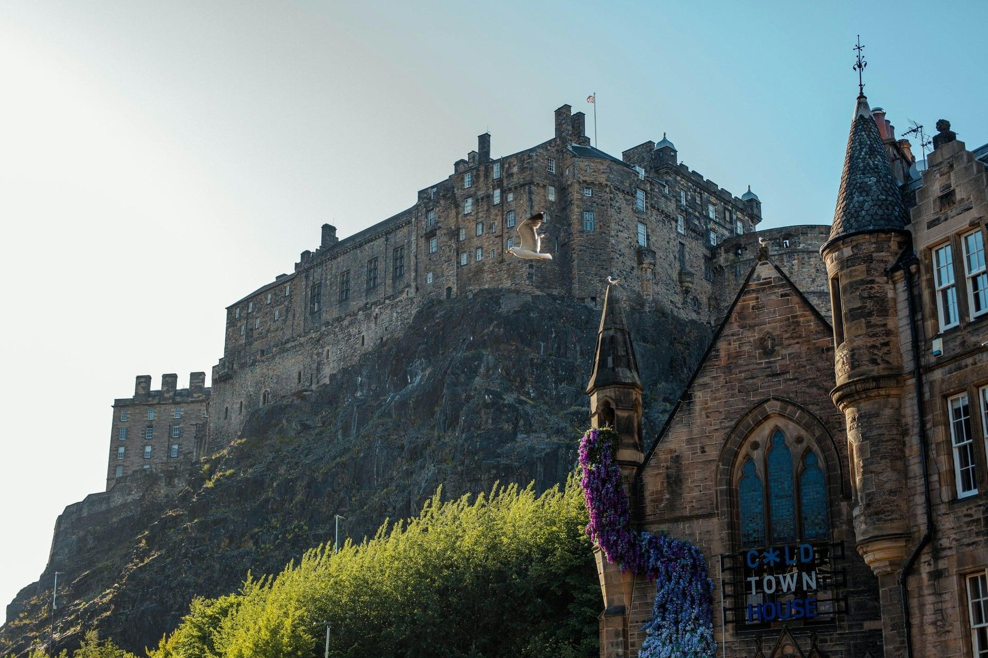
Grassmarket: The Market Under the Rock
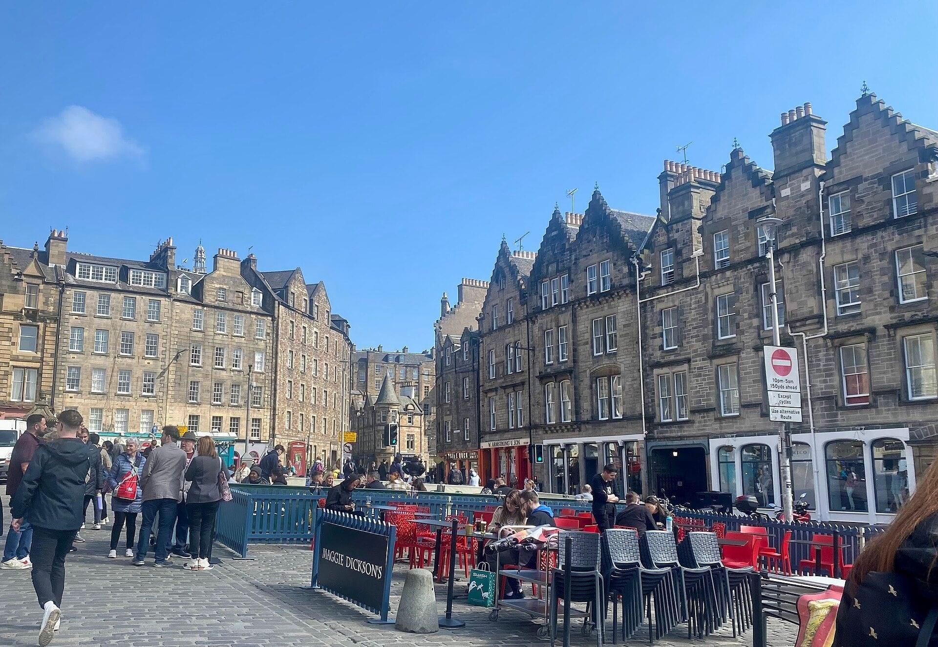
Carts and stalls once filled this hollow. The Grassmarket's long open square under the castle's south cliff, a market by 1500, walled in after Flodden and selling farm produce into the 1900s.
- 9
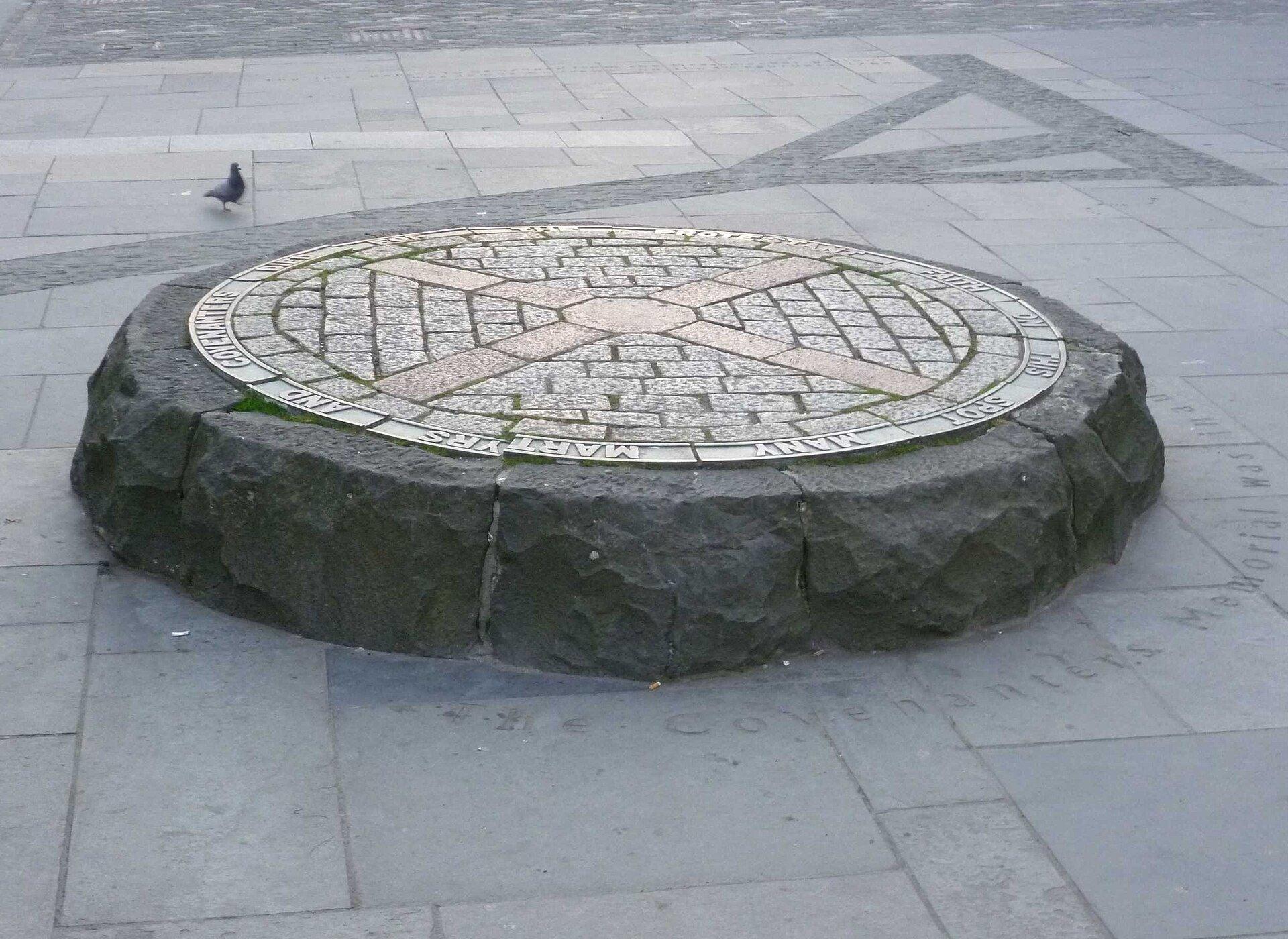
Covenanters' Memorial: The Gallows Ground
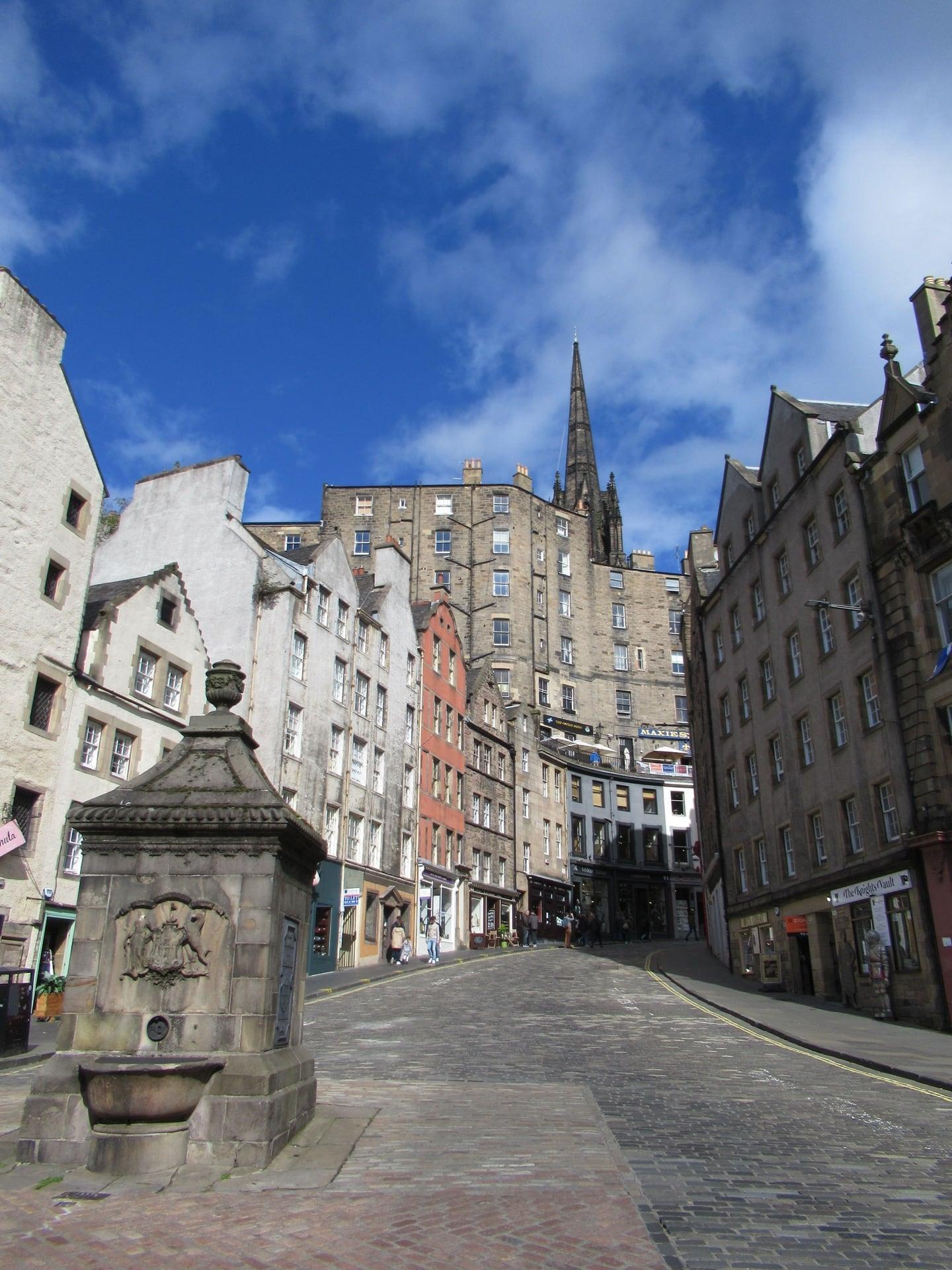
The town's gallows stood on this spot. The 1937 Covenanters' Memorial in the Grassmarket's paving, with the West Bow and Victoria Street climbing away from the market place.
- 10
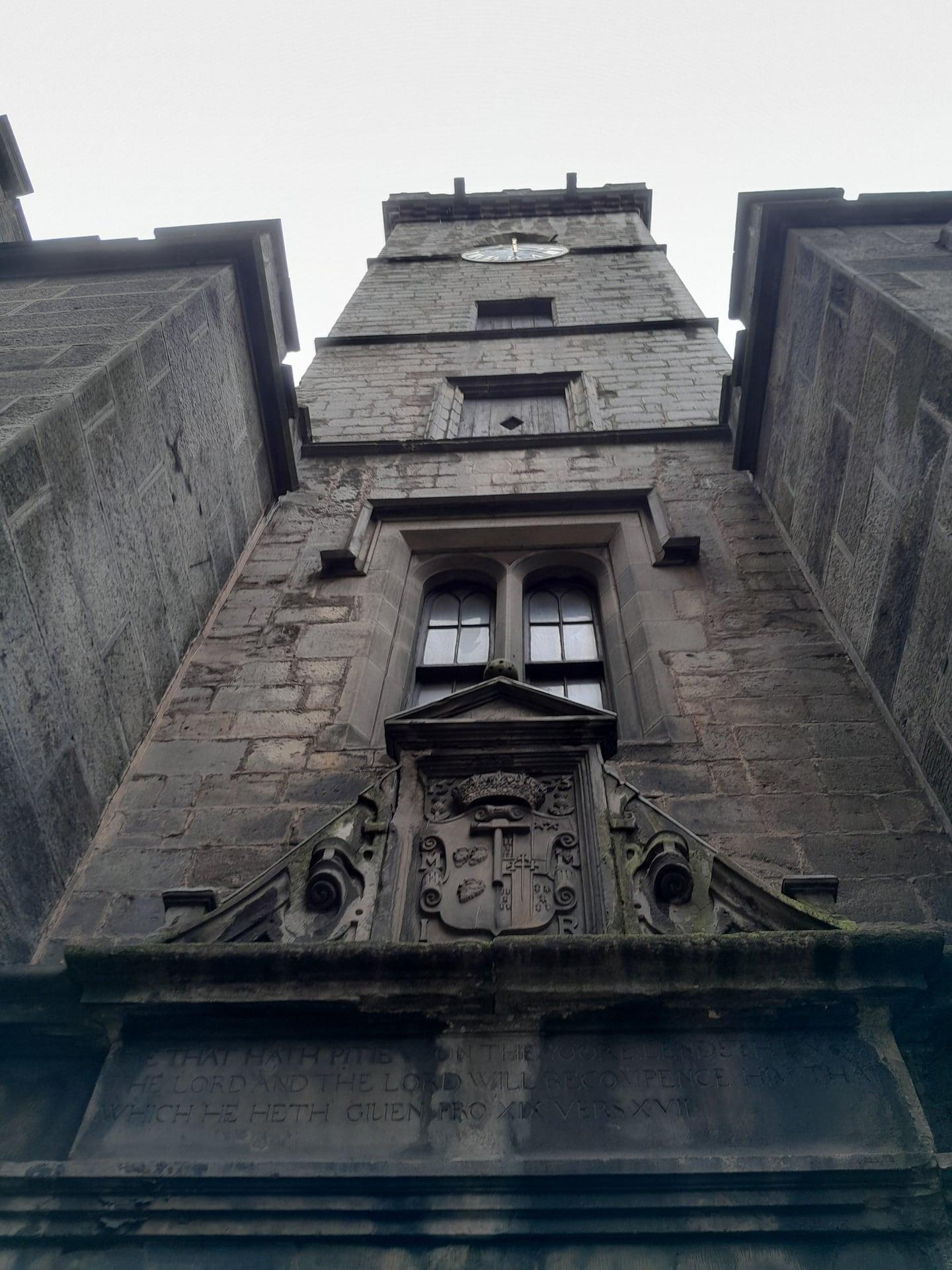
Magdalen Chapel: The Hammermen's Almshouse
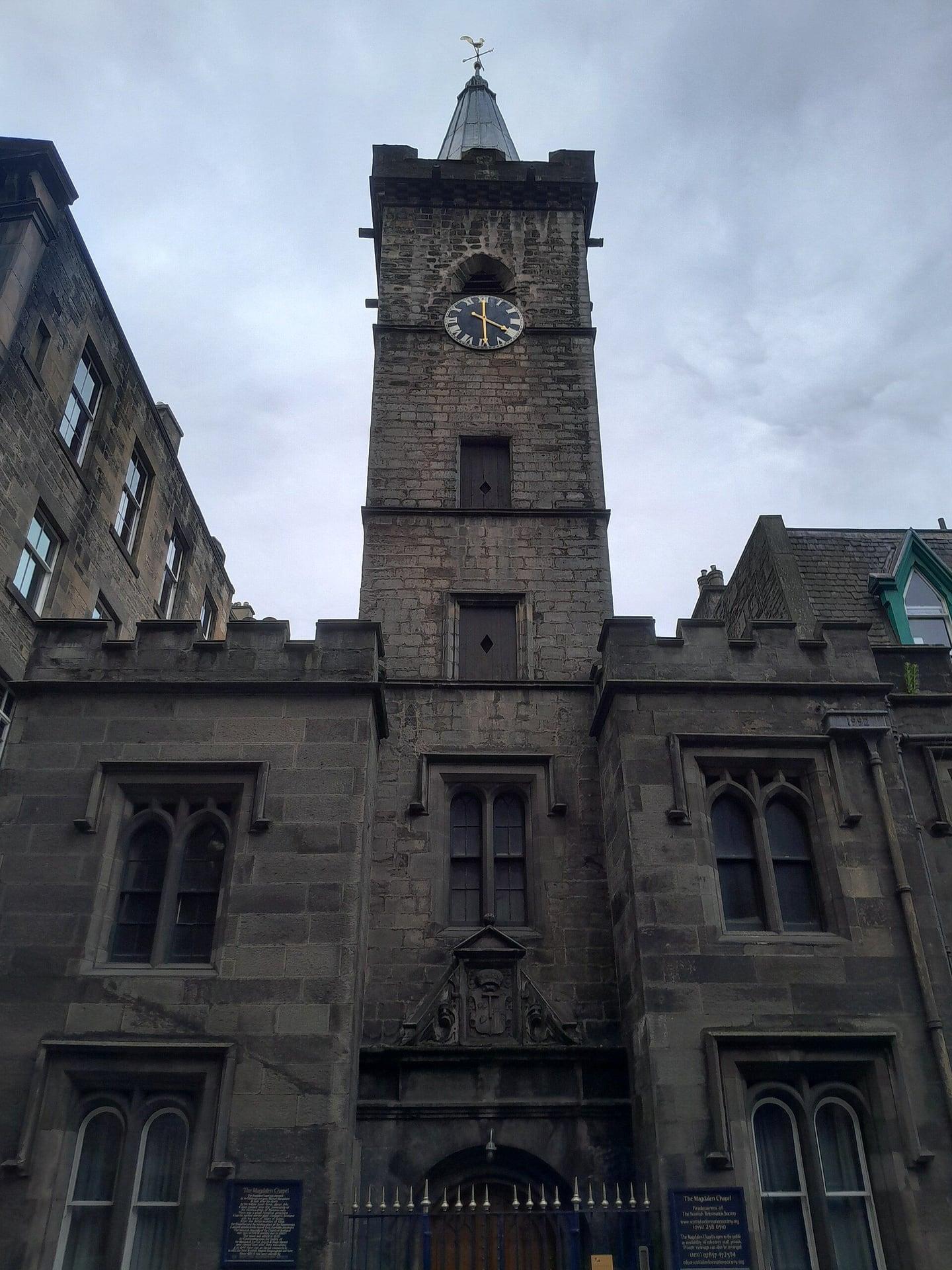
A merchant's bequest built this chapel. The Magdalen Chapel in the Cowgate, an almshouse chapel of the 1540s holding Scotland's only pre-Reformation stained glass still in place, seen from across the street.
- 11
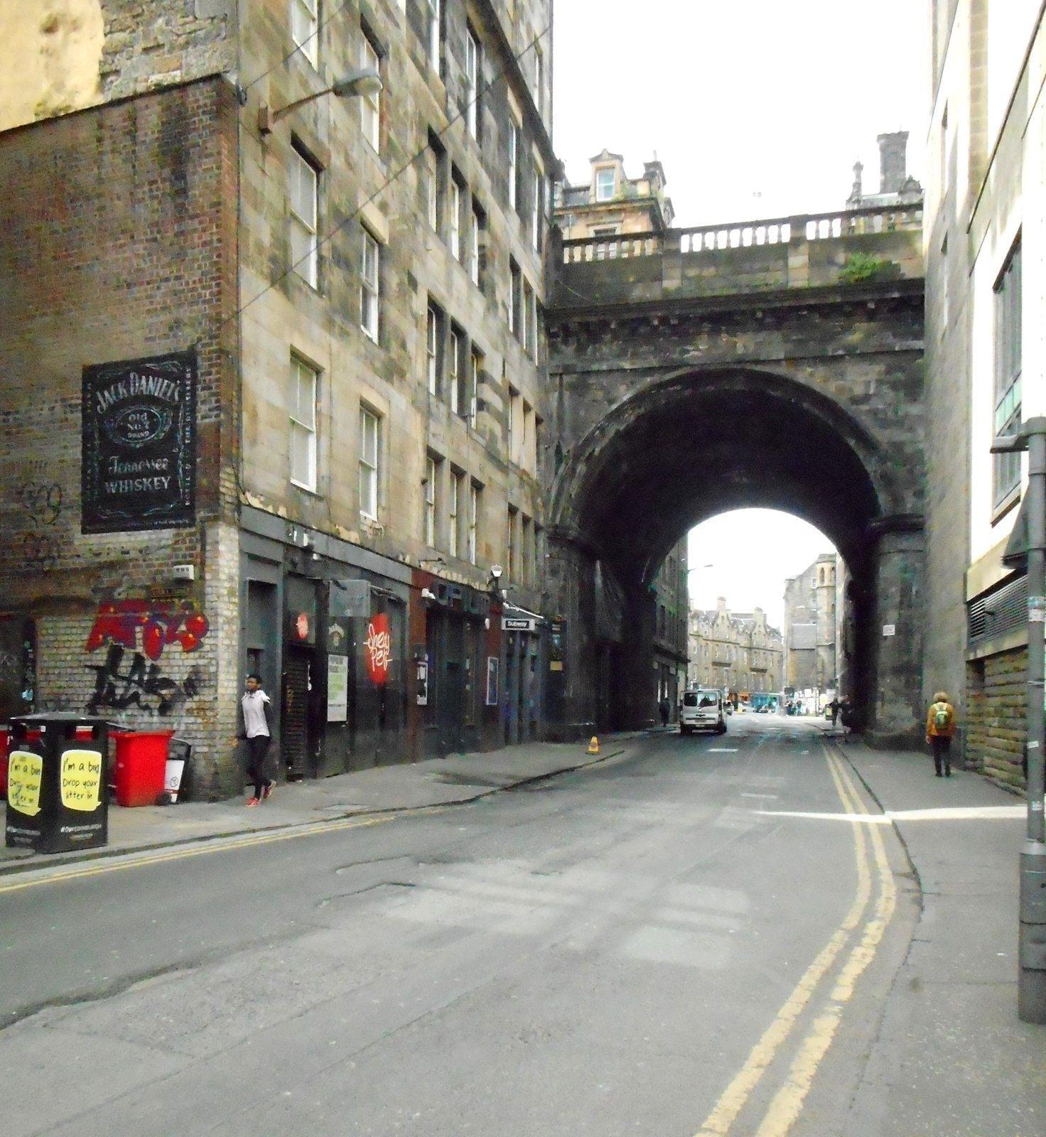
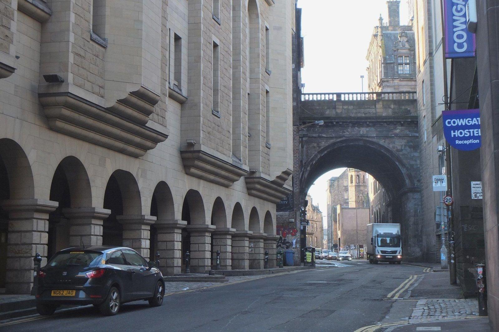
George IV Bridge: A Road Above the Street
A new road passed over the Cowgate. The arch of George IV Bridge, built 1829 to 1834 to carry a road south from the Royal Mile over the old street, seen just after passing beneath it.
- 12
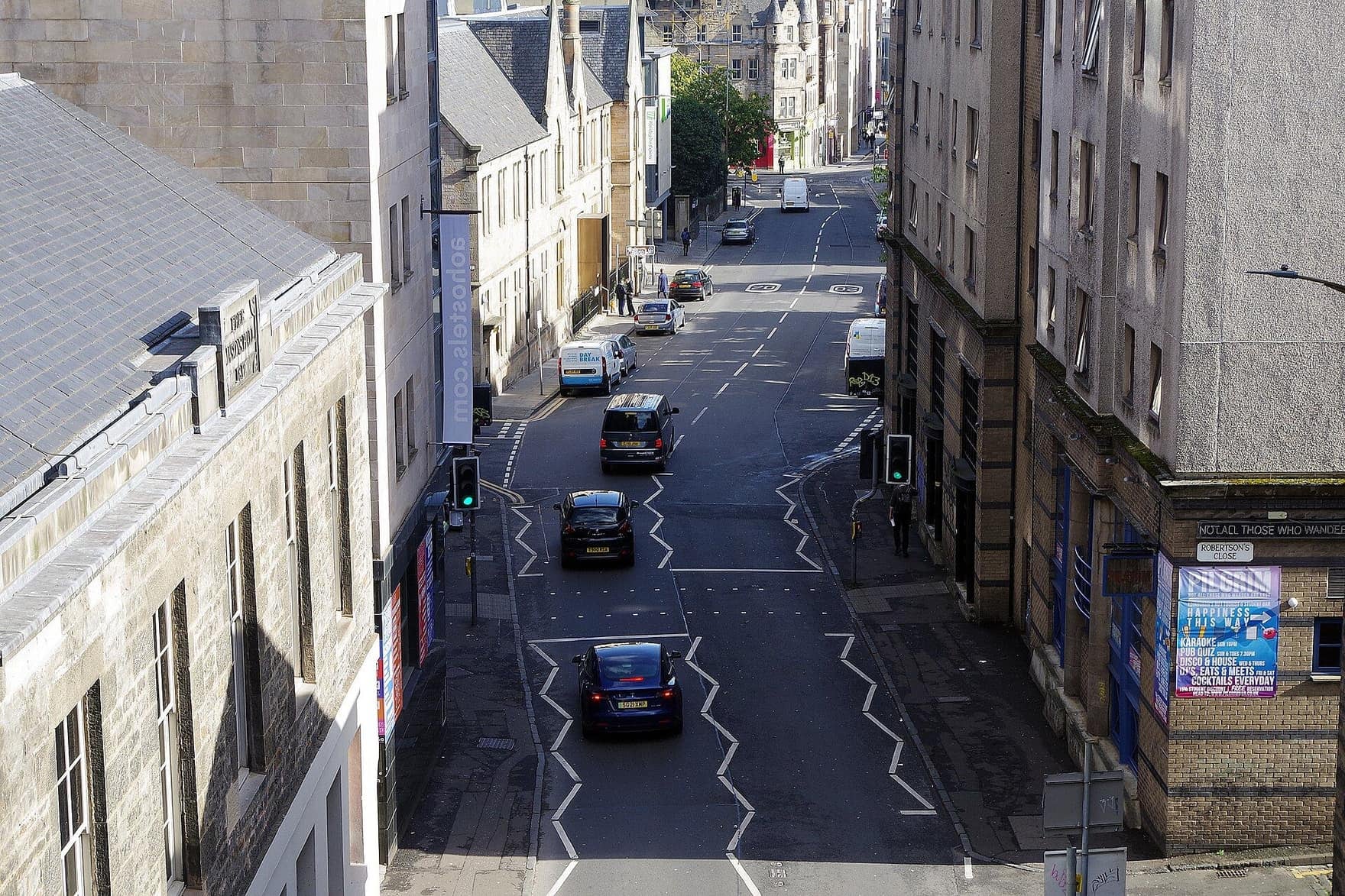
Tailors' Hall: Where the Covenant Was Drafted
The Covenant's draft was approved here. The Tailors' Hall of 1621 across the Cowgate, where the National Covenant's draft was approved in February 1638, with a close falling from the High Street ahead.
- 13
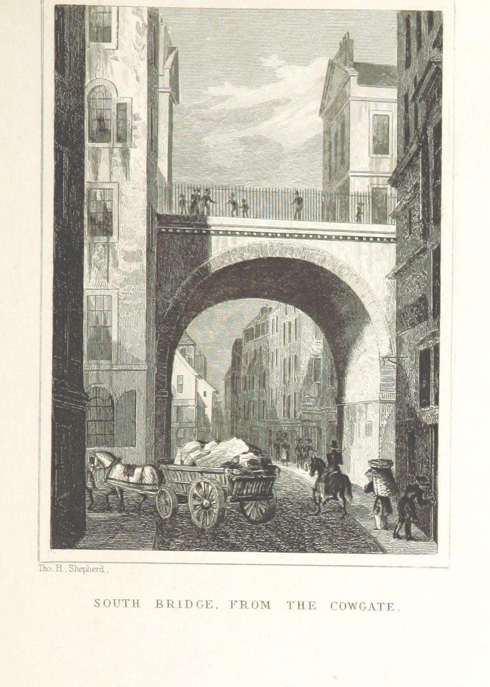
South Bridge: Nineteen Arches, One in Sight
You can see only one of nineteen arches. South Bridge, built 1786 to 1788 over the Cowgate through a crowded quarter, beside St Cecilia's Hall, which lost its street to the bridge.
Details
Best Time to Visit
Start by about 14:00 in December so the kirkyard (stops 1 and 2) is walked in daylight: the sun sets at about 15:44 on 1 December, 15:40 on 21 December and 15:48 on 31 December 2026, and rises at about 08:20 to 08:45 (computed for Edinburgh). After dark the kirkyard's side paths are unlit, but the rest of the line (Lauriston Place, Heriot Place, the Vennel, the Grassmarket and the Cowgate) is lit. Weekday daytimes give the best chance of finding the Magdalen Chapel open; Greyfriars Kirk is closed to visitors from November to March. The Cowgate is quiet by day and crowded late on Friday and Saturday nights. December is short, cold and often wet: mean highs about 7 °C, lows about 2 °C (Met Office 1991 to 2020 averages for the Royal Botanic Garden No 2 station, read from search snippets). Edinburgh's Christmas (from 14 November 2026) is in Princes Street Gardens and the New Town, off this line. On 29 December 2026 the Torchlight Procession (from 18:30 at the Meadows) is led through the Old Town, so expect closures that evening; on 31 December the Grassmarket is packed and the routes to the ticketed street party on Princes Street are closed. Checked 11 November 2026.
Pro Tips
- •Start inside Greyfriars Kirkyard: go in by the gate at the top of Candlemaker Row, beside the Greyfriars Bobby fountain, and follow the path to the kirk's north porch.
- •Getting there on foot: Waverley Station is about a 10-minute walk from Greyfriars Kirk (greyfriarskirk.com). From the Royal Mile, walk south along George IV Bridge from the Lawnmarket junction, about 350 m, to the Bobby fountain (from the map). Checked 11 November 2026.
- •By bus: Lothian Buses 2, 9, 23, 27, 35 and 45 stop close by (greyfriarskirk.com). Greyfriars Place has been closed to northbound traffic since 20 August 2026 for emergency flood works at a property on Forrest Road, with no end date given (Lothian Buses, reported by the Edinburgh Evening News), so check lothianbuses.com for diversions. Checked 11 November 2026.
- •By tram: Princes Street stop (Edinburgh Trams, adult fares from 2.40 GBP in the city zone), then up the Mound and along George IV Bridge to the fountain, about 900 m and uphill (from the map). Checked 11 November 2026.
- •Greyfriars Kirk is free to enter, but open only April to October: Monday to Friday 10:30 to 16:30, Saturday 12:00 to 16:00 (the kirk's FAQ; another page says Saturday 11:00 to 14:00). Closed November to March; the kirkyard is open 24 hours. Checked 11 November 2026.
- •The Covenanters' Prison is always locked. To ask about access, contact the City of Edinburgh Council's bereavement team (bereavement@edinburgh.gov.uk); the Scottish Covenanter Memorials Association, which put up the plaque, says it does not control access. Checked 11 November 2026.
- •Bobby's licensed collar of 1867 and his dish are in the Museum of Edinburgh: free, Wednesday to Sunday 10:00 to 17:00, last entry 16:30 (Culture Edinburgh). Checked 11 November 2026.
- •Magdalen Chapel (stop 10): the Scottish Reformation Society aims to open it Monday to Friday 10:00 to 16:00, depending on volunteers, or by arrangement (scottishreformationsociety.org). Checked 11 November 2026.
- •To avoid the Vennel's 77 steps: from stop 6 go back down Heriot Place, along Lauriston Place, down Lady Lawson Street and along the West Port to stop 7, about 730 m with no steps and no road to cross.
- •Getting away: from the end, go back about 20 paces to Blair Street and climb it, about 110 m, steep setts but no steps, to Hunter Square and the Tron Kirk on the Royal Mile (keep to the street round Hunter Square to avoid its steps). Niddry Street, just past the end, is another step-free climb, but its top is inside the council's St Mary's Street works (order TEMP/26/141, to 30 June 2027), so it may be fenced. Checked 11 November 2026. Waverley Station is about 600 m north over North Bridge (from the map).
Safety & Precautions
- •Greyfriars Kirkyard is open 24 hours, but only the main path along the kirk is mapped as lit; the paths to the Covenanters' Prison gates are not. After dark, play stops 1 and 2 from the lane at the gate, or start at stop 3. It is a working burial ground owned by the council: keep to the paths and keep dogs on a lead. Council rules require written permission for commercial filming, photography or drones in the kirkyard.
- •The Vennel (between stops 6 and 7) is 77 stone steps down, steep, with a handrail and lit; slippery when wet or icy. Setts (stone paving blocks) on the kirkyard lane, Heriot Place, the Grassmarket's north side and Blair Street are slippery in the wet too.
- •Traffic drives on the left. Crossings: the top of Candlemaker Row, to the Bobby fountain and back (no signal or marked crossing: look right first, then left); the mouths of Forrest Hill (a sett lane) and Heriot Place (unmarked); the Grassmarket road at the zebra crossing; and the mouth of Blair Street, a one-way street whose traffic comes down into the Cowgate. Heriot Place is a narrow lane that cars use.
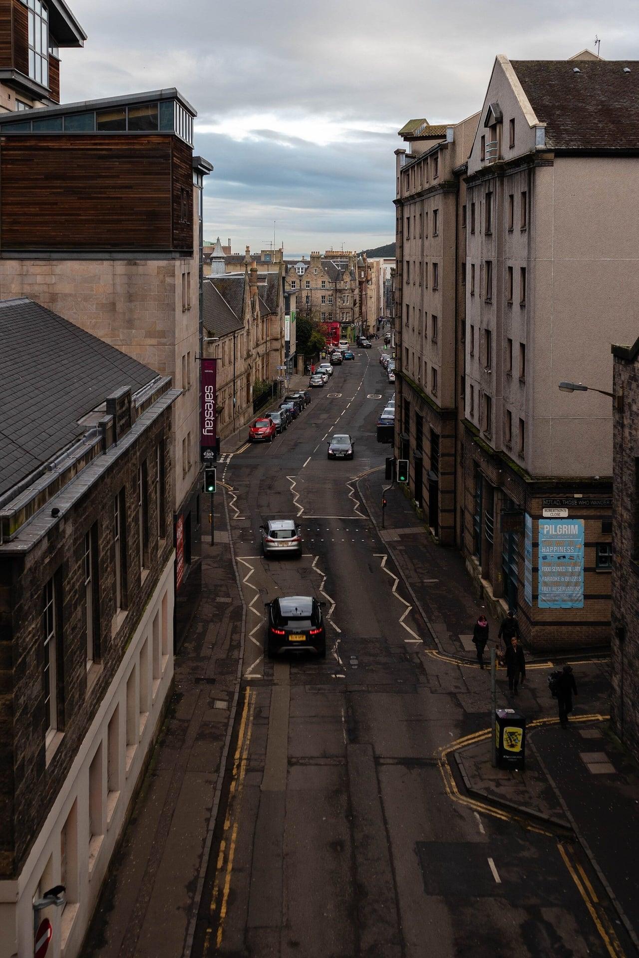
- •The Cowgate has narrow pavements. It is mapped as closed to motor traffic from 22:00 to 05:00, when it becomes the Old Town's late-night club street, crowded and noisy on Friday and Saturday nights. While the council's St Mary's Street works run (order TEMP/26/141, 21 September 2026 to 30 June 2027), the order adds waiting and loading restrictions on the Cowgate by Niddry Street and South Gray's Close, so expect more traffic and works vehicles here. Checked 11 November 2026.
- •George Heriot's School is a private school: stay on the pavement and do not photograph pupils.
- •Please do not rub Greyfriars Bobby's nose: the council has asked visitors to stop.
- •Hogmanay 2026: on 29 December the Torchlight Procession (from 18:30 at the Meadows) is led through the Old Town, with closures that evening (route maps are published nearer the date); on 31 December the Grassmarket's pubs are packed and the routes to the Princes Street street party (from 20:00, ticketed) are closed. Check edinburghshogmanay.com. Checked 11 November 2026.
Travel advisory: Exercise Increased Caution (Level 2).
Gallery
Related Reading
Go deeper on what you'll see, hear, and walk through.
Overview
Best Self-Guided Walking Tours in Edinburgh (2026)
4 min
Overview
Edinburgh Travel Guide: How Many Days, Getting Around, Best Time, and Safety (2026)
7 min
Overview
One Day in Edinburgh: A Walkable Morning-to-Evening Itinerary
8 min
Thematic
Best History Walking Tours in Edinburgh (2026)
3 min
Thematic
Two Cities on Two Ridges: How to Read Edinburgh's Old and New Towns
7 min
Companion
The Grassmarket: Edinburgh's Execution Square and the Old Town Underworld
6 min
Deep dive
Greyfriars Bobby: The Legend, the Monument, and What the Record Actually Says
7 min
Read
What to Eat in Edinburgh: Scottish Dishes and How to Order Like a Local
7 min
Read the walk
The full story of Grassmarket and Greyfriars: The Old Town Below the Rock, in words. Prefer to listen? Play it narrated, from home or on location.
Introduction
Below Edinburgh's castle rock lies a hollow. The ice that flowed round the rock dug it out, and the town filled it with a market, a gallows and a burial ground, shut it in with two walls, and finally built its roads over the top on bridges. This walk goes down into that hollow, the Old Town below the rock.
There are thirteen stops over about one point seven kilometres, just over a mile, and the walk takes about an hour and a quarter. Halfway round it goes down the Vennel, a flight of seventy seven stone steps with a handrail. If you would rather avoid them, there is a step-free way round of about seven hundred metres, given in the route notes.
The walk starts inside Greyfriars Kirkyard, a council burial ground open day and night, but only the main path past the church is lit after sunset, and the kirk itself is closed to visitors from November to March, so it is told from outside. In December the sun sets at about twenty to four, so start by about two in the afternoon to see the kirkyard in daylight. If it is dark, or the gate is ever shut, play the first two stops from the lane at the gate.
The walk ends in the Cowgate, a narrow street under two bridges. Late at night it is the Old Town's club street, crowded and noisy at weekends, with narrow pavements. From the end, a short steep climb with no steps leads up to the Royal Mile.
On the way in you pass the statue of Greyfriars Bobby beside the kirkyard gate. We come back to him on the way out. When you arrive at Greyfriars Kirk, begin with stop one.
1. Greyfriars Kirk: Where the Covenant Was Signed
Welcome to Greyfriars. Walk along the path beside the long stone church, and stop a little beyond its porch, facing the church. If you are hearing this from the lane outside the gate, the church is the long building beyond the gate, among the trees.
This is Greyfriars Kirk, and kirk is the Scots word for church. Its name remembers the grey friars, the Franciscans, whose friary stood nearby at the south east end of the Grassmarket until it was closed in fifteen fifty nine, at the Reformation. Three years later the town council asked the queen for the friars' ground as a burial place, because the churchyard at Saint Giles' was overcrowded. It is still a burial ground: please keep to the paths.
The church came later. It was begun in the first years of the sixteen hundreds and opened on Christmas Day sixteen twenty, and Historic Environment Scotland calls it the first church built in Edinburgh after the Reformation.
Look at its front: pointed windows, buttresses topped with small stone obelisks, and in the middle a porch with two doors. Two doors, because two congregations shared this building. In seventeen eighteen, gunpowder stored in the tower exploded and destroyed the tower and the west end. A second church was built onto the first, back to back, and the porch added in the early seventeen twenties gave each congregation its own door.
Then the reason Greyfriars matters to Scotland. In February sixteen thirty eight, the National Covenant was signed here, inside the church, in front of the pulpit. It was a solemn pledge, made against the Crown's changes to the way Scots worshipped. A later tradition has people signing it on the flat tombstones outside, but Historic Environment Scotland and the kirk itself put the signing inside the church, and one original copy is in the kirk's own museum. The kirk opens to visitors from April to October.
Down the slope, on the kirkyard's boundary wall, the Martyrs' Monument of seventeen hundred and seven remembers the Covenanters executed in Edinburgh. Their story runs through this whole walk.
Follow the route on along the path and round the end of the church. The next stop is a pair of locked iron gates.
2. Covenanters' Prison: A Thousand Men in the Open
Walk on along the path to the iron gates ahead, and stop in front of them.
These gates stay locked. Behind them is the part of the kirkyard known as the Covenanters' Prison, and the plaque beside the gates, put up in two thousand and seven, tells its story plainly.
In June sixteen seventy nine, supporters of the National Covenant, the pledge signed in the church you have just left, were defeated by government forces at the battle of Bothwell Brig. More than a thousand of them were held here, on ground south of the old kirkyard wall, for more than four months, with no shelter at all, each man allowed four ounces of bread a day.
Some of them died here. Some were tried and executed for treason. Some escaped, and some were freed after signing a bond of loyalty to the Crown. In November, the two hundred and fifty seven men who were left, sentenced to transportation overseas, were taken to Leith and put aboard a ship bound for the American colonies. The ship was wrecked in the Orkney islands, and nearly all of them drowned. Forty eight of the prisoners survived.
Now look through the gates, at the long lane of grand walled tombs. Those came later, and the plaque is careful about it: the ground behind the gates was laid out for burials in seventeen hundred and five, and the prison also took in land that now lies under the buildings on the street beyond.
The lane is closed in by two walls you will meet again. Along one side runs the wall of George Heriot's, the great school next door, and at the far end stands a stretch of the town's second wall, the Telfer Wall.
Follow the route back out of the kirkyard by the gate you came in, and at the end of the lane cross the top of Candlemaker Row to the statue: there is no signal there, so look right first, then left.
3. Greyfriars Bobby: The Record and the Legend
Carry on to the end of the lane, cross to the small bronze dog on top of the granite fountain, and stop beside it. Take the crossing first: the story will wait.
This is Greyfriars Bobby. The bronze was put up in eighteen seventy three, on a red granite fountain with one basin low down at its base and another higher up. Read the plaque on the base. It calls the statue a tribute to the affectionate fidelity of Greyfriars Bobby, and then makes a modest claim: in eighteen fifty eight this faithful dog followed the remains of his master to Greyfriars churchyard, and lingered near the spot until his death in eighteen seventy two.
That much has some record behind it. In eighteen sixty seven the Lord Provost, the head of the town council, paid for Bobby's licensed collar to keep him safe. The collar, engraved with his name and that year, survives in the Museum of Edinburgh, and so does his dinner dish, which the family who fed him at their coffee house nearby gave to the museum.
The rest is the story the Victorians loved: a dog who watched over his master's grave for fourteen years. Historic Environment Scotland says the story became a cult soon after the dog's death, and even the council's own plan for the kirkyard says Bobby supposedly guarded the grave. A historian's book of twenty eleven goes further. It argues that the vigil was good business for the neighbourhood, a stray fed by visitors, and that the first Bobby may have died around eighteen sixty seven and been replaced by another dog. What survives is a collar, a dish, this fountain and a very good story.
Back inside the kirkyard gate are two stones that belong to it: one over his master's grave, put up by American dog lovers, and one for Bobby at the entrance, from nineteen eighty one.
His nose shines because people rub it. The council has asked visitors not to.
Follow the route back across the top of Candlemaker Row to the kirkyard side, with the same care as before, and on along that pavement. This is the longest stretch of the walk.
4. George Heriot's School: A Palace for Poor Bairns
Walk on along the railings to the school gate with its small stone lodge, and stop on the pavement just short of the gate.
Across the playing field is George Heriot's School. It is still a school, and a private one, so the walk stays out here on the pavement. Please do not photograph the pupils.
George Heriot was a goldsmith and money-lender to the king and queen. When he died in sixteen twenty four, he left more than twenty three thousand pounds to found a hospital, which then meant a charitable school and home, for poor fatherless bairns. Bairns is the Scots word for children. The plan came from his nephew, who seems to have based it on a design in an Italian book of architecture, and the foundation stone was laid on the first of July sixteen twenty eight. In sixteen fifty troops commandeered the building for use as a hospital, and the school did not open until April sixteen fifty nine.
Look at the side facing this road. In the middle a tall, many-sided bay rises above the roofline to a curving half-dome crowned with stone finials, and below it are three tall pointed windows: that is the chapel. But this was never the grand front. The show front faces the other way, over the Grassmarket, where it could be admired from the castle. These other sides were rough stone covered in harling, a rough lime render, until they were faced with new stone in eighteen thirty three.
Now the road itself. To bring this ground inside the town, the council built a second town wall, and Historic Environment Scotland says the line of that wall fixed the line of this road, Lauriston Place. The stretch of wall here was taken down before the lodge and the railings beside you were built, in eighteen twenty eight.
Follow the route on along the railings, then turn right up Heriot Place, the narrow lane beside the school, crossing its mouth to the pavement on the far side.
5. Telfer Wall: The Town's Second Wall
Walk on up the lane and stop on the pavement, opposite the long, rough wall of orange brown stone across the lane. That is the Telfer Wall, the second of Edinburgh's town walls. It takes its name from its mason, and it was built between sixteen twenty eight and sixteen thirty…
Full narration for this stop unlocks with the tour.
6. Flodden Wall Tower: Walled In After a Defeat
Walk on to the head of the lane and stop beside the square stone tower, at the top of the steps. This is the older of the two walls. After a Scottish army's defeat at Flodden, in September fifteen thirteen, Edinburgh's town council raised a levy, a special tax, to strengthen…
Full narration for this stop unlocks with the tour.
7. West Port and the Vennel: The Town Gate
At the foot of the steps, turn right along the pavement and stop after a few paces, with the steps behind you. You have just come down the line of the Flodden Wall. The steps follow it from the tower to here, and here, at the corner of the Grassmarket, stood the West Port, the…
Full narration for this stop unlocks with the tour.
8. Grassmarket: The Market Under the Rock
Walk on along the wide paved side of the market place, under the castle, and stop there. This is the Grassmarket, and it lies at the bottom of the hollow. Look up at the castle on its cliff. The British Geological Survey describes the rock as a plug of hard volcanic stone. When…
Full narration for this stop unlocks with the tour.
9. Covenanters' Memorial: The Gallows Ground
Walk on to the low ring of stone and railings set into the paving, and stop beside it. This is the Covenanters' Memorial, and it marks the place where the town's public gallows stood. Many Covenanters, supporters of the Covenant signed at Greyfriars, were executed here, between…
Full narration for this stop unlocks with the tour.
10. Magdalen Chapel: The Hammermen's Almshouse
Walk on along this pavement and stop opposite the narrow front across the street, with a slender stone tower and spire rising behind it. This is the Magdalen Chapel. Its front is a plain one of eighteen sixteen, but behind it stands a chapel built between fifteen forty one and…
Full narration for this stop unlocks with the tour.
11. George IV Bridge: A Road Above the Street
Walk on under the bridge and a little beyond it, and stop on this pavement. Then turn round and look back at the arch you have just walked under. That is George the Fourth Bridge, built between eighteen twenty nine and eighteen thirty four. It belongs to the same plan as…
Full narration for this stop unlocks with the tour.
12. Tailors' Hall: Where the Covenant Was Drafted
Walk on along this pavement and stop opposite the opening in the buildings across the street, where a courtyard runs back to an old stone hall. That is the Tailors' Hall. In sixteen twenty the Incorporation of Tailors, the town's guild of tailors, bought land on the south side…
Full narration for this stop unlocks with the tour.
13. South Bridge: Nineteen Arches, One in Sight
Walk on under the bridge ahead and stop on this pavement, beneath its arch. This is the last stop, under South Bridge. It was built between seventeen eighty six and seventeen eighty eight, as the continuation of the North Bridge, to carry a road south from the Old Town across…
Full narration for this stop unlocks with the tour.
- This is a photo of listed building number — Enric, CC BY-SA 4.0 · source
- This is a photo of listed building number — Carlos Delgado, CC BY-SA 3.0 · source
- This is a photo of listed building number — AlasdairW, CC BY-SA 4.0 · source
- This is a photo of listed building number — AlasdairW, CC BY-SA 4.0 · source
- Main south facade of George Heriot's School Edinburgh as seen from Lauriston Place entrance — Stephencdickson, CC BY-SA 3.0 · source
- George Heriot's School, south side facing Lauriston Plce (rear) — Stephencdickson, CC BY-SA 4.0 · source
- 17th-century Telfer Wall on Heriot Place, George Heriot's School behind Camera location55° 56′ 45.6″ N, 3° 11′ 47.76″ W View this and other — User:Jonathan Oldenbuck, CC BY 3.0 · source
- This is a photo of listed building number — Andrew Gray, CC BY-SA 3.0 · source
- Bastion of the 16th-century Flodden Wall, with Edinburgh Castle behind. Camera location55° 56′ 46.32″ N, 3° 11′ 48.84″ W View this and other — User:Jonathan Oldenbuck, CC BY 3.0 · source
- This is a photo of listed building number — Enric, CC BY-SA 4.0 · source
- West Port, Edinburgh — Andrew Abbott, CC BY-SA 2.0 · source
- Shadow of the gibbet delineated in paving on the site of public executions, next to the Covenanters Memorial from 1937. — Kim Traynor, CC BY-SA 3.0 · source
- George IV Bridge — Richard Sutcliffe, CC BY-SA 2.0 · source
- The Cowgate and George IV Bridge, Edinburgh — Jim Barton, CC BY-SA 2.0 · source
- Cowgate, Edinburgh — Stephen McKay, CC BY-SA 2.0 · source
- Cowgate — Peter McDermott, CC BY-SA 2.0 · source
- View of Cowgate from South Bridge, Edinburgh — Mr H, CC BY-SA 2.0 · source
Images may be cropped or resized. Other photos via Unsplash and Pexels.