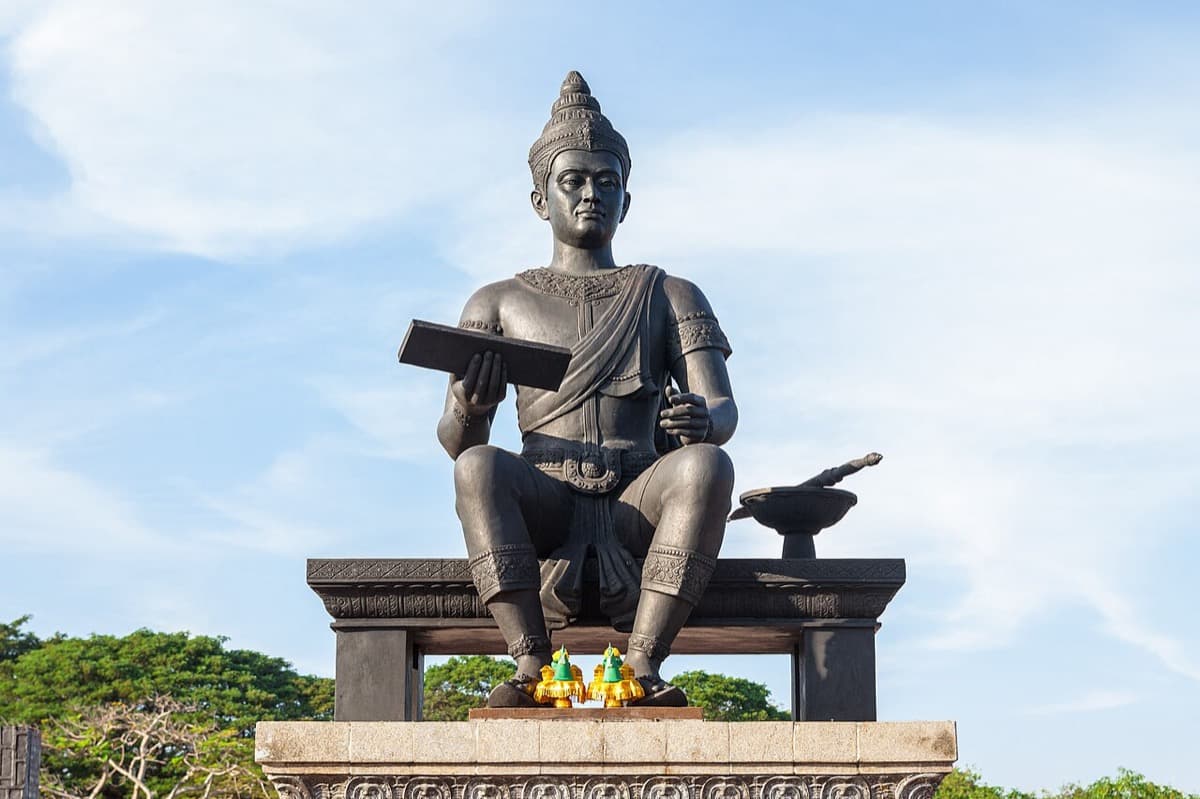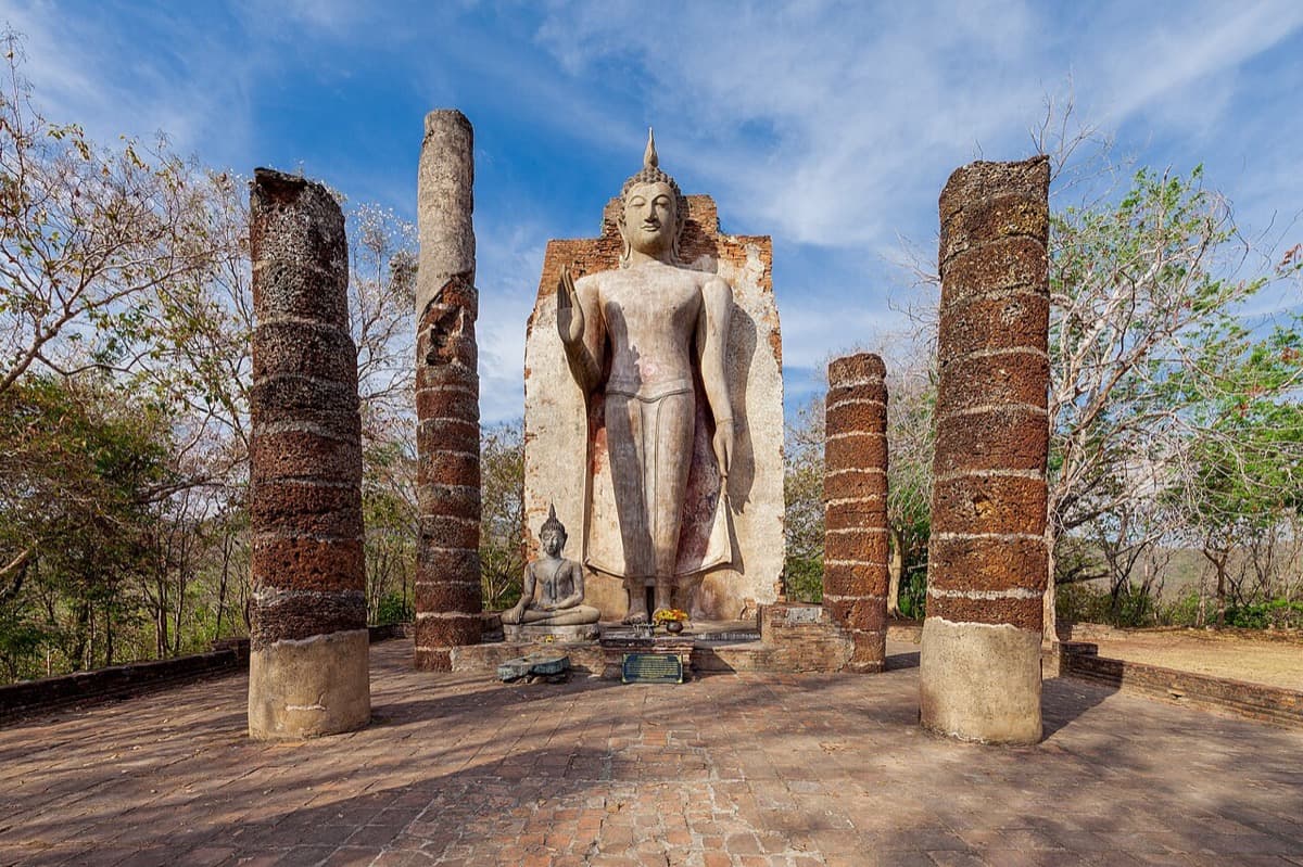
Wat Saphan Hin is a stone stair, a ruined hall, and a standing Buddha about twelve and a half metres tall, set on a forested ridge that rises roughly two hundred metres above the plain. The colossus faces east, back down over the grid of the old walled city and the ponds that once held its water. That single line of sight is the whole argument of a walk through western Sukhothai: a kingdom on a dry plain engineered its own water supply behind an earthen dam, then carried its most sacred images uphill to sit above the fields that water fed. Engineering at the bottom, transcendence at the top, and a slate staircase running between them like a load path.
Start with the problem the summit answers. Sukhothai sits on a plain in north central Thailand with no dependable dry season river. A city here is a hydraulic proposition before it is anything else. You cannot pray your way through eight rainless months, so the kingdom raised the Saritphong Dam, an earthen embankment thrown between two hills about three kilometres west of the walls, to trap the seasonal runoff. The Sao Ho canal then carried the stored water down a natural slope into the city, where it was distributed among four reservoirs with names almost too gentle for infrastructure: silver pond, gold pond, lemon pond, and water spinach pond. Every graceful chedi in the park sits downstream of that unglamorous mound of packed earth.
The stair is the thesis in stone
The name Wat Saphan Hin means stone bridge, after the long path and staircase of slate slabs laid up the hillside. Read it as a piece of engineering, because that is what it is. Each slab was carried and set by hand, a deliberate surface driven across a slope that resisted it, exactly the way the dam is a deliberate embankment driven across a valley that would otherwise let the monsoon run off. The two structures rhyme. One holds water on the flat; the other holds a route on the incline. A civilization that will move that much stone up a hill to reach a Buddha is the same civilization that will pile that much earth between two hills to reach a dry season, and the summit temple is where those two instincts become one gesture.
At the top, in a ruined viharn, stands the Phra Attharot, the colossal standing Buddha, right hand raised palm outward in the gesture of dispelling fear. A smaller seated Buddha and a lotus bud chedi in the classic Sukhothai style keep him company. The images are dated to the thirteenth century. What matters is not the height alone but the orientation. The great Buddha does not face the forest behind him or the sky above. He turns and looks back out over the plain, over the old grid and the reservoirs the dam filled. The building points at the plumbing. That is unusual enough to be the whole reason to make the climb.
Why the plain has to come first
Hear a stop from this walk
Saritphong Dam: The Earthwork That Made a City
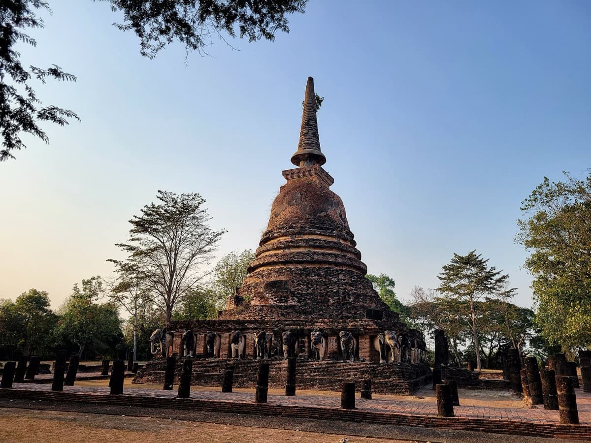
The summit only lands if you have walked up to it, which is why the full route on the Sukhothai walking tours starts on the flat and climbs. The first stop, Wat Chang Lom, is a Ceylonese style bell shaped tower on a square brick base roughly eighteen metres a side, girdled at its feet by thirty two stucco elephants, each stepping out of its own bricked niche as if the herd were carrying the tower on its backs. The symbolic reading, elephants bearing the Buddhist cosmos, is an interpretation rather than an inscription, so treat it as the accepted meaning, not a documented fact. Walk the full circle and you notice the sculptors varied every tusk and trunk, so a ring of thirty two animals never quite repeats.
Wat Chetuphon makes a stranger point. Its heart is not a great tower but a compact shrine, a mondop, that once showed the Buddha in four postures at once: walking to the east, reclining to the south, standing to the west, seated to the north. The walking figure, the phra lila, is the celebrated Sukhothai innovation, a fluid gliding form caught mid stride with robes flowing and one heel lifting. It is easy to pass a headless standing figure and miss how radical it was to carve a god in motion. Everything sacred at these first two stops is still down on the plain, and that is the setup the dam pays off.
Then the walk pivots hard to the Saritphong Dam itself, the load bearing fact beneath every beautiful thing you have seen. A fairness note the audio insists on: the impressive modern figures you may read, a dam nearly five hundred metres long and several metres thick, describe a twentieth century refurbishment by the irrigation and fine arts authorities, not the original fourteenth century earthwork. And no single engineer is named. Phra Ruang, the name attached to the dam, is a legendary and dynastic royal name, so the work belongs to the kingdom as a whole rather than one man.
The threshold, then the summit
Between the dam and the summit sits Wat Chang Rop, a forest temple where the character of the ground changes and the land starts climbing. This is the Aranyika, the forest monastery district, where monks studied scripture and meditated away from the city. At its center is an old friend, a bell shaped tower whose base was once ringed with elephants, recorded at about twenty four, though they survive only as damaged reliefs under a broken tower. A caution worth carrying: a separately named temple at Kamphaeng Phet shares this name, so counts and dates you find online may belong to that site. Better to walk the base and count what you can see.
Stand here and you feel the two instincts meeting, the practical one that stored water on the flat and the spiritual one that carried faith uphill. That is the frame the climb to Wat Saphan Hin completes. The Buddha at the top is mentioned in Sukhothai Inscription Number One, the Ramkhamhaeng inscription, a document whose authenticity scholars have genuinely debated, with the prevailing consensus upholding it as at least partly authentic. Legend, not documented fact, holds that King Ramkhamhaeng rode a white elephant named Ruchakhari up this hill on Buddhist sabbath days to worship the image. Take the slate stair slowly, in a cooler part of the day, and when you reach the giant, turn and look where he looks. The water was stored down there, carried into the reservoirs, and the holiest image was carried up here to watch over all of it. Plan the walk from the city page for Sukhothai, give yourself about three hours across roughly eleven kilometres, and read the ruins as one continuous idea rather than a scatter of separate temples.
Sources
- Roamer self-guided audio tour, "The Hydraulic City" (Sukhothai West): fact-audited tour transcript and the primary source for every temple detail, dimension, and posture described here.
- Wat Saphan Hin, Sukhothai Historical Park (renown-travel.com): the slate stair, the Phra Attharot colossus at about twelve and a half metres, and the summit layout.
- Saritphong Dam (Wikipedia): the earthen dam, its two flanking hills, the Sao Ho canal, the four named reservoirs, and the twentieth century refurbishment figures.
- Ram Khamhaeng Inscription (Wikipedia): the scholarly debate over the inscription's authenticity and the current consensus that it is at least partly authentic.
- Sukhothai Historical Park (Wikipedia): the western forest zone, the Aranyika monastery district, and the shared water control infrastructure recognized as a World Heritage listing.
Ready to experience it?
Wat Saphan Hin: The Hydraulic City
150 min · 11 km · hard
More from Sukhothai
Explore more at your own pace.
One Day in Sukhothai: A Walkable Morning-to-Evening Itinerary
Sukhothai Travel Guide: Days, Transport, Costs, and Safety
Sukhothai: The Kingdom Thailand Reads as Its Beginning
Wat Mahathat: Where Sukhothai Turned Its Origin Story Into Stone
Wat Si Chum and the Buddha That Watches Through a Slot