Historic Center: The City That Kept Reassigning Itself
110 min · 3.2 km · moderate
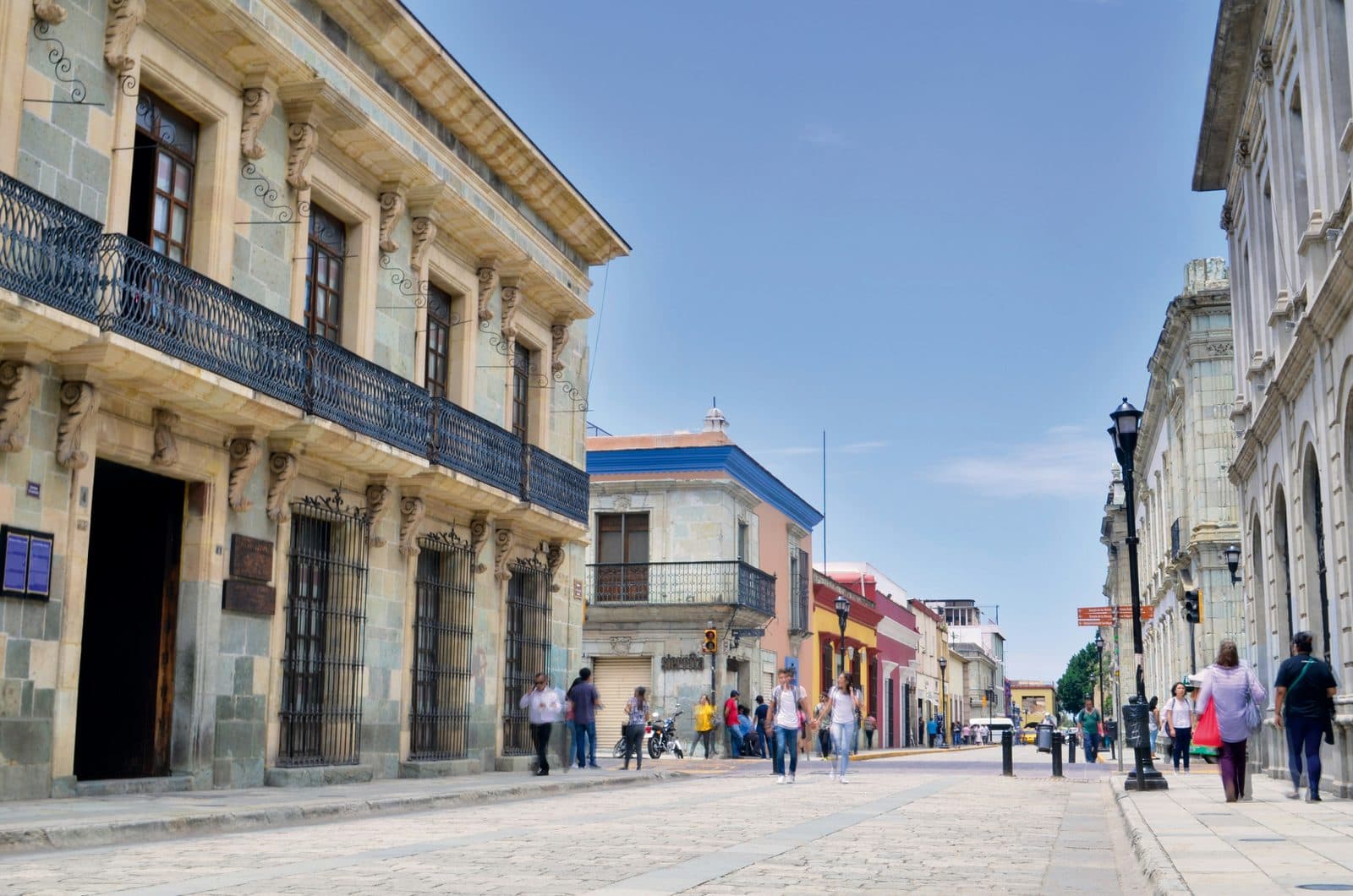
There is a comfortable story about Oaxaca that goes like this. Most colonial Spanish cities in Latin America were built on top of what came before, the Aztec capital under Mexico City, the Inca capital under Cusco, but Oaxaca was built beside its indigenous past instead of over it, which is why the centre reads as a stack of eras sitting politely next to one another.
The first half of that is true. The Oaxaca half is not, and it is worth clearing away before anything else, because what actually happened is more interesting.
Two things are on the record. First, there was no surviving indigenous city here to build beside. The Zapotec capital was Monte Albán, on a levelled mountaintop about eight kilometres west, and it had been abandoned as a political centre for centuries before the Spanish arrived. What stood on the site of today's Zócalo was a Mexica garrison, posted in 1486 by the ruler Ahuizotl, and the national institute of anthropology is explicit about why it was there: to control and watch the Zapotecs. The Spanish grid was traced fresh in 1529 and measured outward from that square.
Second, the people who were living here were not left in place. Viceroy Mendoza's memorial of 1544, held in the Archivo General de Indias, records the mexica, zapoteca and mixteco inhabitants of Huaxyácac as displaced to other areas of the city and replaced with Spaniards. Cortés's own doctrine was that Spanish cities be raised over indigenous ones.
So what does explain the density that everyone notices? Reassignment. Almost nothing in this centre has ever been demolished, and almost everything has been given to somebody else for a different purpose, over and over, for five hundred years. The layers are real. They were not laid politely side by side. They were argued over, one building at a time.
The rest of the sequence is still worth knowing, because it is what got reassigned. The Mixtec offering buried at Monte Albán in Tomb 7 now sits in the Museo de las Culturas inside the old Dominican convent, eight blocks from the cathedral. UNESCO recognised the connection in 1987 by inscribing the colonial centre and Monte Albán as a single property. The two sites are one heritage object, not two.
The Zapotec foundation
The Zapotec civilization is one of the oldest continuous cultures in the Americas. Settlement in the Valley of Oaxaca dates back at least four thousand years. By roughly 500 BCE, the Zapotec had built Monte Albán on a levelled mountaintop with views over three converging valleys. At its height, between about 200 and 700 CE, Monte Albán housed something close to twenty-five thousand people and ran trade and tribute networks that reached the Maya regions to the south and central Mexico to the north. The Zapotec invented one of the earliest writing systems in the Americas, with calendar glyphs and a logographic script that pre-date most Maya writing.
Around 700 CE, Monte Albán was abandoned as a major political centre. The reasons are still debated. The Zapotec dispersed into smaller settlements across the valley and into the surrounding mountains, where their descendants still live. Mixtec groups moved in from the north and west and reused Monte Albán's tombs for elite burials, including the famously rich Tomb 7, which the Mexican archaeologist Alfonso Caso opened on 9 January 1932. The point that gets lost in the retelling is that the gold is not Zapotec: it is a Mixtec offering placed inside a Zapotec tomb that was already centuries old when it was reused. Even the grave was second-hand. The conservation project that INAH began in 2013 has treated 245 of the objects, among them seventy necklaces, strands and bracelets strung with more than six thousand beads of gold, silver, jet, shell, rock crystal, greenstone, turquoise, pearl and amber. They are displayed eight blocks from the Zócalo.
When the Mexica reached this valley in the late 1400s, they posted a garrison here. Ahuizotl put it on a low hill of huaje trees in 1486 and the place took the name Huaxyácac from them, and the national institute of anthropology gives the purpose without decoration: to control and watch the Zapotecs, who by then lived in the valley and the surrounding mountains rather than at Monte Albán. The Spanish, arriving in the 1520s, kept the name. Huaxyácac became Antequera and then Oaxaca. The inhabitants did not stay: the 1544 viceregal memorial records them displaced to other parts of the city and replaced with Spaniards.
The colonial overlay
Hear a stop from this walk
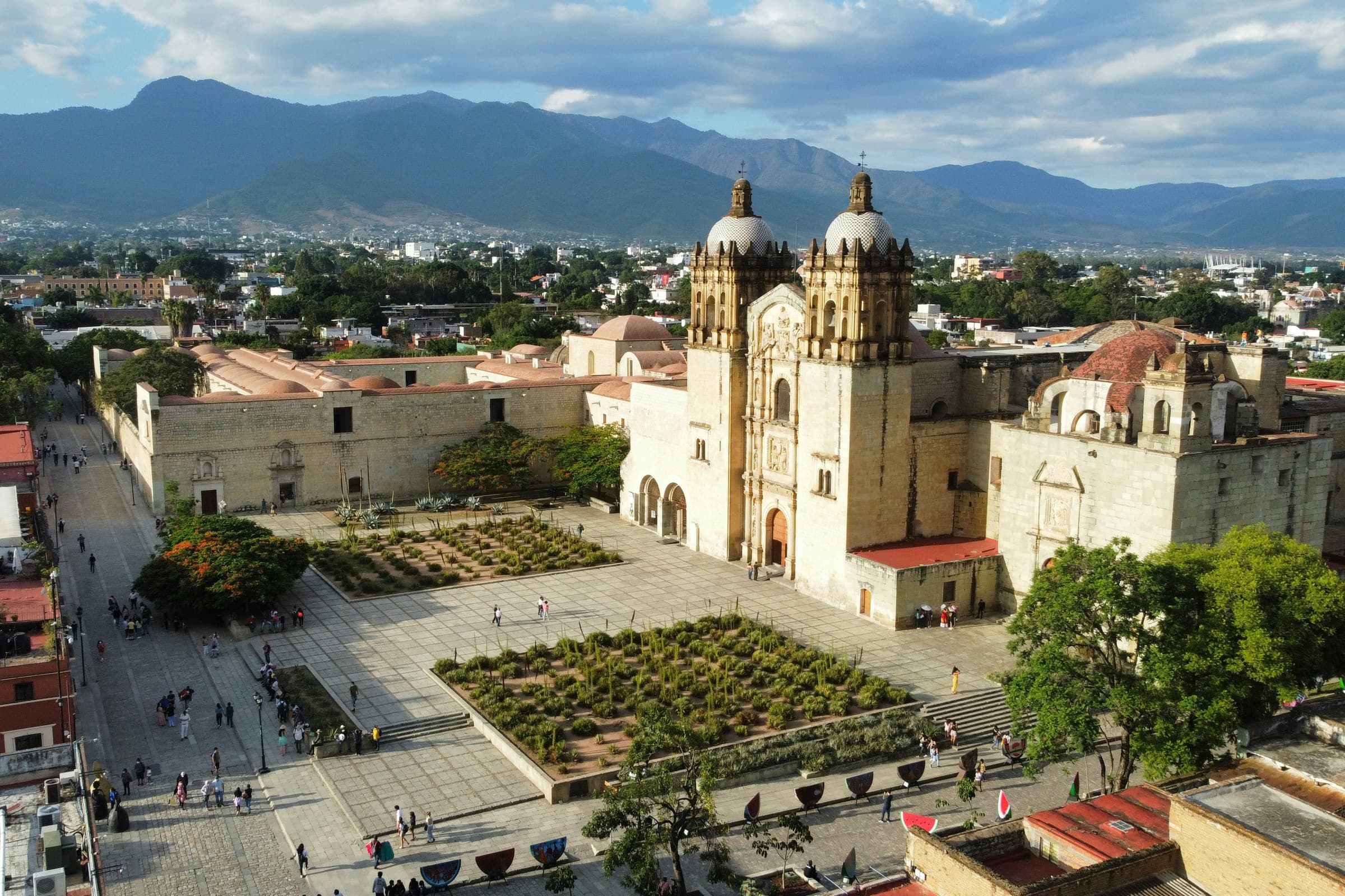
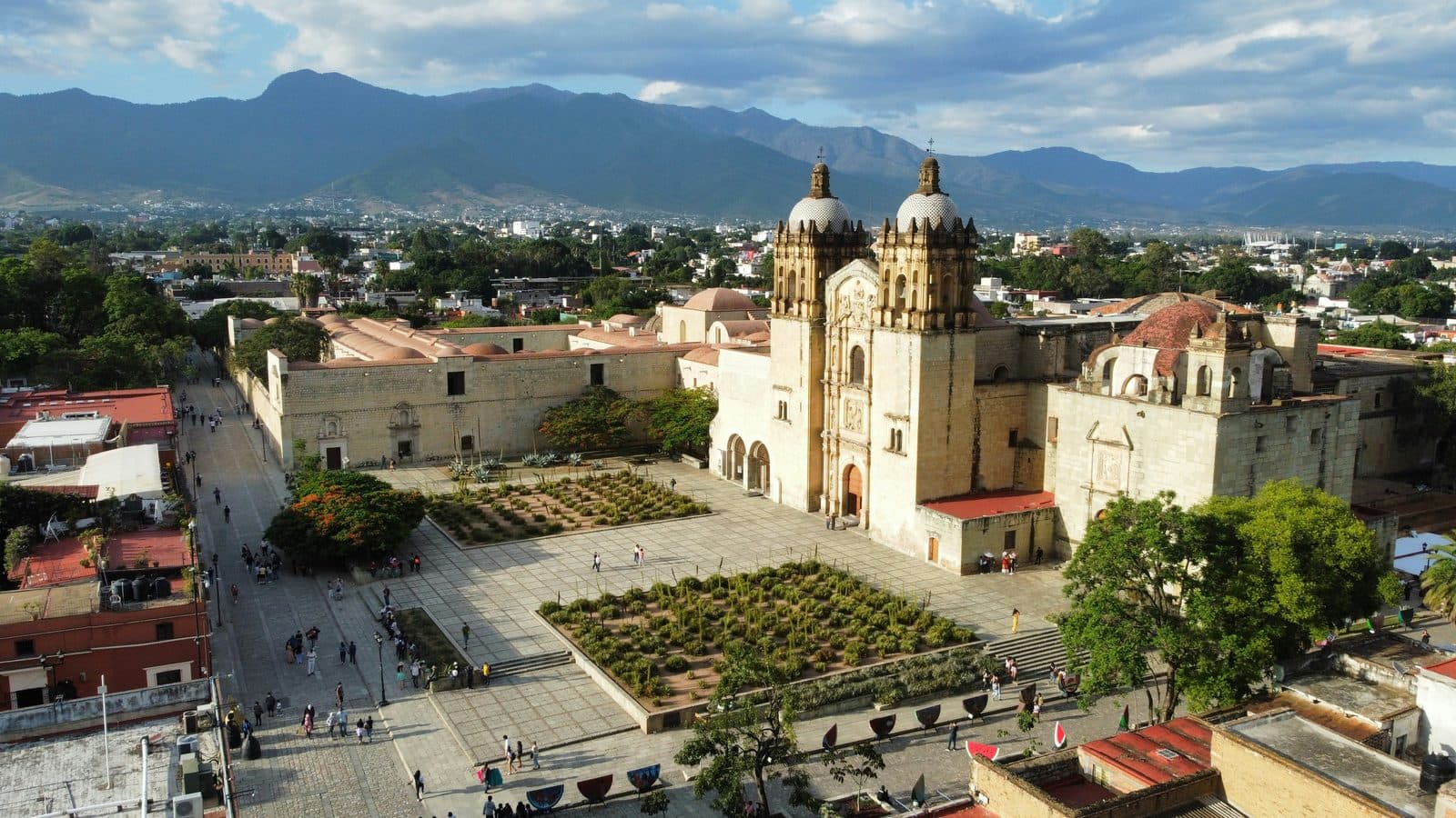
Santo Domingo: A Church, a Barracks, and a Garden in the Drill Yard
The Spanish town founded in 1529 is the grid you walk today. It follows the standard colonial pattern: a central plaza ringed by arcaded portales, a cathedral on one side, a government palace on another, and a square street grid radiating out. What is unusual about Oaxaca is what was placed at the corners of this grid. The Dominican order, which took spiritual responsibility for the region, built two of the great baroque complexes of the Americas within walking distance of each other. At the Templo de Santo Domingo, whose fabric was begun in the 1570s and was still being finished in the eighteenth century, the plasterwork and the gilding of the barrel vault and the high choir are dated and attributed: 1659, by an unnamed master from Puebla, laid as gold interlace on white seventeen metres above the floor. The church of the Soledad, begun in 1682 with the works finished in 1689, holds the city's patron Virgin. The story of how the image arrived, involving a mule train and a box nobody could account for, is a religious legend, which the city's own heritage writing says plainly, and even its year is disputed.
Cochineal funded most of this. The red dye extracted from insects living on prickly pear cactus was, for two centuries, the second-most valuable export from New Spain after silver. Oaxaca was the centre of its production. The wealth flowed into the cathedral, into Santo Domingo, into the network of churches and convents and the merchant houses that line the historic centre's streets.
The architecture has a recurring colour. Almost everything in the old city is built or faced with cantera verde, a green-grey volcanic tuff quarried from the hills around the valley. It is soft when freshly cut and hardens with exposure, which makes it both carvable and earthquake-tolerant. The pale green façades that give Oaxaca its UNESCO-inscribed silhouette are not a stylistic choice. They are the local stone.
The Republican layer
Mexico won independence in 1821. The most important Oaxacan in the century that followed was Benito Juárez, born in 1806 in a Zapotec village in the mountains north of the city. He left it on 17 December 1818, aged twelve, and arrived that night at the house of a merchant called Antonio Maza, where his sister Maria Josefa was the cook. His own memoir is careful about what followed and quietly demolishes most of the folklore: three weeks tending a farm for two reales a day while he looked for a household to serve in, then a place with Antonio Salanueva, a lay bookbinder who became his godfather at confirmation. There is no runaway sheep in the text, and he could already speak Spanish, in his own words without rules and with all the faults with which the common people spoke it.
Juárez separated church and state, suppressed the great monastic landowners, and in 1867 defeated the French-imposed Habsburg emperor Maximilian. What is less often said is where those laws landed. He had taught canon law at the Instituto de Ciencias y Artes, which occupied the ex-convent of San Pablo from 1834 to 1860, and his own Reform Laws nationalised that convent in 1860 and sold it to pay the Institute's teaching salaries. The building is now the Centro Cultural San Pablo.
The next Oaxacan to run the country was Porfirio Díaz, who ruled from 1876 to 1911. The Teatro Macedonio Alcalá is the Oaxacan monument of that era, but not in the way it is usually told. It was not a dictator's commission: it began as a private joint-stock company, named the Teatro-Casino Luis Mier y Terán, and the state took the land, the half-built structure and every asset of the company by Decree number 7 of 21 November 1906, binding itself to finish the job within two years for no less than 140,000 pesos. Part of the money came from town councils across the state, which moved idle funds out of the public pawnshop into the building. It opened on 5 September 1909 with Verdi's Aida, a year before the Revolution began. One correction worth carrying inside: the Louis the Fifteenth decoration people come for is in the vestibule, along with the oval Triumph of Art on its ceiling. The auditorium itself is Empire, in a horseshoe plan.
The artistic continuation
The most distinctive feature of twentieth-century Oaxaca is that the question of who decides what a building is for stopped being answered by a viceroy, a bishop, a governor or an army, and started being answered by painters.
Rufino Tamayo, born in Oaxaca in 1899, built an international career while filling his canvases with Mesoamerican iconography, and over more than twenty years he and Olga Tamayo bought pre-Hispanic pieces off the antiquities market and gave them to the city as a museum of more than a thousand sculptures. The museum is open, 90 pesos, and closed on Tuesdays.
Francisco Toledo, born in Juchitán on the Isthmus of Tehuantepec in 1940 and Zapotec, is the one who changed the centre. He made a great deal of money painting and spent it here, in a sequence you can walk: the graphic arts institute IAGO in 1988, founded in the house he was living in; the contemporary art museum in 1992; the civic group Pro-OAX and the campaign that won the botanical garden in 1993; the Francisco de Burgoa rare book library in 1994; the Manuel Álvarez Bravo photography centre in 1996, opened in the presence of the photographer it was named for. IAGO holds an art library of nearly sixty thousand volumes on open shelves, free, including Rufino Tamayo's own library, inside a wider collection the federal culture ministry puts at more than 125,000 objects. In 2015 Toledo donated the building to the national fine arts institute, four years before he died on 5 September 2019.
The clearest thing he won is behind Santo Domingo. That ground was the convent's orchard and then the army's drill yard, with barracks and sports courts on it. When the military left, the proposal was a private hotel with parking. Toledo, Pro-OAX and a group of artists and citizens beat it, and the garden's own history records the result in one sentence: in July 1998 they planted the first plant.
How to walk it
The two tours of the centre take the argument from opposite ends. The Historic Center loop is twelve stops and about 3.2 km: the Zócalo, the Centro Cultural San Pablo and the textile museum, the Teatro, MACCO, the Álvarez Bravo photography centre, Santo Domingo with the museum and the garden, IAGO, the Casa de Juárez, the Museo Rufino Tamayo, the Soledad, San Felipe Neri, and the cathedral seen from the Alameda de León. Note the name if you are looking it up: the contemporary art museum reopened in July 2024 as MACCO, because the old initials remain the property of the association that used to run it.
The second runs through the food and trade of the city: the central markets, the artist barrios, and a mezcal tasting at the end of the line.
The pattern that actually held for half a millennium is not one of layers left politely alone. It is a long argument about use, conducted one building at a time, by whoever happened to be holding the keys. The most recent person to win it bought a house, filled it with books, opened the door and then signed it over.
Frequently asked questions
- How many self-guided walking tours are there in Oaxaca?
- Roamer currently has 2 self-guided audio walking tours in Oaxaca. Every tour is free to start: the introduction and first stop play in full, and every later stop plays a short preview before you decide to buy.
- How much does a self-guided walking tour in Oaxaca cost?
- Each tour is free to preview and $4.99 for lifetime access. If you want more than one, a 7-day pass is $12.99 and a 30-day pass covering every tour is $19.99, which works out to well under a dollar a day.
- Can I do the Oaxaca tours offline?
- Yes. Tours can be downloaded in advance in the Roamer app and played with no signal, which is useful when you are travelling without mobile data.
- How long are the Oaxaca walking tours?
- They run about 110 to 150 minutes, covering 3.2 to 3.5 km on foot, with 11 or 12 stops depending on the route. You set the pace and can pause any time.
Mexico eSIM· 10% off with ROAMER10
Ready to experience it?
Historic Center: The City That Kept Reassigning Itself
110 min · 3.2 km · moderate
More from Oaxaca
Explore more at your own pace.
Best Self-Guided Walking Tours in Oaxaca (2026)
Oaxaca Travel Guide: How Many Days, Getting Around, When to Go (2026)
One Day in Oaxaca: A Walkable Historic-Center Itinerary (2026)
What to Eat in Oaxaca: A Food Guide (2026)
Markets, Mezcal, and the Continuity the Spanish Never Broke