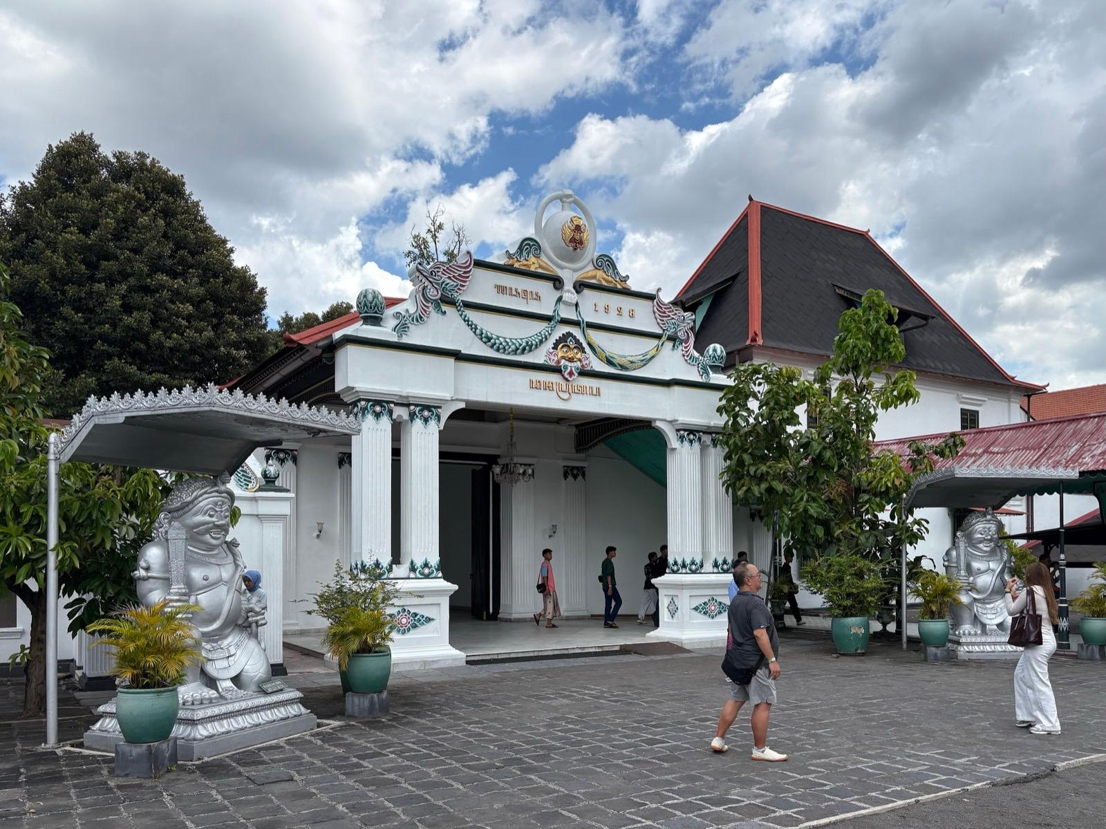
Read Yogyakarta the way its founding sultan meant it to be read, as a single straight line from a northern pillar through the palace toward the southern ocean, a sacred axis UNESCO inscribed in twenty twenty-three.
Start · The Tugu Monument: One End of a City Built as a Line
DirectionsStops
- 1
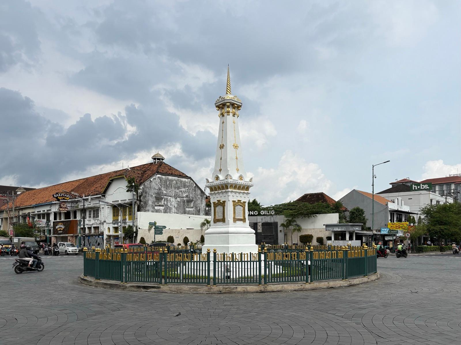
The Tugu Monument: One End of a City Built as a Line
The white-and-gold pillar at the northern crossroads that fixes one end of a capital drawn as a single straight line.
- 2
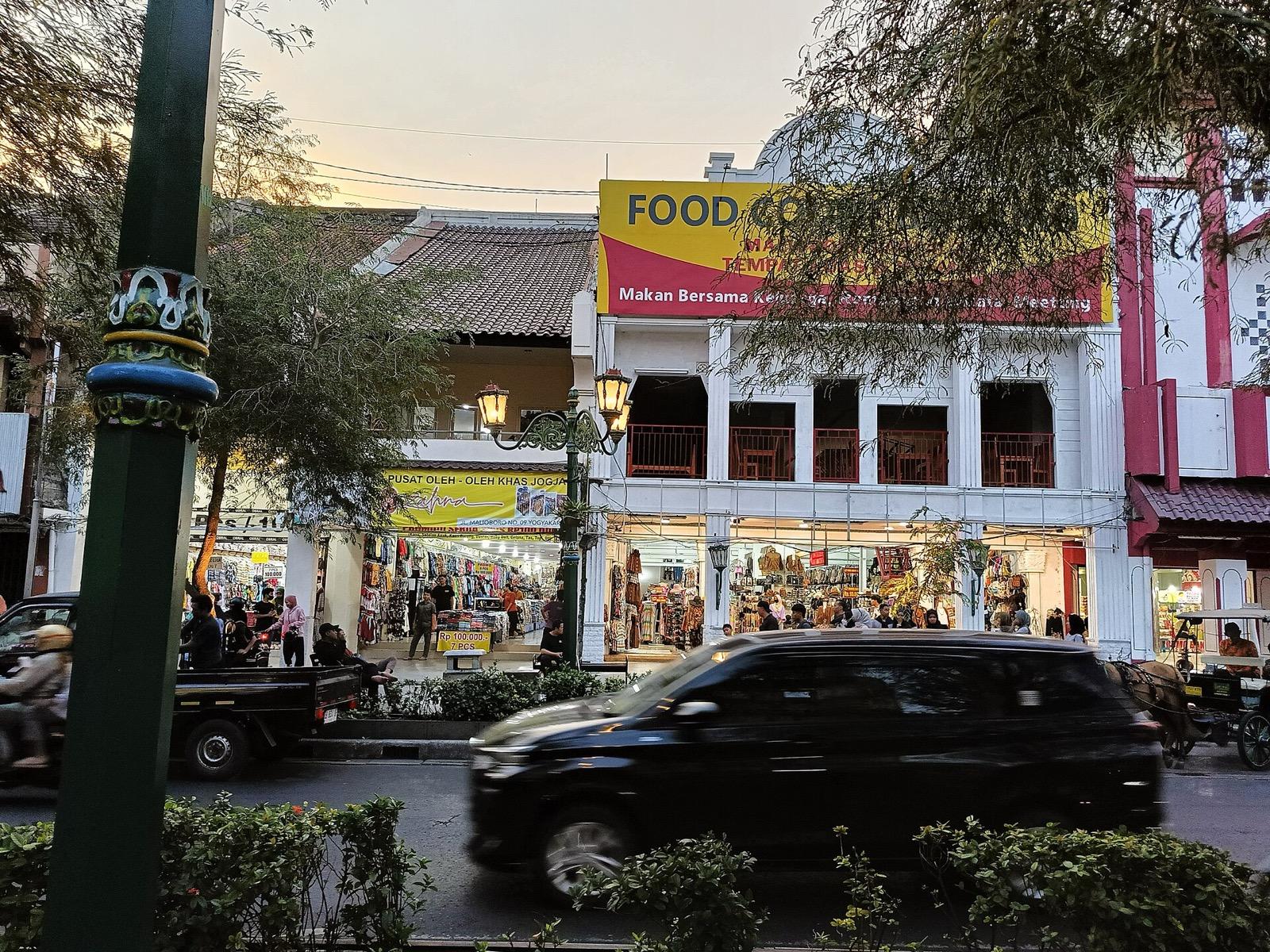
Malioboro Street: The Middle of the Sacred Line
The famous market spine running south from the pillar toward the palace, the middle segment of the sacred axis.
- 3
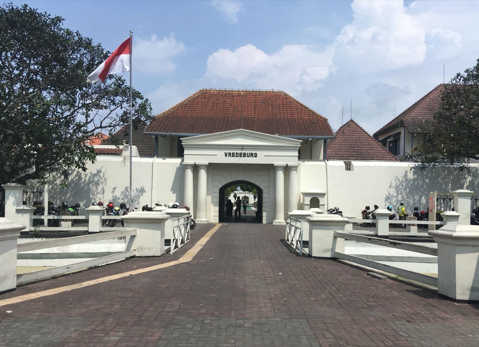
Fort Vredeburg: The Peace Fort Built to Watch a King
The Dutch fort at the foot of Malioboro, its cannon-friendly walls positioned to oversee the sultan's palace.
- 4
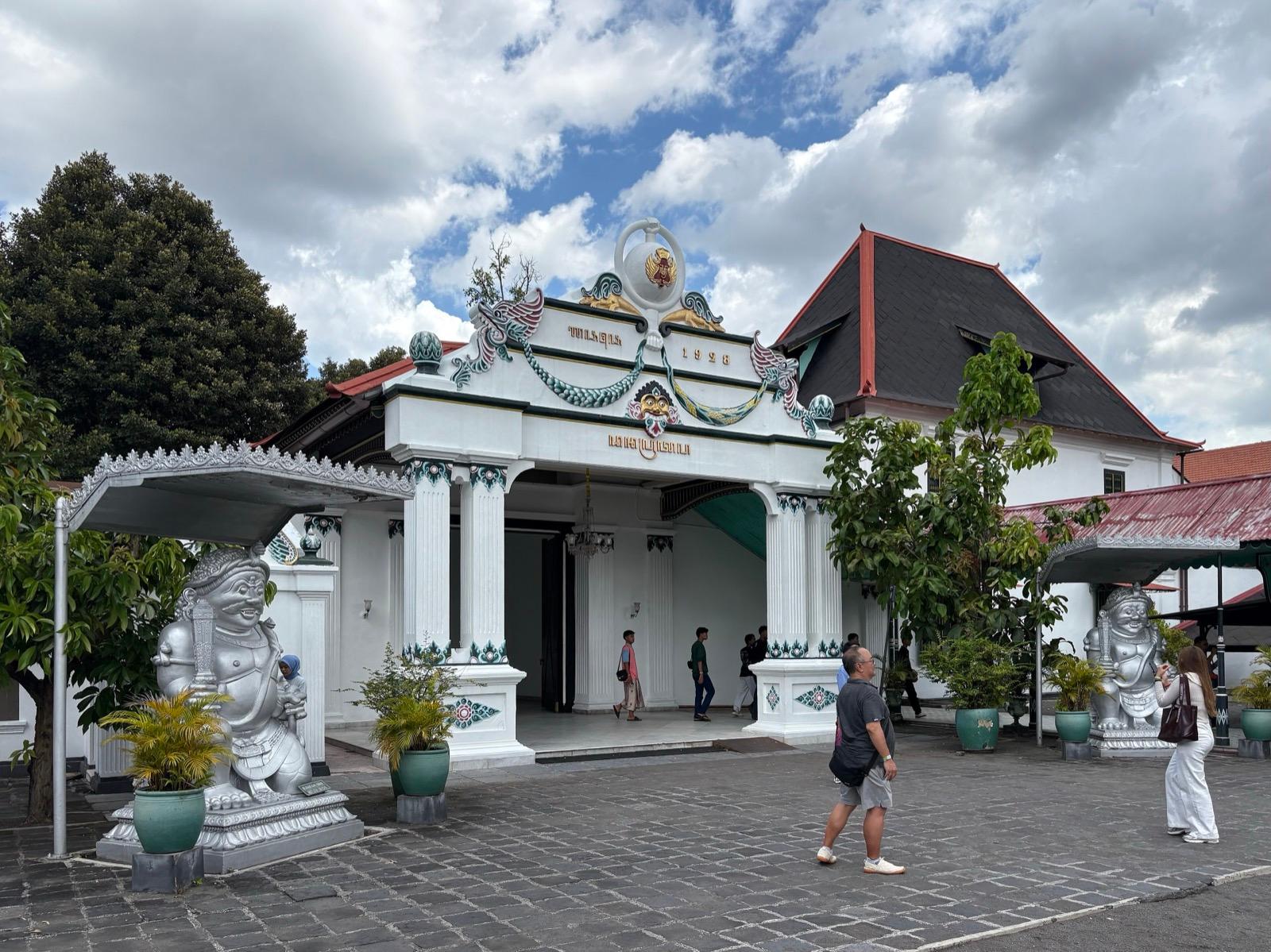
The Kraton: The Living Palace That Drew the Whole City as a Line
The walled royal palace at the centre of the axis, still home to the reigning sultan and the heart from which the whole city was drawn.
- 5
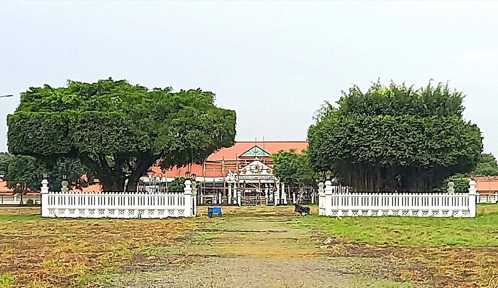
Alun-Alun Utara: The Royal Square of Sacred Trees and Southern Sand
The sandy northern royal square before the palace, guarded by two caged sacred banyan trees.
- 6
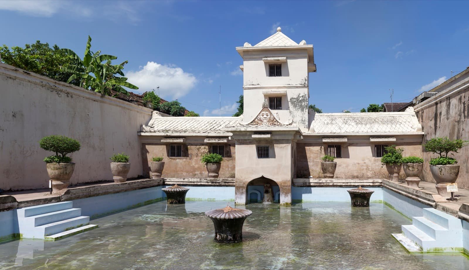
Taman Sari: The Flooded Water Castle with a Mosque Hidden Underground
The sultan's water castle and pleasure garden, with mirrored bathing pools and a circular underground mosque reached by tunnel.
- 7
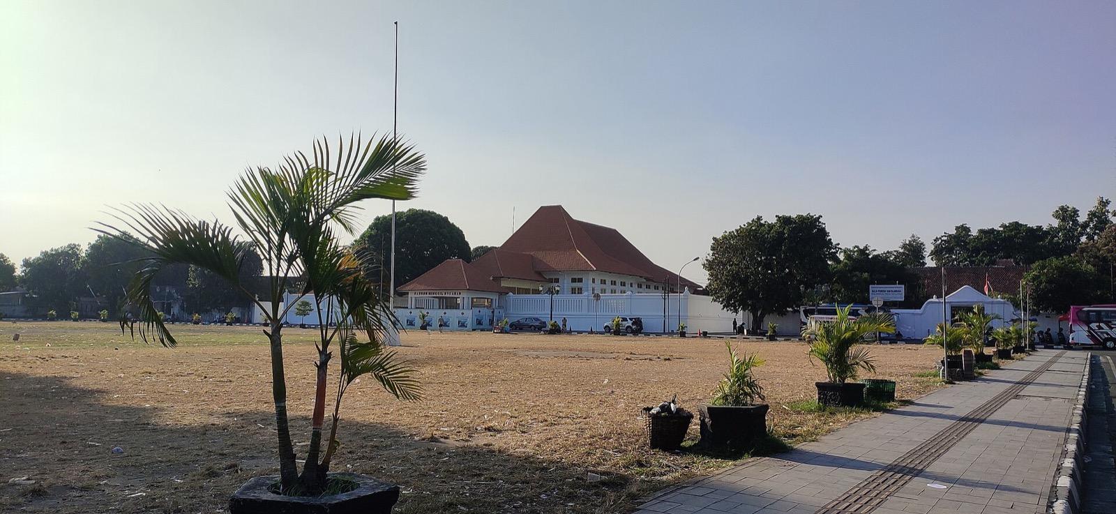
Alun-Alun Kidul: Where the Sacred Line Meets the Everyday
The lively southern royal square that closes the axis, home to twin banyan trees and the blindfold walk called Masangin.
Details
Best Time to Visit
Early morning, from about seven to ten, or late afternoon into the evening. Yogyakarta sits close to the equator and midday sun is fierce with little shade, so the cooler ends of the day are far more comfortable for a walk down the axis. Late afternoon has the added reward of reaching the southern square, Alun-Alun Kidul, as it comes alive in the evening. The Kraton and Taman Sari keep daytime hours, roughly morning to mid-afternoon and closed Mondays for the Kraton, so an early start lets you catch the palace before the heat and the tour crowds peak.
Pro Tips
- •Go south to follow the sacred line the way it was designed to be read, starting at the Tugu pillar in the north and ending at the southern square, so the city's own logic unfolds in order.
- •Reach the Kraton and Taman Sari earlier in the day, since both keep daytime hours and the Kraton closes on Mondays, and both draw large tour groups by late morning.
- •Carry small cash in rupiah for the modest entry fees, about fifteen thousand rupiah each for foreign visitors at the Kraton and Taman Sari and a few thousand at Fort Vredeburg.
- •Dress modestly with shoulders and knees covered for the Kraton, where the court is Muslim, and use the sarong available at the palace entrance if you need one.
- •Save the southern square for late afternoon or evening, when it fills with people and you can watch the blindfold Masangin tradition unfold in the cool of the day.
- •Agree any becak, the pedicab, fare clearly before you set off, and feel free to simply decline drivers and stall-holders politely as you keep your own pace down Malioboro.
Safety & Precautions
- •Malioboro and the two squares get crowded and busy with traffic and becak, so keep your bag zipped and in front of you and stay aware of pickpockets in the densest stretches.
- •Yogyakarta's tropical sun is strong with little shade along the open axis, so carry water, wear a hat and sunscreen, and be ready for sudden heavy rain, especially in the wet season.
- •The Kraton is a living palace and a Muslim court, so keep to visitor areas, dress respectfully, and remember parts are the sultan's private home and closed to the public.
- •At Taman Sari the stone can be uneven and the underground tunnels to Sumur Gumuling are dim and stepped, so watch your footing and take the stairs slowly.
Travel advisory: Exercise Increased Caution (Level 2).
Gallery
Related Reading
Go deeper on what you'll see, hear, and walk through.
Overview
Best Self-Guided Walking Tours in Yogyakarta (2026)
3 min
Overview
One Day in Yogyakarta: A Walkable Itinerary
7 min
Overview
Yogyakarta Travel Guide 2026: Days, Transport, Cost, and Safety
8 min
Thematic
Best History Walking Tours in Yogyakarta (2026)
2 min
Thematic
The Sultan's Line and the Temple Mountains: Reading Yogyakarta
8 min
Companion
The Kraton at the Center: How Yogyakarta Was Drawn as a Single Straight Line
7 min
Deep dive
Taman Sari Water Castle: Yogyakarta's Garden Built to Disappear
7 min
Read
What to Eat in Yogyakarta: Gudeg, Sate Klathak, and How to Order Them
8 min
Read the walk
The full story of Old Town: Walking the Sultan's Sacred Line, in words. Prefer to listen? Play it narrated, from home or on location.
Introduction
In seventeen fifty-five a rebel prince won half a kingdom, took the title Hamengkubuwono the First, and did something few founders ever do. He laid out an entire capital as a single straight sentence, a line running roughly six kilometres from a pillar in the north, down a market street, through his palace, and on toward the Indian Ocean in the south. UNESCO records this as the Cosmological Axis of Yogyakarta, inscribed in twenty twenty-three, and it was meant to be read on foot, one landmark at a time. That is exactly what this walk does, here in Yogyakarta, Indonesia, north to south, at your own unhurried pace. There are seven stops across about six kilometres, and roughly two-and-a-half to three hours if you linger. Along the way the serene idea of the axis, the mountains as the source of life and the sea as the final return, meets harder facts: a market street the Dutch built into a commercial artery, and a colonial fort aimed straight at the palace. Sacred geometry and colonial surveillance share one street, and this walk holds both without hurrying you past either. You move solo, no group van, no schedule, no one steering you toward a shop. You can pause at a caged banyan tree or a mirrored bathing pool for as long as you like. The starting point is the tall white-and-gold pillar at the northern crossroads, the Tugu monument. When you arrive at the Tugu monument, begin with stop one.
1. The Tugu Monument: One End of a City Built as a Line
This slender white pillar with its gold-tipped crown marks the northern end of the Cosmological Axis, the line that is Yogyakarta itself. Sultan Hamengkubuwono the First raised it in seventeen fifty-five, the same year he founded the city, and he called it Tugu Golong-Gilig. Back then it was a cylindrical pole with a rounded top, standing about twenty-five metres tall. Local tradition holds that the sultan used it as a focal point for meditation, standing at his palace far to the south and sighting along this pillar toward Mount Merapi, the volcano on the northern horizon. That sightline is the whole design. The axis runs from the southern sea, through the palace at its heart, up to Merapi, so that the mountains stand for the source of life and the sea for the final return. The pillar you see now is not the original. In the eighteen sixty-seven earthquake the tall pole collapsed. The Dutch colonial authorities rebuilt it in eighteen eighty-nine, but shorter, about fifteen metres, with a square base and a conical top, and they gave it a plain Dutch name meaning the white monument. A renovation in twenty twelve added the gold-painted detail, said to be twenty-two carat, that catches the light at the tip today. UNESCO records the whole axis, this pillar included, as inscribed heritage since twenty twenty-three. Take a moment here at the northern crossroads. Everything ahead of you, the market street, the fort, the palace, the two great squares, sits on the line that begins right here. You are standing at one end of a sentence the city was built to speak.
2. Malioboro Street: The Middle of the Sacred Line
You are now walking the middle of the line. Malioboro is the historic street that runs south from the Tugu pillar straight toward the palace gates, and it sits squarely on the north-south axis between the Sultan's Palace and Mount Merapi. To the sultan who designed it, this was a sacred segment, part of the journey from mountain to sea. To almost everyone else who has come since, it has been something more everyday: a market. Even the name is a puzzle that has never been fully settled. One idea traces Malioboro to the Sanskrit word malyabhara, meaning a garland of flowers, fitting for a ceremonial approach to a palace. Another traces it to Marlborough, the name of a British figure from the brief interlude when the British held Java, roughly eighteen eleven to eighteen sixteen. Both stories have their defenders, and the truth is genuinely unresolved, so you can walk the street holding both at once. What is clear is what happened here later. The Dutch made this the commercial artery of the city, and from around nineteen hundred the trade thickened, with merchants building up the shopfronts. By the nineteen tens the southern stretch had become the city's Chinatown. Today Malioboro is one of Southeast Asia's most touted and crowded shopping streets, thick with stalls and with becak drivers, the men who pedal the three-wheeled pedicabs, calling out for a fare. Here is where going solo pays off. You set the pace along these two-and-a-half kilometres. No one is steering you into a particular shop or hurrying you along. You can read the street as the sacred spine it was drawn to be, and also as the living market it became, on your own clock.
3. Fort Vredeburg: The Peace Fort Built to Watch a King
At the southern end of Malioboro, just short of the palace, stands a low white European fort. Its Dutch name, Vredeburg, means peace fort, from the Dutch words for peace and for stronghold. The name was meant to celebrate the supposed peaceful coexistence of the fort and the palace it faced. There is a quiet irony in that, because this was a garrison, positioned so its guns could oversee the sultan's home. The building went up in stages. Around seventeen sixty the Dutch governor Nicolaas Harting requested a fort, and the sultan, Hamengkubuwono the First, provided the land. In seventeen sixty-seven it was extended into a permanent structure, and by seventeen eighty-seven it was completed and first named Fort Rustenburg. The eighteen sixty-seven earthquake that toppled the Tugu pillar damaged this fort too. When the Dutch rebuilt it, they renamed it Vredeburg, the name it still carries. The arrangement is worth reading plainly. The palace and the fort sit within sight of each other on the same axis, the sacred line the sultan drew and the colonial watchpost the company built, sharing one street. The land beneath the fort is still owned by the Yogyakarta Sultanate, though the buildings now serve a different purpose. Since nineteen ninety-two Fort Vredeburg has been a history museum, its rooms filled with dioramas telling the story of Indonesia's independence struggle. You can view the grounds and the whitewashed walls from outside, or pay the small entry fee to walk in among the exhibits, at whatever pace suits you.
4. The Kraton: The Living Palace That Drew the Whole City as a Line
This is the centre of everything, the point from which the whole line was drawn. The Kraton, meaning the sultan's walled palace, is the heart of Yogyakarta, and its full name is Kraton Ngayogyakarta Hadiningrat. Sultan Hamengkubuwono the First built it in seventeen fifty-five to…
Full narration for this stop unlocks with the tour.
5. Alun-Alun Utara: The Royal Square of Sacred Trees and Southern Sand
Just north of the palace opens a wide sandy forecourt, the Alun-Alun Utara, the north great square. Alun-alun means a great royal square, and this one is roughly a hundred and fifty metres on each side, its surface covered in pale sand rather than grass. At its centre stand two…
Full narration for this stop unlocks with the tour.
6. Taman Sari: The Flooded Water Castle with a Mosque Hidden Underground
About two kilometres south of the palace core lies one of the strangest and most beautiful places on the whole line, Taman Sari, the water castle. Sultan Hamengkubuwono the First began building it around seventeen fifty-eight and it was finished around seventeen sixty-five. It…
Full narration for this stop unlocks with the tour.
7. Alun-Alun Kidul: Where the Sacred Line Meets the Everyday
You have reached the southern square, and the end of the walk. This is the Alun-Alun Kidul, the south great square, and locals simply call it Alkid. It is the palace's back forecourt, and like its northern twin it has two banyan trees standing together at its centre. This square…
Full narration for this stop unlocks with the tour.