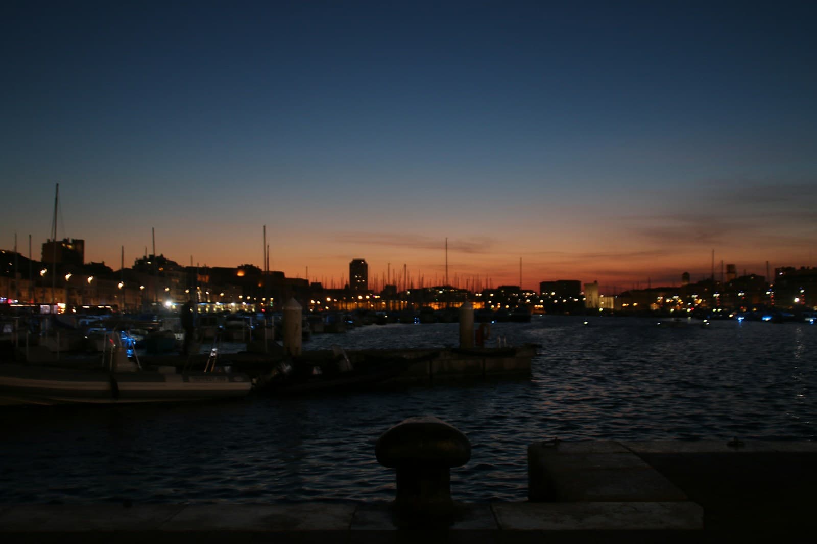
Seven stops. Two point three kilometres around the Vieux-Port and into Le Panier. The Vieux-Port of Marseille has been a working harbour without meaningful interruption since Greek sailors from Phocaea anchored here around six hundred BCE, making this single inlet one of the longest continuously inhabited urban waterfronts in Europe. The walk reads 2,600 years of port evolution off the same axes the Greeks laid.
Start · Jardin des Vestiges: The Soil the Phocaeans Walked
DirectionsStops
- 1

Jardin des Vestiges: The Soil the Phocaeans Walked
Centre Bourse, first arrondissement. Greek and Roman harbour remains unearthed in nineteen sixty-seven during shopping-arcade construction; about ten thousand square metres classified Monument Historique; officially opened to the public on the seventeenth of October two thousand and nine.
- 2

Place de Lenche: Where the Greek Agora Stood
Le Panier, second arrondissement. The oldest square in Marseille, on the site of the ancient Greek agora overlooking the Lacydon. Saint-Sauveur cellars beneath the square, thought to be the cisterns of the third-century-BCE Greek city; classified Monument Historique in eighteen forty.
- 3

Centre de la Vieille Charité: The Royal Period Arrives
Two rue de la Charité, Le Panier. Almshouse and hospice built sixteen seventy-one to seventeen forty-nine by Marseille-born sculptor and architect Pierre Puget under the seventeenth-century royal confinement-of-the-poor policy. Classified Monument Historique on the twenty-ninth of January nineteen fifty-one.
- 4

Cathédrale de la Major: The Imperial Layer at the Seam
Place de la Major, second arrondissement. One hundred forty-two metres of Romano-Byzantine basilica, built eighteen fifty-two to eighteen ninety-three. Foundation stone laid by Louis-Napoléon Bonaparte on the twenty-sixth of September eighteen fifty-two. Architect succession: Léon Vaudoyer, Henri-Jacques Espérandieu, Henri-Antoine Révoil.
- 5

Fort Saint-Jean and MuCEM: The Diptych at the Harbour Mouth
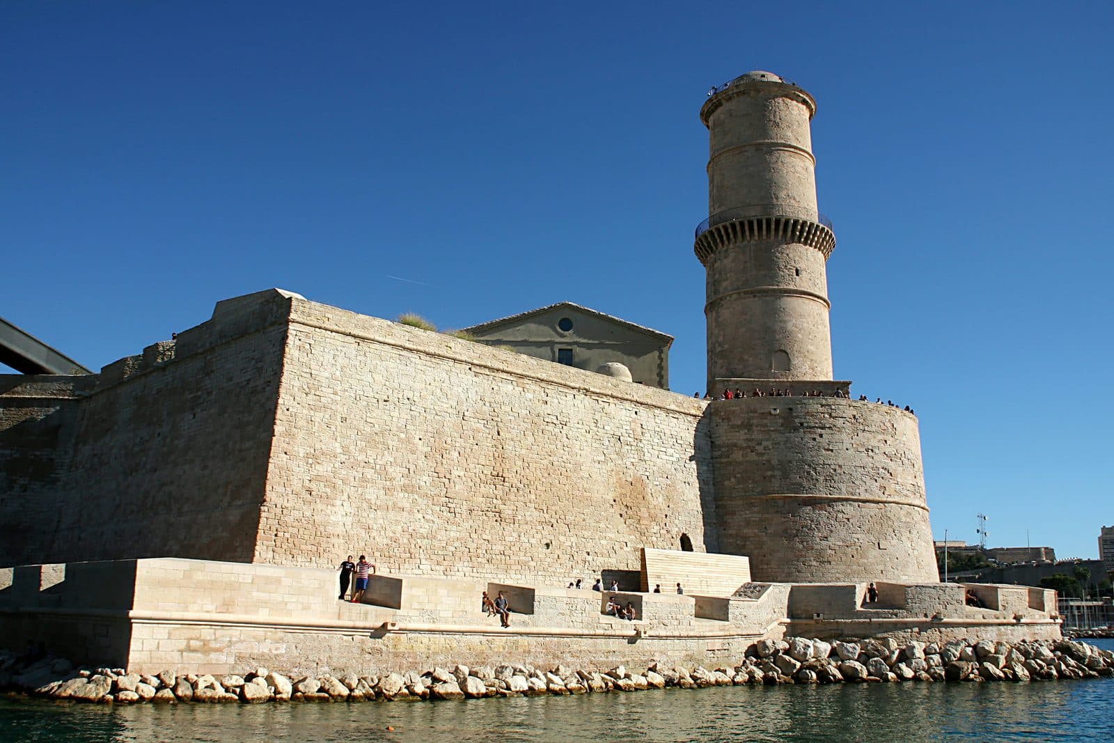
Esplanade J4, second arrondissement. Fort Saint-Jean built in sixteen sixty by order of Louis XIV under chief engineer Louis Nicolas de Clerville. MuCEM opened on the seventh of June twenty thirteen, designed by Rudy Ricciotti in association with Roland Carta. Linked by an aerial walkway of black concrete.
- 6

L'Ombrière at the Quai de la Fraternité: The 2,600-Year View
Quai de la Fraternité, head of the Vieux-Port. Polished stainless-steel canopy forty-six metres by twenty-two metres, designed by Foster + Partners under Norman Foster with landscape architect Michel Desvigne, installed in twenty thirteen for Marseille-Provence European Capital of Culture.
- 7

Le Panier: The Wound and What Survived
Centre of Le Panier, between Place des Moulins and Rue du Petit-Puits. Marseille's oldest neighbourhood, on the site of the original Greek settlement. The north quarter below rue Caisserie was dynamited in February nineteen forty-three after the rafle du Vieux-Port; the medieval south survived.
Details
Best Time to Visit
Late morning to mid-afternoon on a weekday, ideally Tuesday through Friday. The Vieux-Port reads most legibly between about ten in the morning and three in the afternoon, when the light fills the harbour basin and the mistral, if it is blowing, has typically eased. Saturday markets at Quai des Belges crowd the head of the port and slow the climax at Stop six. Mondays close several interiors at MuCEM, but the exterior reading at Stop five still holds. Summer afternoons run hot on the unshaded quays; an October or April walk gives the cleanest light and the lowest crowds.
Pro Tips
- •The audio anchors on the exterior of every stop; you do not need to buy entry to any of the seven sites to follow the tour. If you want to add an interior, MuCEM at Stop five and the Musée d'Histoire de Marseille at Stop one are the strongest experiences and are open most days. Book MuCEM at mucem.org before you arrive to skip the line on busy days.
- •Stop one is inside the Centre Bourse shopping arcade. Enter through the main mall entrance on Rue de Bir Hakeim and follow signs for the Musée d'Histoire de Marseille; the Jardin des Vestiges is visible from the museum lobby and from the upper-level walkway above. You can read the site from above for free without entering the museum itself.
- •The climb from Place de Lenche at Stop two up to the Vieille Charité at Stop three is steep and stepped. About two hundred metres of narrow uphill lanes. Wear closed shoes with grip; the cobbles can be slick after rain.
- •Stop four, the Cathédrale de la Major, is fully readable from the outside. If you want to step inside, the cathedral is open most days and entry is free; the interior is one of the most ambitious nineteenth-century mosaic programmes in France.
- •The walk between Stop five and Stop six runs along the north quay of the Vieux-Port and is one of the best walking stretches in the city. Stay on the harbour side of the road for the cleanest views back across to Notre-Dame de la Garde and Fort Saint-Nicolas.
- •L'Ombrière at Stop six is a popular meeting point and an iconic photo spot; expect groups underneath the mirror canopy at midday. The mirror reads cleanest in early morning or late afternoon, when the angled light catches the underside.
- •The synthesis stop at Le Panier sits in the medieval heart of the quarter. After the audio closes, the small artisan workshops along Rue du Petit-Puits, the savonneries on Rue du Refuge, and the Place des Moulins are five-minute detours that reward the listener who has just walked the harbour's biography.
Safety & Precautions
- •Pickpocketing is documented at the head of the Vieux-Port, around L'Ombrière at Stop six, and in the Centre Bourse arcade at Stop one. Keep wallets and phones in front pockets or zipped bags, and stay alert in the dense crowds at the Quai de la Fraternité.
- •The walk includes one steep climb from the harbour quay up into Le Panier between Stop two and Stop three, and a second climb from L'Ombrière back up to the synthesis stop at Le Panier. Total elevation gain is modest, about sixty metres, but the climbs are on narrow stepped lanes that can be uneven. Wear comfortable closed shoes.
- •Marseille summers run hot and the quays around Stops four, five, and six have limited shade. Carry water and consider a morning start in July and August. The mistral wind can pick up suddenly along the harbour mouth at Stop five; a light layer is worth carrying even in summer.
- •Some streets in Le Panier are quiet residential lanes. Keep voices low and be respectful of residents, especially around the synthesis stop at Stop seven, which holds the memory of the nineteen forty-three rafle.
- •Stop five at Fort Saint-Jean involves walking on uneven historic stone surfaces and crossing the aerial walkway between Fort Saint-Jean and MuCEM. The walkway has a railing but is nineteen metres above the ground; visitors with strong vertigo may prefer to read the diptych from the J4 esplanade below rather than crossing the bridge.
Travel advisory: Exercise Increased Caution (Level 2).
Gallery
Related Reading
Go deeper on what you'll see, hear, and walk through.
Overview
Best Self-Guided Walking Tours in Marseille (2026)
4 min
Overview
Marseille Travel Guide: How Many Days, Getting Around, Safety, When to Go (2026)
5 min
Overview
One Day in Marseille: A Walkable Old-Port Itinerary (2026)
5 min
Thematic
Best History Walking Tours in Marseille (2026)
2 min
Thematic
The Oldest City in France Was Never Really French: Marseille as a 2,600-Year Port of Arrival
6 min
Thematic
What to Eat in Marseille: A Food Guide (2026)
4 min
Companion
One Inlet, 2,600 Years: A Companion to the Vieux-Port History Tour
5 min
Deep dive
The Bridge Between 1660 and 2013: Fort Saint-Jean and the MuCEM
4 min
Deep dive
The Greek Harbour Under the Shopping Mall: Marseille's Jardin des Vestiges
4 min
Read the walk
The full story of Vieux-Port: 2,600 Years on the Same Inlet, in words. Prefer to listen? Play it narrated, from home or on location.
Introduction
Above your head, a concrete arcade built in nineteen sixty-seven. Below your feet, on the other side of the railing, a wall built before Rome existed. The soil under the modern shopping arcade is the soil the Phocaean Greeks first walked around six hundred BCE.
The Vieux-Port of Marseille has been a working harbour without meaningful interruption since Greek sailors from Phocaea anchored here around six hundred BCE, making this single inlet one of the longest continuously inhabited urban waterfronts in Europe. The walk reads twenty-six hundred years of port evolution off the same axes the Greeks laid.
The thesis is a single inlet surviving every foreclosure. Caesar's siege in forty-nine BCE. Saracen raids in eight thirty-one and eight thirty-eight. The Black Death of thirteen forty-eight. Louis the Fourteenth's punishment forts in sixteen sixty, cannons pointed inward at the city. The Suez Canal bypass of eighteen sixty-nine, when cargo shifted to Joliette. The German destruction of fifteen hundred buildings in February nineteen forty-three. Through all of it, this inlet kept loading and unloading.
Seven stops. About five kilometres. Roughly one hundred minutes including stop dwell. From this archaeological garden, up into Le Panier to the Greek agora, through the seventeenth-century almshouse and the nineteenth-century cathedral, down to the harbour mouth where a sixteen-sixty royal fort faces a twenty-thirteen concrete-lace museum, across the head of the port under a mirror canopy, and back up into the medieval quarter that wraps it all.
When you arrive at the Jardin des Vestiges inside the Centre Bourse, begin with stop one.
1. Jardin des Vestiges: The Soil the Phocaeans Walked
You are looking down at the Jardin des Vestiges. Three square towers in cut stone, a gateway, the inner basin of an ancient freshwater stream, and a stretch of Roman docks. The towers and gateway date to the second or third century BCE. The Roman docks above them date to the first century CE.
Per Wikipedia's Jardin des Vestiges article and the Musée d'Histoire de Marseille record, this site was discovered in nineteen sixty-seven when workers cutting foundations for the Centre Bourse shopping arcade ran into Greek harbour fortifications. About ten thousand square metres of ancient port fabric was unearthed. The construction stopped. The city placed the site under monument-historique protection. The site officially opened to the public on the seventeenth of October two thousand and nine.
The inner basin in front of you, the small stretch of preserved water and stone, is what the Greeks called the Lacydon. A freshwater stream once fed it. The Phocaeans found it around six hundred BCE, anchored their ships in its protected inlet, and built a colony on the hillsides around it. The Phocaeans were Ionian Greeks from the city of Phocaea on the western coast of Anatolia, modern Foça in Turkey. They were one of the great seafaring peoples of the archaic Mediterranean, and they founded a string of colonies west of the Aegean: Massalia around six hundred BCE; Emporion at Empúries in Catalonia around five seventy-five BCE; Elea at Velia in Campania around five forty BCE. Massalia is the eldest of the three.
A story Aristotle preserved in The Constitution of the Massaliotes tells of a Phocaean sailor named Protis and a Ligurian princess named Gyptis, daughter of the chief Nannus of the Segobrigii. At her father's banquet, Gyptis chose Protis as her husband by offering him a cup of water. The fragment survives in Athenaeus' Deipnosophistae, of the second or third century CE, and a parallel Latin version is preserved in Justin's epitome of Pompeius Trogus. Modern scholarship treats the story as foundation-myth in literary form, the marriage-feast-choice motif a recurring Greek-colonisation framing, archaeologically anchored in attested Phocaean-Ligurian contact. The names belong to a story Aristotle preserved, not to the historical record.
Fifty-four years after the first Phocaean colonists arrived, the Persian king Cyrus the Great conquered Phocaea in five forty-six BCE. Many Phocaeans chose exile over Persian rule, and a second wave reached Massalia around five forty-five to five forty BCE. The foundation event and the refugee event are separated by half a century. The conflation of the two is a common piece of romance about Marseille; the record names two waves.
The Roman docks above the Greek fortifications are the first verifiable instance of the thesis's specific mechanic. In April forty-nine BCE, Massalia closed its gates to Caesar and allied with Pompey and the Optimates under Lucius Domitius Ahenobarbus. Caesar besieged the city for about four months, broke the Massiliot fleet, and took the city in September. He permitted nominal autonomy in deference, in his own phrasing in the Bellum Civile, to ancient ties of friendship and support of Rome. The city lost its fleet, its treasure, and most of its territory. The political settlement changed. The harbour kept loading and unloading. The Roman docks in front of you are the proof.
The stop is the anchor. The inlet is older than France. The next stop is where the Greeks ran the city from.
2. Place de Lenche: Where the Greek Agora Stood
You are standing on Place de Lenche, the oldest square in Marseille. Per the Marseille Tourism record and tourisme-marseille.com, this square sits on the site of the ancient Greek agora of Massalia, overlooking the Lacydon, the inner basin you saw at Stop one.
Look around. A small triangular square. Café terraces. Quiet for a city of this size. Forty metres downhill, on the harbour side, the streets fall away toward the water. Behind you, the narrow lanes of Le Panier climb the hillside. The Greek city of Massalia developed up two hills here: the Butte Saint-Laurent, where Place de Lenche sits, and the Butte des Moulins behind you to the north, the acropolis the Greeks dedicated to Athena.
Underneath your feet, beneath the square, are the Saint-Sauveur cellars. The municipal record describes them, per tourisme-marseille.com, as cisterns thought to have served the Greek city in the third century BCE. They were classified as a Monument Historique in eighteen forty, but they are inaccessible to the public. The political-civic centre of Greek Massalia sat where this café terrace sits today. The continuity is not poetic. It is the same patch of ground.
The name Lenche comes from the Corsican Lincio family who installed a coral workshop on the square in the sixteenth century. The name displaced whatever the medieval city had called the square, which displaced whatever the Greeks had called it. The square is older than its name.
Around five forty-five BCE, a second wave of Phocaeans climbed up to this agora. They had fled Phocaea after Cyrus the Great's conquest in five forty-six BCE. Per Wikipedia's Phocaea article and the Livius source on Phocaea, the second wave joined the existing colony and made Massalia one of the wealthiest Greek cities of the western Mediterranean. Wikipedia's History of Marseille records that by the fourth century BCE, the city held about fifty thousand inhabitants on roughly fifty hectares. The cisterns beneath this square were watering that city.
This is the second stop in the Greek anchor. The harbour you saw at Stop one was the commercial face. The square you are standing on was the political face. Two faces of the same Greek polis.
The next stop walks two centuries forward at a time. The seventeenth century arrives at the medieval Panier in the form of a building that wants nothing to do with the medieval streets around it.
3. Centre de la Vieille Charité: The Royal Period Arrives
You have walked two hundred metres uphill from Place de Lenche. The lanes of Le Panier are narrow and stepped, ochre and pink-walled. Then a high pink-and-yellow stone wall opens onto a baroque courtyard. One hundred twelve metres by ninety-six. Four arcaded galleries in three storeys. No outward-facing windows. A chapel under an ovoid dome at the centre.
This is the Centre de la Vieille Charité. Per Wikipedia's Vieille Charité article and Marseille Tourism, it was built between sixteen seventy-one and seventeen forty-nine to designs by Pierre Puget, sixteen twenty to sixteen ninety-four, Marseille-born sculptor and architect, working for the City of Marseille under the seventeenth-century royal policy of confinement of the poor and beggars. The walls are in pink-and-yellow molasse stone from the Cap Couronne quarries west of the city.
Puget died in sixteen ninety-four. The central chapel under the ovoid dome was erected between sixteen seventy-nine and seventeen oh four, completed under the direction of his son François Puget after his father's death. The whole hospice was classified as a Monument Historique on the twenty-ninth of January nineteen fifty-one. Since nineteen eighty-six it has operated as a multidisciplinary cultural centre. It houses the Musée d'Archéologie Méditerranéenne and the Musée d'Arts Africains, Océaniens, Amérindiens.
The beat is the change of grammar. Two stops ago you stood on the Greek agora, an open square at the top of a hillside, the political face of a Greek polis. Here in the same Le Panier, two thousand years later, the seventeenth century has built a closed quadrangle that turns its back on the streets around it. The poor and the beggars of Marseille were confined inside these walls. No outward views. A chapel at the centre for the salvation of those confined. Classical-baroque rigour in a medieval-vernacular neighbourhood.
The building's grammar belongs to Louis XIV's France, not to Provençal Marseille. And Pierre Puget himself is the human collaborator at this beat. Born in this city in sixteen twenty, trained in Italy under Pietro da Cortona, called back to Marseille in his maturity, and given the commission for the city's hospice. He spent twenty-three years on it. He died at seventy-four with the chapel still unfinished. His son took it over. The Vieille Charité is one of the few baroque hospices in Provence and the only major Pierre Puget building in Marseille that survives at full scale.
The royal period has begun. The next stop walks one hundred eighty years forward, to where the new cathedral arrives at the seam between the medieval Panier and the new docks the nineteenth century was about to build.
4. Cathédrale de la Major: The Imperial Layer at the Seam
You have walked two hundred fifty metres west from the Vieille Charité, down toward the quayside. In front of you stands a basilica one hundred forty-two metres long, in striped stone, Romano-Byzantine in style. This is the Cathédrale de la Major, also called…
Full narration for this stop unlocks with the tour.
5. Fort Saint-Jean and MuCEM: The Diptych at the Harbour Mouth
You are now at the mouth of the Vieux-Port on the north side, at Fort Saint-Jean. Look across the water. The corresponding fort on the south side is Fort Saint-Nicolas. The two forts face each other across the harbour entrance. Per Wikipedia's Fort Saint-Jean article, the MuCEM…
Full narration for this stop unlocks with the tour.
6. L'Ombrière at the Quai de la Fraternité: The 2,600-Year View
You are standing under L'Ombrière at the head of the Vieux-Port, on the Quai de la Fraternité. Above you, a polished stainless-steel canopy mirrors the people and the boats and the water beneath it. Per the Foster and Partners project record, the Public Delivery architecture…
Full narration for this stop unlocks with the tour.
7. Le Panier: The Wound and What Survived
You have climbed back up into Le Panier and stopped near the centre of the medieval quarter, between Place des Moulins and Rue du Petit-Puits. Look around. Narrow streets. Laundry strung between windows. Small squares. Painted shutters. Ochre and pink walls. Per Marseille…
Full narration for this stop unlocks with the tour.