
From Quan Thanh Temple up the Co Ngu causeway between Truc Bach and West Lake, past the McCain memorial to Tran Quoc Pagoda on its islet, then round Truc Bach's north shore into Ngu Xa, the bronze casters' island, to finish on its west shore at sunset, all from public sidewalks and lakeside lanes.
Start · Quan Thanh Temple: Guardian of the North
DirectionsStops
- 1
Quan Thanh Temple: Guardian of the North
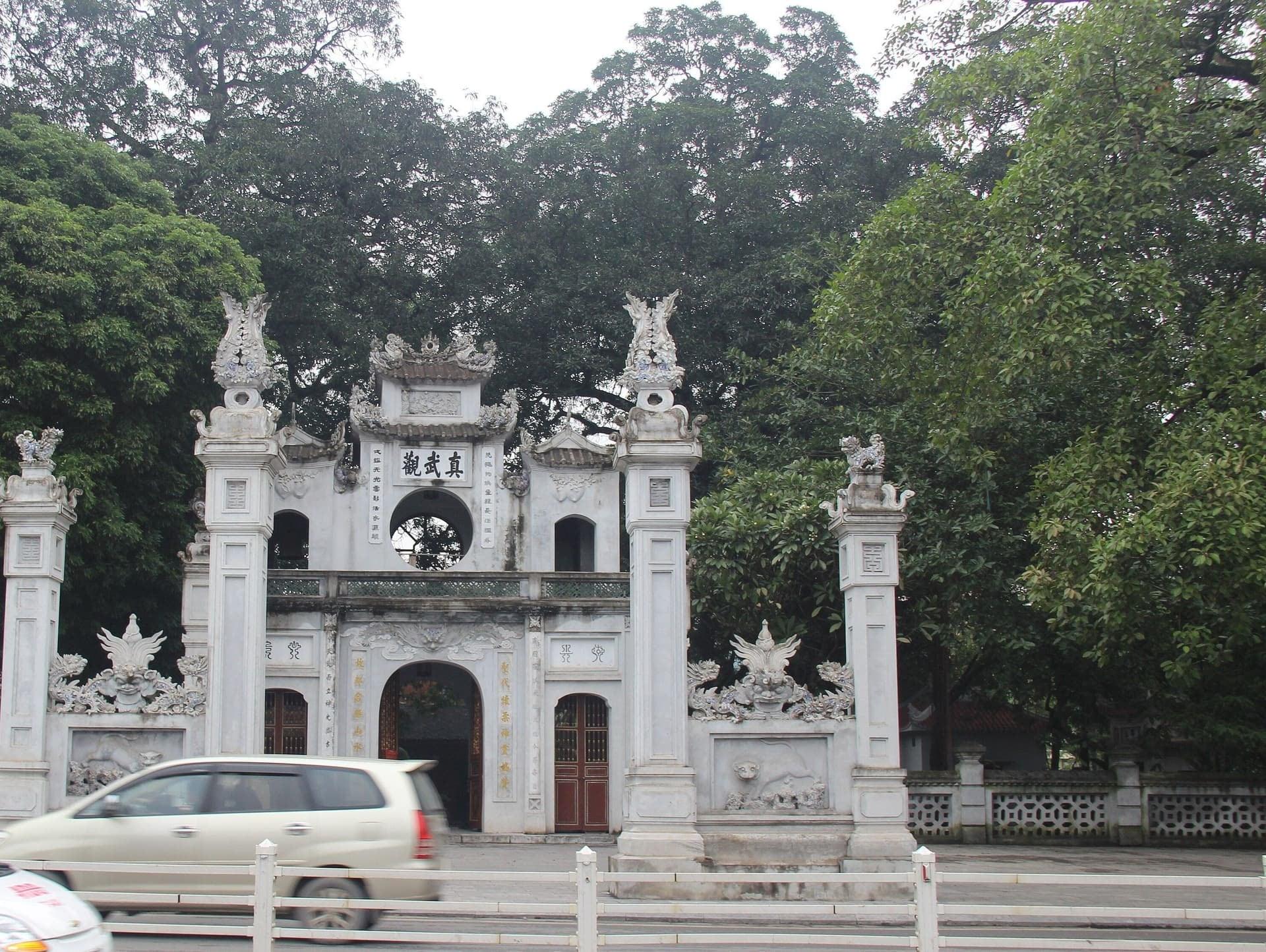
A guardian temple keeps the old city's north. Quan Thanh Temple's gate on Quan Thanh Street, with old trees over the wall and, inside the main hall, a black bronze guardian cast in 1677.
- 2
Truc Bach Lake
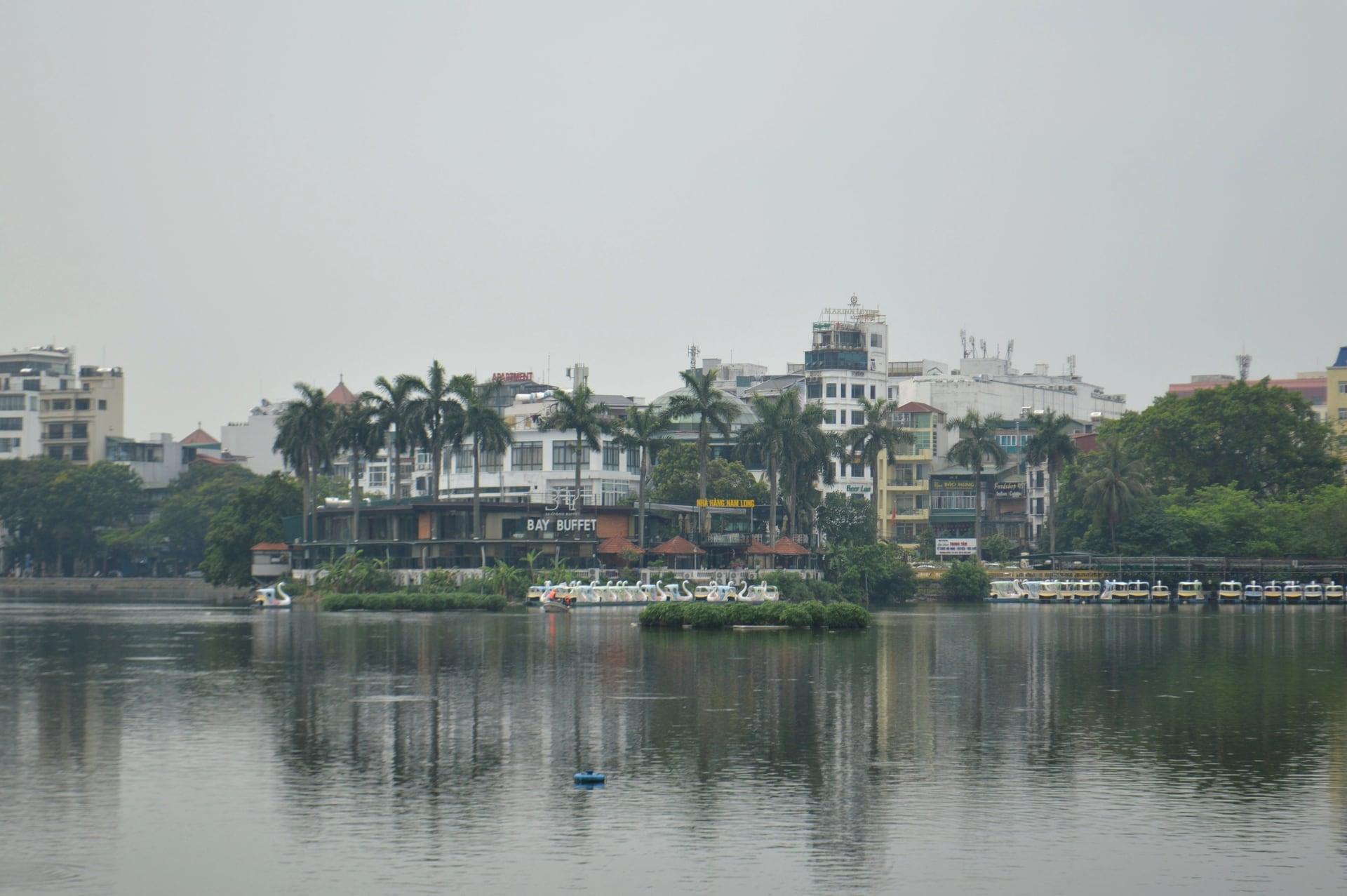
One look takes in the whole lake. Truc Bach from its south-west corner on Thanh Nien Road, with Ngu Xa island's roofs low on the water and the north shore beyond.
- 3
Co Ngu Causeway: One Road, Two Lakes
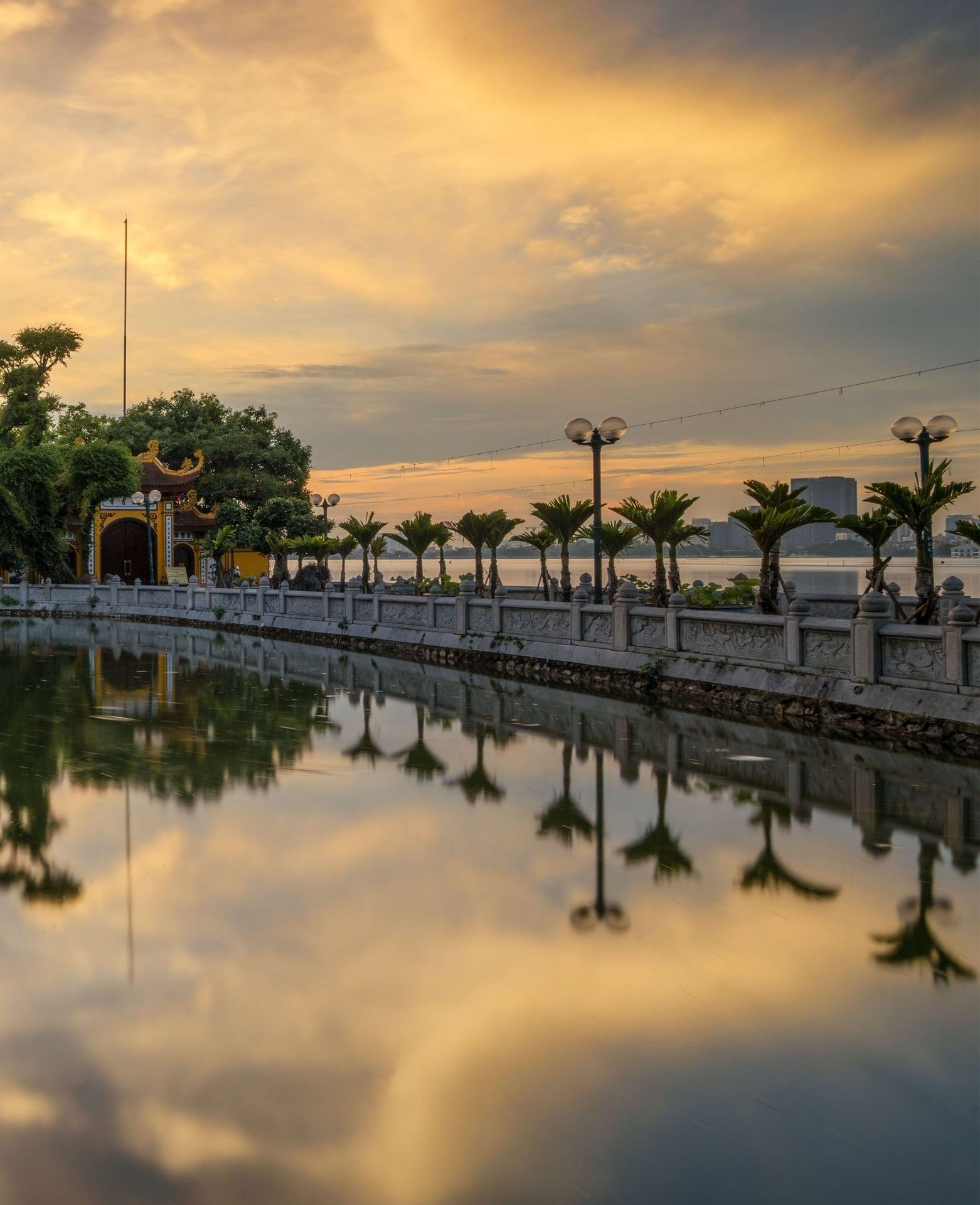
One road divides two lakes here. The Co Ngu causeway, a fishermen's embankment mended every year, widened into Thanh Nien Road in the early 1960s.
- 4
McCain Memorial
A small memorial records a capture in 1967. The memorial on Thanh Nien Road's Truc Bach sidewalk to the capture of US Navy pilot John McCain, reworded in 2015.
- 5
Tran Quoc Pagoda: The Pagoda That Moved
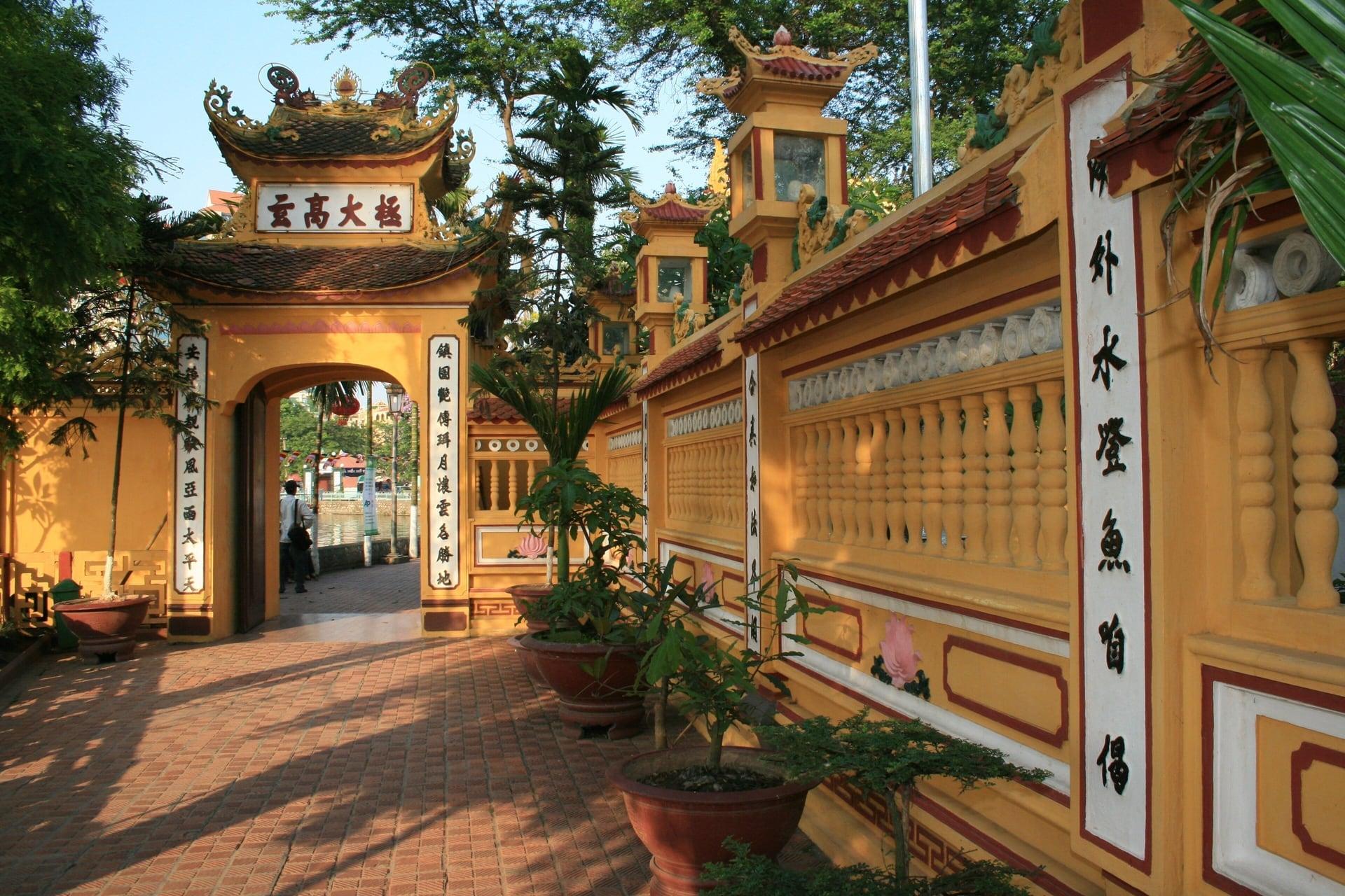
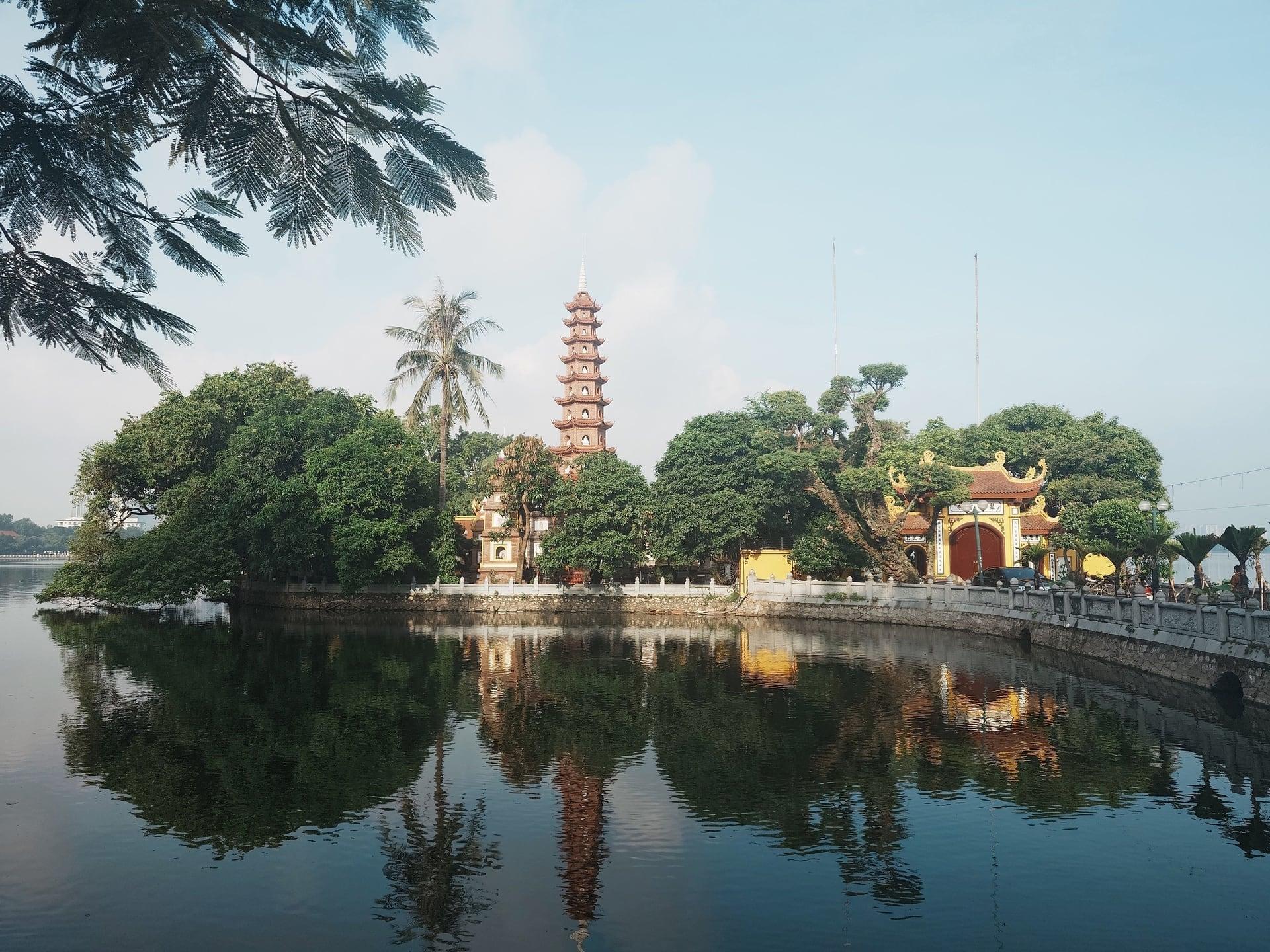
A pagoda that moved sits on an islet. Tran Quoc Pagoda in West Lake, seen from the shore of Thanh Nien Road, with its 2003 stupa and a bodhi tree planted in 1959.
- 6
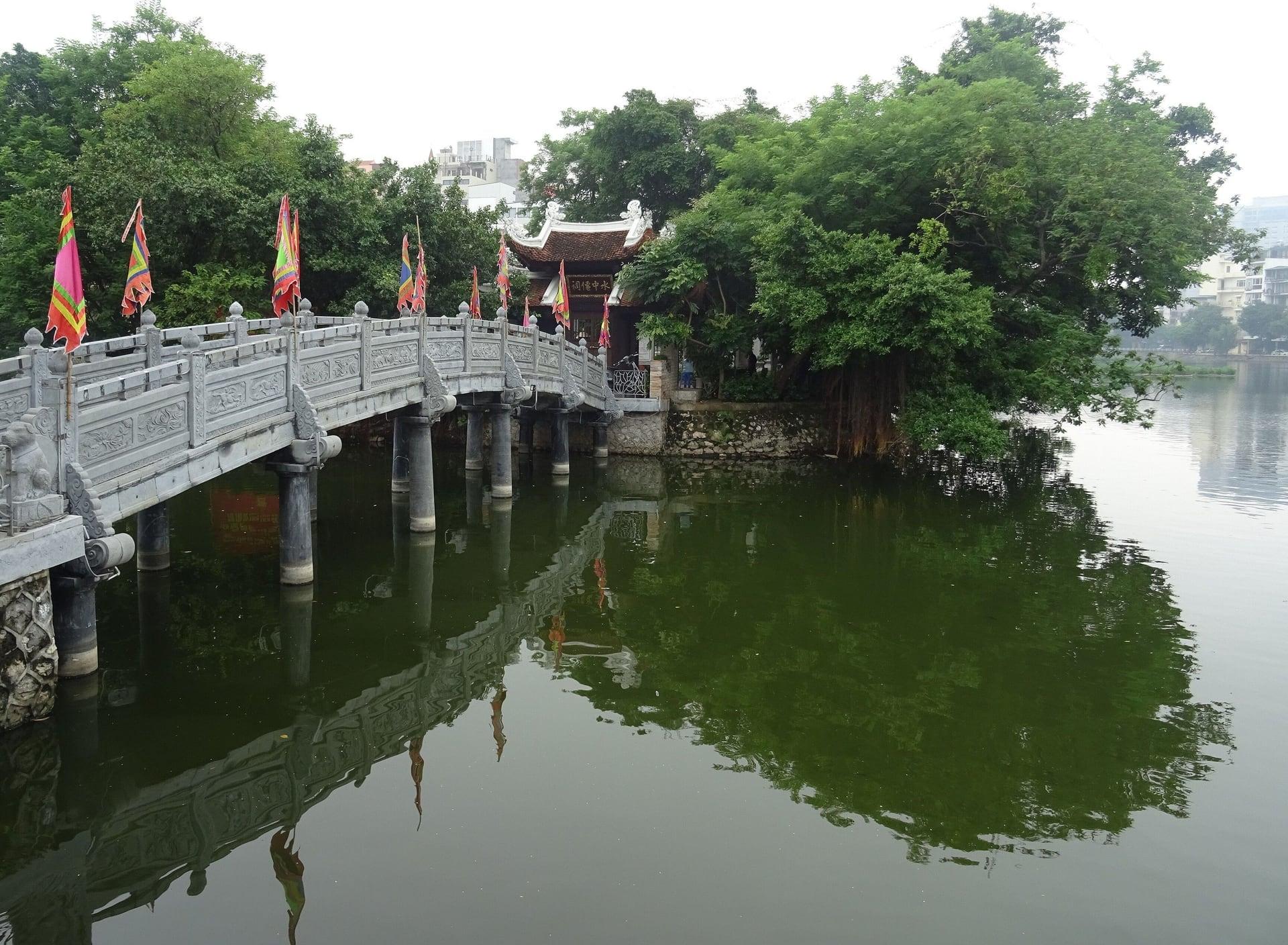
Thuy Trung Tien Temple
A puppy's prophecy lives on this islet. Thuy Trung Tien Temple, a tiny shrine on Truc Bach reached by a short footbridge, tied by legend to the founding of Thang Long.
- 7
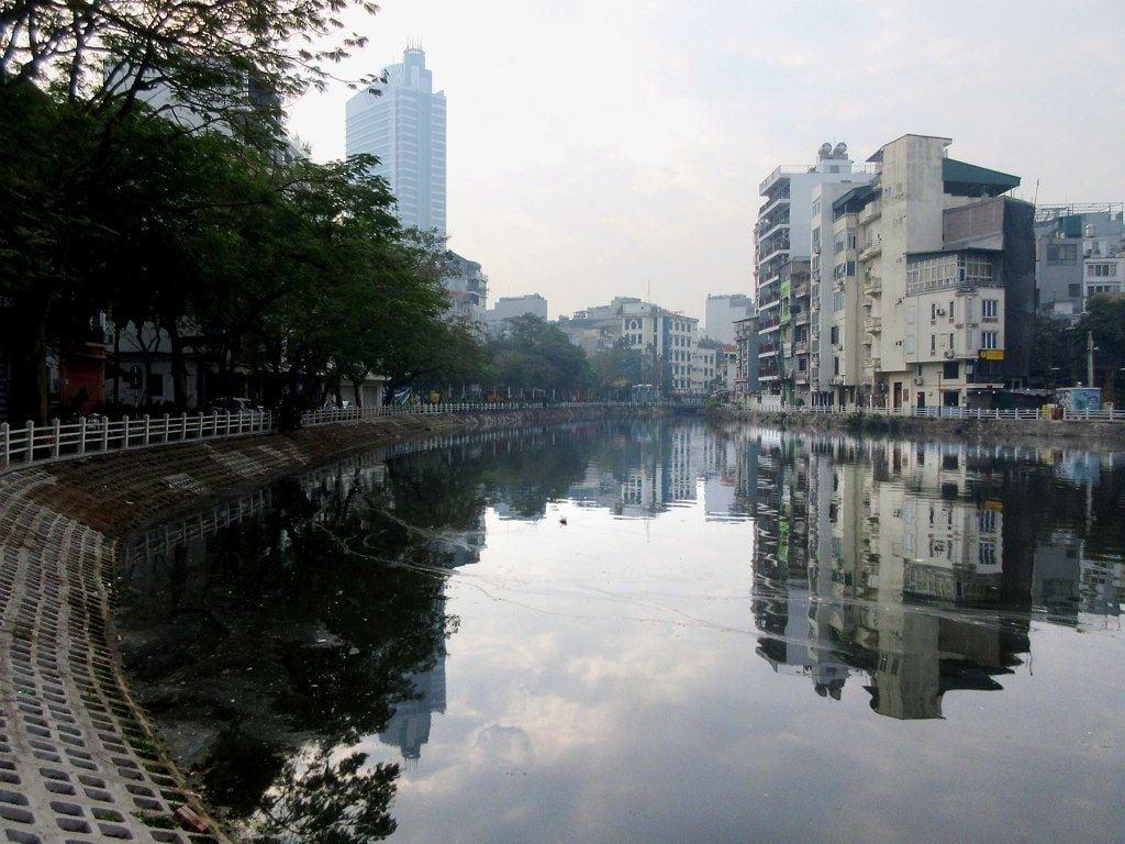
Truc Bach North Shore: The Silk Name
The lake took its name from silk. Truc Bach's north shore, where the story of palace women weaving a white silk gives the lake its name.
- 8
Ngu Xa Island: The Casters' Village
Five communes of casters settled this island. Ngu Xa across its narrow channel, a bronze-casting village where family workshops are still at work.
- 9
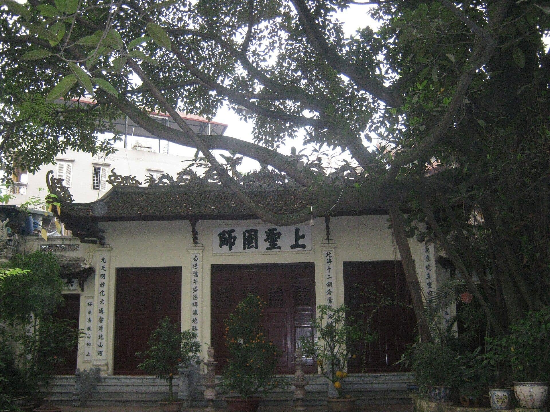
Ngu Xa Pagoda
The village's biggest bronze is inside. Ngu Xa's Than Quang Pagoda and communal house, with an Amitabha of about 12.3 metric tons cast between 1949 and 1952.
- 10
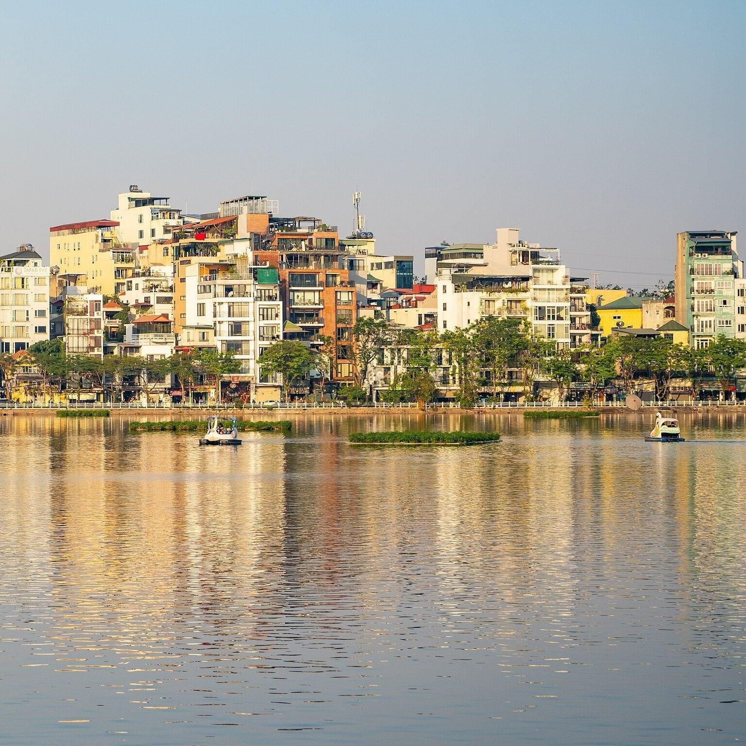
Ngu Xa Lakeside: Sunset over the Causeway
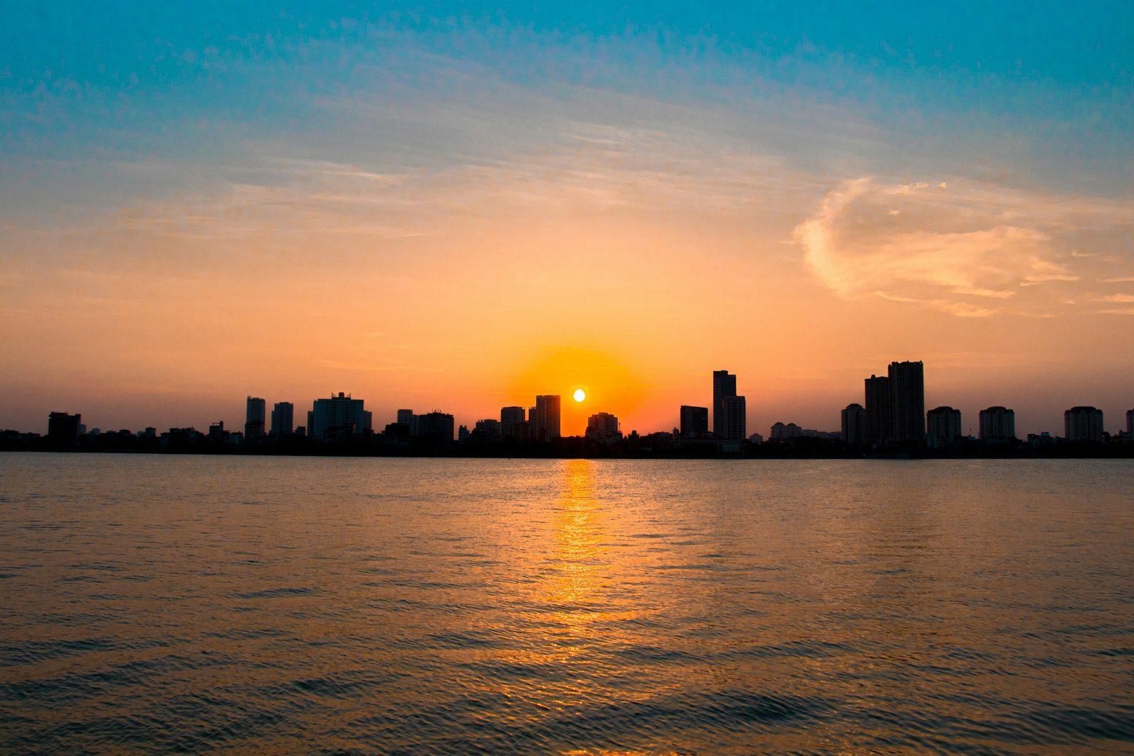
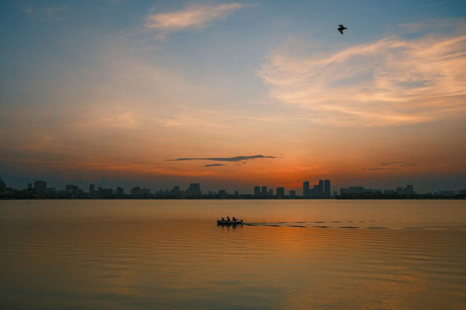
Sunset falls over the causeway from here. Ngu Xa's west shore, facing back across Truc Bach to Thanh Nien Road and the winter sunset.
Details
Best Time to Visit
Late afternoon, starting about an hour before sunset, so the walk finishes on Ngu Xa's west shore as the sun goes down over the causeway: sunset is about 17:17 on 11 November, 17:14 on 1 December, 17:17 on 15 December, 17:35 on 15 January and 17:54 on 15 February (computed for Hanoi). The temples and Tran Quoc Pagoda open by day and are shut by dusk; none publishes official hours (Tran Quoc is most often cited as 08:00 to 16:00, longer on the 1st and 15th of the lunar month: secondary). The sidewalks and lakeside lanes are public at all hours, so the walk works when every gate is shut. Weekend evenings bring heavier traffic and crowds on the causeway, which makes the two zebra crossings harder. December to February is the cool season, with days around 20 °C, often grey with drizzle. Checked 11 November 2026.
Pro Tips
- •Getting to the start: take a taxi or ride-hailing car to Quan Thanh Temple, at the corner of Quan Thanh Street and Thanh Nien Road. On foot it is about 600 m west of the Imperial Citadel's North Gate along Phan Dinh Phung and Quan Thanh streets, and about 2 km from Hoan Kiem Lake. No metro station is near the start.
- •Quan Thanh Temple: a fee of about 10,000 VND is reported (secondary, undated) and no hours are published. Tran Quoc Pagoda is free by day. Cover shoulders and knees for both. Checked 11 November 2026.
- •Time the start for sunset: begin about an hour before (about 16:15 in December), so the last stop on Ngu Xa's west shore catches the sun going down over the causeway.
- •Tran Quoc Pagoda's islet path leaves the West Lake sidewalk a few steps past stop 5. If you go in, do it then: the walk does not come back to that side of the road.
- •From the end on Ngu Xa island: taxis come into Truc Bach Street, and Quan Thanh Temple is about 700 m back round the lake's south shore along Tran Vu Street. The Old Quarter's edge is about 1 km south-east down Truc Bach Street and Hang Than.
- •Ngu Xa Street, on the island, is known for pho cuon (rolled pho), if you want to eat at the end.
Safety & Precautions
- •Crossings: the walk crosses Thanh Nien Road twice, at zebras with no signal (after stops 4 and 5), and traffic, which drives on the right, does not always stop. Wait for a real gap, then walk at a slow, steady pace without running, stopping or stepping back. Motorbikes also ride on sidewalks and against the traffic.
- •From stop 6 to the end (about 760 m) the lanes on Truc Bach's north and east shores and on Ngu Xa have no sidewalk: keep to the lake side, expect motorbikes from both directions, and step round parked bikes and doorstep cooking.
- •Keep your phone and bag on the side away from the road: snatching from passing motorbikes is reported in tourist areas, more so around Tet.
- •Temples and pagodas are places of worship: shoulders and knees covered, voices low, no climbing on altars or statues, and ask before photographing anyone. The Ngu Xa workshops are family homes: do not walk in uninvited.
- •At the McCain memorial (stop 4), official delegations sometimes lay wreaths: if a ceremony is under way, wait at a distance until it is over.
- •Weather and air: December to February is often grey with fine drizzle that makes tiles and lake edges slippery. Air quality in winter can be poor and changes quickly: check a live reading on the day.
- •Tet, the Lunar New Year, falls on Saturday 6 February 2027 (the official holiday dates were not yet set on 11 November 2026): many shops close for several days, and the lake temples, Thuy Trung Tien among them, are crowded.
- •Works: Hanoi approved a West Lake area renovation with a new lakeside road on 15 June 2026, to be completed by 2030 (Tuoi Tre News, 17 June 2026); no works on Thanh Nien Road or Truc Bach had been announced. Checked 11 November 2026.
Travel advisory: Exercise Normal Precautions (Level 1).
Gallery
Related Reading
Go deeper on what you'll see, hear, and walk through.

Overview
Hanoi Travel Guide: How Many Days, Getting Around, When to Go (2026)
8 min

Overview
How to See Hanoi: A Capital Built on Top of Itself
5 min
Thematic
Hanoi's Bronze Casters: Quan Thanh's Guardian and the Island of Ngu Xa
4 min

Thematic
What to Eat in Hanoi: A Food Guide (2026)
6 min
Companion
West Lake and Truc Bach: Two Lakes, a Causeway and a Village of Bronze Casters
5 min
Deep dive
Hoa Lo Prison: The Maison Centrale and Its Two Memories
4 min
Read the walk
The full story of West Lake and Truc Bach: Two Lakes and a Causeway, in words. Prefer to listen? Play it narrated, from home or on location.
Introduction
Two lakes lie side by side in the north of Hanoi, Vietnam's capital, divided by a single road. West Lake, the city's largest, is a bend of the old Red River left behind. Truc Bach, beside it, was cut off by a fishermen's path, mended every year until it became Thanh Nien Road. This walk goes round the smaller lake: from Quan Thanh Temple and its bronze of the sixteen hundreds, up the causeway past a memorial from the war, to a pagoda on an islet in West Lake, and into Ngu Xa, a village of bronze casters on an island of its own.
There are ten stops over about one point seven kilometers, about one mile, and it takes about sixty minutes. It is flat and step free. Twice it crosses Thanh Nien Road at zebra crossings with no signal, and the stops explain how. The last stretch follows lakeside lanes with no sidewalk, shared with motorbikes.
The temples and the pagodas open by day, at hours that are not published, and are shut by dusk. If you go in, cover your shoulders and knees. Nothing on the walk needs a gate to be open, and it is made to finish at sunset: about a quarter past five in December, nearer six by mid February. Start about an hour before.
From December to February, days are mild, around twenty degrees Celsius, about sixty eight Fahrenheit, and often grey, with fine drizzle that makes tiles slippery. Check the air quality on the day.
The walk ends on Ngu Xa's western shore, facing back across the lake toward the sunset. When you arrive at Quan Thanh Temple, begin with stop one.
1. Quan Thanh Temple: Guardian of the North
This is Quan Thanh Temple, at the northern edge of old Hanoi. Face the gate. Over the wall, old trees shade a court, and behind them rise the roofs of the halls, built in the style of the nineteenth century.
This is a temple, not a pagoda. It honors a guardian spirit, Huyen Thien Tran Vu, and it was formerly known as Tran Vu Temple. When this city was the capital called Thang Long, four sacred temples stood round its citadel as its guardians, and this one keeps the north. So the walk begins at a compass point of the old city's spirit map, with the lakes just beyond it.
Inside the main hall sits the reason most visitors go in: the guardian himself, seated, in black bronze, nearly four meters tall and weighing about four metric tons. Records say it was cast in sixteen seventy seven, in place of an earlier wooden statue. Those records also name the official who directed the casting: Vu Cong Chan, who lived from sixteen eighteen to sixteen ninety eight. Today the statue is recognized as a national treasure.
Keep that bronze in mind. Bronze is the thread of this walk, and it comes back at the far end, on an island in the lake, in a village of casters.
If the gate is open, you can go in. It is a working temple, so cover your shoulders and knees, keep your voice low, and ask before photographing anyone at prayer. A small entry fee has been reported, and the opening hours are not published. If the gate is shut, the walk loses nothing: every stop on it is seen from the street or the shore.
Follow the route to the corner of the big road, and up its lake side. On the way you cross the mouth of one small side street: watch for motorbikes turning in.
2. Truc Bach Lake
Stop here, at the corner of the lake, and turn to face the water. This is Truc Bach Lake, and the whole walk is laid out across it.
Straight over the water, the roofs and trees sitting low on the lake belong to Ngu Xa, an island village. That is where the walk finishes, on the island's shore facing this road, looking back across the water. The houses lining the distant shores are the lake's north and east sides, and the route goes round them. And the road beside you, running north along the railing, is the causeway that made this a lake of its own.
Truc Bach was once part of a much bigger lake, West Lake, which lies on the other side of that road. From the seventeenth century, fishermen built up an embankment across the water, and over time it divided the two. So in a sense this lake was made by people mending a path. You will stand on that path at the next stop.
Both lakes are smaller than they used to be. Houses and gardens have pushed in at their edges. The World Lake Database records West Lake at four hundred and sixty six hectares in nineteen sixty, and four hundred and thirteen in nineteen ninety two: about a tenth of it gone in one generation. The shore you walk today is the part that held.
So here is the plan. Up the causeway, past a small memorial from the war years. Over the road to a pagoda on an island in West Lake. Back across to a tiny temple on its own islet. Round the quiet north shore, where the lake's name comes from. Then over a bridge into the casters' village, Ngu Xa, to finish on the water as the light goes.
Follow the route north along the railing, with the lake at your right hand.
3. Co Ngu Causeway: One Road, Two Lakes
Stop here, halfway up the causeway. Truc Bach is right beside you at the railing. Now look across the road, past both lanes of traffic, to the trees on the far side and the wide water showing through them. That is West Lake. One strip of road, two lakes.
You are standing on the dike that divided them. From the seventeenth century, fishermen built a narrow embankment across the water here, a shortcut between villages on either shore, and it had to be mended every year. One record dates a dam here, called Co Ngu, to sixteen forty two. The old name, Co Ngu, is usually explained as a word for that steady upkeep, which later ears heard as ancient fish. Either way, the name stayed with the dike long after it stopped being a fishermen's path.
In the early nineteen sixties the embankment was widened into this road and given a new name, Thanh Nien, which means Youth. So the line you are walking was drawn by people, one season of repairs at a time, and the city then paved it.
The water on both sides is older than the road. West Lake was once a stretch of the Red River's course, left behind by the river, and Truc Bach is its corner, sealed off by this dike. You will hear more about the big lake at the pagoda.
Look along the sidewalks at the trees. Some of them flower in season, purple and flame red. On clear evenings, people come out to the causeway for the sun going down over West Lake. The walk is timed for the same light, seen from the far shore of Truc Bach at the end.
Follow the route on up the lake side. A small memorial on the railing side, a short way ahead, is the next stop.
4. McCain Memorial
Stop here, a few steps short of the memorial standing on the lake side of the sidewalk. It is small, its text is in Vietnamese, and the lake is right behind it. It records one day in the war. On the twenty sixth of October nineteen sixty seven, a United States Navy pilot, John…
Full narration for this stop unlocks with the tour.
5. Tran Quoc Pagoda: The Pagoda That Moved
Stop here, on the West Lake side, and face the water. Out on a small islet, joined to the shore by a path just ahead, are the roofs of Tran Quoc Pagoda, and above the trees a tall red tower of stacked stories. First, the lake. West Lake is Hanoi's largest lake, and a shallow…
Full narration for this stop unlocks with the tour.
6. Thuy Trung Tien Temple
Stop on the lakeside path. Across a short stretch of water, on its own tiny islet, sits a small temple, reached by the short footbridge you have just passed. Its name today is Thuy Trung Tien. Its older name, Cau Nhi, points to a puppy, and the legend behind it reaches back to…
Full narration for this stop unlocks with the tour.
7. Truc Bach North Shore: The Silk Name
Stop at the bend of the shore, and look out across the water. Ngu Xa's houses sit low on the water across the lake, and away to their right, at the far end of the water, stand the trees of the causeway you walked up. This shore gives the lake its name, and the story goes like…
Full narration for this stop unlocks with the tour.
8. Ngu Xa Island: The Casters' Village
Stop here, where the lane runs beside a narrow channel. The houses across it belong to Ngu Xa, an island in the lake, joined to this shore by a street bridge just ahead. Ngu Xa means five communes. Bronze workers from five communes in Bac Ninh and Hung Yen settled on this…
Full narration for this stop unlocks with the tour.
9. Ngu Xa Pagoda
Stop at the junction. On the corner ahead is the gate of Ngu Xa's pagoda, known by its own name, Than Quang Pagoda. Beside it, just to the right, stands the village's communal house, its shared hall. Pagoda and communal house side by side: the two centers of the village. Inside…
Full narration for this stop unlocks with the tour.
10. Ngu Xa Lakeside: Sunset over the Causeway
Stop at the railing and turn to face the water. This is the island's western shore, and everything you have walked lies across the lake from you. Straight over the water runs the causeway, with its line of trees and the traffic of Thanh Nien Road. Straight across, on its near…
Full narration for this stop unlocks with the tour.
- The Thủy Trung Tiên Temple in Hanoi. — Christophe95, CC BY-SA 4.0 · source
- A 1.5-kilometer path runs right around Truc Bach Lake on the north side of Hanoi, Vietnam. — David Stanley, CC BY 4.0 · source
- Trúc Bạch Lake, Pan Pacific Hotel (20231225) — Takeshi Aida from Hong Kong, Hong Kong, CC BY-SA 2.0 · source
Images may be cropped or resized. Other photos via Unsplash and Pexels.