Oudegracht Wharves: The Streets Below the Street
90 min · 3.3 km · easy
Utrecht reads like a medieval city, but its real subject is what sits below and behind the surface: a Roman river fort under the central square, a canal whose water runs far below the street, a cathedral tower that has stood alone since a storm pulled the nave out of the church, and a design tradition that reduced whole visual languages to a few clean lines. This is a city that keeps its most important layers out of first sight. To understand Utrecht, you look down, back, and beneath, not up.
Start with the ground itself. The open Domplein at the center of the city sits directly on top of a Roman military fort called Traiectum, Latin for river crossing. It was founded around the year 47 under the Emperor Claudius on the southern bank of the Rhine, on the frontier line the Romans called the limes. The first fort was earth and timber; the final version was stone, roughly 125 by 150 metres, holding around five hundred troops, with a headquarters building that even had underfloor heating. Medieval Utrecht grew outward from this single footprint, and the church that rose beside the fort turned the city into the ecclesiastical capital of the medieval Netherlands. The Roman stones now lie about four to five metres below the square, reachable through an undercroft, while stainless steel ridges in the pavement trace the vanished ramparts. In 2021 the Lower Germanic Limes, this site included, was inscribed as a UNESCO World Heritage Site. The Dom and Roman crossing walk begins here, on two thousand years stacked under one square.
The emptiness is the monument
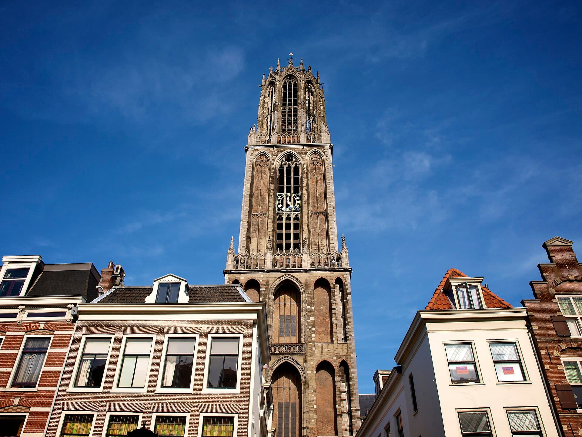
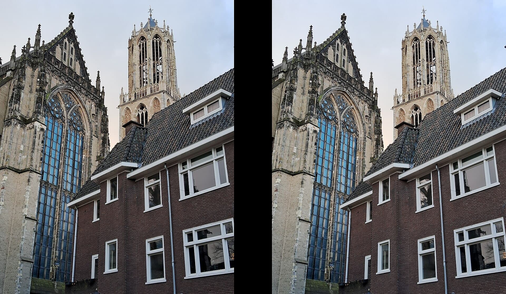
Above that fort stands the strangest silhouette in the Netherlands. The Domtoren, the Dom Tower, was built over roughly sixty years, from about 1321 to 1382, to the design of an architect recorded as John of Hainaut. It rises 112 metres, the tallest church tower in the country, and it is freestanding: it is not attached to a church at all. A bell tower is supposed to grow out of the building it serves. This one rises out of open air. The reason sits across the square. On the first of August in the year 1674, a violent storm crossed the province and tore out the cathedral's still-unfinished nave, which was poorly supported, lacking flying buttresses and carrying its roof on a wooden structure rather than a stone vault. It was never rebuilt. Its footprint is the open Domplein. What survives, the choir and transept of the Domkerk dedicated to Saint Martin of Tours, is the only pre-Reformation cathedral in the Netherlands and was once the country's largest church. The most famous view in the city, the tower framed across the square, exists only because the middle of the building is gone. Historians still debate whether the storm was a tornado or straight-line derecho winds, and the honest answer is that the paradox is the same either way.
The church quarter closes quietly around that wound. The Pandhof cloister garden, laid out roughly between 1390 and 1440, keeps its walls, its herbs, and a fountain crowned by a seated fourteenth-century canon named Hugo Wstinc. A short way east, the Pieterskerk, consecrated on the first of May in the year 1048 by Bishop Bernold, is one of the oldest churches in the Netherlands, its nave pillars each hewn from a single piece of red sandstone. Tradition says a ring of churches was arranged as a cross around the Dom, though whether that was deliberate remains one of the city's most disputed questions. And in the medieval Great Chapter House beside the university's Academiegebouw, the Union of Utrecht was signed on the twenty-third of January in the year 1579, remembered as a foundation of the Dutch Republic, though it created no centralized nation on its own.
A second street below the street
Hear a stop from this walk
Weerdsluis: where the city met the river
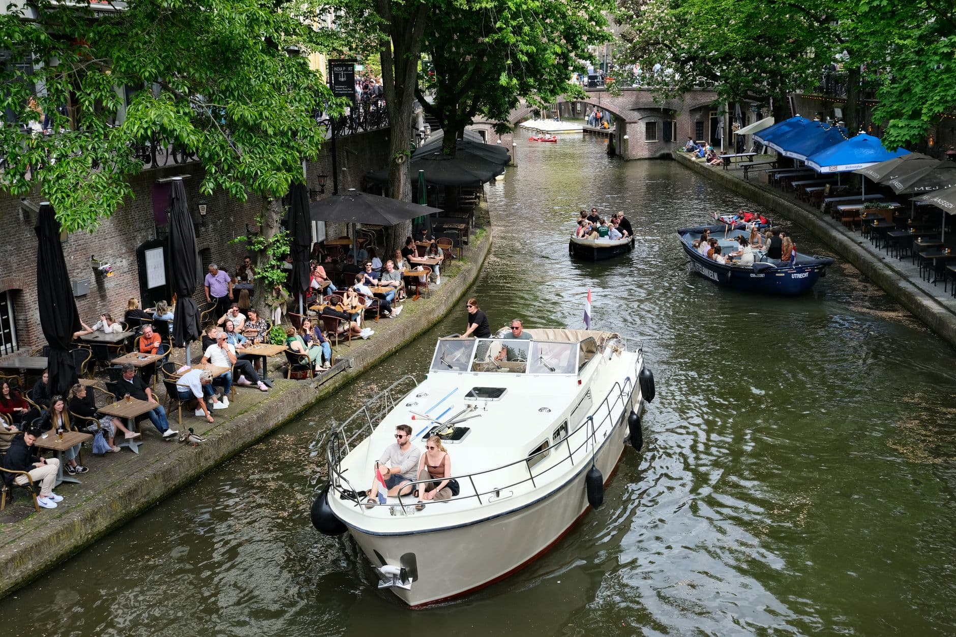
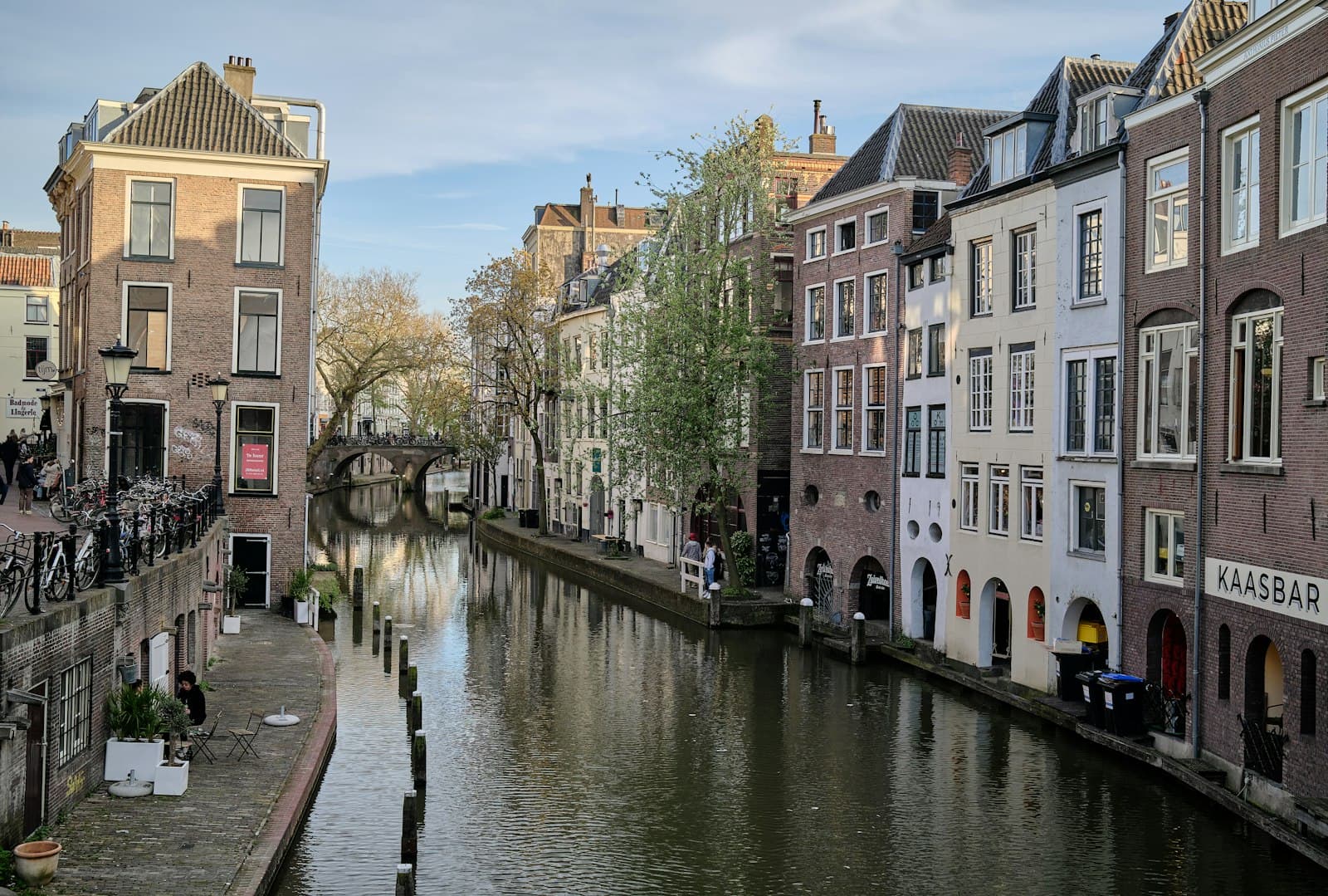
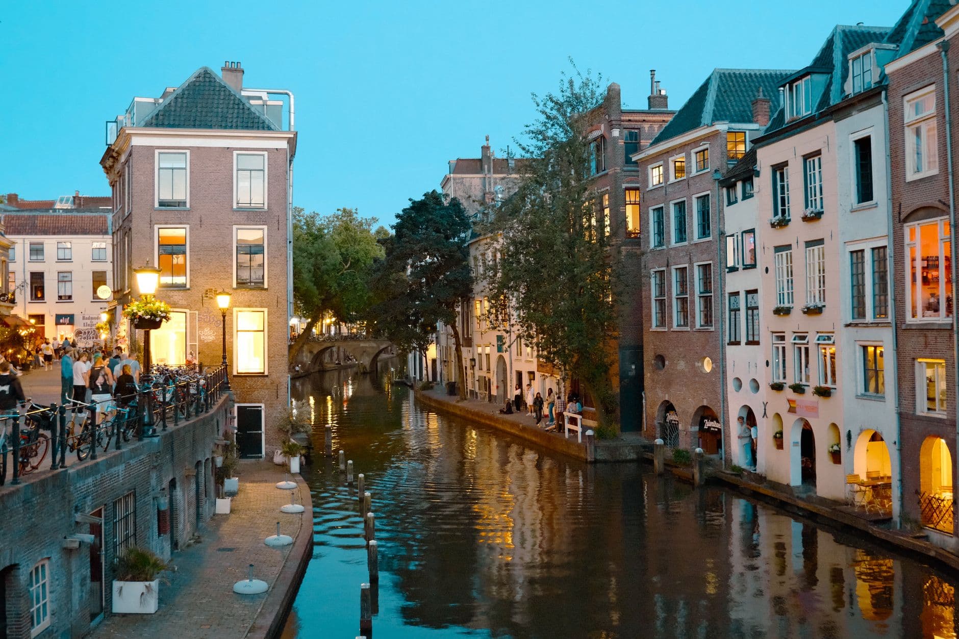
Utrecht's other buried system is its water. The Oudegracht, the Old Canal, runs about two kilometres through the city as an elongated inland harbour. Its defining feature is not its beauty but its depth: unlike Amsterdam's canals, which meet the streets almost at water level, the Oudegracht runs well below the street. That drop is the enabling condition for everything else. When the city finished its system of locks in 1275, the water level finally became constant, which meant you could build cellars down at the waterline that stayed permanently dry. Along the water runs a continuous lower quay, the werf, and set into the wall, back under the road you were just standing on, are vaulted brick cellars, the werfkelders. They tunnel from the houses in under the street and open at the water's edge. A merchant's boat pulled up, the cargo crossed a few steps of wharf, and it went straight into the basement beneath his own house. Most of these cellars were dug in the thirteenth and fourteenth centuries, and by around 1500 the system lined both sides of the canal. This two-level arrangement is widely described as the only inner-city harbour system of its kind anywhere in the world. The wharf-and-cellar walk reads the canal as medieval machinery first and beloved public space second.
The canal kept working long after the Middle Ages. The Winkel van Sinkel, opened in 1839 and widely described as the first department store in the Netherlands, was decorated with heavy cast-iron caryatids cast in England and shipped up the canal. During unloading on the ninth of September, 1837, the city crane's top broke and one statue plunged into the water; the spot is still marked. North of the old city, the Weerdsluis lock connected Utrecht's canals to the Vecht river and was the departure point of the trekschuit, the tow-boat to Amsterdam. In eighteenth and nineteenth-century Utrecht, towing horses were banned inside the city, so people, including women and children, pulled the boats by hand. The same engineering served a gentler world too: the Nieuwegracht, dug between 1390 and 1393 despite its name meaning New Canal, uses identical low water and cellar logic, but its private cellars kept it quiet, lined with more than a hundred monumental canal houses under the trees.
The essential shape beneath the surface
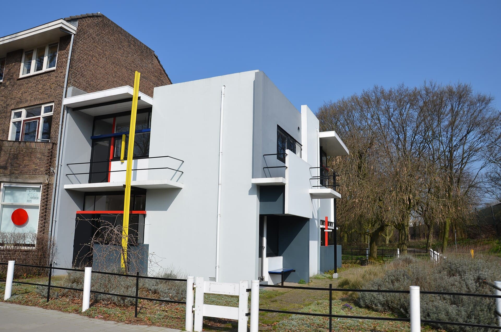
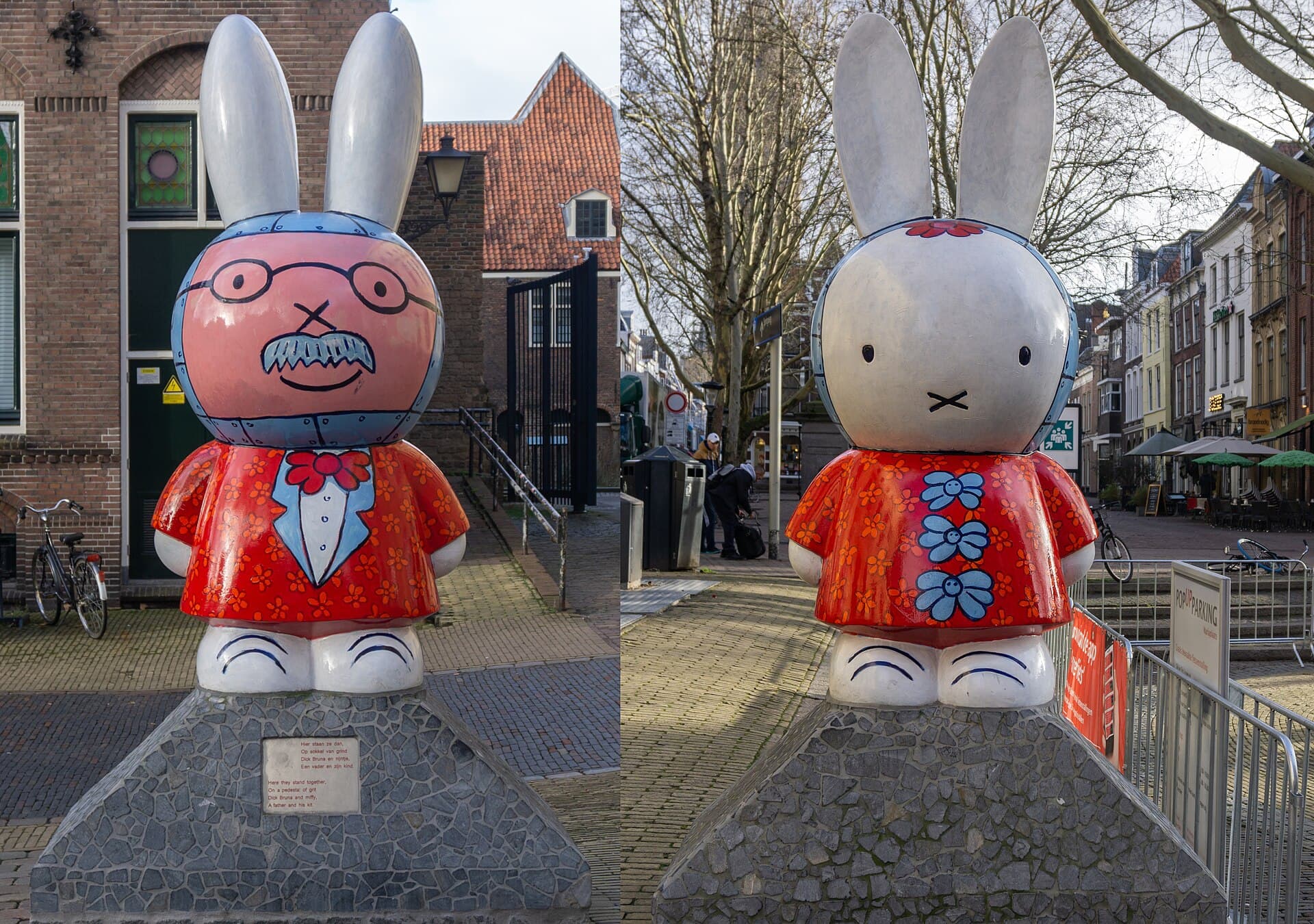
The instinct that governs Utrecht, stripping a thing to its essential shape, runs straight into the twentieth century. This medieval-looking city authored two landmarks of radical modern reduction. The Centraal Museum, founded in 1838 and the oldest municipal museum in the country, holds both. One thread is Dick Bruna, the Utrecht illustrator born in 1927, who in 1955 drew a little rabbit reduced to a few clean lines and flat primary colours; the world knows her as Miffy, from the Dutch konijntje, little rabbit. The other thread is Gerrit Rietveld, the furniture-maker turned architect. Around 1918 he designed the Red and Blue Chair, a whole philosophy of the De Stijl movement compressed into an object, and in 1924 he built the Rietveld Schroderhuis with and for Truus Schroder-Schrader. Its facades are a composition of separate planes and lines in primary colour, its top floor reconfigurable by sliding panels from one open space into three bedrooms. Inscribed as a UNESCO World Heritage Site in 2000, it is often called, arguably, the only true De Stijl building on earth. The design-city walk traces this from the medieval centre to that white house on the modern edge, and in 2017 Utrecht became the first Dutch city named a UNESCO City of Literature. To read Utrecht the way its own makers did, look for the essential shape beneath the medieval surface. Plan a visit with the Utrecht walking tours.
Sources
- Tour research and fact audit, "The Tower and the Church a Storm Took," Roamer (Domplein, Traiectum, Domtoren, Domkerk, storm of 1674).
- Tour research and fact audit, "The Streets Below the Street," Roamer (Oudegracht, werfkelders, Weerdsluis, Nieuwegracht).
- Tour research and fact audit, "From De Stijl to a Little White Rabbit," Roamer (Centraal Museum, Dick Bruna, Gerrit Rietveld, Rietveld Schroderhuis).
- UNESCO World Heritage List, Rietveld Schroderhuis (inscribed 2000) and Frontiers of the Roman Empire, Lower Germanic Limes (inscribed 2021).
- Centraal Museum, collection and history of the museum, the Rietveld and Bruna holdings.
Frequently asked questions
- Why does the Dom Tower in Utrecht stand alone, separate from its church?
- On the first of August in the year 1674, a violent storm tore out the cathedral's still-unfinished nave, which was poorly supported and carried a wooden roof structure rather than a stone vault. The nave was never rebuilt, so the 112-metre Dom Tower, the tallest church tower in the Netherlands, and the surviving choir have stood apart across the open Domplein ever since. Historians debate whether the storm was a tornado or straight-line derecho winds.
- What makes Utrecht's canals different from Amsterdam's?
- Utrecht's Oudegracht runs well below street level, not near it as Amsterdam's canals do. That drop allowed a two-level system: a continuous lower quay called the werf, with vaulted cellars called werfkelders tunnelling back under the road so boats could unload straight into basements. This arrangement is widely described as the only inner-city harbour system of its kind in the world.
- Is Utrecht built on a Roman site?
- Yes. The central Domplein sits directly on top of a Roman military fort called Traiectum, founded around the year 47 under the Emperor Claudius on the Rhine frontier. The Roman stones now lie roughly four to five metres below the square. In 2021 the Lower Germanic Limes, including this site, was inscribed as a UNESCO World Heritage Site.
- What is the connection between Utrecht and De Stijl design?
- De Stijl was not founded in Utrecht, but the city produced Gerrit Rietveld, who gave the movement its clearest form. He designed the Red and Blue Chair around 1918 and built the Rietveld Schroderhuis in 1924, a UNESCO World Heritage Site since 2000 that is often called arguably the only true De Stijl building. Utrecht is also the home city of Dick Bruna, who created the rabbit character Miffy in 1955.
- How many walking tours cover Utrecht's history and what do they focus on?
- There are three themed self-guided audio walks. One reads the Oudegracht and its wharf-cellar system, one traces the Roman fort, the Dom Tower and the church a storm took, and one follows the design tradition from De Stijl to the Rietveld Schroderhuis. Each is short-stop and skippable, built for a solo traveller moving at their own pace.
Ready to experience it?
Oudegracht Wharves: The Streets Below the Street
90 min · 3.3 km · easy
More from Utrecht
Explore more at your own pace.
One Day in Utrecht: A Walkable Morning-to-Evening Itinerary
The Dom Church of Utrecht and the Storm That Split It From Its Tower
The Rietveld Schröder House: Utrecht's Manifesto You Can Stand Inside
Nijntje Pleintje: Utrecht's Little Bronze Rabbit and the Man Who Drew Her
The Oudegracht: Why Utrecht's Canal Runs Below the Street