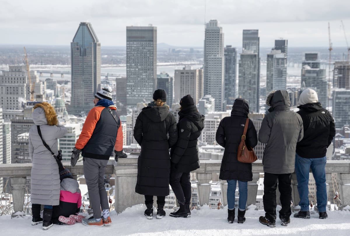
Most cities organize themselves around a skyline they build upward. Montreal organized itself around a ceiling it refused to exceed. The Mount Royal walk climbs the mountain at the center of the island in seven stops and a little under three and a half kilometres, and it reads a single idea out of the view: the summit is not just the city's great lookout, it is the upper limit the city imposed on itself.
The number that governs downtown
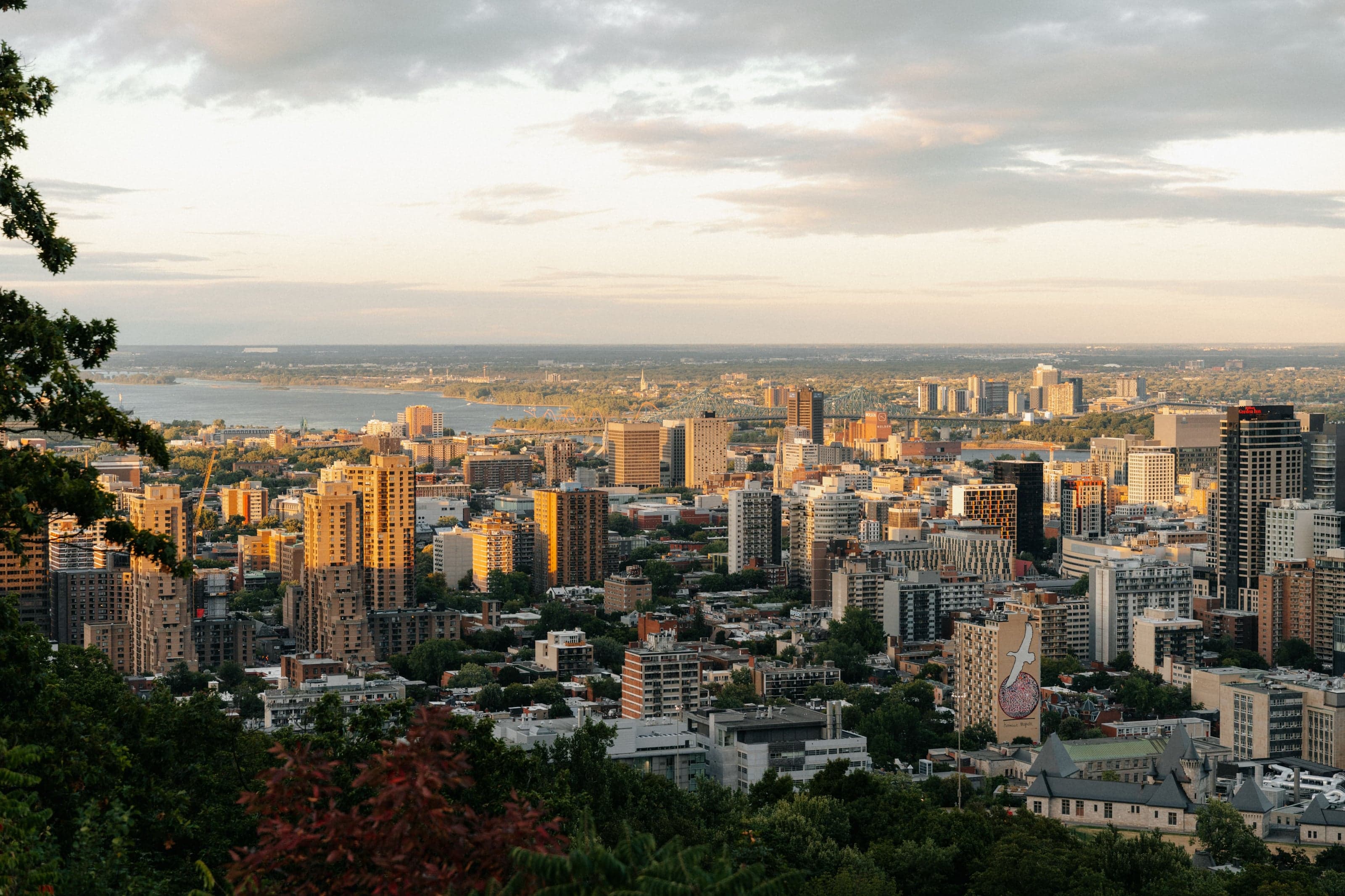
The summit of Mount Royal stands 232.5 metres above sea level. Since its 1992 urban plan, the City of Montreal has held that no building may rise higher than that, and the rule is still written into the height map for downtown: "Aucun immeuble ne peut dépasser la hauteur du sommet du mont Royal," no building may exceed the height of the summit. Only Saint Joseph's Oratory stands above it. The skyline you see from the top is the skyline the city permitted itself to have.
This is what makes the walk more than a nature walk. The mountain is the instrument of a policy, and the policy is visible from the belvédère.
Olmsted designed the ascent, not the view
Hear a stop from this walk
Beaver Lake: A Lake Made in the Depression
The city hired Frederick Law Olmsted in 1874, and the park opened in 1876. It was the first major public park he designed after his partnership with Calvert Vaux, his collaborator on New York's Central Park, ended in 1872; his master plan is dated 1877. Olmsted's central idea was that the mountain should be climbed slowly. He wanted the great views enjoyed "as successive incidents of a sustained landscape poem, to each of which the mind is gradually and sweetly led up," and he wanted the carriage drive never to exceed a five per cent grade.
He did not get everything he asked for. The first long section of the drive was built in the winter of 1875 to 1876 as relief work for the unemployed after the Panic of 1873, without consulting his plans: it gave him his gentle grades, and he was distressed by the "rude, artificial character" of its cuttings and embankments. His plan was never carried out in every detail, though the city says its principles still guide the park. Olmsted explained his intentions in a small book published in New York in 1881, Mount Royal, Montreal. The walk climbs by footpaths, steps and a stretch of his carriage road, so the route itself is a nineteenth-century argument about how a person should move through terrain.
Seven stops on one hill
The walk's method is to treat the mountain as a stack of civic decisions, each of which left a physical mark:
- The Cartier Monument, at the foot of the mountain on Avenue du Parc, inaugurated in 1919, with eighteen bronze figures around a granite column, anchors the mountain to national memory and to the Sunday drumming that has gathered there since the late 1970s.
- Olmsted's carriage road, where its bends show the five per cent rule at work.
- The Belvédère Camillien-Houde, on the eastern flank, built with the car road across the mountain that opened in 1958, faces east over the Plateau toward the leaning mast of the Olympic Stadium, about six kilometres away.
- The Croix du Mont-Royal, the riveted steel cross about 30 metres tall, was raised in 1924 by the Société Saint-Jean-Baptiste, paid for by volunteers, most of them schoolchildren, selling five-cent stamps. It recalls the cross Maisonneuve carried up the mountain in January 1643, according to the colony's own accounts.
- The Belvédère Kondiaronk and the chalet beside it, built in 1931 and 1932 as Depression relief work, face downtown. The lookout is named for Kondiaronk, the Wendat chief who spoke at the great peace conference in Montreal in 1701 and died while it was still under way.
- The sculpture clearing and Maison Smith, works from the 1964 international sculpture symposium set near the last farmhouse on the mountain.
- Lac aux Castors, Beaver Lake, a basin dug between 1936 and 1938 to plans by Frederick Todd as part of the city's Depression public works.
Reading the city from the top
The reason to walk this route slowly is that the summit view is not a photo opportunity, it is a legible document. From the Kondiaronk lookout the downtown towers rise in front of you and stop short of the summit's height, because the plan made them stop. Below those towers runs the RÉSO, the underground pedestrian network that began beneath Place Ville Marie, a story told in our Place Ville Marie companion. From the eastern lookout you can pick out the leaning mast of the Olympic Stadium, covered in our piece on the Olympic Park.
The mountain is the one part of Montreal that belongs to neither side of the Main, the neutral summit above the two solitudes described in how to read Montreal along the Main. Everyone looks up at it, and then the city agreed, in writing, never to look down on it. Compare the routes in the best walking tours in Montreal overview.
Ready to experience it?
Mount Royal: Lookouts, the Cross and Beaver Lake
90 min · 3.4 km · moderate
More from Montreal
Explore more at your own pace.
The Deli and the Bagel: Mile End's Jewish Food Map
The Future That Bankrupted the City: Reading Montreal's Olympic Park
Richler's Mile End: Moe's Cigar Store and the Bagel Ovens
The Anglophone City Inside the French One: A Companion to the Plateau and Mile End Walk
Notre-Dame Basilica: One Church, Two Architects, Fifty Years Apart