Back to Learn
The Esquina del Coco: A Tree and a Grid
Tour Companion

The Esquina del Coco: A Tree and a Grid

May 15, 2026
8 min read

There is a coconut palm in the middle of an intersection in central Ibarra. The intersection is the corner of Calle Sucre and Calle Oviedo, about two blocks south of the cathedral. The corner has a name: La Esquina del Coco, the Coconut Corner. The tree is unusual for two reasons, and the corner is important for one.

The tree is unusual because coconut palms are coastal. Cocos nucifera grows naturally in tropical lowlands. The Ecuadorian Pacific coast at Esmeraldas, two hundred kilometres west and at sea level, is the natural habitat. Ibarra sits at 2,200 metres in the northern highlands. The climate is mild and dry. The soil is volcanic. A coconut palm has no business being here.

But there has been a coconut palm at this corner since at least the early colonial period. The tradition is that a Mercedarian friar planted the original tree as a botanical curiosity, sometime in the 1600s or 1700s, in the small garden of a private house that stood on this corner. The garden is gone. The house is gone. Successive plantings have kept the palm in the same spot. The current tree is the most recent in a chain of replantings that goes back some four hundred years.

The intersection is important because of what happened on August 16th, 1868.

The morning of the earthquake

At about half past six on the morning of August 16th, an earthquake estimated at magnitude 7.2 struck the Ibarra region. The shaking lasted long enough to bring down almost every building in the city. The cathedral. The churches of San Agustín, La Merced, and Santo Domingo. The municipal buildings. Most of the houses. Several thousand people died in Ibarra and the surrounding villages.

The survivors, somewhere between several hundred and several thousand, walked out of the ruins. Most of them went to a hamlet south of the city called La Esperanza, on higher ground. For the next four years, the ruined city of Ibarra sat empty. There was no functioning municipal government. The roofs of the collapsed buildings rotted. The walls fell further. Vegetation grew through the rubble.

Through all of this, the coconut palm at the corner of Sucre and Oviedo kept standing. The buildings around it had collapsed. The palm did not. Palms are surprisingly earthquake-resistant. Their root systems are shallow and broad, and the trunk is fibrous rather than brittle. A palm will sway under seismic load where a brick wall will fracture. The coconut palm at this corner did what palms do, and survived.

Why the survival mattered in 1872

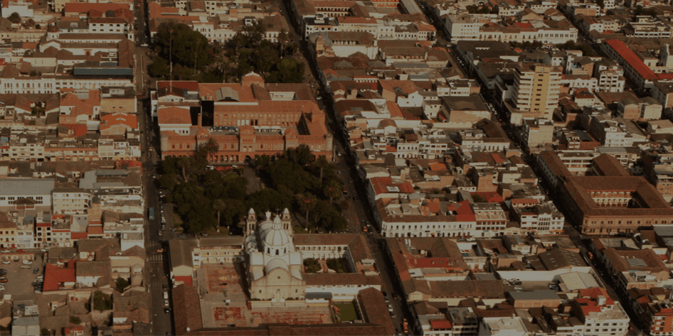
When the decision to rebuild Ibarra was made in 1872, the survivors who returned had a practical problem. They needed to lay out the new grid on the site of the old. The 1606 colonial grid had been a standard Spanish American plan: a square central plaza, with streets running off at right angles to the cardinal directions, in a regular pattern of blocks each about a hundred metres on a side.

The grid had been clear enough on the ground when the buildings were standing. With the buildings gone and four years of weather and vegetation overlaid on the rubble, locating the original street lines was not trivial. There was no pre-earthquake survey detailed enough to reconstruct the grid from documents alone. The rebuild would have to be tied to physical reference points that had survived.

The coconut palm at the corner of Sucre and Oviedo became one of the reference points. It was already in the right place, on the corner of the block where it had stood since before anyone living could remember. The grid was rebuilt around it. According to the local tradition still recorded on a small plaque at the foot of the tree, the surveyors of the 1872 reconstruction used this intersection as a starting point to lay out the streets in their direction.

That makes this corner, in a literal sense, the origin point of modern Ibarra. The 1606 city ran on a grid that referenced the cathedral and the central plaza. The 1872 city runs on a grid that also references a tree.

What survives at the corner now

The current palm is a replanting. The 1868 tree was replaced at least once, perhaps twice, in the late nineteenth and early twentieth centuries, as the original trunk aged out. The current tree dates from the mid-twentieth century. The chain of replanting is part of how the corner has worked: each generation of Ibarra residents understands that there should be a coconut palm here, and so when one tree fails, the next one goes in the same spot.

The intersection itself has been formalized in stages. In the late nineteenth century the corner was a simple unpaved cross-street with the palm in the middle. In the early twentieth century the city paved the streets, set the palm into a small protected base, and added benches. In the mid-twentieth century a plaque was set into the base of the trunk recording the tree's symbolic role in the reconstruction.

The buildings around the corner are typical of the post-1872 rebuild. Two-story white plaster fronts. Tile roofs. Wooden balconies on the upper level. The window proportions are republican neoclassical: tall, narrow, evenly spaced. The doors are framed in painted wood, often deep blue or forest green against the white. The buildings were not built in 1872 exactly, but they were built within the forty-year window when most of the historic centre was rebuilt, and they share the visual vocabulary of the reconstruction.

Why the legend works

Cities accumulate stories at intersections. Most of them are sentimental and most of them are not literally true. The Esquina del Coco story is unusual because the central fact behind it, that a single tree survived the destruction of the city around it, is geologically and botanically plausible.

A magnitude 7.2 earthquake at shallow depth will bring down almost every adobe-and-brick building it shakes. The same earthquake will leave most mature palm trees standing. Palms have evolved on islands and coastlines where wind loading is constant. Their structural design is well-suited to the kind of side-to-side motion that an earthquake produces. The palm at the corner of Sucre and Oviedo would have swayed for the duration of the shaking and returned to vertical when it stopped, while the buildings on the same corner failed in shear.

The detail that the surveyors used the tree as a reference for the rebuilt grid is harder to verify, because the 1872 reconstruction was not extensively documented. But it is plausible. Rebuilding teams in post-disaster contexts routinely tie new layouts to whatever physical landmarks have survived. A mature coconut palm, with a recognizable trunk and a position on a specific corner, would have been a useful reference. The plaque at the base of the tree records the tradition rather than proving it, and the tradition itself has weight independent of any single surveyor's notebook.

The wishing tree

There is a smaller tradition attached to the palm. Locals say that if you touch the trunk and make a wish, the wish will come true, but only if you are an Ibarreño by birth. This is the kind of folk addition that grows up around any landmark over a long enough period. It is not the reason the corner matters. It is the kind of thing that happens when a place matters.

The serious answer to why the Esquina del Coco matters is geometric. Walk any block of the central grid and look at the orientation of the streets. The grid runs slightly off true cardinal, on a heading that matches the colonial original. The heading is held in place by reference points, of which this corner is one. The palm is not decorative. It is structural to the city's continued legibility as the city that was rebuilt in 1872.

What to look for when you stop here

Stand on the south side of the intersection with the palm in front of you and the cathedral tower visible over the rooftops to the north. The straight line you can draw from where you are standing to the cathedral is the line that the 1872 surveyors laid out using this tree as the starting point. The visual axis is the axis of the rebuild.

Look at the base of the trunk. The plaque records the tradition. Look at the buildings on the four corners of the intersection. They are not the buildings that were here in 1872, but they sit on the same plot lines, and the plot lines were redrawn from this point.

The tour walks you past the Esquina del Coco between the cathedral and the church of San Agustín. The corner is brief in the audio. The point it makes is that Ibarra is not just a city that was rebuilt. It is a city that was rebuilt around a single living thing that did not fall down. The grid is held in place by a tree.

Explore Ibarra with Roamer

Take these audio tours to experience the stories mentioned in this guide