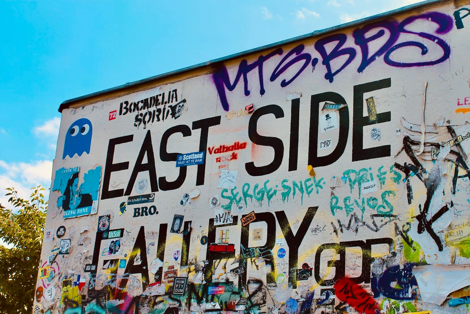
Walk the Berlin Wall Memorial on Bernauer Strasse from Nordbahnhof past the Window of Remembrance, the preserved border strip and its watchtower, the Chapel of Reconciliation and two tunnel sites, to the Mauerpark's inner wall.
Start · Nordbahnhof: A Station with Two Doors
DirectionsStops
- 1
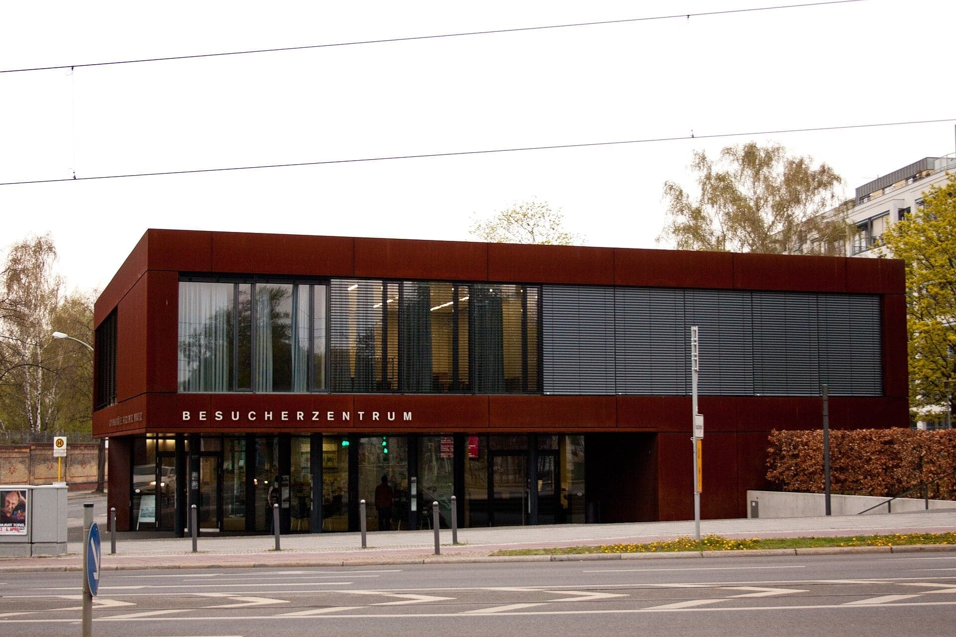
Nordbahnhof: A Station with Two Doors
A station with one door in each Berlin. Under the Wall, West Berlin trains slowed through Nordbahnhof without stopping, and the station's old brick boundary wall became the border.
- 2
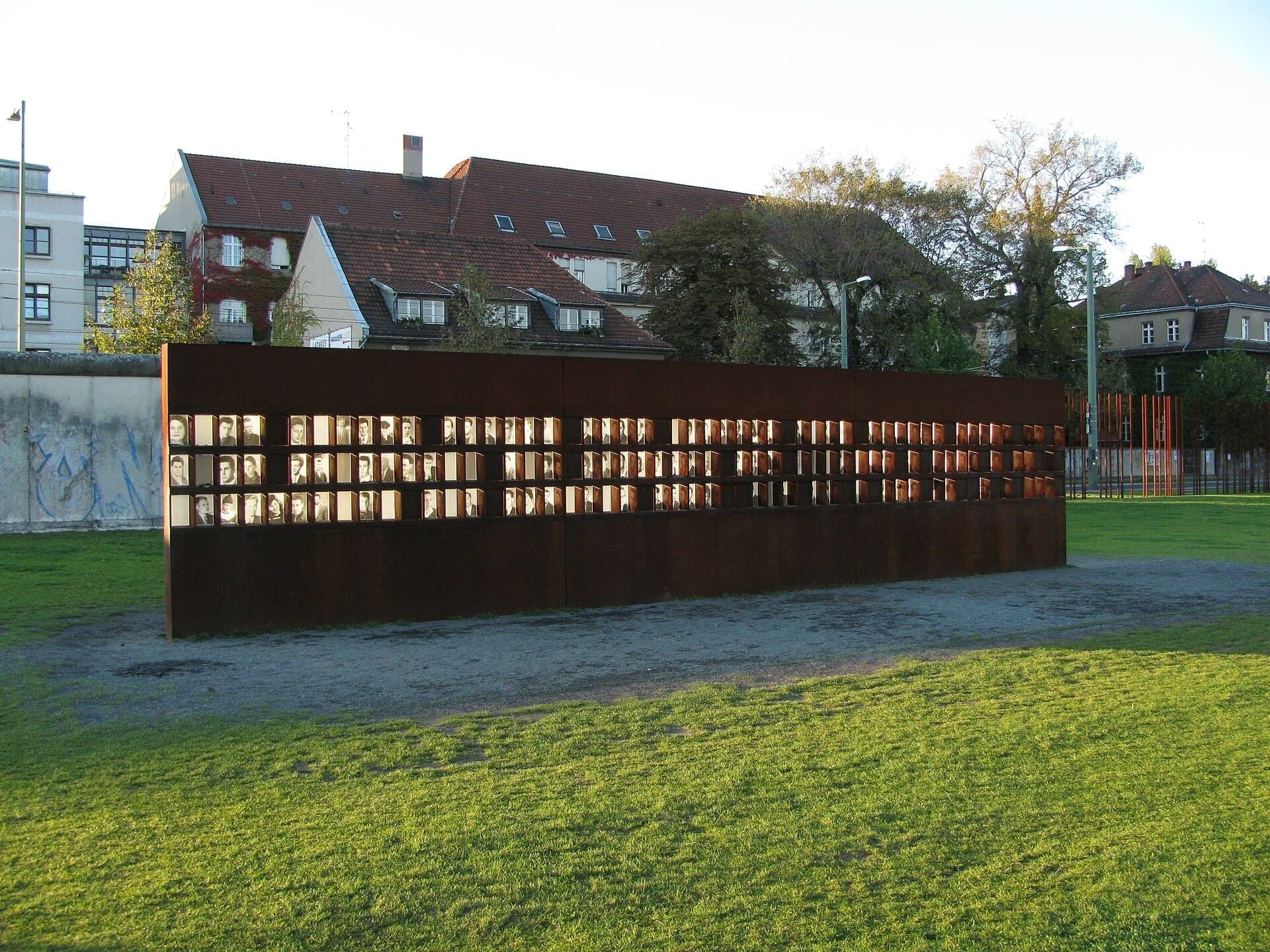
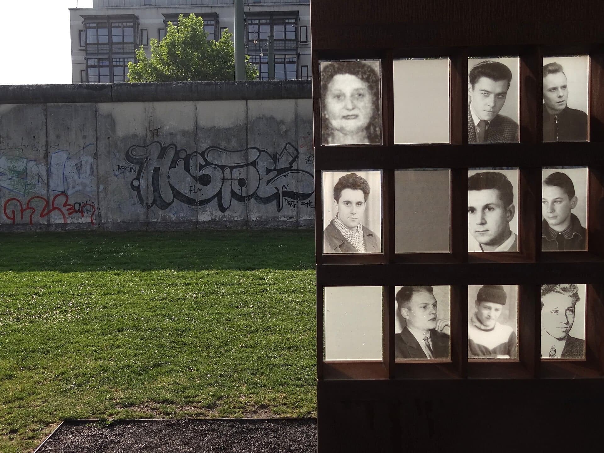
Window of Remembrance: A Name in Every Window
A steel memorial on the old patrol path. Each window holds the photograph of one person who died at the Wall, counted under a strict published rule.
- 3
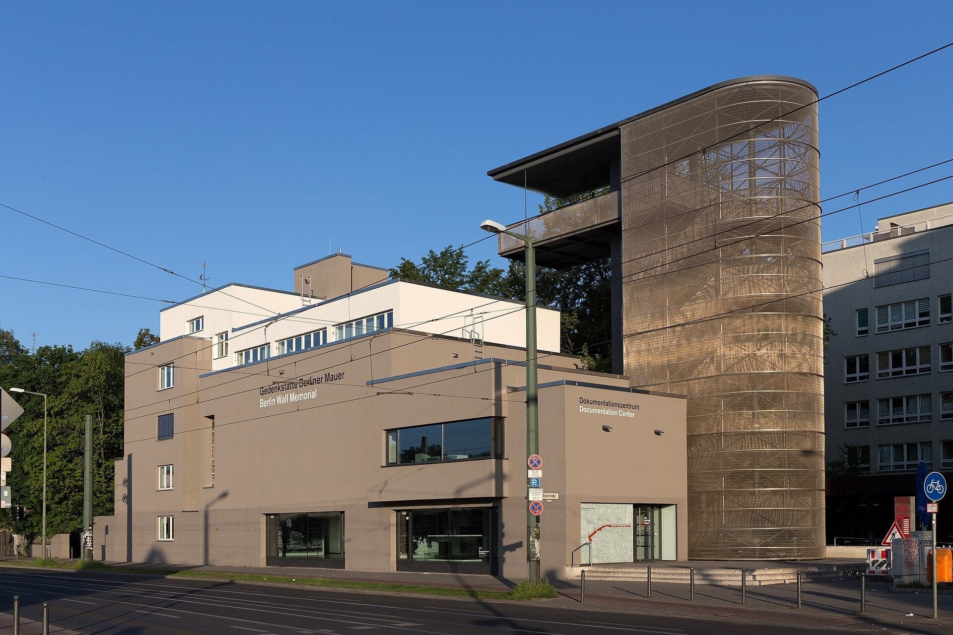
Documentation Center: One Street, Two Cities
Where the street was West and houses East. The Documentation Center's tower looks down on the strip; from the pavement you see the front wall and steel.
- 4
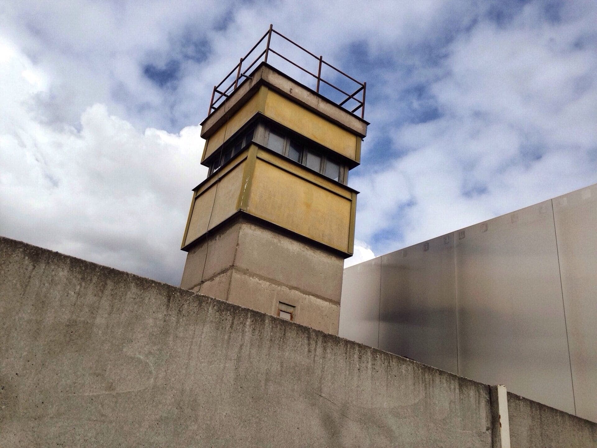
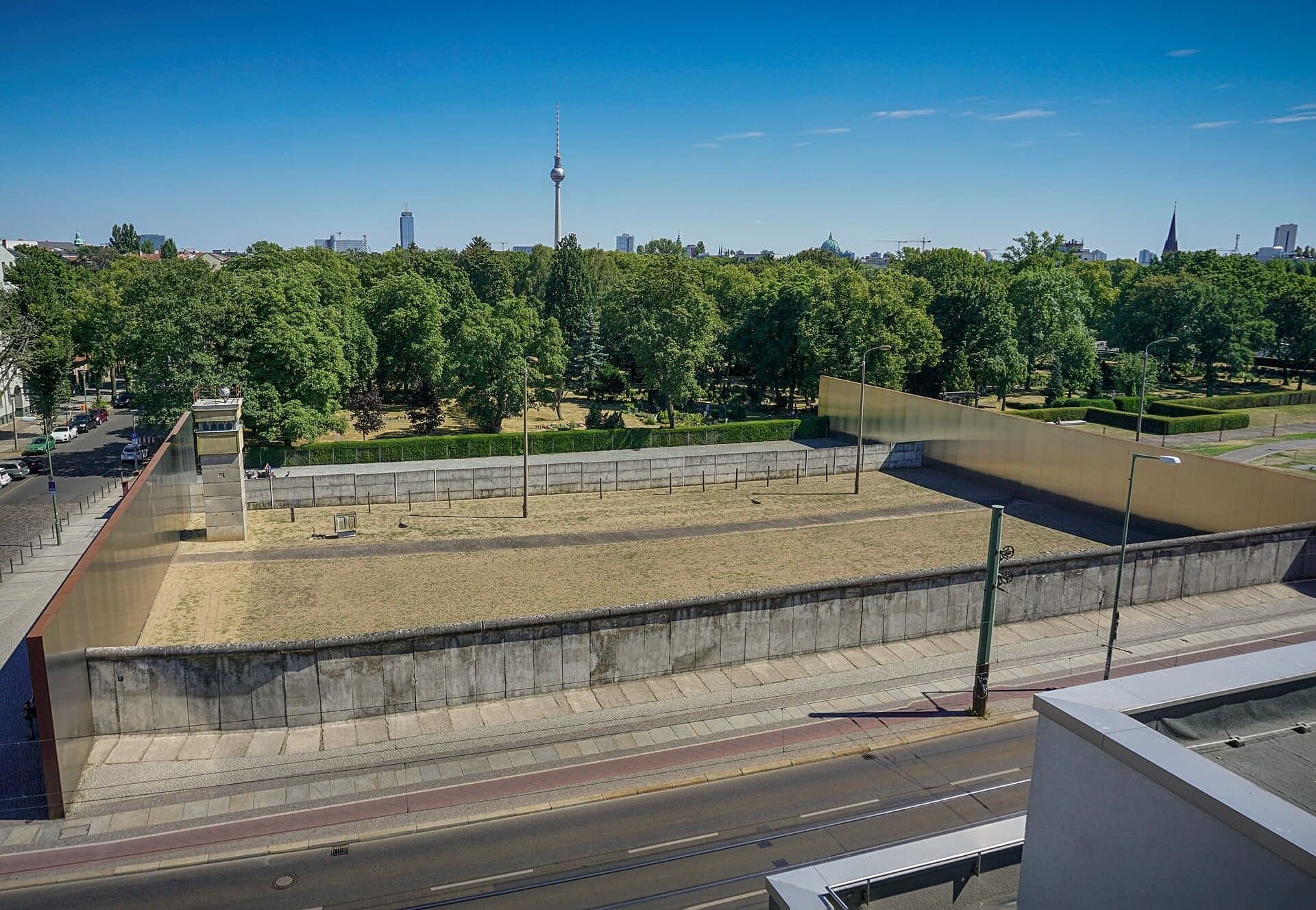
Border Strip and Watchtower: The Wall in Section
The one stretch of border kept in place. Seventy metres of real fortifications between two steel walls, a donor watchtower, and the pastor who stopped the demolition.
- 5
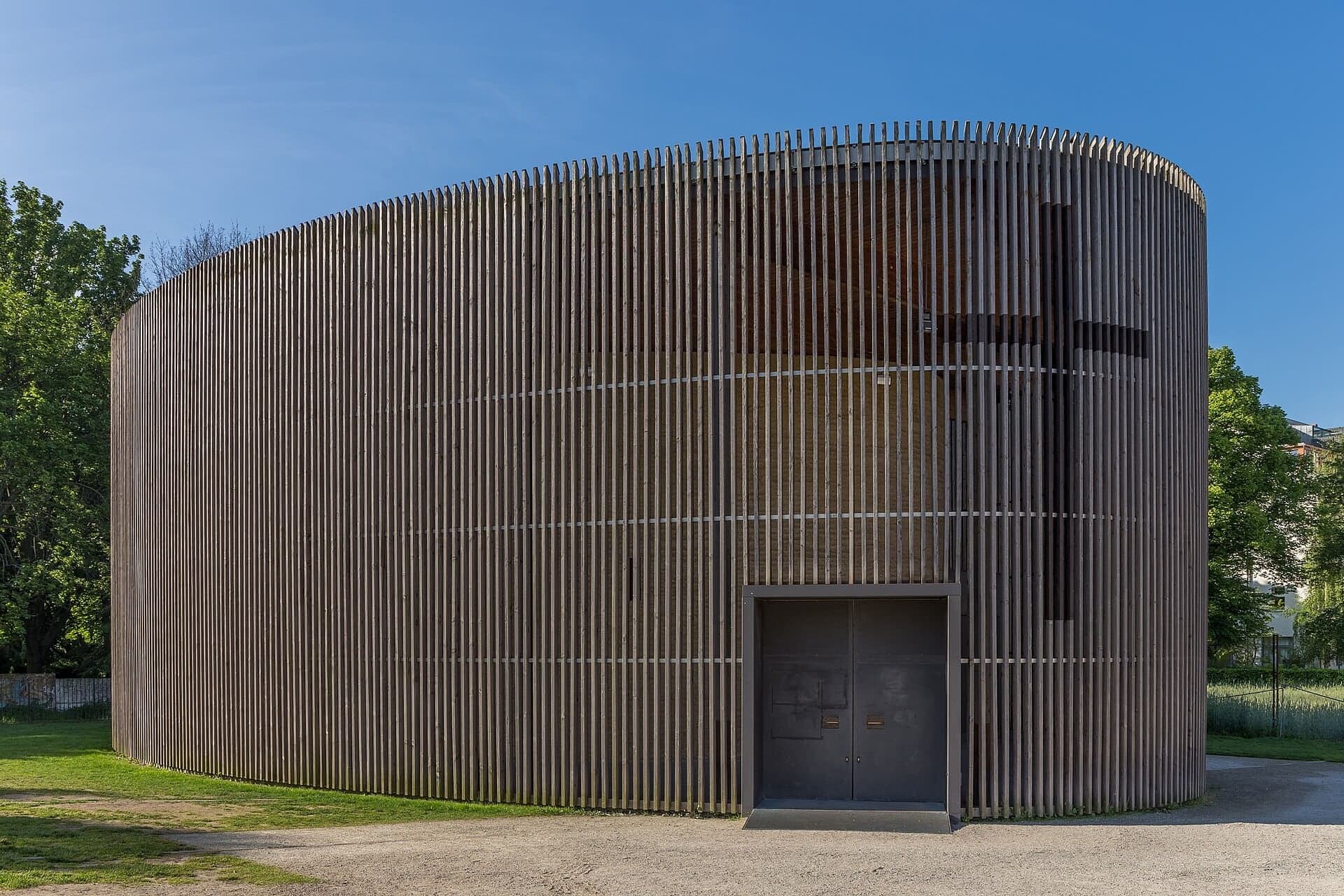
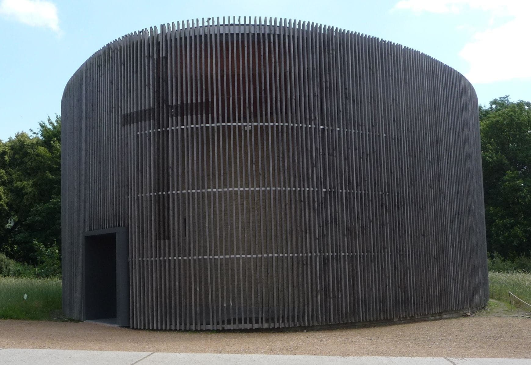
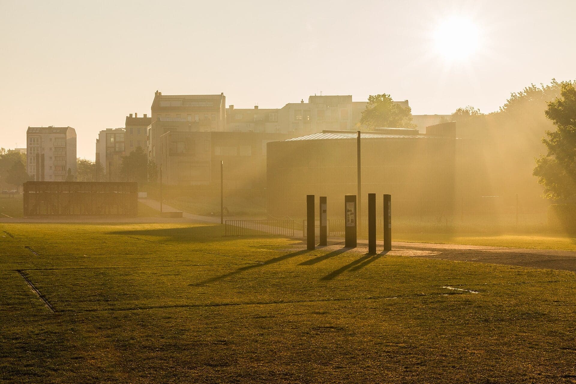
Chapel of Reconciliation: Built from the Rubble
A chapel rebuilt from its church's rubble. The church stood in the death strip until 1985; its replacement of rammed earth holds the ruin's crushed stone.
- 6
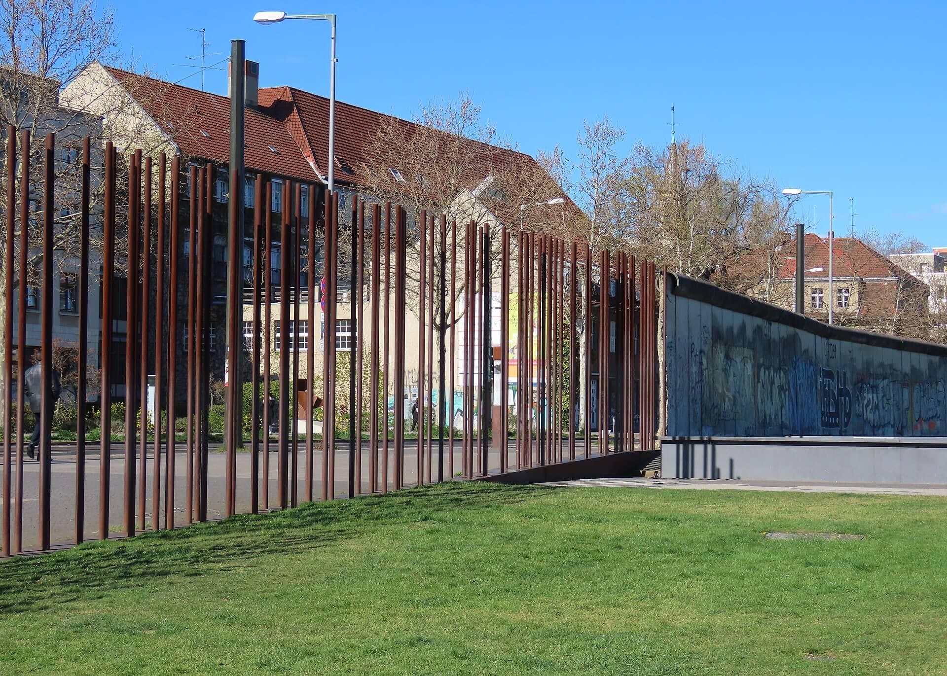
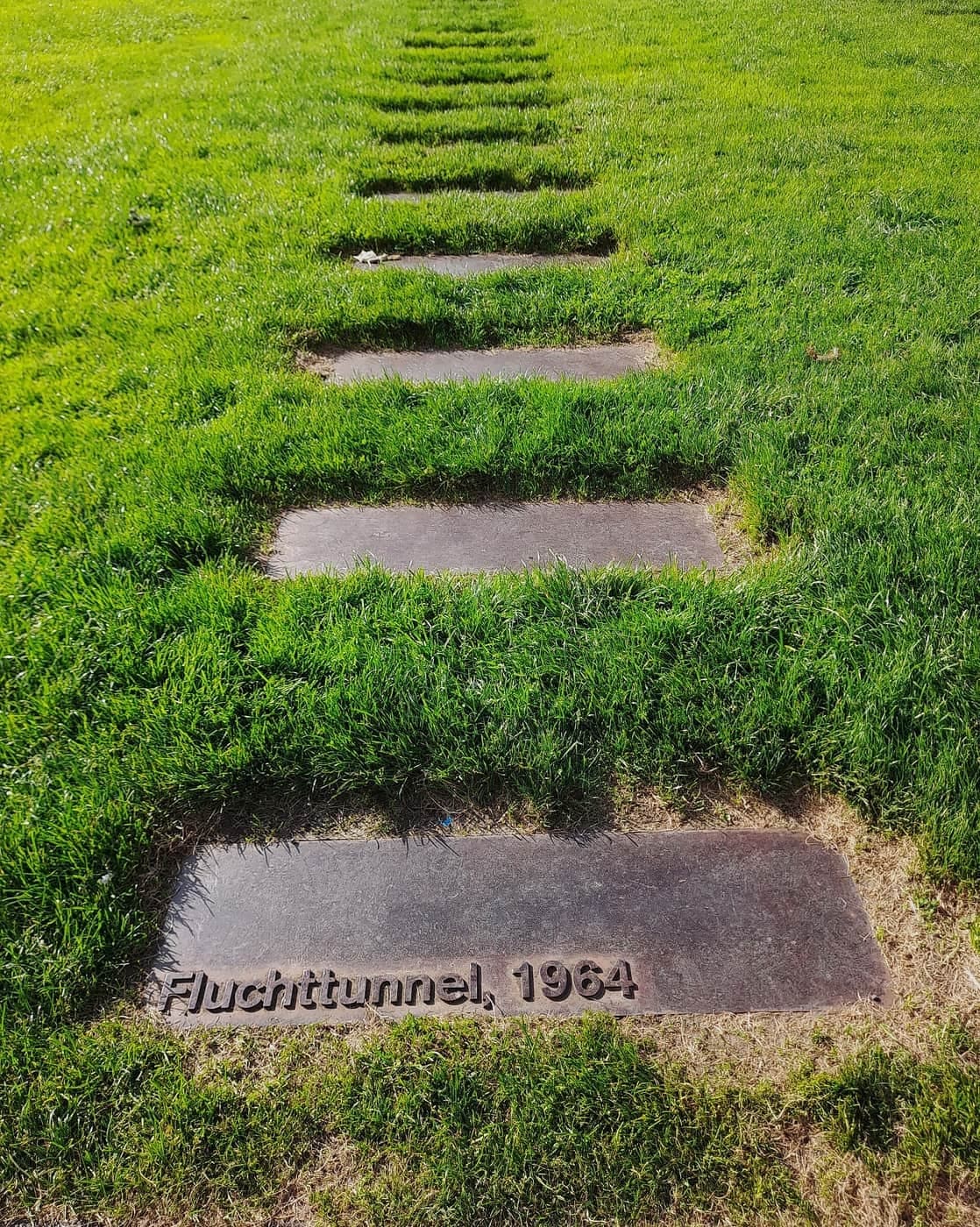
Border Zone: A Neighborhood Turned into a Strip
An open strip where a neighborhood stood. From 1963 a permit zone, from 1965 cleared of houses, and close by, the exit of the tunnel that freed 57 people.
- 7
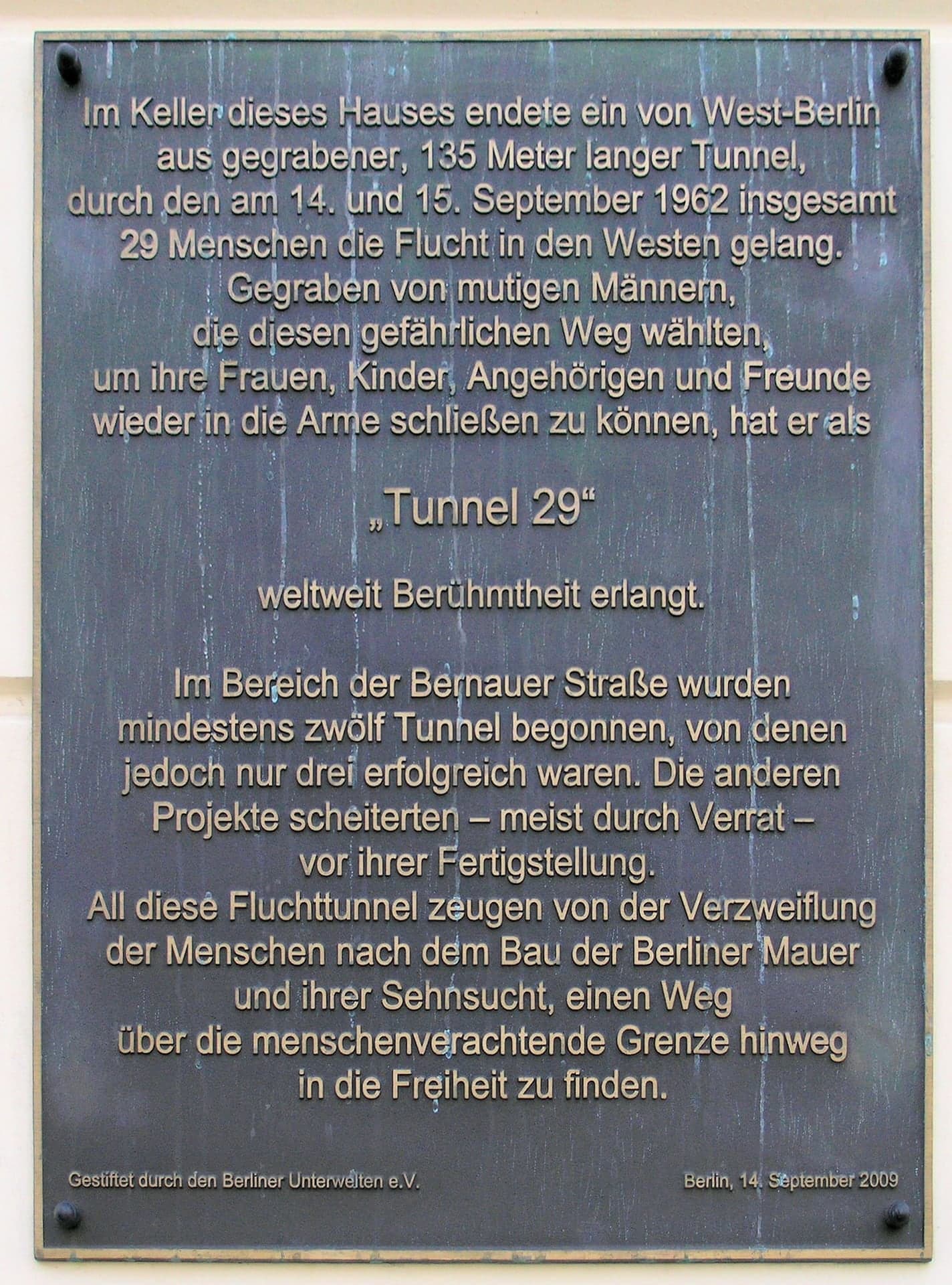
Tunnel 29: A Hole Under the Wall
A plaque where a famous tunnel ended. In September 1962 twenty-nine people escaped through a tunnel dug from West Berlin into this house's cellar.
- 8
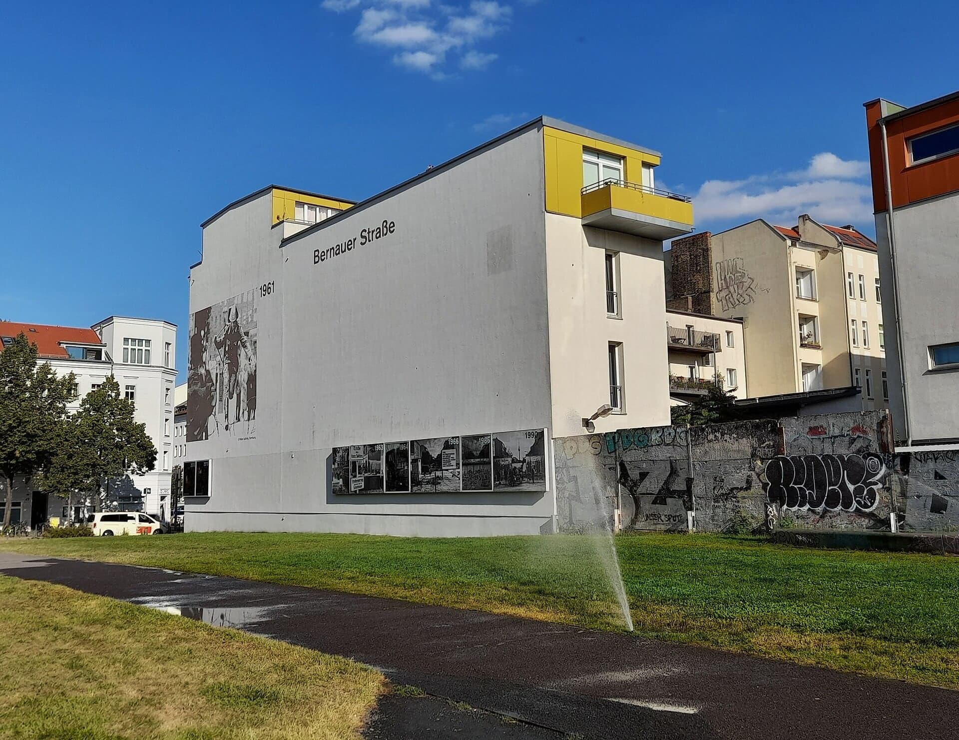
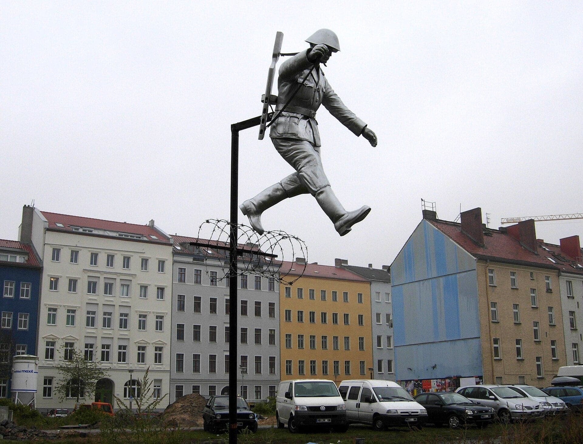
Conrad Schumann's Jump: When the Wall Was Wire
Where a border policeman jumped the wire. On 15 August 1961 the border at this corner was a coil of barbed wire, and one photograph went around the world.
- 9
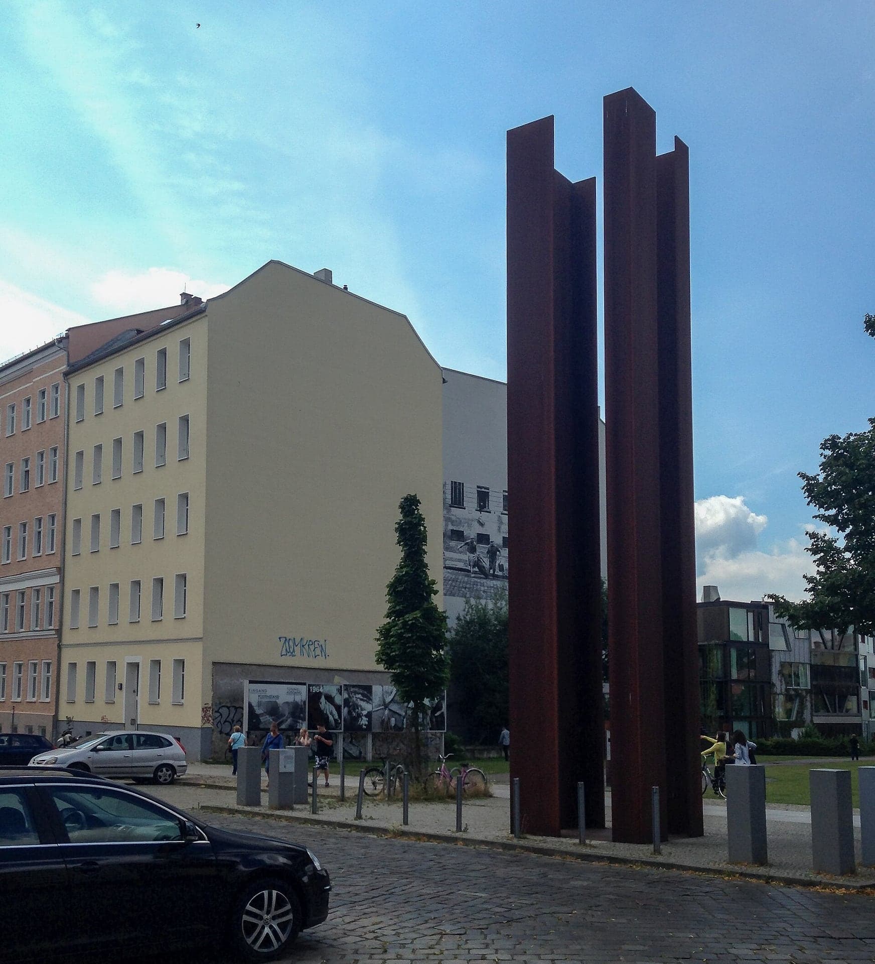
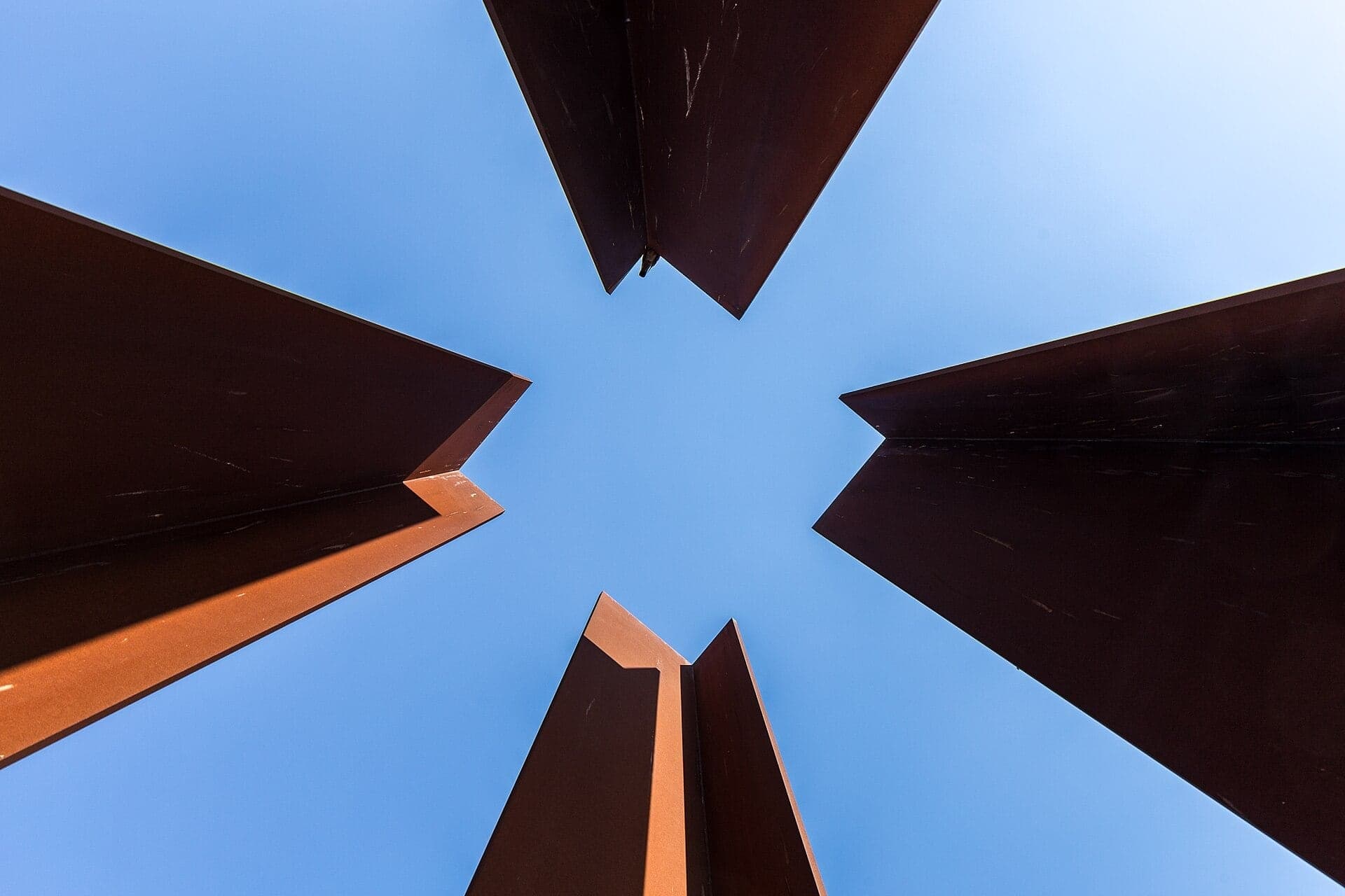
Watchtower Marker: A Tower Drawn in Steel
A watchtower drawn in rusting steel. A frame about three metres high stands on a real tower's foundation, seen from the old patrol path.
- 10
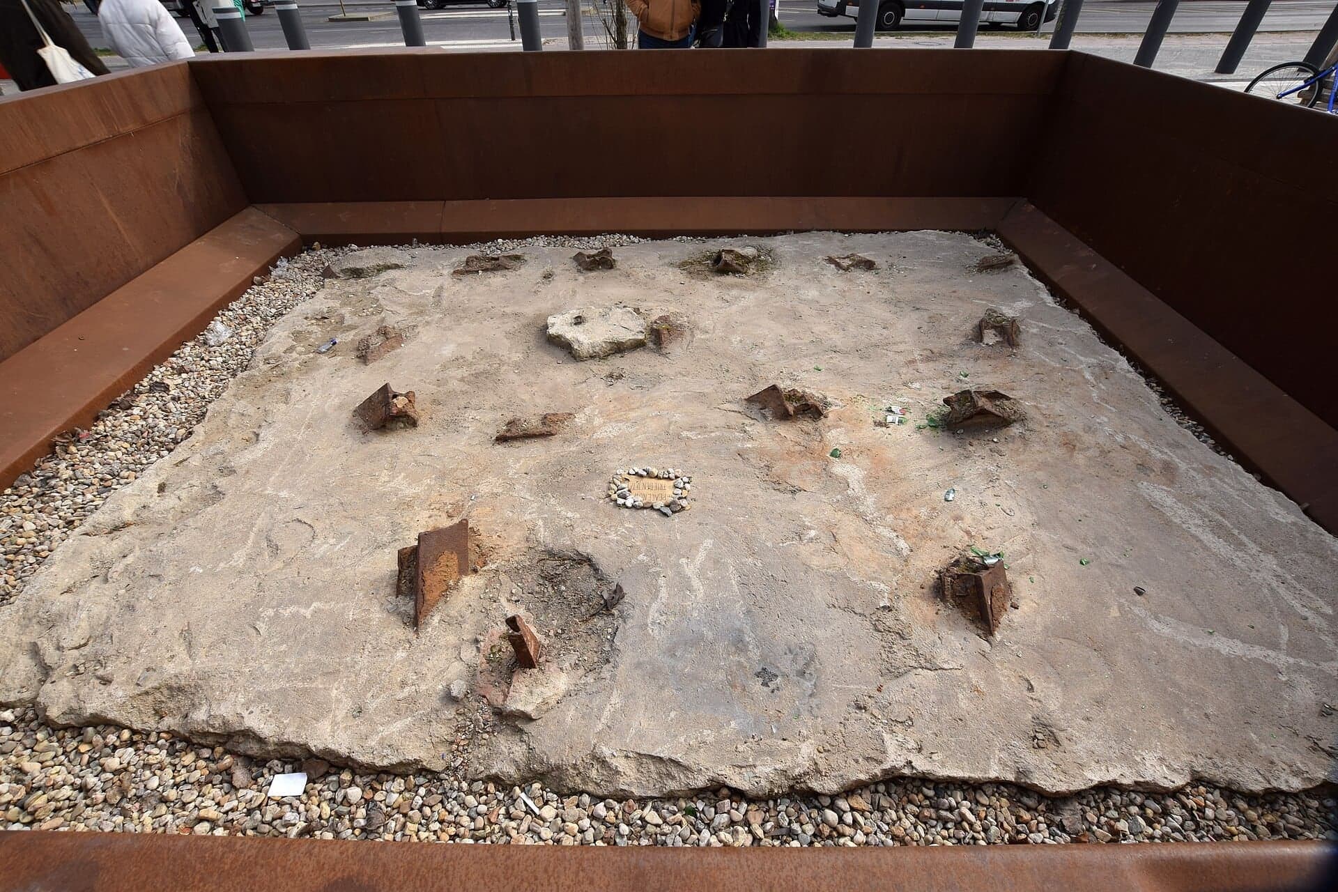
Mauerpark Gate: The Border Under the Path
Where border remains lie under the park. In 2018 workers found a vehicle barrier and an escape-tunnel entrance at this park gate, now on show.
- 11
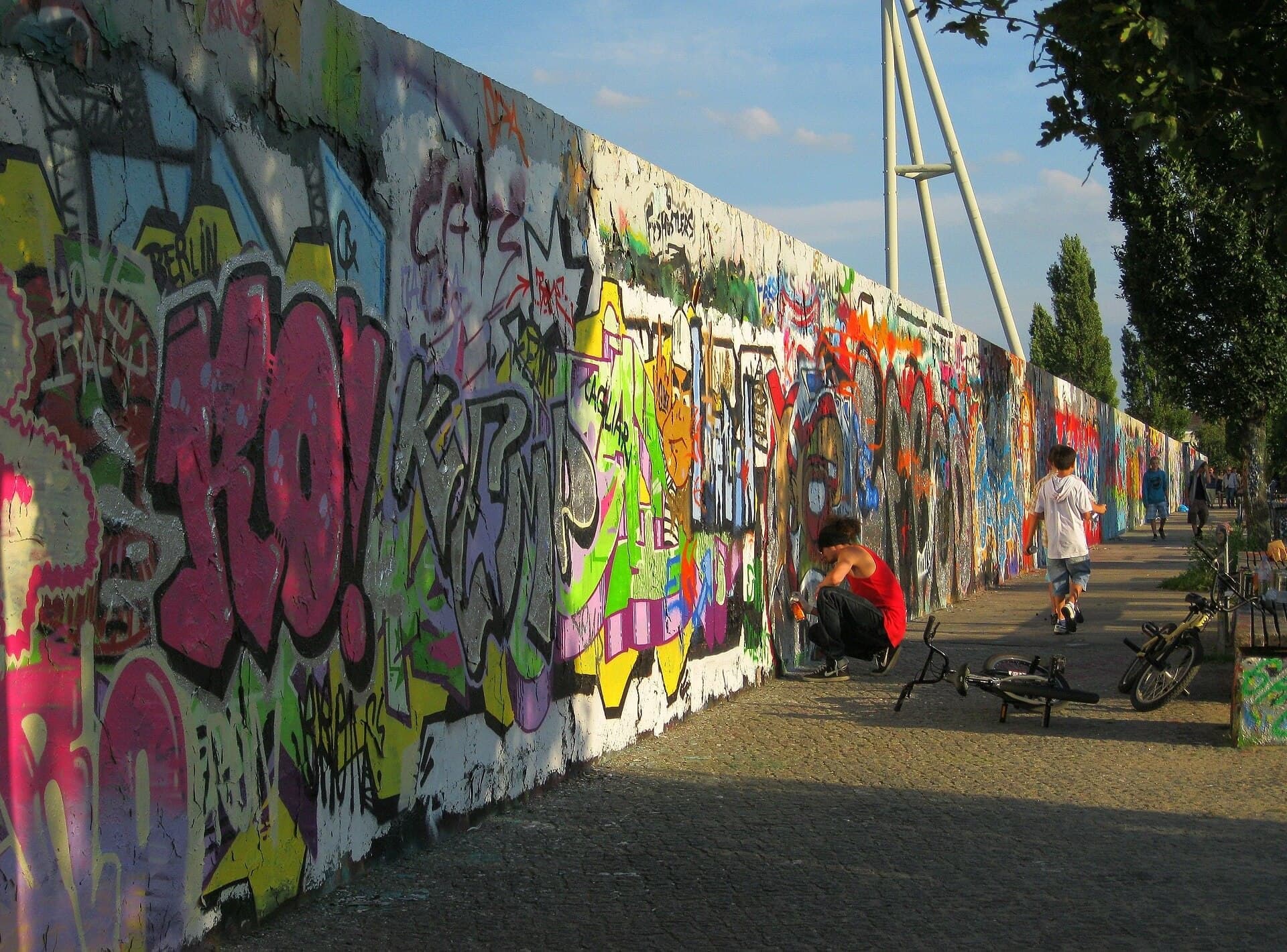
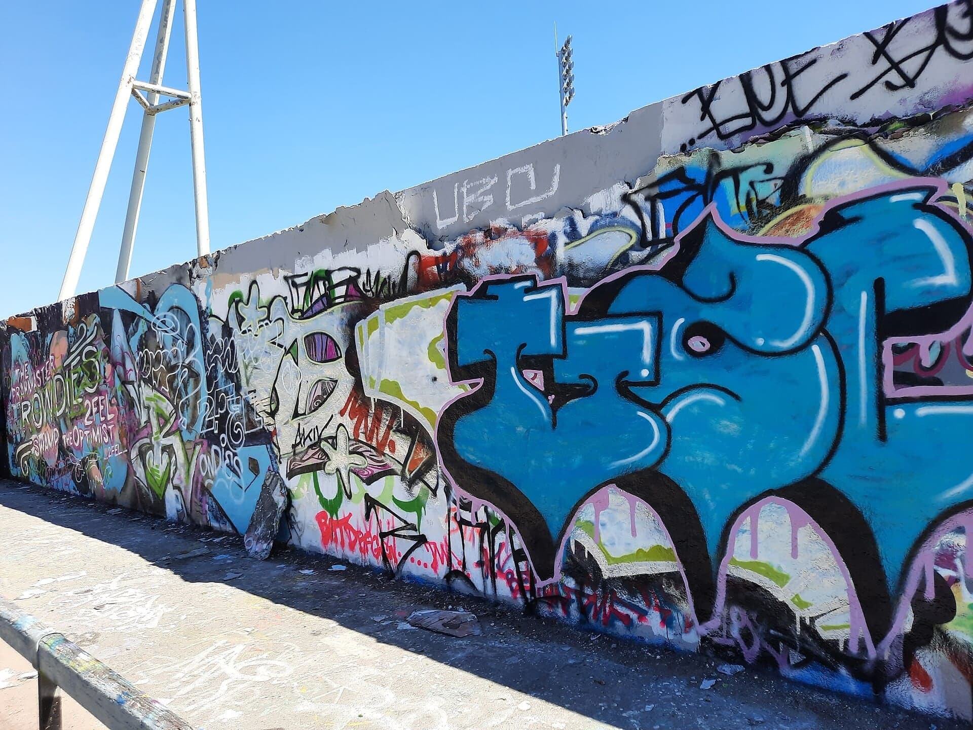
Hinterland Wall: The Wall That Became a Canvas
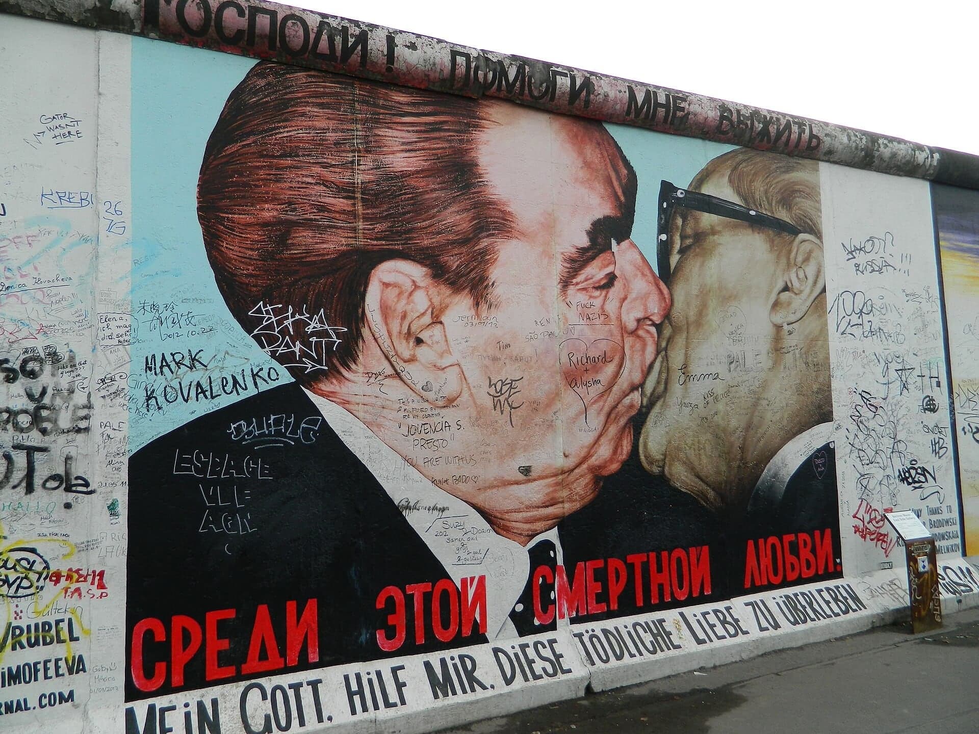
The inner wall that became a canvas. About 300 metres of the Hinterland wall survive here, built higher for a stadium crowd and now open to graffiti.
- 12
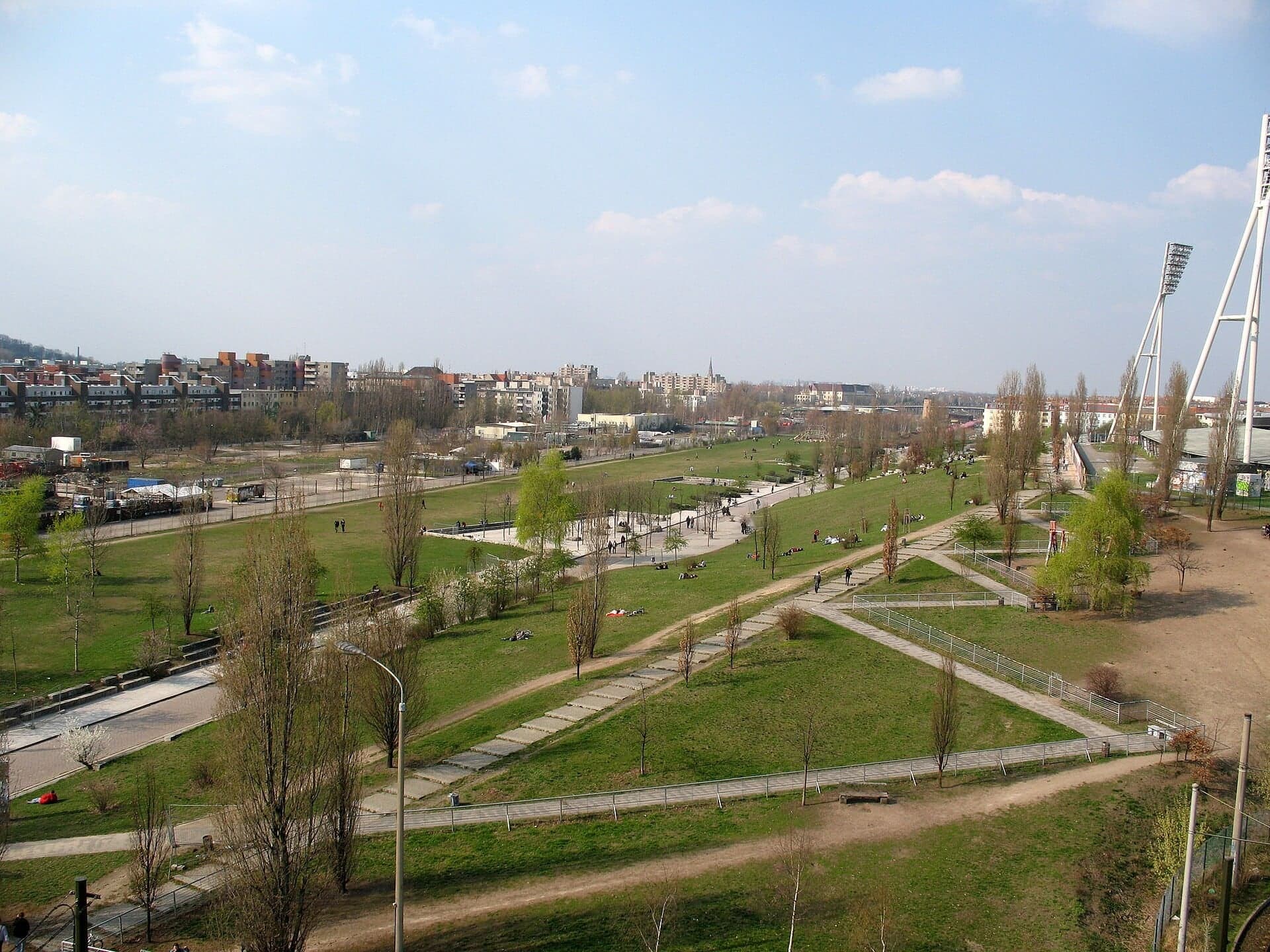
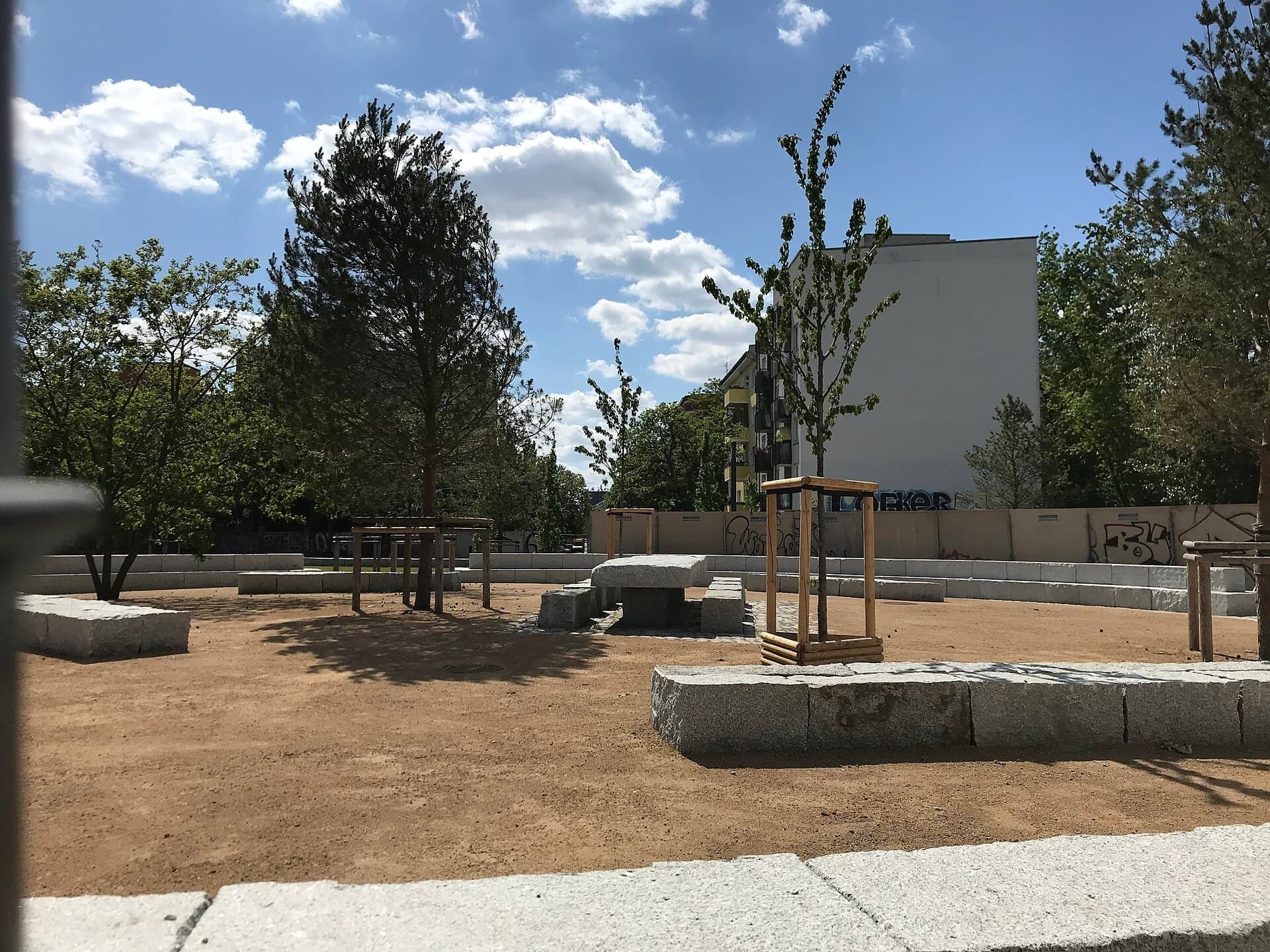
Mauerpark Hilltop: From Border Strip to Lawn
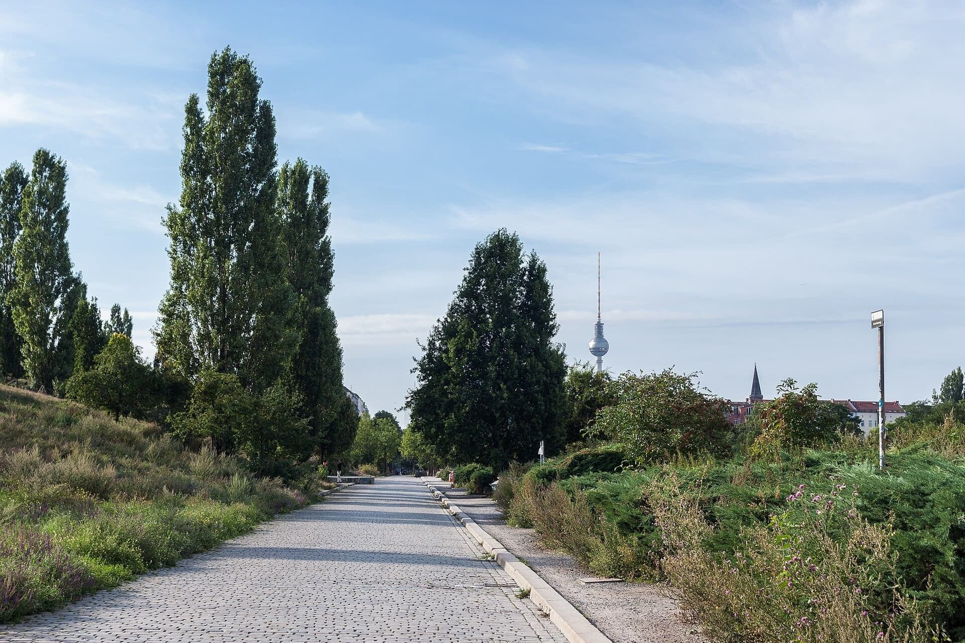
A border strip turned into a lawn. The Mauerpark opened in 1994 on open ground that was a parade ground, a revolution site and then the border.
Details
Best Time to Visit
Tuesday to Sunday between 10am and 5pm, when the Visitor Center, the Documentation Center and its observation tower (10am to 6pm, last ascent 5.45pm) and the Chapel of Reconciliation (10am to 5pm) are open; on Mondays the indoor sites are closed but the outdoor memorial still works (8am to 10pm daily). It is a daylight walk: in mid-October it is dark by about 6.30pm. Weekday mornings are quietest. On Sundays the Mauerpark fills with its flea market and, until mid-October, the open-air karaoke, which makes a lively ending if you like crowds. Checked 9 October 2026.
Pro Tips
- •Getting to the start: S-Bahn S1, S2, S25 or S26 to Nordbahnhof (exit Gartenstrasse/Bernauer Strasse), tram M10 to Nordbahnhof, or bus 247. U8 Bernauer Strasse and U6 Naturkundemuseum are also close. The Stiftung notes a temporary covered walkway outside the S-Bahn exit because of construction. Check bvg.de or sbahn.berlin for disruptions on the day. Checked 9 October 2026.
- •Getting away: the walk ends in the Mauerpark. The park's own page gives U2 to Eberswalder Strasse and tram M10 to Wolliner Strasse. Checked 9 October 2026.
- •Visitor Center (stop 1, Bernauer Strasse 119) and Documentation Center (stop 3, Bernauer Strasse 111): free, Tuesday to Sunday 10am to 6pm, closed Mondays; the last ascent of the observation tower is at 5.45pm. On Monday 9 November 2026 both open 10am to 6pm; both are closed on 24, 25 and 31 December 2026. The outdoor grounds are open every day 8am to 10pm. Wheelchairs and folding seats can be borrowed free at the Visitor Center desk. Checked 9 October 2026 at stiftung-berliner-mauer.de.
- •The observation tower at the Documentation Center (stop 3) is the way to see the preserved border strip laid out whole; from the street it is hidden behind the front wall. It is free.
- •Chapel of Reconciliation (stop 5): free, Tuesday to Sunday 10am to 5pm, opened by volunteers, so short-notice changes happen; a short prayer for the dead of the Wall is held at noon, Tuesday to Friday by the parish's account (the Stiftung says weekdays). Checked 9 October 2026 at kapelle-versoehnung.de.
- •Nordbahnhof's ghost-station exhibition, inside the S-Bahn station, is free and open during the station's opening hours.
- •The Stiftung runs public guided tours of the memorial: 5 euros (3 reduced), 7 euros (4 reduced) for tours over 90 minutes. Checked 9 October 2026.
- •The Mauerpark runs on north from the hilltop to Gleimstrasse if you want to keep walking.
Safety & Precautions
- •Bernauer Strasse carries the M10 tram in the roadway and red cycle tracks run along the pavements, often level with them: at stops 1, 3 and 10 stand well back from the red track. The route crosses at signals at Gartenstrasse/Bernauer Strasse (two stages, over the tram), Strelitzer Strasse, Brunnenstrasse (two stages with an island, a cycle track on each kerb) and Bernauer Strasse at Wolliner Strasse (one phase across the tram tracks). Ackerstrasse, Schönholzer, Ruppiner, Swinemünder and Wolliner Strasse are crossed without lights: look both ways.
- •Between stops 8 and 9 the path has three steps with a handrail, and the map shows a ramp beside them (OpenStreetMap, ramp checked 2023, not yet confirmed on site); the Bernauer Strasse pavement runs parallel, a short block away, if the ramp is blocked. The climb into the Mauerpark (stops 10 to 12) is a zigzag ramp with no steps.
- •The Mauerpark is under renovation into 2027. In 2026 the slope and the path in front of the inner wall (stops 11 and 12) were being renewed, and the graffiti wall was open only one half at a time. If the path is fenced, end the walk at the top of the zigzag ramp, where the wall is in view. Checked 9 October 2026 at mauerpark.berlin.
- •Sundays bring the flea market and karaoke crowds to the Mauerpark, and the Senate's 2024 figures include pickpocketing there: keep bags closed and in front of you.
- •This is a memorial to people who died. Please do not climb on the walls, the steel tracings or the watchtower marker; graffiti is allowed only on the park side of the Mauerpark wall, under the park's rules.
- •The Chapel of Reconciliation is a working church, usually open Tuesday to Sunday from 10:00 to 17:00, with a short prayer for the dead of the Wall at noon on weekdays; visit quietly. Checked 9 October 2026.
- •Walk in daylight: the memorial grounds close at 10pm, and the Mauerpark above the gate is dark at night.
Travel advisory: Exercise Increased Caution (Level 2).
Gallery
Related Reading
Go deeper on what you'll see, hear, and walk through.
Overview
Berlin Travel Guide: Days, Transport, Safety and Budget
7 min
Overview
Best Self-Guided Walking Tours in Berlin (2026)
5 min
Thematic
Berlin: The City That Reads Its Own Scar
7 min
Thematic
Best History Walking Tours in Berlin (2026)
2 min
Companion
Bernauer Strasse: Where the Berlin Wall Ran Through People's Homes
6 min
Deep dive
Brandenburg Gate: The Triumphal Arch Marooned by the Berlin Wall
6 min
Read
What to Eat in Berlin: Dishes, Origins, and How to Order
7 min
Read the walk
The full story of Berlin Wall Memorial: Reading the Wall in Steel, in words. Prefer to listen? Play it narrated, from home or on location.
Introduction
Berlin, the capital of Germany, was cut in two for twenty-eight years. From the thirteenth of August, nineteen sixty-one, to the ninth of November, nineteen eighty-nine, a border about a hundred and fifty-five kilometers long ran all the way around West Berlin. Here on Bernauer Strasse, the Berlin Wall Memorial keeps the one place in the city where a stretch of the border survives with all of its parts.
It was never a single wall. On this street it began as a row of house fronts and a coil of barbed wire, and over the years it grew into a machine: a front wall, a lit strip, a patrol path, an alarm fence, watchtowers, and an inner wall. Much of what you will see is a drawing of that machine: wherever a piece is gone, the memorial marks it in rust-brown steel.
Three people appear along the way. Manfred Fischer, the pastor who saved this stretch from the demolition crews. Conrad Schumann, a young border policeman who jumped the wire. And Gustav Lange, the landscape architect who turned the strip into a park.
The walk is twelve stops over about two point two kilometers, almost a mile and a half, and takes about seventy-five minutes. It follows the memorial's own paths from Nordbahnhof station to the top of the Mauerpark, with a few steps at one point, and a ramp beside them.
1. Nordbahnhof: A Station with Two Doors
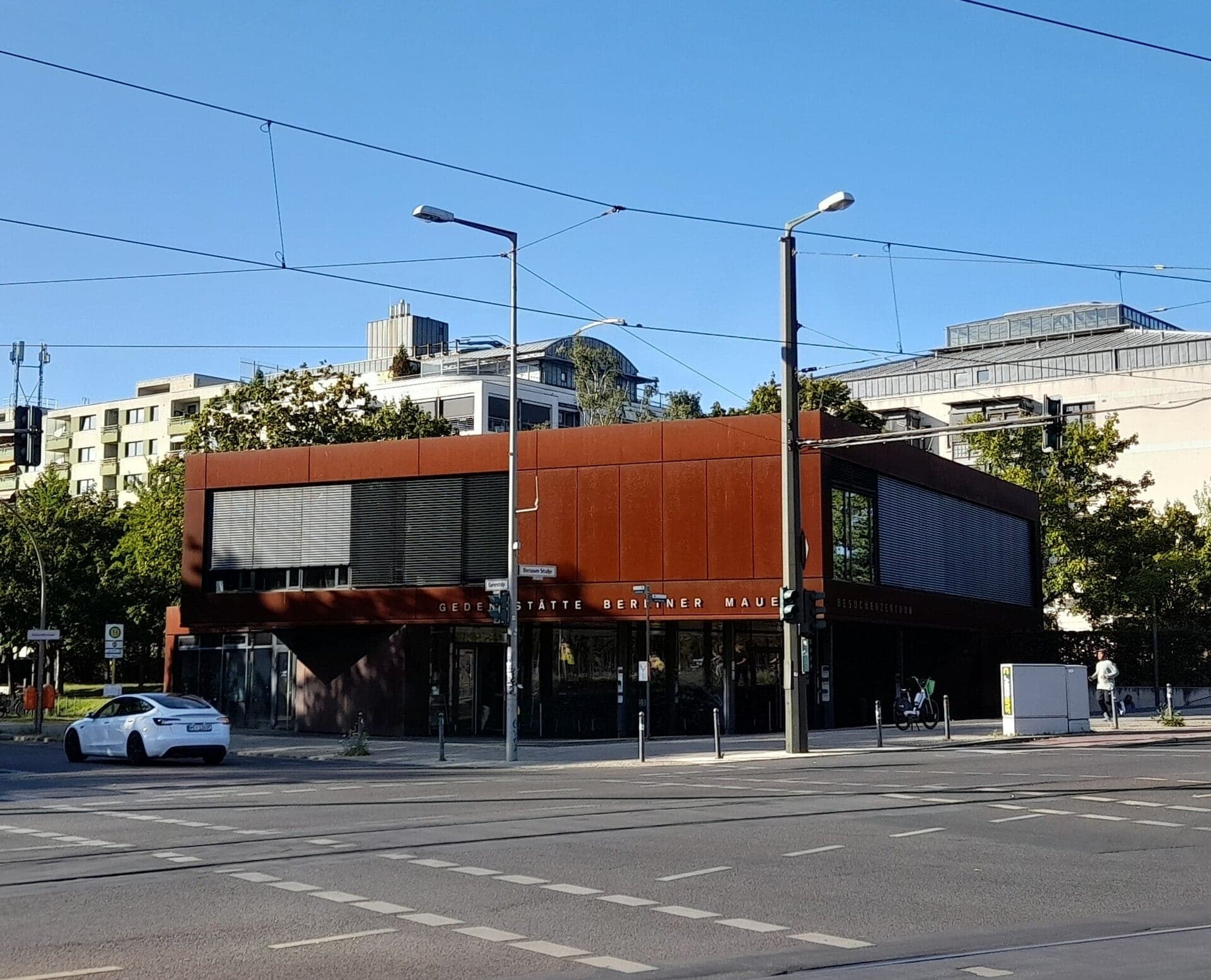
Welcome to Bernauer Strasse, and to the Berlin Wall Memorial. Stop by the wall of the small pavilion, out of the way of the red bike track and the people waiting at the lights. The pavilion is the memorial's Visitor Center. It is free, and it is closed on Mondays.
Start underground. The station here, Nordbahnhof, opened in nineteen thirty-five as an underground S-Bahn station. After August nineteen sixty-one it became one of Berlin's ghost stations. Its platforms lay under East Berlin, but the trains that used them ran between the north and the south of West Berlin, passing under the East on the way. They slowed down as they went through, and never stopped. A plaque at the station puts the strangest part plainly: the entrance on Invalidenstrasse was in East Berlin, the entrance here on Gartenstrasse was in West Berlin, and the Wall ran between the two doors. Below ground, walls and alarms blocked the passages. A free exhibition about the ghost stations is inside the station, open while the station is.
Now above ground. Here the border followed Gartenstrasse, the street beside the pavilion. Along it ran the old brick boundary wall of the railway grounds, built in eighteen ninety-five. In nineteen sixty-one the East German state simply put it to work as the border, with its openings bricked up and barbed wire along the top. A new wall went up behind it a few years later.
Keep that in mind: on the first day, the Wall was whatever was already standing, pressed into service.
Follow the route across Bernauer Strasse at the lights, over the tram tracks, and into the memorial.
2. Window of Remembrance: A Name in Every Window
Walk on along the path into the memorial, and stop when you see a long wall of rust-brown steel in the grass, set with small windows.
Look down first. The path you are standing on was the patrol path, the path the border guards patrolled along the length of the strip. And the concrete wall beside it is the inner wall, called the Hinterland wall, which closed the strip off on the East German side. You are inside the border.
Now the steel. This is the Window of Remembrance, unveiled in May twenty ten. Each small window holds a photograph of one person who died at the Wall, with a name and two dates.
How many people? The Berlin Wall Foundation, the Stiftung Berliner Mauer, which runs this memorial, counts them together with a research center for contemporary history in Potsdam. Their figure is at least a hundred and forty people between nineteen sixty-one and nineteen eighty-nine. Their rule is strict. It counts people killed at the Wall while trying to escape, and people whose deaths were directly linked, in time and place, to the border regime. That includes people with no plan to escape at all, and eight East German border soldiers killed on duty. Other lists give other totals, because they count by other rules.
Notice the material. This rust-brown steel is the memorial's one rule. Wherever part of the border, a house, or a church no longer exists, the memorial draws it again in this same steel, as rods, outlines and markers. When you see a thin line of rusted steel standing in for something, you are looking at a drawing.
Follow the route through the memorial, toward the street.
3. Documentation Center: One Street, Two Cities
Walk on to the end of this path, where it meets the pavement of Bernauer Strasse, and stop there.
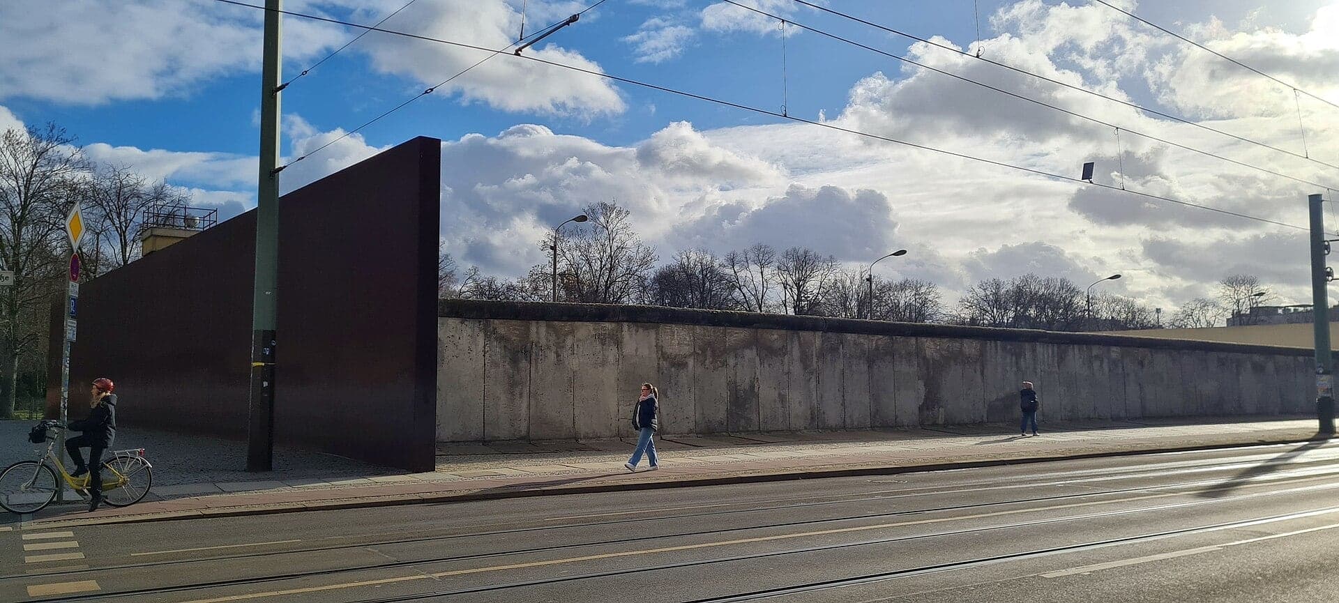
Across the road stands the Documentation Center, in the old parish hall of the Reconciliation Church, with an observation tower that looks down on the preserved border strip. It is free, closed on Mondays, and the view from the top shows the strip laid out whole. From down here the strip is hidden. What you can see is the front wall along the pavement, a steel wall at each end, and a watchtower rising behind.
Now the street itself. When Berlin was divided, the border on Bernauer Strasse ran along the faces of the houses on this side of the street. The roadway, and the pavement in front of the houses, belonged to the West, to the district of Wedding. The houses themselves belonged to the East, to Mitte. So the first Wall on Bernauer Strasse was a row of house fronts.
In August nineteen sixty-one, people climbed out of those houses. West Berlin's fire brigade held out rescue nets, and people jumped, or slid down ropes. The Chronicle of the Wall, run by the memorial and the Potsdam center, says more than a hundred and fifty people reached the West this way in the first three months. Then the doors were nailed shut, the windows bricked up, and the residents were forced to move out. From nineteen sixty-five the houses were torn down, but their ground-floor fronts stood on as the Wall until about nineteen eighty.
The Foundation counts ten people who died in the area of this memorial, all in the nineteen sixties. Four were shot. Five died after jumping or sliding down from the border houses. One, a border guard, died in an exchange of fire.
Follow the route along the pavement, beside the front wall, to the steel wall at the far end.
4. Border Strip and Watchtower: The Wall in Section
Walk on to the end of the steel, and stop beside it, where the cab of the watchtower rises above the rust-brown wall.
Between the two steel walls lies the stretch the whole memorial was built around: about seventy meters of the real border, by the Foundation's count. From the pavement the front wall hides it; the tower at the Documentation Center shows it whole. The steel walls are six meters high, rusted outside and polished inside, so the stretch between them is reflected back and forth, as if it ran on forever.
Behind the front wall, from the street inward, it runs like this. First, the front wall, of a type known as Border Wall Seventy-Five. Behind it, a barrier against vehicles. Then a line of lamps that lit the strip at night. Then the patrol path. Then a signal fence, wired to raise the alarm. Then the tower, and last, the inner wall. Both walls were painted white on the sides that faced the strip, so that anyone crossing it showed up as a shadow.
About that tower. It is not the one that stood here, and what became of that one is not known. The memorial's staff found a tower of the same type at a barracks outside Berlin and rebuilt it on the strip.
In nineteen ninety, souvenir hunters, nicknamed wall peckers, chipped this stretch down to its steel bars. Manfred Fischer, pastor of the Reconciliation Church, lived right beside it. In July nineteen ninety he stopped the construction companies from tearing it down, and that summer he and others put up a sign asking the wall peckers to leave it alone. On the second of October, nineteen ninety, one day before reunification, the stretch was listed as a monument. Its concrete has since been repaired: real, but restored.
Follow the route across Ackerstrasse: there are no lights, so look both ways.
5. Chapel of Reconciliation: Built from the Rubble
Walk on along the path, and stop between the two structures ahead: an oval chapel wrapped in a screen of upright wooden slats, and an open timber frame that holds bells. Before the Wall, a large neo-Gothic brick church stood here, the Church of Reconciliation, built in the…
Full narration for this stop unlocks with the tour.
6. Border Zone: A Neighborhood Turned into a Strip
Walk on along the path through the open grass, and stop by the information board beside it. The strip opens out here into a broad band of grass, with apartment blocks along its far edge. The Wall was not built once. Berlin's monument office counts four phases of building along…
Full narration for this stop unlocks with the tour.
7. Tunnel 29: A Hole Under the Wall
Walk on to the plaque on the house at Schönholzer Strasse, and stop there. Past Brunnenstrasse the memorial changes. This is its extended section, and instead of a preserved strip it follows the line of the old patrol path, with panels and markers. So from here on, much of what…
Full narration for this stop unlocks with the tour.
8. Conrad Schumann's Jump: When the Wall Was Wire
Walk on to the corner of Ruppiner Strasse, and stop at the information board there. On the afternoon of the fifteenth of August, nineteen sixty-one, two days after the border was sealed, a nineteen-year-old border policeman, Conrad Schumann, jumped over the barbed wire at this…
Full narration for this stop unlocks with the tour.
9. Watchtower Marker: A Tower Drawn in Steel
Walk on along the path, past the end of Swinemünder Strasse, and stop by the rust-brown steel frame beside the path. That frame is a watchtower, drawn in steel. It is about three meters high, and it stands on the foundation of a real tower, on the spot where that tower stood.…
Full narration for this stop unlocks with the tour.
10. Mauerpark Gate: The Border Under the Path
Walk on along the pavement to the corner of the Mauerpark, and stop there, well back from the red bike lane. Mauerpark means Wall Park. For twenty-eight years the border ran through this ground. On the night of the tenth of November, nineteen eighty-nine, the first sections of…
Full narration for this stop unlocks with the tour.
11. Hinterland Wall: The Wall That Became a Canvas
Walk on up the path until the long concrete wall covered in graffiti is in front of you, and stop there. This is a surviving piece of the inner wall, the Hinterland wall: the same layer you met beside the Window of Remembrance at the start. About three hundred meters of it…
Full narration for this stop unlocks with the tour.
12. Mauerpark Hilltop: From Border Strip to Lawn
Walk on to the top of the path, at the crest of the park, and stop there, with the graffiti wall still beside you as it comes to an end just ahead. Between the front wall and the inner wall there was a strip where no one could walk. Today it is a lawn. This ground has a longer…
Full narration for this stop unlocks with the tour.
- Besucherzentrum (Gedenkstätte Berliner Mauer) — Aagnverglaser, CC BY-SA 4.0 · source
- "Window Of Remembrance", an central element of the Berlin Wall Memorial, Bernauer Strasse, Berlin, Germany — Inhiber, CC BY-SA 3.0 · source
- Photos of Germans Killed Attempting to Escape - Berlin Wall Memorial - Eastern Berlin - Germany — Adam Jones, Ph.D., CC BY-SA 3.0 · source
- Berlin Wall Documentation Center at Bernauer Strasse in Berlin-Mitte. — Ansgar Koreng, CC BY 3.0 · source
- Dokumentationszentrum (Gedenkstätte Berliner Mauer) — Derbrauni, CC BY 4.0 · source
- A segment of intact Berlin wall along Bernauer Strasse — Einaz80, CC BY-SA 4.0 · source
- The Chapel of Reconciliation on the grounds of the Berlin Wall Memorial at Bernauer Strasse in Berlin. The chapel was designed by the archit — Ansgar Koreng, CC BY 3.0 · source
- Berlin Wall Memorial at Bernauer Straße, Berlin. — [[User:Ad Meskens|Ad Meskens You are free to use this picture for any purpose as, CC BY-SA 4.0 · source
- Berlin Wall Memorial site Bernauer Straße in the early morning light. — Ansgar Koreng, CC BY-SA 4.0 · source
- Memorial plaque, Tunnel 29, Schönholzer Straße 7, Berlin-Mitte, Germany — OTFW, Berlin, CC BY-SA 3.0 · source
- Bernauer Straße (Berlin), Nachzeichnung Fluchttunnel von 1964 — Aagnverglaser, CC BY-SA 4.0 · source
- Gedenkort - Mauerspringer Conrad Schumann an der Bernauer Straße (Berlin) — Aagnverglaser, CC BY-SA 4.0 · source
- Skulptur auf dem Mauerstreifen an der Bernauer Straße (Nähe Ruppiner Straße) in Berlin-Mitte; sie erinnert an den NVA-Soldaten Conrad Schuma — Jotquadrat, CC BY-SA 3.0 · source
- Nachzeichnung des Wachturms BT9 an der Bernauer Straße, Berlin. — HerrAdams, CC BY-SA 4.0 · source
- Representation of a watchtower BT-9. View from bottom to top. Berlin Wall Memorial site Bernauer Straße. — Ansgar Koreng, CC BY 3.0 · source
- Mauerpark Berlin Lortzingstrasse — Traktorminze, CC BY-SA 4.0 · source
- Berliner Mauer im Mauerpark — Stadtpoetin, CC BY-SA 3.0 · source
- Graffiti on the wall of the former sports parc next to the Berlin Mauer parc — Ciell, CC BY-SA 4.0 · source
- Mauerpark, 31.03.2007 — Franz Richter (User:FRZ), CC BY-SA 3.0 · source
- Mauerpark in Berlin, facing south. — Ansgar Koreng, CC BY-SA 3.0 · source
Images may be cropped or resized. Other photos via Unsplash and Pexels.