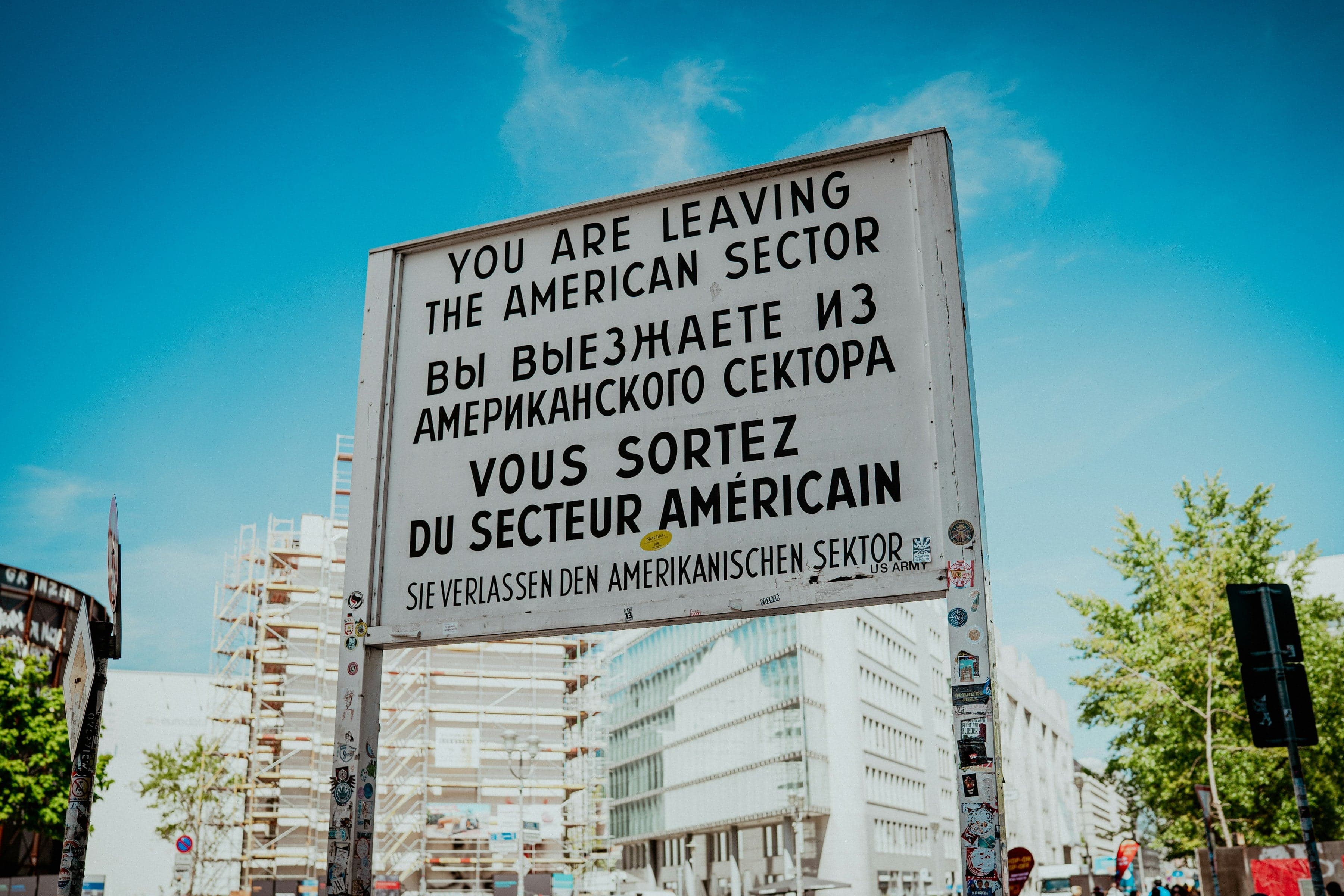
Walk from the Holocaust Memorial past the Führerbunker site, the Georg Elser marker and the Nazi Air Ministry to the Berlin Wall remnant at the Topography of Terror, Checkpoint Charlie and the Peter Fechter memorial.
Start · Memorial to the Murdered Jews of Europe: The Field's Edge
DirectionsStops
- 1
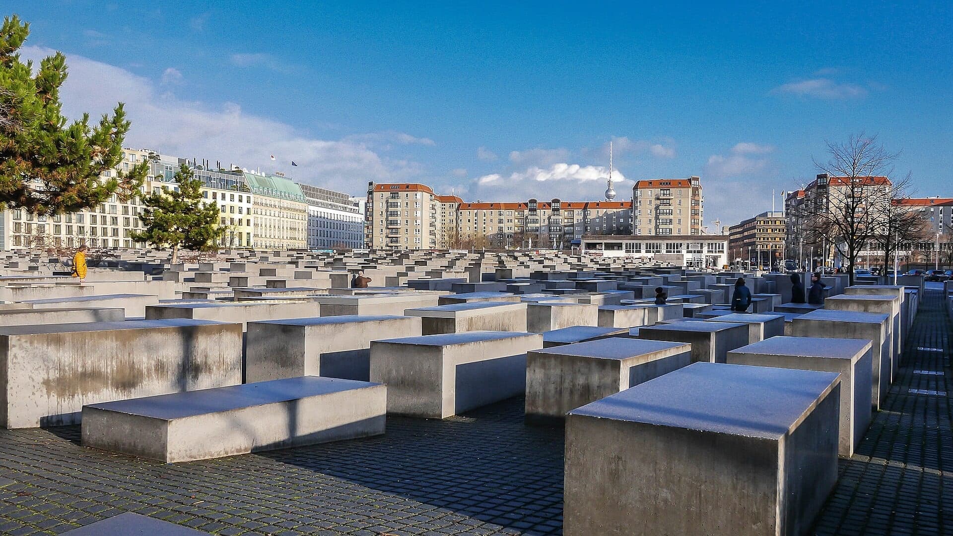
Memorial to the Murdered Jews of Europe: The Field's Edge
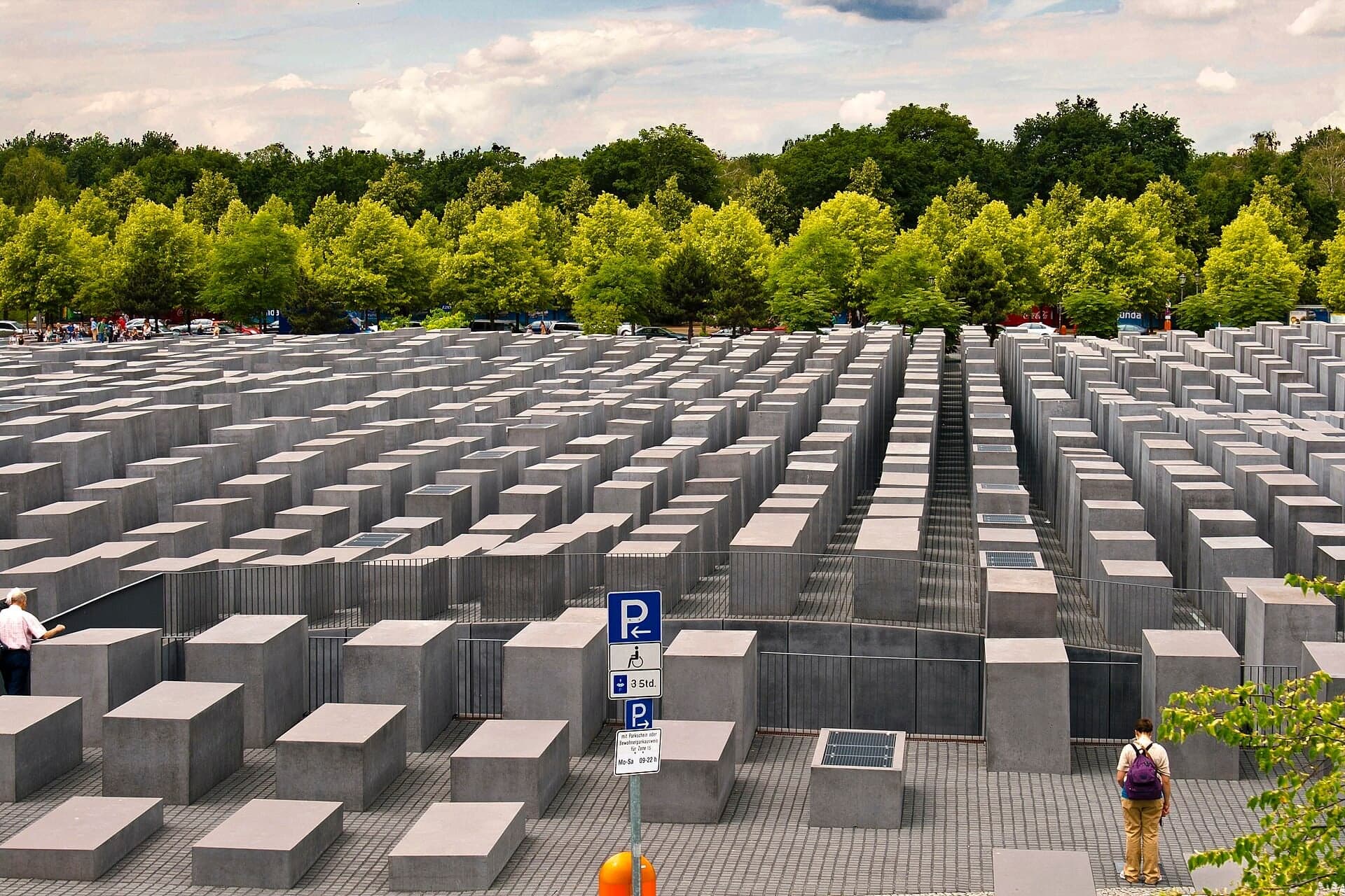
The field of stelae from its edge. Peter Eisenman's memorial, opened in May 2005 on the former ministers' gardens, with a free underground Information Center that is closed on Mondays.
- 2
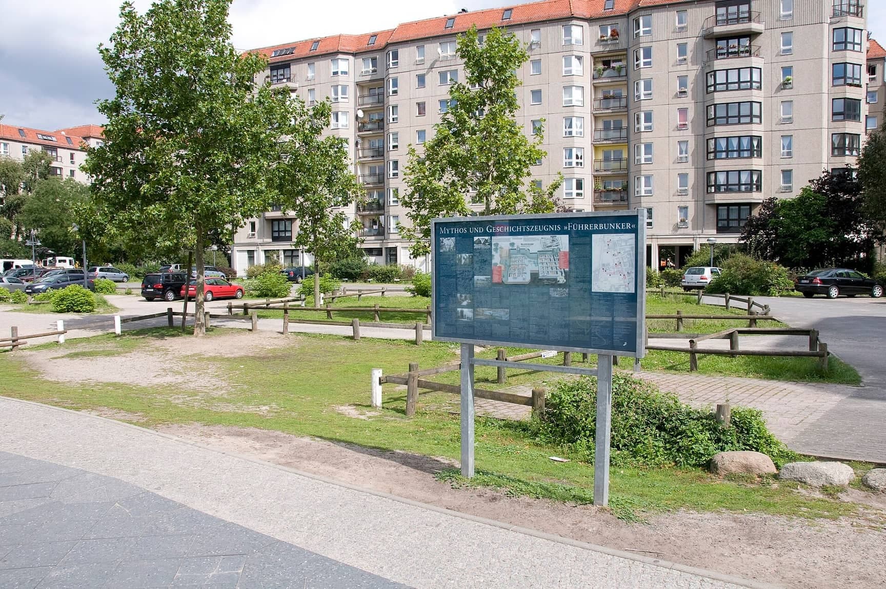
Führerbunker Site: A Car Park and a Board
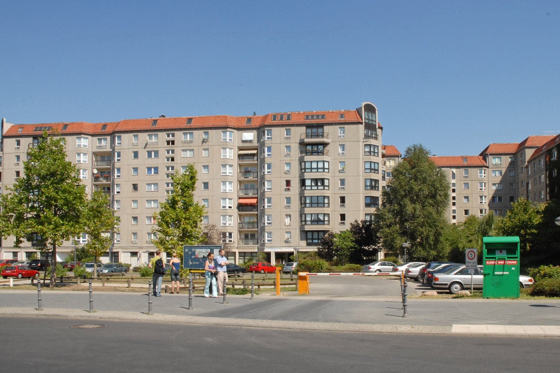
A car park over Hitler's last bunker. Left unmarked for decades after the war, the site has carried a sober information board since June 2006, put up by a private association.
- 3
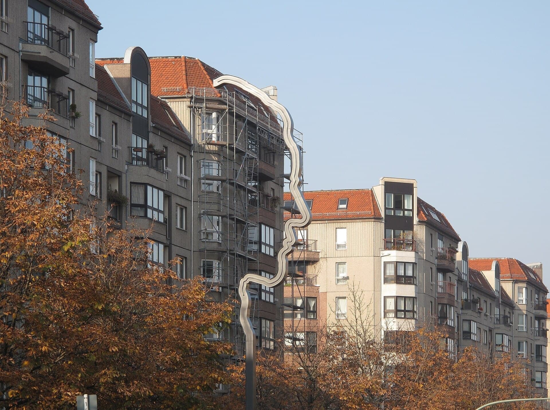
Georg Elser Marker: A Profile in Steel
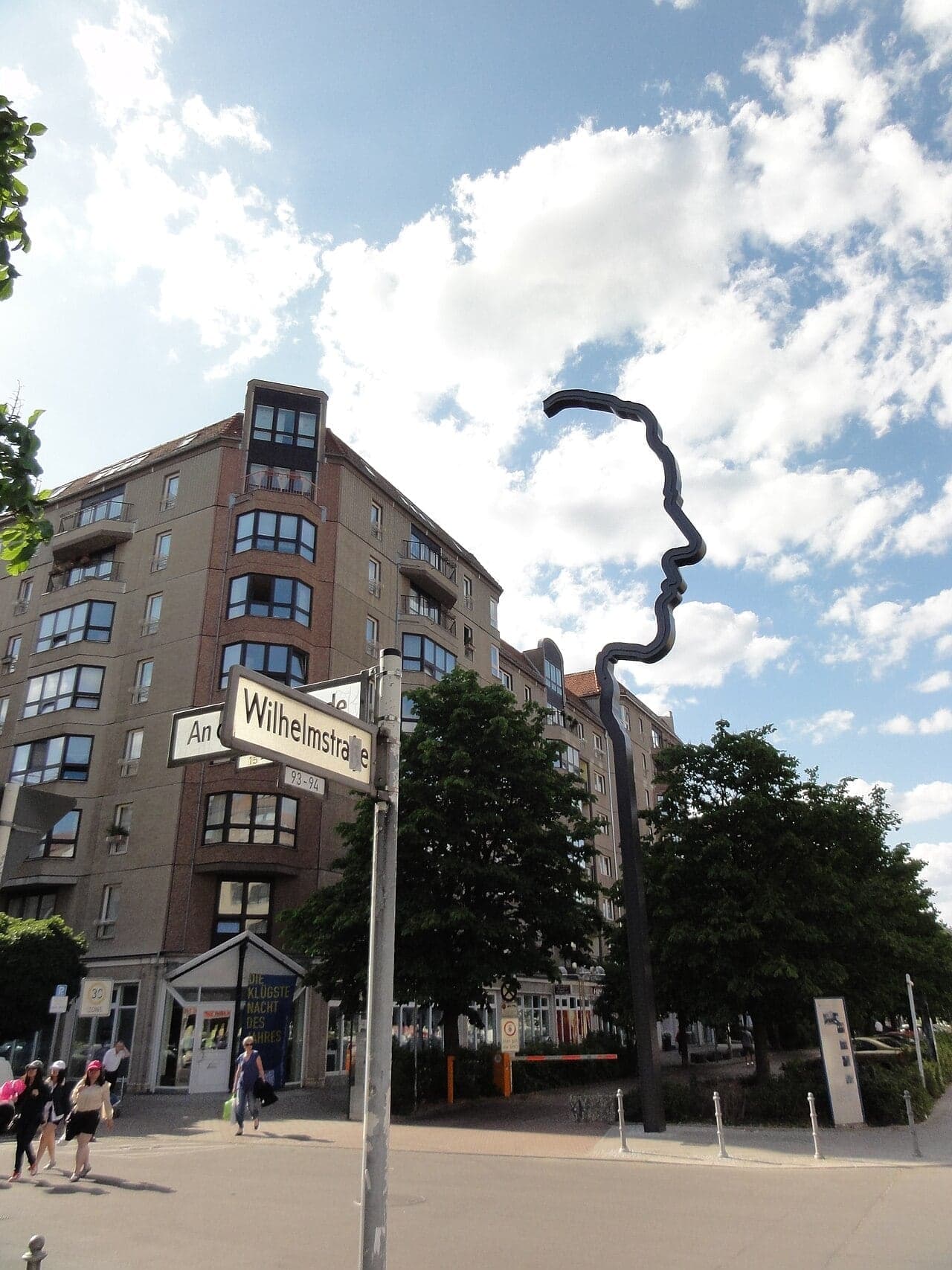
A steel profile for a lone resister. More than 17 m tall, unveiled on 8 November 2011 on the former Reich Chancellery grounds, it remembers the carpenter who tried to kill Hitler in 1939 to prevent the war.
- 4
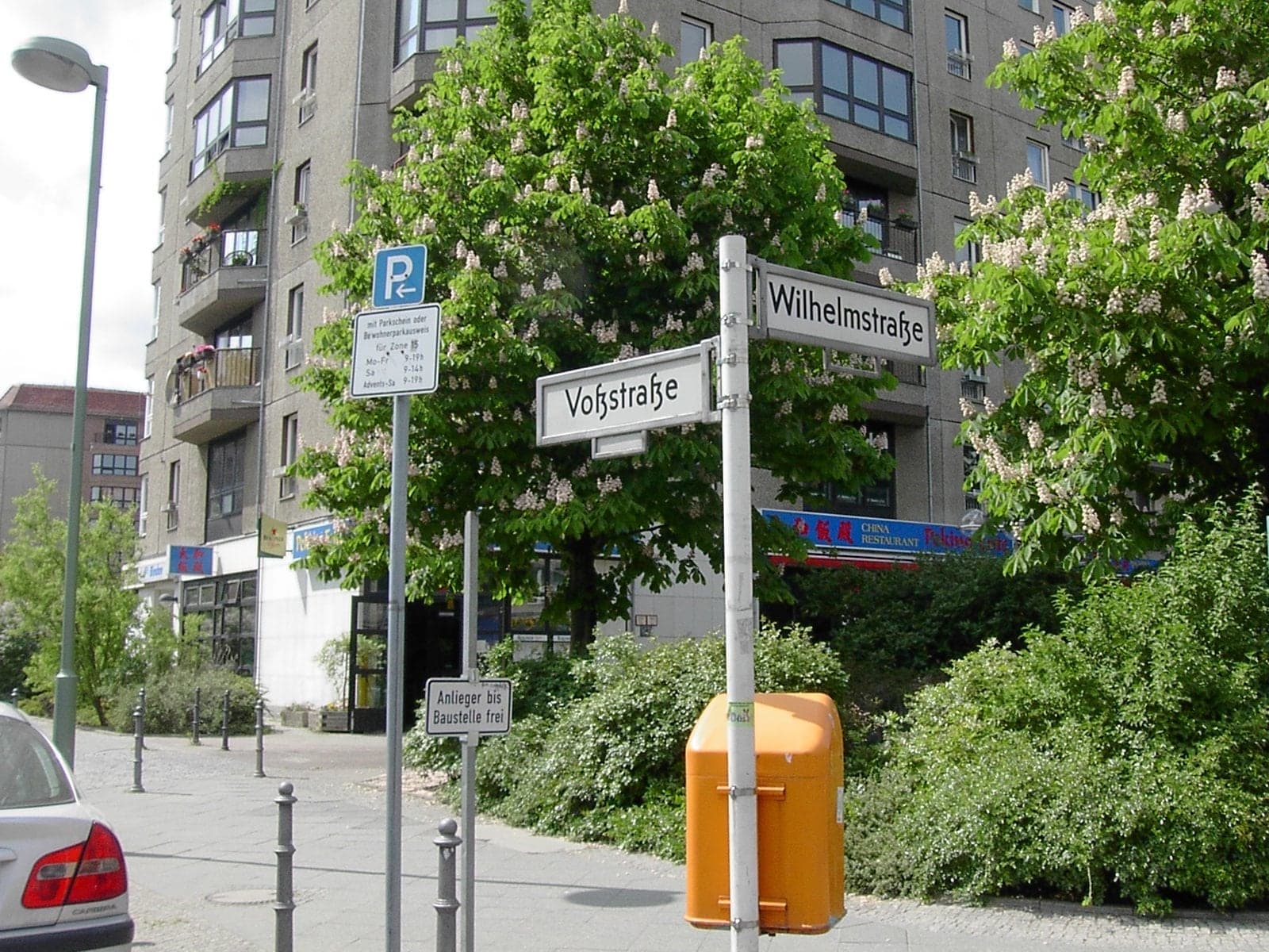
Wilhelmstrasse: The Street of Ministries
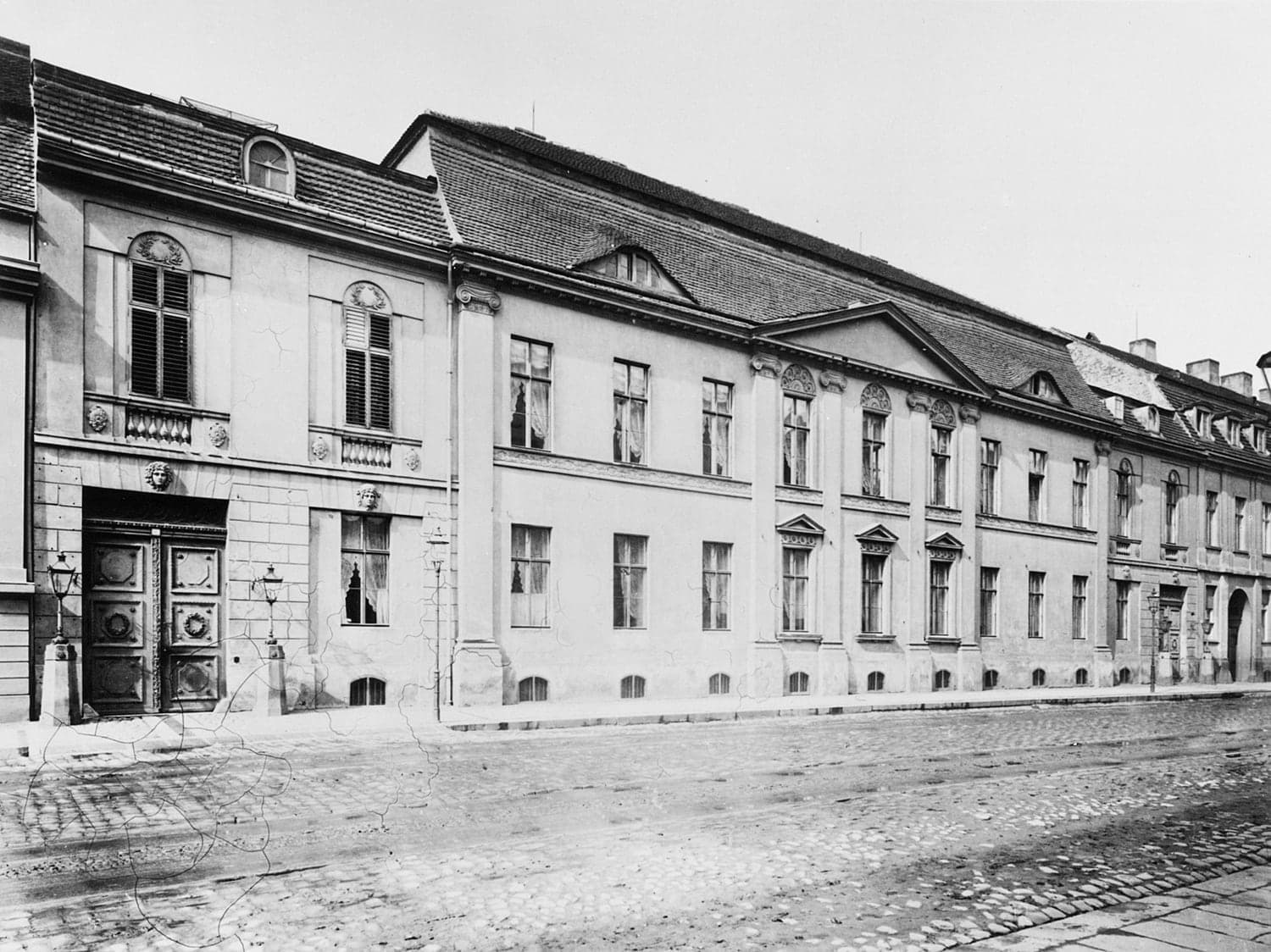
The street that ran Prussia and the Reich. Almost nothing is left of the Reich Chancellery, the Foreign Office or the President's palace; a trail of numbered boards tells where each stood.
- 5
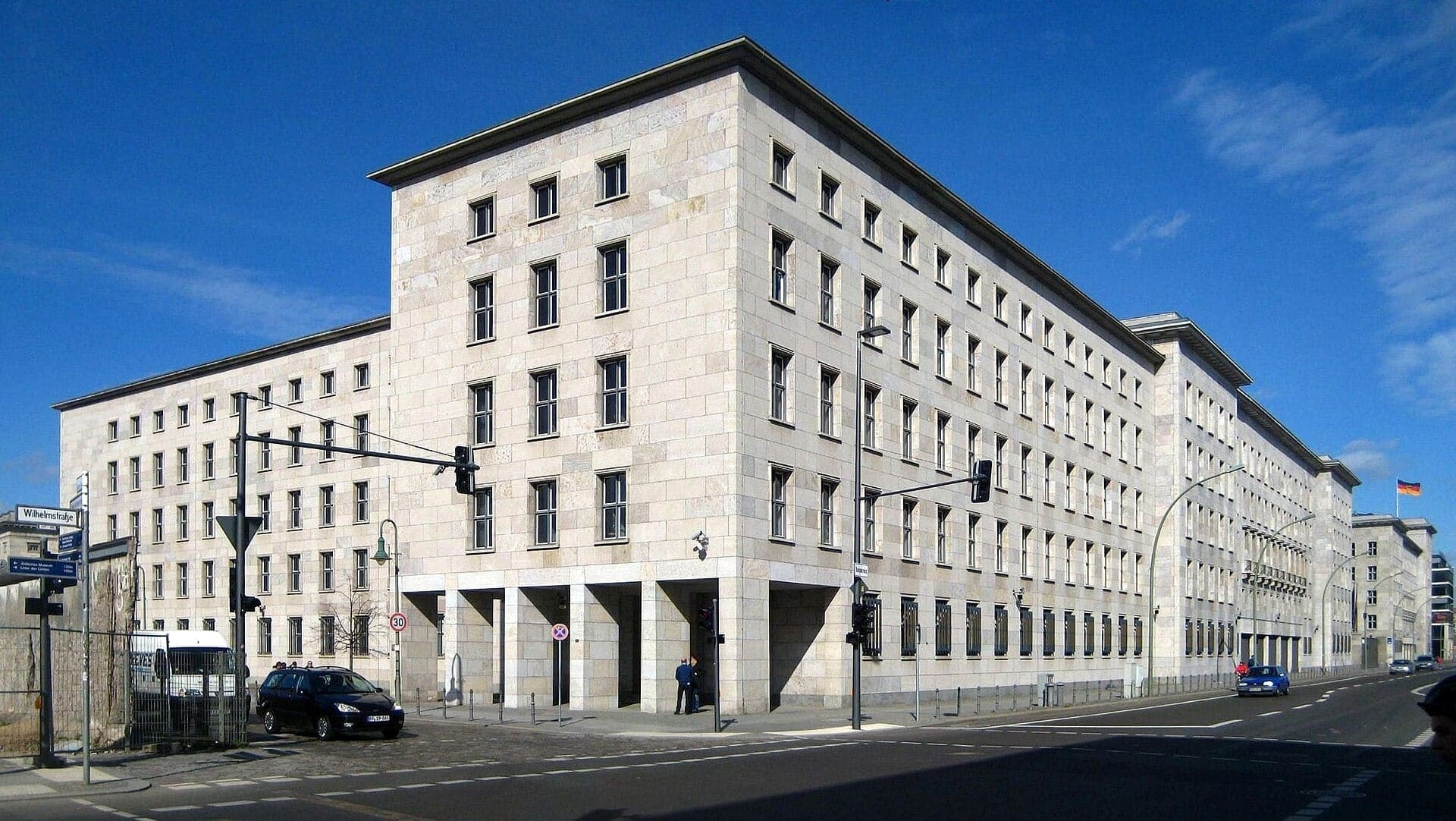
Air Ministry: A Stone Skin on a Steel Frame
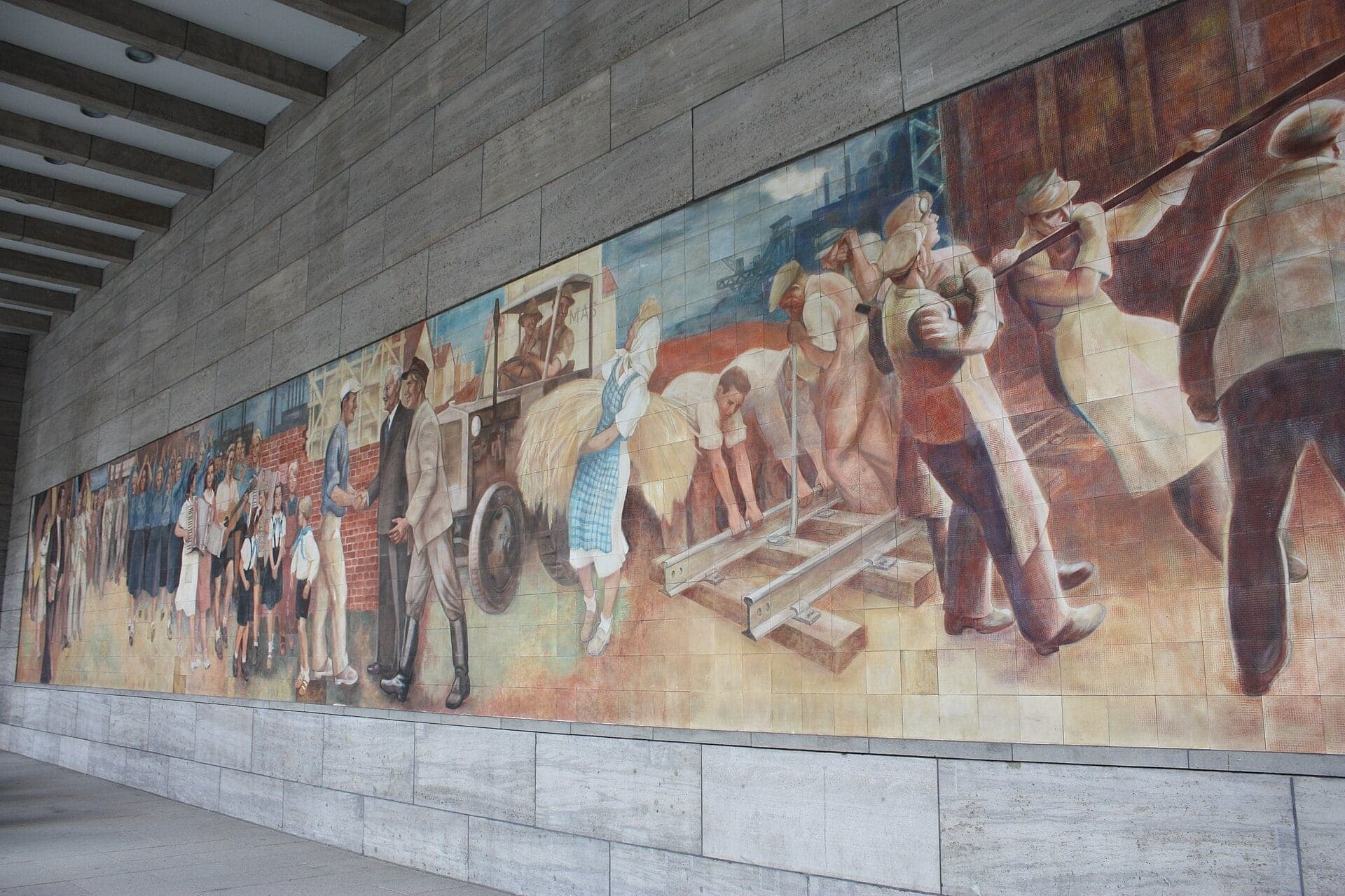
Göring's Air Ministry and the 1953 uprising square. A 1936 office block clad in shell limestone over a steel frame, now the Finance Ministry, with a GDR tile mural in its colonnade and a 1953 photograph set in the paving.
- 6
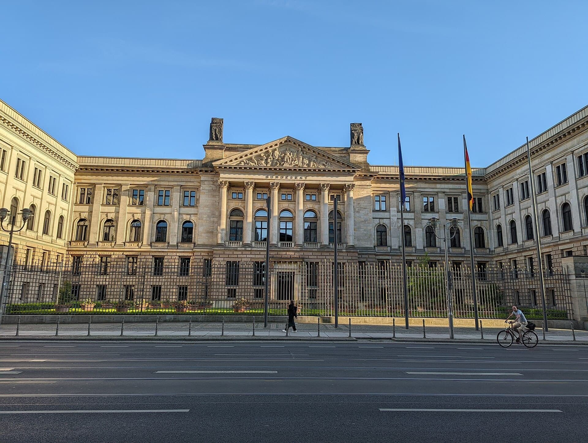
Bundesrat: A Palace for Sixteen States
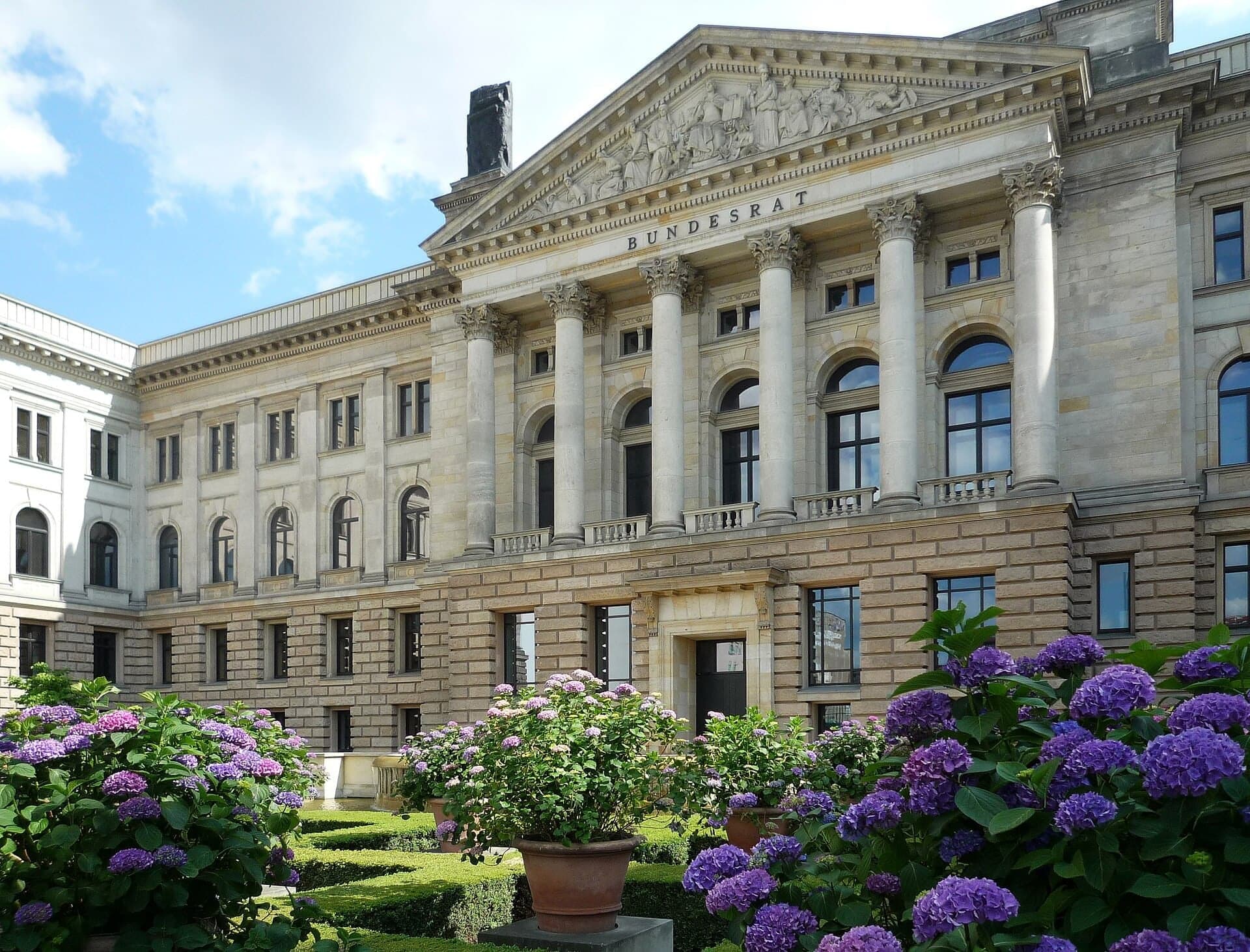
A 1904 palace that now houses the Bundesrat. Built for the Prussian House of Lords around a courtyard of honor, it has been the chamber of Germany's sixteen states since September 2000.
- 7
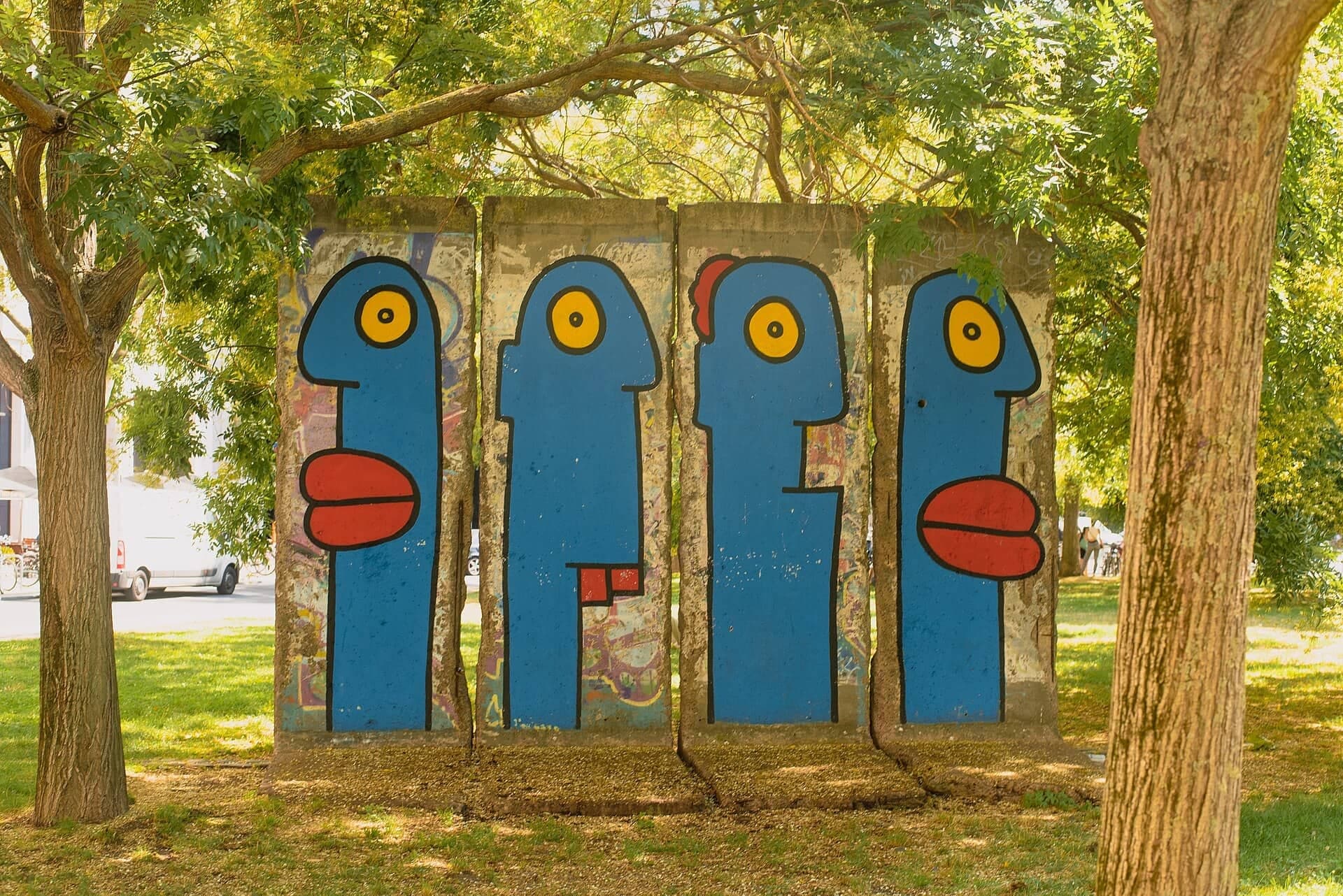
Leipziger Platz: A Wall Built for the View
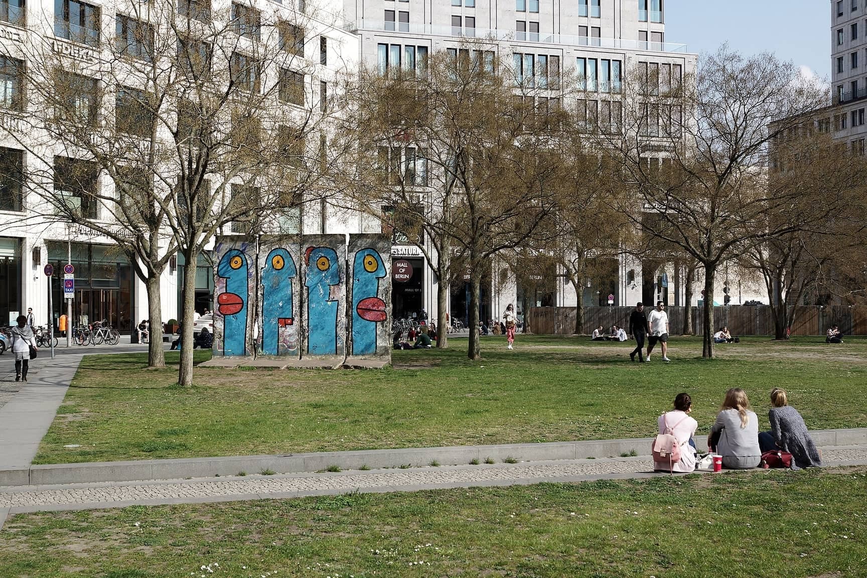
An eight-sided square and its tidy wall. Cleared into the death strip after 1961 and rebuilt since 1990, Leipziger Platz keeps a few Wall slabs: inner wall, built from front-wall sections to look orderly from the West.
- 8
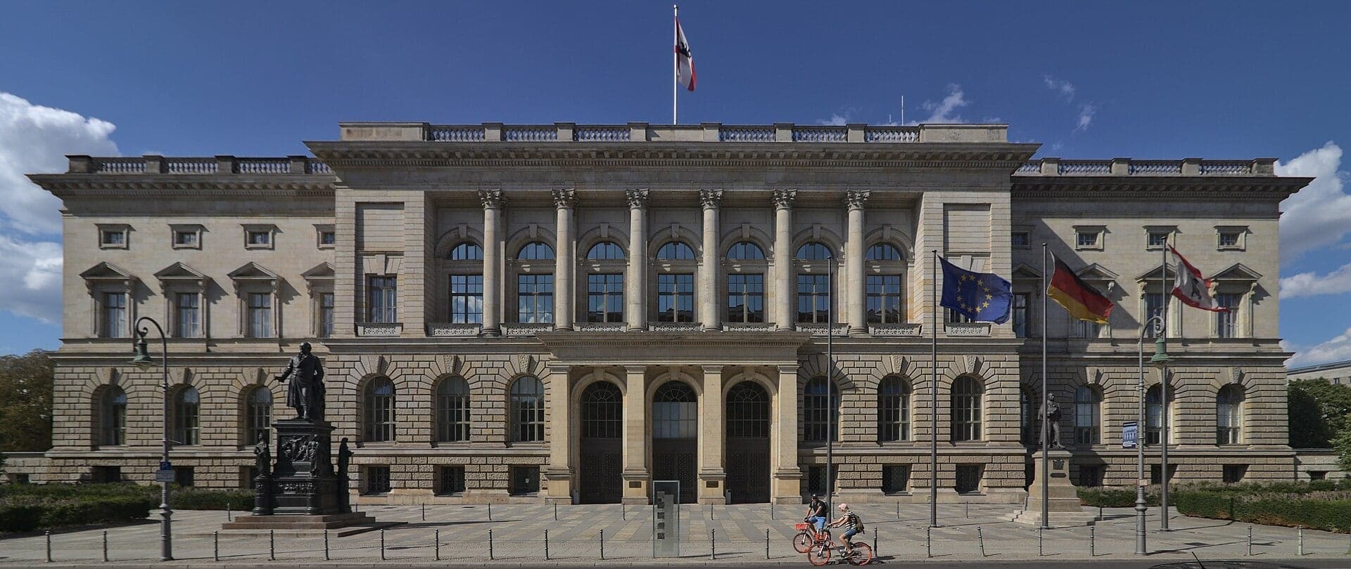
Niederkirchnerstrasse: Stone Front, Brick Back
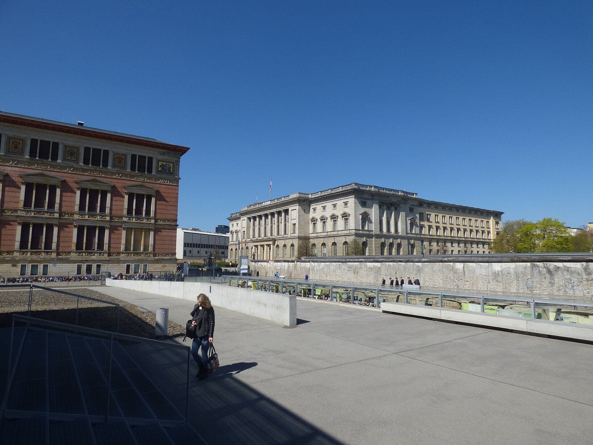
Prussia's old parliament and the Gropius-Bau. Berlin's House of Representatives, built for Prussia's elected chamber, faces the red-brick Gropius-Bau, whose main door the Wall closed off from 1961 to 1989.
- 9
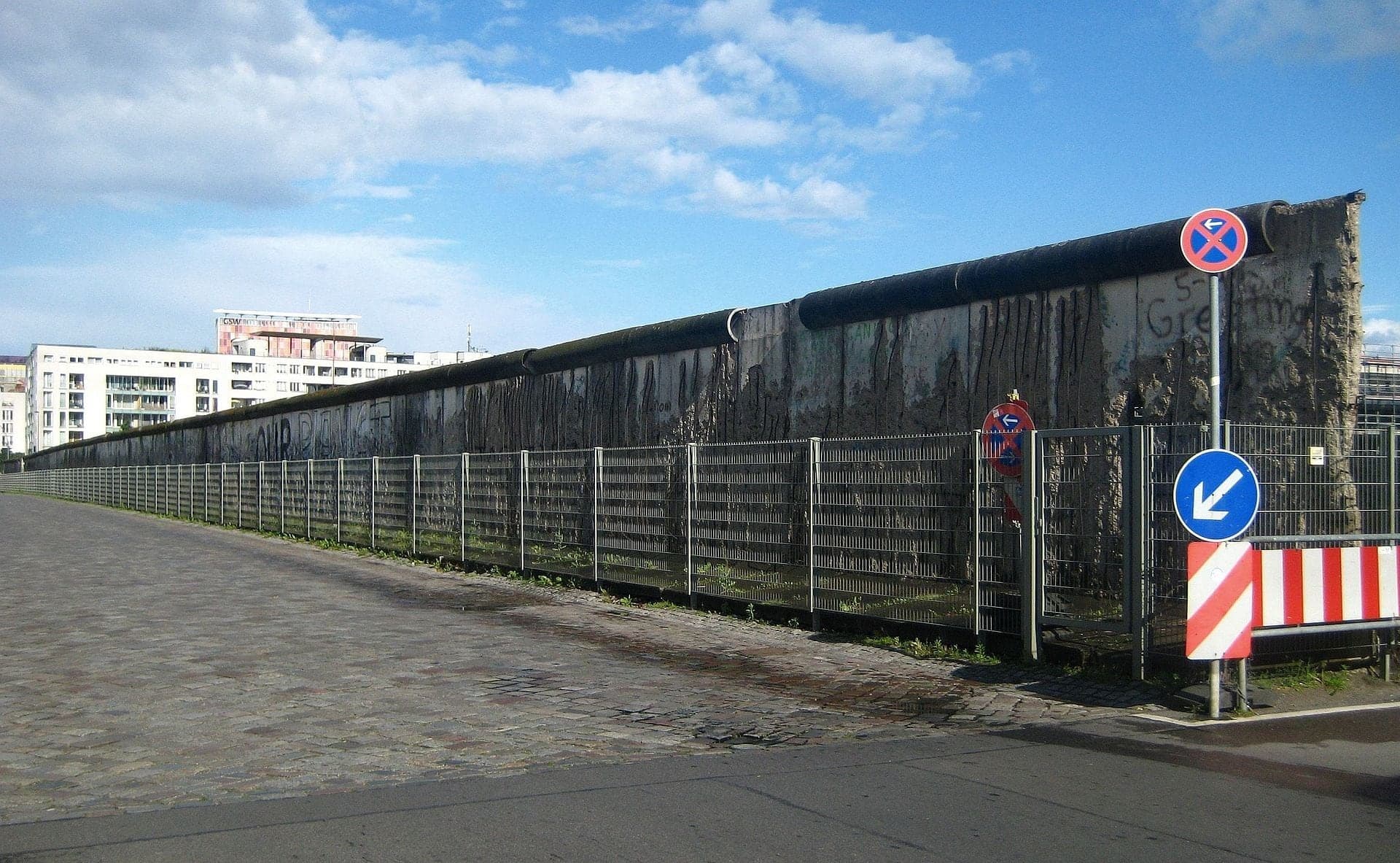
Topography of Terror: The Wall Left Standing
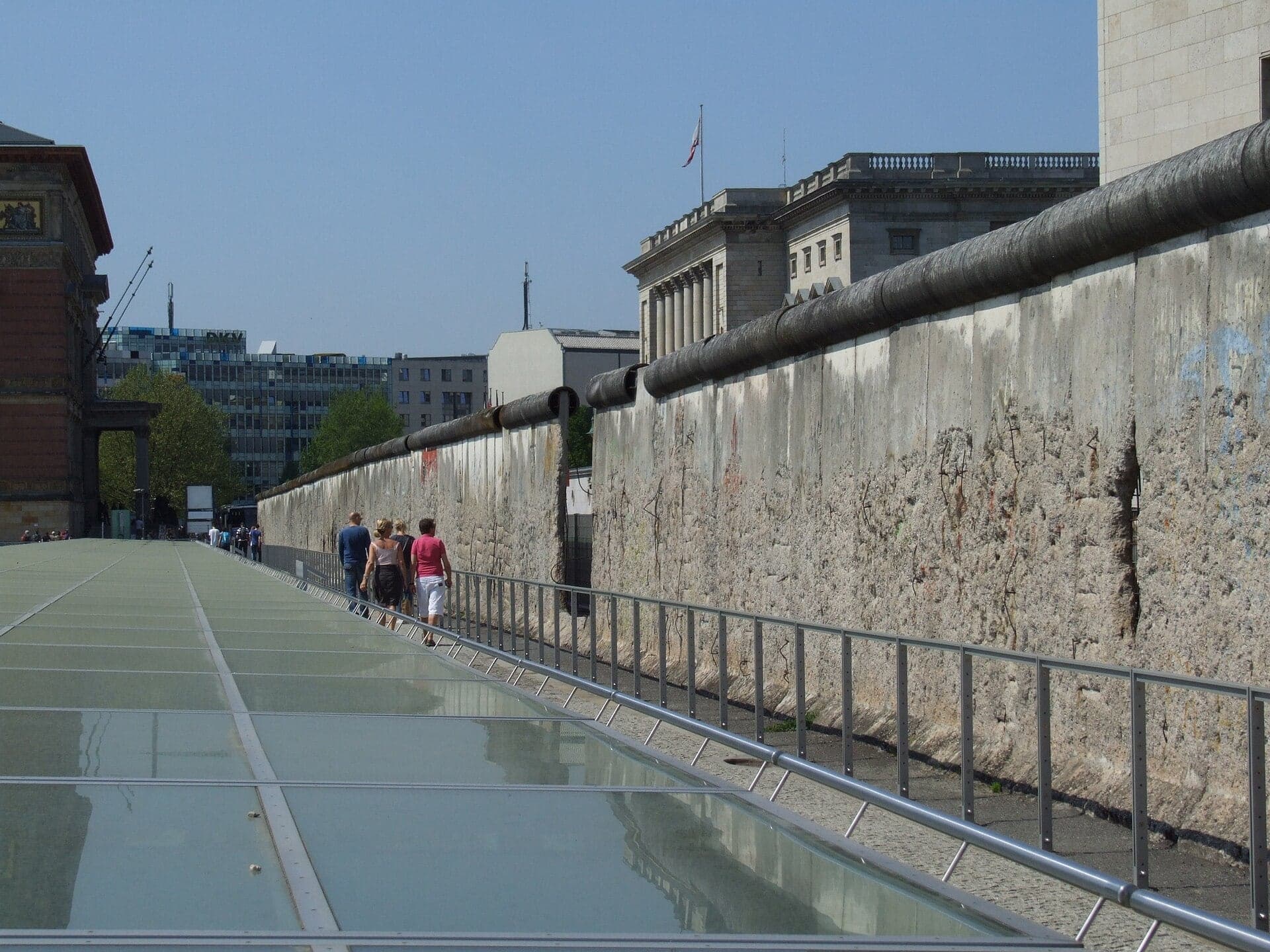
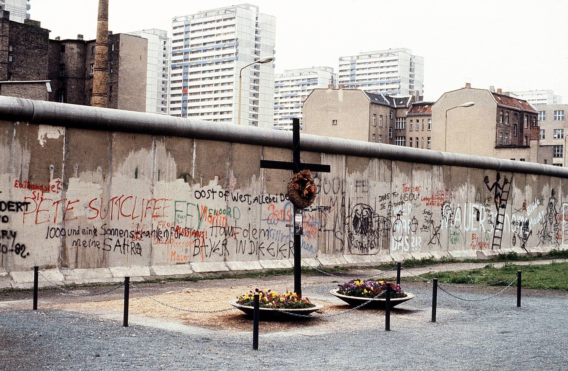
The Wall remnant beside the Gestapo site. About 200 m of the 1970s border wall, chipped to the steel in 1989, in front of the free documentation center on the site of the Gestapo, SS leadership and Reich Security Main Office.
- 10
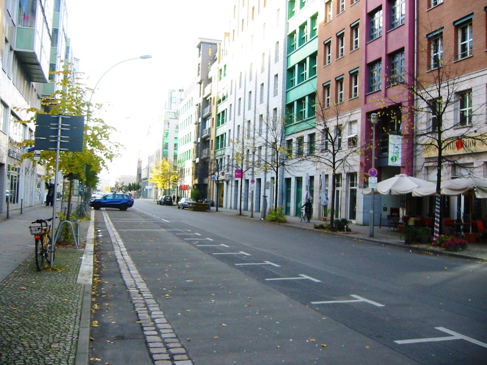
Zimmerstrasse: Living on the Line
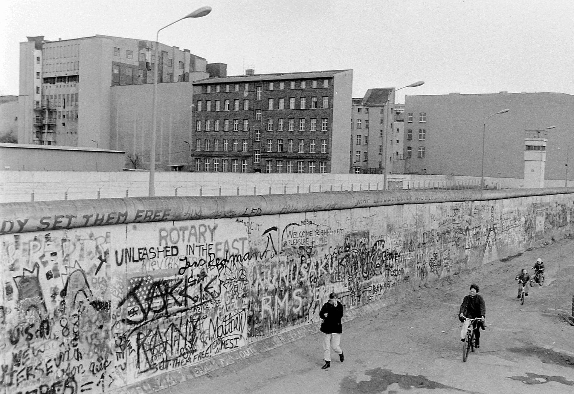
The street the Wall ran along. From 1961 to 1990 the Wall followed Zimmerstrasse past the old newspaper quarter, beside houses whose windows were barred and bricked up.
- 11
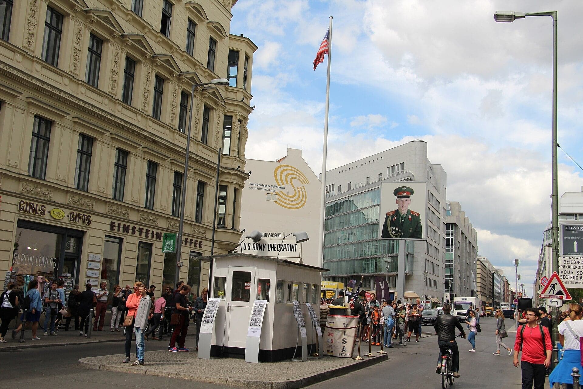
Checkpoint Charlie: A Crossing Rebuilt for Visitors
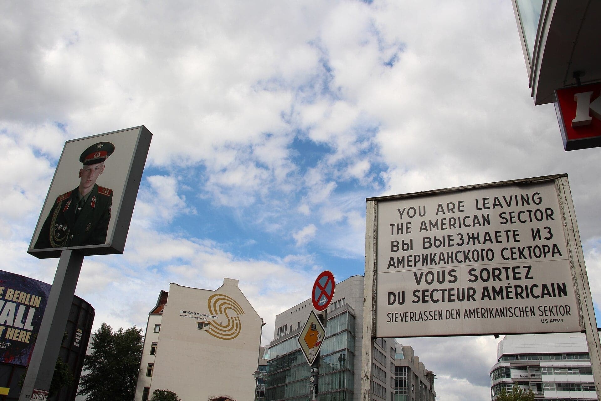
The Allied crossing and its replica hut. Where foreigners and Allied soldiers crossed, and American and Soviet tanks faced off in October 1961; today a replica hut and a light box of two soldiers' portraits, one of a man who never served here.
- 12
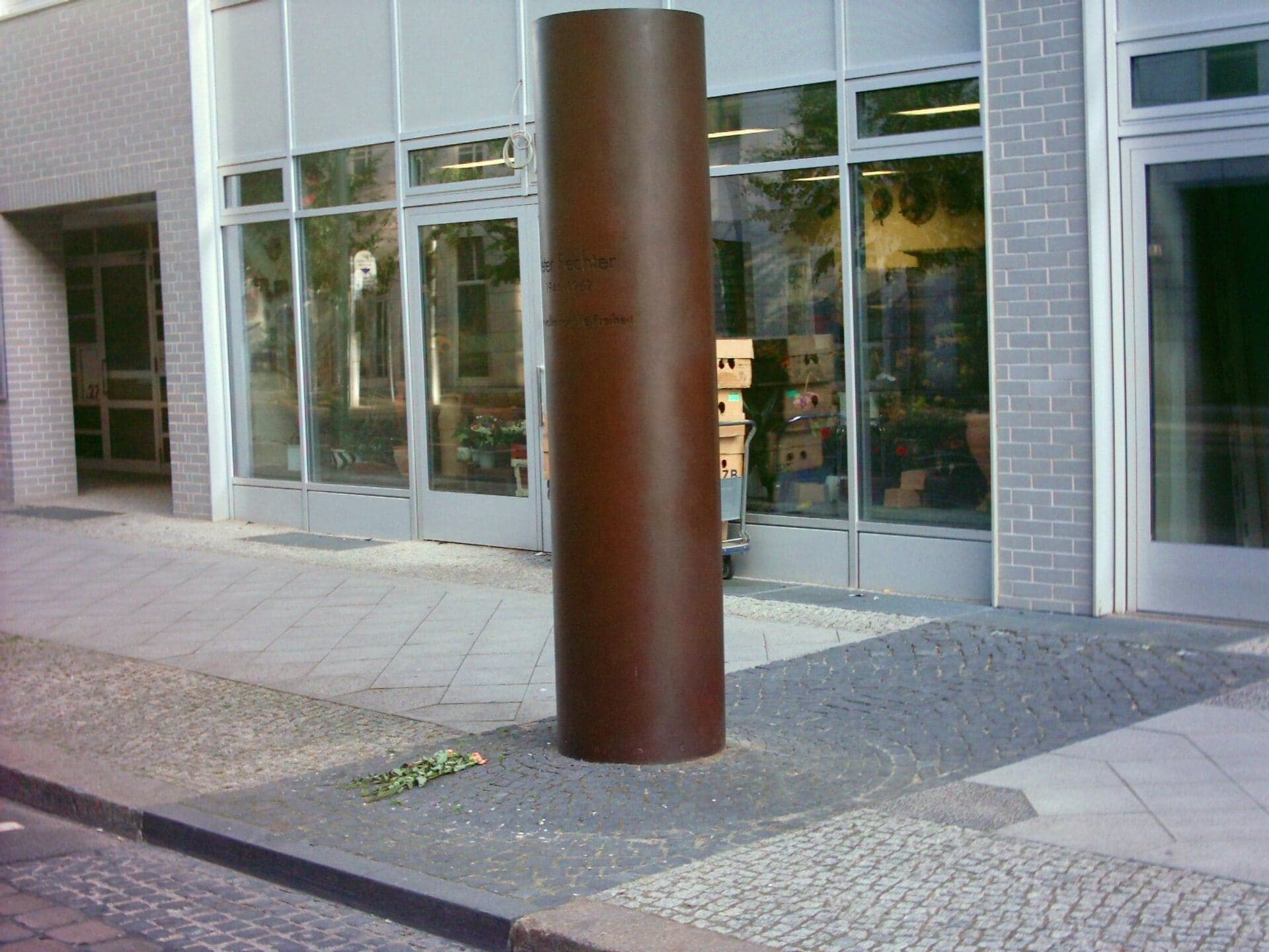
Peter Fechter Memorial: A Column and a Name
A steel column for Peter Fechter. The 18-year-old was shot trying to climb the Wall here on 17 August 1962 and lay in the border strip for fifty minutes; a granite slab marks the spot.
Details
Best Time to Visit
Tuesday to Sunday, starting at about 10am: the Holocaust Memorial's Information Center opens at 10:00 and is closed on Mondays, the Topography of Terror opens at 10:00, and its outdoor areas close at dusk (before 19:00 in early October, before 17:00 after the clocks go back on 25 October). The Gropius-Bau is closed on Tuesdays. Checkpoint Charlie is least crowded in the morning. The walk is all outdoors on pavement and works in any season; the Wall remnant and the Air Ministry are in open view whatever the leaves. Checked 9 October 2026.
Pro Tips
- •Getting to the start: stop 1 is on the south pavement of Hannah-Arendt-Strasse, across from the south-east corner of the field of stelae. The nearest stations are U Anton-Wilhelm-Amo-Strasse (U2), S+U Brandenburger Tor (S1, S2, S25, S26, U5) and S+U Potsdamer Platz (S1, S2, S25, S26, U2), each about five minutes' walk; buses 300 and M48 stop nearby. Line details from berlin.de; checked 9 October 2026.
- •The walk ends on Zimmerstrasse, about 300 m on foot from U Kochstrasse/Checkpoint Charlie (U6), back along Zimmerstrasse and down Friedrichstrasse.
- •Holocaust Memorial Information Center (stop 1): free, Tuesday to Sunday 10:00 to 18:00, last admission 45 minutes before closing, closed Mondays; security check, no large bags or suitcases. Allow at least an hour. Checked 9 October 2026 at stiftung-denkmal.de.
- •Topography of Terror (stop 9): free; the Documentation Center and the exhibition trench along the Wall are open daily 10:00 to 20:00, the other outdoor areas until dusk, 20:00 at the latest. It deserves an hour or two of its own. Checked 9 October 2026 at topographie.de.
- •Martin-Gropius-Bau (stop 8): 15 euros, 10 euros reduced, one ticket for all exhibitions; Monday and Wednesday to Friday 12:00 to 19:00, weekends 10:00 to 19:00, closed Tuesdays, ticket desk until 18:00. Checked 9 October 2026 at berlinerfestspiele.de.
- •Berlin's House of Representatives (stop 8) runs free open tours in German on Wednesdays at 11:00 and Fridays at 16:30 (not on public holidays): bring photo ID and arrive ten minutes early, no booking. The Bundesrat (stop 6) can be visited only by registration. Checked 9 October 2026.
- •The asisi panorama of the divided city stands at Friedrichstrasse 205, beside Checkpoint Charlie: daily 10:00 to 18:00, from 14 euros, about an hour. Checked 9 October 2026 at visitberlin.de.
Safety & Precautions
- •This walk covers Nazi crimes and deaths at the Berlin Wall. The Memorial to the Murdered Jews of Europe and the Peter Fechter memorial are places of mourning: the foundation asks visitors to enter the field on foot, slowly and quietly, and not to climb or jump on the stelae.
- •Checkpoint Charlie and Potsdamer and Leipziger Platz are crowded: watch your bags, walk past photo sellers and souvenir touts, and never let anyone stamp your passport.
- •There are no traffic lights at Checkpoint Charlie: the crossings of Friedrichstrasse and Zimmerstrasse are unmarked, so look both ways. Elsewhere, cross Wilhelmstrasse and the six-lane Leipziger Strasse only at the lights.
- •On Stresemannstrasse a separate bike path runs right beside the pavement: keep to the footway.
- •The Bundesrat extension (stops 6 and 7) is a building site until about 2029: expect trucks, hoarding and possible pavement closures on Erna-Berger-Strasse. If the short passage off Leipziger Platz or Erna-Berger-Strasse is closed, go round by Potsdamer Platz and Stresemannstrasse.
- •The Führerbunker board (stop 2) stands beside a private car park: read it from the pavement and keep clear of cars turning in.
- •The Air Ministry building (stop 5) is the Federal Finance Ministry and is guarded: stay on the forecourt and the pavement, and look into the colonnade from outside.
- •The Topography of Terror's outdoor grounds close at dusk (before 19:00 in early October, before 17:00 after 25 October); the Wall remnant can be seen from the street pavement at any hour. Checked 9 October 2026.
Travel advisory: Exercise Increased Caution (Level 2).
Gallery
Related Reading
Go deeper on what you'll see, hear, and walk through.
Overview
Berlin Travel Guide: Days, Transport, Safety and Budget
7 min
Overview
Best Self-Guided Walking Tours in Berlin (2026)
5 min
Overview
One Day in Berlin: A Walkable Itinerary
8 min
Thematic
Berlin: The City That Reads Its Own Scar
7 min
Thematic
Best History Walking Tours in Berlin (2026)
2 min
Companion
The Memorial to the Murdered Jews of Europe: How Berlin Reads Its Own Reckoning
7 min
Read
What to Eat in Berlin: Dishes, Origins, and How to Order
7 min
Read the walk
The full story of Checkpoint Charlie and the Topography of Terror: Marked or Hidden, in words. Prefer to listen? Play it narrated, from home or on location.
Introduction
Berlin, the capital of Germany, was run for well over a century from a few streets just south of the Brandenburg Gate. Prussia's most important ministries stood here, then the German Empire's, then the Nazi state's: the Reich Chancellery, the Foreign Office, the Propaganda Ministry, the Air Ministry, and around the corner, the headquarters of the Gestapo. From nineteen sixty-one, the Berlin Wall ran straight through the same district.
Since then, the city has had to decide what to do with each of these places. One it left unmarked for decades. One it dug up and opened to everyone. One stretch of the Wall it kept exactly as damaged as it found it. And at its most famous crossing point, much of what you see was put there afterward.
Three people come up along the way. Peter Eisenman, the American architect of the Memorial to the Murdered Jews of Europe. Georg Elser, a carpenter who tried, entirely on his own, to stop the war in nineteen thirty-nine. And Peter Fechter, an eighteen-year-old construction worker who died at the Wall in nineteen sixty-two.
The walk has twelve stops over about two and a half kilometers, a mile and a half, and takes about ninety minutes. It is flat, on public pavements, and several stops deal with Nazi crimes and deaths at the Wall. It starts at the edge of the Holocaust memorial and ends a few minutes past Checkpoint Charlie.
1. Memorial to the Murdered Jews of Europe: The Field's Edge
Welcome to the Memorial to the Murdered Jews of Europe, where this walk begins. Across the road is the edge of its field: rows of gray concrete blocks, called stelae, rising away from you between the trees. The field is open day and night, and it is free.
The memorial was designed by the American architect Peter Eisenman and opened in May two thousand five, in memory of up to six million Jewish victims.
Look at the blocks nearest the road. They are low, some barely above the ground. Further in, they stand far taller than a person, up to four point seven meters. Yet every block has the same footprint, a little under a meter wide and about two and a half meters long, and each leans by up to two degrees. What changes is the height of each block, and the ground beneath it. The floor of the field was lowered unevenly, so the paths dip as you walk in, and the blocks close over your head. There are about twenty-seven hundred of them, set in a grid.
Eisenman has declined to give the field one fixed meaning. The foundation that runs it asks that you walk in on foot, slowly and quietly.
Under the field is the Information Center, free, open Tuesday to Sunday and closed on Mondays. In its Room of Names, names of murdered Jews are shown and short life stories read aloud. The foundation says that reading the name and story of every victim this way would take about six years, seven months and twenty-seven days.
This ground was once the ministers' gardens of the government quarter, just north of the Reich Chancellery. The rest of the walk goes into that quarter.
Follow the route away from the field, down the side street toward the apartment blocks.
2. Führerbunker Site: A Car Park and a Board
Cross the quiet side street, where there are no lights, and walk on to the information board beside the car park, and stop there.
There is nothing else to see, and that is deliberate. Under this car park and the apartment blocks around it lay the garden of the Reich Chancellery, and under the garden, a bunker. It was begun in nineteen thirty-five on a much smaller scale and grew into a set of rooms behind walls more than four meters thick. Adolf Hitler took his own life in it on the thirtieth of April, nineteen forty-five, as Soviet troops closed in.
After the war, Soviet soldiers blew up most of the bunker. In the nineteen eighties, what remained was filled with rubble, and the apartment blocks went up around it in East Berlin's last years. Nothing can be entered, and nothing is meant to be.
For sixty-one years, the city put up no sign at all. Officials feared that any marker would turn the place into a pilgrimage site for neo-Nazis. In June two thousand six, after years of lobbying, a private association that researches Berlin's underground spaces was allowed to put up this board. It is plain on purpose: a chronology, drawings and photographs, in German and English. At the unveiling, a historian working with the association called the popular stories of a twelve-floor bunker with an underground highway complete nonsense. The association said it wanted to demystify the site.
So the place is marked as plainly as it could be, by a board that draws nobody in.
Read the board from the pavement. The car park is private and residents drive in and out here, so keep clear of the entrance.
Follow the route between the apartment blocks and through a passage under one of them, toward Wilhelmstrasse.
3. Georg Elser Marker: A Profile in Steel
Come out of the passage and walk on toward the tall steel outline, stop by its information board, and look up.
At first it looks like a thin steel frame, more than seventeen meters tall. Against the sky it turns into the outline of a man's head in profile. The man is Georg Elser, a carpenter from Swabia.
In nineteen thirty-eight, Elser decided on his own to kill Hitler and two of his closest men, to prevent a war. Over weeks in the summer of nineteen thirty-nine, he secretly prepared a pillar in a Munich beer hall and built his own bomb into it. On the eighth of November, nineteen thirty-nine, two months into the war, Hitler left the hall minutes before the explosion. Eight people were killed. That evening, customs officers arrested Elser at Constance as he tried to reach Switzerland. He was imprisoned for more than five years and murdered at Dachau concentration camp on the ninth of April, nineteen forty-five. The German Resistance Memorial Center says there is no doubt that he acted entirely of his own accord.
This marker was unveiled on the eighth of November, two thousand eleven, seventy-two years after his attempt. Its designer chose steel because Elser was a fine craftsman, and placed it so the profile reads only against the sky, not against the concrete apartment blocks around it. Lines of Elser's own words are set into the pavement and light up at night. One of them says: I wanted to prevent the war.
The marker stands on the former grounds of the Reich Chancellery, in what its designer called the forecourt of power. Across Wilhelmstrasse lay Wilhelmplatz, the square the Chancellery faced, and on it stood the Nazi Propaganda Ministry.
Follow the route over the small side street in front of you, looking both ways, then down Wilhelmstrasse, crossing at the lights.
4. Wilhelmstrasse: The Street of Ministries
Walk on along Wilhelmstrasse and stop by the information board on the pavement.
This is Wilhelmstrasse. Its northern end was laid out in the seventeen thirties as a quarter of houses for Prussian officials. From the early eighteen hundreds it became the address of Prussia's most important ministries, after eighteen seventy-one of the German Empire's, and then of the Nazi state's. Along this street stood the Reich President's palace, the Foreign Office, the Reich Chancellery, the Transport Ministry, the Propaganda Ministry and the Air Ministry. On Vossstrasse, the side street at the corner you just crossed, stood the New Reich Chancellery, in use from nineteen thirty-nine to nineteen forty-five.
Look for them. Most of them no longer exist. What stands here now is late East German housing and newer offices. In East Berlin the street even lost its name in nineteen sixty-four, and got it back only in nineteen ninety-three.
So the street marks its own history with boards. This one belongs to a trail of thirty, called Historic Wilhelmstrasse, set up for the city in nineteen ninety-six, reworked in two thousand seven, and presented today by the Topography of Terror foundation. Each board carries an old address, photographs and a short history in German and English. Read the number on this one, and the building it describes.
Germany's Foreign Office, looking back at its own past here, put it this way: the Nazis used the old, traditional front of Wilhelmstrasse to disguise the policies made behind its walls. And they built new as well. In the same speech, the Foreign Office called architecture here a language of seduction, intimidation and power, and named two buildings. One is the Air Ministry, and it is still standing, at the next stop.
Follow the route on along Wilhelmstrasse, across Leipziger Strasse at the lights, and then back over Wilhelmstrasse at the next lights.
5. Air Ministry: A Stone Skin on a Steel Frame
Once across, walk on into the paved forecourt at the corner of the long, pale building, and stop near the plaque. This is the former Air Ministry of Hermann Göring, finished in nineteen thirty-six. The walls are smooth slabs of pale shell limestone, with rows of small, tall…
Full narration for this stop unlocks with the tour.
6. Bundesrat: A Palace for Sixteen States
Walk on along Leipziger Strasse until the railings open onto a garden courtyard, and stop there. At the back of the courtyard is a portal of six tall columns under a triangular pediment with sculpted figures. This was built as a palace, and it is laid out like one: the main…
Full narration for this stop unlocks with the tour.
7. Leipziger Platz: A Wall Built for the View
Walk on to the edge of the square and stop where the paths meet. Ahead, a few slabs of the Berlin Wall stand on the paving. This is Leipziger Platz, an eight-sided square. Early in the twentieth century, this square and Potsdamer Platz beside it were among the most important…
Full narration for this stop unlocks with the tour.
8. Niederkirchnerstrasse: Stone Front, Brick Back
Walk on along the pavement to the statues on the forecourt beside you, and stop there. Across the road is the Martin-Gropius-Bau, a ticketed exhibition hall, closed on Tuesdays; the details are on this stop's card. This is Prussia's old parliament building, the elected lower…
Full narration for this stop unlocks with the tour.
9. Topography of Terror: The Wall Left Standing
Walk on beside the long gray wall across the road, and stop about halfway along it. Behind that wall is the Topography of Terror, a free documentation center and outdoor exhibition; the details are on this stop's card. This is about two hundred meters of the Berlin Wall, in its…
Full narration for this stop unlocks with the tour.
10. Zimmerstrasse: Living on the Line
Walk on along Zimmerstrasse and stop on the pavement, a short way before the crossroads with Friedrichstrasse. From nineteen sixty-one to nineteen ninety, the Berlin Wall ran along this street. Before that, it was an ordinary city street, at the edge of Berlin's lively…
Full narration for this stop unlocks with the tour.
11. Checkpoint Charlie: A Crossing Rebuilt for Visitors
Walk on toward the crossroads and stop on the pavement. Ahead, just down Friedrichstrasse on an island in the middle of the road, is the small hut, and above the street, a tall light box with a soldier's portrait. This is Checkpoint Charlie. The Western Allies built it in…
Full narration for this stop unlocks with the tour.
12. Peter Fechter Memorial: A Column and a Name
Walk on along Zimmerstrasse to the dark steel column on the pavement, and stop there. This is a place of mourning, so give it a moment of quiet. The column, two point six meters tall, and the granite slab in front of it remember Peter Fechter. He was born in Berlin in nineteen…
Full narration for this stop unlocks with the tour.
- Berlin Holocaust-Mahnmal in Mitte 1 — NoRud, CC BY-SA 4.0 · source
- Berlin Holocaust Memorial — Laima Gūtmane (simka…, CC BY-SA 3.0 · source
- Dit is de plek in Berlijn waar de restanten van de zgn. Führerbunker onder de grond zitten. — Hnapel, CC BY-SA 4.0 · source
- le site de la Chancellerie du Reich en 1944 et des bunkers souterrains a été rasé par les soviétiques pour faire disparaître les souvenirs d — Jean-Pierre Dalbéra from Paris, France, CC BY 2.0 · source
- The historical marker Denkzeichen Georg Elser is a sculpture in Berlin-Mitte commemorating to the German opponent of Nazism and Hitler-assas — Lienhard Schulz, CC BY-SA 3.0 · source
- The Detlev-Rohwedder-Haus at the corner of Wilhelmstraße (right) and Niederkirchnerstraße in Berlin-Mitte, now seat of the German Federal Mi — Jörg Zägel, CC BY-SA 3.0 · source
- A Soviet-era mural depicting communist society on the side of the Reichsluftfahrtministerium (Reich Air Ministry), a government department d — Sarah Ewart, CC BY-SA 3.0 · source
- Bundesrat | categories: Files with coordinates missing SDC location of creation|Flickr images reviewed by FlickreviewR 2|Bundesratsgebäude|P — Daniel from Glasgow, United Kingdom, CC BY 2.0 · source
- Building of Deutscher Bundesrat (German Federal Council) in Berlin, Leipziger Straße. — Manfred Brückels, CC BY-SA 3.0 · source
- Teile der Berliner Mauer mir Graffiti auf dem Leipziger Platz Berlin-Mitte. — Flocci Nivis, CC BY 4.0 · source
- Leipzig Square and Berlin Wall in Berlin, Germany — Anil Öztas, CC BY-SA 4.0 · source
- 2018-08-11 DE Berlin-Mitte, Niederkirchnerstraße, Preußischer Landtag — Paul Korecky, CC BY-SA 2.0 · source
- Memorial del muro de Berlín y Topografía del terror (Niederkirchnerstrasse) — Luis Alvaz, CC BY-SA 4.0 · source
- Remaining front wall segment of the Berlin Wall ("Front Wall 75") at Niederkirchnerstraße between Berlin-Mitte and Berlin-Kreuzberg. About 2 — Beek100, CC BY-SA 3.0 · source
- Berlin Wall - Niederkirchner Strasse — Pudelek (Marcin Szala), CC BY-SA 3.0 · source
- Zimmerstraße in Berlin-Kreuzberg (Germany) — Assenmacher, CC BY-SA 3.0 · source
- Zimmerstrasse, a Berlini Fal és Kelet-Berlin a Wilhelmstrasse sarkán álló kilátóról nézve. — Fortepan / Urbán Tamás, CC BY-SA 3.0 · source
- Kreuzberg. Friedrichstraße Checkpoint Charlie was the name given by the Western Allies to the best-known Berlin Wall crossing point between — Fred Romero from Paris, France, CC BY 2.0 · source
- Kreuzberg. Friedrichstraße Checkpoint Charlie was the name given by the Western Allies to the best-known Berlin Wall crossing point between — Fred Romero from Paris, France, CC BY 2.0 · source
- Fechter Mahnmal Gesamtansicht in der Nähe des Checkpoint Charlie vom 19.06.2005 Fotograf: Jens Lordan Dateistatus: GNU FDL — Jens Lordan (uploader Jensen, de.wikipedia), CC BY-SA 3.0 · source
Images may be cropped or resized. Other photos via Unsplash and Pexels.