Melbourne was drawn in 1837 with wide streets out front and narrow ones for service, and the city ended up living in the narrow ones. Nine stops from the clocks of Flinders Street Station through Degraves Street and Centre Place, the Block and Royal Arcades, the old GPO, Chinatown and the Town Hall to Hosier Lane and Federation Square. Your pace, your order, no group and no schedule.
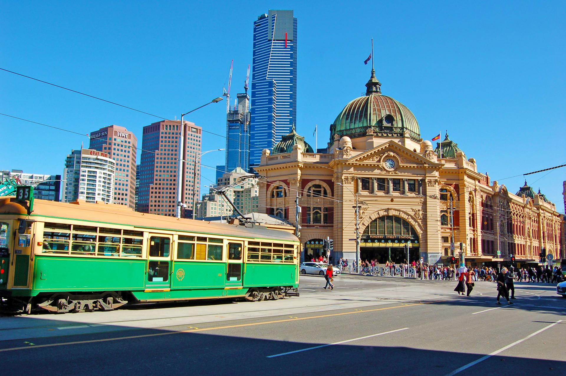
Start · Flinders Street Station: Meet Me Under the Clocks
DirectionsStops
- 1
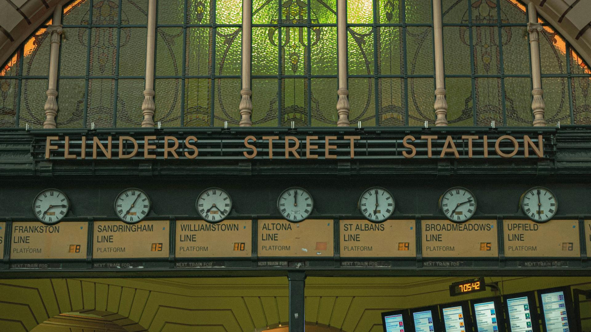
Flinders Street Station: Meet Me Under the Clocks
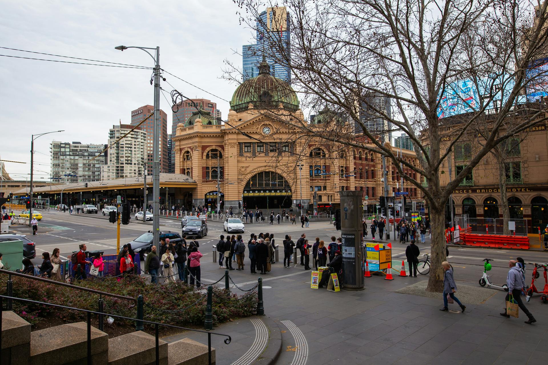
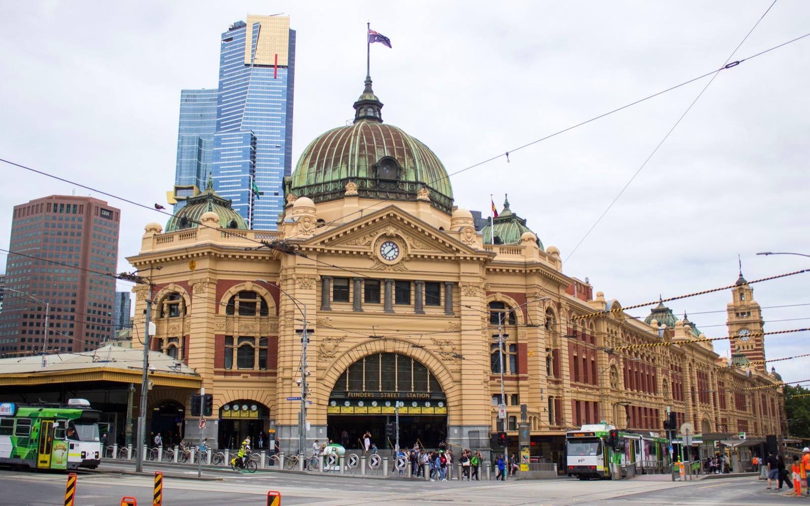
The station where Melbourne arranges to meet, under a row of departure clocks switched on in July 1910 and saved by a public outcry in 1983.
- 2
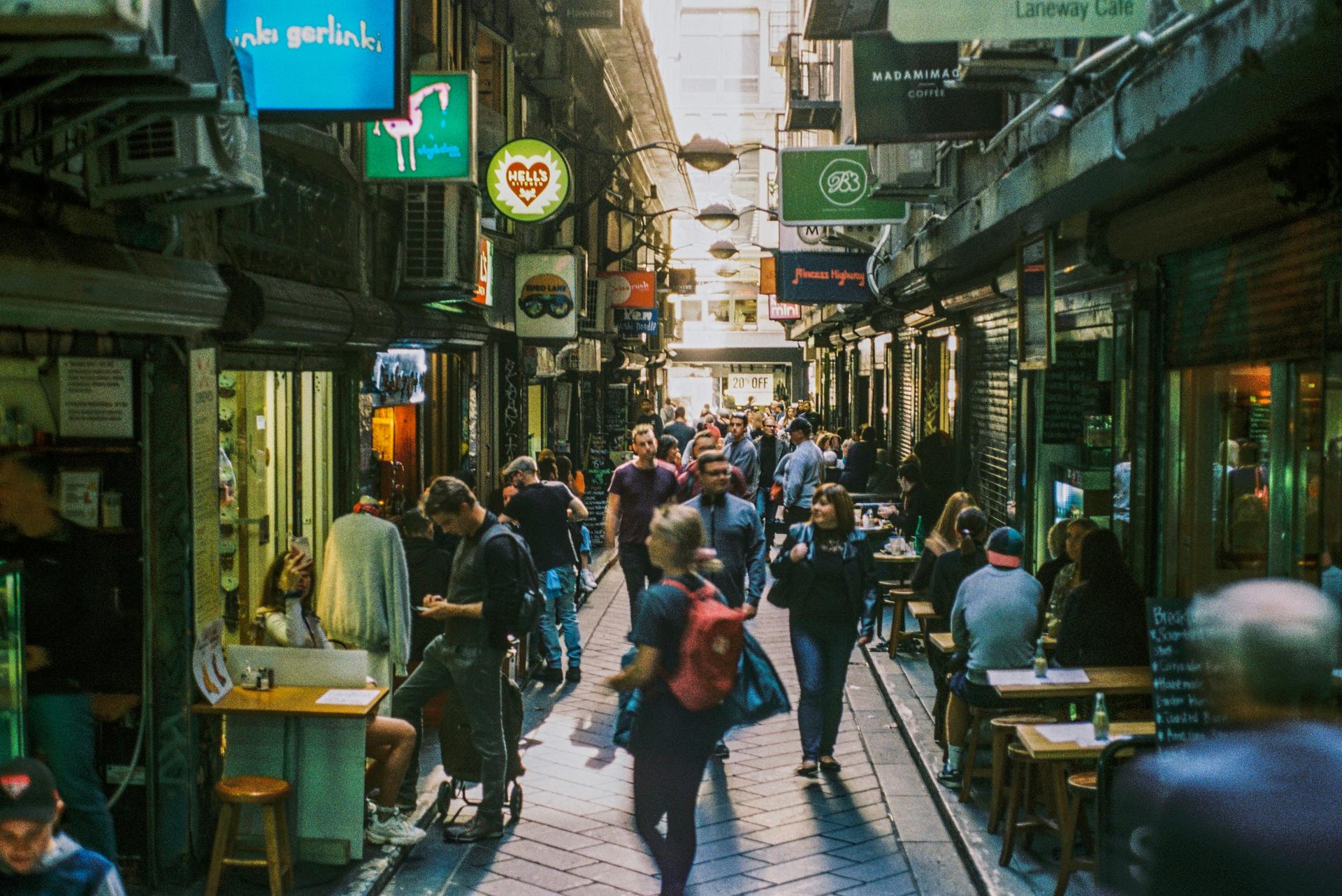
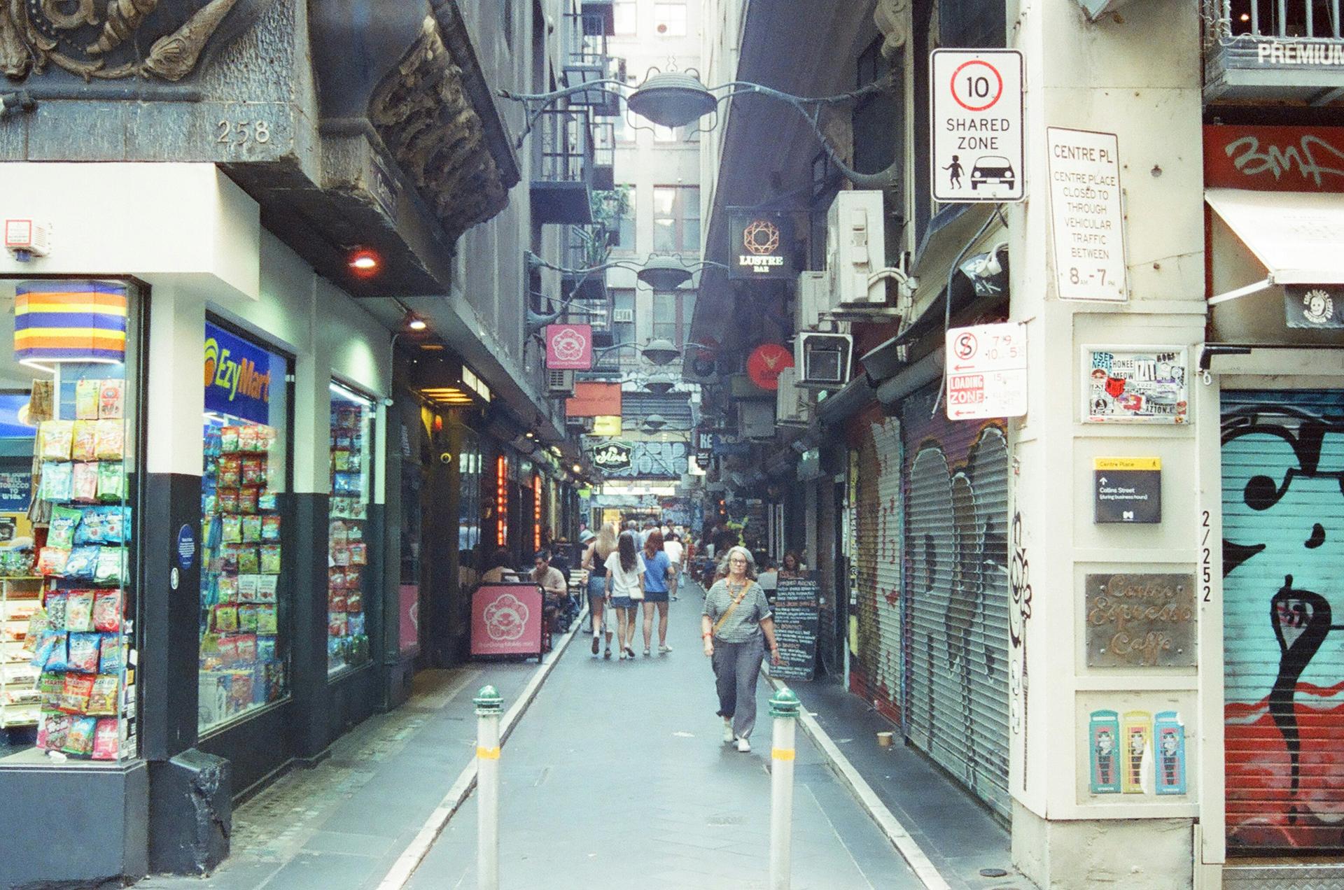
Degraves Street and Centre Place: The Lanes That Came Back
Two narrow lanes on either side of Flinders Lane, service alleys for a century. Centre Place was among the first lanes revived in the 1980s, and both are cafe lanes now.
- 3
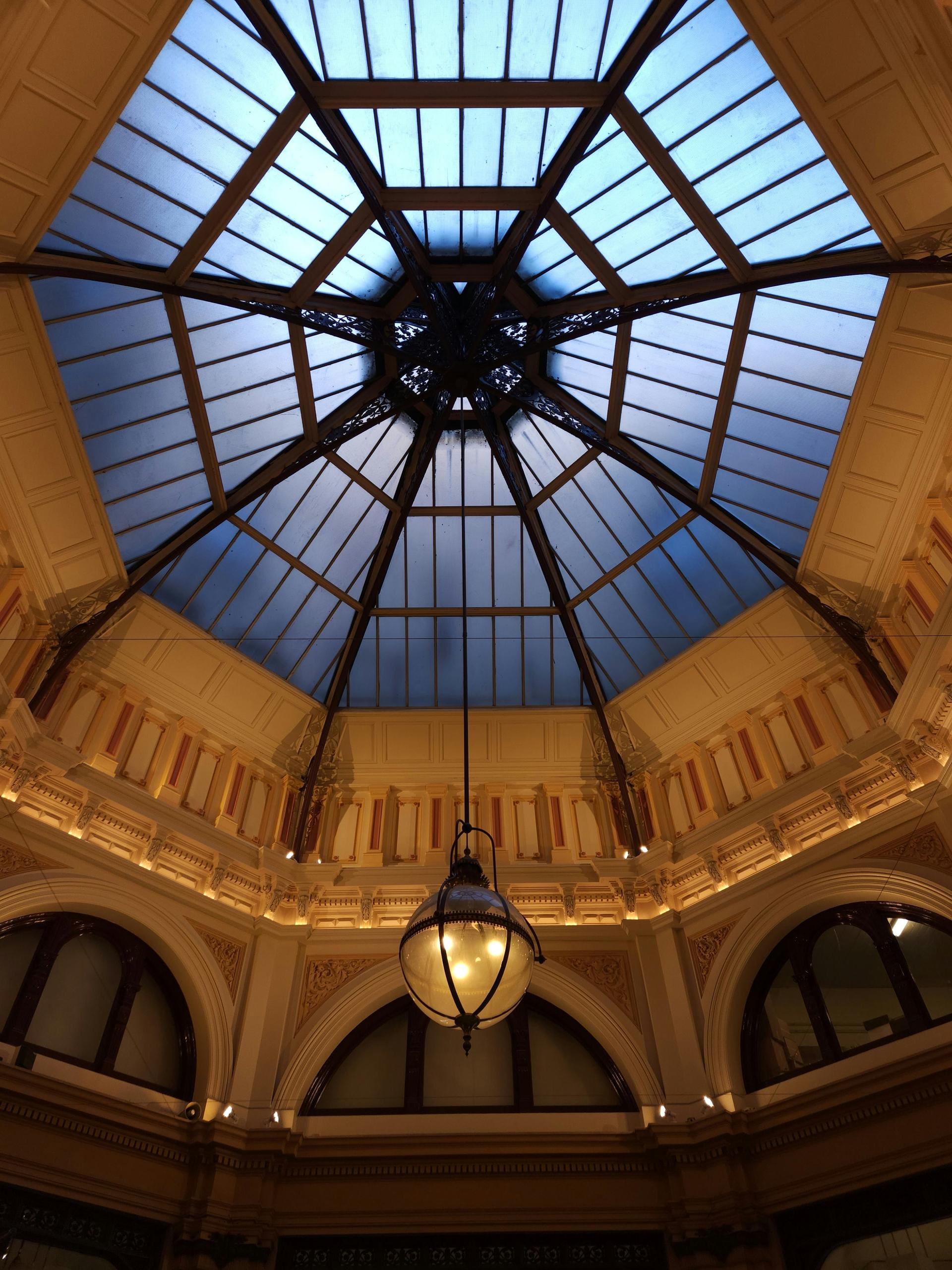
The Block Arcade: Doing the Block
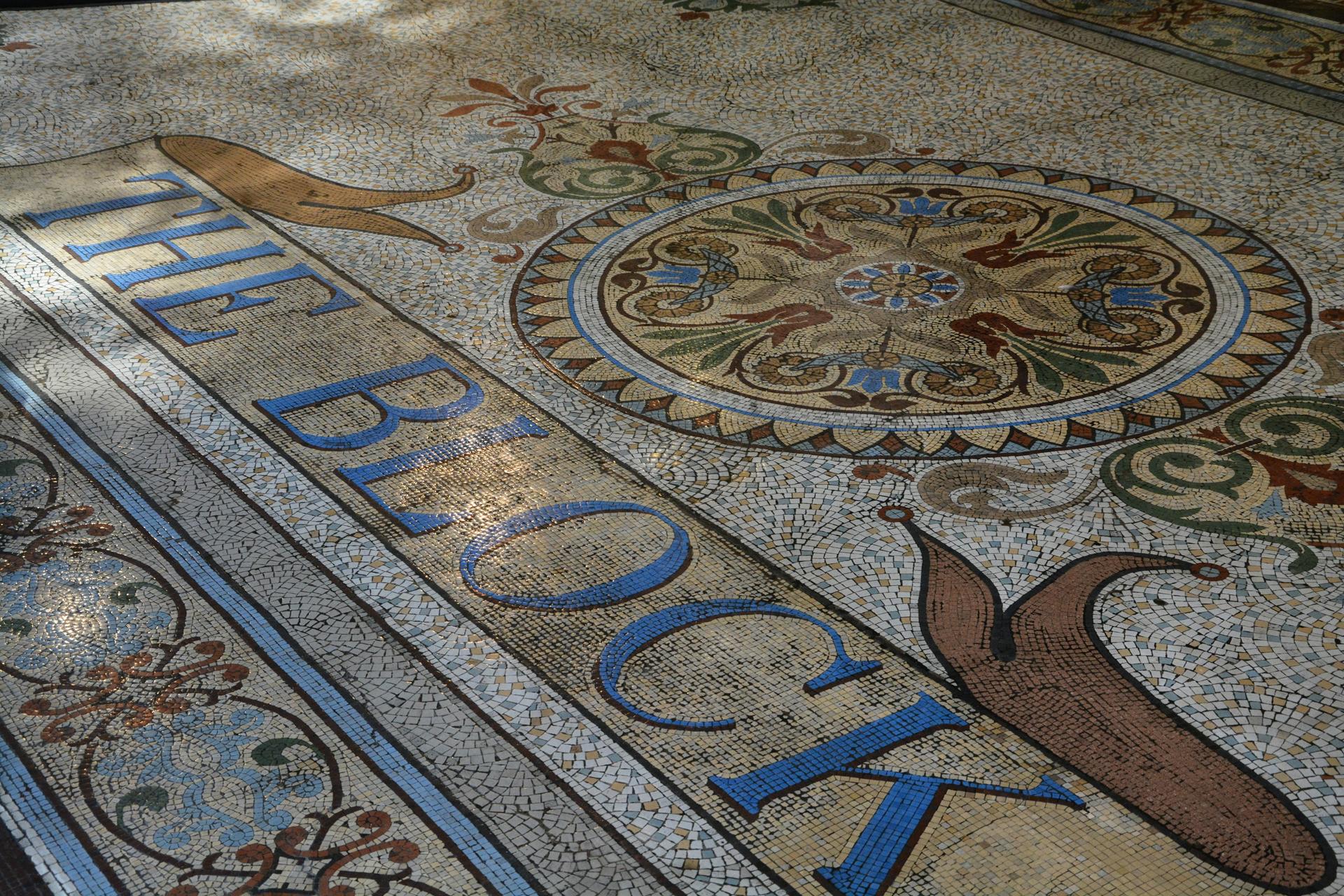
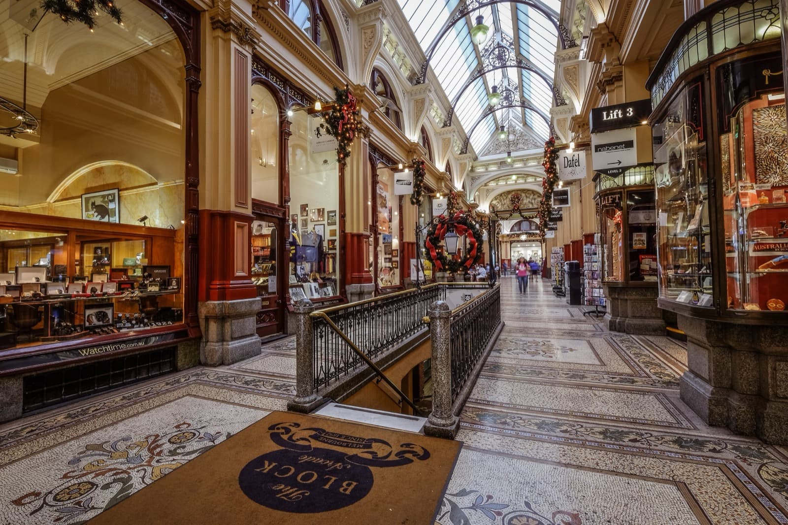
Victoria's most elaborate shopping arcade, built from 1891 to 1893 around a glass-domed octagon and a mosaic floor, and named after a promenade older than itself.
- 4
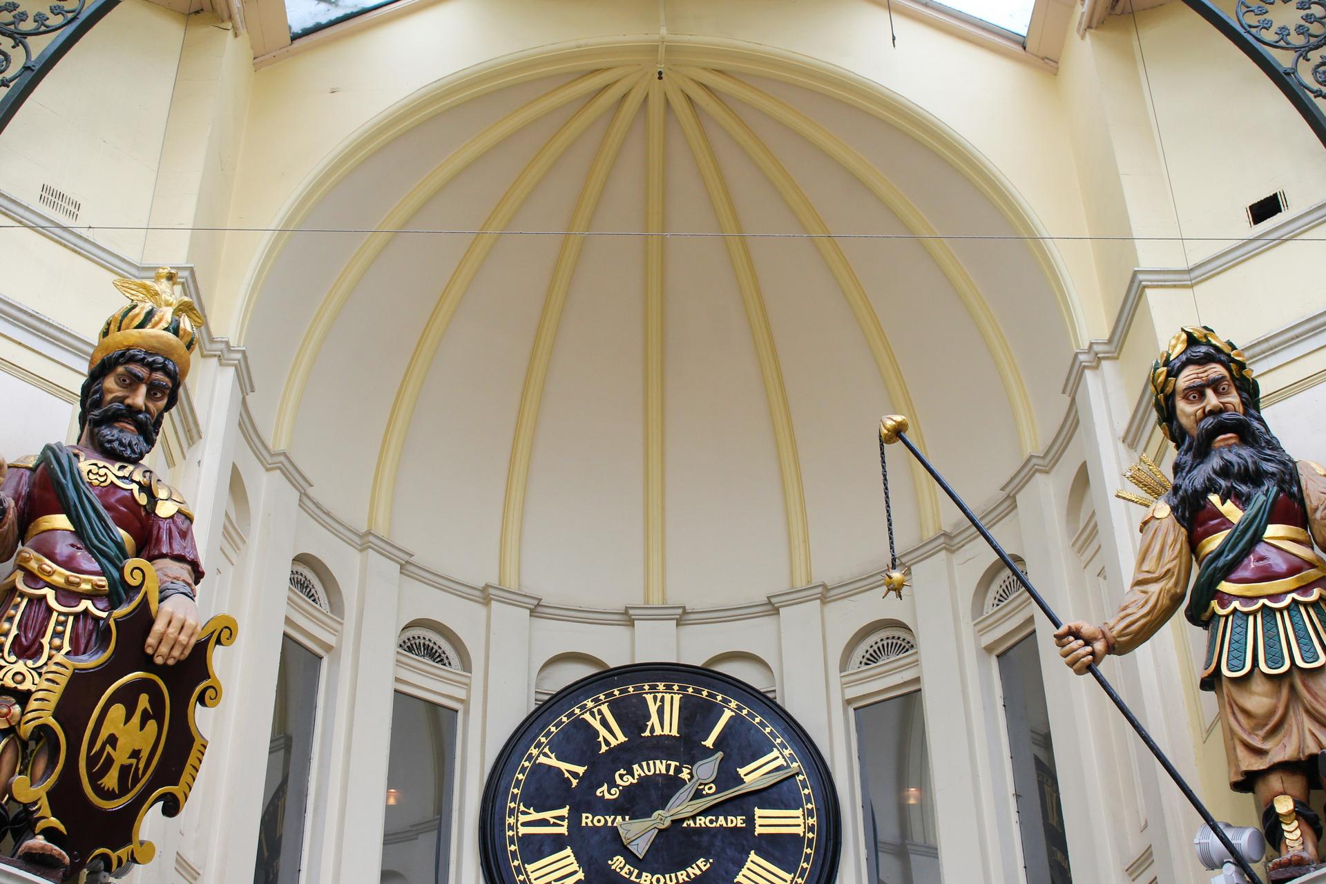
The Royal Arcade: Gog, Magog and Gaunt's Clock
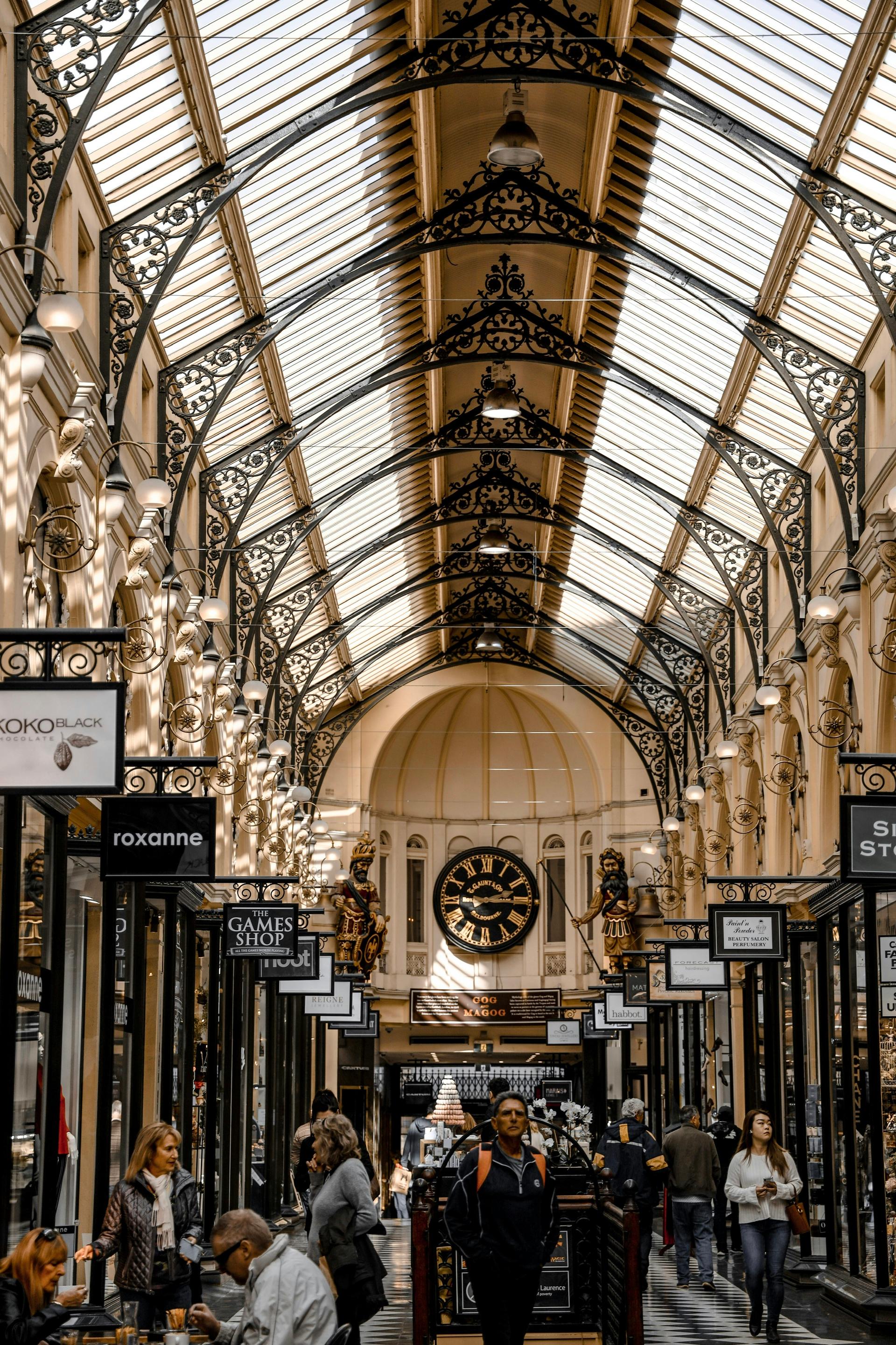
Australia's oldest surviving shopping arcade, built in 1869, where two carved giants from a London legend have struck the hours since 1892.
- 5
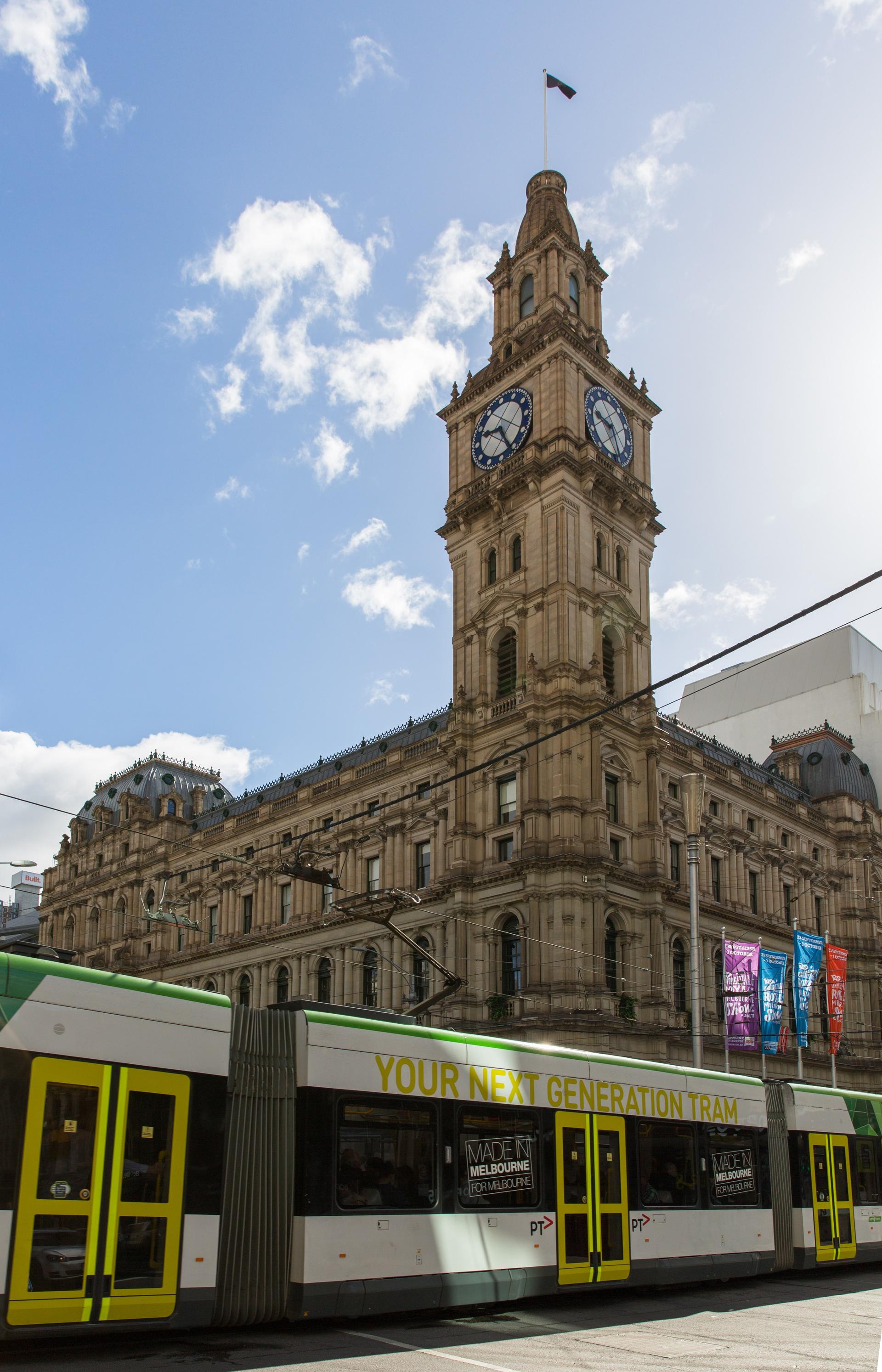
Bourke Street Mall and the GPO: Read It From the Bottom Up
The Bourke Street Mall beside the General Post Office. A post office has stood on this corner since 1841, and the building's three orders of columns show the stages it was built in.
- 6
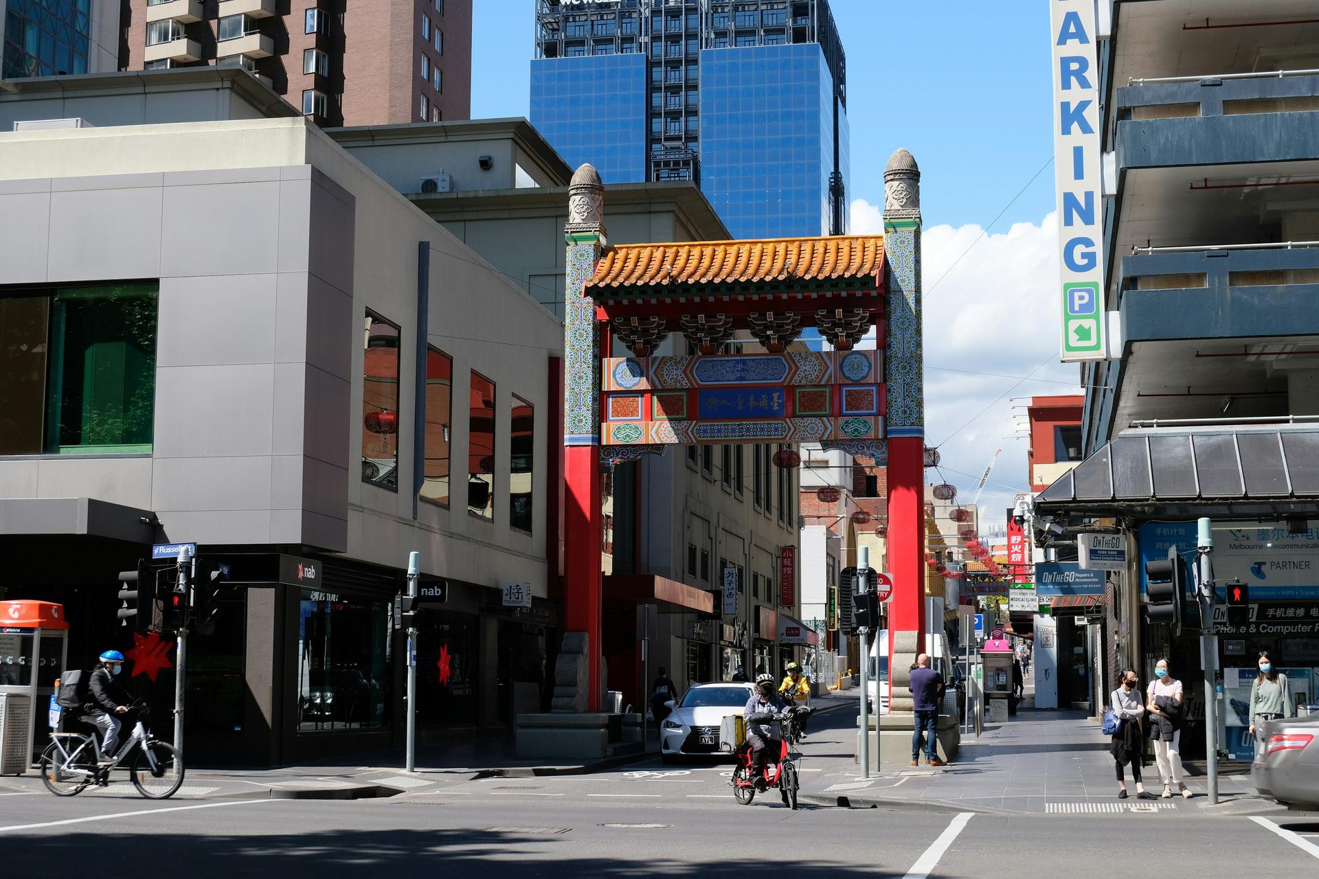
Chinatown: The Street the Gold Rush Built
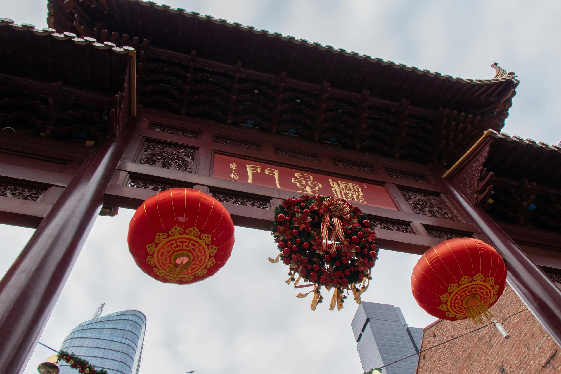
Little Bourke Street's gold-rush Chinatown. The first Chinese lodging houses opened here in the 1850s, and the City of Melbourne calls it Australia's oldest Chinatown.
- 7
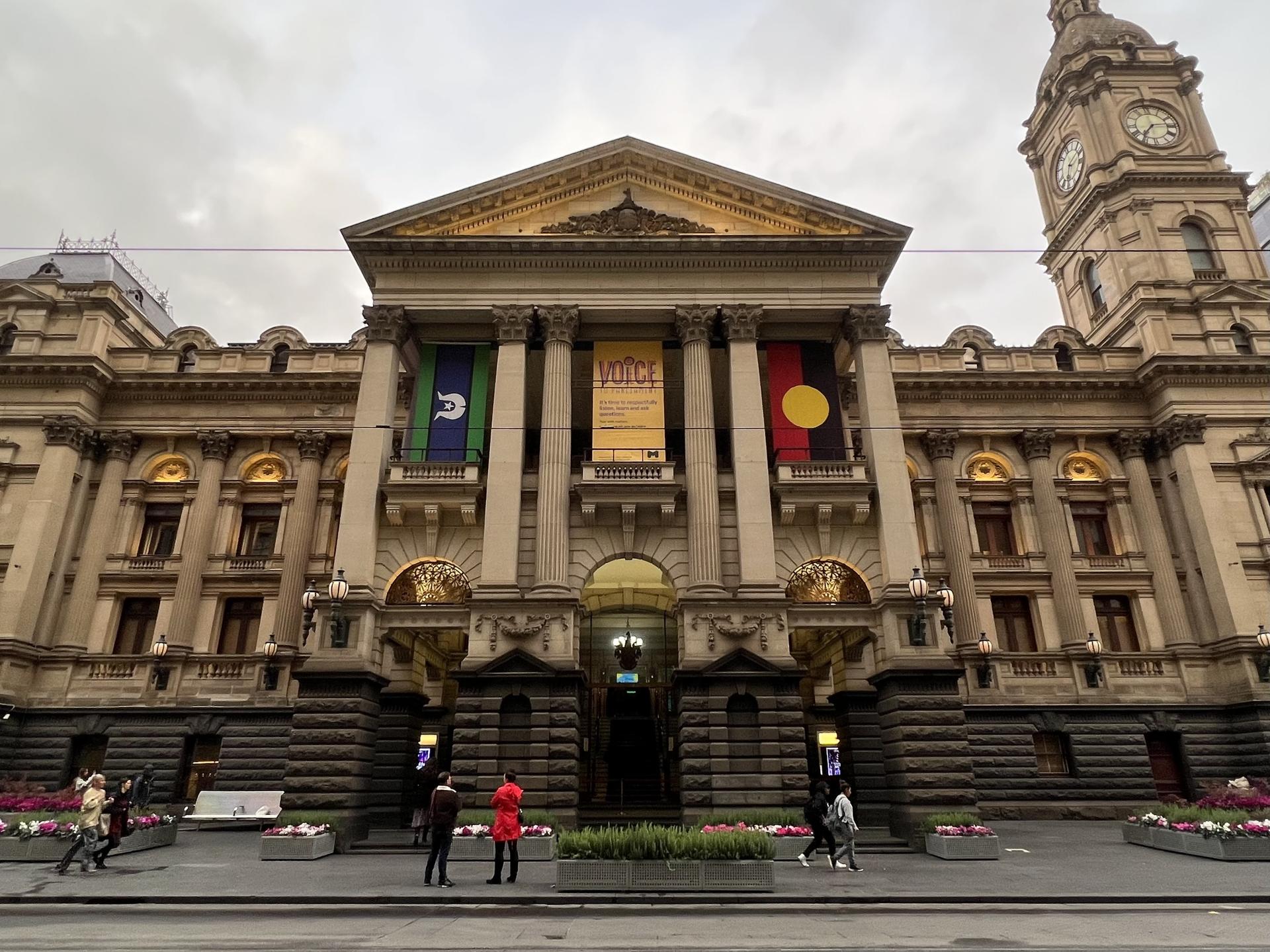
Melbourne Town Hall: The Balcony Over the Street
The Town Hall where the Beatles waved from the balcony in 1964. It opened in 1870, across Swanston Street from the Manchester Unity Building, which rose a floor a week in 1932.
- 8
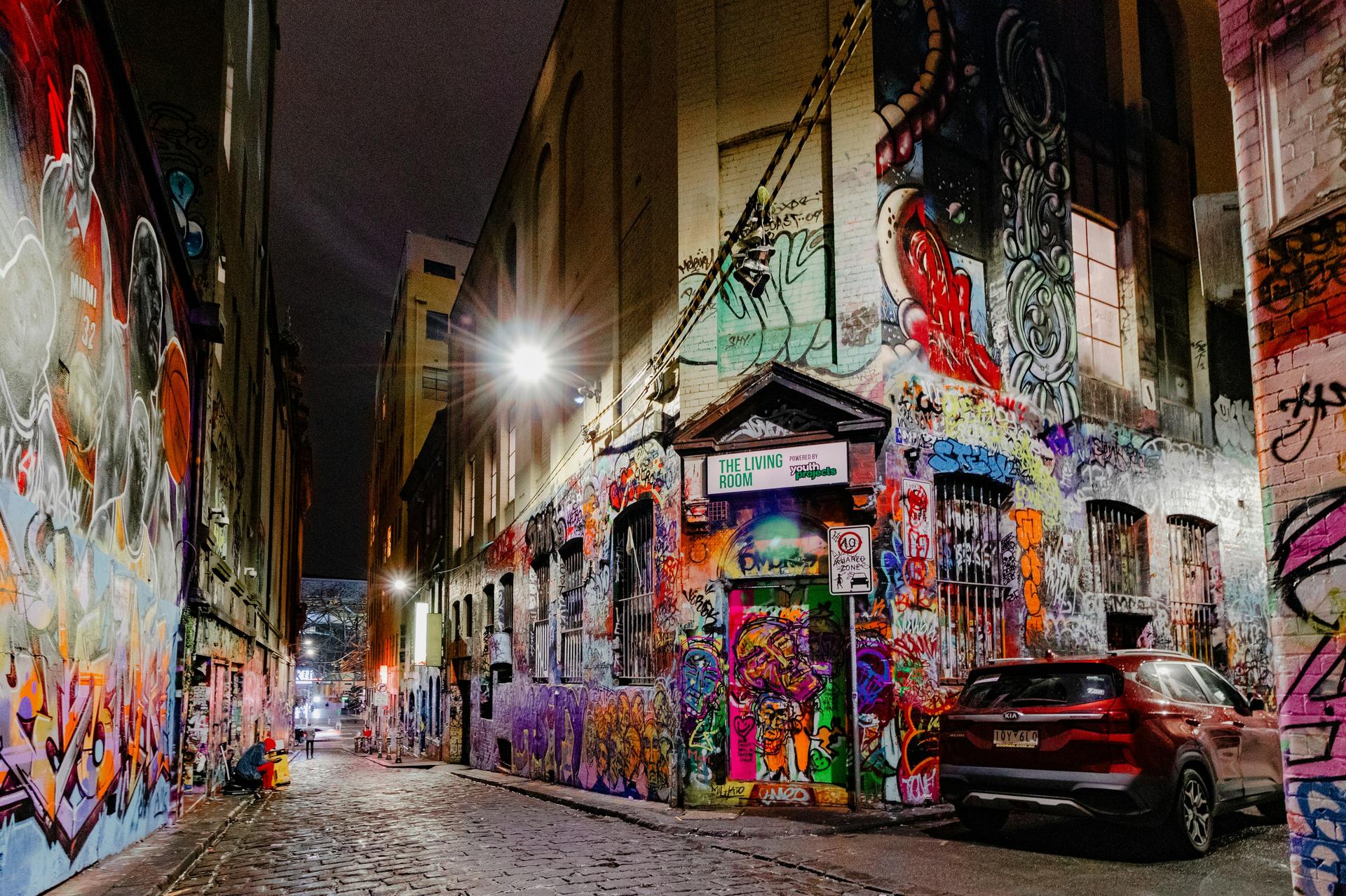
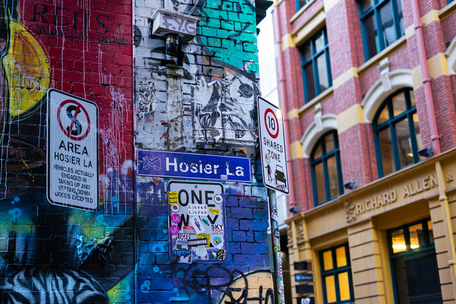
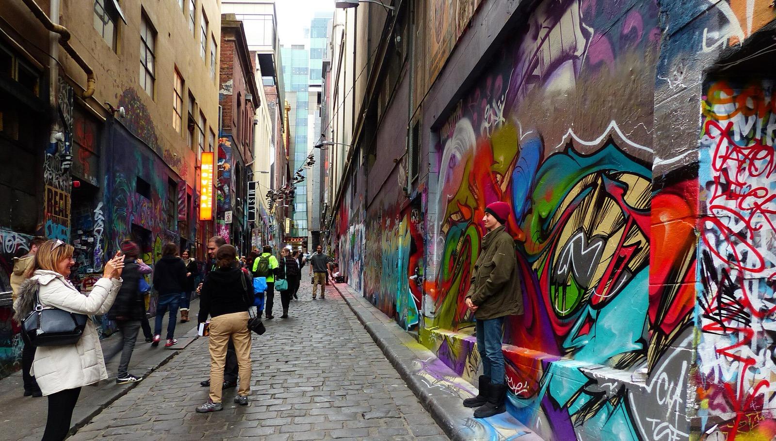
Hosier Lane: The Wall That Changes Overnight
The cobbled lane the City of Melbourne calls the birthplace of Melbourne street art, a de facto free-to-paint wall whose murals can change overnight.
- 9
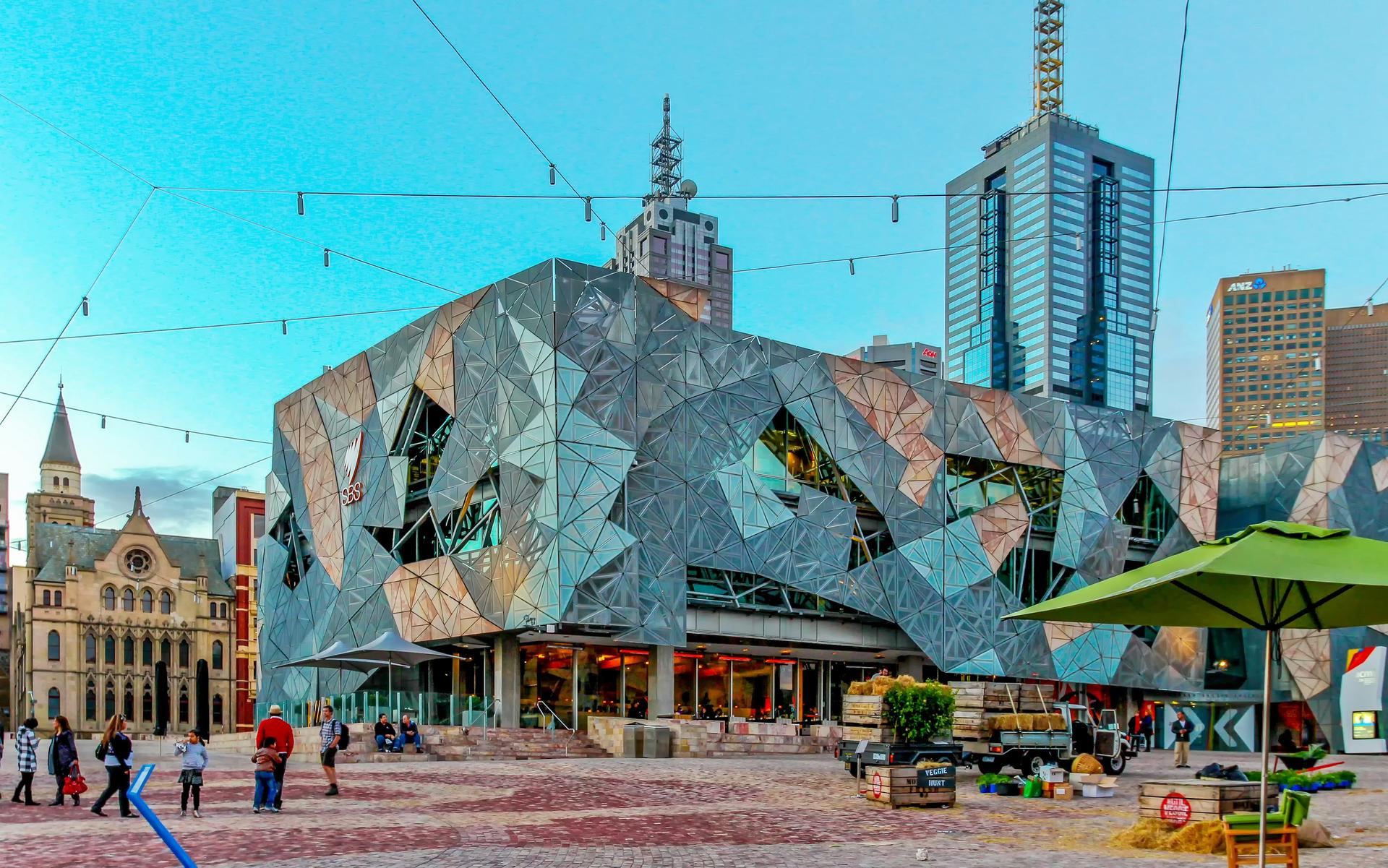
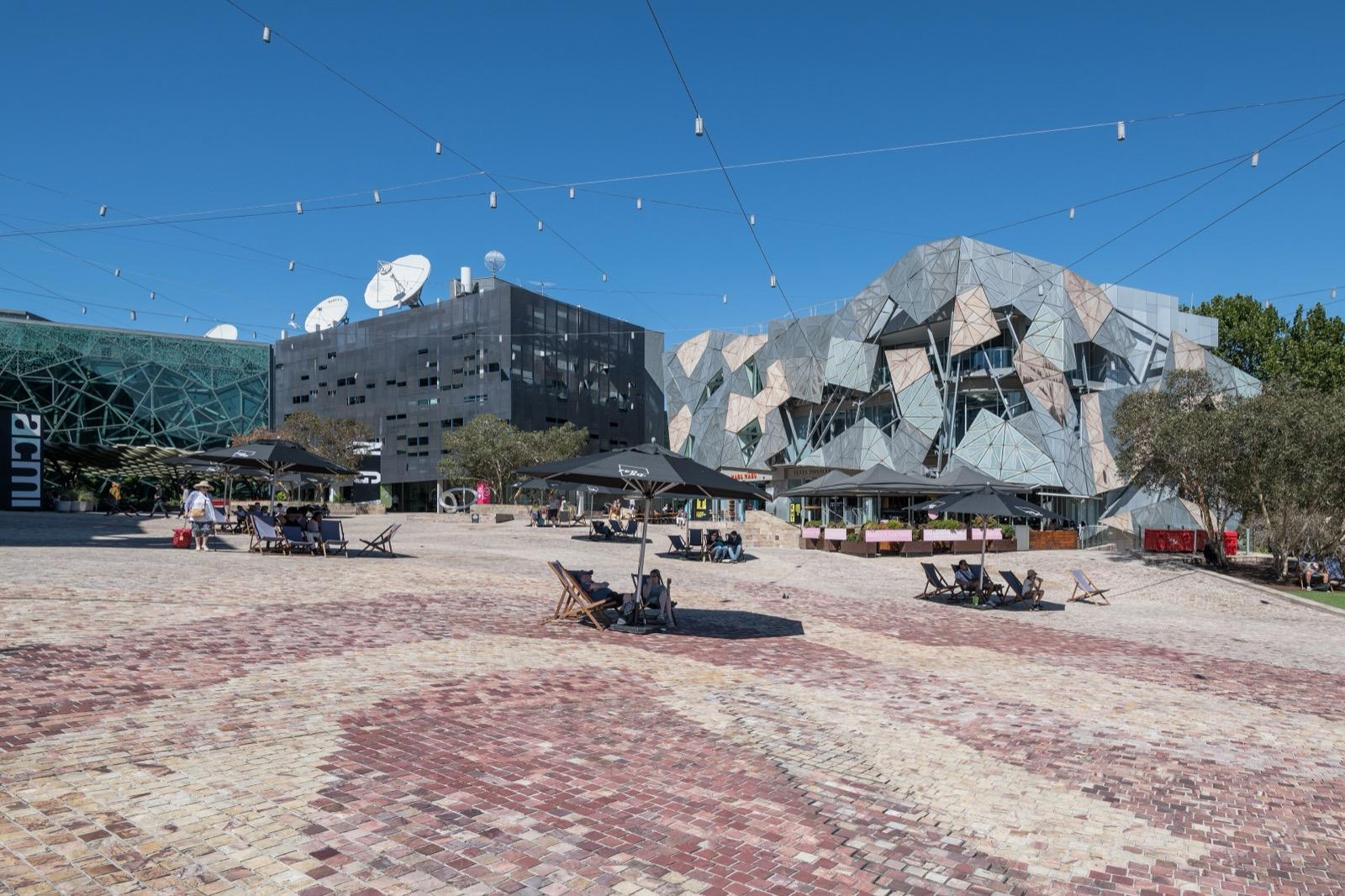
Federation Square: The Lid Over the Railway
A civic square opened in 2002 on a deck over the railway, designed to echo Melbourne's lanes, beside the Birrarung on Wurundjeri Woi-wurrung Country.
Details
Best Time to Visit
Walk it between mid-morning and late afternoon, when both arcades are open, the cafe tables are out in Degraves Street and Centre Place, and the light reaches down into the lanes. Weekdays show the working city, and the Bourke Street Mall and the front of the Block Arcade are favourite busking spots. Time the Royal Arcade for a few minutes before the hour and you will see Gog and Magog strike. Melbourne's weather changes fast, and two of the stops are under glass roofs, so a grey day suits this walk better than most.
Pro Tips
- •Gog and Magog strike the hours on iron bells at Gaunt's clock in the Royal Arcade, and the City of Melbourne says they are still heard today. Reach stop 4 a few minutes before the hour. Checked 17 September 2026.
- •Arcade hours: the Block Arcade is open Monday to Thursday 8am to 6pm, Friday 8am to 8pm, Saturday 8am to 6pm and Sunday 9am to 6pm; the Royal Arcade Monday to Thursday 7am to 7pm, Friday 7am to 8.30pm, Saturday 8am to 7pm and Sunday 9am to 7pm. Checked 17 September 2026 on the arcades' own sites.
- •The free Melbourne Town Hall tours run on Monday, Wednesday, Thursday and Friday at 11am and 1pm, except public holidays, take about an hour and need booking; they usually include the portico balcony where the Beatles stood. Checked 17 September 2026.
- •To go deeper into Chinatown, carry on along Little Bourke Street past Russell Street to the Chinese Museum at 22 Cohen Place, open daily 10am to 4pm except public holidays; adult entry was $17. Checked 17 September 2026.
- •At Federation Square, the Koorie Heritage Trust in the Birrarung Building and NGV Australia at the Ian Potter Centre are both open daily 10am to 5pm (the Trust closes on public holidays), with free general entry. Checked 17 September 2026.
- •Halfway along Degraves Street, stairs lead down to the Campbell Arcade, a pink-tiled 1955 passage under Flinders Street to the station, reopened in July 2025 after the Metro Tunnel works. Checked 17 September 2026.
- •The route goes round the GPO by Elizabeth Street because Postal Lane, the covered lane on its east side, has heritage gates and we could not confirm when they are open. If it is open, it is a short cut from the Mall to Little Bourke Street. Checked 17 September 2026.
- •Hosier Lane's walls can change overnight, so photograph what you like while it is there.
- •After the last stop, Birrarung Marr, the riverside park just east of Federation Square, is a good place to sit down.
Safety & Precautions
- •Trams run through the Bourke Street Mall and along Swanston, Collins and Flinders Streets. Cross at the lights, and in the Mall treat the tracks as a road.
- •Centre Place climbs a short flight of stairs into the Centreway Arcade. For a street route instead, turn right along Flinders Lane to Swanston Street, left up Swanston, cross Collins Street at the lights, and turn left along it to the Block Arcade on the north side.
- •Hosier Lane is cobbled, uneven and slippery when wet, and it is a one-way service lane that delivery vehicles still use. Scaffolding or hoardings may block part of its Flinders Street end, where repair works on the Forum theatre were reported in April 2026.
- •The path from the foot of Hosier Lane up into Federation Square includes a short flight of steps.
- •Metro Tunnel works at the Swanston Street corner of Federation Square were still under way in September 2026, and the crossing between St Paul's Cathedral and Federation Square was closed. The route uses the crossings at Degraves Street and at the foot of Hosier Lane; follow the signs if paths change.
- •The arcades close in the evening, the Block Arcade at 6pm on most days. After that, walk Collins Street west to Elizabeth Street and up to the Bourke Street Mall instead of going through them.
- •The Mall and the arcades get crowded; keep bags and phones close, as in any city centre.
Travel advisory: Exercise Normal Precautions (Level 1).
Gallery
Related Reading
Go deeper on what you'll see, hear, and walk through.
Overview
Best Self-Guided Walking Tours in Melbourne (2026)
4 min
Overview
Melbourne Travel Guide: How Many Days, Getting Around, and When to Go
7 min
Overview
One Day in Melbourne: A Walkable Itinerary Through the Laneways and the Gold-Boom Edge
6 min
Thematic
Gold-Rush Melbourne: The Hidden Laneways and the Boom City
8 min
Companion
Hosier Lane and the Hidden City Inside Melbourne's Grid
8 min
Deep dive
Flinders Street Station: Why Melbourne Meets Under the Clocks
7 min
Read
What to Eat in Melbourne: A Local's Guide to the City's Dishes
7 min
Read the walk
The full story of Laneways and Arcades: The Hidden City Inside the Grid, in words. Prefer to listen? Play it narrated, from home or on location.
Introduction
Melbourne, in Australia, was drawn with a ruler. In March eighteen thirty seven the surveyor Robert Hoddle began marking out a grid of main streets thirty metres wide, broad enough, he believed, to keep the air of the town healthy. The governor, Sir Richard Bourke, insisted on something else as well: narrow back streets between the main ones, so every lot could be reached from behind. Hoddle disliked those, but he disliked narrower main streets even more, so the town got both.
That compromise is what this walk is about. The grand streets became Melbourne's front of house. Behind them, as the blocks were divided and divided again, the lanes multiplied, eighty with names by eighteen fifty six, used for deliveries, workshops and far worse. Then arcades were cut through the blocks, and more than a century later the city worked out that its back lanes were the best rooms in the house.
Nine stops, about two kilometres, around seventy five minutes, from Flinders Street Station to Federation Square, just across the road from where you start. Two carved giants, a mosaic floor, a Chinatown as old as the gold rush and a lane whose walls can change overnight are all on the way. No group, no schedule, nobody waiting for you.
When you arrive at Flinders Street Station, at the corner of Flinders and Swanston Streets, begin with stop one.
1. Flinders Street Station: Meet Me Under the Clocks
Welcome to Flinders Street Station. You are standing on the spot Melbourne uses when it says where to meet. Look up at the row of clocks above the entrance. For generations, meet me under the clocks has been the one arrangement nobody in this city needs explained.
They are not ordinary clocks. They show when the trains leave, and they were switched on in July nineteen ten. A newspaper that day told its readers: passengers may now discover from the street the times at which their trains depart. For more than seventy years a railwayman set the hands with a long pole, around nine hundred times in an eight hour shift. In nineteen eighty three the railways planned to swap them for digital displays. The public objected, and the clocks stayed. A computer turns them now.
The building was designed by two men on the railway department's own staff, an architect, James Fawcett, and an engineer named Ashworth, who won a competition judged in nineteen hundred. This corner entrance opened on a Sunday in October nineteen oh nine, and the station was finished the following year. Notice that the entrance is set on the diagonal, facing the middle of the crossroads, as if the whole building has turned to greet the city.
Trains have left this spot since eighteen fifty four, when it was the town end of Australia's first steam passenger railway. Before that, there was a fish market here.
Now take in what surrounds you: two of the grid's great streets, crossing at full width, wide and public. That is Melbourne's front of house. The rest of this walk goes looking behind it. With the station on your left, walk west along Flinders Street for about eighty metres and cross at the lights. On the far side, turn left, and after about twenty five metres turn right into the narrow lane. That is Degraves Street.
2. Degraves Street and Centre Place: The Lanes That Came Back
This is Degraves Street: narrow, lined with cafe tables, and closed to cars.
It is named after William Degraves, a flour miller who came over from Hobart with his brother in eighteen forty nine and bought an acre on this block for a steam mill. Within a few years he was also a buyer of gold. Melbourne's lanes appeared as the big blocks of the grid were subdivided, and they were the back of house: deliveries, workshops, rubbish, and a smell of urine that the Encyclopedia of Melbourne calls one of the ubiquitous nineteenth century city smells.
Ahead, cross Flinders Lane. It began as one of the grid's little streets, and its nameplates still said Little Flinders Street until at least the nineteen thirties. On the far side is Centre Place. In the eighteen nineties this was Cummings Alley, and one stretch of it was lined with urinals. Halfway along, one arm of the old lane hooks off to your left. That kink is why no cart or car could ever get through. The way straight on, up the steps, was cut through to Collins Street by nineteen fifteen.
So what changed? In the nineteen eighties the city and the state began protecting and opening up lanes like these, and Centre Place was one of the first. From nineteen ninety two a program called Postcode Three Thousand set out to bring residents back to the centre, and city homes went from about seven hundred to nearly ten thousand in a decade. As the residents came, the lanes and arcades open to the public grew from three hundred metres in nineteen ninety four to more than three kilometres ten years later.
Walk up Centre Place, climb the steps into the Centreway Arcade, and come out on Collins Street. Cross at the lights straight ahead, turn left, and the Block Arcade is about forty metres along.
3. The Block Arcade: Doing the Block
Walk on to the octagon under the glass dome, where the arcade bends, and stop there. The arm you walked up runs back to Collins Street, and the other turns off to your left, to Elizabeth Street.
Look down first. The floor is a mosaic of tiles imported from Europe, and when the arcade was new a building journal claimed it was the largest area of mosaic yet laid in Australia. Then look up at the iron roof ribs, and at the panes of glass that the National Trust records as keeping their original decoration.
The arcade is named after something older than itself. From the eighteen sixties, the stretch of Collins Street outside, between Elizabeth and Swanston Streets, was known as the Block, and on weekday afternoons fashionable Melbourne walked up and down its shady side to see and be seen. That was doing the Block. In a novel of eighteen eighty six, Fergus Hume wrote that Collins Street was to Melbourne what Bond Street was to London. When the arcade opened, it became part of the ritual.
It was designed by David Askew of the firm Twentyman and Askew, modelled on the great galleria in Milan, and it rose where a fire had destroyed the shops on this site in eighteen eighty nine. The Collins Street arm was finished in February eighteen ninety two, and the Elizabeth Street arm in October eighteen ninety three.
And here is the twist. The man behind it, the financier Benjamin Fink, became insolvent in eighteen ninety two, the year it opened, and left Melbourne for London. The land boom that paid for all this was already collapsing.
Even the bend in the plan has a reason: it follows Block Place, the narrow passage at the corner that leads out to Little Collins Street. Walk up it, and cross Little Collins Street straight over into the Royal Arcade.
4. The Royal Arcade: Gog, Magog and Gaunt's Clock
Walk in under the great clock, go on a few more steps, then stop and turn round. Look up at the end you just came in by. Two carved giants, each about two metres tall, stand either side of a great black and gold clock. They are Gog and Magog, and they have been here since…
Full narration for this stop unlocks with the tour.
5. Bourke Street Mall and the GPO: Read It From the Bottom Up
Out here on the Bourke Street Mall, trams still run straight through, so keep an ear out for the bell. The mall was opened by the Prince and Princess of Wales in nineteen eighty three. Now look ahead and to your left, across the tracks, at the big stone building with the clock…
Full narration for this stop unlocks with the tour.
6. Chinatown: The Street the Gold Rush Built
Cross to the arch at the western end of Chinatown and look down Little Bourke Street. The City of Melbourne calls this Australia's oldest Chinatown, and it goes back to the gold rush. Gold was found in Victoria in eighteen fifty one. From eighteen fifty three Chinese migrants…
Full narration for this stop unlocks with the tour.
7. Melbourne Town Hall: The Balcony Over the Street
This is Melbourne Town Hall. Walk on until the portico is over your head. It was added in eighteen eighty seven, and it reaches right out over the footpath to the kerb. On top of it is a balcony. On the sixteenth of June nineteen sixty four, the Beatles stood up there and waved…
Full narration for this stop unlocks with the tour.
8. Hosier Lane: The Wall That Changes Overnight
This is Hosier Lane. The City of Melbourne calls it the birthplace of Melbourne street art, and nothing on these walls is guaranteed to be here tomorrow. The city's own visitor guide says work here disappears and appears overnight. That is because the lane runs on an unusual…
Full narration for this stop unlocks with the tour.
9. Federation Square: The Lid Over the Railway
This is Federation Square, the last stop, and the youngest place on the walk. It opened on a Saturday in October two thousand and two, a year late for the hundredth anniversary of Australian Federation it was built to mark. Look at the ground you are standing on. You are on a…
Full narration for this stop unlocks with the tour.
- General Post Office, Bourke Street, Melbourne — KimaGuseva, CC BY-SA 4.0 · source
- Melbourne Town Hall, October 2023 — Argmae, CC BY-SA 4.0 · source
Images may be cropped or resized. Other photos via Unsplash and Pexels.