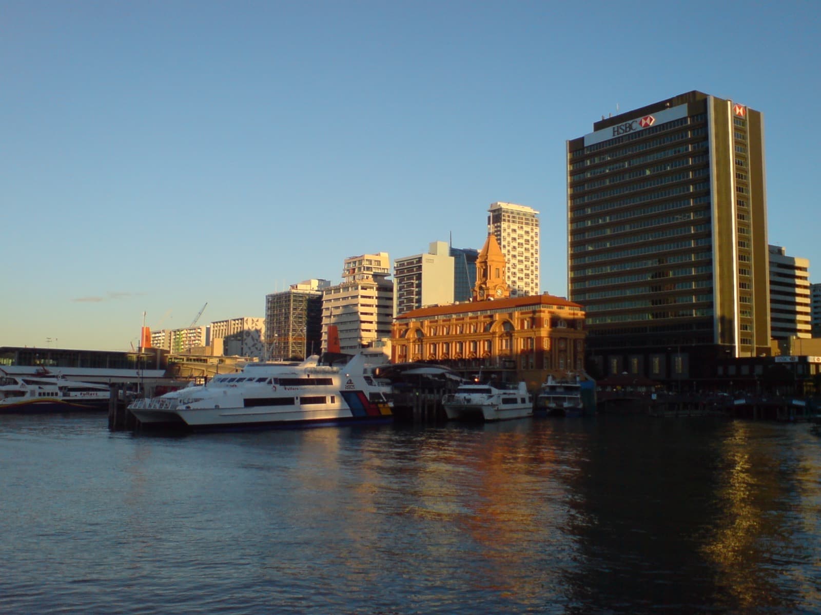
A level harbour-front walk along the working edge of Auckland, reading the layers of a shoreline remade again and again, from whaling port to yacht village to glass towers.
Start · The Ferry Building: The Harbour's Front Door
DirectionsStops
- 1
The Ferry Building: The Harbour's Front Door
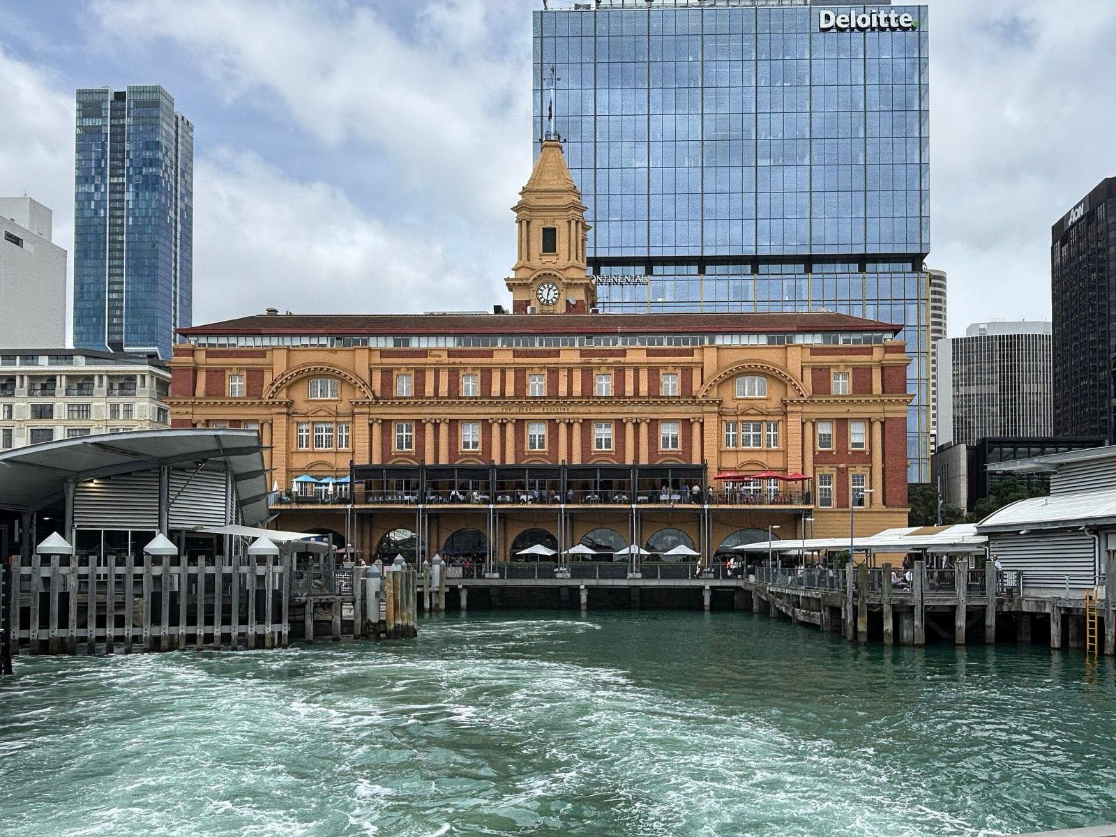
The ornate Edwardian ferry building on Quay Street, the front door of Auckland's harbour, built on land reclaimed from the sea.
- 2
Queens Wharf: The People's Wharf
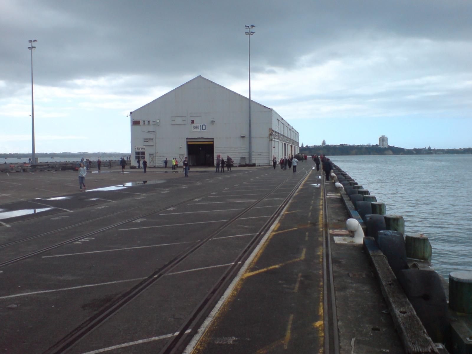
The old cargo wharf at the foot of Queen Street, long the port's working heart, now reopened to the public as a cruise terminal and open space.
- 3
Britomart: The Warehouses and the Old Post Office
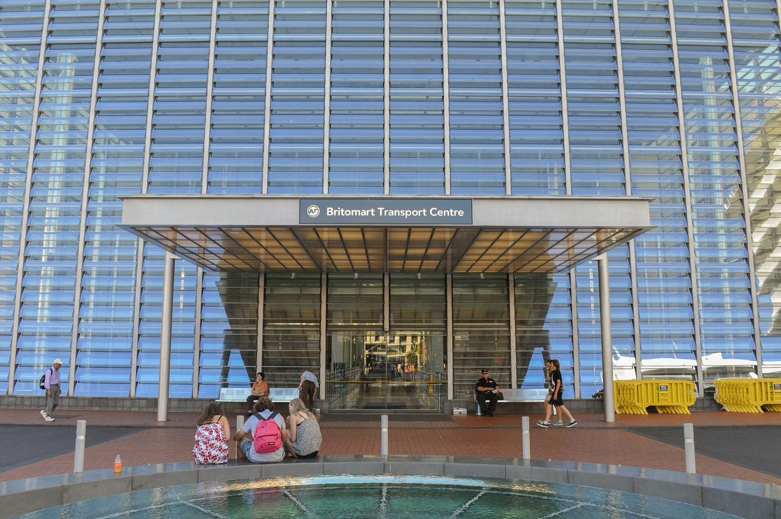
A tight block of restored Victorian and Edwardian warehouses wrapped around a former post office that is now the city's underground rail station.
- 4
Commercial Bay: The Buried Beach
The line of Auckland's original eighteen forty shoreline, a block inland, where the tidal Commercial Bay met the beach before the downtown was reclaimed from the sea.
- 5
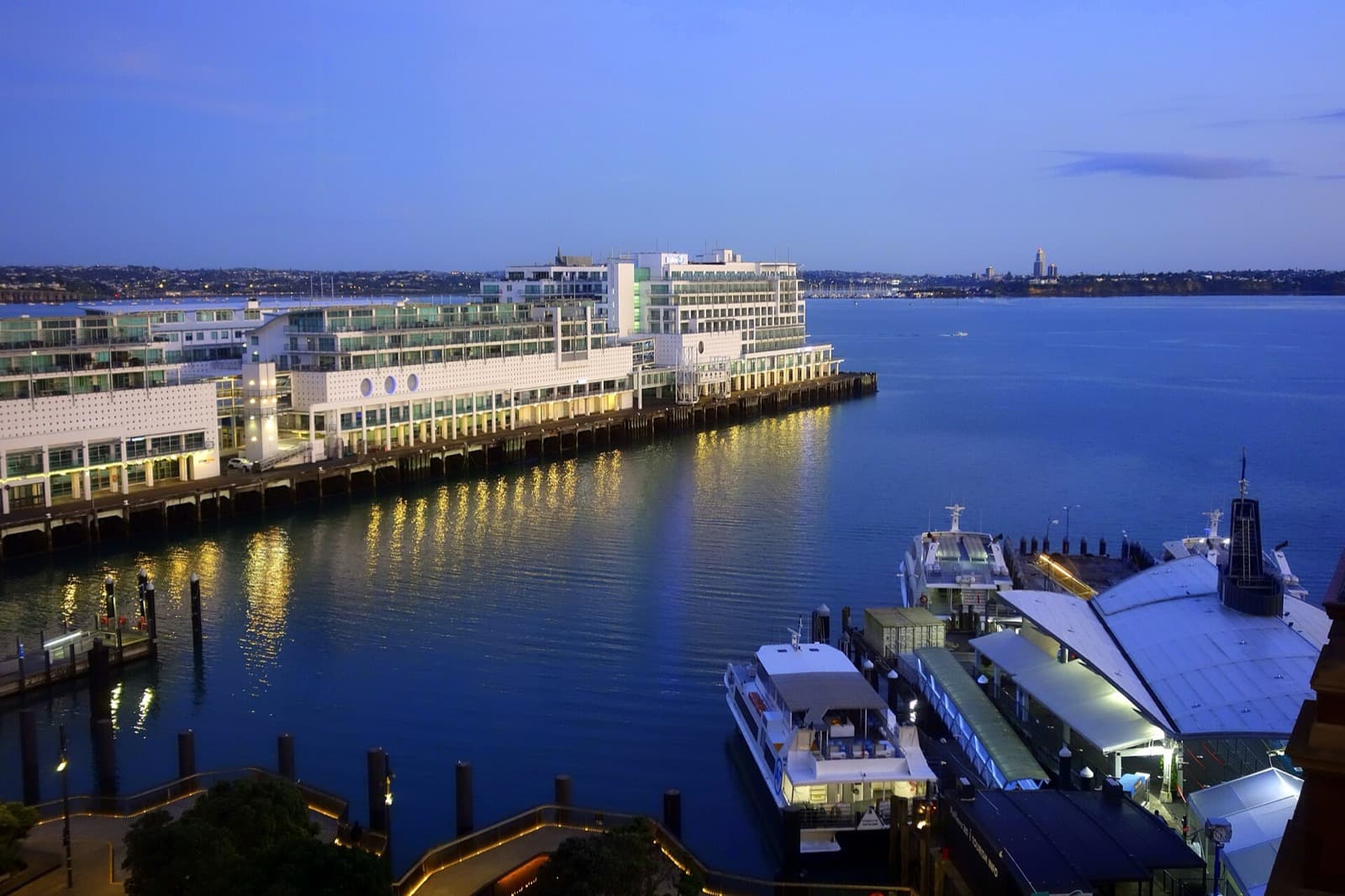
Princes Wharf: Toward the Young Volcano
A long finger wharf reaching into the harbour, now carrying a hotel and cruise terminal, with a view across the water to the young volcano Rangitoto.
- 6
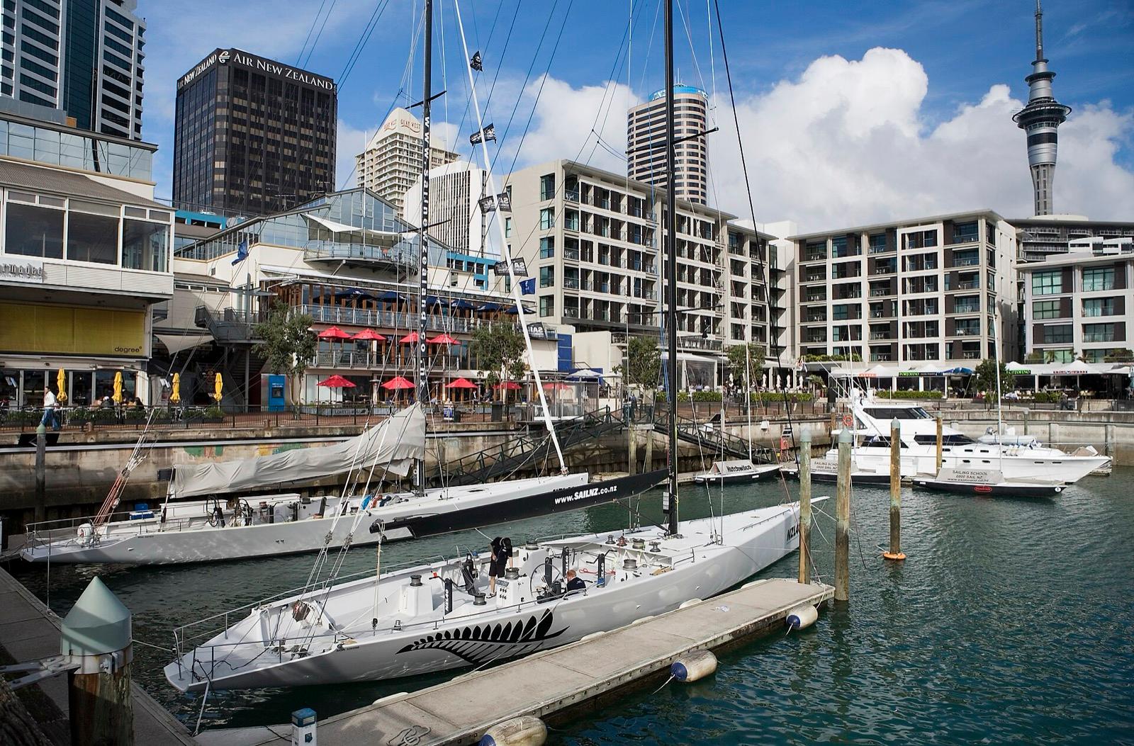
Viaduct Harbour: The Basin That Held the Cup
A former commercial fishing and cargo basin west of the wharves, redeveloped into a yacht basin and waterside quarter for the America's Cup.
- 7
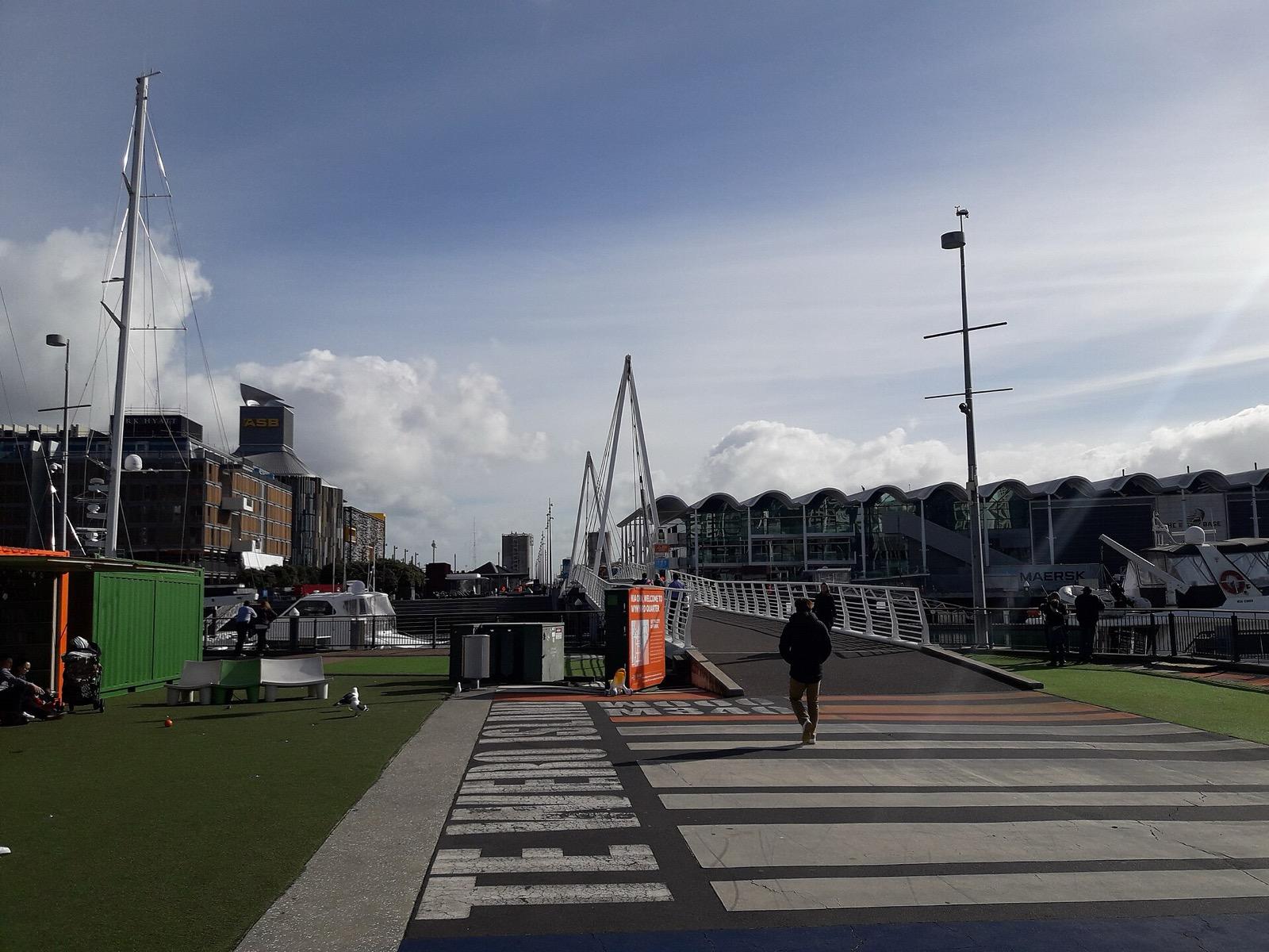
Wynyard Quarter: From Tank Farm to Silo Park
A former petrochemical tank farm at the western end of the waterfront, remade into a public quarter where retained concrete silos remember the working harbour.
Details
Best Time to Visit
Late afternoon into early evening is ideal, when the low light comes off the Waitematā and the harbour front glows. Mornings are quieter and cooler for the wharves. On a clear day the view across to Rangitoto from Princes Wharf is worth timing for, and the western quarters at Viaduct Harbour and Wynyard come alive toward evening.
Pro Tips
- •This is a level walk on made ground and paved promenades, easy underfoot the whole way, so ordinary comfortable shoes are plenty.
- •The harbour ferries from the Ferry Building run all day, so you never need to hurry a stop to catch a boat; watch a few come and go if you like the rhythm of the water.
- •At Princes Wharf, walk right to the end for the clearest line across the harbour to Rangitoto, the low even cone on the horizon.
- •Read the old shoreline at Fort Street with the modern wharves in mind: everything seaward of that street is land reclaimed from the sea, which makes the whole layout suddenly legible.
- •Carry water and take your time; the seven stops sit close together, so you can pause as long as you like at any one without falling behind a schedule.
- •The old post office at Britomart is a working railway station entrance, so you can step inside the concourse for the interior even outside shop hours.
Safety & Precautions
- •The harbour front is open and exposed, so bring sun protection against the reflected glare off the water and a light waterproof for the wind and quick changes off the Waitematā.
- •This is a busy working waterfront with cruise terminals, ferry berths and marinas, so keep clear of vehicle lanes and loading areas around the wharves and mind the edges where there are no rails.
- •The story here touches the loss of Ngāti Whātua land after eighteen forty; treat that history with quiet respect as real and living, and use the present tense for the iwi who remain mana whenua of this harbour today.
- •Keep ordinary city street-awareness in the busier quarters at Britomart, Viaduct Harbour and Wynyard, and keep valuables discreet in crowds; some venues and events on the wharves may charge entry in New Zealand dollars.
Travel advisory: Exercise Normal Precautions (Level 1).
Gallery
Related Reading
Go deeper on what you'll see, hear, and walk through.
Overview
Auckland Travel Guide: How Many Days, Getting Around, Safety, and Budget
7 min
Overview
Best Self-Guided Walking Tours in Auckland (2026)
4 min
Overview
One Day in Auckland: A Walkable Harbour-to-Crater Itinerary
8 min
Thematic
Auckland: The Harbour City Read in Layers
8 min
Thematic
Best History Walking Tours in Auckland (2026)
2 min
Companion
The Auckland Ferry Building: A Front Door Built on Water
7 min
Deep dive
Viaduct Harbour, Auckland: The Fishing Basin That Held the America's Cup
6 min
Read
What to Eat in Auckland: A Local Food Guide
7 min
Read the walk
The full story of Britomart & the Waterfront: From Whaling Port to America's Cup, in words. Prefer to listen? Play it narrated, from home or on location.
Introduction
Auckland, New Zealand, was born on this shore. In eighteen forty the colonial town grew around a muddy tidal bay called Commercial Bay, and almost all the flat downtown ground you will cross today was later reclaimed from the sea, so the old beach now runs a block inland. This walk reads that harbour city from the water: the grand Edwardian ferry building, the saved warehouses of Britomart wrapped around an old post office, the public wharves, and the western basins remade for yacht racing and the modern city. All of it stands on the Country of Ngāti Whātua, and the wider iwi, the Māori tribes, of Tāmaki Makaurau, the Māori name for the Auckland isthmus, often rendered the place desired by many. This is a self-guided walk, which means your pace and your own quiet map. There is no group to keep up with, no schedule, no tip expected. Linger on a wharf for the light you want, or move straight on. A good local guide is wonderful company here; this simply lets you set your own clock. There are seven stops. Plan for about two hours, though you can stretch that as long as you like, over roughly two and a half kilometres of level harbour-front walking. Māori names appear along the way, each glossed once in plain English, because te reo Māori is a living language and this harbour was theirs long before the town. When you arrive at the Ferry Building on Quay Street, begin with stop one.
1. The Ferry Building: The Harbour's Front Door
You are standing at the harbour's front door. The Ferry Building rises on Quay Street at the foot of Queen Street, on land reclaimed from the water's edge of the Waitematā, the harbour Auckland is built on. Heritage New Zealand records that it was designed by the architect Alexander Wiseman and built between nineteen oh nine and nineteen twelve for the Auckland Harbour Board. Its style is a stately English Baroque, four storeys of sandstone and brick over a base of Coromandel granite, crowned by a clock tower. This was Wiseman's best-known work. It took longer than planned partly because the public objected to a building blocking the harbour views, and an early five-storey proposal was cut back to four storeys plus the tower. Heritage New Zealand lists it as a Category One historic place. For more than a century this has been the hub of Auckland's harbour ferries, which still cross the Waitematā to Devonport and the North Shore all day long. That matters for a solo walker: you are not tied to a departure. The boats come and go, and you can watch them from here at your own pace before you move on. Remember, too, whose harbour this is. This front is the Country of Ngāti Whātua, the mana whenua here, meaning the iwi holding customary authority over the land, and the wider Māori people of Tāmaki Makaurau. The colonial town that raised this ornate building was young; the harbour before it is ancient. Take a moment with the water, then turn along the front toward the next wharf.
2. Queens Wharf: The People's Wharf
Just east of the Ferry Building, Queens Wharf reaches out into the Waitematā from the foot of Queen Street. For most of the last century this was the main working wharf of the port, stacked with cargo rather than open to the public. It was built in stages, so as not to disrupt operations, between nineteen oh seven and nineteen thirteen. Two cargo sheds once stood on it. Only one survives: Shed Ten, built in nineteen ten, the last original building on the wharf. Heritage New Zealand lists it as a Category One historic place. This shed was a key storage point for Auckland's export trade, and it stood here as troops were waved off from this wharf for the First World War. Around twenty ten the wharf was bought back into public ownership, and the city reopened it to people rather than freight. Shed Ten was carefully restored and reopened in August twenty thirteen as Auckland's main cruise-ship terminal and events space, keeping its heritage frame. Panuku Development Auckland, which manages the waterfront, oversees it now. From out here the harbour opens north across the water to Devonport and the North Shore. As a solo walker you have the run of it: the whole wharf is public open space, so you can walk to its end, stand at the rail, and take the harbour in for as long as you please. This is the people's wharf again, a working port structure handed back to the city. When you have had your fill of the view, turn back toward the block of old warehouses behind you.
3. Britomart: The Warehouses and the Old Post Office
Behind the wharves, between Quay Street and the rail lines, sits Britomart: a tight block of restored Victorian and Edwardian warehouses. They were built between eighteen eighty and nineteen ten to service Auckland's growing port trade, and most of their external walls are still the original brickwork. By the late twentieth century the precinct had decayed, and it was regenerated from the early two thousands into one of the most-cited heritage reuse projects in the city. The whole block is wrapped around the former Chief Post Office at the foot of Queen Street. The City Rail Link's heritage record notes that this post office was designed by the government architect John Campbell, built between nineteen oh nine and nineteen eleven, and opened in nineteen twelve by the Prime Minister William Massey before a crowd of about eight thousand people. Its Baroque grandeur echoes the Auckland Town Hall. Today that old post office is the entrance to the underground Britomart railway station, officially Waitematā Station. When the central station returned to this site as the Britomart Transport Centre in July two thousand and three, it triggered the regeneration of all these warehouses around it. A post office became a rail hub; decayed brick sheds became a living quarter of shops and eating places. As a solo walker you can read the layers at your own pace: run your eye along the original brick, step into the station concourse in the old post office, and feel the port trade written into the walls. There is no rush and no set route through here. When you are ready, head back toward the water and the line of the old shore.
4. Commercial Bay: The Buried Beach
A block back from the present wharves, around lower Fort Street, runs the line of Auckland's original shoreline from eighteen forty. This is the turn of our walk, the buried beach where the town began. Here the tidal Commercial Bay once met a beach, before the whole downtown…
Full narration for this stop unlocks with the tour.
5. Princes Wharf: Toward the Young Volcano
West of the Ferry Building, Princes Wharf runs as a long finger into the Waitematā, now carrying a hotel and the cruise terminal out over the water. Plans were drawn up by the Auckland Harbour Board in nineteen twenty, construction began in nineteen twenty-one, and the wharf was…
Full narration for this stop unlocks with the tour.
6. Viaduct Harbour: The Basin That Held the Cup
West of the wharves lies the Viaduct Harbour, once a run-down commercial fishing and cargo basin, now a bright yacht basin and waterside quarter. This is where the America's Cup came ashore. NZHistory records that Team New Zealand won the America's Cup in San Diego in nineteen…
Full narration for this stop unlocks with the tour.
7. Wynyard Quarter: From Tank Farm to Silo Park
Cross the Viaduct entrance on the Wynyard Crossing, a modern lifting footbridge built in twenty eleven, and you reach the Wynyard Quarter at the western end of Auckland's central waterfront. This resolves our walk on the remade front. For most of the last century this was an…
Full narration for this stop unlocks with the tour.