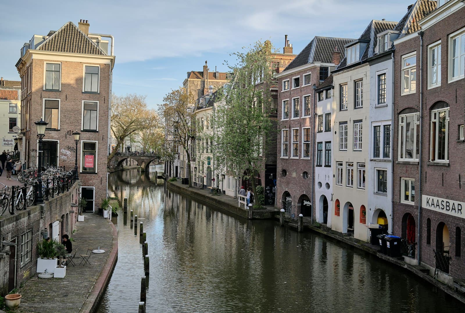
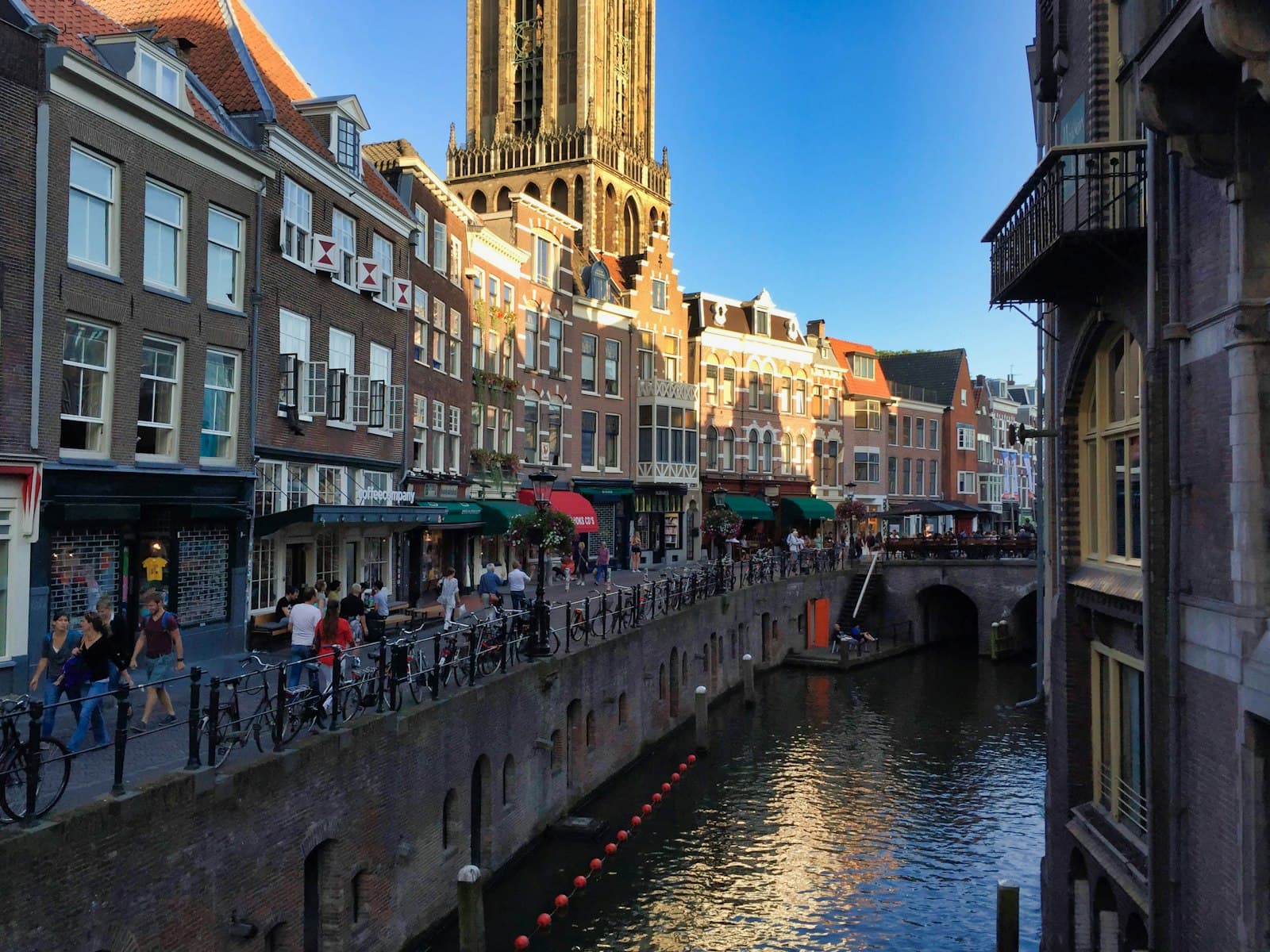
Utrecht built a second street below the street: a working wharf and vaulted cellars dug beneath the road, where boats once unloaded straight into merchants' basements. This walk reads the canal as medieval machinery first and the city's most beloved public space second.
Start · Stadskasteel Oudaen: the house that could afford stone
DirectionsStops
- 1
Stadskasteel Oudaen: the house that could afford stone
A medieval city castle on the Oudegracht that survived because its patrician builders could afford permanence in stone when the rest of the city was wood.
- 2
Stadhuisbrug and the Stadhuis: merchant houses that became a government
A broad bridge-square over the Oudegracht where medieval merchant houses grew into the town hall behind a nineteenth-century classical front.
- 3
The Oudegracht: a harbour running through the town
Utrecht's roughly two-kilometre trade canal, whose deliberately low water level is the engineering key to the whole two-level city.
- 4
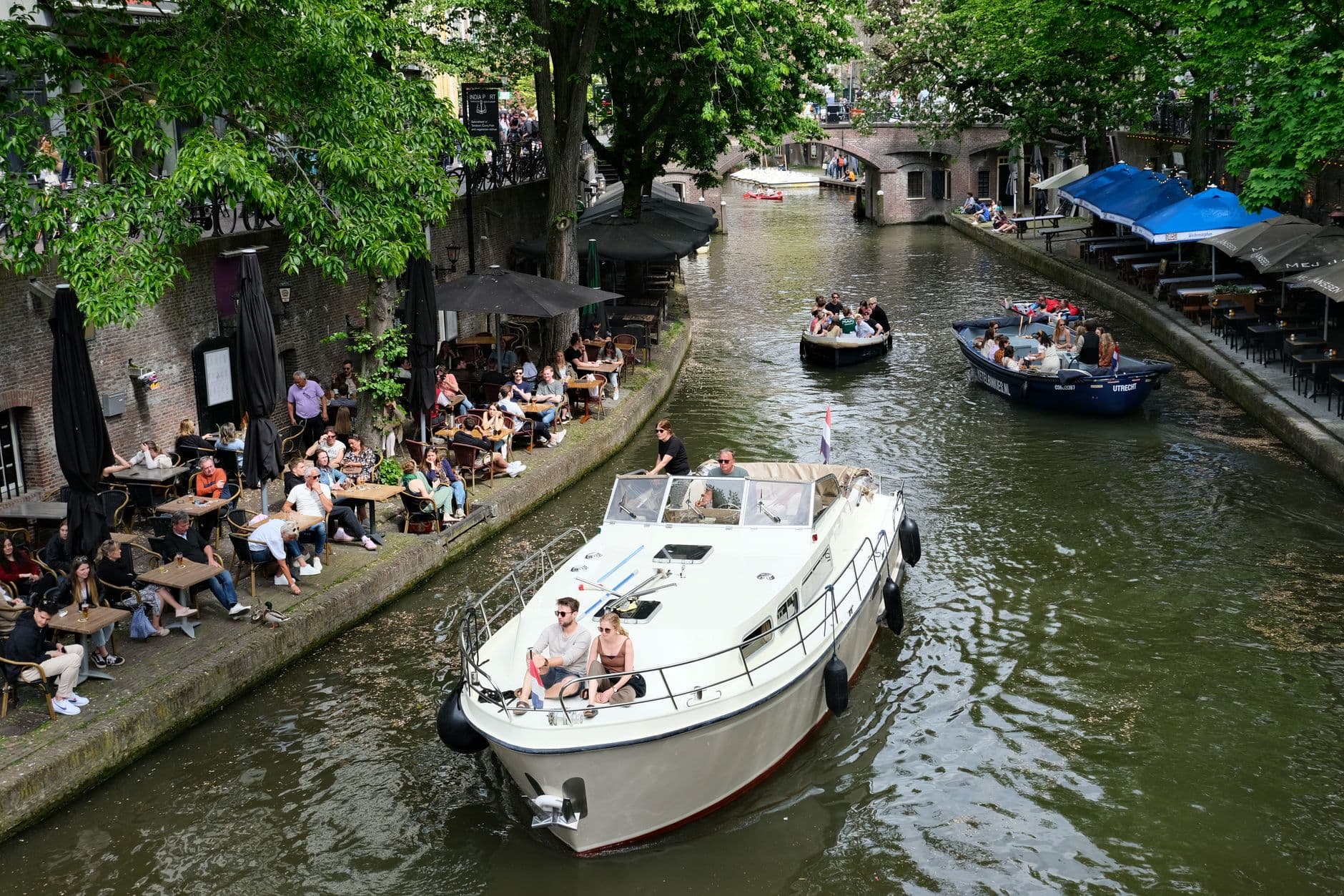
The werf and the werfkelders: the second street
The continuous lower wharf and its vaulted cellars tunnelled back under the street, the physical heart of Utrecht's two-level city.
- 5
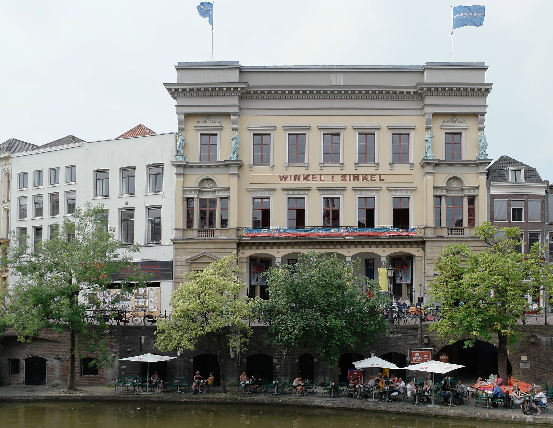
Winkel van Sinkel: the statue that fell in the canal
A grand nineteenth-century building, described as the first department store in the Netherlands, whose cast-iron statues arrived by boat, one of them into the water.
- 6
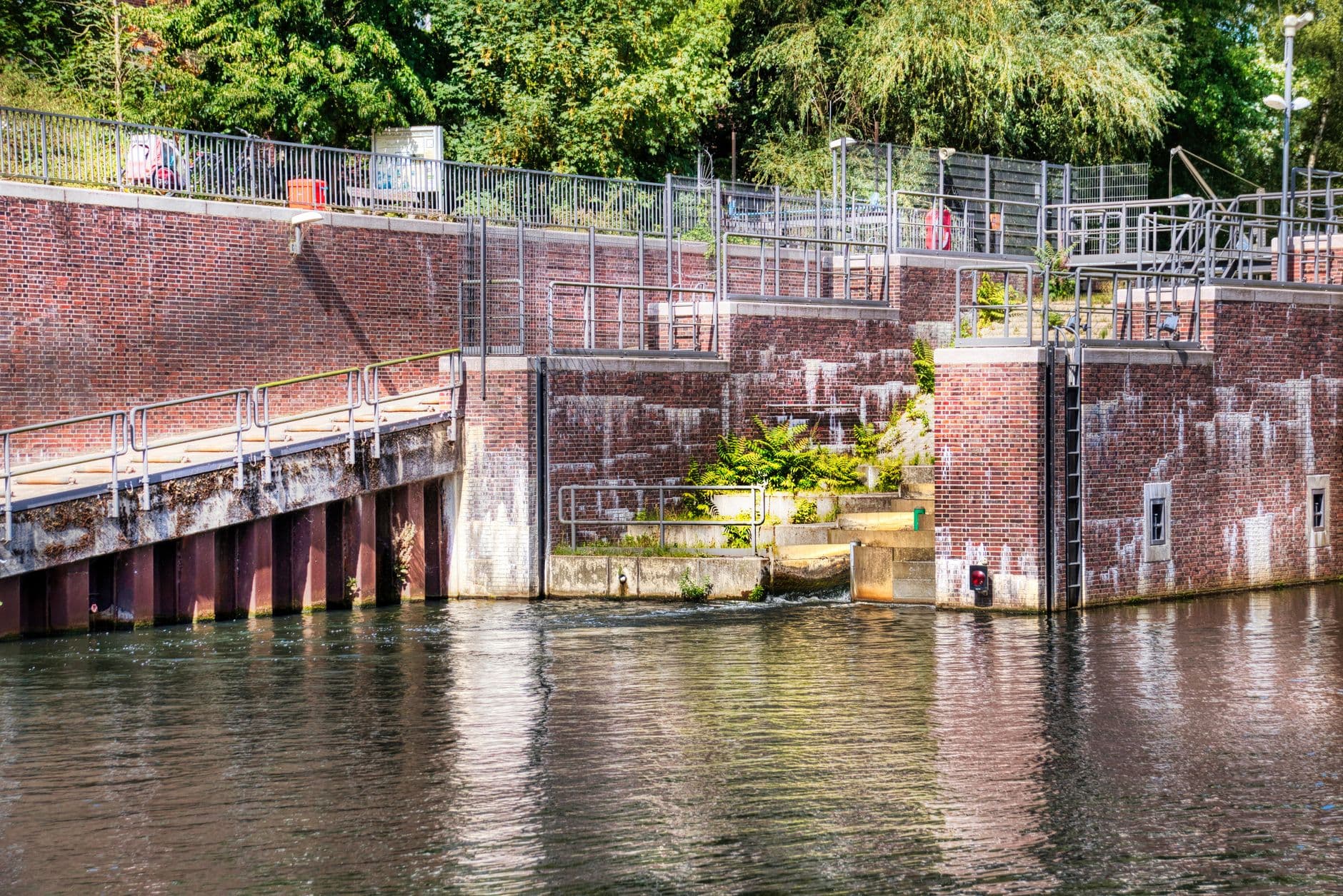
Weerdsluis: where the city met the river
A lock at the northern edge of the old city where cargo transferred between city canals and the Vecht river, and the tow-boats to Amsterdam once departed.
- 7
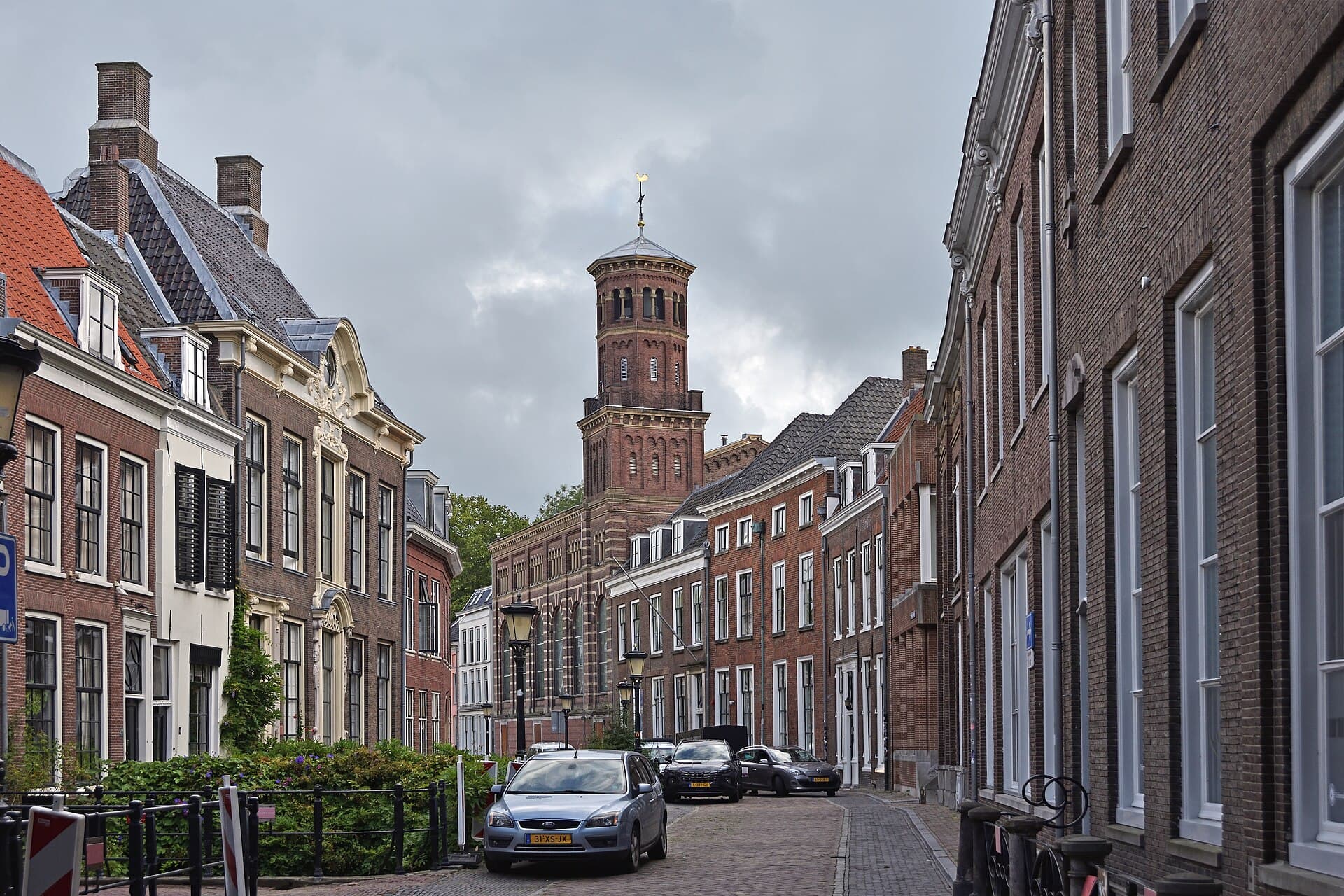
The Nieuwegracht: the same engineering, a quieter world
A tree-lined fourteenth-century canal with the same low water and wharf-cellar system as the Oudegracht, but private, calm, and lined with monumental houses.
Details
Best Time to Visit
Late morning to mid-afternoon on a dry day, when light reaches down onto the wharves and the werfkelder terraces are open. Spring and summer are liveliest along the lower quays; a crisp autumn day gives you the clearest views of the water far below the street. Weekday mornings are calmest for descending onto the wharf without crowds. Avoid the walk right after rain, when the stone steps and quays turn slick.
Pro Tips
- •Wear shoes with real grip. The stone steps down to the werf and the wharves themselves are worn and can be slippery, especially near the water.
- •Go down onto the wharf at least once, even if only for a few steps. The whole tour is about the lower level, and you cannot feel the two-level city from the street above.
- •Look for cellars now open as cafes and galleries. Stepping inside a werfkelder lets you stand under the vault and see how far the storage tunnels back beneath the road.
- •The stops sit mostly along the Oudegracht, so the middle of the walk is a simple stroll up one canal; take your time and let the water be your guide.
- •Bring a little cash or a card for a coffee down on the wharf; sitting at water level is the single best way to absorb this place.
- •At the Weerdsluis, check whether the fish doorbell webcam season is active in spring; watching the lock work is a quiet reward at the northern end.
Safety & Precautions
- •Many canal edges and the lower wharves have no railings and drop straight to deep water. Keep well back from the edge, and watch children closely on the werf.
- •Cyclists and trams have priority in Utrecht and move fast and almost silently. Look both ways before crossing any street or bike lane, and do not stand in cycle paths to take photos.
- •The steps down to the wharves are steep, narrow, and uneven, and the cobbles and old quays are irregular underfoot. Move slowly and use handrails where they exist.
- •Bridges, stone steps, and the wharves become genuinely slippery when wet or frosty. If it has rained or frozen, take extra care descending to the water, or admire the lower level from the street instead.
Travel advisory: Exercise Increased Caution (Level 2).
Gallery
Related Reading
Go deeper on what you'll see, hear, and walk through.
Overview
Best Self-Guided Walking Tours in Utrecht (2026)
3 min
Overview
One Day in Utrecht: A Walkable Morning-to-Evening Itinerary
8 min
Overview
Utrecht Travel Guide: Days, Transport, Safety, and Budget
6 min
Thematic
Utrecht: The City That Keeps Its Story Below the Surface
7 min
Companion
The Werfkelders of Utrecht: How a City Built a Street Below the Street
7 min
Deep dive
The Oudegracht: Why Utrecht's Canal Runs Below the Street
7 min
Read
What to Eat in Utrecht
7 min
Read the walk
The full story of Oudegracht Wharves: The Streets Below the Street, in words. Prefer to listen? Play it narrated, from home or on location.
Introduction
Most cities meet their water at one level. Utrecht meets it at two. Here in Utrecht, in the Netherlands, the Oudegracht runs far below the street, and in the gap between the water and the houses lies a second, lower street: a continuous stone wharf, with vaulted cellars dug back under the buildings and the road above. Merchants once unloaded boats straight into their basements. Today people drink coffee on the same quays. This tour follows seven stops over roughly three and a half kilometres, and takes about two hours at an unhurried pace, though every stop is short and skippable, so the pace is entirely yours. We begin with a stone castle that survived because its owners were rich enough to build in stone when almost everyone else built in wood. We move to the civic heart, where medieval merchant houses became the town hall. We read the canal itself as infrastructure, then step down onto the wharf and into the cellar logic that makes this place unlike anywhere else. We pass a grand nineteenth-century building whose statues arrived by boat, proof the canal was still delivering cargo centuries after the Middle Ages. We follow the water north to the lock where the city met the river. And we close on a quieter second canal, where the same engineering served a gentler world of churches and gardens. You will spend this walk pointing down and back, not up. When you arrive at Stadskasteel Oudaen on the Oudegracht, begin with stop one.
1. Stadskasteel Oudaen: the house that could afford stone
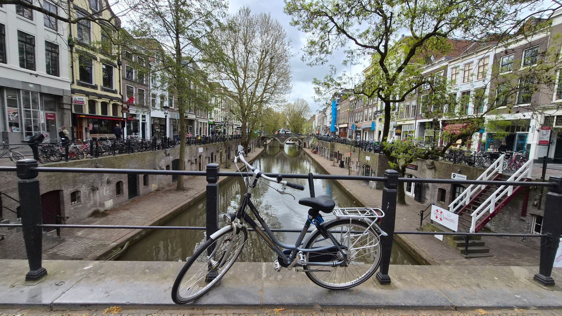
Look up at this facade and notice the tower section on the left, with its own separate roof. This is Stadskasteel Oudaen, a stadskasteel, a city castle, and it is here to teach you the first rule of medieval Utrecht: almost nobody could afford stone. In the Middle Ages the ordinary city was built of wood and loam, with thatched roofs that burned. Only the very richest households built in stone, which is why the buildings that survive from that world are the buildings of the merchant and patrician elite, not of the ordinary city. This one went up shortly after twelve seventy-six, a date confirmed by dendrochronology, the dating of its timbers. It was raised by the Zoudenbalch family, one of Utrecht's most prominent households. The name Oudaen comes from a different family, the Van Oudaen, who acquired it in thirteen ninety-five, and that name has stuck ever since. Of the large medieval stone houses along the Oudegracht, this one has best preserved its medieval appearance. Now come closer to the wall. Embedded in the facade, front and rear, you can find cannonballs. They are damage from the siege of the nearby Vredenburg castle, fought between fifteen seventy-six and fifteen seventy-seven, during the long Dutch struggle against Spanish rule. Someone, at some point, chose to leave them there, so the wall still carries its own war record. Today Oudaen is a hospitality venue with its own brewery, so the same stone that announced a merchant family's wealth now pours beer. Hold onto that idea as we walk. In this city, brutally practical medieval fabric keeps getting turned into pleasure.
2. Stadhuisbrug and the Stadhuis: merchant houses that became a government
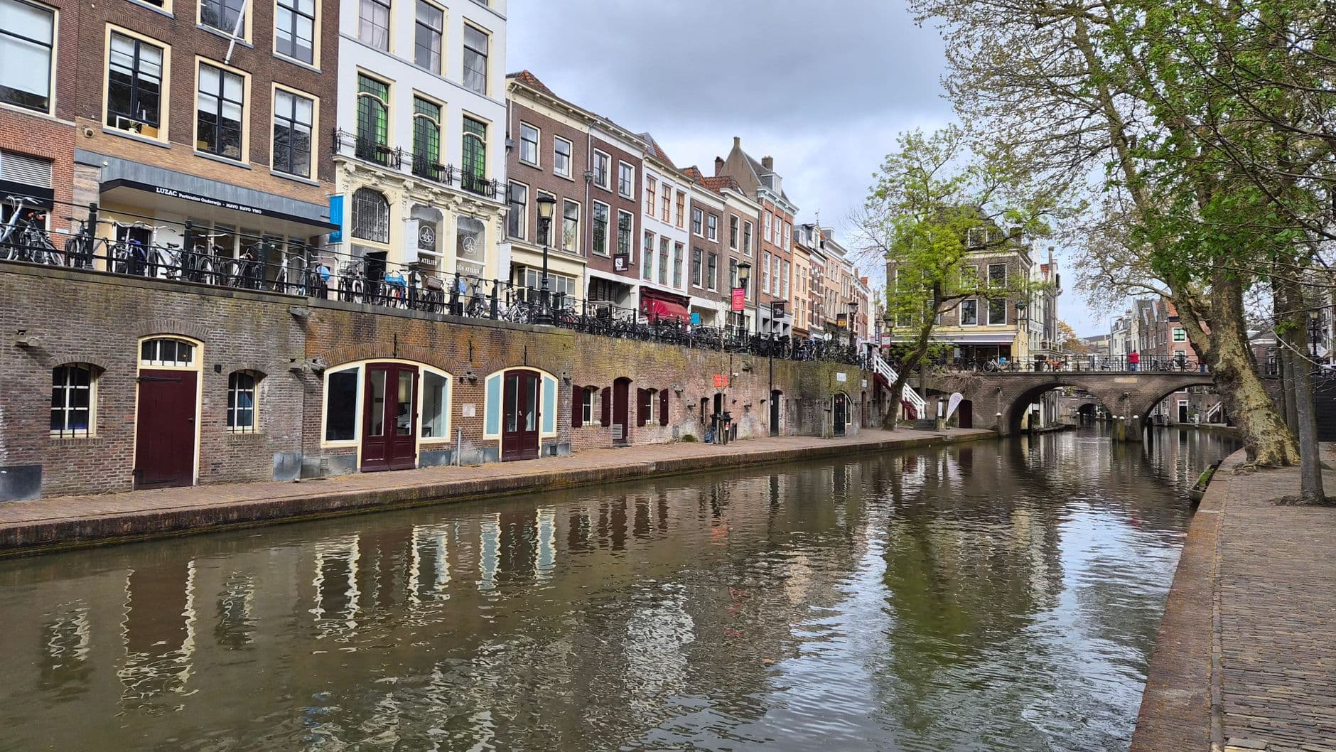
You are standing on a bridge, though it may not feel like one. This is the Stadhuisbrug, and Brug means bridge. It is one of the widest bridges on the canal, a broad paved square where the Oudegracht has been covered over and the water runs hidden beneath your feet. To one side stands the Stadhuis, the town hall, and its story is the whole city in miniature: private merchant houses that slowly became a public government. Back in thirteen forty-three, the city's aldermen relocated to a house called Hasenberg here on the Oudegracht, after their old meeting place was needed for the expansion of a nearby church. Over the centuries the town hall grew by swallowing its neighbours, chiefly Hasenberg and the twelfth-century house called Lichtenberg, both raised by prominent families. So the seat of city power was quite literally assembled out of the homes of the merchant elite. Now look at the heavy front you see today. That facade is not medieval. It dates to eighteen twenty-six through eighteen thirty, designed by the architect Johannes van Embden, in Bentheimer sandstone with a row of Doric columns, in the sober classical taste of its day. Beneath and behind that dignified stone front, the medieval house-plots survive, and Lichtenberg reportedly still keeps its medieval wharf cellar down at water level. Much later, between nineteen ninety-seven and the year two thousand, the Spanish architect Enric Miralles reworked the rear with strikingly modern additions, and Queen Beatrix reopened the building on the thirtieth of August, two thousand. So when you look at this town hall, read it in layers. A classical front, medieval merchant houses inside, a modern hand at the back, all sitting on a canal that the square itself conceals.
3. The Oudegracht: a harbour running through the town
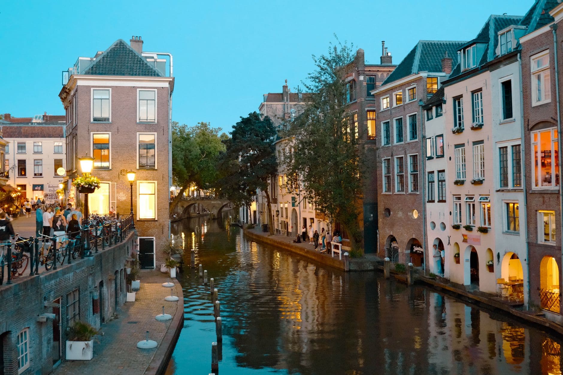
Stop at the edge and look down at the water. Notice how far below the street it sits. This is the Oudegracht, which simply means the Old Canal: Oude is old, Gracht is canal. It runs about two kilometres through the city, and it was the spine of medieval Utrecht's trade. This is not a decorative waterway. Think of it as an elongated inland harbour running right through the middle of town, linking the old Rhine channels and the Vecht so that boats could carry goods deep into the city. The southern part was begun in eleven twenty-two, after the Rhine's level here dropped because of a new dam built upstream at Wijk bij Duurstede. The northern stretch is older still, roughly around the year one thousand. Now, that low water is the whole secret. In Amsterdam the canals meet the streets almost at water level. Not here. In Utrecht the water runs well below the street, and that difference is not an accident, it is the enabling condition for everything else on this walk. The turning point came in twelve seventy-five, when the city finished its system of locks and the water level finally became constant, no longer rising and falling with the river. A steady water level meant you could build cellars down at the waterline that stayed permanently dry, and quays you could actually work from. As the historical record puts it, the finishing of the locks in twelve seventy-five is what made dry cellars and working quays possible. So hold two things in your mind as we go on. First, this canal was machinery. Second, its stubbornly low water is what let the city build a second street beneath the first.
4. The werf and the werfkelders: the second street
Here is the moment the whole tour has been building toward. Find the stone steps that lead down from the street, and go down. You have just left the upper street and arrived on the lower one. This lower quay is the werf, the wharf, and it runs almost continuously along the…
Full narration for this stop unlocks with the tour.
5. Winkel van Sinkel: the statue that fell in the canal
Look up at this facade and count the figures. Standing along the front are four cast-iron caryatids, the female support figures that appear to hold the building up, plus more cast-iron statues representing themes of commerce and trade. This is the Winkel van Sinkel, which means…
Full narration for this stop unlocks with the tour.
6. Weerdsluis: where the city met the river
You have followed the water north to the edge of the old city, to the Bemuurde Weerd, and here you reach the Weerdsluis. Sluis means lock. A lock is the hinge of a canal system: it lets boats pass between two stretches of water at different levels, and it lets the city hold its…
Full narration for this stop unlocks with the tour.
7. The Nieuwegracht: the same engineering, a quieter world
For our last stop, leave the working harbour behind and come to a canal that feels like its quiet twin. This is the Nieuwegracht, the New Canal: Nieuwe is new. And there is a gentle irony in that name, because this canal is not new at all. It was dug between thirteen ninety and…
Full narration for this stop unlocks with the tour.