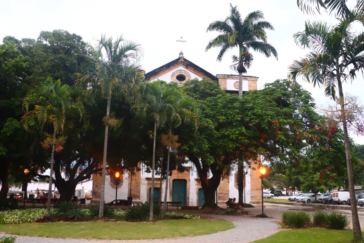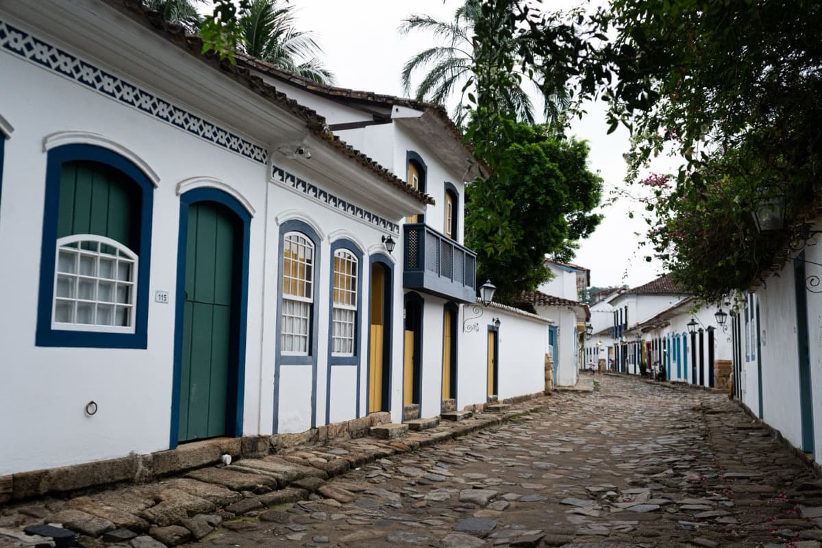
Walk the old commercial spine of Paraty, the Rua do Comercio, and the town asks you to look up at colonial fronts that have barely changed in centuries. The better instruction is to look down. The historic streets of Paraty are a working eighteenth-century sanitation machine: irregular stones called pe de moleque, laid on a deliberate slope so that high tides flood the town, wash the cobbles, and drain back to the sea. It is drainage with no moving parts, powered by the moon, and it still runs today.
Stones that look careless and are not
The paving underfoot is made of big, uneven stones that locals call pe de moleque, which translates roughly as kid's foot. They look rough, almost thrown down without a plan. The impression is wrong. The whole historic grid was laid with intention, pitched toward the water so the sea could do a job the town could not otherwise afford to do by hand.
The cleverness is in the grade. The streets slope gently down to the bay. On ordinary days that slope carries off rain. On the highest tides, the spring tides and the full-moon tides, the sea does the opposite of drain. It climbs. Seawater flows up into the streets through openings at the water's edge, spreads a shallow sheet across the stones, and then withdraws as the tide falls, carrying the day's debris back out with it. The water is not deep, a matter of centimeters, and it does not stay long. That is the entire point. It arrives, it rinses, it leaves.
This was not an accident that residents learned to tolerate. It was engineered into the town's eighteenth-century design, a way to keep a dense colonial settlement clean without sewers, pumps, or labor. The moon supplied the schedule. The builders supplied the slope. Between them they gave Paraty a self-flushing floor.
Why the sea was invited in
Hear a stop from this walk
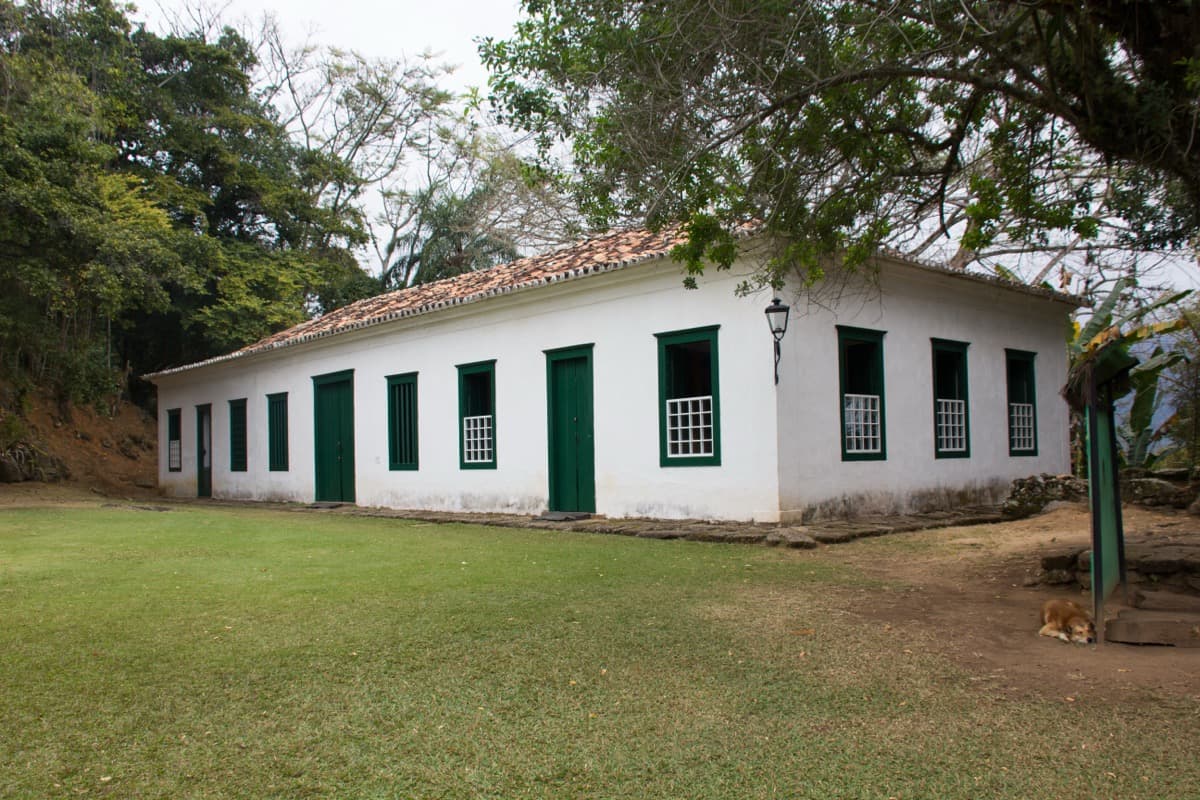
Forte Defensor Perpetuo
To understand why anyone would build a town that floods on purpose, you have to know what Paraty was for. In 1693, gold was discovered inland in the mountains of Minas Gerais, and this small stretch of the Rio de Janeiro coast became the Atlantic doorway where that mountain fortune was loaded onto ships for Lisbon. UNESCO's citation describes the gold route as the link that ran the wealth of the mines down to Paraty, where it was shipped to Europe. The town grew up entirely to serve the quay.
A port town handling gold, mule caravans, tools, and human cargo was a crowded, working place, and crowded working places generate waste. Fresh water and refuse management are the quiet problems every dense settlement has to solve. Paraty solved its refuse problem by reading the tide chart. The same bay that made the port possible was drafted into keeping the streets livable. The wealth that flowed through here paid for the whitewashed houses and the churches, but the humbler genius is in the ground: a public utility disguised as pavement.
A single technique from the sea to the mountains
The pe de moleque paving was not confined to the town. The same stone technique was used on the gold trail, the Caminho do Ouro, that climbed inland over the coastal mountains toward the mines. That trail was cut and paved by enslaved Africans over generations, following older paths first walked by Indigenous people. So the street you stand on and the mountain road that fed the port were built the same way, by the same hands, out of the same stones.
Hold that fact where you can feel it. The beauty of this pavement, the postcard texture that draws visitors, is inseparable from forced labor. Every stone in the street and every stone on the trail was set by people who were owned. The tidal cleaning system is elegant. Its construction was not gentle. Both things are true at once, and the honest way to walk Paraty is to carry both.
What UNESCO chose to protect
When Paraty and neighboring Ilha Grande were inscribed as a mixed World Heritage Site in 2019, the listing did something unusual. It treated the relationship between the town's layout and the water as part of the heritage, protecting the tidal interaction of the streets along with the buildings. In most heritage towns, the protected thing is the facade, the skyline, the object you photograph. Here the invisible engineering of the ground is protected too, and modern drainage is deliberately limited so the original hydrology is not altered.
That distinction matters. It means the heritage of Paraty is not only its pretty fronts but the slope of its streets and the openings that let the sea in. Change the grade, seal the openings, and you would be destroying the monument even if every wall stayed standing. The flooding is not a quaint side effect the town puts up with. It is part of what was declared worth keeping.
Standing on it
There is a plain reward in seeing the system work. On a spring tide or a full-moon tide the streets of the historic center still flood and drain, exactly as they were meant to, and if your timing is right you can watch a colonial town let the sea walk through its front rooms and leave them clean.
Two practical notes make that experience better. Wear closed shoes with real grip, because the stones are as uneven as they are clever and turn slick when wet. And check the tide before you wander, because on high water parts of the center flood by design, and you will want to plan your route and your footing around it rather than be surprised by it.
Then walk slowly. Let the working texture of the place settle in. This is a street that was built to be washed by the moon, and it has been keeping that appointment for roughly three hundred years. The full walk from the old port up to the hilltop fort reads a whole gold boom and bust into the built environment of Paraty, but it begins, honestly, at your feet.
Sources
- UNESCO World Heritage Centre, Paraty and Ilha Grande: Culture and Biodiversity (List 1308). The 2019 mixed inscription, the gold route linking Minas Gerais to the port of Paraty, and the protection of the historic center's relationship to the water.
- Wikipedia, Paraty. Founding, gold-route history, and the pe de moleque cobblestone streets of the historic center.
- OZY and other reporting on Paraty's intentional tidal flooding, describing the shallow spring and full-moon flooding through the historic center and its original eighteenth-century street-cleaning purpose.
- Roamer field research and tour transcript, The Gold Trail Port (Paraty). Fact-audited primary source for the pe de moleque slope, the tidal cleaning mechanism, and the shared paving with the Caminho do Ouro.
Brazil eSIM· 10% off with ROAMER10
Ready to experience it?
Historic Center: The Gold Trail Port
90 min · 2.7 km · easy
More from Paraty
Explore more at your own pace.
One Day in Paraty: A Walkable Colonial-Port Itinerary (2026)
Paraty Travel Guide: How Many Days, Getting There, When to Go (2026)

What to Eat in Paraty: A Caicara and Cachaca Food Guide (2026)
Forte Defensor Perpetuo: The Fort Built to Guard Paraty's Gold

How Cachaça Made Paraty Rich, Then Became the Town's Own Name