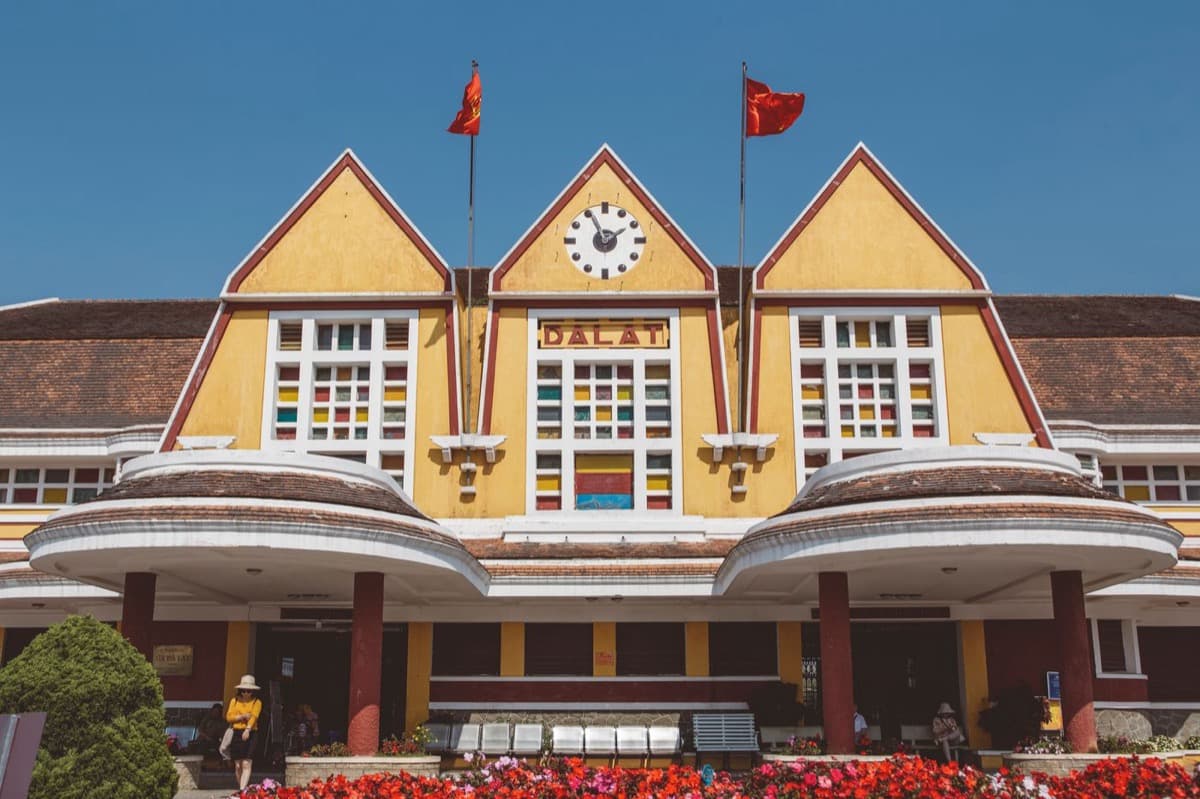
The story of how a homesick empire built a small piece of France on a cool Vietnamese mountain, and the city that later reclaimed it. Six stops through Da Lat's Art Deco railway station, red-brick lycee, palace hotel, and rooster-topped cathedral.
Start · Lycee Yersin: The School That Names the Founder
DirectionsStops
- 1
Lycee Yersin: The School That Names the Founder
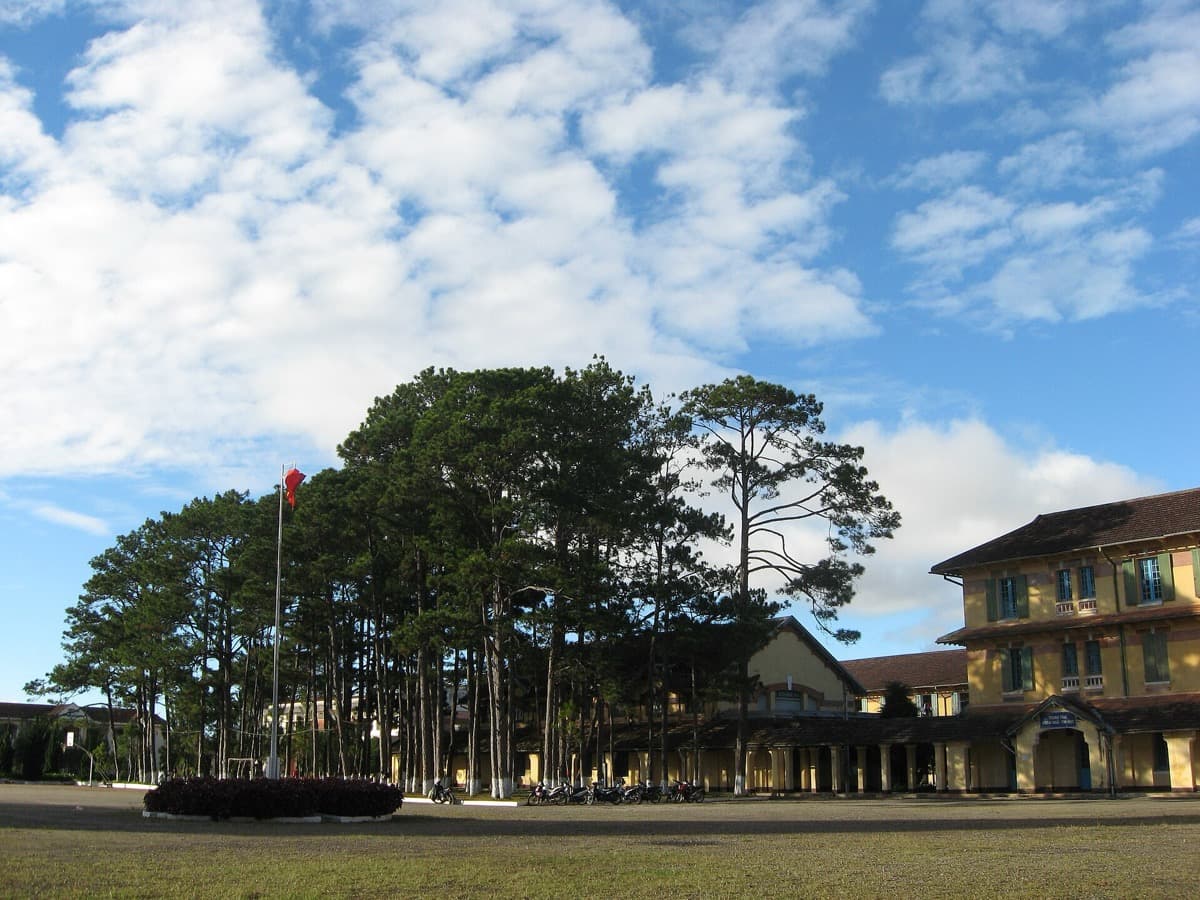
A long crescent of imported red brick, named for the doctor who found this plateau and set the whole town in motion.
- 2
Da Lat Railway Station: The Climb Out of the Heat
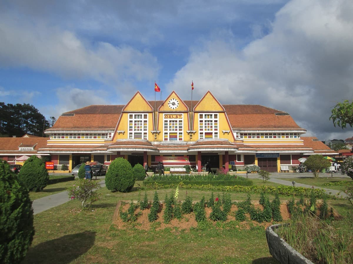
An Art Deco terminus with three mountain-peak roofs, the gateway of the cog railway that hauled France up onto the plateau.
- 3
The French Villa Quarter: Homesickness in Stone
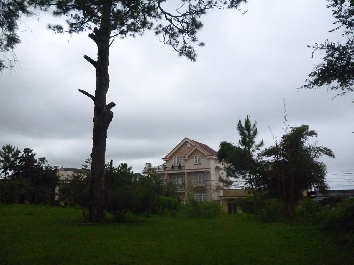
Streets of steep-roofed colonial villas set in pine gardens, an empire rebuilding the European countryside it missed.
- 4
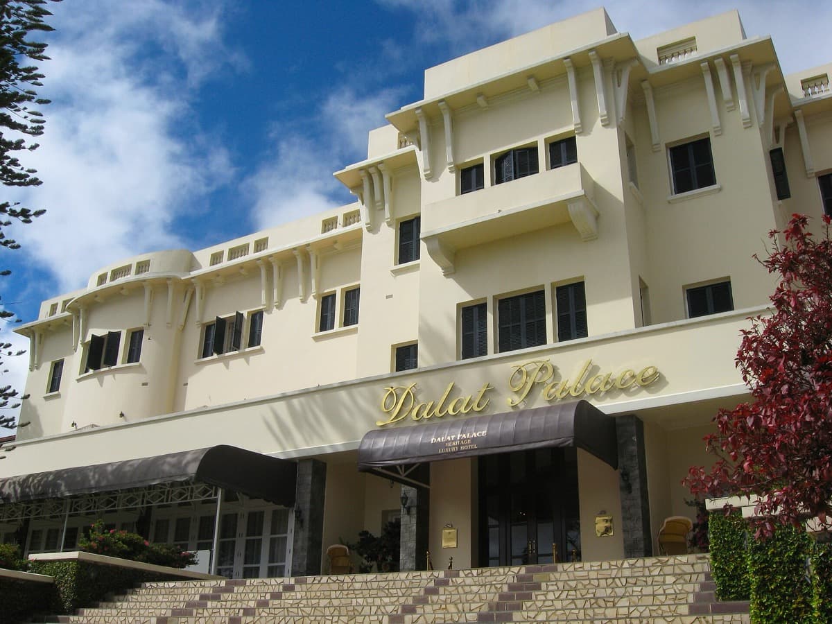
Dalat Palace Hotel: Leisure and Power by the Lake
The ridge's grandest address, a colonial pleasure palace above Xuan Huong Lake and the reward at the top of the railway.
- 5
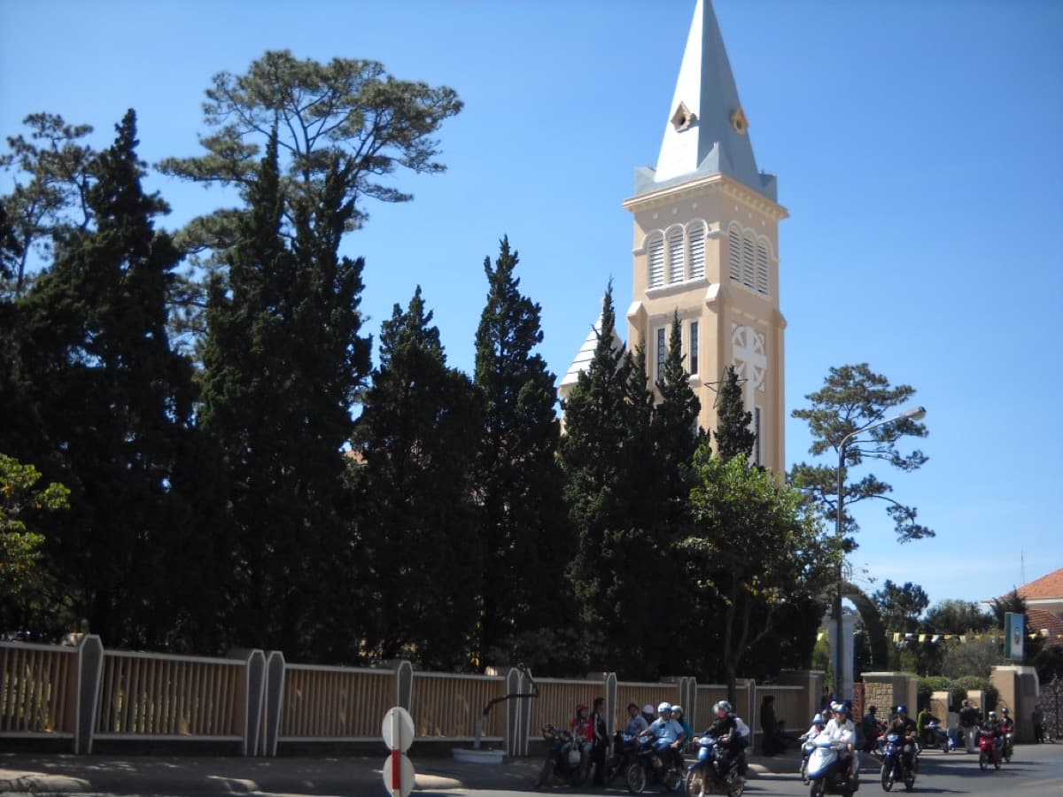
St Nicholas Cathedral: The Rooster Facing Home
The Chicken Church, whose spire carries a rooster weathervane read as both the Gallic cock and a Gospel symbol.
- 6
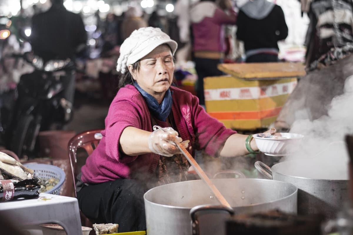
Hoa Binh Square: The City That Kept the Stage
The old French market square, now a Vietnamese civic heart where the town lives on the core the empire laid out.
Details
Best Time to Visit
Da Lat stays cool and spring-like all year, so the light and the temperature are pleasant almost any day. The dry season, roughly from December through March, gives the clearest skies and the easiest walking. In the wetter months, from about May through October, mornings are usually bright and the rain tends to arrive in the afternoon, so start early. Weekday mornings are calmest at the station and the square; weekends draw larger Vietnamese crowds.
Pro Tips
- •Bring a light jacket or layer even on sunny days. The air near fifteen hundred metres stays cool, and it turns chilly once clouds or evening arrive.
- •Start early, especially in the wet season. Clear mornings often give way to afternoon rain, and the light on the station and cathedral is best before midday.
- •At the Lycee Yersin, admire the curved facade and bell tower from outside. Interior access for visitors has been restricted in recent years.
- •The railway station usually charges a small fee, a few thousand dong, to step onto the platform among the old rail cars. The forecourt and exterior are free.
- •The cathedral is a working church. Time your visit outside Mass, and if a service is underway, keep to the edges and stay quiet.
- •Distances between some stops are longer than the map suggests, and the town is hilly. If your legs tire, a short taxi or motorbike ride between sites is easy to find.
Safety & Precautions
- •Da Lat sits near fifteen hundred metres and the streets rise and fall steeply. Pace yourself on the climbs, and give the thinner mountain air a little respect if you have just arrived from the lowlands.
- •Weather shifts fast on the plateau. It can be warm and bright one hour and cool and raining the next, so carry a layer and a compact rain cover.
- •The churches and pagodas are active places of worship. Dress modestly with shoulders and knees covered, lower your voice, and follow any signs about photography or entry.
- •Pavements are often uneven, sloped, or broken, and a few legs between sites are genuinely long. Wear sturdy, closed shoes and watch your footing, especially where stone or tile is wet.
Travel advisory: Exercise Normal Precautions (Level 1).
Gallery
Related Reading
Go deeper on what you'll see, hear, and walk through.
Overview
Best Self-Guided Walking Tours in Da Lat (2026)
3 min
Overview
Da Lat Travel Guide: How Many Days, Getting Around, When to Go (2026)
5 min
Overview
How to See Da Lat: A Borrowed France That Vietnam Kept
6 min
Overview
One Day in Da Lat: A Walkable Hill-Station Itinerary (2026)
6 min

Thematic
What to Eat in Da Lat: A Food Guide (2026)
5 min
Companion
The Empire of Homesickness: How France Built Da Lat to Hide From Vietnam
7 min
Deep dive
The Cog Railway That Hauled France Up a Mountain: Da Lat's Art Deco Station
6 min
Read the walk
The full story of Hill Station: The Empire's Escape, in words. Prefer to listen? Play it narrated, from home or on location.
Introduction
High in the southern highlands of Vietnam, near fifteen hundred metres above the sea, sits a town that never quite believed it was in the tropics. Da Lat was imagined by the French as a refuge from the heat of the lowlands, and over a single generation they assembled a small alpine Europe on this ridge: an Art Deco railway station, a spired cathedral crowned with a rooster, a palace hotel above a lake, and a long curved school of red brick imported from home. This walk reads Da Lat as an act of homesickness, an empire building a piece of the country it missed in order to hide from the country it ruled. And it ends on the Vietnamese city that inherited that borrowed France and made it its own.
There are six stops, and together they cover roughly eight kilometres over about three hours, near a hundred and eighty minutes of walking, though the town is hilly and spread out, so let the timing bend to your own legs. The stops are short and easy to skip. If a leg feels long, that distance is part of the story, because the French laid this town out as a landscape, not a grid. Bring a light layer, since the mountain air stays cool even under a bright sun.
You will move from a school named for the man who found this plateau, down through the station, the villa streets, the grand hotel, and the cathedral, and out into the living square at the heart of it all. When you arrive at the Lycee Yersin, begin with stop one.
1. Lycee Yersin: The School That Names the Founder
Start with a question this building forces on you: why is there a curved French lycee, built of red brick, standing on a mountain in southern Vietnam? The answer begins with the name carved into the school itself. It honors Alexandre Yersin, a bacteriologist who in the year eighteen ninety-three climbed onto a cool pine plateau near fifteen hundred metres, up in the Lang Biang highlands. He did not build a town here. He found the plateau, and a few years later, around eighteen ninety-seven, he urged the colonial governor-general, Paul Doumer, to build a mountain sanatorium on it, a place where the French could escape the heat of the lowlands. Da Lat grew out of that suggestion.
The school came later. By the college's own history, it was created by decree on July sixteenth, nineteen twenty-seven, and opened that September as the Petit Lycee de Dalat. On May tenth, nineteen thirty-five, it was renamed the Lycee Yersin, in the doctor's honor. The French architect Paul Moncet gave it that unmistakable curved main wing, a long crescent of red brick imported all the way from Europe, with a bell tower rising some fifty-four metres. If you look closely at the brickwork, you can still find the faint traces where a large clock once sat.
Its classrooms taught remarkable pupils, among them Bao Dai, the last emperor of Vietnam, and a future king of Cambodia. Today it serves as a teachers' college, and access inside has been limited in recent years, so the exterior is the landmark. Take your time with the curve. Everything else on this walk flows from the man this school is named for. Whenever you are ready, move on at your own pace.
2. Da Lat Railway Station: The Climb Out of the Heat
The station in front of you is the reason Da Lat could exist at all. To turn a cool plateau into a working refuge, the French had to haul themselves up out of the delta heat, and that meant a railway that could climb a mountain. By the railway record, the Da Lat to Thap Cham line ran about eighty-four kilometres from the coastal plain up to this ridge, rising roughly fourteen hundred metres along the way. Ordinary rails cannot grip a slope that steep, so engineers built three rack sections, a toothed cog rail down the center that a locomotive's gear could bite into, and they cut five tunnels through the highlands. It was a feat of stubborn engineering in the service of comfort.
The building itself was designed in nineteen thirty-two and opened in nineteen thirty-eight, the work of the French architects Moncet and Reveron. Look at the roofline. Those three steep peaks are Art Deco, but they also echo the tall communal houses of the Central Highlands peoples, and they are said to stand for the three summits of Lang Biang mountain. Some travelers see in them a memory of a seaside station back in Normandy. Either way, the message is the same: an alpine gateway on a tropical mountain.
After the war the line fell silent, and for decades the tracks lay largely unused. It was recognized as a national historic monument in the year two thousand one. A short seven-kilometre stretch, running out to the village of Trai Mat, reopened for visitors in the nineteen nineties, so you can still ride a small piece of the climb. There is usually a modest fee to step onto the platform. Linger over the old rails, then carry on when you like.
3. The French Villa Quarter: Homesickness in Stone
Leave the grand public buildings for a while and walk into the streets where the French actually lived. Da Lat still holds well over one thousand villas from the colonial era, one of the largest collections of its kind in the country, and the houses along this quarter are the…
Full narration for this stop unlocks with the tour.
4. Dalat Palace Hotel: Leisure and Power by the Lake
Now the ridge shows its grandest face. Above Xuan Huong Lake stands the palace hotel, opened in nineteen twenty-two as the Lang-Bian Palace Hotel, the address where colonial leisure and colonial power fused into one long veranda. Its design was drawn up before the First World…
Full narration for this stop unlocks with the tour.
5. St Nicholas Cathedral: The Rooster Facing Home
Even the town's worship faced homeward. The cathedral rising ahead is dedicated to Saint Nicholas, and it is the mother church of the Catholic diocese of Da Lat. Its cornerstone was laid on July nineteenth, nineteen thirty-one, by an archbishop named Colomban Dreyer, and yet the…
Full narration for this stop unlocks with the tour.
6. Hoa Binh Square: The City That Kept the Stage
The walk ends where the town has always gathered. This is the Hoa Binh area, the old central square, laid out by the French as the Place du Marche, the market place, at the commercial heart of their hill station. A wooden market roofed in corrugated iron stood here from about…
Full narration for this stop unlocks with the tour.