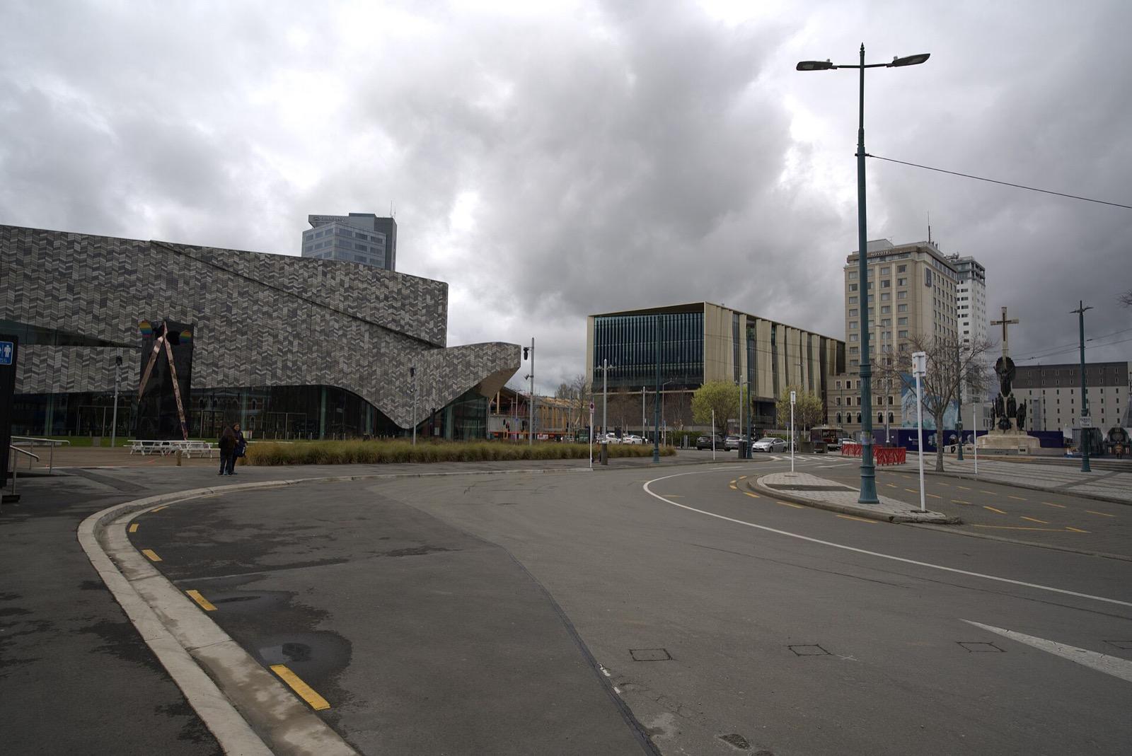
A flat walk through the rebuilt heart of Christchurch, reading both the grief of the twenty eleven earthquake and the patient, visible work of putting a city back together.
Start · Cathedral Square: The Centre of the Planned City
DirectionsStops
- 1
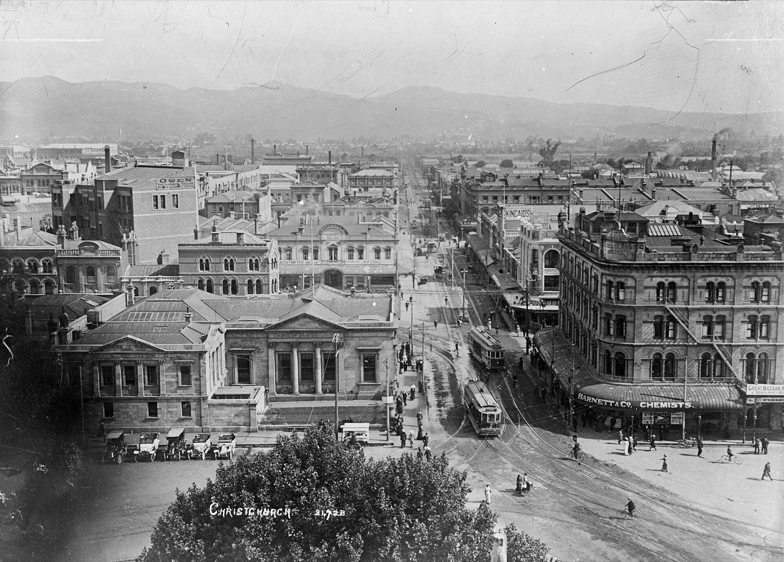
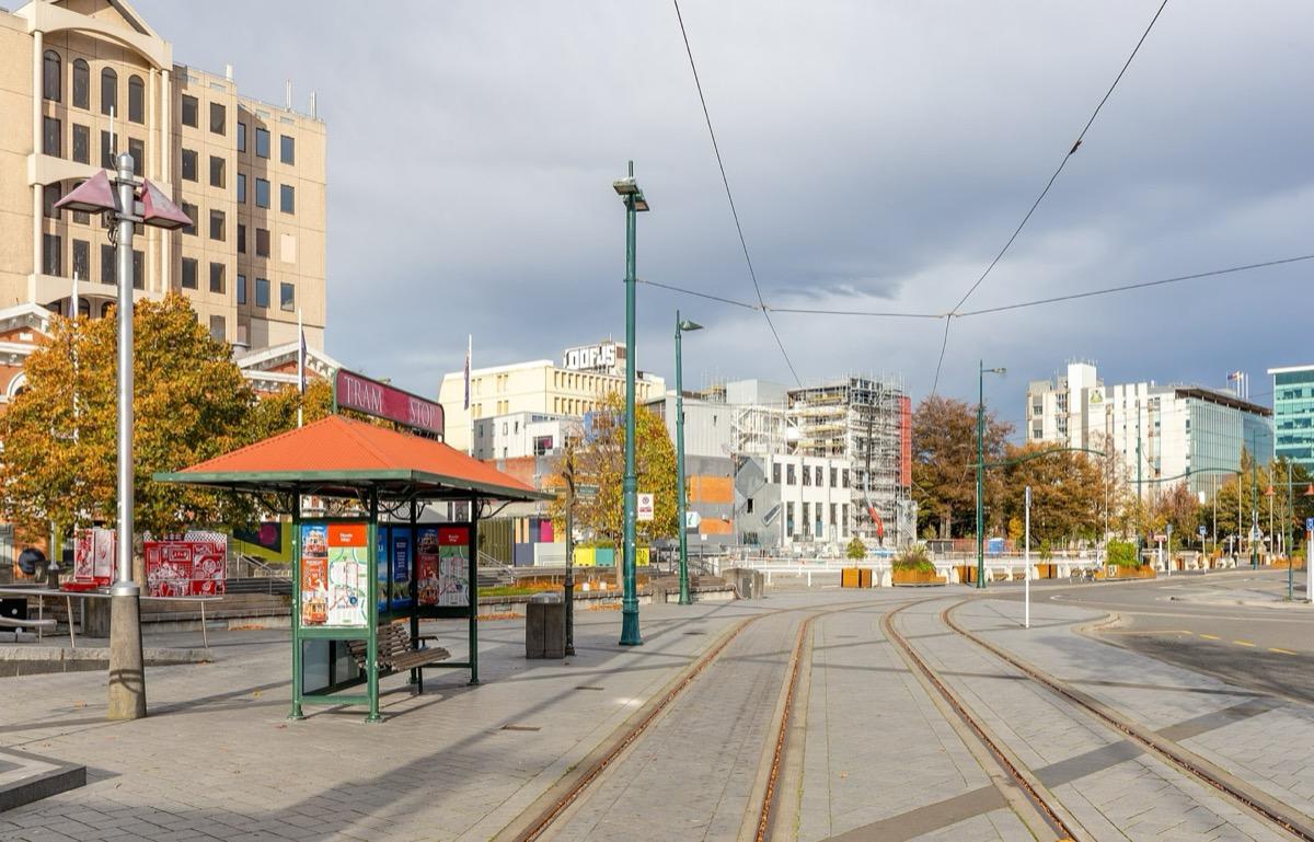
Cathedral Square: The Centre of the Planned City
The geographical and symbolic heart of the planned city, laid out around a cathedral and now the focus of the whole recovery.
- 2
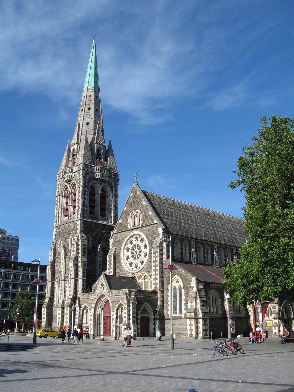
ChristChurch Cathedral: The Fallen Spire
The wounded stone cathedral whose spire fell in the earthquake and became the image of the broken city, now slowly being raised again.
- 3
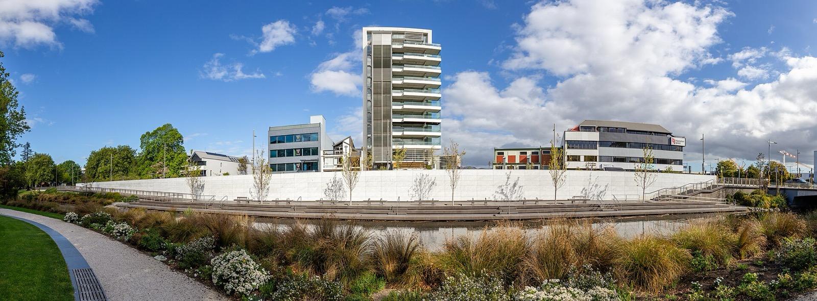
Oi Manawa: The Wall That Names the Dead
A long curved marble wall stands by the quiet river. It carries the names of every one of the one hundred and eighty-five people who died.
- 4
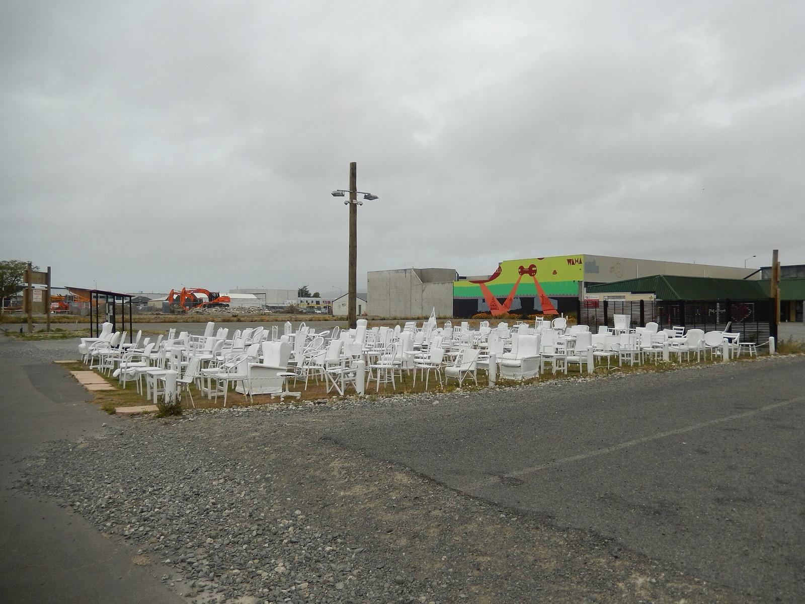
The 185 Empty Chairs: One for Each Life
The memory of one hundred and eighty-five white chairs, one for each person who died, since carried home by the people of the city.
- 5
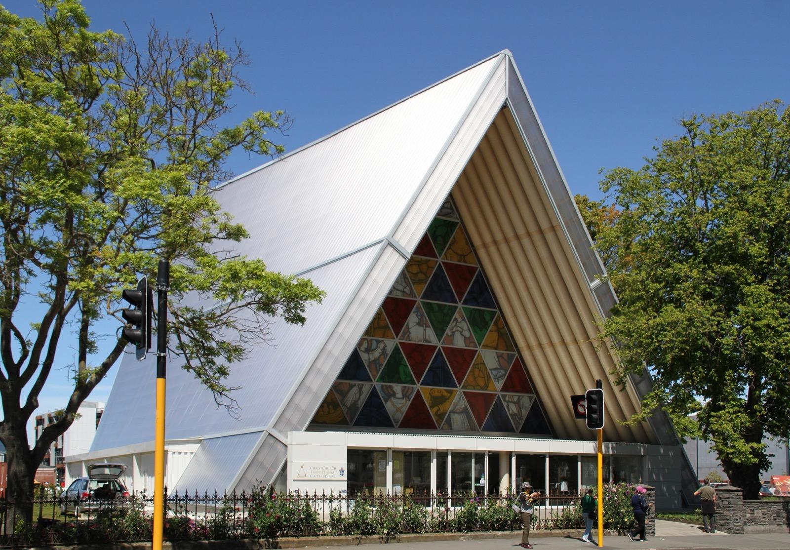
The Transitional Cathedral: Faith Built of Cardboard
The remarkable cathedral built largely of cardboard tubes that carried the city's faith through the long years of rebuilding.
- 6
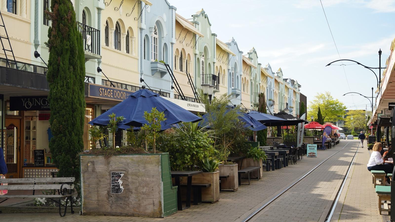
New Regent Street: Colour Brought Back
A pastel Spanish Mission shopping lane brought lovingly back to life, with the old heritage tram gliding through.
- 7
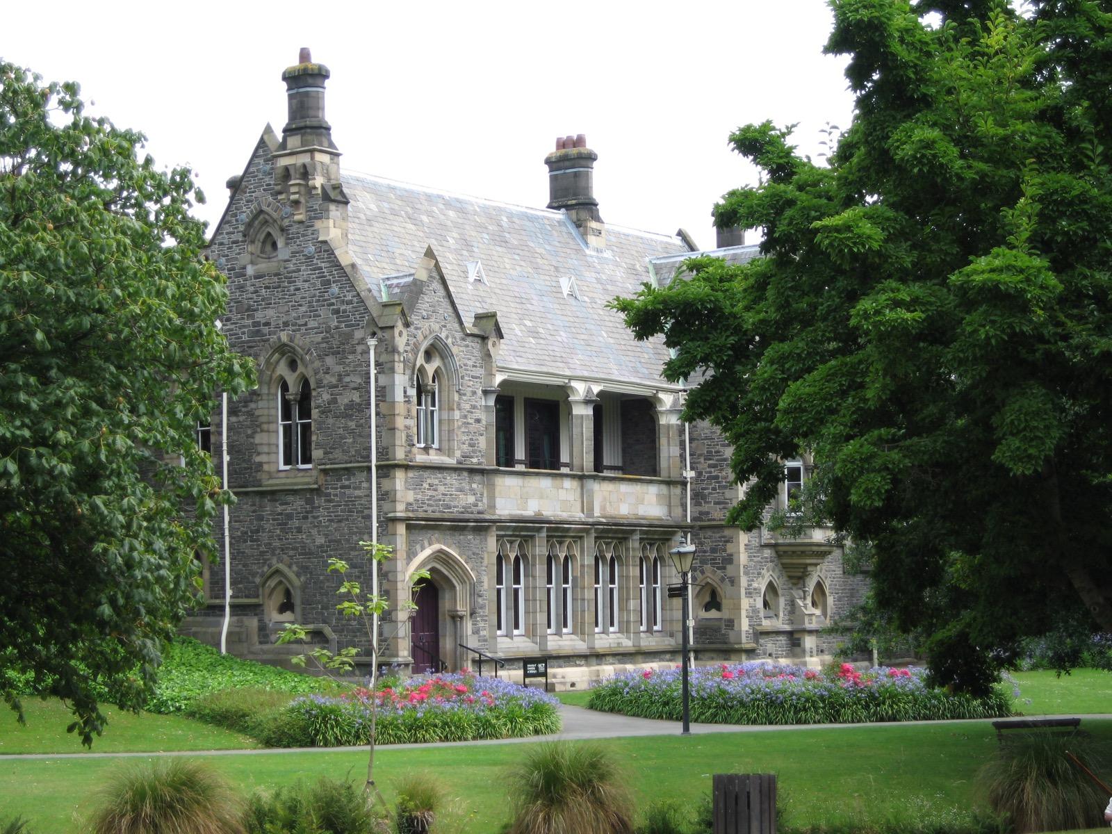
The Provincial Council Buildings: A Stone Chamber Reassembled
The only purpose-built provincial parliament house left in New Zealand, its Gothic stone chamber shattered by the quake and now being pieced back together.
Details
Best Time to Visit
Late morning to mid-afternoon is ideal, when the square and the river terraces are gently busy and the light is good for the pastel shopfronts of New Regent Street. Spring and autumn bring the mildest Canterbury weather, though the walk works in any season on the flat plain. If you can, visit on a clear day so the exposed rebuild sites and the marble memorial wall read at their best.
Pro Tips
- •The whole route is flat and easy, on level ground across the Canterbury plain, so you can take it slowly and comfortably at your own pace.
- •Give yourself extra time at Oi Manawa, the earthquake memorial wall by the river; it rewards a slow, quiet reading of the names rather than a quick look.
- •Time your pass through New Regent Street to catch the heritage tram gliding down the lane, and pause to look up at the arched, pastel shopfronts.
- •The Transitional Cathedral is a working cathedral open to visitors, so step inside when it is open and a donation, or koha, is appreciated.
- •Remember that the one hundred and eighty-five empty chairs no longer stand as a single installation; carry it as a memory rather than looking for a field of chairs on site.
- •Both the ChristChurch Cathedral and the Provincial Council Buildings are active rebuild sites, so read them from outside and expect fencing and construction around them.
Safety & Precautions
- •Oi Manawa and the other earthquake sites mark deep and recent grief for the people of Christchurch, where quiet respect matters most; keep your voice low and your pace slow, and treat the named dead as real people.
- •The ChristChurch Cathedral and the Provincial Council Buildings are live rebuild and construction sites, so stay outside the fences and follow any posted safety signage.
- •Canterbury weather is changeable and can turn quickly, so carry a waterproof and sun protection even on a fine morning.
- •This is an ordinary city centre, so keep valuables discreet and stay aware of traffic and tram movements, and note that some museums and historic sites elsewhere in the city charge entry in New Zealand dollars.
Travel advisory: Exercise Normal Precautions (Level 1).
Gallery
Related Reading
Go deeper on what you'll see, hear, and walk through.
Overview
Best Self-Guided Walking Tours in Christchurch (2026)
3 min
Overview
Christchurch Travel Guide: Days, Transport, Weather, Safety, Budget
6 min
Overview
One Day in Christchurch: A Walkable Morning-to-Evening Itinerary
7 min
Thematic
Christchurch: The Garden City That Rebuilt Its Heart
8 min
Companion
The Fallen Spire: Reading Christchurch's Rebuild from Cathedral Square
7 min
Deep dive
The Cardboard Cathedral: How Christchurch Built Faith From Paper Tubes
7 min
Read
What to Eat in Christchurch: Canterbury Lamb, Akaroa Salmon, and How to Order Like a Local
6 min
Read the walk
The full story of Cathedral Square: A City Rebuilt from the Rubble, in words. Prefer to listen? Play it narrated, from home or on location.
Introduction
This is a walk through the centre of Christchurch, New Zealand, a garden city on the flat Canterbury plain that was broken by a shallow earthquake at twelve fifty-one in the afternoon on the twenty-second of February twenty eleven, and has spent more than a decade putting itself back together. The land here is the Country of Ngai Tahu, the iwi, or people, who hold mana whenua, customary authority, over Otautahi, the Maori name for Christchurch. Over seven stops, across about three and a half kilometres and roughly ninety minutes at an easy pace, you read both the loss and the deliberate act of rebuilding. There is the wounded stone cathedral whose fallen spire became the image of the broken city. There is a curved marble wall by the river that names all one hundred and eighty-five people who died. There is a memory of one hundred and eighty-five white chairs, a cathedral built of cardboard tubes, a pastel shopping lane brought back to life, and a Gothic stone parliament house being pieced together again. This is your own quiet map, at your own pace, with no group, no schedule, and no one steering you. Linger as long as you need at a place of real and recent grief, or move quickly through the parts that ask less of you. Some stops are active rebuild sites and some are places of mourning, so carry a slow and respectful pace where it matters. When you arrive at Cathedral Square, begin with stop one.
1. Cathedral Square: The Centre of the Planned City
You are standing in the centre of Christchurch, and it was designed to be exactly that. When the settlement was surveyed in eighteen fifty, the plan set Cathedral Square at the crossing of the two main streets, Colombo Street and Worcester Street, and reserved it for the cathedral that would give the whole city its name. Christchurch was planned by the Canterbury Association as a Church of England settlement, and the square was meant to be its physical and symbolic heart. Around you, over the years, the city gathered its landmarks: a statue of one of the settlement's founders, unveiled in eighteen sixty-seven and described as the first public statue in New Zealand; a war memorial; and a modern sculpture of stacked leaf forms revealed in two thousand and one. Long before any of this, though, this was Maori land. Ngai Tahu are mana whenua here, the iwi holding customary authority, and before them lived Waitaha and Ngati Mamoe. The Maori name for the city is Otautahi, taken from the Ngai Tahu chief Tautahi, whose settlement stood on the banks of the Otakaro, the river the settlers renamed the Avon. Since the earthquake of twenty eleven, this square has been the focus of the city's rebuilding as much as its daily life. What was planned as the centre of a new town has become the centre of a long recovery. The empty spaces, the fenced sites, and the slow return of buildings all read from here. This is where the story of the rebuilt city begins, at the point it was always meant to begin.
2. ChristChurch Cathedral: The Fallen Spire
On the east side of the square stands the ChristChurch Cathedral, and its story is the story of the whole city in one building. Its cornerstone was laid on the sixteenth of December eighteen sixty-four. The design came from the English architect George Gilbert Scott, working in an early Gothic Revival style in stone, and from eighteen seventy-three the New Zealand architect Benjamin Mountfort served as supervising architect and adapted the tower and spire. The nave and tower were consecrated on the first of November eighteen eighty-one. The spire rose sixty-three metres, about two hundred and seven feet, above the square, and for generations it was the mark you steered by. Earlier earthquakes, in the eighteen eighties and in nineteen oh one, had each damaged that spire, and in time the upper part was rebuilt in timber sheathed in copper. Then, at twelve fifty-one in the afternoon on the twenty-second of February twenty eleven, the spire was completely destroyed, leaving only the lower half of the tower standing. That image, the cathedral with its spire torn away, became the enduring picture of the broken city. Heritage New Zealand records list the building as Category One, its highest heritage class, dated the seventh of April nineteen eighty-three. For years the city argued over whether to demolish it or save it. The answer, eventually, was to reinstate it. The reinstatement project stalled over funding, then restarted, with work aiming to bring the cathedral back over the years ahead. So you are looking at a wound that is being closed, slowly, stone by stone, in full public view.
3. Oi Manawa: The Wall That Names the Dead
Now the walk comes to the river, and to the hardest and quietest place on it. This is Oi Manawa, the Canterbury Earthquake National Memorial. It opened to the public on the twenty-second of February twenty seventeen, the sixth anniversary of the earthquake. It stands on the south bank of the Otakaro, the Maori name for the Avon River, and it takes the form of a long, gently curved wall that follows the river's bend for more than one hundred metres, about three point six metres high. The wall is clad in Italian Carrara marble, and set into it are the names of the one hundred and eighty-five people who died. A wide terrace with seating and trees separates the wall from the water, so there is room to stand, or sit, and simply read. The earthquake that these names record struck at twelve fifty-one in the afternoon on the twenty-second of February twenty eleven. It measured magnitude six point three, and it killed one hundred and eighty-five people. Of those, one hundred and fifteen died in the collapse of a single building, the Canterbury Television building. The memorial was a joint project of the New Zealand Government, the Christchurch City Council, and Te Runanga o Ngai Tahu. It was Ngai Tahu who gifted the name Oi Manawa, which means the tremor, or quivering, of the heart. The Christchurch City Council's memorial record describes it that way. There is nothing to do here but take your time. These are real people, named one by one, and the wall gives each of them their place.
4. The 185 Empty Chairs: One for Each Life
As you walk on from the river, it is worth carrying with you the memory of another memorial, one that no longer stands as a single field. It was known as the one hundred and eighty-five empty chairs, and it was made by a local artist, Peter Majendie. On the twenty-second of…
Full narration for this stop unlocks with the tour.
5. The Transitional Cathedral: Faith Built of Cardboard
At the corner of Hereford and Madras Streets, opposite Latimer Square, stands one of the most surprising buildings of the whole rebuild. It is the Transitional Cathedral, and almost everyone calls it the Cardboard Cathedral. It opened on the sixth of August twenty thirteen. The…
Full narration for this stop unlocks with the tour.
6. New Regent Street: Colour Brought Back
After the sober places, the walk gives you a little colour, and it is more than earned. This is New Regent Street, a short terraced lane of little shops that opened on the first of April nineteen thirty-two. That date matters, because it was the depths of the Depression, and the…
Full narration for this stop unlocks with the tour.
7. The Provincial Council Buildings: A Stone Chamber Reassembled
The walk ends by the river again, at the Canterbury Provincial Council Buildings. These were designed by the architect Benjamin Mountfort and built in stages between eighteen fifty-eight and eighteen sixty-five. The foundation stone was laid in January eighteen fifty-eight, the…
Full narration for this stop unlocks with the tour.