Barranco: The Bridge of Sighs and the Way Down to the Sea
65 min · 1.8 km · easy
Miraflores is the district of Lima most visitors sleep in, and it is easy to take it for a purely modern place: towers along the avenues, a shopping center, a cliff-top run of parks above the Pacific. It began as a seaside village. When the widened Calle Larco was opened as an avenue on 30 July 1941, the mayor, Daniel Ruzo, told the crowd they were watching a village resort turn into a modern city: in 1907 Miraflores had 1,258 people, and now it had 50,000. The Miraflores: The Village That Walked to the Edge walk follows that avenue from the park at the district's heart to the cliff where the city stops.
The village center
Parque Kennedy is the district's front room. It is really two halves of the old Parque Central, one renamed for John F. Kennedy and the other called Parque 7 de Junio, and it is famous for its cats. In the 1990s the town let the first cats in to deal with rats; residents then began abandoning their own pets there, and the colony grew. Today there are more than a hundred, looked after by volunteers who find them homes, and the municipality has been microchipping them since 2023.
Beside the park stands the church of the Virgen Milagrosa, designed by Ricardo de Jaxa Malachowski, the architect of the Archbishop's Palace on Lima's Plaza Mayor and of the Government Palace front across from it. He worked on the church from 1928, and it was finished in 1939. Nearby, the Municipal Palace came out of a competition of 1939, won by the architect Luis Miró Quesada Garland with a neocolonial design, and was finished in 1944. Look at its corner: the tower is turned forty-five degrees to face the park, which the architect explained as a tribute to civic power and a nod to the town halls of Flanders.
Tarata
Hear a stop from this walk
Mirador Catalina Recavarren: The Edge of the Pacific
A block away, Calle Tarata is a short pedestrian street of cafés and apartment blocks. On 16 July 1992, at about 9:20 at night, the Shining Path set off a car bomb here, loaded with about 400 kilos of explosives. According to Peru's Truth and Reconciliation Commission, the target was a bank on the corner of Avenida Larco, whose back faced Tarata; when guards would not let the car park, the driver let it roll down into the residential block. Twenty-five people were killed and 155 were injured. Two years later the city unveiled a granite memorial in a pool of water on the street, and every 16 July the municipality holds a ceremony there.
Down the avenue to the cliff
Avenida Larco carries the name of José A. Larco, an Italian who came to Peru in 1838, founded the Banco Italiano and was mayor of Miraflores in the early 1890s. He is not the archaeologist Rafael Larco of the Larco Museum. Before 1941 the street was winding and cobbled; widening it took fifteen months, and the new avenue was seen as an extension of Avenida Arequipa.
At its sea end the avenue meets Parque Salazar. It is named for Alfredo Salazar Southwell, a twenty-four-year-old air force pilot who, on 14 September 1937, steered his failing biplane away from the houses and came down on the cliff; his monument, with a condor, dates from 1953. Below the park, Larcomar, a shopping center completed in 1998, was built down into the cliff, so the view from the park stays open. A statue of Paddington, the bear from darkest Peru, looks out from the promenade.
A cliff of river gravel
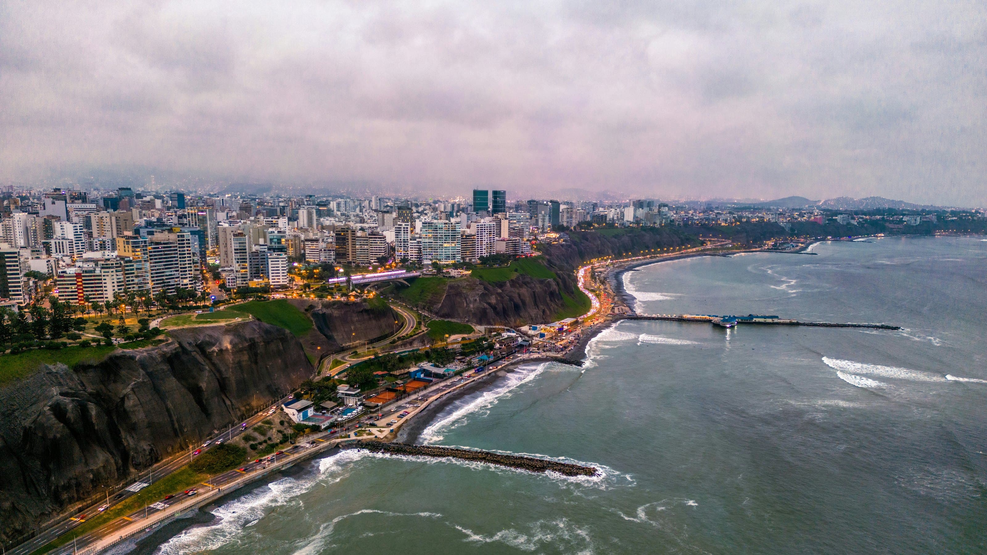
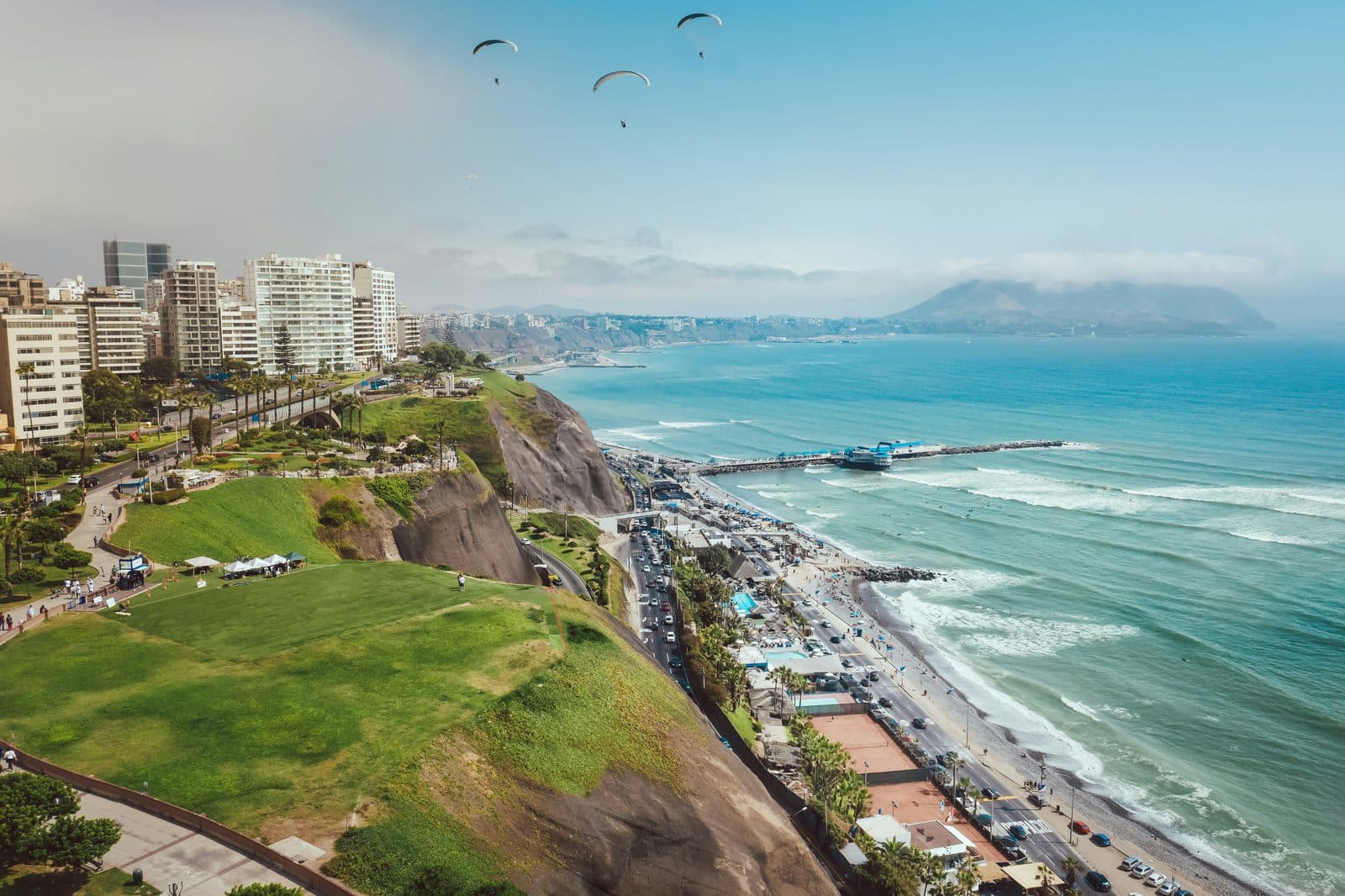
From here the walk follows the malecón along the edge. The cliffs of Miraflores run for about four and a half kilometres and stand fifty to seventy metres high. They are not rock. Peru's Geophysical Institute describes them as part of the fan of gravel and sand laid down by the Rímac and Chillón rivers, cut back by the sea. That is why they crumble: an earthquake on 15 June 2025 shook stones down along the whole cliff, and constant watering of the cliff-top parks opens cracks up to two and a half metres deep. On a desert coast where it almost never rains, every lawn up here is irrigated, and the gravel pays for it.
The parks along the edge each carry a story. Parque Intihuatana holds a stone sculpture by the painter Fernando de Szyszlo, and below it Playa Makaha is a favourite of Lima's surfers. The Puente Villena Rey crosses a ravine cut into the cliff, the old road down to the beach: the first bridge dates from 1967, and its twin, 114 metres long, was handed over in 2016. In the Parque del Amor, Víctor Delfín's concrete couple, El Beso, three metres high and twelve long, lies on the lawn, modelled on the sculptor and his partner, María Ortiz, beside curving mosaic benches set with words about love.
Riding the wind
The walk ends at Parque Raimondi, named for the Milan-born naturalist Antonio Raimondi, who arrived in Peru in 1850 and wrote "El Perú". Here the cliff shows its other gift. The sea breeze hits the cliff and is pushed upward, and paragliders ride it. Since December 2023 tandem flights have taken off from the park's launch site under an agreement between the municipality and associations of certified pilots, by day, whenever the wind allows.
The walk is eleven stops and a little under three kilometres, about an hour and a half, level or gently downhill with no stairs. It is a daytime walk. If you want more of the coast afterwards, our Barranco walk starts a short taxi ride south along the same cliff, and our historic center walk passes his Archbishop's Palace and Government Palace.
Ready to experience it?
Barranco: The Bridge of Sighs and the Way Down to the Sea
65 min · 1.8 km · easy
More from Lima
Explore more at your own pace.
Best Self-Guided Walking Tours in Lima (2026)
Lima Travel Guide: How Many Days, Getting Around, When to Go (2026)
One Day in Lima: A Coast-to-Colonial Itinerary (2026)
Best Culture Walking Tours in Lima (2026)

What to Eat in Lima: A Food Guide (2026)