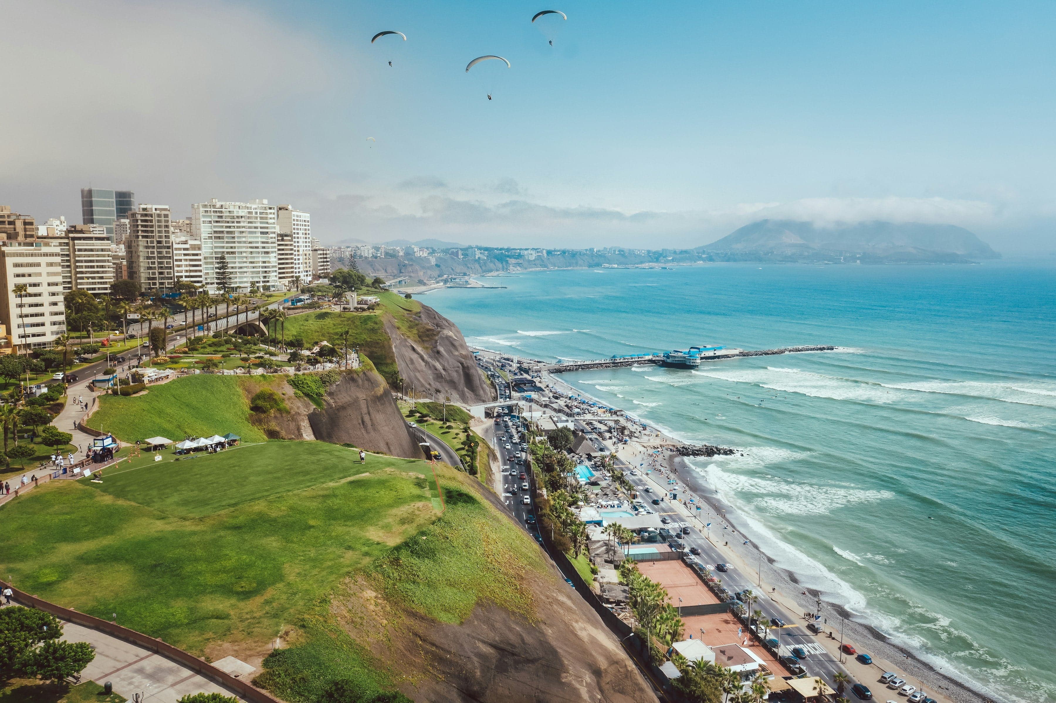
From Parque Kennedy and its cats past the church, the town hall and the Tarata memorial, down Avenida Larco to Larcomar in the cliff, then along the cliff-top parks over the Pacific to El Beso and the paraglider launch.
Start · Parque Kennedy: The Park and Its Cats
DirectionsStops
- 1
Parque Kennedy: The Park and Its Cats
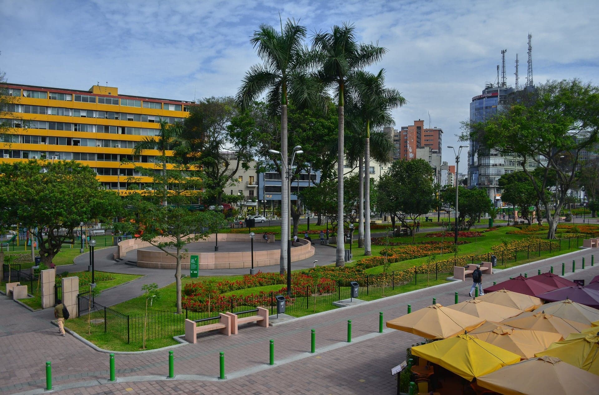
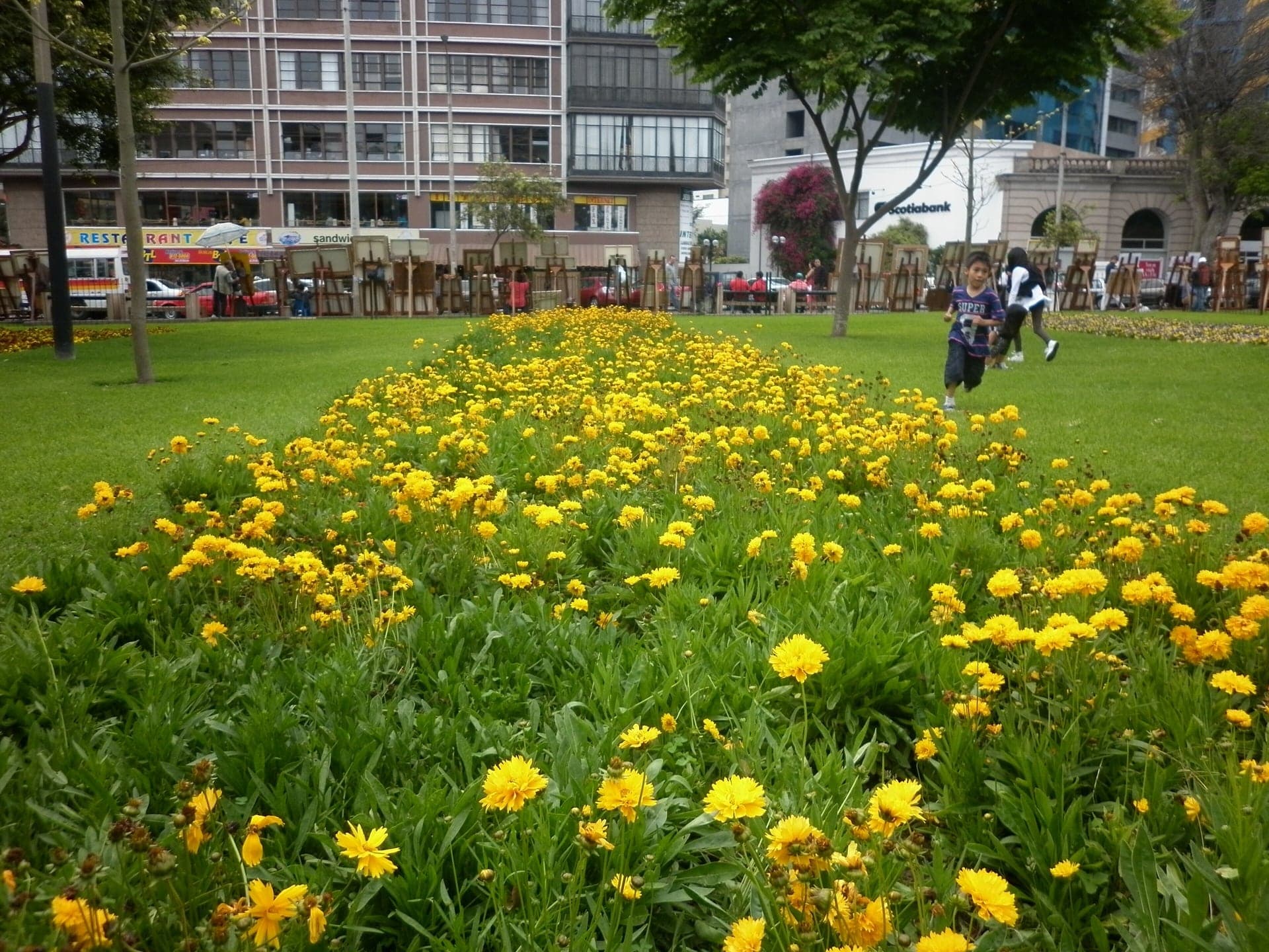
A park in two halves in central Miraflores. Lawns, flower beds, the bust of John F. Kennedy and a colony of cats that began as a cure for rats.
- 2
Virgen Milagrosa: The Architect from the Main Square
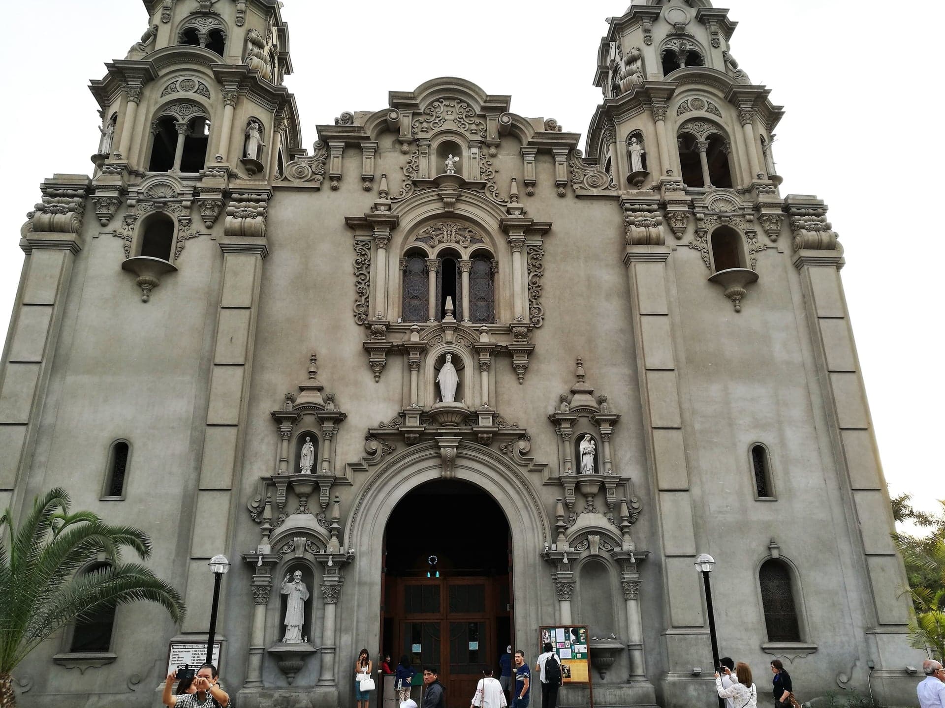
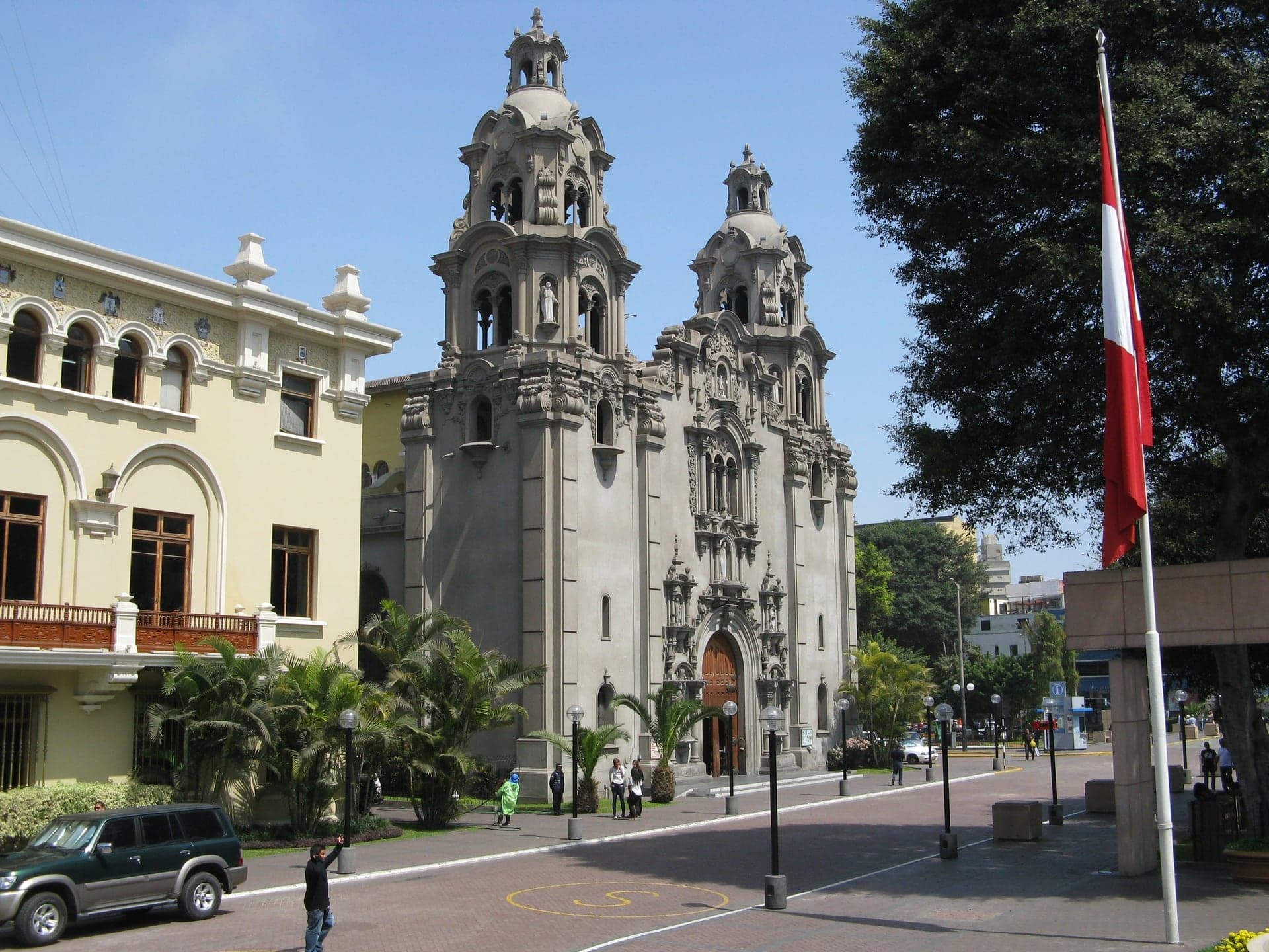
A quiet church front by a Lima architect. Finished in 1939, it was designed by one of the architects of the Archbishop's Palace front on Lima's main square.
- 3
Municipal Palace: A Tower Turned to the Park
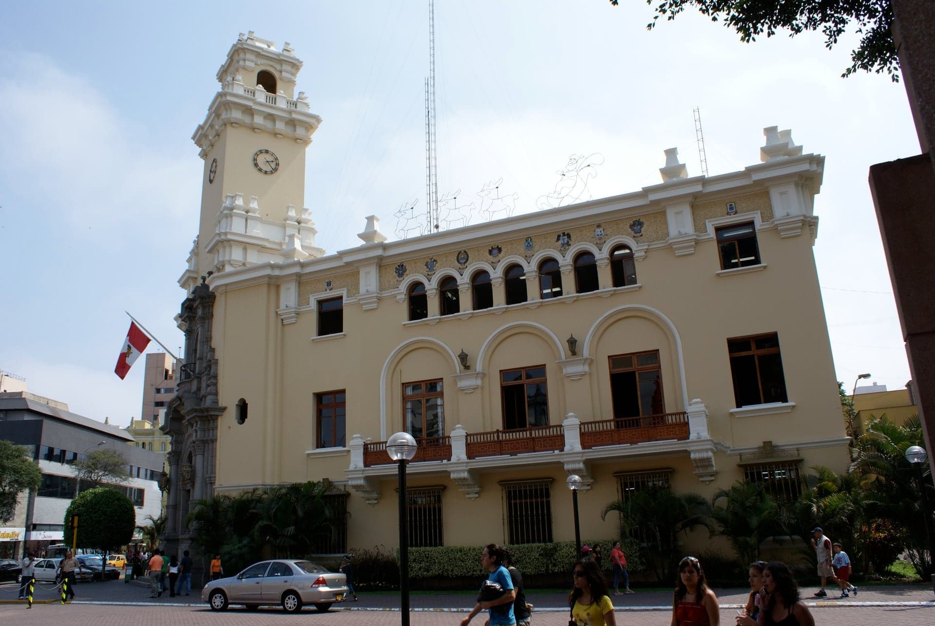
A town hall whose tower faces the park. Finished in 1944 in a neocolonial style, it is a rare twentieth-century national monument.
- 4
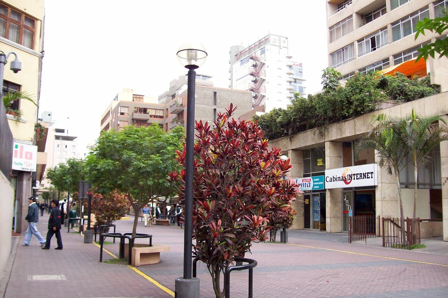
Calle Tarata: The Street That Remembers
A pedestrian street with a granite memorial. On 16 July 1992 a car bomb killed 25 people here; the street was reopened as a walk of solidarity.
- 5
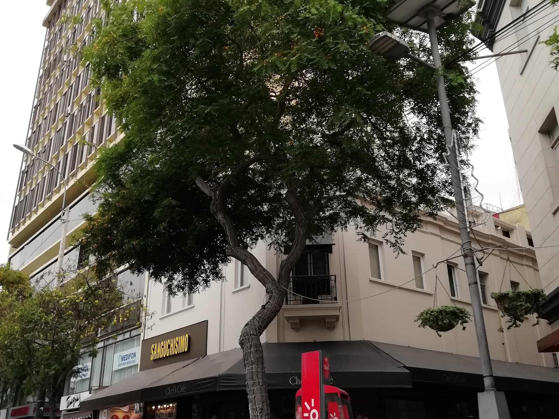
Avenida Larco: From Village Street to Avenue
The avenue that leads down to the sea. It was widened and opened in 1941, when the town's mayor spoke of 50,000 people.
- 6
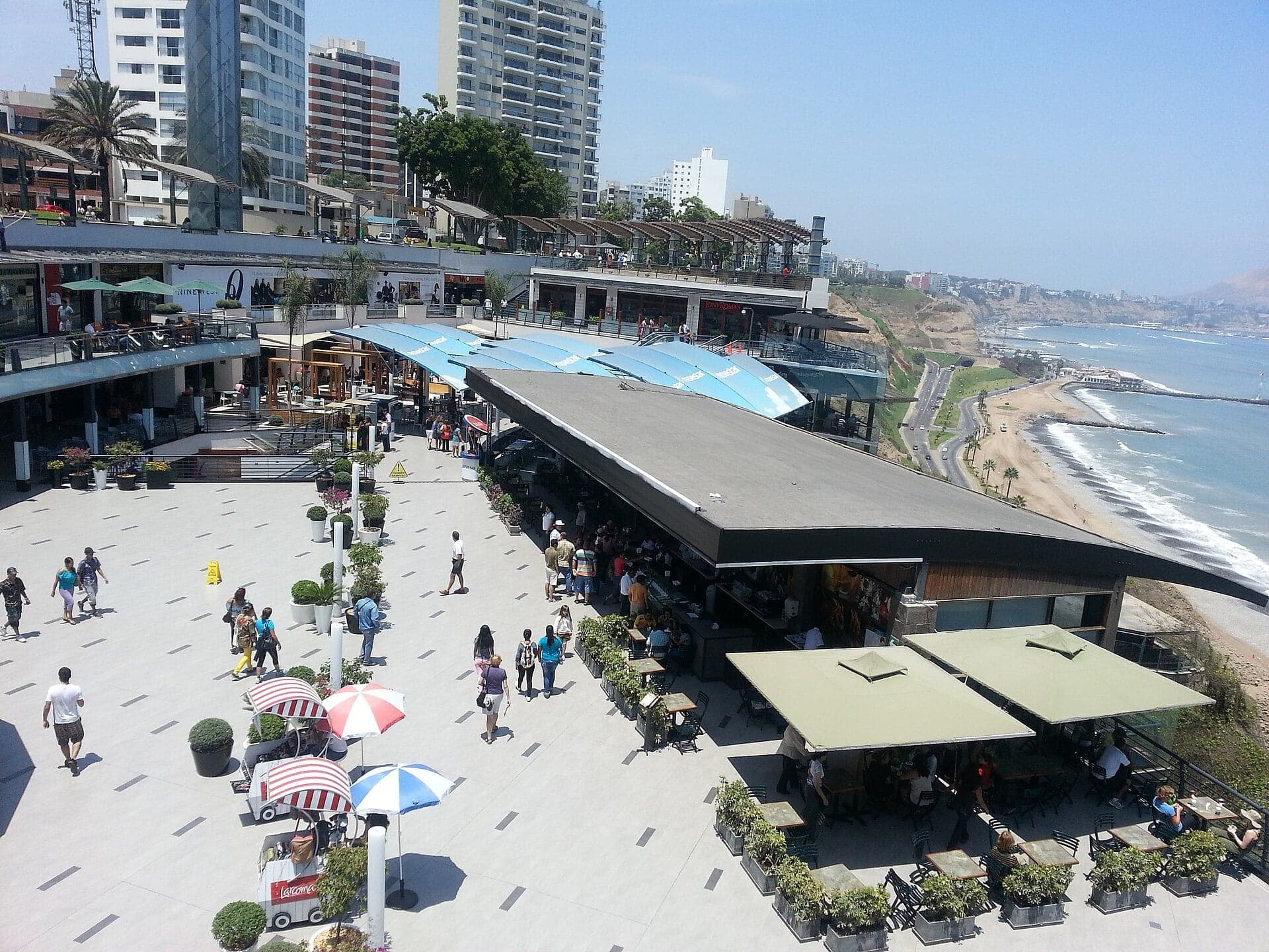
Parque Salazar and Larcomar: Where the Avenue Ends
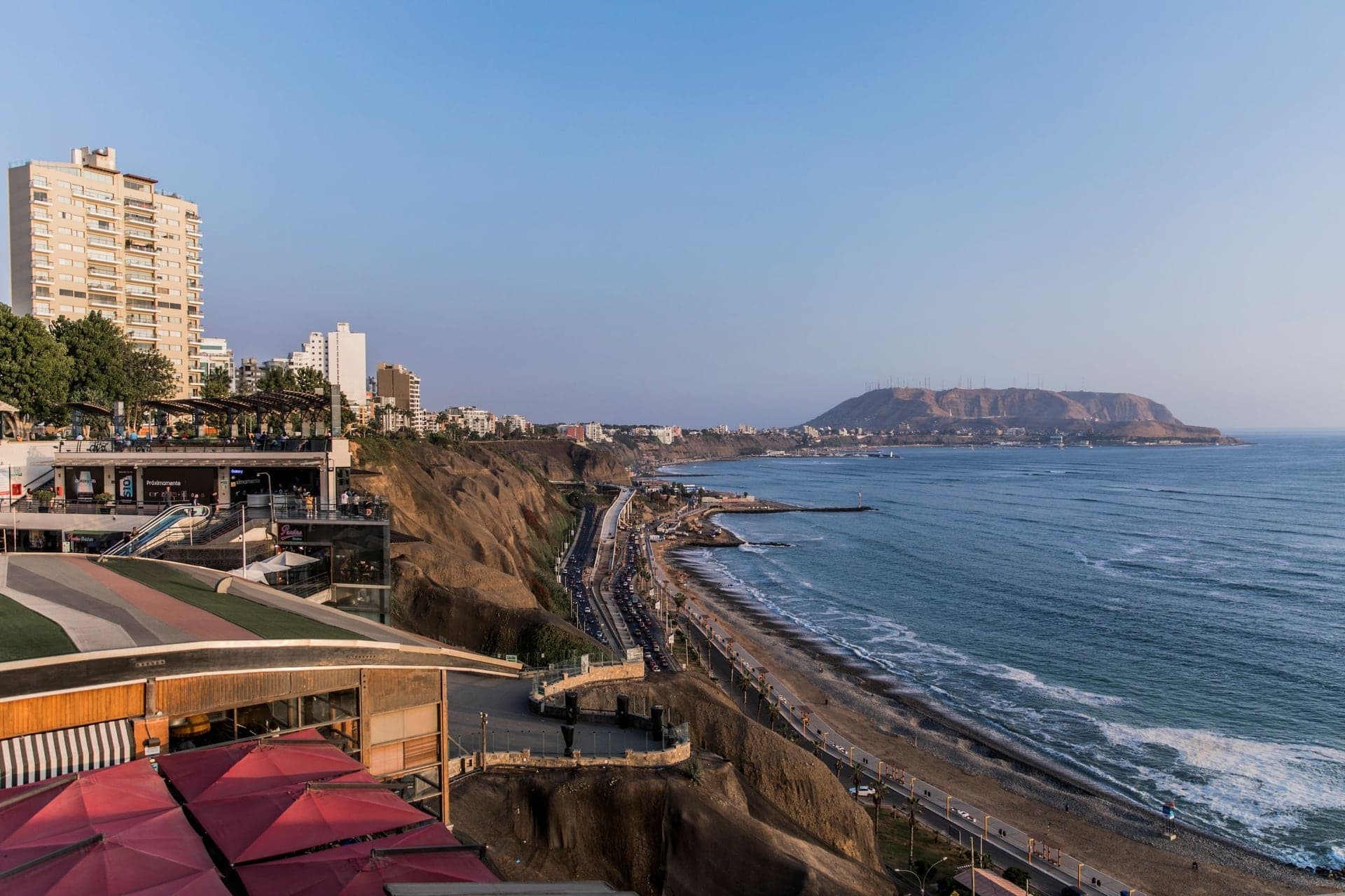
Where Avenida Larco meets the cliff edge. A shopping center is dug into the cliff below a park named for a young pilot.
- 7
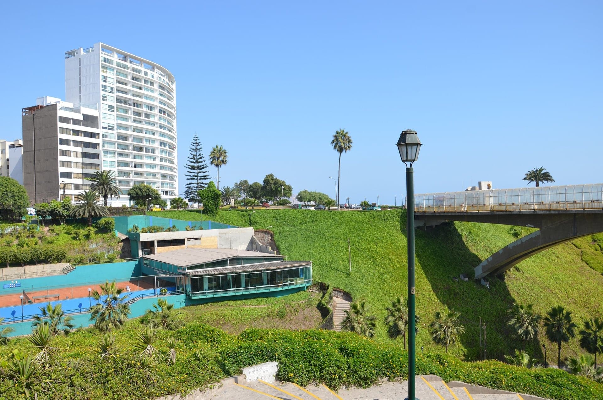
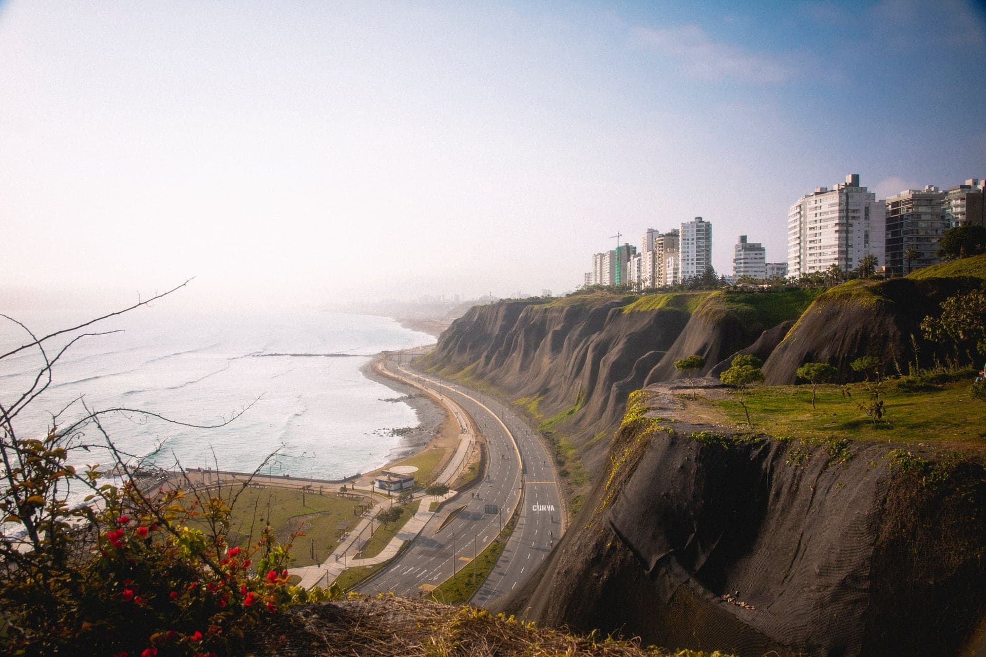
Malecón de la Reserva: A Cliff of River Gravel
A cliff-top path above the Green Coast. The cliffs below are Ice Age river gravel, fifty to seventy metres high, and they crumble.
- 8
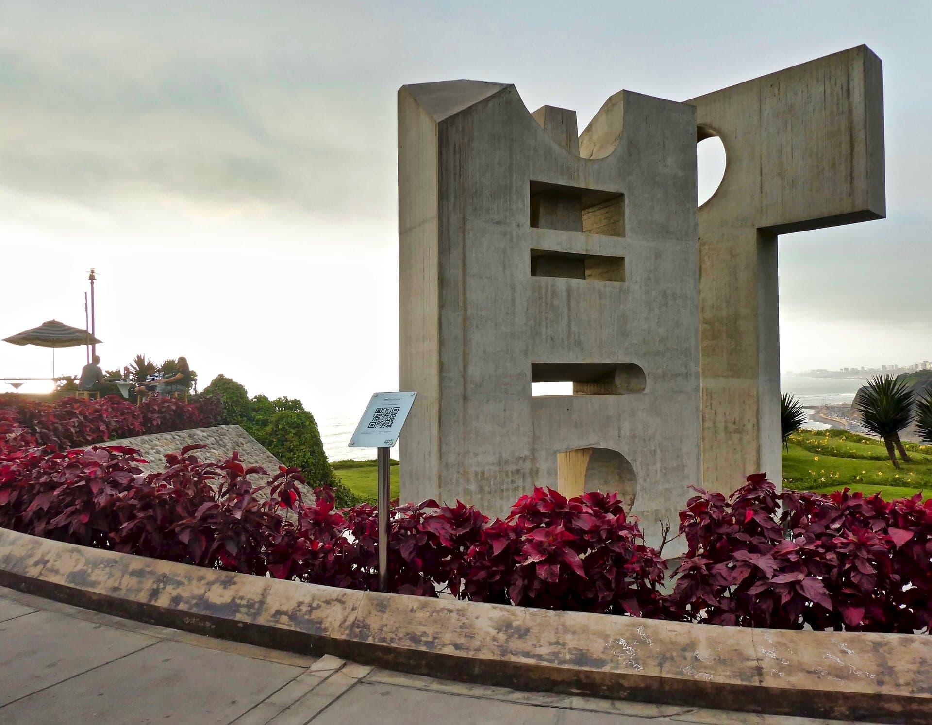
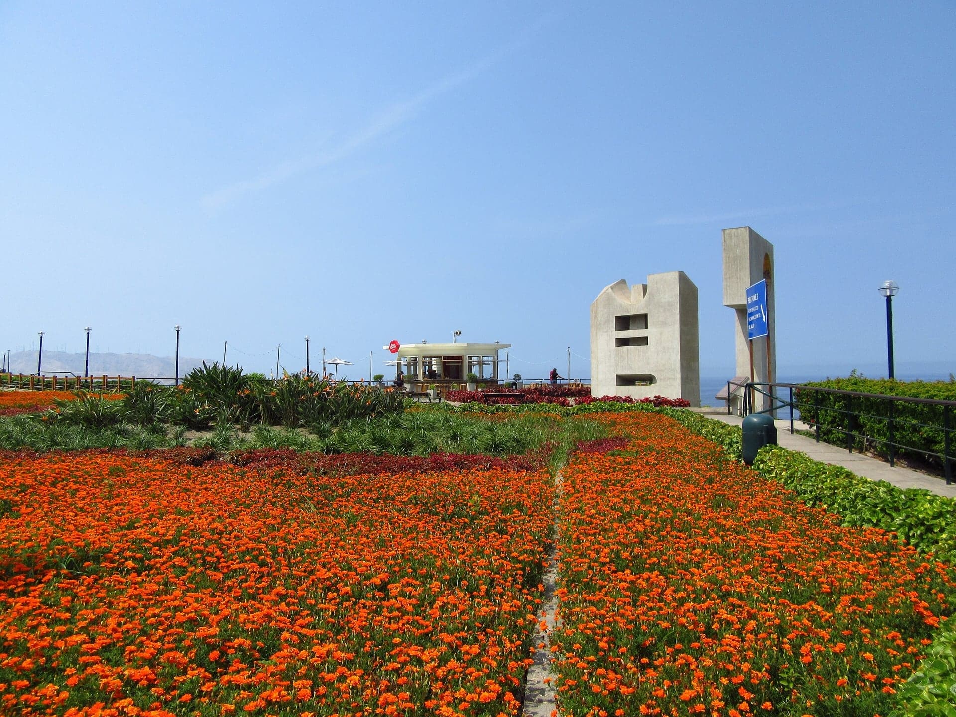
Parque Intihuatana: A Post to Tie the Sun
A stone sculpture above a surfing beach. Its name comes from the carved Inca stones of the Andes.
- 9
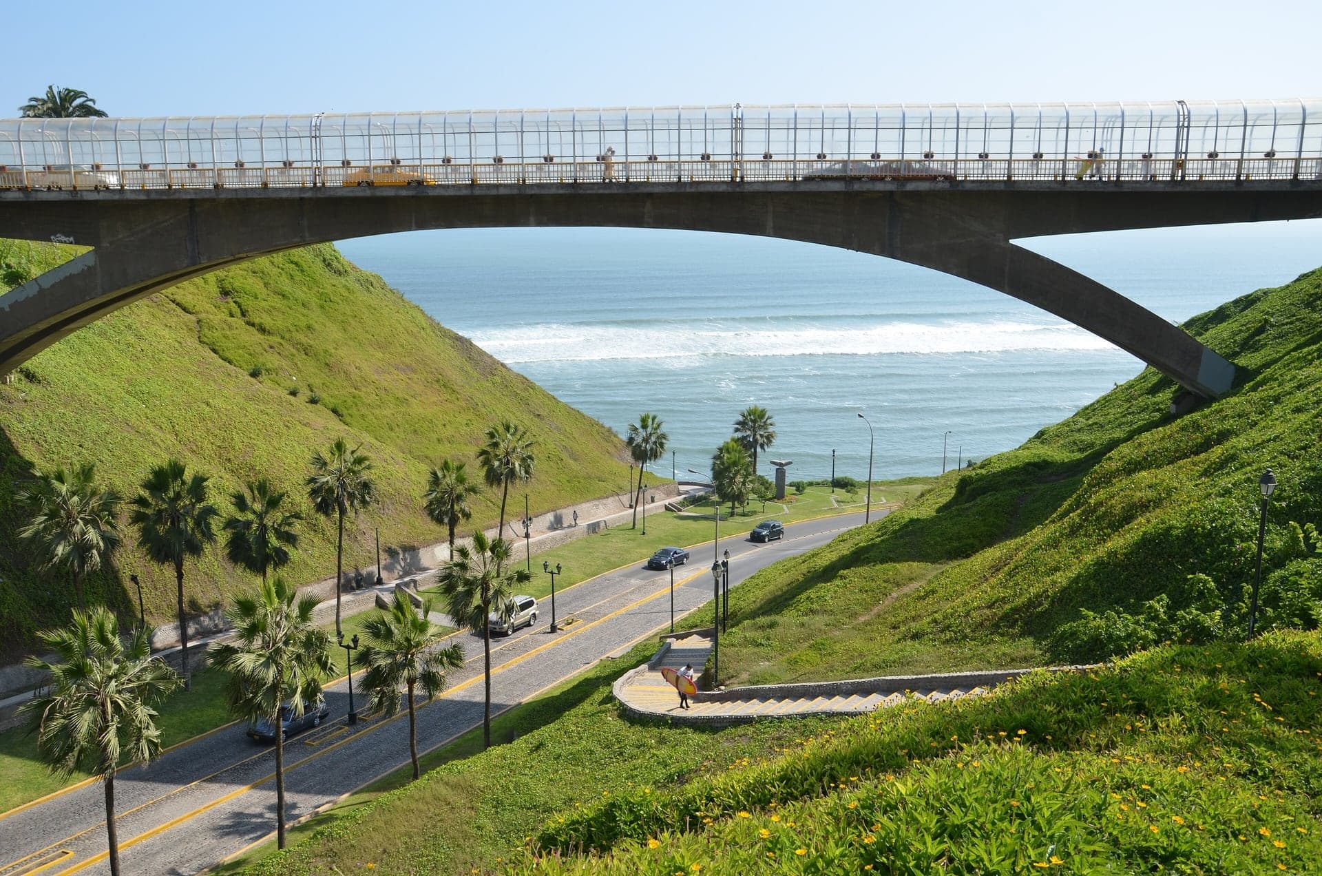
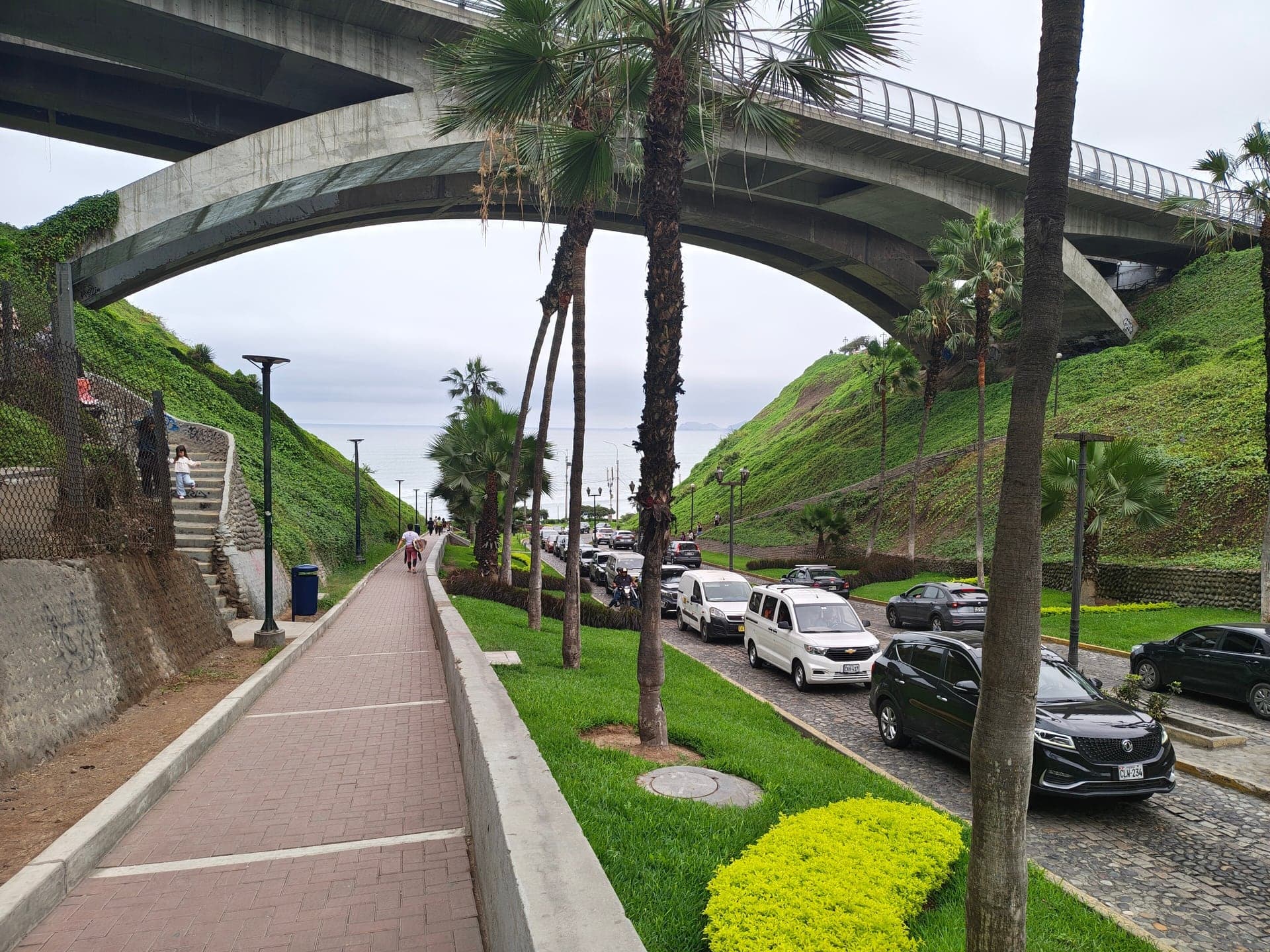
Puente Villena Rey: Over the Ravine
A bridge over a ravine cut into the cliff. Its original span dates from 1967 and its twin from 2016, one for each direction of traffic.
- 10
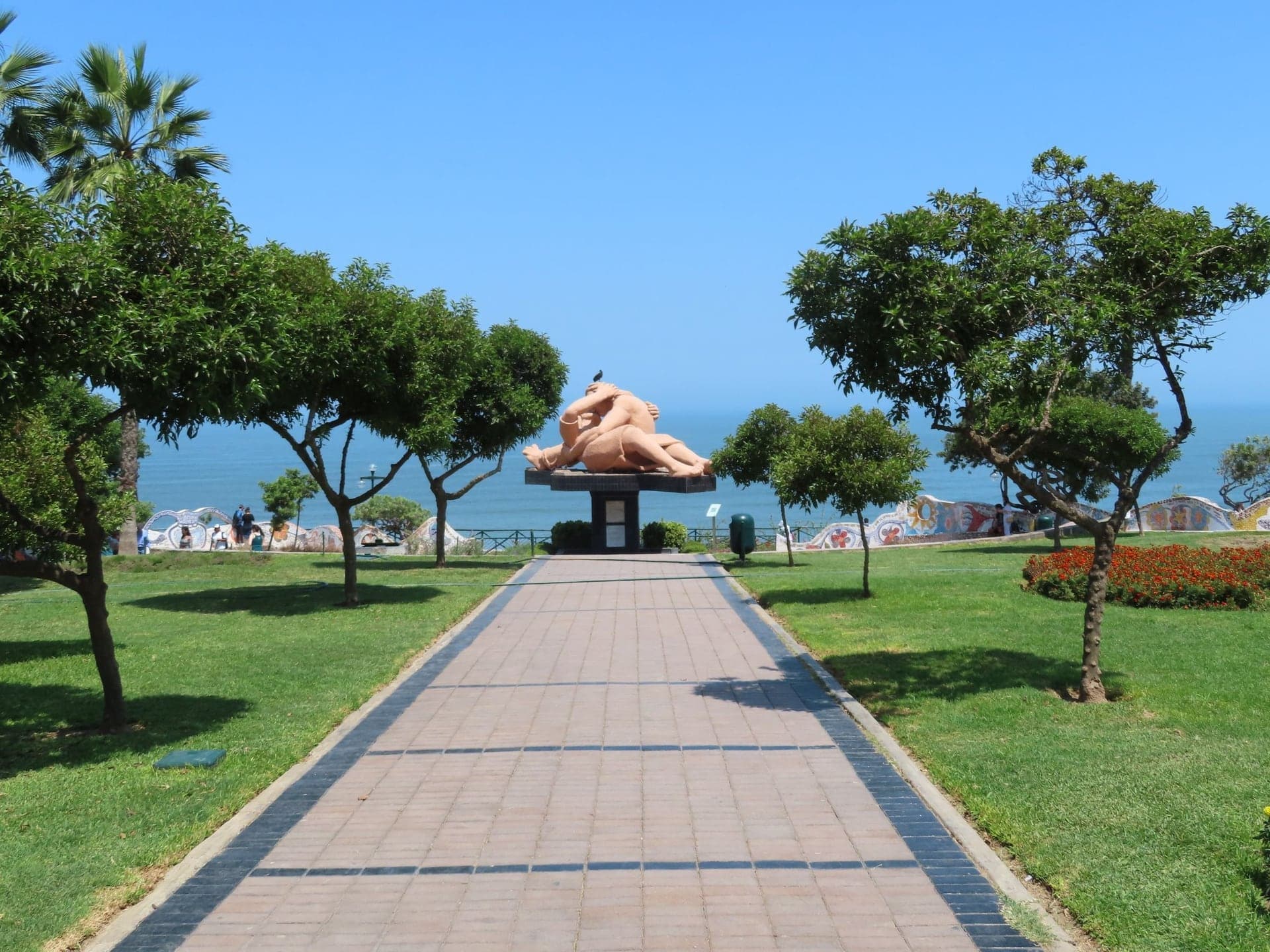
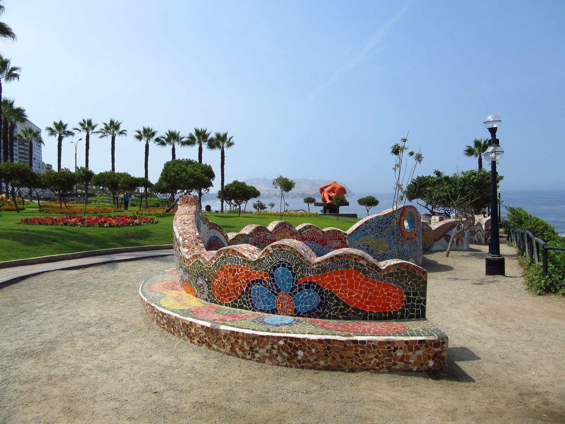
Parque del Amor: The Kiss on the Cliff
A cliff-top park with a giant concrete kiss. Víctor Delfín's El Beso lies on the lawn, ringed by mosaic benches written with lines about love.
- 11
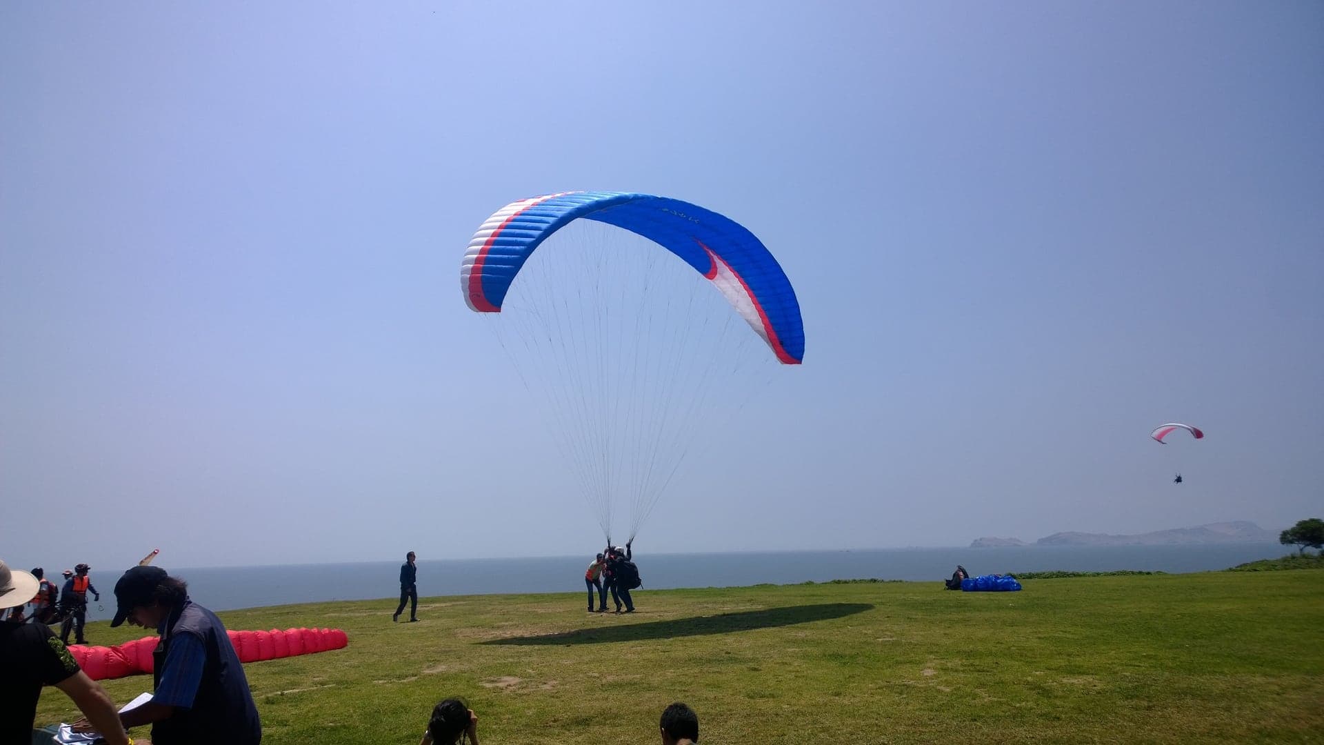
Parque Raimondi: Riding the Cliff's Wind
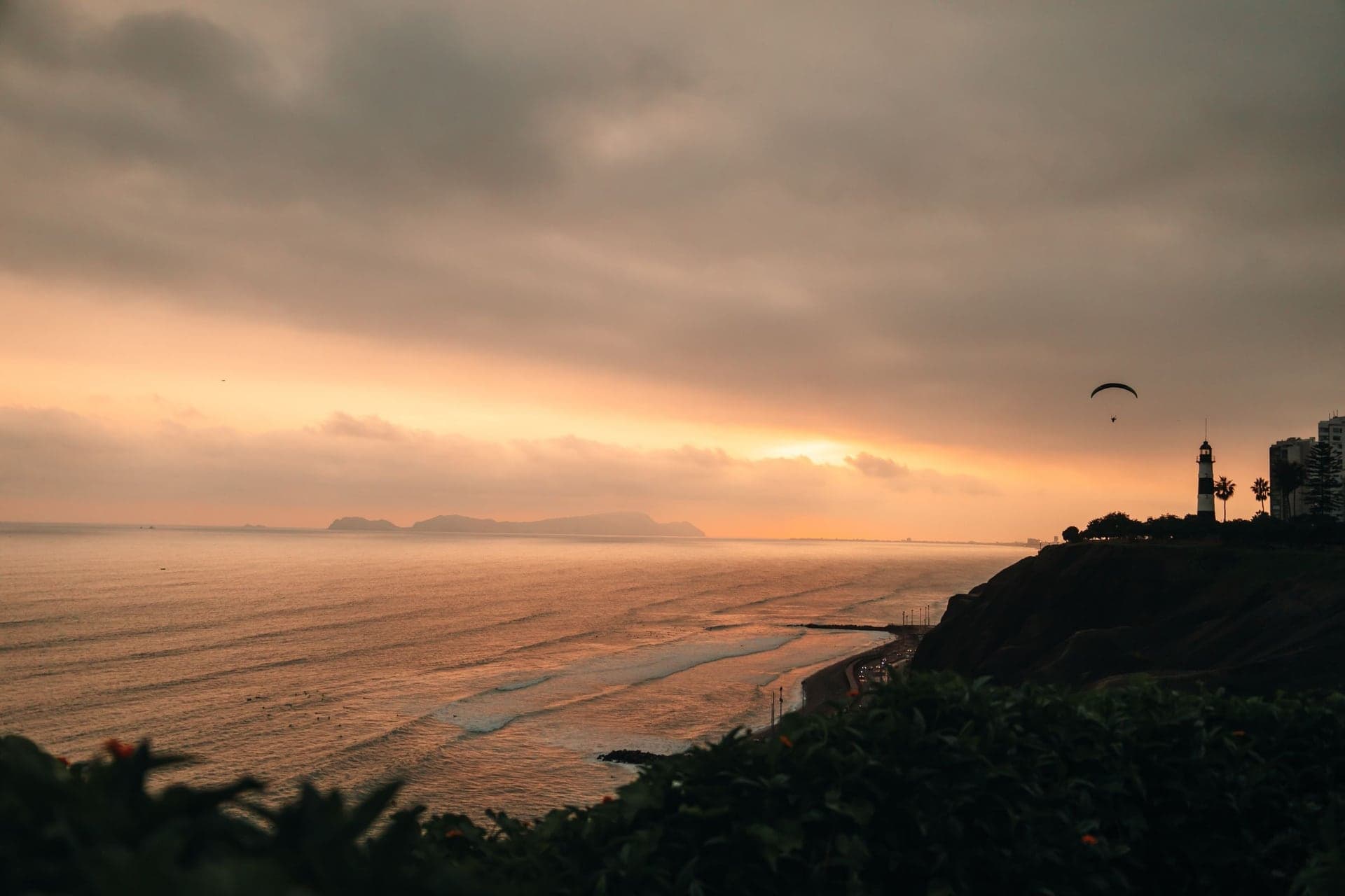
The paraglider launch on the Miraflores cliff. The sea breeze strikes the cliff and rises, and tandem pilots ride it along the edge.
Details
Best Time to Visit
By day, ideally from late morning into the afternoon, when the paragliders are most likely to be flying (always weather permitting). Sunset at Parque del Amor is beautiful and crowded. From about April to November the sky over the coast is usually grey with the drizzle Lima calls garúa; December to March is sunnier. Avoid the cliff-top parks after dark.
Pro Tips
- •Getting to the start: Parque Kennedy is in the center of Miraflores. The nearest Metropolitano stations on the Vía Expresa are Ricardo Palma and Benavides, both a short walk east; the fare is S/ 3.20 on the trunk line or S/ 3.50 with a feeder route, paid with a rechargeable card (fares from 30 May 2026). From the airport, Airport Express Lima lists a Kennedy Park stop at S/ 20 per person or S/ 15 each for two or more. Checked 6 October 2026.
- •Huaca Pucllana, a great stepped mound of small handmade adobe bricks built by the Lima culture between about AD 400 and 700, is about 1.2 km north of Parque Kennedy on Calle General Borgoño. It is CLOSED ON TUESDAYS. Day visits Wednesday to Monday 9:00 to 17:00, night visits Wednesday to Sunday 18:45 to 21:00; S/ 15 by day and S/ 17 at night (prices reported in November 2024, so check before you go). Checked 6 October 2026.
- •The Casa Museo Ricardo Palma, the house where Ricardo Palma lived his last years and died in 1919, is at the corner of General Suárez and Narciso de la Colina, north-east of Calle Tarata. It has been a museum since 1969 and was restored by the municipality in 2020; check its hours before you go.
- •The Centro Cultural Ricardo Palma, across Avenida Larco from stop 5, runs changing exhibitions and free concerts; see the Municipalidad de Miraflores events pages.
- •Tandem paragliding flights leave from Parque Raimondi by day, weather permitting, under a municipal agreement with licensed pilots. There is no official published price: agree it with the pilot before you fly.
- •Makaha and Waikiki, the surf beaches below the cliff, are reached by steps and roads down the cliff that are not part of this walk; the climb back up is long and steep, and the beach highway at the bottom carries fast traffic.
- •The walk ends at Parque Raimondi. The Faro La Marina lighthouse is a short stroll further along the cliff, and our Barranco walk starts a short taxi ride south along the same coast.
Safety & Precautions
- •Parque Kennedy and the blocks around it are busy all day: keep phones and bags close, especially when you stop to look at the cats or take photos.
- •Cross Avenida Larco, Avenida Benavides and the roads at the cliff end of Larco only at the lights. On Larco south of Benavides, a busy bus lane runs along the curb: keep to the sidewalk.
- •Along the cliff-top parks a two-way cycle path runs beside the footpath: keep to the footpath.
- •The cliff is loose gravel and can crumble, especially after earthquakes: stay on the paths and behind hedges and railings, and keep children close at the edge.
- •The cliff top is exposed to strong sun and wind even on grey days: bring sun protection and a layer.
- •This is a daytime walk: some edges of the cliff-top parks are dimly lit after dark.
Travel advisory: Exercise Increased Caution (Level 2).
Gallery
Read the walk
The full story of Miraflores: The Village That Walked to the Edge, in words. Prefer to listen? Play it narrated, from home or on location.
Introduction
Lima, the capital of Peru, ends at the Pacific in a cliff, and Miraflores is the district that stands on its edge. It began as a seaside village. In nineteen forty-one, as a newly widened avenue carried the town down to the cliff, its mayor reminded the crowd that in nineteen oh seven Miraflores had one thousand two hundred and fifty-eight people. Now it had fifty thousand.
This walk follows that avenue. Over eleven stops and a little under three kilometres, about a mile and three quarters, it starts in the park at the heart of the district, passes the church and the town hall, pauses on a street that remembers one terrible night in nineteen ninety-two, and then runs down Avenida Larco to the edge. From there it follows the cliff-top parks to the place where paragliders launch over the ocean. Allow about an hour and a half. The way is level or gently downhill, with no stairs.
Two names come back along the way: José Larco, an Italian banker and mayor whose name the avenue carries, and Ricardo de Jaxa Malachowski, the architect of the town's church.
And one thing to watch for: water. On a desert coast where it almost never rains, every lawn on this walk is watered, and at the cliff you will see why that matters.
1. Parque Kennedy: The Park and Its Cats
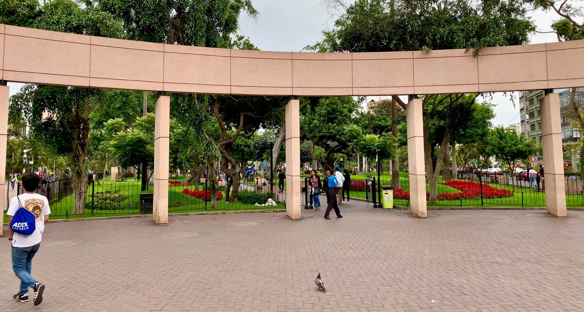
Welcome to Miraflores, and to Parque Kennedy, the first stop on this walk. Find a spot on the path near the bust of John F. Kennedy, among the lawns and flower beds.
This is the district's front room. The green space here is really one park in two halves. One half was renamed for the American president, the other is called Parque Siete de Junio, and together they cover a little over two hectares. Almost everyone simply calls the whole thing Parque Kennedy.
Now look into the flower beds and along the benches. You will very likely see cats, asleep among the plants. In the nineteen nineties, the town let the first cats into the park to deal with a rat problem. The cats stayed, and people began leaving their own unwanted pets here too. Since twenty twenty-three the municipality has been counting the cats and fitting them with microchips, and volunteers look after them and find them homes. As of late twenty twenty-five, local reports still put the colony at well over a hundred.
Notice, too, how green all of this is. Lima stands on a desert coast where it almost never rains, so every lawn and flower bed here is watered. Keep that in mind. It comes back at the cliff.
At one corner of the park, across the busy road, a lane of restaurants opens off it: Calle San Ramón, long nicknamed the street of pizzas, which reopened as a pedestrian boulevard in twenty twenty-one.
Above the trees you can see a church tower. Follow the route through the park. Next, that church.
2. Virgen Milagrosa: The Architect from the Main Square
Walk on along the pedestrian street and stop where you can face the front of the church, with its carved doorway and its wooden door.
This is the parish church of the Virgen Milagrosa, the Miraculous Virgin, and it replaced the town's older church. Its architect was Ricardo de Jaxa Malachowski. He began designing it in nineteen twenty-eight, and it was finished in nineteen thirty-nine.
If you walk our Historic Center tour, you will meet his work there too. Malachowski was one of the architects of the front of the Archbishop's Palace on Lima's main square, finished in nineteen twenty-four, and he worked on the Government Palace on the same square.
Look at the front. It is a restrained, classical face. The decoration is gathered around the doorway, where the carving is, and the rest of the wall is left calm. The tower rises at the corner of the front, and from the park it is the landmark you steer by. For a much smaller town than the capital's center, the same architect built something quieter.
Keep Malachowski in mind. His name comes back twice before the end of the walk: once on the avenue, and once at the cliff.
The church is a working parish. If the door is open and no service is under way, you can step inside quietly; the walk carries on from the street.
Follow the route along the pedestrian street and cross Avenida Larco at the lights by the town hall. Next, the town hall, seen from across the avenue.
3. Municipal Palace: A Tower Turned to the Park
Walk on along this side of the avenue and stop on the sidewalk. Then turn to face the long building across Avenida Larco, the one with the clock tower at its corner by the park.
This is the Municipal Palace, the town hall of Miraflores. It came out of an architecture competition held in nineteen thirty-nine, and it was finished in nineteen forty-four in a neocolonial style, borrowing the look of Lima's old colonial buildings. It is one of the few buildings of the twentieth century to be declared a national monument.
Look at the tower. The main entrance sits beneath it, under a large doorway, and the whole tower is turned on the diagonal, at forty-five degrees, so that it faces the park rather than the street. Its architect explained it as a tribute to civil power, a nod to the great town halls of Flanders. So the park has two towers at its edge: the parish's, and the town's.
Miraflores became a district of its own in eighteen fifty-seven. Its early records did not survive: they were lost in the fire that followed the battle of Miraflores in eighteen eighty-one, during Peru's war with Chile. So the town you are walking through is mostly the one that came afterward, and this hall was built for it when it had grown into a city.
Street trees may hide part of the ground floor. The tower stands clear above them.
Follow the route down this side of Larco, crossing two side streets at the lights. Next, a short pedestrian street, and a quieter stop.
4. Calle Tarata: The Street That Remembers
Walk on into Calle Tarata and stop by the granite memorial in the middle of the pedestrian street.
This stop is about a bombing, and it is told plainly.
Calle Tarata today is a short street of apartment blocks, with cafés and small hotels at street level. On the night of the sixteenth of July, nineteen ninety-two, at about twenty past nine, a car bomb exploded on this block. Peru's Truth and Reconciliation Commission, which later investigated the years of political violence in the country, found that it was set by a unit of the Shining Path.
The car carried about four hundred kilos of explosives. Its target was not this street. It was a bank on the corner of Avenida Larco, whose back faced Tarata. The commission found that private guards would not let the car park in front of the bank, so the driver slowed, left the car, and let it roll down into this street of homes, with apartment buildings on both sides. Twenty-five people were killed and one hundred and fifty-five were injured. Five more were never found. The blast damaged homes, shops and offices for three hundred metres around.
It was not the only one. Between January and July of that year, the commission counted thirty-seven car bombs in Lima. Less than two months after this one, the leader of the Shining Path was captured in Lima.
Two years after the bombing, this block was reopened as a walk of solidarity, with the granite memorial at its center. Every sixteenth of July the municipality holds a ceremony here, with a minute's silence and flowers laid at the stone.
Follow the route on to the far end of Tarata and around the block, crossing the wide Avenida Benavides at the lights. Next, back to Avenida Larco.
5. Avenida Larco: From Village Street to Avenue
Walk on to the corner of Avenida Larco and stop on the corner sidewalk, looking straight across the avenue at the municipal cultural center. This is Avenida Larco, the spine of Miraflores, and it carries the name of José Larco. He came to Peru from Italy as a boy of eight, in…
Full narration for this stop unlocks with the tour.
6. Parque Salazar and Larcomar: Where the Avenue Ends
Walk on through the park to the paved walk at its seaward edge, above the open hollow of the shopping center, and stop there. Avenida Larco ends here, at the edge. And below the rim, the cliff itself has been dug out and filled with a shopping center. This is Larcomar. Read the…
Full narration for this stop unlocks with the tour.
7. Malecón de la Reserva: A Cliff of River Gravel
Walk on along the cliff-top path beside the park and stop where you can see along the coast. This is the Malecón de la Reserva, the cliff-top road of Miraflores. Look along the shore. The cliffs run for about four and a half kilometres through the district, and here they stand…
Full narration for this stop unlocks with the tour.
8. Parque Intihuatana: A Post to Tie the Sun
Walk on along the path and stop on the path a few steps from the stone sculpture. This sculpture is called Intihuatana. High in the Andes, the Incas shaped stones known by that name, the best known at Machu Picchu, and the word is usually put into English as a hitching post for…
Full narration for this stop unlocks with the tour.
9. Puente Villena Rey: Over the Ravine
Walk on onto the bridge and stop about halfway across, on the side toward the sea. Look down, through the screen along the edge, into the ravine below. This is a gully cut into the cliff, and through it runs the Bajada Balta, a cobbled road that winds down to the beach. Gullies…
Full narration for this stop unlocks with the tour.
10. Parque del Amor: The Kiss on the Cliff
Walk on into the park and stop where the path bends, with the giant reclining couple just ahead. This is El Beso, The Kiss, by the sculptor Víctor Delfín: two figures in concrete, three metres high and twelve metres across, stretched out on the lawn and locked in a kiss. Delfín…
Full narration for this stop unlocks with the tour.
11. Parque Raimondi: Riding the Cliff's Wind
Walk on along the cliff-top path and stop where you can see the launch area, on the sea side of the path. This is Parque Raimondi, and on a day with the right wind, this is where Lima's paragliders take off. A pilot and a passenger run toward the edge, the wing fills above…
Full narration for this stop unlocks with the tour.
- Vista del Parque Kennedy, Miraflores, Lima — Carlos Figueroa, CC BY-SA 4.0 · source
- flores en peru, flores peru, parque kennedy miraflores lima peru — Floresenperu, CC BY-SA 3.0 · source
- Façana de la Iglesia Virgen Milagrosa, Miraflores — Pitxiquin, CC BY-SA 4.0 · source
- Downtown Miraflores. — Avodrocc, CC BY 2.0 · source
- Miraflores district, Lima, Peru. — magicmonkey, CC BY 2.0 · source
- Parque Central de Miraflores — F Delventhal, CC BY 2.0 · source
- calle Tarata, Miraflores, Perú — No machine-readable author provided. Sancebau assumed (based on copyright claims)., CC BY-SA 3.0 · source
- Avenida Larco -Miraflores.jpg — Pilar, CC BY-SA 4.0 · source
- CC Larcomar, Miraflores en Lima, Perú. — Qwertymith, CC BY-SA 3.0 · source
- Malecón de la Reserva — Christian Córdova, CC BY 2.0 · source
- Parque Intihuana — F Delventhal, CC BY 2.0 · source
- Jardines en Miraflores con Intihuatana escultura de Fernando de Szyszlo — Felipe Restrpo Acosta, CC BY-SA 4.0 · source
- Puente Villena, Miraflores district of Lima, Peru. — Avodrocc, CC BY 2.0 · source
- Bajada de Balta at Miraflores district under Eduardo Villena Rey bridge, Lima Perú. — Alexgerena, CC BY-SA 4.0 · source
- Parque del amor — Felipe Restrpo Acosta, CC BY-SA 4.0 · source
- Paragliding in Lima. — Checo890, CC BY-SA 3.0 · source
Images may be cropped or resized. Other photos via Unsplash and Pexels.