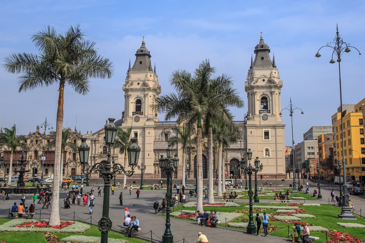
From Plaza San Martín along the Jirón de la Unión to La Merced, Torre Tagle's balconies, San Francisco, the old railway station, the Plaza Mayor and Santo Domingo, reading what is colonial and what was rebuilt.
Start · Plaza San Martín: A Square for a Centenary
DirectionsStops
- 1
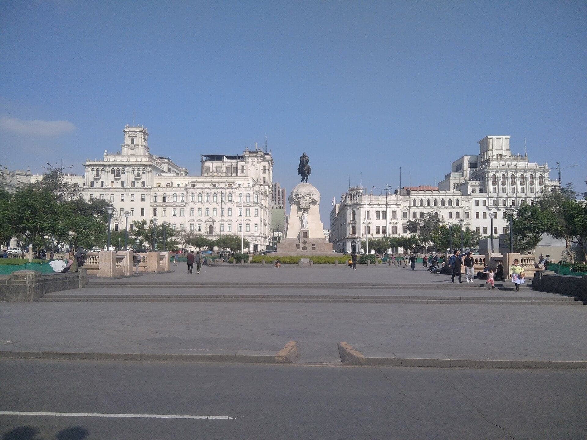
Plaza San Martín: A Square for a Centenary
A 1921 square where a railway station stood. Plaza San Martín was built for a hundred years of independence and framed by grand fronts over the next two decades.
- 2
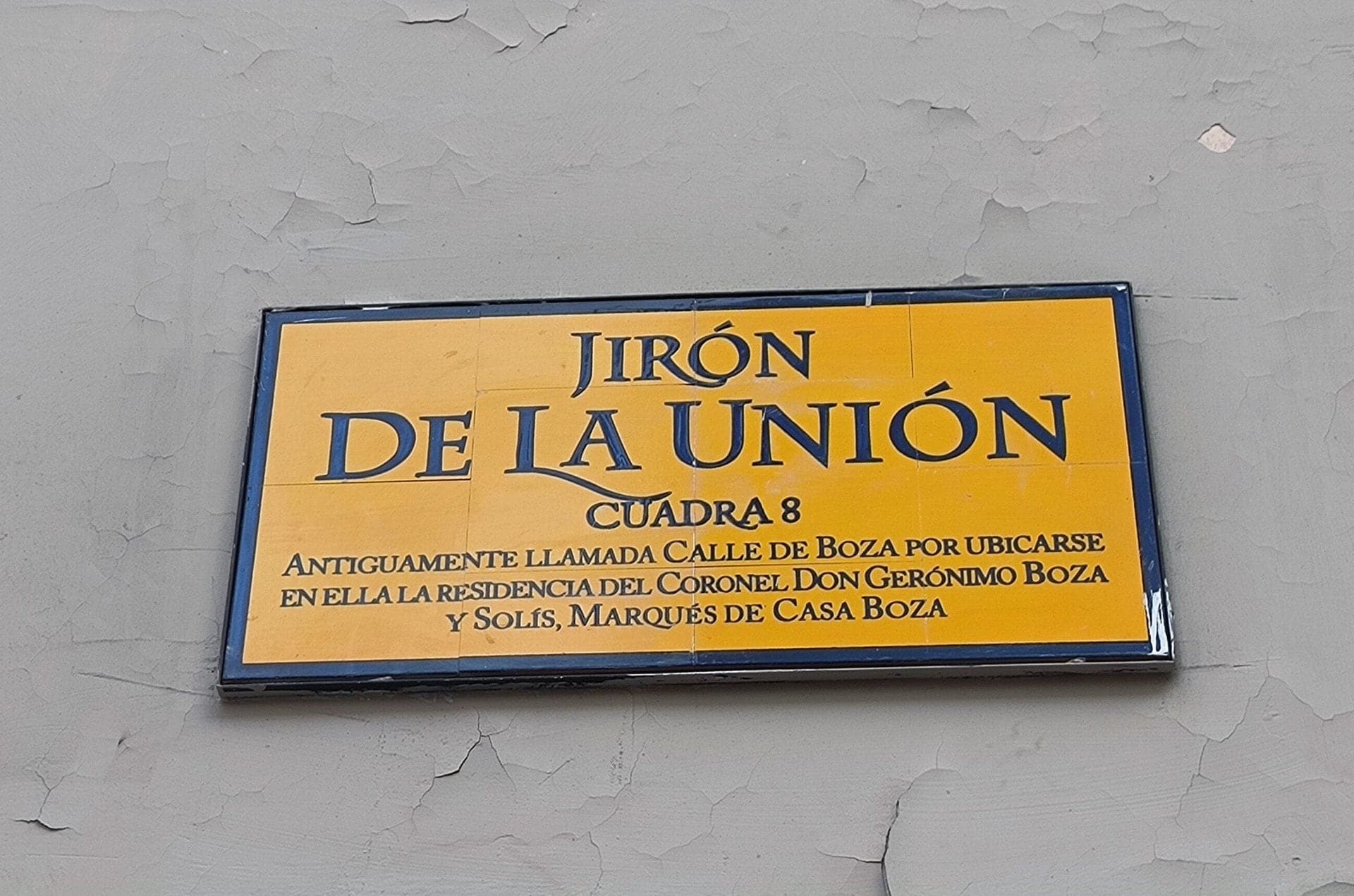
Jirón de la Unión: One Street, Eleven Names
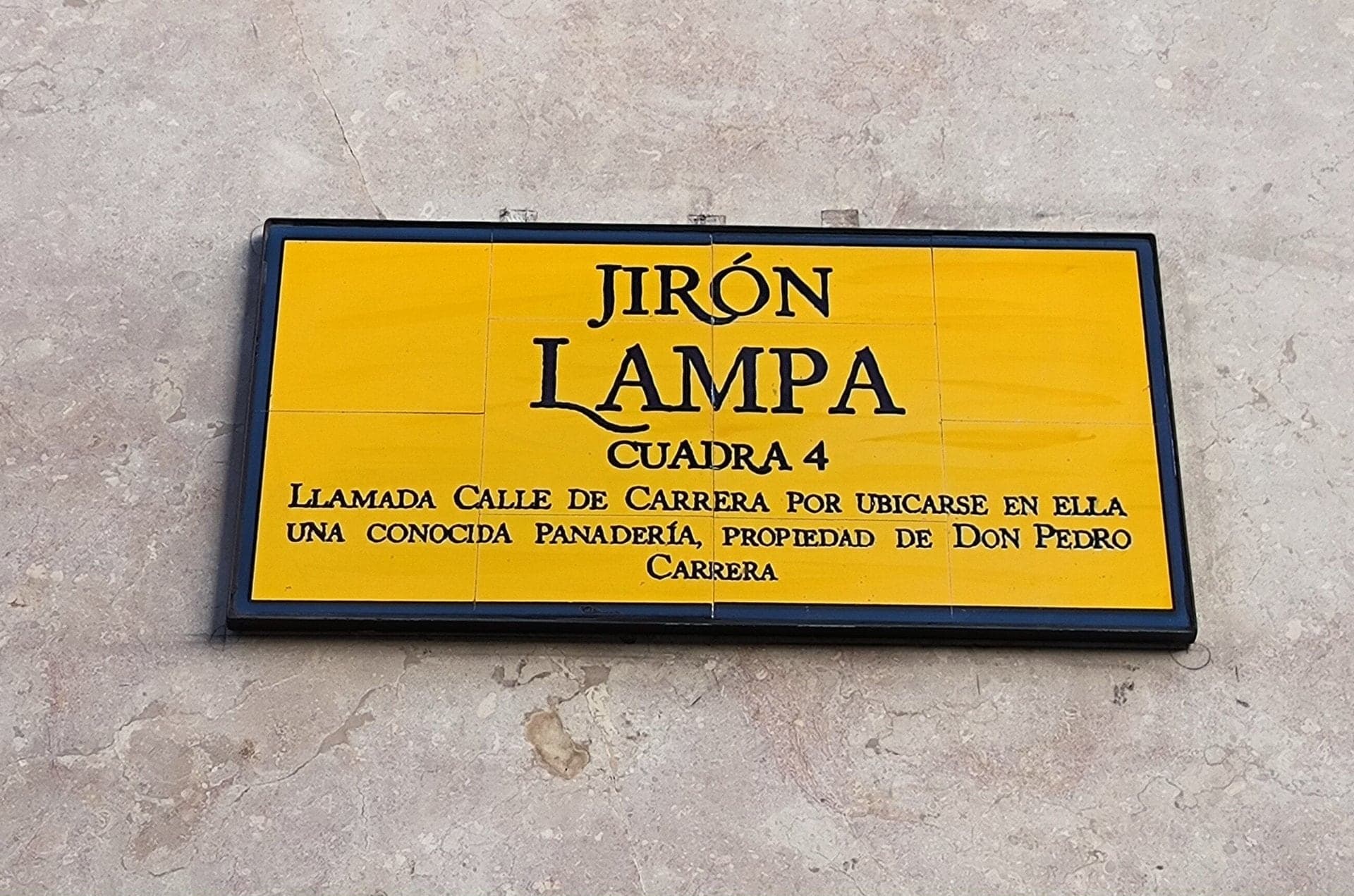
Old main street joining Lima's two squares. Until the 1860s every block of the Jirón de la Unión had its own name, and a yellow plaque still recalls this one.
- 3
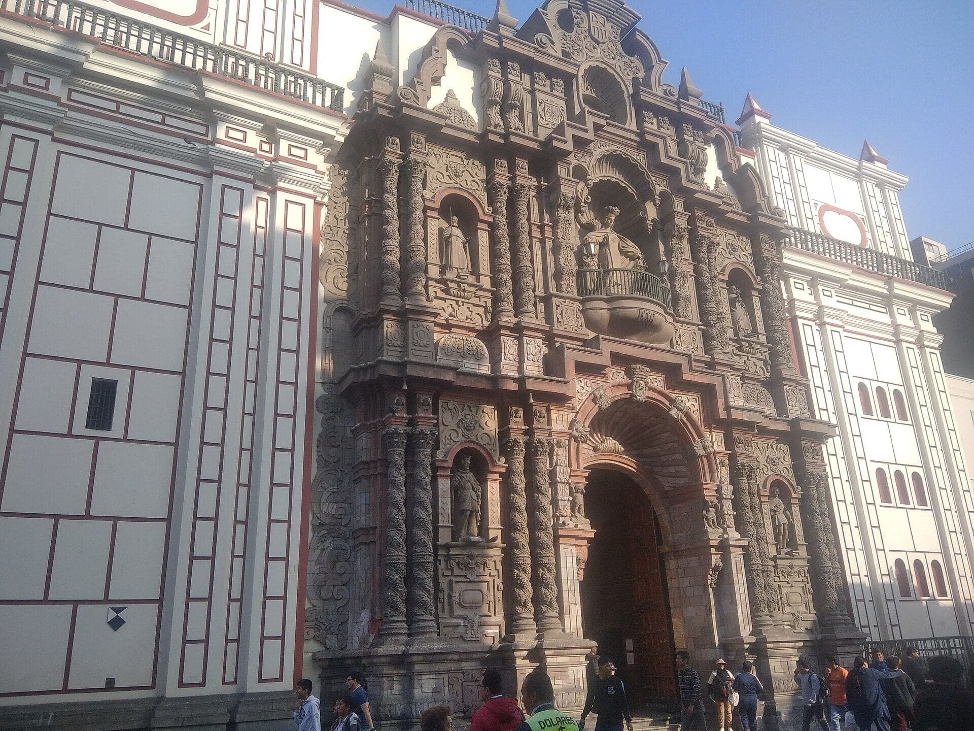
La Merced: A Front That Leans Back
Carved stone front hauled from the highlands. La Merced's tiers step back against earthquakes, and what you see is a twentieth-century rebuild of the front of 1702.
- 4
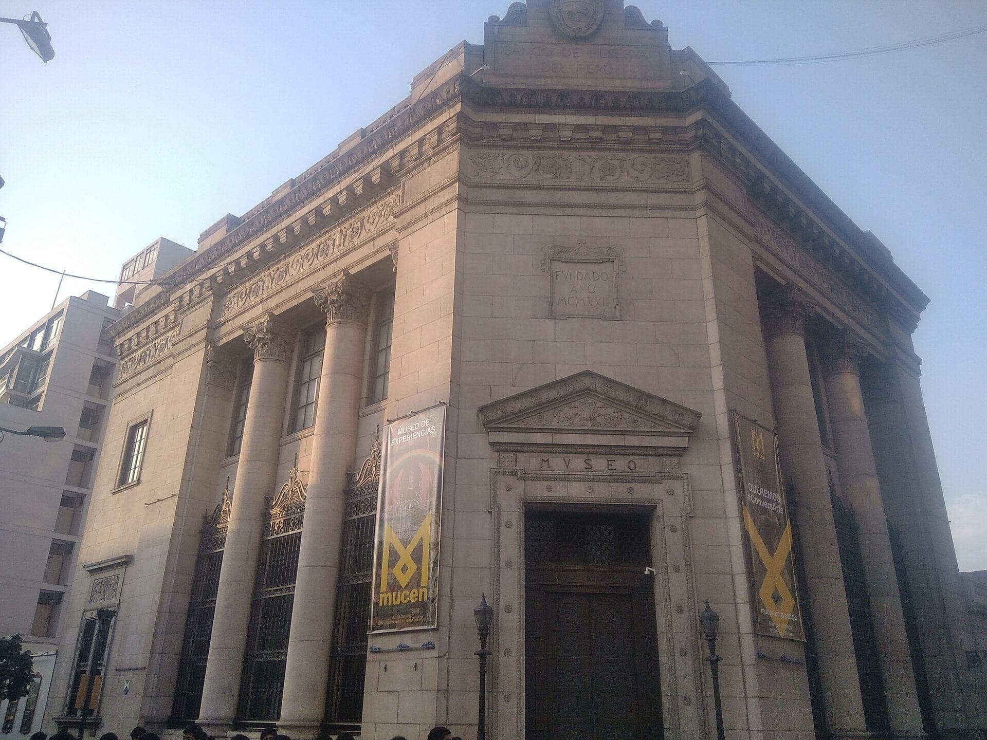
Jirón Ucayali: The Bank of 1929
A granite bank from 1929. The old reserve bank on Jirón Ucayali was built by the same American firm as the Hotel Bolívar.
- 5
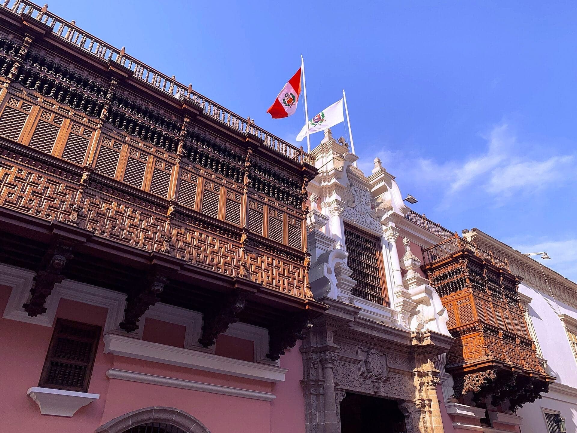
Torre Tagle: Balconies That Watch
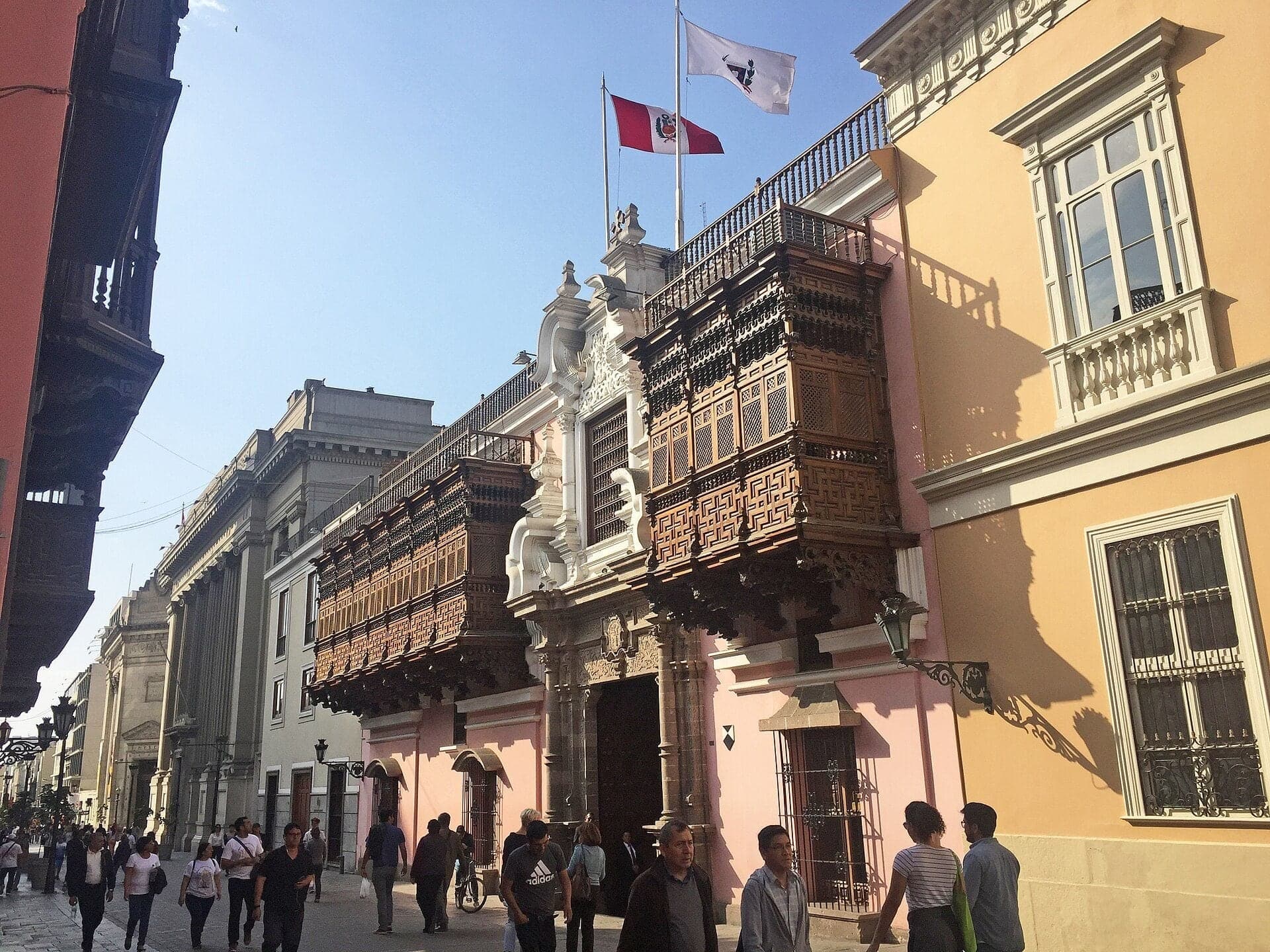
A 1730s palace with two closed balconies. Torre Tagle, Peru's Foreign Ministry since 1920, shows how Lima's balconies let people watch the street unseen.
- 6
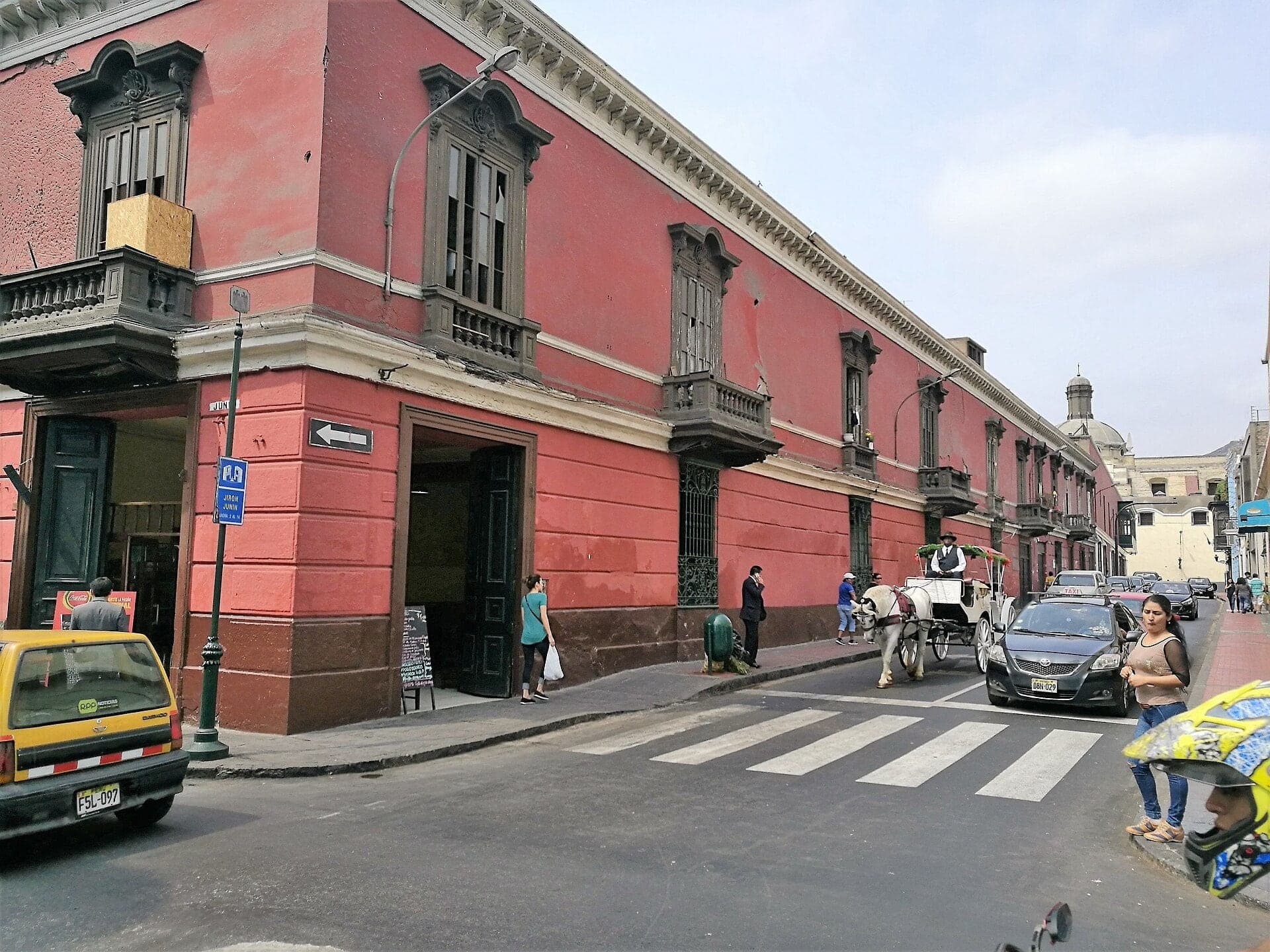
Jirón Junín: Pizarro's Checkerboard
A straight street of the 1535 checkerboard. Jirón Junín runs dead straight to the Plaza Mayor, and the city's name is older than the Spanish.
- 7
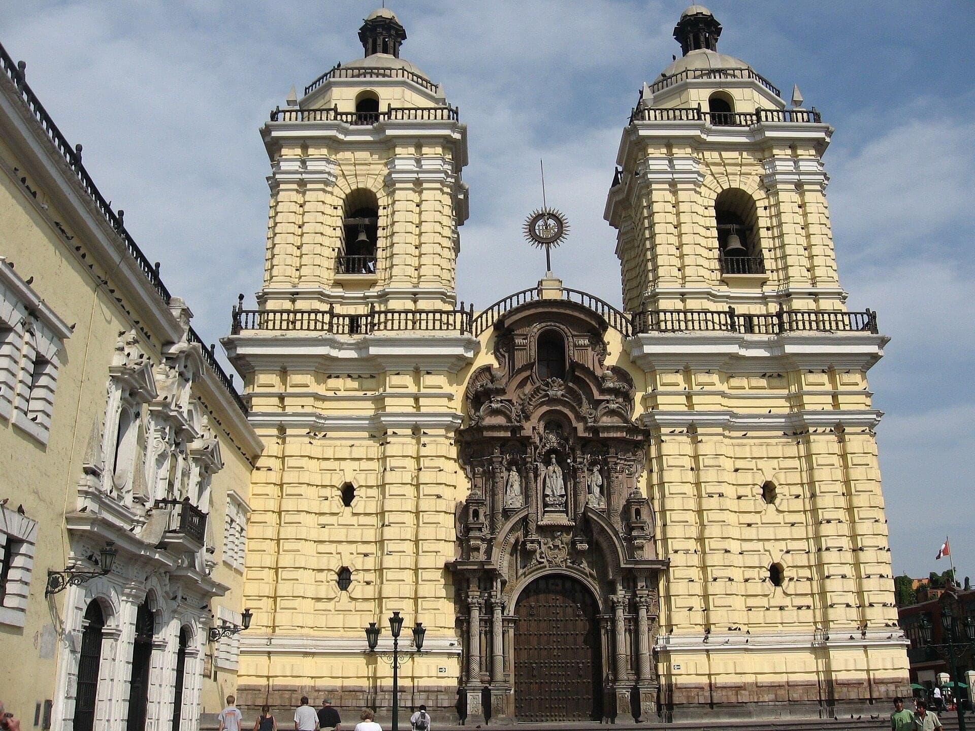
San Francisco: Not Always Yellow
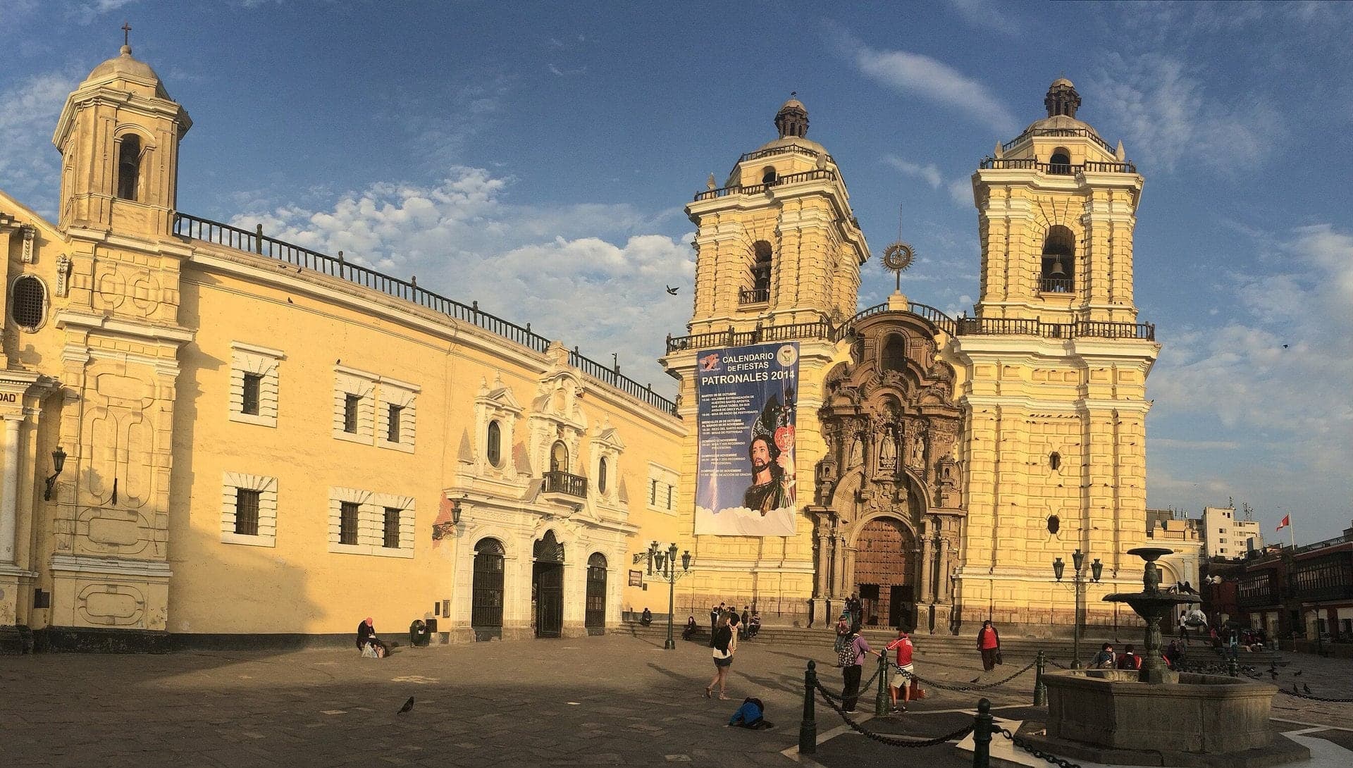
A yellow church that was long white and black. San Francisco's convent, rebuilt after earthquakes, sits over catacombs of tens of thousands of Limeños.
- 8
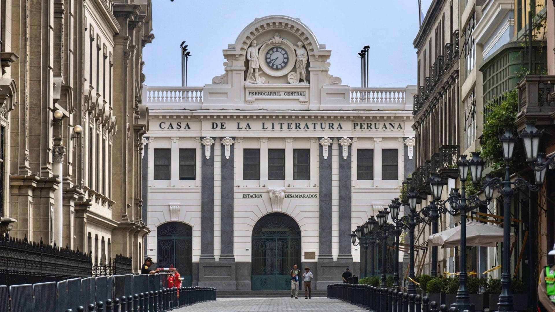
Casa de la Literatura: The Station by the River
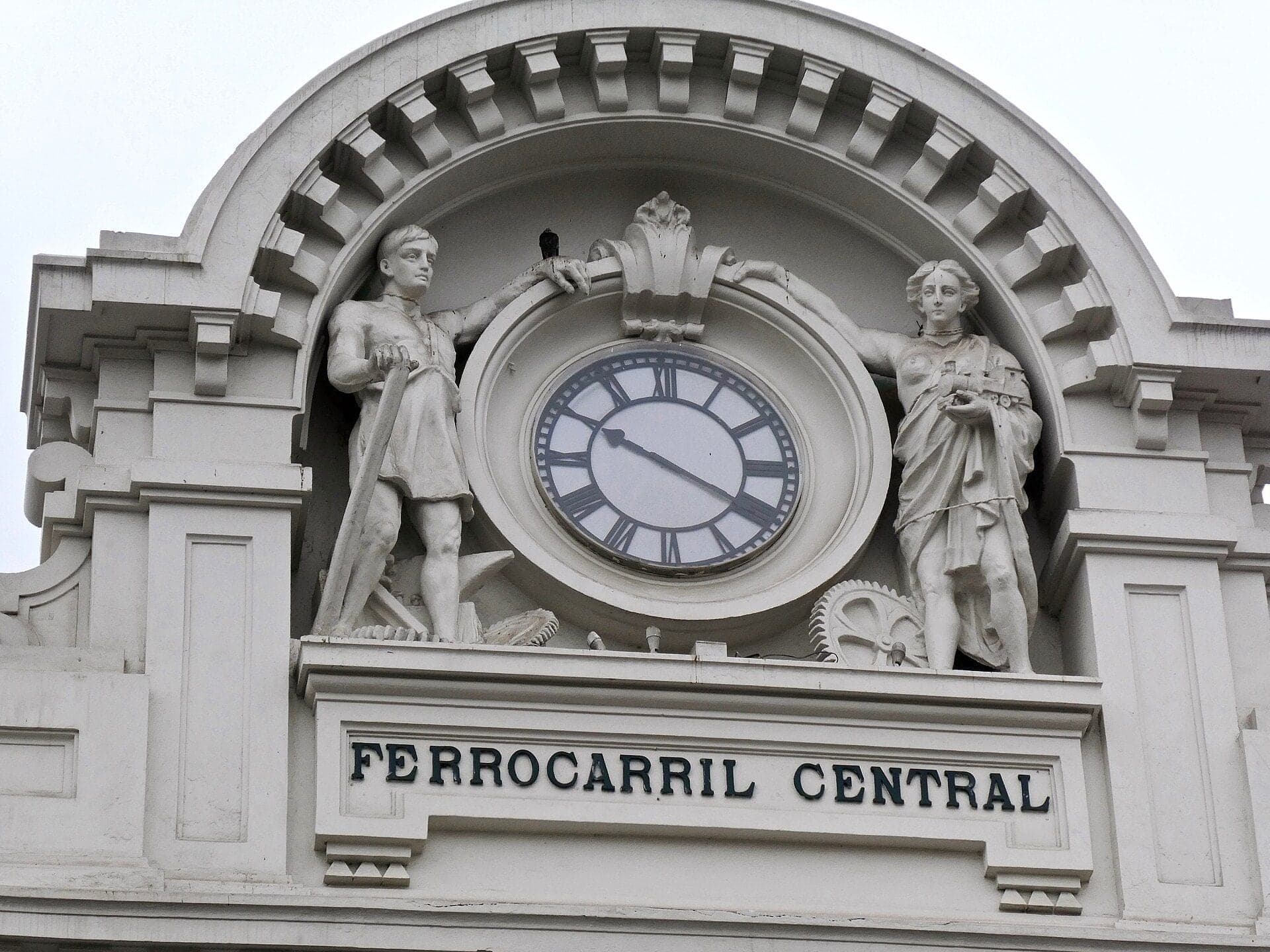
A 1912 station by the Hotel Bolívar's architect. The Desamparados station, where a few tourist trains still left in 2025, is now Peru's free house of literature.
- 9
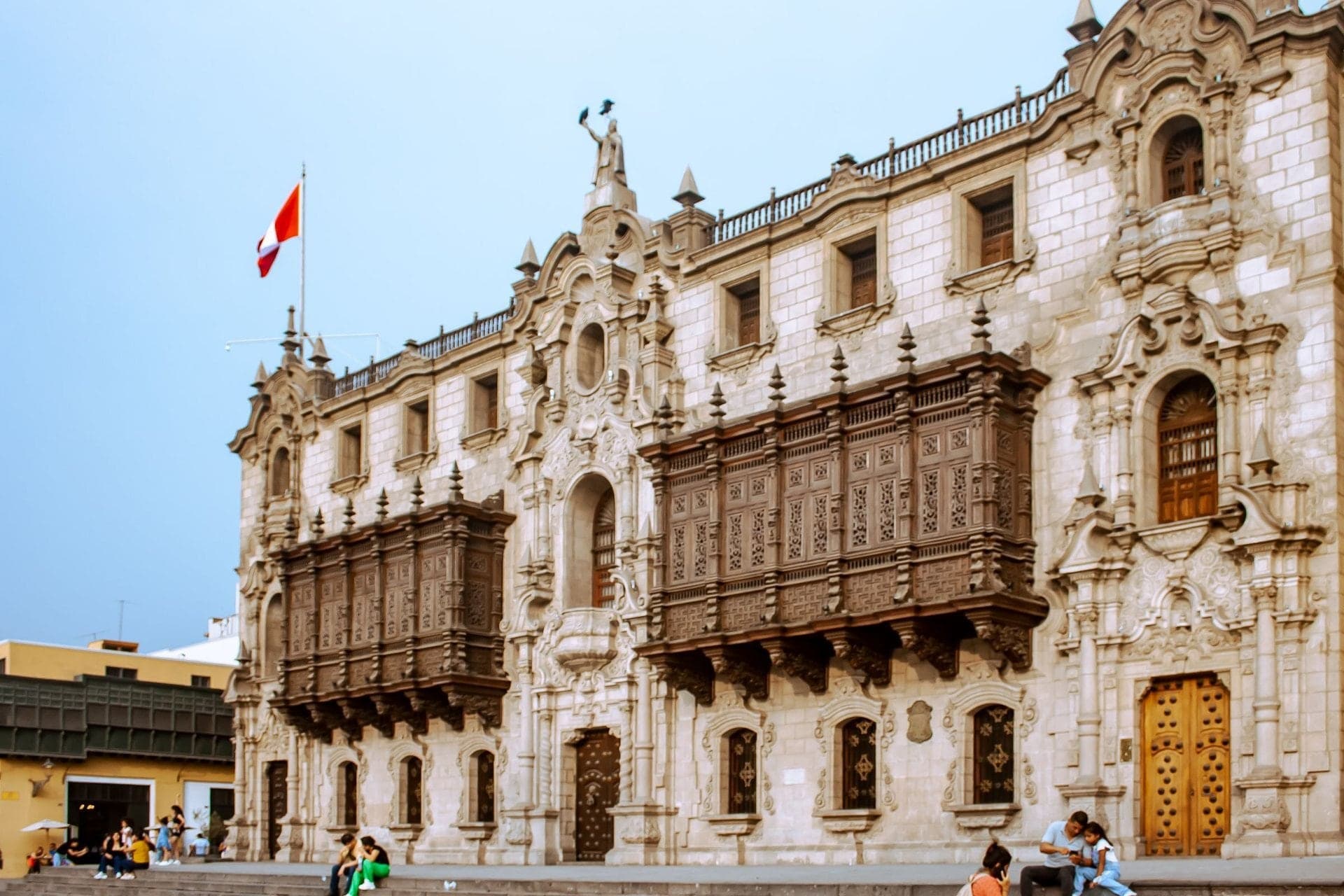
Archbishop's Palace: A Copy from 1924
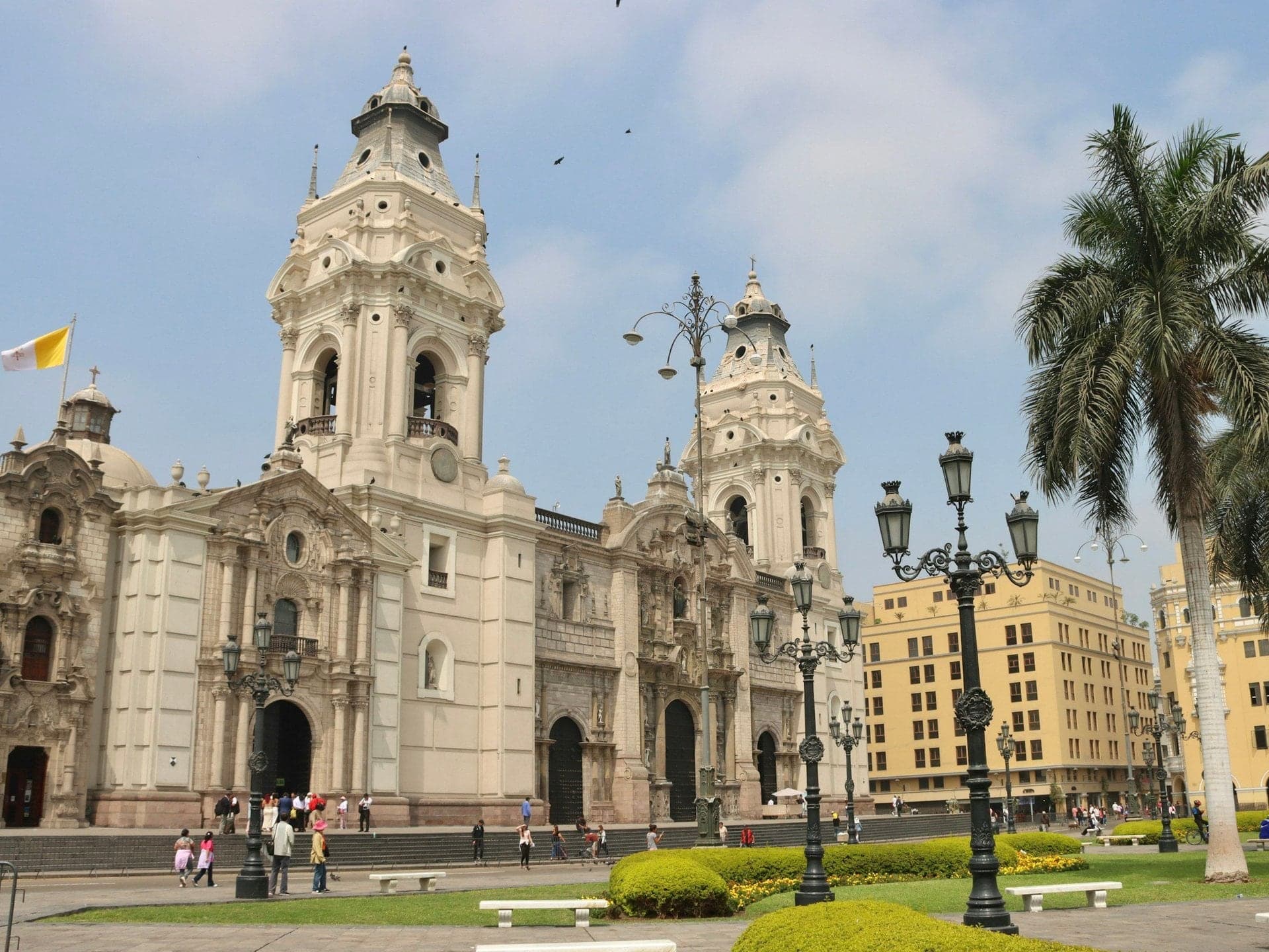
A colonial-looking palace finished in 1924, modelled on Torre Tagle. Beside it, Lima's cathedral, rebuilt after 1746 with hollow wooden columns, holds Pizarro's tomb.
- 10
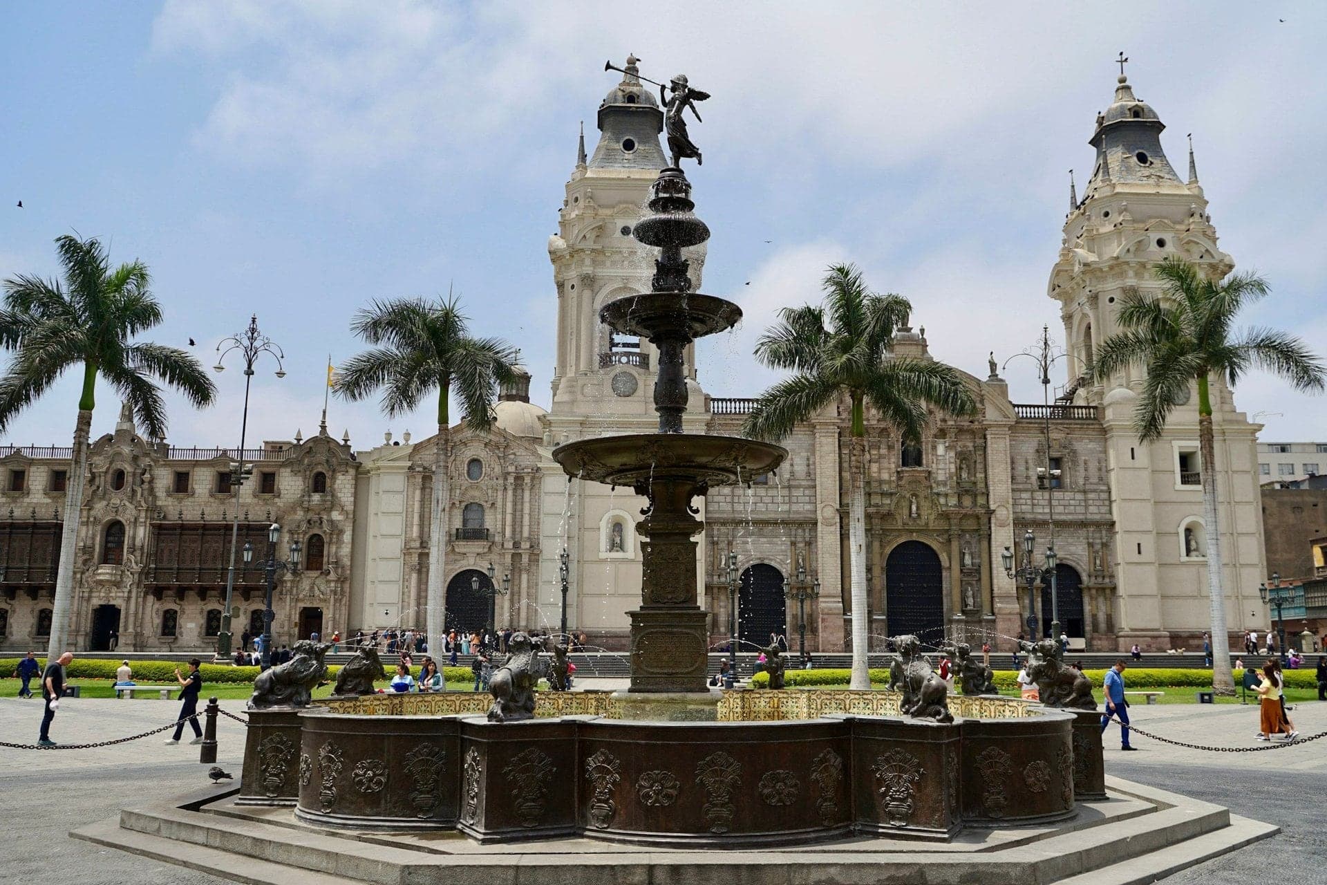
Plaza Mayor: Four Sides and a Fountain
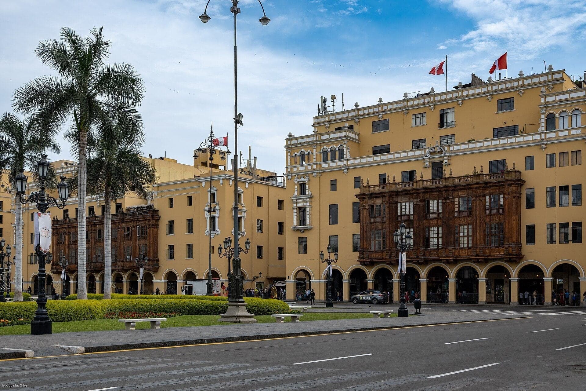
The founding square and its 1651 fountain. Round it stand the cathedral and three palaces, most of them rebuilt in the twentieth century.
- 11
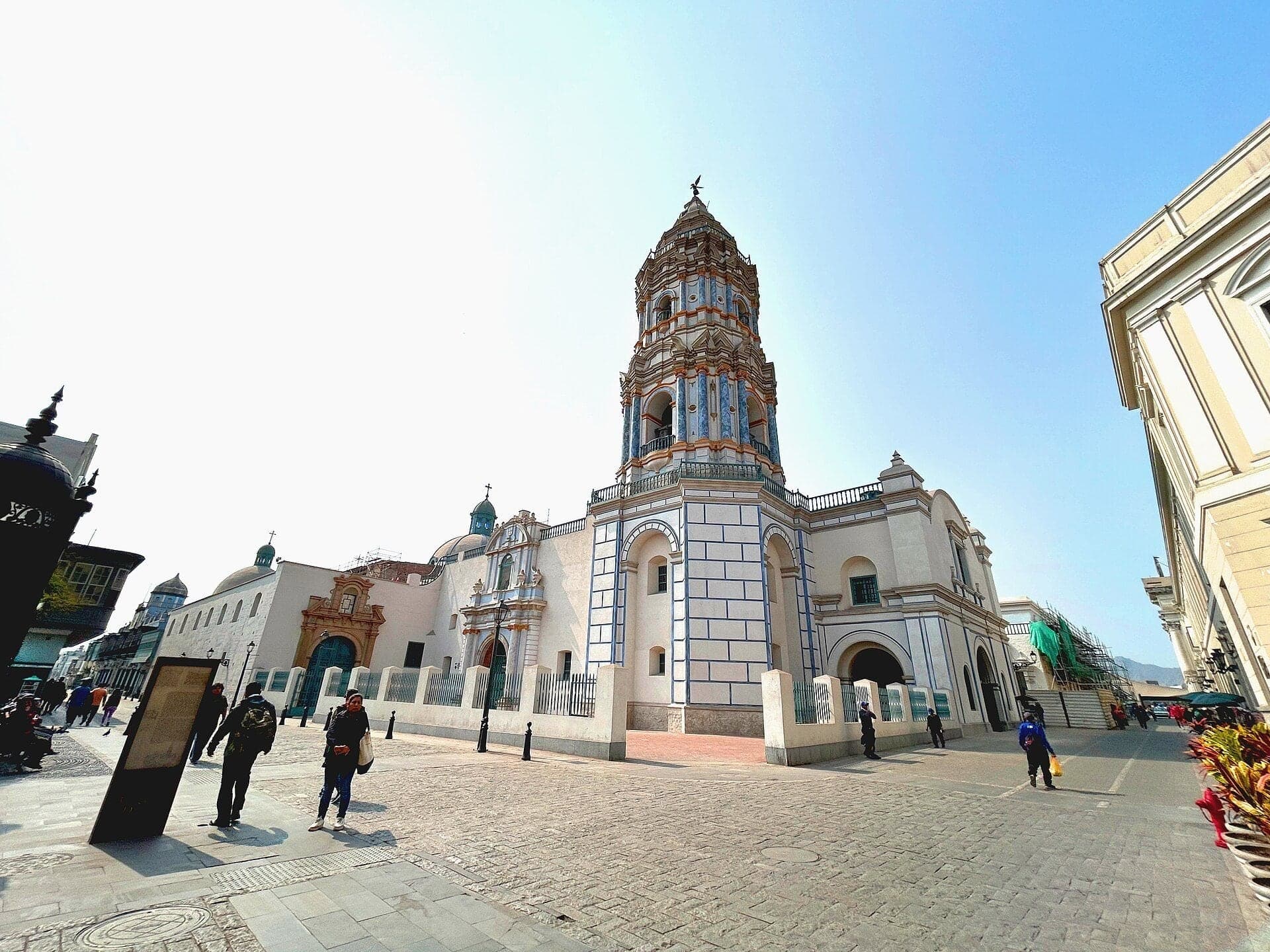
Santo Domingo: Where San Marcos Began
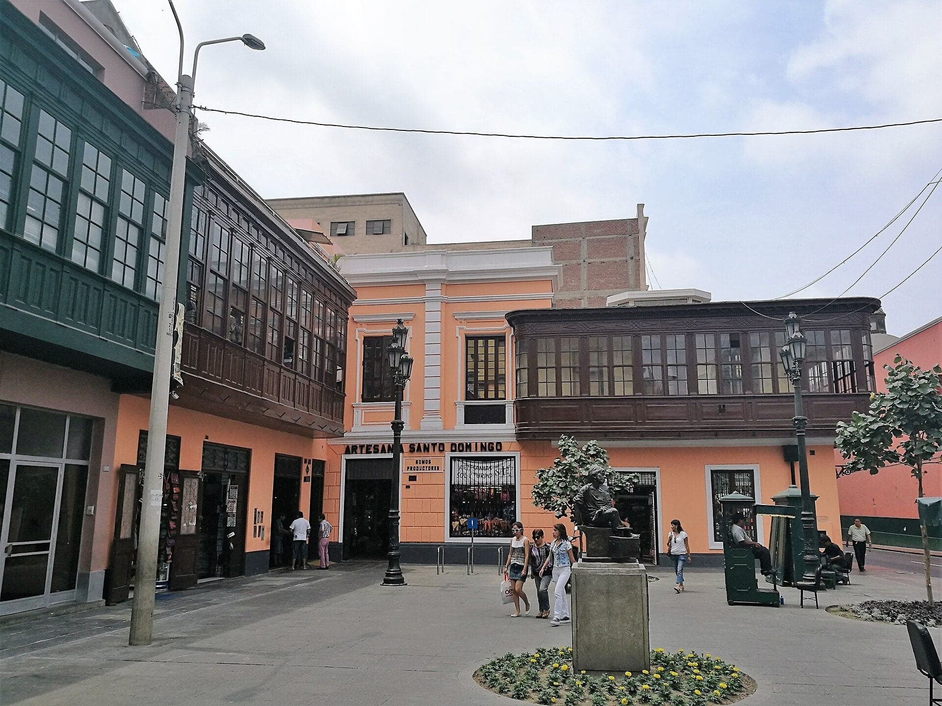
Where Lima's university held its first classes. Santo Domingo's tower, finished in 1780, was for a time the highest point in Lima.
- 12
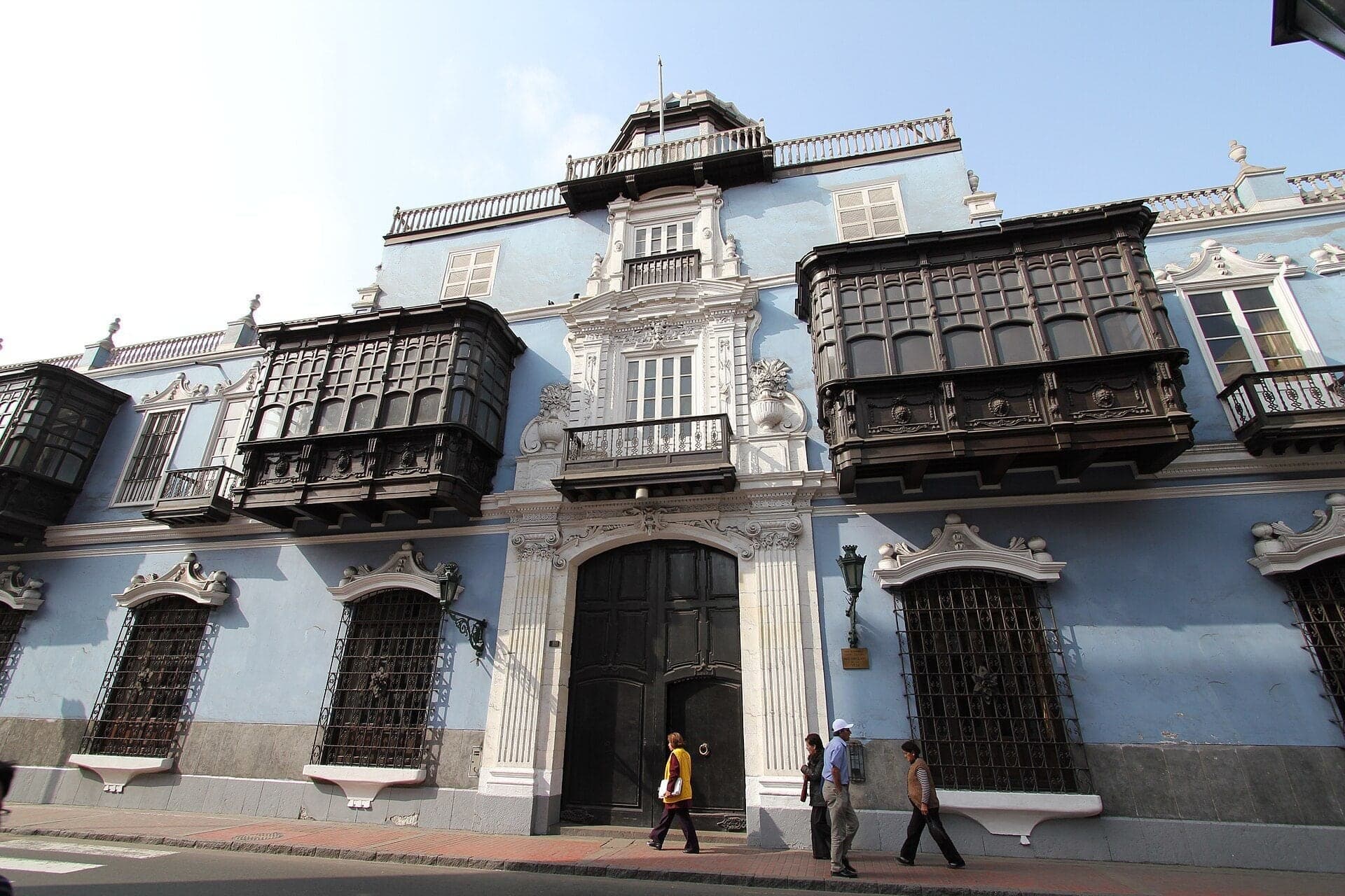
Casa de Osambela: The Lesson of 1746
A balconied house of about 1800 restored in 2026. On the Calle Conde de Superunda, it ends the walk with how Lima rebuilt after the earthquake of 1746.
Details
Best Time to Visit
A morning from Tuesday to Saturday, starting around 10:30: the churches and the Casa de la Literatura are open (it closes on Mondays), and you reach the Plaza Mayor around midday, when the changing of the guard is usually held. Start by about 15:00 at the latest so you finish in daylight. Lima's center is quieter on weekday mornings than on weekend afternoons. In October and early November the Señor de los Milagros processions can fill the Unión, the Plaza Mayor and the streets round it: an extraordinary sight, but on a procession day the walk will not run as written.
Pro Tips
- •Getting to the start: the Colmena and Jirón de la Unión stations of the Metropolitano bus are a short walk from Plaza San Martín; they can close during protests. By taxi, use a licensed app or phone taxi rather than hailing one in the street (UK travel advice, updated 2 October 2026). Checked 6 October 2026.
- •Cathedral of Lima museum (stop 9): foreign visitors 30 soles, Peruvians and residents 20, students and children 6 to 12 10, under 6 free; Monday to Friday 09:00 to 20:00, Saturday 10:00 to 22:00, Sunday 13:00 to 19:00; timed tickets online at catedraldelima.org.pe. Checked 6 October 2026.
- •San Francisco's convent museum and catacombs (stop 7): guided visits only, about 45 minutes, in Spanish and English, no photos in the catacombs. There is no official price or schedule online; press reports from 2021 to 2024 gave about 15 soles for adults. Ask at the convent's ticket office, and do not trust websites selling tickets. Checked 6 October 2026.
- •Torre Tagle (stop 5): free guided visits on Saturdays and Sundays, 16:00 to 19:00, per the Foreign Ministry's leaflet of September 2024 (the palace is Jirón Ucayali 363; registration in 2024 was next door at number 337). Confirm before you go. Checked 6 October 2026.
- •Santo Domingo's convent museum (stop 11): Tuesday to Sunday, 09:30 to 13:00 and 14:00 to 17:30, 15 soles (Andina, August 2024); the church itself is free. Checked 6 October 2026.
- •Casa de la Literatura Peruana (stop 8): free, Tuesday to Sunday 10:00 to 19:00, closed on Mondays. Checked 6 October 2026.
- •Casa de Aliaga, Jirón de la Unión 224, just past the Plaza Mayor's north corner: a colonial house shown only on guided visits by reservation, 35 soles per person, daily 09:30 to 17:00 (casadealiaga.com). The family says it has lived there since 1535. Checked 6 October 2026.
- •For a drink at the start or the end: the Hotel Bolívar's bar on Plaza San Martín serves an oversized pisco sour it calls the Catedral.
Safety & Precautions
- •The Plaza Mayor is often fenced and guarded by police: reports in February 2025, October 2025 and March 2026 describe railings on all or most sides. Stops 9 and 10 stand on the streets outside the fence and work either way; never climb or pass the barriers. Checked 6 October 2026.
- •On protest days police close Plaza San Martín (declared a no-protest zone by the city in November 2025) and the accesses to the Plaza Mayor on Carabaya, Junín, Callao and the Unión, and the Metropolitano stations nearby can shut. Protests often happen in the historic center (UK travel advice, 2 October 2026). If Plaza San Martín is shut, stop 1 works from the far pavement of the avenue where the Unión begins. Check the news on the morning you walk, and keep away from any demonstration. Checked 6 October 2026.
- •Between stops 8 and 9 the route passes a police gate at the corner of Áncash and Carabaya, beside the Government Palace. If it is closed, walk back along Áncash to Jirón Lampa, follow Lampa and Junín to the corner of the Plaza Mayor, and rejoin the route on Carabaya. If Junín is closed too, carry on down Lampa to Jirón Huallaga and join the route at the square's south corner.
- •The Unión, the squares and Jirón Azángaro are crowded: keep your phone and valuables close, especially while you listen and look up.
- •Stay on the route's streets. Do not continue east along Áncash, Junín or Ucayali past Azángaro toward Avenida Abancay, or cross Abancay into Barrios Altos or toward Mesa Redonda. At the end, go back to the Plaza Mayor or the Unión for a licensed taxi rather than walking on along Conde de Superunda to Avenida Tacna or down to the river and the Puente de Piedra.
- •Walk in daylight: start by about 15:00.
- •The route is flat, with one short flight of steps leaving Plaza San Martín.
- •The Plazuela de San Francisco has been a worksite: the city restarted its restoration on 5 January 2026, expecting about five months, and no completion has been reported. Hoardings may block part of the view from stop 7. Checked 6 October 2026.
- •Churches open at service times and close for part of the day; do not go in during Mass except to attend it.
- •On Sunday 18 October 2026 the Señor de los Milagros procession fills the Unión, the Plaza Mayor, Carabaya, Ucayali and Junín, and other procession days fall in October and early November; expect closures and very large crowds (El Peruano, 30 September 2026).
Travel advisory: Exercise Increased Caution (Level 2).
Gallery
Related Reading
Go deeper on what you'll see, hear, and walk through.
Read the walk
The full story of Historic Center: The City of Kings, Rebuilt, in words. Prefer to listen? Play it narrated, from home or on location.
Introduction
Lima, the capital of Peru, was founded in January fifteen thirty-five as the City of Kings, probably for the Three Kings of Epiphany. At first glance its old center looks purely colonial: carved stone church fronts, dark wooden balconies, a grand main square. On a second look, the story changes. Earthquakes knocked much of the colonial city down, and in the twentieth century a young republic rebuilt the colony it wanted to remember. Some of the most colonial-looking palaces here are only about a hundred years old.
This walk is about reading the street: what is original, what was rebuilt, and why. A second thread runs through the street names, which Lima swept away and replaced in the eighteen sixties.
Three names come back along the way: Francisco Pizarro, the Spanish conqueror who founded the city on its checkerboard of streets; Rafael Marquina, architect of a grand hotel and a railway station; and Ricardo de Jaxa Malachowski, a Polish architect trained in Paris, who gave the main square much of its present face.
The walk is twelve stops over about two and a half kilometres, a mile and a half, on flat streets, and takes about an hour and three quarters. It runs from Plaza San Martín up the old main street, past San Francisco and the old railway station, round the Plaza Mayor, to a house of balconies near Santo Domingo.
1. Plaza San Martín: A Square for a Centenary
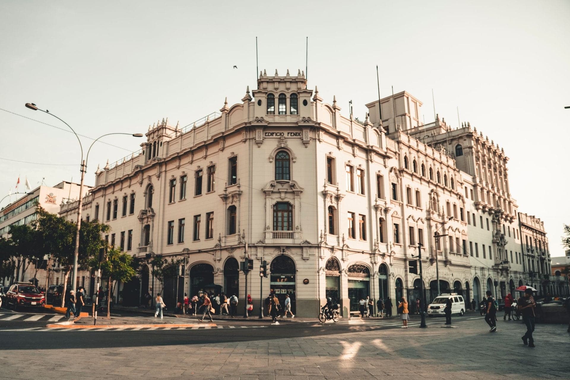
Welcome to Lima's historic center, and to Plaza San Martín. Take in the fronts all round the square: white and cream, with towers, arcades and carved ornament, grand and old-looking. Almost all of them went up in the nineteen twenties and later.
This square opened on the twenty-seventh of July, nineteen twenty-one, for a hundred years of Peru's independence, and it was not finished. The buildings that frame it came over the next two decades. Before that, this block held a convent, and later the station of the English railway to the port of Callao, pulled down to make a square about the size of the Plaza Mayor.
The monument in the middle honors José de San Martín, the general who first proclaimed Peru's independence, in the Plaza Mayor you will reach later. A competition found no design fit to build, so the government hired a Spanish sculptor directly, and he finished the group in Madrid in nineteen thirteen. Then the First World War intervened, and the monument stood wrapped in canvas on the empty lot until just before the opening. The sculptor wanted San Martín more statesman than warrior.
Across the avenue stands the big white Gran Hotel Bolívar, opened in December nineteen twenty-four. Its architect was Rafael Marquina, and you will meet his work again by the river. Its builder was an American firm, Fred T. Ley, a name that also comes back. The fronts round the square follow the hotel's lead, a baroque revival with a French accent. One of them, the Club Nacional of nineteen twenty-nine, is by Ricardo de Jaxa Malachowski. Hold on to that name.
Since the day it opened, this square has been where Lima gathers to celebrate and to protest.
Follow the route down a short flight of steps and cross the avenue at the lights onto the Jirón de la Unión. Next, a street with eleven names.
2. Jirón de la Unión: One Street, Eleven Names
Walk on up the Jirón de la Unión and stop partway along this pedestrian block. This street joins Lima's two great squares: Plaza San Martín behind you, and the Plaza Mayor ahead.
Until the eighteen sixties, it had no single name. Each block had its own, eleven in all, from the Calle del Puente de Piedra by the river to the Calle de Juan Simón at this end. This block was the Calle de Boza, after the house of the Marquis of Casa Boza. Look along the walls for a yellow plaque that says so. Plaques like it, with the old name and a line of history, went up in the nineteen eighties.
In the eighteen sixties Lima swept the old block names away and named its streets after Peru's regions, provinces and rivers. That is why, on this walk, you will follow Ucayali, a river of the Amazon, and Junín, a region of the Andes. Only two long axes got names of their own, and this was one of them: the Union.
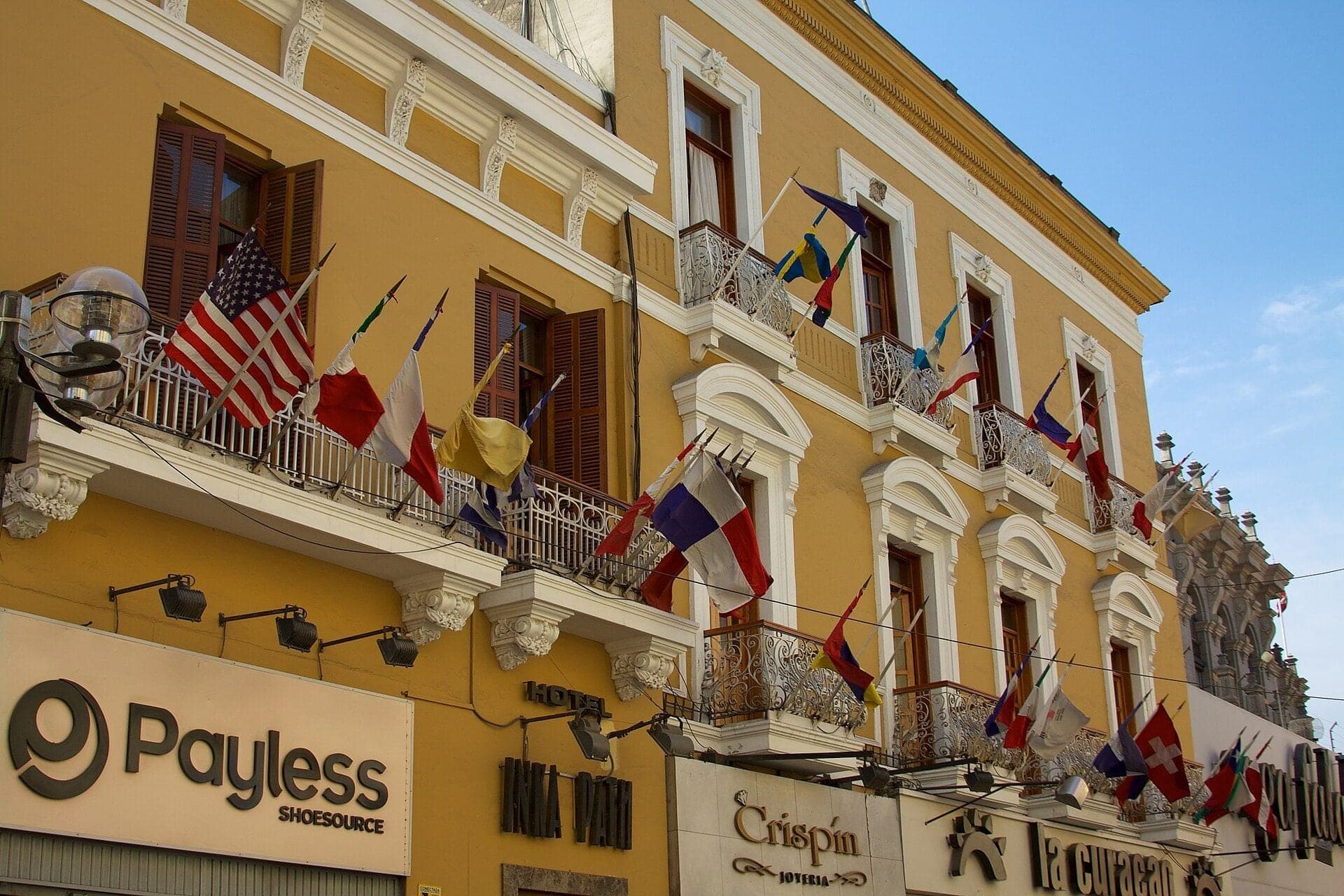
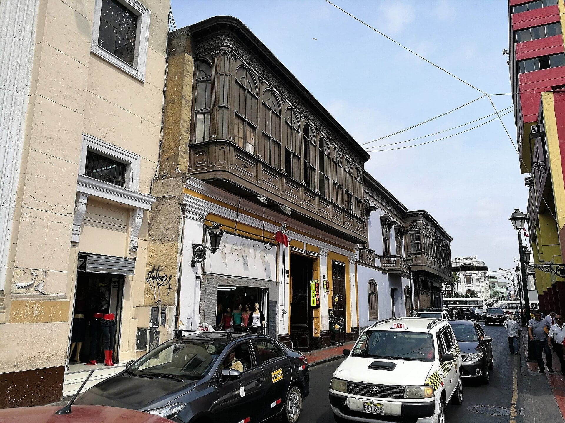
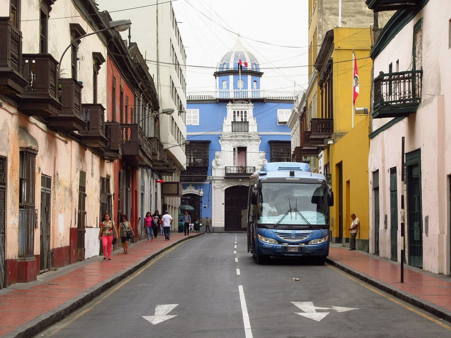
Now look up, above the shop signs. Some fronts here still carry closed wooden balconies, boxes of carved wood hung on the wall. Keep an eye out for them: they come back until the last stop.
Follow the route along the Unión. At the big crossing ahead, cross at the lights: the Metropolitano buses run in their own lane in the middle. Next, a church front that leans back.
3. La Merced: A Front That Leans Back
Walk on to the church with the gray carved stone front, and stop across the street from its middle. This is La Merced, the church of the Mercedarian friars, who said that Lima's first Mass was held here, before the city was founded. That is the order's own tradition.
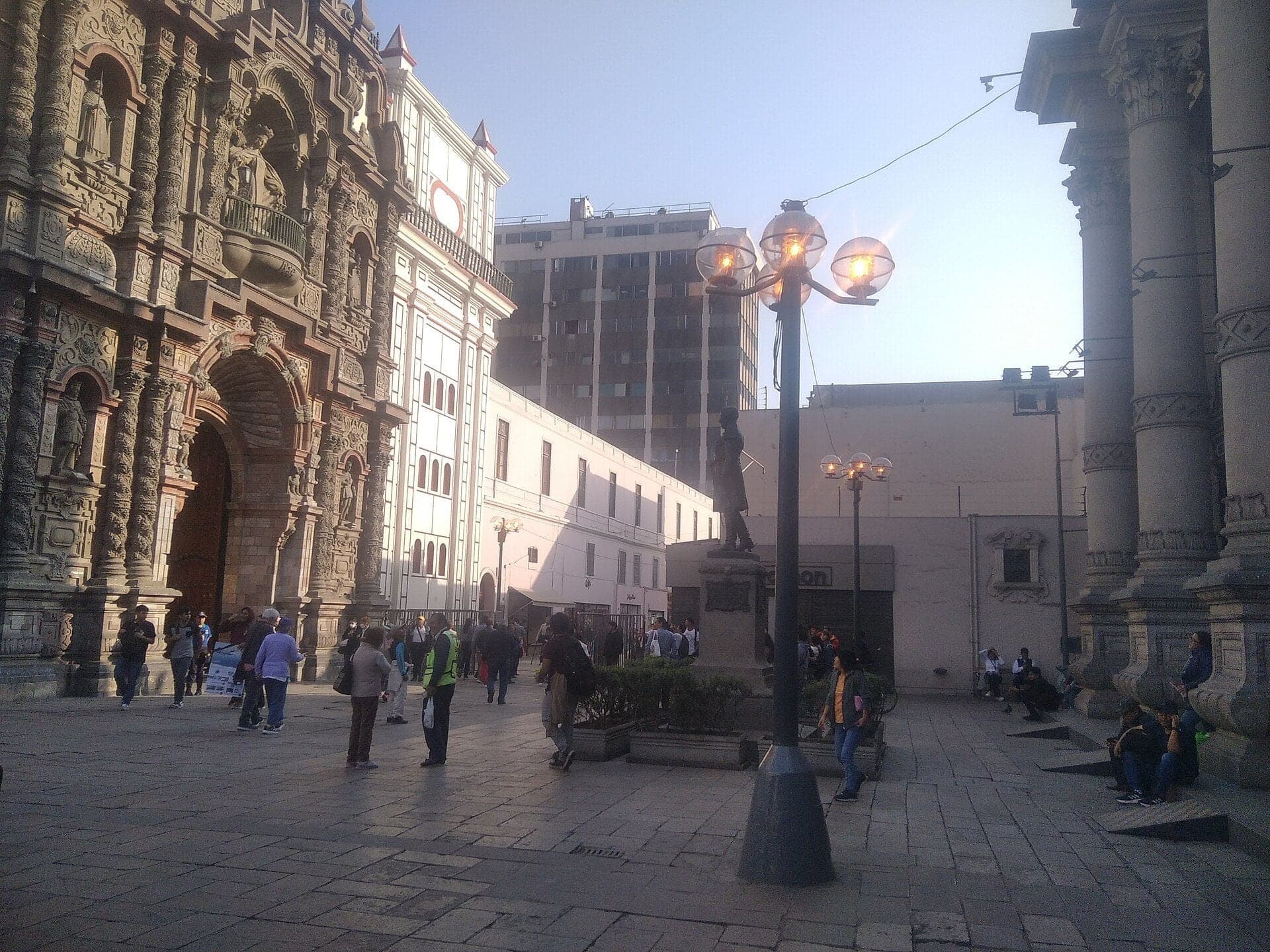
Now the front. It is built like an altarpiece turned outward onto the street: twisted columns, niches and carved stone in tiers between plain painted walls. The stone came a long way. In January sixteen ninety-seven a muleteer was hired to carry it down from a quarry at Virco, near Huamantanga, up in the highlands inland, and that July the stonecutter signed his contract.
Look at how each tier steps back from the one below it. A historian of Lima's architecture reads that as a guard against earthquakes. The earthquake of sixteen eighty-seven left this church in ruins. It was rebuilt with vaults and a dome in light materials, and finished around seventeen oh two, with this stone front.
But look again. What you see is not quite the front of seventeen oh two. In the twentieth century an architect rebuilt it, copying the old one; photographs from about eighteen ninety show the stepped-back tiers more clearly than today. The colonial front of La Merced is a twentieth-century copy of itself.
Most of Lima was built more lightly still. After the great earthquakes, ordinary buildings went up with adobe and brick below, and above them quincha: a light frame of wood or cane filled with mud, a technique used here since before the Spanish. Keep that word, quincha. It is the secret of the city's upper floors.
If the doors are open and no Mass is on, you can step inside; the church is free.
Follow the route on along the Unión and into Jirón Ucayali. Next, a bank from nineteen twenty-nine.
4. Jirón Ucayali: The Bank of 1929
Walk on along Jirón Ucayali and stop before the corner with Jirón Lampa. The street is named for a river, the Ucayali, in the Amazon: the renaming of the eighteen sixties at work.
On the corner just ahead stands a building faced in granite and artificial stone. It opened on the second of January, nineteen twenty-nine, as Peru's reserve bank, and the bank itself described its style as a modern adaptation of the Italian Renaissance. It was built by Fred T. Ley, the same American firm that built the Hotel Bolívar at the first stop. Since nineteen eighty-two it has been the central bank's museum, the Museo Central. In colonial times this corner joined two streets called Carrera and Villalta, two more names the eighteen sixties swept away.
Back at the last corner you passed stands the Hotel Maury. A French merchant founded it in eighteen thirty-five, but the building is from the nineteen fifties, when the original was pulled down. Its bar claims a hand in perfecting the pisco sour; that is the house's own story.
Two hotels and a bank, all of them twentieth-century buildings. In the same years Lima built modern banks like this one, it was also building palaces that look three hundred years old. You will see one by the cathedral, once you have seen the real thing.
Follow the route on along Ucayali. Next, a palace of carved balconies.
5. Torre Tagle: Balconies That Watch
Walk on along Ucayali and stop on this side of the street, across from the long front with two great carved wooden balconies. This is the Torre Tagle palace. On weekend afternoons the Foreign Ministry has offered free guided visits inside, and they are worth it; the details are…
Full narration for this stop unlocks with the tour.
6. Jirón Junín: Pizarro's Checkerboard
Walk on up Jirón Azángaro and stop just short of the corner with Jirón Junín. Junín runs dead straight from this corner to the Plaza Mayor, one line of the oldest plan in the city. Lima was founded on the eighteenth of January, fifteen thirty-five, by Francisco Pizarro, the…
Full narration for this stop unlocks with the tour.
7. San Francisco: Not Always Yellow
Walk on up Jirón Lampa and stop at the edge of the little square, with the yellow and white church and its two towers across it. This is San Francisco. Its convent museum and the catacombs beneath it are ticketed and visited only with a guide, and they are well worth it; the…
Full narration for this stop unlocks with the tour.
8. Casa de la Literatura: The Station by the River
Walk on along Jirón Áncash and stop before the gray and white stone front with the clock. Over the clock it reads Ferrocarril Central, the Central Railway, and over the doors, Estación Desamparados. Today it is the Casa de la Literatura Peruana, Peru's house of literature, and…
Full narration for this stop unlocks with the tour.
9. Archbishop's Palace: A Copy from 1924
Walk on along Carabaya and stop where the street meets the main square, beside the gray stone front with two great dark wooden balconies and the cathedral's towers next to it. If the square is fenced, as it often is, this street normally stays outside it. The cathedral is…
Full narration for this stop unlocks with the tour.
10. Plaza Mayor: Four Sides and a Fountain
Walk on under the arcade and stop where a passage opens off it, then turn to face the square. If the gates are open, you can walk in to the fountain; if the square is fenced, as it often is, everything here can be seen from the arcade. This is the Plaza Mayor, the heart of…
Full narration for this stop unlocks with the tour.
11. Santo Domingo: Where San Marcos Began
Walk on round the corner and stop along the little square, across the street from the church with the tall tower. This is Santo Domingo, the church of the Dominicans. The convent's cloisters behind it are a ticketed museum, and worth it; the church itself is free when it is…
Full narration for this stop unlocks with the tour.
12. Casa de Osambela: The Lesson of 1746
Walk on a little farther along the street and stop across from the long front with its row of big closed wooden balconies. This is the Casa de Osambela, built around eighteen hundred for Martín de Osambela, a merchant from Navarre, in the north of Spain. On the roof, at the…
Full narration for this stop unlocks with the tour.
- This is a photo of a monument in Peru, identified by ID — Ovruni, CC BY-SA 4.0 · source
- Monumentos del Centro histórico de Lima — Johnattan Rupire, CC BY-SA 4.0 · source
- Flags and fantastic balconies of one of the colonial buildings. — McKay Savage from London, UK, CC BY 2.0 · source
- This is a photo of a monument in Peru, identified by ID — Ovruni, CC BY-SA 4.0 · source
- This is a photo of a monument in Peru, identified by ID — Ovruni, CC BY-SA 4.0 · source
- This is a photo of a monument in Peru, identified by ID — Ovruni, CC BY-SA 4.0 · source
- Letrero con el antiguo nombre de la calle — Txolo, CC BY-SA 4.0 · source
- This is a photo of a monument in Peru, identified by ID — Miguel Francisco Rueda Ñañez, CC BY-SA 4.0 · source
- This is a photo of a monument in Peru, identified by ID — Gatodemichi, CC BY-SA 4.0 · source
- Encreuament entre el jirón Azángaro i el jirón Junin, al centre històric de Lima amb Sant Francisco al fons i un carruatge de cavalls — Pitxiquin, CC BY-SA 4.0 · source
- Encreuament entre el jirón Azángaro i el jirón Junin, al centre històric de Lima — Pitxiquin, CC BY-SA 4.0 · source
- San Francisco Monastery, Lima — Colin W, CC BY-SA 3.0 · source
- Basílica Menor e Convento de São Francisco o Grande, Lima - Peru — Paulo JC Nogueira, CC BY-SA 3.0 · source
- FERROCARRIL CENTRAL - Casa de la Literatura Peruana — F Delventhal, CC BY 2.0 · source
- Lima’s Historic Center, the heart of Peru’s capital, is a UNESCO World Heritage site founded in 1535 by Francisco Pizarro as the "City of Ki — xiquinhosilva, CC BY 2.0 · source
- Convento de Santo Domingo e iglesia de la Veracruz de Lima — Gatodemichi, CC BY-SA 4.0 · source
- Plazoleta de Santo Domingo, Cercado de Lima — Pitxiquin, CC BY-SA 4.0 · source
- Casa de Osambela. — comicpie, CC BY 2.0 · source
- Casa de Osambela desde jirón Cailloma — Felipe Restrpo Acosta, CC BY-SA 4.0 · source
Images may be cropped or resized. Other photos via Unsplash and Pexels.