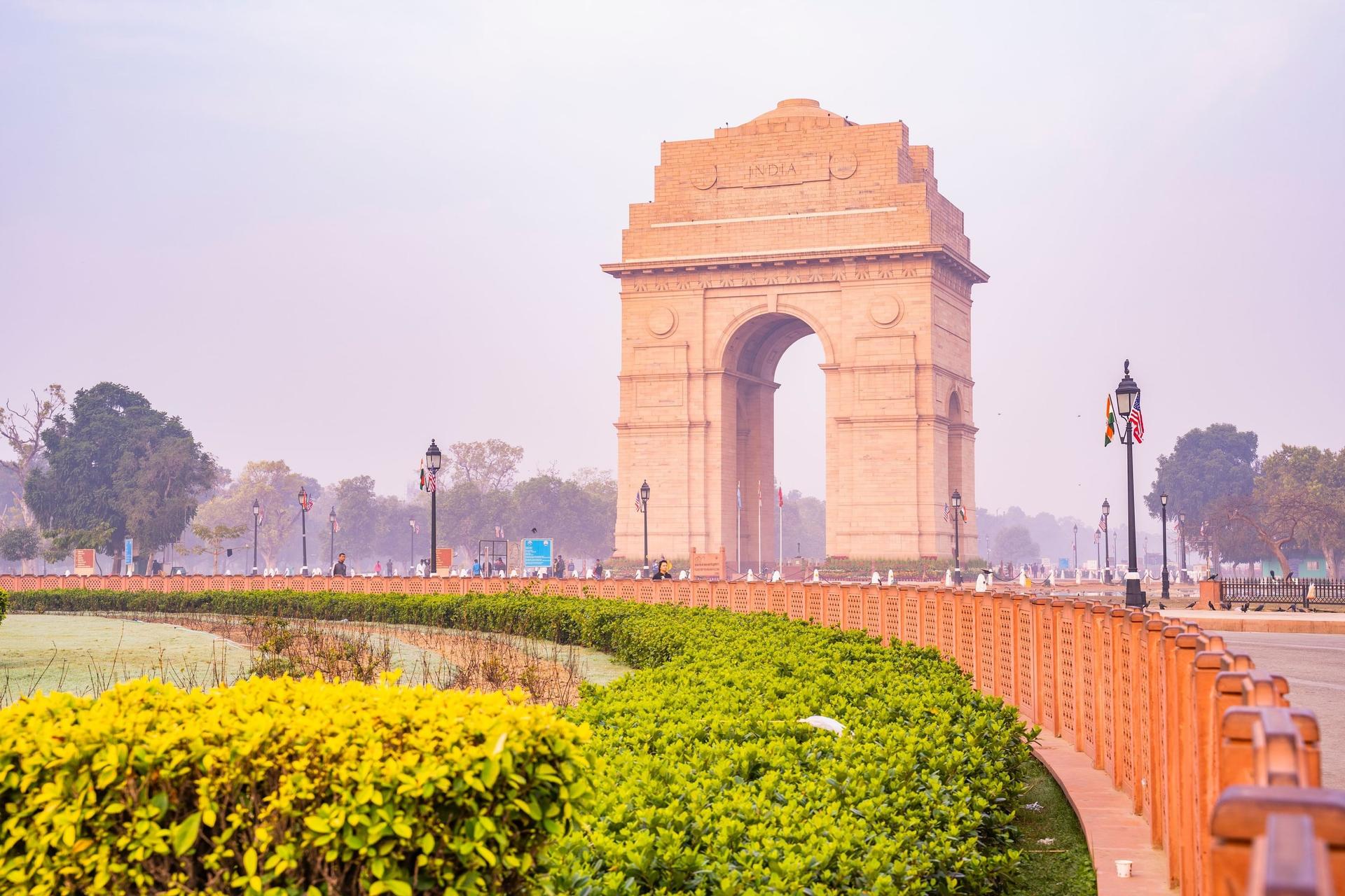
From the National War Memorial round the Netaji canopy to India Gate and the old place of the Amar Jawan Jyoti, then west along Kartavya Path past its tree rows, canals and the Republic Day parade route, under Janpath, to Rafi Marg and the view up Raisina Hill.
Start · National War Memorial
DirectionsStops
- 1
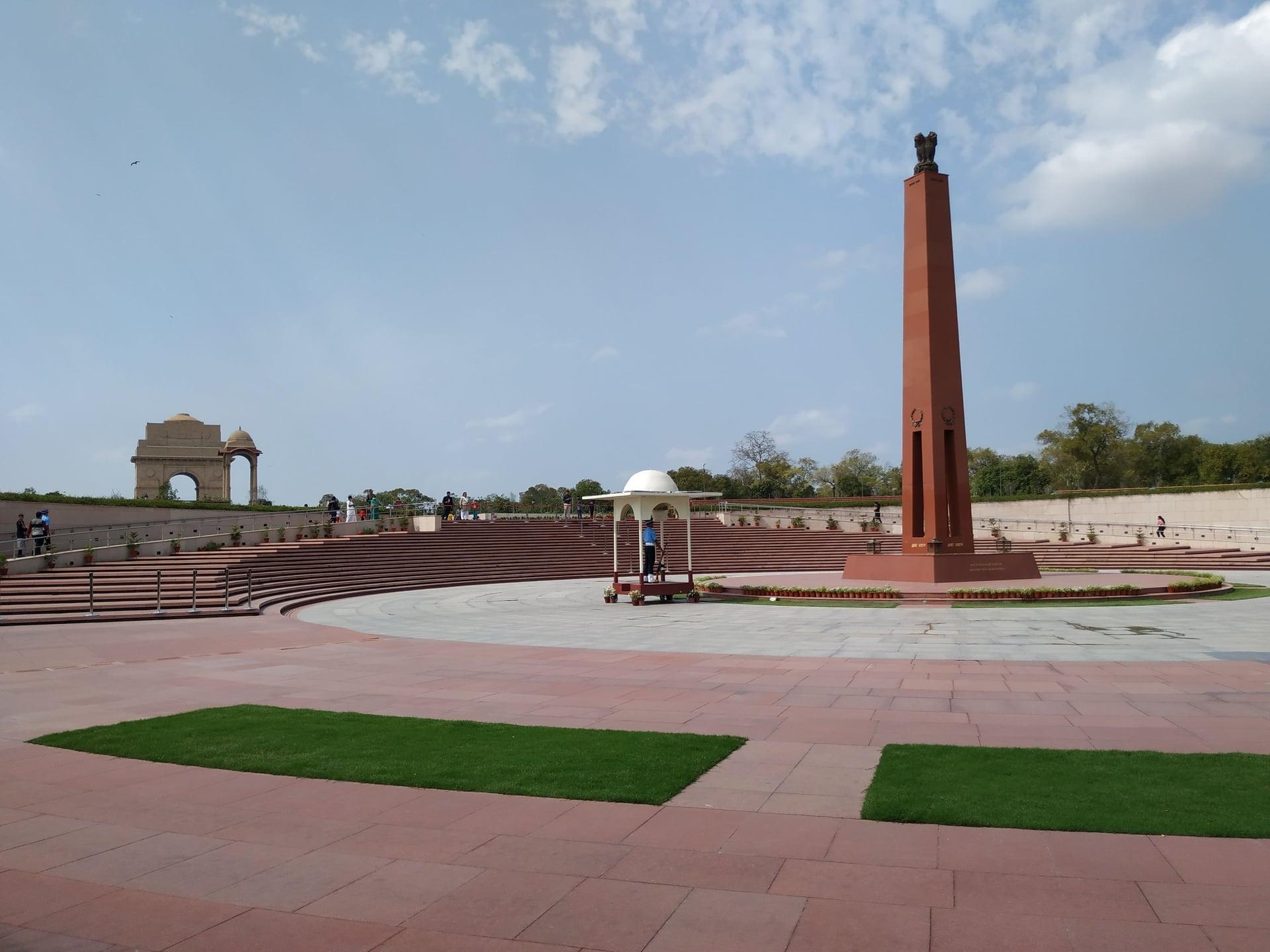
National War Memorial
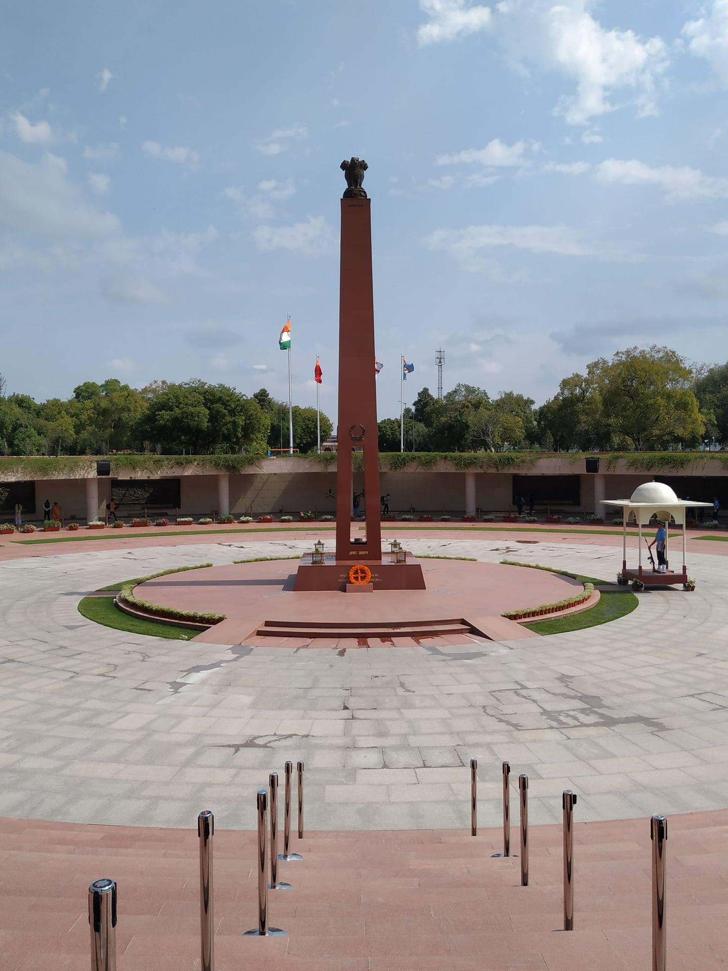
This memorial names soldiers since 1947. The National War Memorial (2019), seen over its west gate from the plaza: four rings round an obelisk and an eternal flame, with the names of more than 26,000 soldiers who died since 1947.
- 2
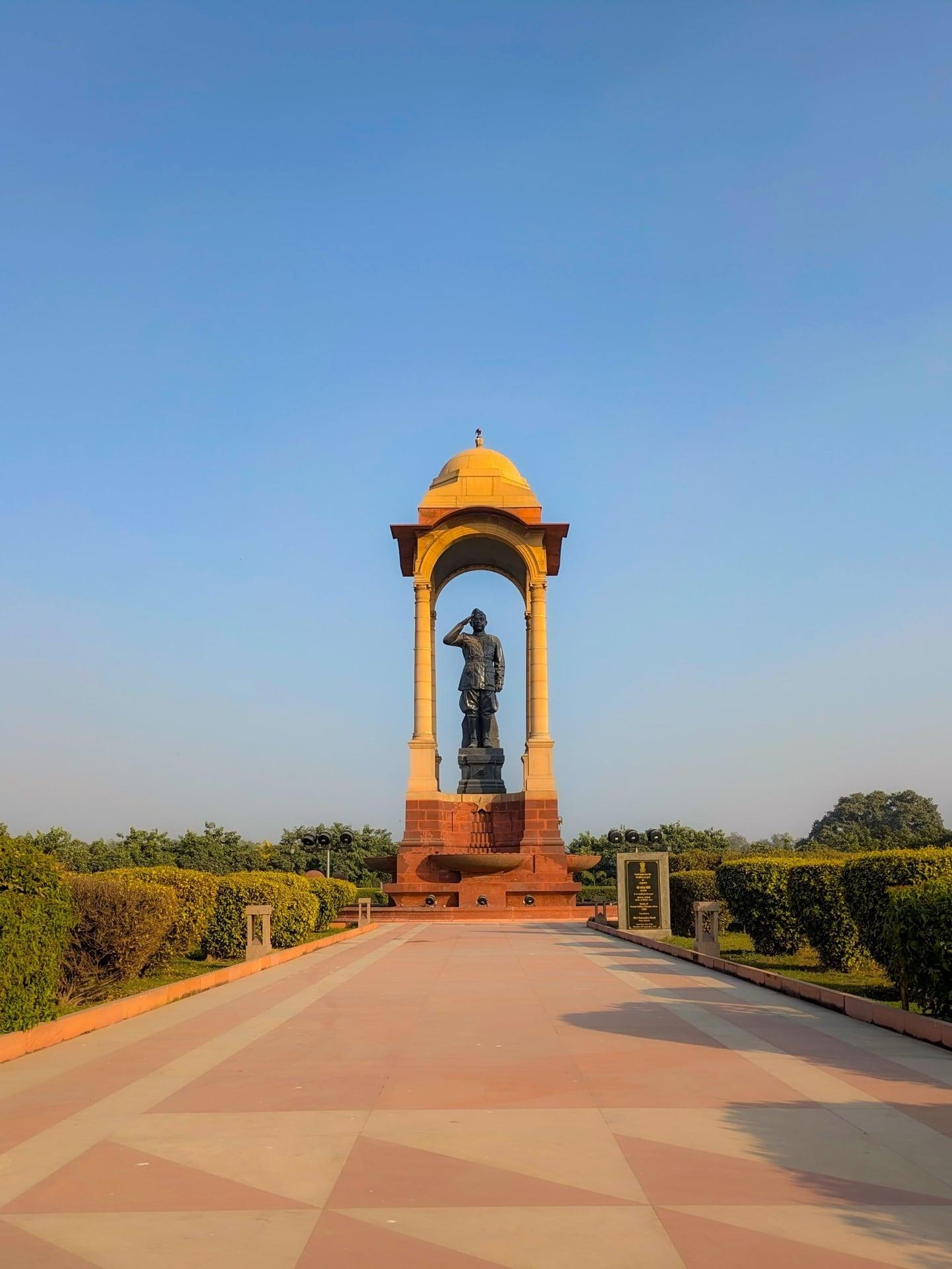
Netaji Statue: The King's Empty Canopy
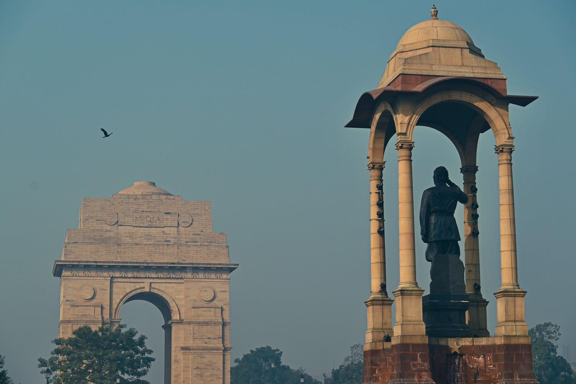
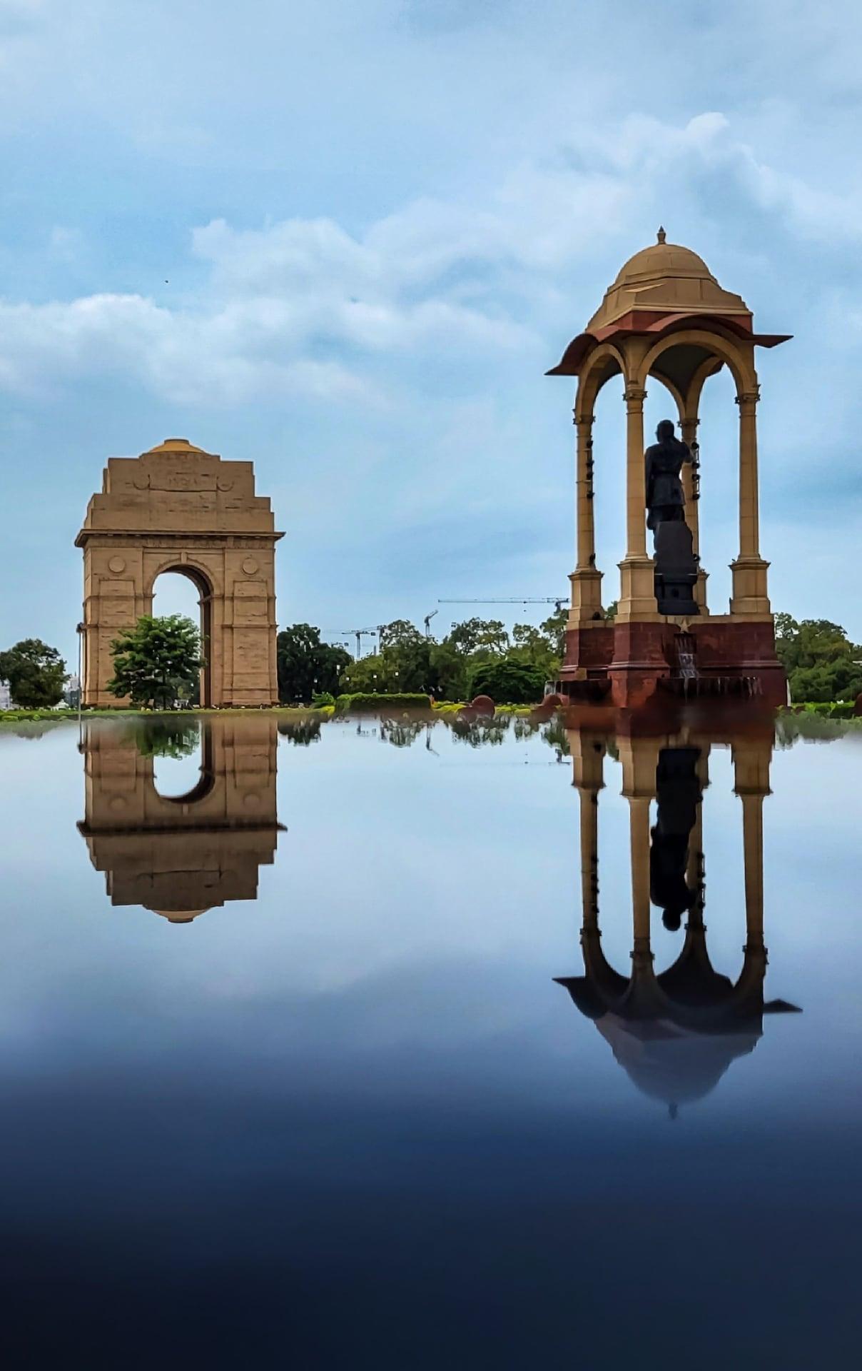
A canopy built for a king stood empty. The pale stone canopy of the 1930s, built for a statue of the British king that was removed in 1968, has held the granite statue of Netaji Subhas Chandra Bose since 8 September 2022.
- 3
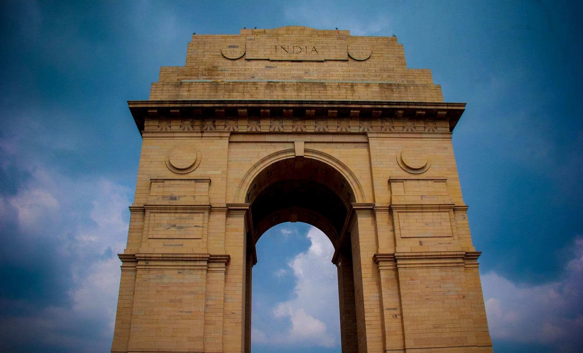
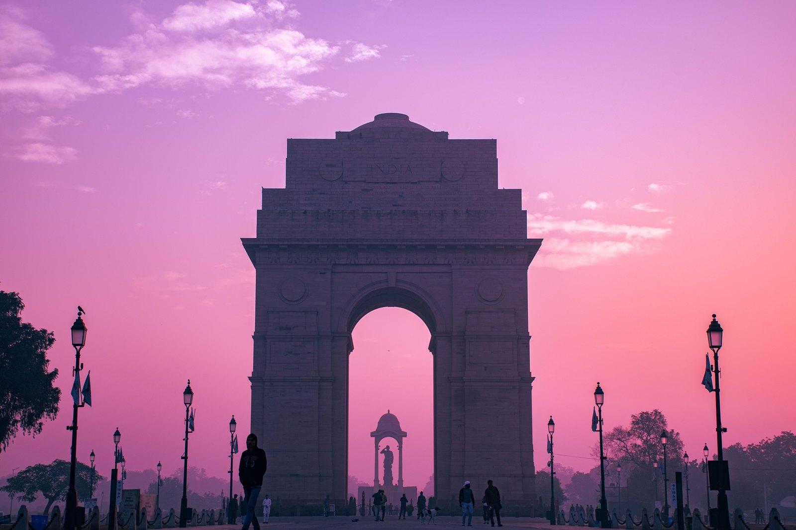
India Gate: The Names on the Arch
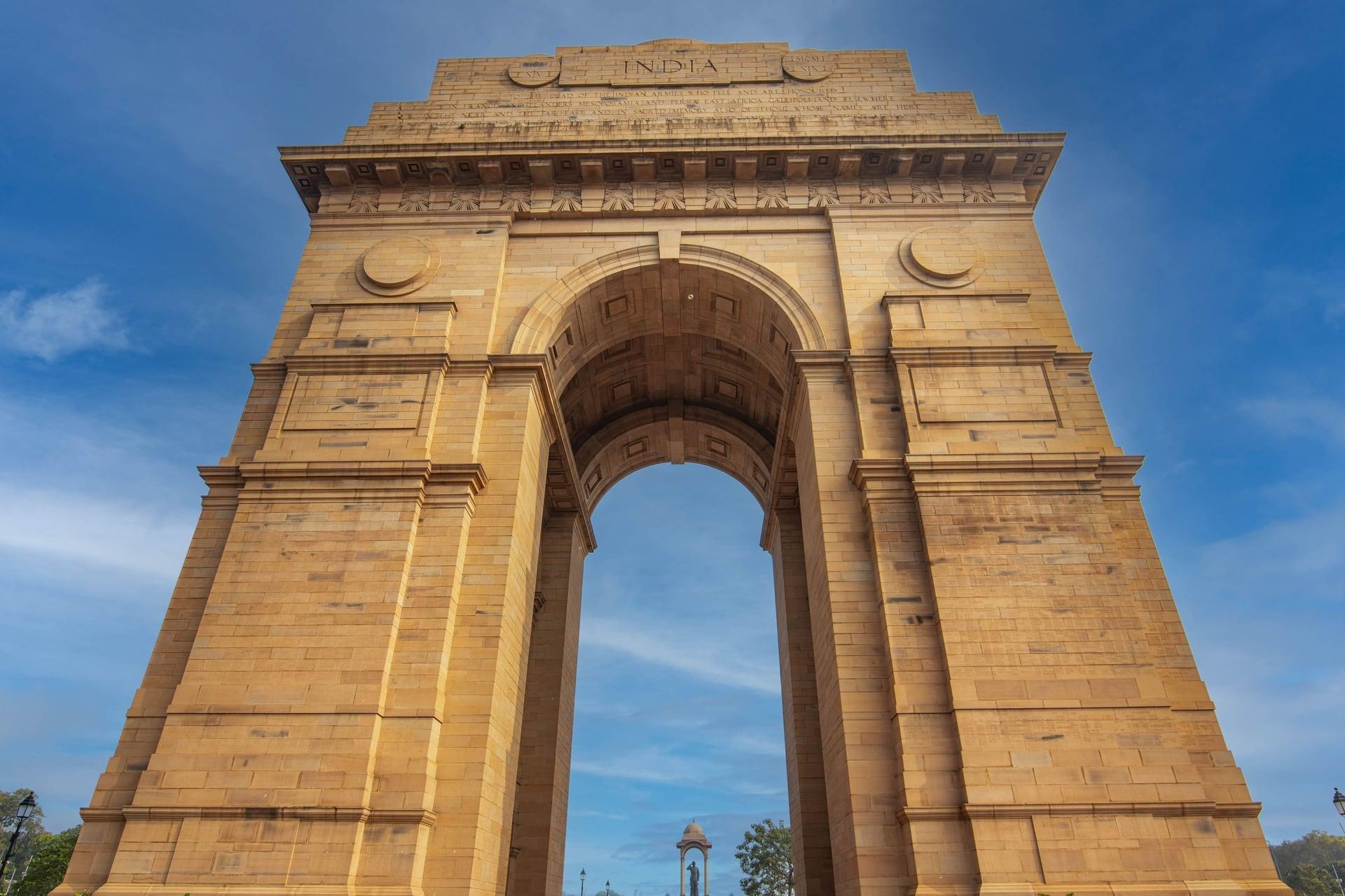
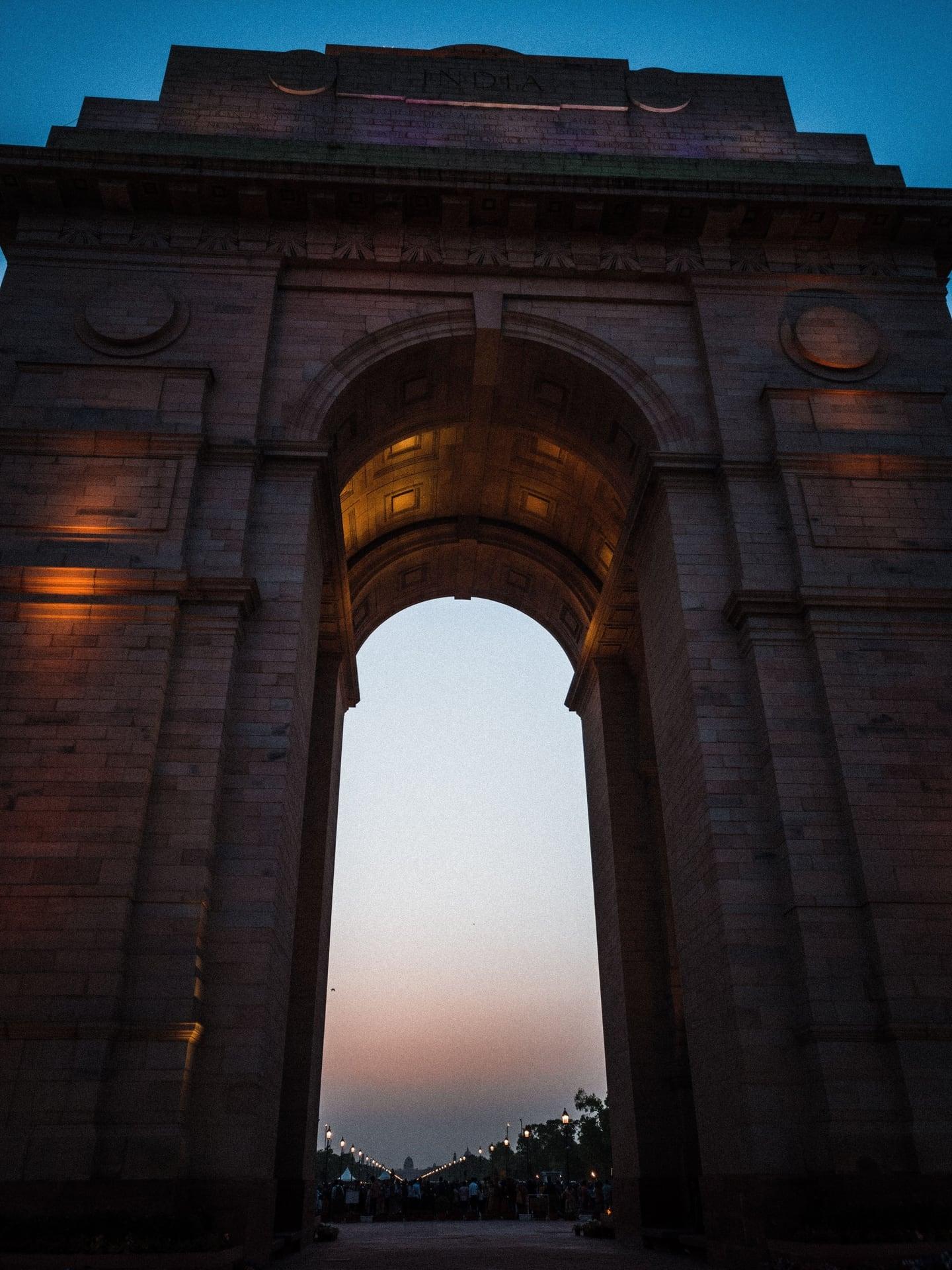
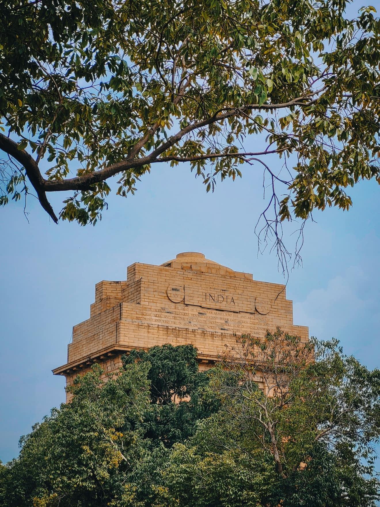
Most names here fell on the frontier. India Gate, the All India War Memorial by Edwin Lutyens: foundation stone 10 February 1921, unveiled 12 February 1931, 42 m high, with more than 13,000 names on its piers.
- 4
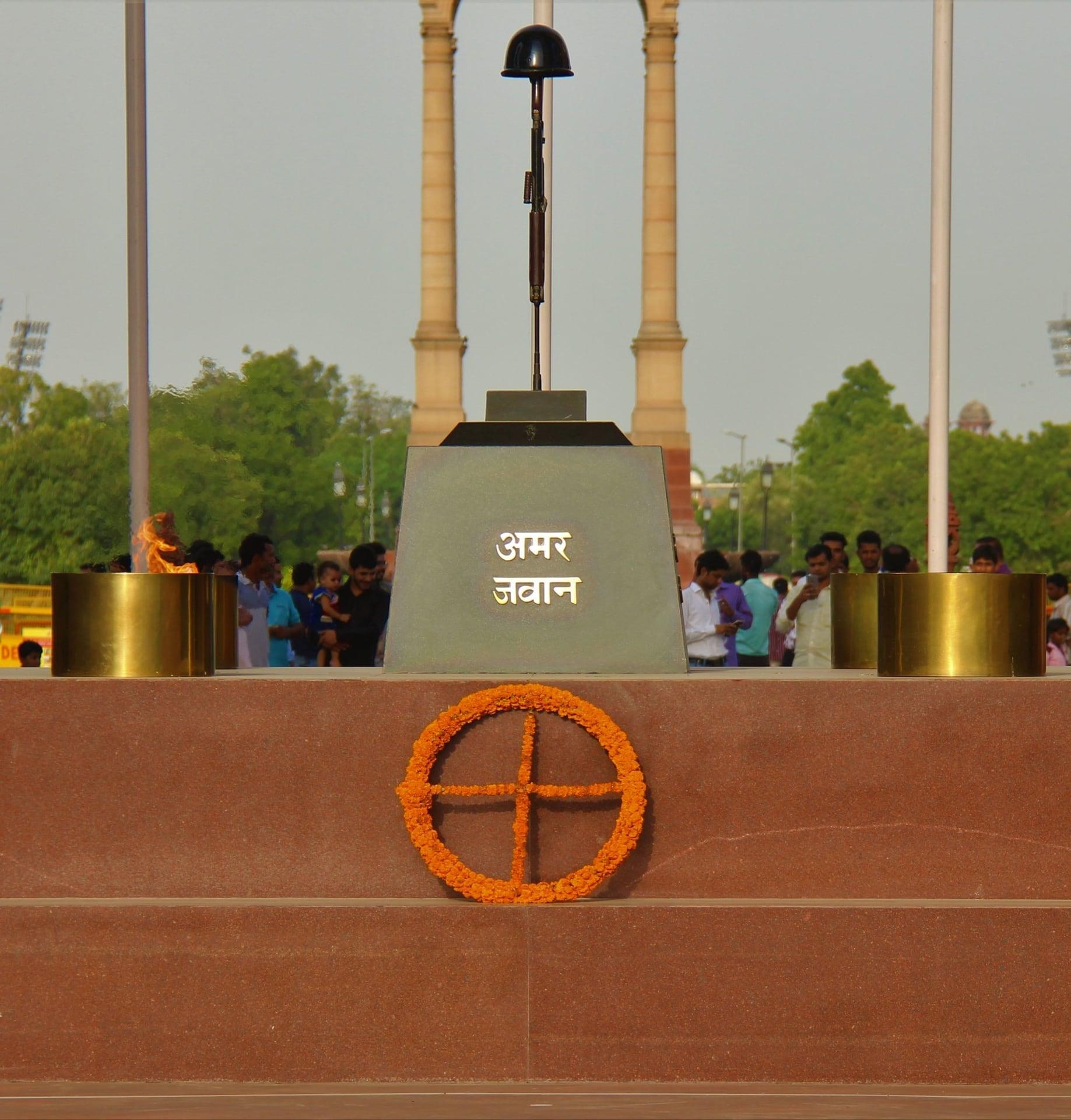
Amar Jawan Jyoti: The Flame That Moved
A flame burned here for fifty years. Under India Gate's arch, the Amar Jawan Jyoti, an upturned bayonet, a helmet and an eternal flame, honored the dead of 1971 from January 1972 until its flame was merged with the War Memorial's on 21 January 2022.
- 5
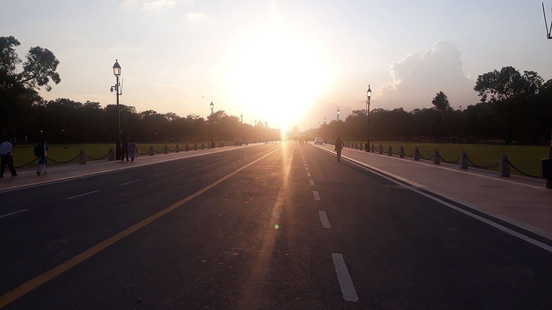
Kartavya Path: Three Names, One Avenue
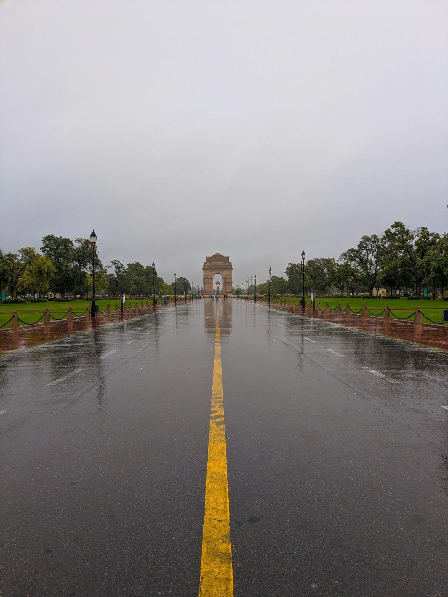
One avenue has carried three names. The ceremonial avenue, rebuilt from 2021 and renamed on 8 September 2022: wider lawns, 15.5 km of red granite walkways, four pedestrian underpasses, refurbished canals and 16 bridges.
- 6
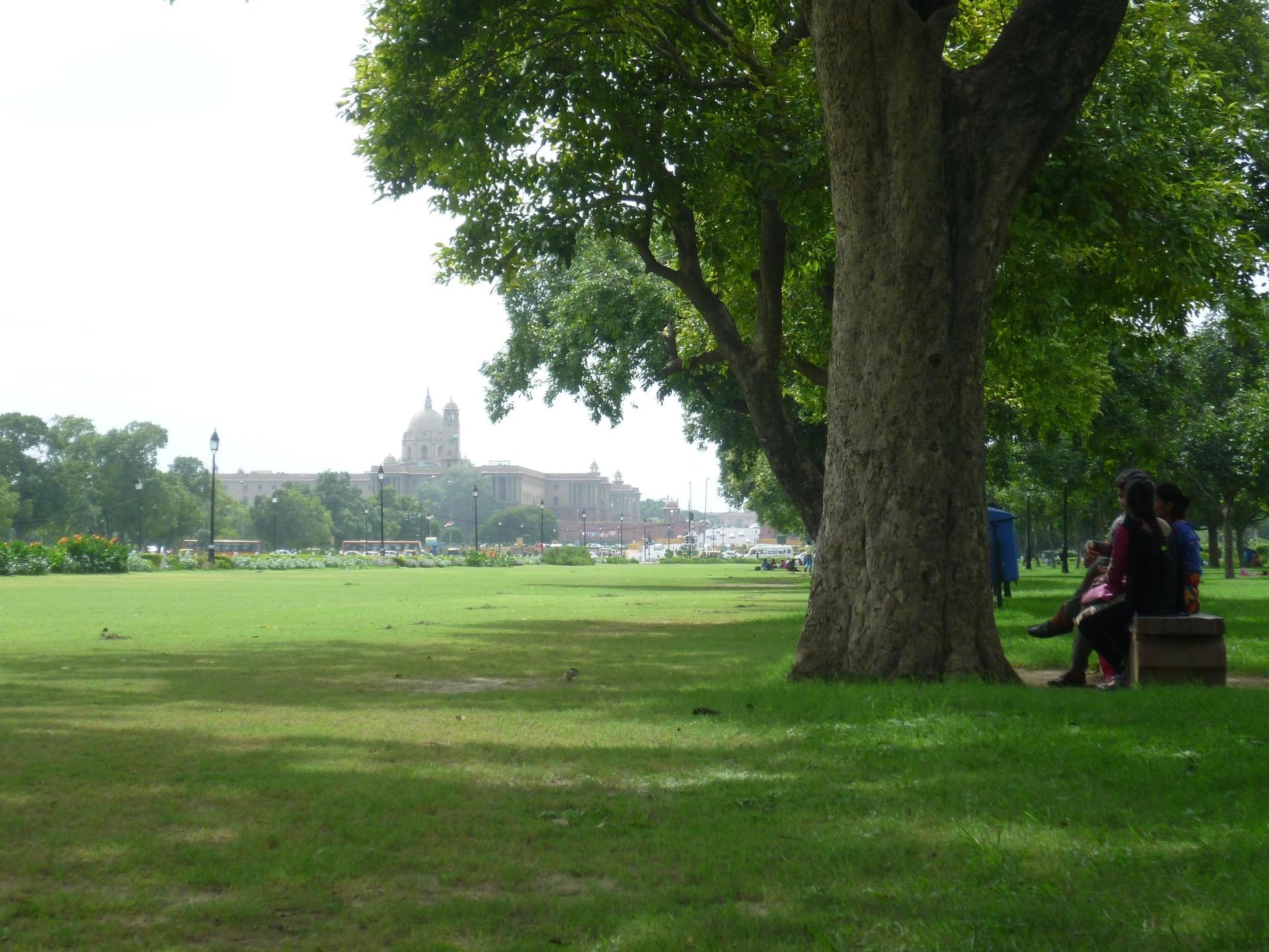
Avenue Trees: Planted in Crosses
The trees are part of the drawing. Rows of trees set back on the lawns: thirteen species chosen by the planners' committee for low upkeep (jamun, neem, imli, arjan, mulberry), planted in crosses; the original scheme had 454 trees.
- 7
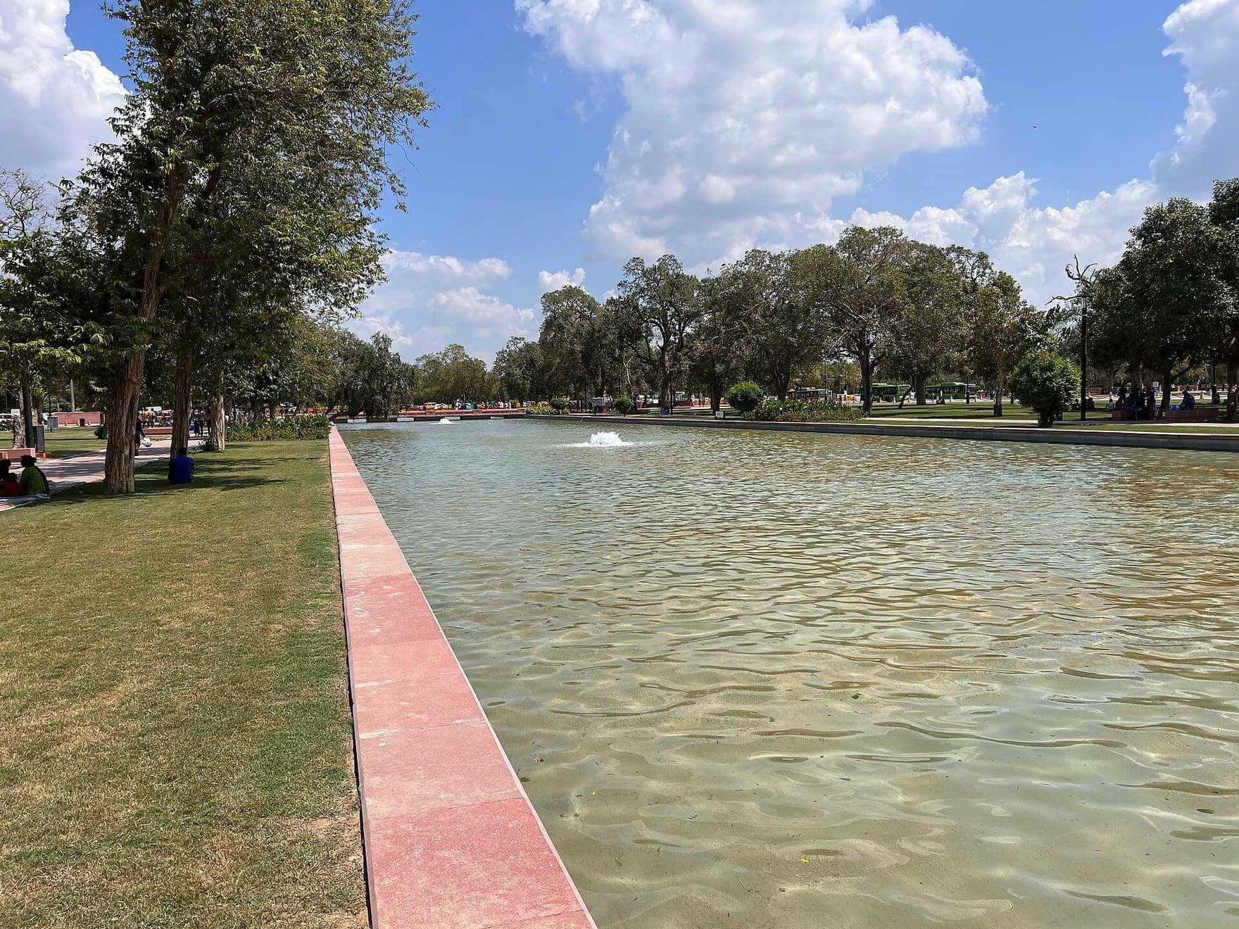
Canals and Bridges
Water runs beside the whole axis. The canals flanking Kartavya Path, refurbished in 2021 to 2022 (19 acres, aerators, 16 bridges); boating ran here from the 1960s until 2018 and was not restarted.
- 8
Janpath: Where the Axes Cross
Queen's Way crossed King's Way here. Janpath, once Queen's Way, meets the ceremonial axis at right angles, about halfway from India Gate to Vijay Chowk; walkers now pass beneath it by a 2022 underpass.
- 9
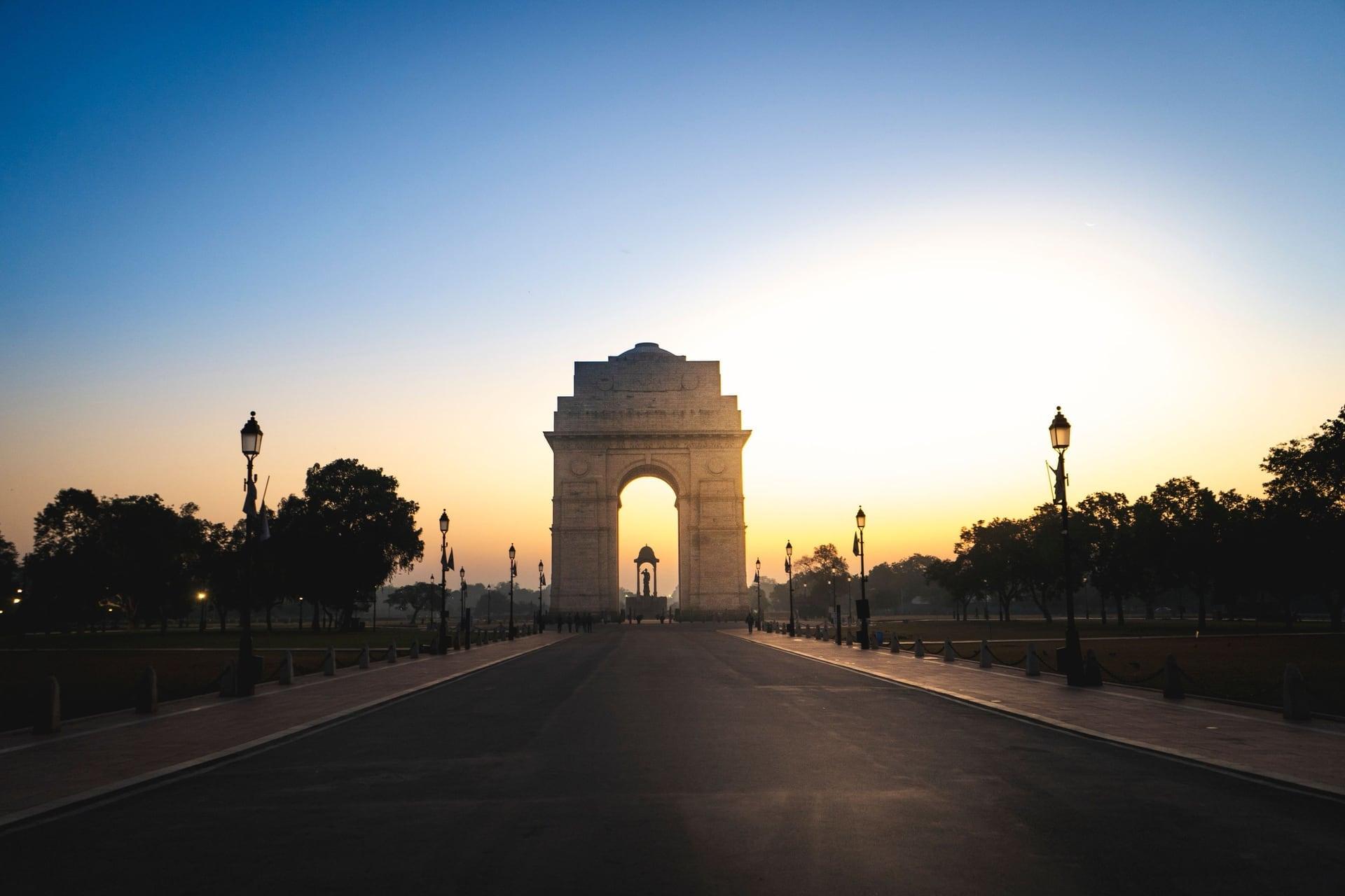
Republic Day Parade Route
This lawn is built for one day a year. The curb of the Republic Day parade route, used every year since 1955; the 2022 redesign added folding standard seating so that national events disrupt the avenue less.
- 10
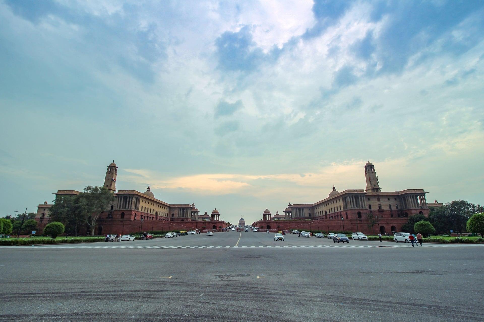
Dome Ahead: Lutyens and Baker's Slope
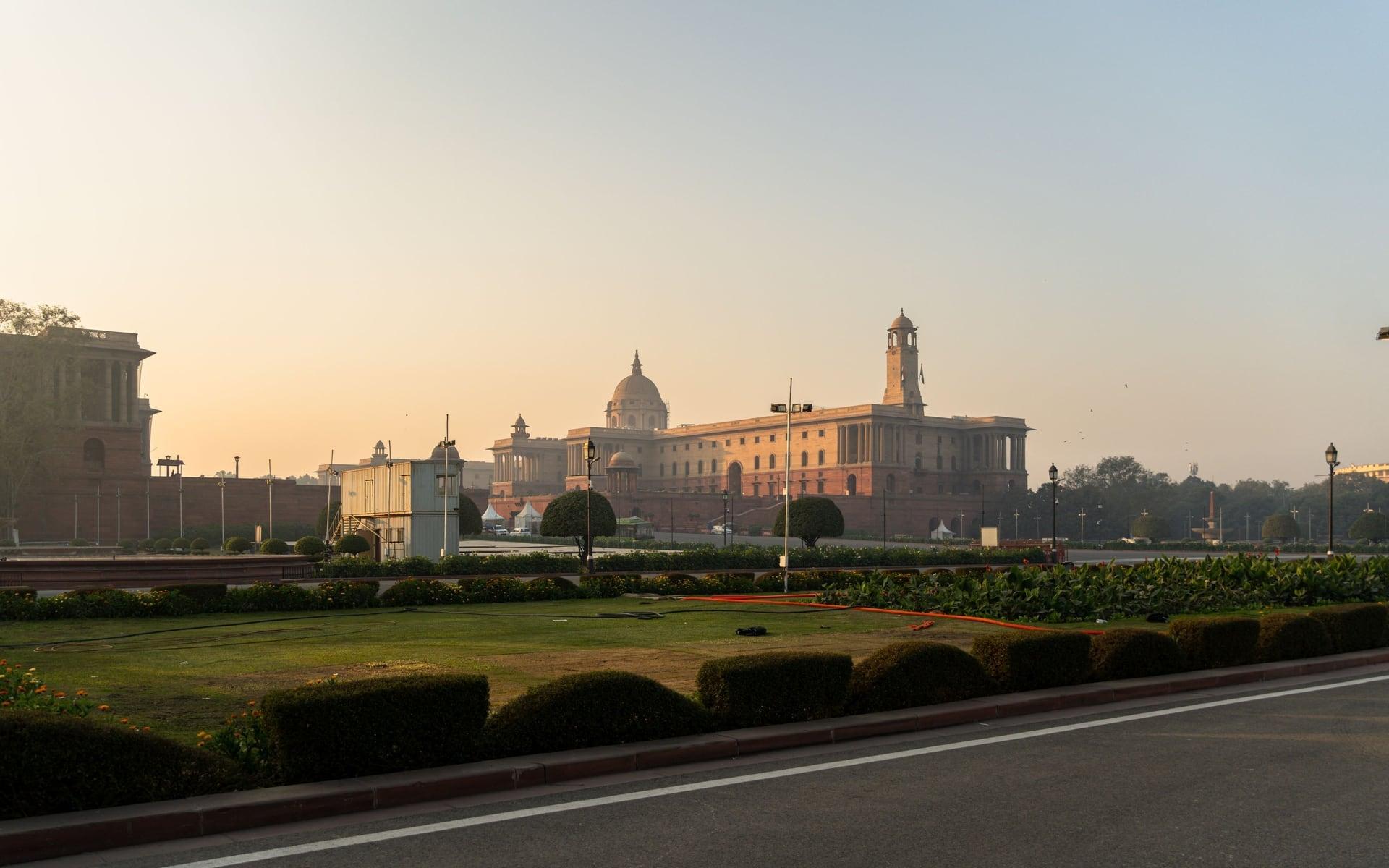
One slope split two architects. The dome of Rashtrapati Bhavan between the North and South Block towers: Lutyens wanted the house seen from King's Way, Baker's climb between his Secretariats hides it from Vijay Chowk, and Lutyens called it his Bakerloo.
- 11
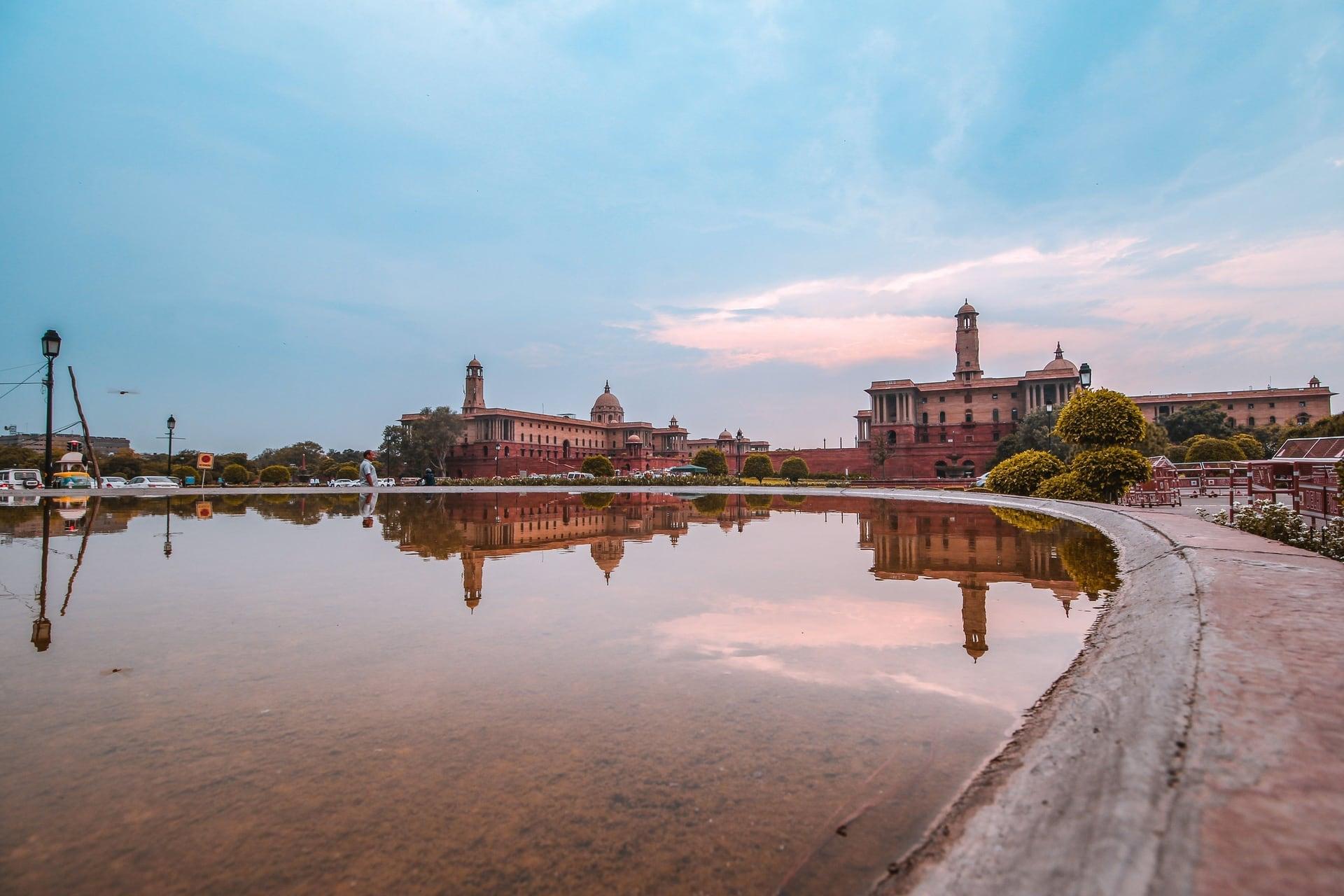
Rafi Marg: The Later Cross Street
A cross street was added for traffic. Rafi Ahmed Kidwai Marg, a cross street and node added to the plan for north to south traffic, with the North and South Block towers rising beyond it, planned since 2026 as a national museum.
- 12
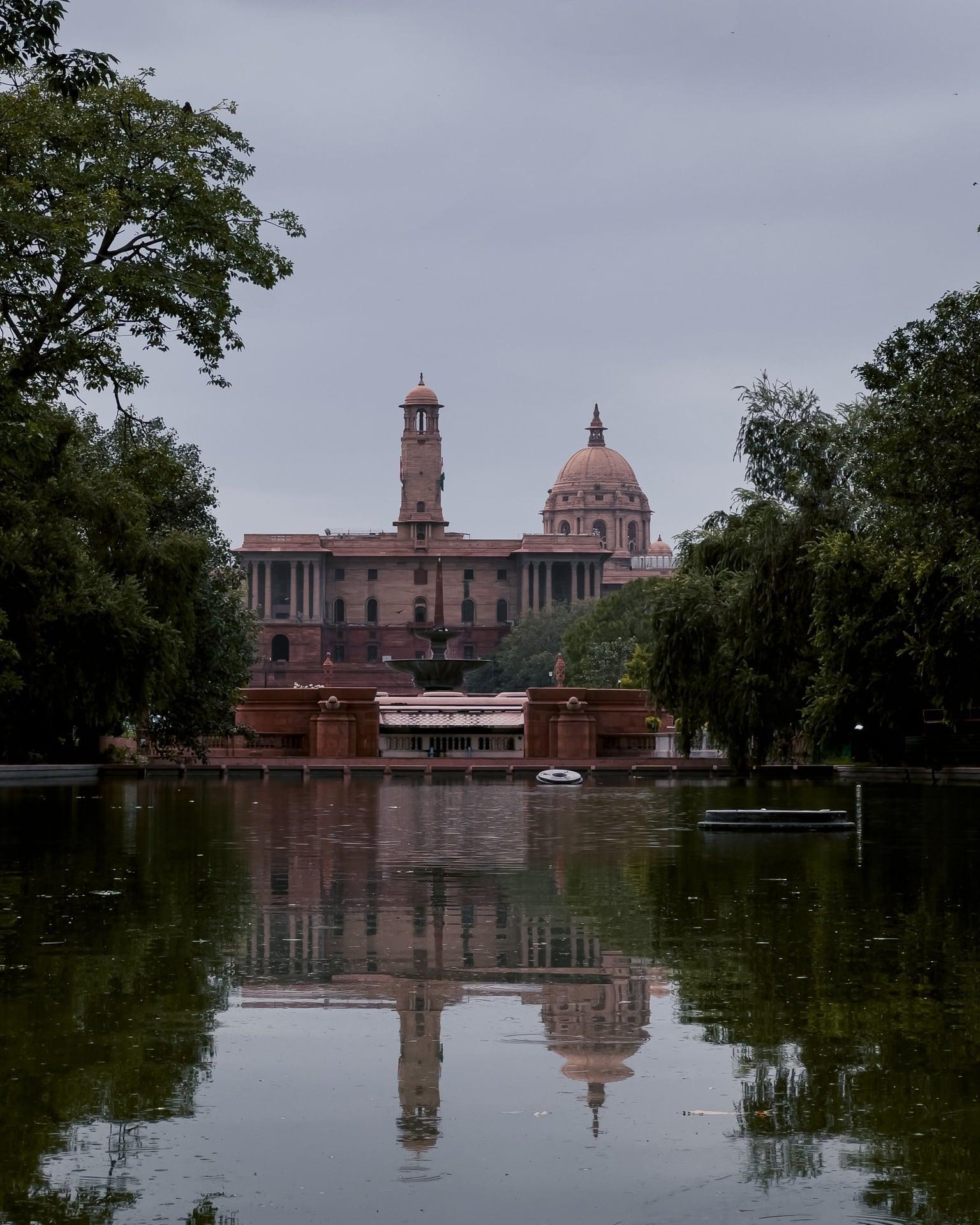
Raisina Hill View
The whole axis was drawn for this view. From Rafi Marg's east corner: Vijay Chowk about 270 m ahead, the North and South Block towers and the dome of Rashtrapati Bhavan on Raisina Hill; New Delhi, announced in 1911, inaugurated on 13 February 1931.
Details
Best Time to Visit
A clear morning from October to March, when the long view to Raisina Hill is sharp and the sun is behind you, or late afternoon for the light on India Gate (or walk it in reverse at dusk, see the tips). The ground is open at all hours; the War Memorial itself is open 09:00 to 19:30 from November to March. December and January mornings are often foggy, which hides the far end of the avenue. Sunset is about 17:24 in early December, 17:35 on 1 January, 17:45 on 15 January and 17:59 on 1 February (computed). Avoid about 15 to 29 January 2027 (Republic Day and Beating Retreat closures), and expect very large crowds at India Gate on winter evenings, holidays, Christmas and New Year. Checked 11 November 2026.
Pro Tips
- •Start on the plaza between the National War Memorial and the Netaji canopy, inside the C-Hexagon round India Gate. Taxi or auto: ask for the National War Memorial drop-off.
- •Getting there: taxis, autos and ride-hailing drop off at the zones on the C-Hexagon's radial roads (the memorial's FAQ; Delhi Traffic Police name a pick-up point near the National War Memorial gate). No metro station is close: the memorial lists Mandi House (Blue and Violet lines) at about 1.5 km and Khan Market (Violet line) at about 2 km; take an auto or taxi from either. DTC buses stop on the C-Hexagon at Baroda House, National Stadium and National Art Gallery. Checked 11 November 2026.
- •To go inside the National War Memorial (free; optional; the walk stays outside): open daily 09:00 to 19:30 November to March (last admission 19:00), 09:00 to 20:30 April to October; entry may be restricted at capacity or for ceremonies. No bags, food or tripods; do not touch the walls, busts or murals; no candles; flowers only at the base of the honour walls. Retreat drill daily just before sunset; change of guard and band display before it on Sundays (nationalwarmemorial.gov.in, Wayback captures 2023 and 2026). Checked 11 November 2026.
- •Carry only a phone and a small pouch. Food, bags, bedsheets and pets were reported banned at India Gate from about the end of June 2025 (NewsX, 30 June 2025), with a banner at Kartavya Path's entrance naming bags, pets, bicycles and two-wheelers (Free Press Journal, 8 July 2025; Republic World, 9 July 2025; no order found; whether every item is still enforced is not confirmed). Checked 11 November 2026.
- •At the end: Central Secretariat metro (Yellow and Violet lines), Gate 3, is about 140 m north on the same (east) side of Rafi Marg, past the bus stop; no road to cross, though the last few meters are not a mapped footpath. Gate 4 and Seva Teerth station (formerly Udyog Bhawan, renamed 14 February 2026 as reported; Yellow line, about 500 m south) are across Rafi Marg, whose zebra crossings here have no signals. Gate numbers are from OpenStreetMap; DMRC's site was not opened. Checked 11 November 2026.
- •Walk it in reverse at dusk: start out of Central Secretariat Gate 3 (no road to cross), walk the axis east and finish at India Gate and the War Memorial as the lights come on. The memorial's retreat drill is just before sunset (about 17:25 in early December, 17:45 in mid-January, 18:00 in early February) and it closes at 19:30. At Man Singh Road, walking east, it is the SECOND half of the crossing that has no light. Underpass lighting after dark is not confirmed.
- •Republic Day and Beating Retreat tickets are sold through the Ministry of Defence's Aamantran portal and app (2026: Rs 100 for the Beating Retreat, Rs 20 for the full dress rehearsal; IANS, 5 January 2026). On those days the walk does not run.
Safety & Precautions
- •Man Singh Road (between stops 5 and 6) is the one surface crossing, and it has no pedestrian signal: cross at the junction beside the lights in two halves, look right first (traffic keeps left), wait for a real gap on the unprotected first half, then cross the second half when the junction's lights have stopped the traffic from the left. Never cross the C-Hexagon on the surface: use the underpass, or the zebras on the Tilak Marg, Dr Zakir Hussain Marg, Shahjahan Road and K.G. Marg radials (Delhi Traffic Police, reported 18 May 2023). Drivers do not reliably stop, even at crossings (Government of Canada, India travel advice, 6 November 2026).
- •January: Kartavya Path closes for the Republic Day parade (Tuesday 26 January 2027), its rehearsals and the Beating Retreat at Vijay Chowk (Friday 29 January 2027). In 2026 it was reported closed 10:15 to 12:30 on 17, 19, 20 and 21 January, from 18:00 on 25 January to the parade's end, and 14:00 to 21:30 on 29 January. The 2027 orders are not out: assume no walk from about 15 to 29 January 2027 and check Delhi Traffic Police advisories. Independence Day (15 August) and state events can close the area at short notice. Checked 11 November 2026.
- •Weather, fog and air: New Delhi's normal highs and lows are about 23 and 8 °C in December and 20 and 8 °C in January, with fog on about 20 days a month (IMD, Safdarjung 1991 to 2020). Dense morning fog hides Raisina Hill entirely. Air is often very poor in winter (GRAP Stage III invoked across Delhi-NCR on 6 November 2026 at AQI 380; All India Radio): check the day's AQI, a mask helps, and take care if you have asthma.
- •The two underpasses (C-Hexagon north, Janpath north) each have a flight of steps at both ends with a ramp beside them; they crowd on evenings and holidays. Christmas and New Year bring very large crowds to India Gate.
- •The axis beyond Rafi Marg to Vijay Chowk was mapped closed to walkers with a barrier board in August 2026 (OpenStreetMap survey): do not pass any barrier, and follow any instruction from police. Do not photograph security installations or staff, and do not fly a drone: flying in central Delhi needs Central Government permission under the Drone Rules 2021, and the Delhi Police bans aerial platforms round national days.
- •The War Memorial and India Gate are war memorials: keep your voice low and stay outside the arch's railing. Ask before photographing anyone.
- •There is almost no shade on the paths. Walking west in a winter afternoon puts the low sun in your eyes from about 15:30; a morning walk has it behind you.
Travel advisory: Exercise Increased Caution (Level 2).
Gallery
Related Reading
Go deeper on what you'll see, hear, and walk through.
Overview
Delhi Monument Tickets, Hours and Closures (Checked November 2026)
4 min
Overview
Delhi Travel Guide: How Many Days, Getting Around, Best Time, and Safety
5 min
Thematic
How to Read Delhi on Foot: Six Walks, Eight Centuries
4 min
Thematic
The Seven Cities of Delhi: A Tradition, Not a Count
4 min
Companion
India Gate and Kartavya Path: Who Is Named Where on the Axis
5 min
Read the walk
The full story of India Gate and Kartavya Path: The Names and the Axis, in words. Prefer to listen? Play it narrated, from home or on location.
Introduction
Delhi's ceremonial axis runs dead straight from India Gate to Raisina Hill, and it was drawn as a single picture. This walk follows it west and asks two plain questions on the way: whose names are cut into India Gate, and why the flame that burned under it now burns somewhere else.
There are twelve stops over about two point two kilometers, about one point four miles, and it takes about seventy five minutes. It is flat. Twice the route goes under a main road by a pedestrian underpass, each with steps and a ramp beside them. Once it crosses a road on the surface, at Man Singh Road, and stop five tells you how.
All of it is free, open ground. The National War Memorial, at the start, is free to enter, from nine in the morning until half past seven in the evening between November and March; the walk itself stays outside. Since the summer of twenty twenty five, food, bags and pets have been reported banned around India Gate, and the memorial bans bags too, so carry only a phone and a small pouch.
In late January the avenue closes for the Republic Day parade on the twenty sixth, its rehearsals, and the Beating Retreat on the twenty ninth, so check before you come between about the fifteenth and the twenty ninth. State events can also close it at short notice.
There is almost no shade. From December to February the days are cool, and on many mornings fog hides the far end of the avenue, so the long views need a clear day. Winter air is often very poor: check the day's air quality index; a mask helps, and take care if you have asthma.
The walk ends at Rafi Marg, short of Vijay Chowk, because the last stretch may be barricaded. When you arrive at the National War Memorial, begin with stop one.
1. National War Memorial
Put India Gate behind you and look past the low gate in front: inside rings of walls and trees, a tall obelisk rises. This is the National War Memorial, and it is where the walk begins and where its story lands. It carries the names of the soldiers of India's armed forces who have died since nineteen forty seven. There are more than twenty six thousand of them.
It was dedicated in February twenty nineteen, after a design competition won by a studio from Chennai. The plan is four circles, one inside the next. The outermost is the Circle of Protection: rows of trees, each standing for the soldiers who guard the country. Then the Circle of Sacrifice: concentric walls of honor, with one granite tablet for each soldier who died, the name etched in gold letters. The memorial says those walls recall an ancient battle formation. Inside them, the Circle of Bravery, a covered gallery with six bronze murals. And at the center, the Amar Chakra, the Circle of Immortality: the obelisk, and at its foot an eternal flame.
That flame is not alone. On the twenty first of January twenty twenty two, the flame that had burned for fifty years under India Gate, a short way west, was merged with this one, with full military honors. The announcement said that from then on all homage ceremonies would be held here. You will stand at the old place at stop four.
Going in is free and optional, by its own entrances. Its rules ask for quiet, no bags or food, and no touching of the walls, busts or murals. A retreat ceremony is held each day just before sunset.
Follow the route round the plaza toward the stone canopy with the statue under it.
2. Netaji Statue: The King's Empty Canopy
Across the water, under the pale stone canopy, stands a figure in black granite. It is Subhas Chandra Bose, known across India as Netaji. In the Second World War he led the Indian National Army against the British.
The statue is twenty eight feet tall, carved from a single block of granite, and weighs sixty five metric tons. It was unveiled on the eighth of September twenty twenty two, the same day the avenue ahead reopened under its new name. Earlier that year, in January, a hologram of Netaji had been projected in this same spot, while the stone figure was being made.
Now look at the canopy itself. It was built in the nineteen thirties for a statue of the British king who, in nineteen eleven, had announced that the capital would move to Delhi. That statue was taken away in nineteen sixty eight. For fifty four years, from nineteen sixty eight to twenty twenty two, the canopy at the head of the axis stood empty. The king's statue was later moved to Coronation Park, the ground where his durbar, a great royal assembly, had been held in nineteen eleven.
So this one small structure carries the whole span of the axis: built for a king, left empty for half a century, and filled again in twenty twenty two.
The statue stands in its pool and is seen from the ring, at any hour. On evenings and holidays the plaza is crowded.
Follow the route on round the ring and along the straight path toward the great arch. As you go, look up at India Gate whole, while it fills the view ahead: at the next stop you will be close.
3. India Gate: The Names on the Arch
This is India Gate, forty two meters of sandstone. Its piers are covered in lines of lettering: names, more than thirteen thousand of them, hard to read one by one from outside the railing.
A British royal duke laid its foundation stone on the tenth of February nineteen twenty one, and the viceroy unveiled it ten years later, in February nineteen thirty one. Its name then was the All India War Memorial. Its architect was Edwin Lutyens, who also designed the great house on the hill at the far end of this walk. The duke said the arch would keep in the thoughts of later generations the officers and men of the Indian Army who fought and fell in the Great War.
So you might expect the names of men who fell on that war's battlefields overseas. Mostly, they are not here. India's National War Memorial describes the arch as built for the soldiers who died in the First World War and in the Third Afghan War of nineteen nineteen. And the Commonwealth War Graves Commission says that most of the men named here died fighting on or beyond the North West Frontier, the old frontier with Afghanistan, and in that Afghan war, and have no known grave. By the Commission's count, about seventy thousand soldiers of undivided India died between nineteen fourteen and nineteen twenty one, and most of them are named on memorials outside India. The arch stands for all of them. Its stone mostly carries the men of the frontier.
This is a war memorial: please keep the voice low and the paths clear, and do not cross the railing.
Follow the route round the arch's north side and out onto the lawn beyond it. At the next stop you will turn back and look at the arch's other face.
4. Amar Jawan Jyoti: The Flame That Moved
Turn back toward India Gate, and you are looking at its west face. Under this arch, from January nineteen seventy two, stood the Amar Jawan Jyoti, the flame of the immortal soldier: an upturned bayonet with a soldier's helmet on it, and an eternal flame burning beside it. It was put up overnight, in the memorial's own words, in memory of the soldiers who died in the war of nineteen seventy one between India and Pakistan. Those soldiers were never named on the arch.
For fifty years the flame burned here. On the twenty first of January twenty twenty two, it was carried to the National War Memorial, where this walk began, and merged with the flame there. Whatever stands under the arch today, the flame no longer burns at India Gate.
So in the first four stops you have passed both homes of one flame. An arch built for one generation's wars held a flame for another, until a memorial that names everyone who has died since nineteen forty seven took it in.
Now turn the other way, with the arch at your back. Ahead runs the axis of New Delhi, dead straight for about two kilometers to Vijay Chowk, the square at the foot of Raisina Hill, and then up the hill to the dome of Rashtrapati Bhavan, the President's house. On a clear day you can see it from here. On a foggy morning you will have to take it on trust.
Follow the route under the C Hexagon, the ring road round India Gate, by the pedestrian underpass just ahead: down the steps, or the ramp beside them, and up on the far side. Never cross the ring road on the surface; the traffic police ask walkers to use the underpasses.
5. Kartavya Path: Three Names, One Avenue
This is Kartavya Path, and it has had three names. The British laid it out as King's Way. After independence it became Rajpath. In September twenty twenty two, after a rebuilding, it reopened as Kartavya Path, the path of duty. The plan behind it is simple to see from here. The…
Full narration for this stop unlocks with the tour.
6. Avenue Trees: Planted in Crosses
Look out across the lawns on either side, to the long rows of trees set back from the path. They are not decoration added later. They are part of the drawing. The planners' committee chose thirteen kinds of tree for this avenue, among them jamun, neem, imli, arjan and mulberry.…
Full narration for this stop unlocks with the tour.
7. Canals and Bridges
Water runs beside the axis here, in a long straight canal with a stepped edge, crossed here and there by low bridges. The plan flanks the avenue with green spaces and water channels, and on a still day the canal does what the plan asks of it: it lays the axis down again, in…
Full narration for this stop unlocks with the tour.
8. Janpath: Where the Axes Cross
Ahead, a main road cuts across the axis at right angles. This is Janpath. In the plan it was Queen's Way, crossing King's Way, the avenue you have been following. The two names made a pair, and the crossing made a node, one of the meeting points the planners set along the axis.…
Full narration for this stop unlocks with the tour.
9. Republic Day Parade Route
You are now at the edge of the parade route itself. Every year since nineteen fifty five, on the twenty sixth of January, Republic Day, the national parade has come down this avenue. In the first years of the republic it was held elsewhere: at the Red Fort, the National Stadium,…
Full narration for this stop unlocks with the tour.
10. Dome Ahead: Lutyens and Baker's Slope
Look straight down the avenue. On a clear day a dome sits above the hill at its end, between two towers. The dome crowns Rashtrapati Bhavan, about a kilometer and a half away; the towers belong to the two Secretariat blocks, North Block and South Block, that stand on the slope…
Full narration for this stop unlocks with the tour.
11. Rafi Marg: The Later Cross Street
Ahead, a busy road crosses the axis: Rafi Ahmed Kidwai Marg, usually called Rafi Marg. It is one road the first plan did not draw this way. The Central Vista's account says an additional cross street and junction were added here to carry the city's growing traffic between north…
Full narration for this stop unlocks with the tour.
12. Raisina Hill View
This is the end of the walk, and the view the whole axis was drawn for. Straight ahead, beyond Rafi Marg, the avenue runs on to the open square of Vijay Chowk, about two hundred and seventy meters away. From there it climbs Raisina Hill between the two Secretariat towers to the…
Full narration for this stop unlocks with the tour.
- Amar Jawan Jyoti with Canopy in the background — AKS.9955, CC BY-SA 4.0 · source
- Kartavya Path in the evening in New Delhi — Pinakpani, CC BY-SA 4.0 · source
- Rajpath Sitting Park, New Delhi, India — Radosław Botev, CC BY 3.0 · source
- Remodeled Central Vista renamed as Kartavaya Pathwas recently opened to public — Ramesh lalwani, CC BY-SA 4.0 · source
Images may be cropped or resized. Other photos via Unsplash and Pexels.