
Walk from the Plaza de los Ponchos and its concrete mushrooms down Calle Sucre to El Jordán, Parque Bolívar and San Luis, then across a wooded ravine to the food market that moved there in 2016.
Start · Plaza de los Ponchos: The Concrete Mushrooms
DirectionsStops
- 1
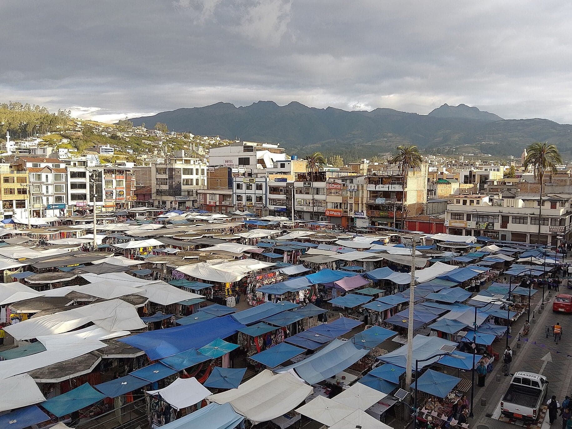
Plaza de los Ponchos: The Concrete Mushrooms
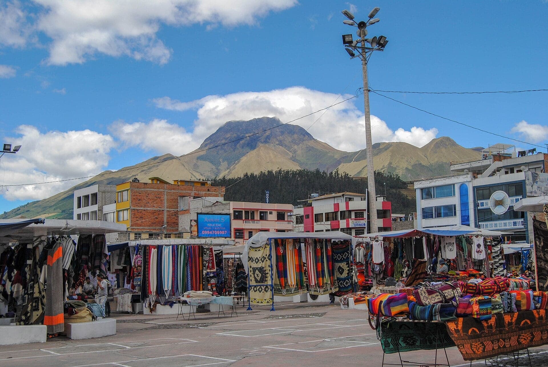
Otavalo's craft market fills a square redesigned in the 1970s. Under the tarps, its stalls stand beneath concrete umbrellas the stallholders call mushrooms.
- 2
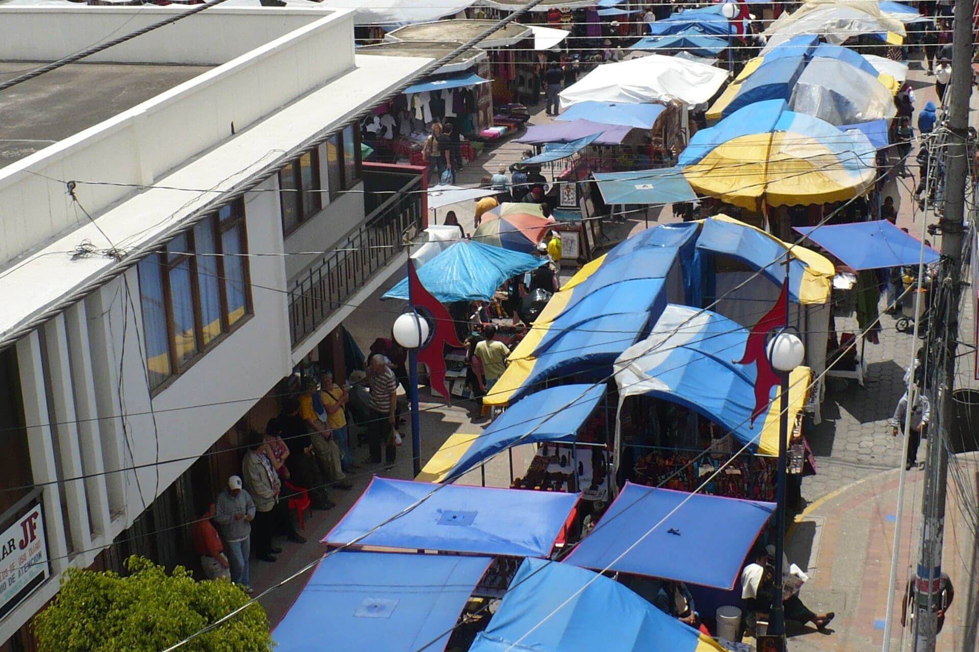
Calle Sucre: The Saturday Street
The street that joins the market to the grid. On fair days the stalls have run down Calle Sucre toward the old food market, as Otavalo's trade has run outward for centuries.
- 3
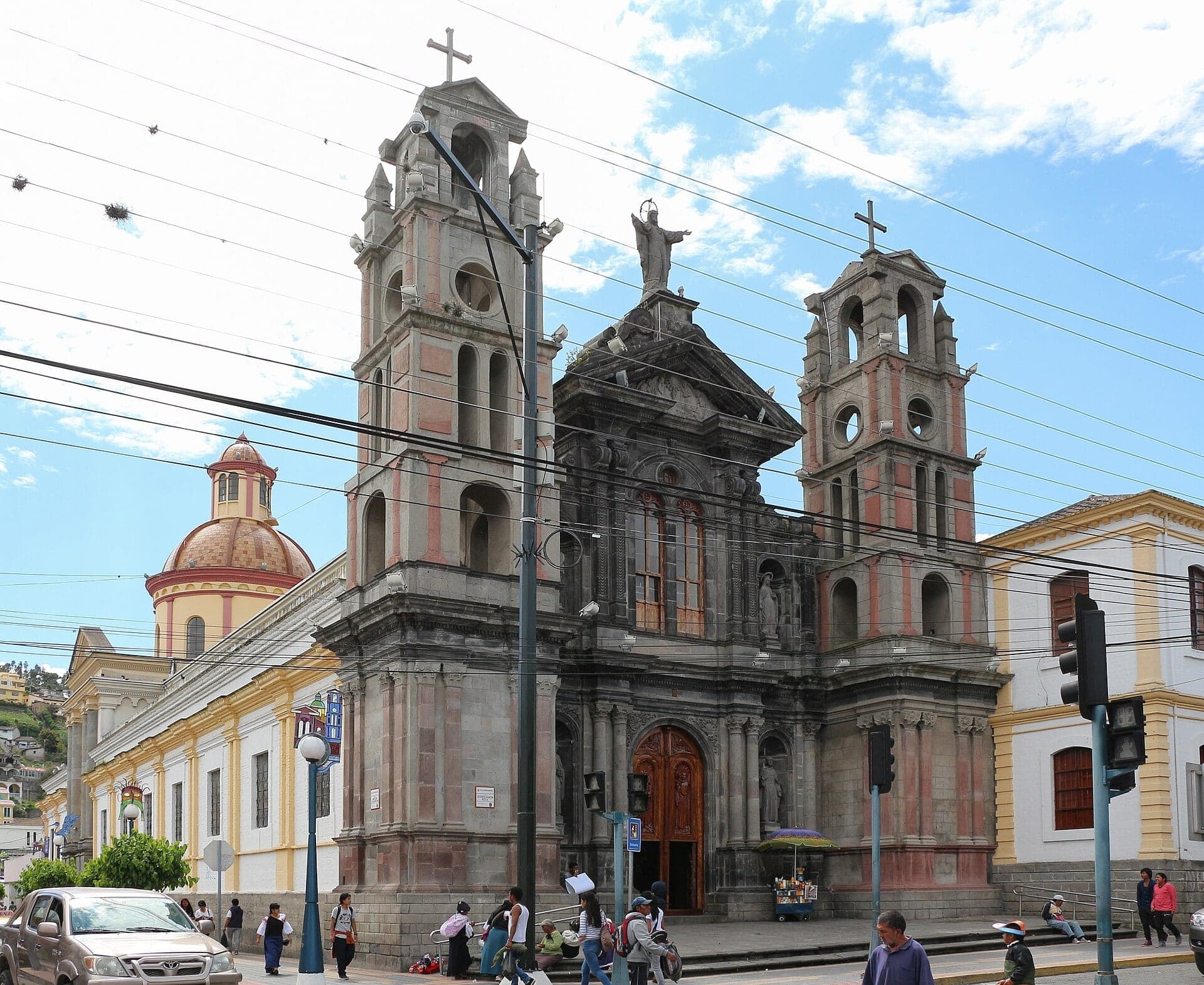
El Jordán: The Fair's Second Square
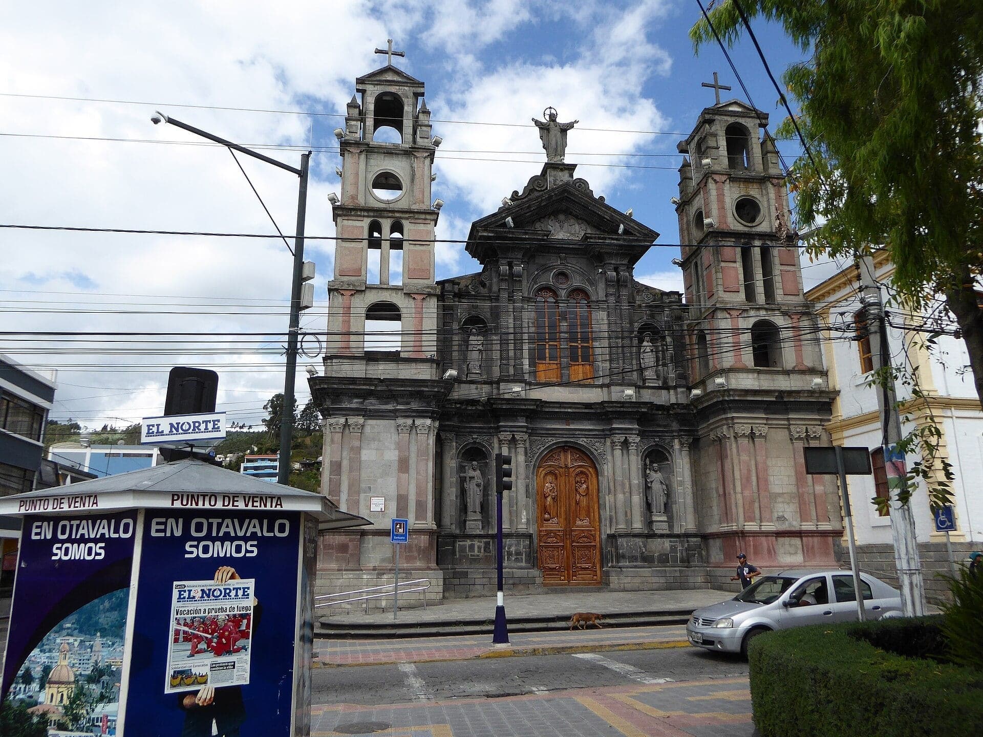
A grey stone church with two bell towers. El Jordán faces the little square that the town's historians name as the fair's second home.
- 4
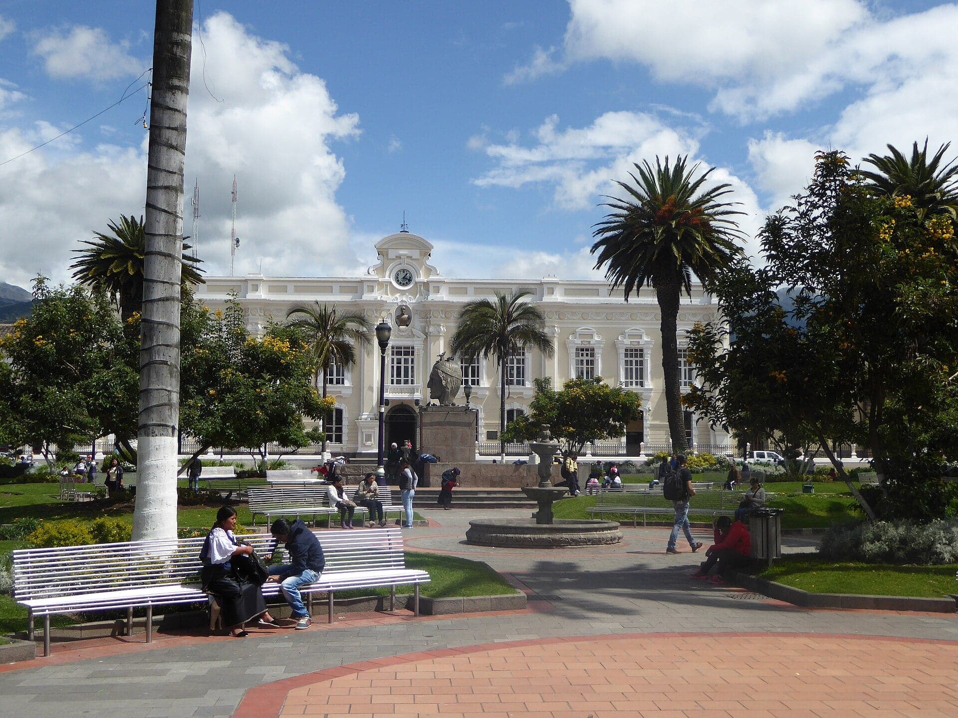
Parque Bolívar: The Fair's First Square
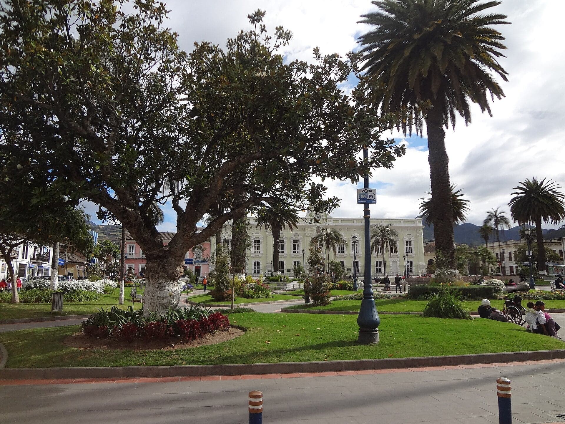
The town's historians name this main square as the market's earliest site. Parque Bolívar has the town hall on one side and a stone bust of Rumiñahui at its center.
- 5
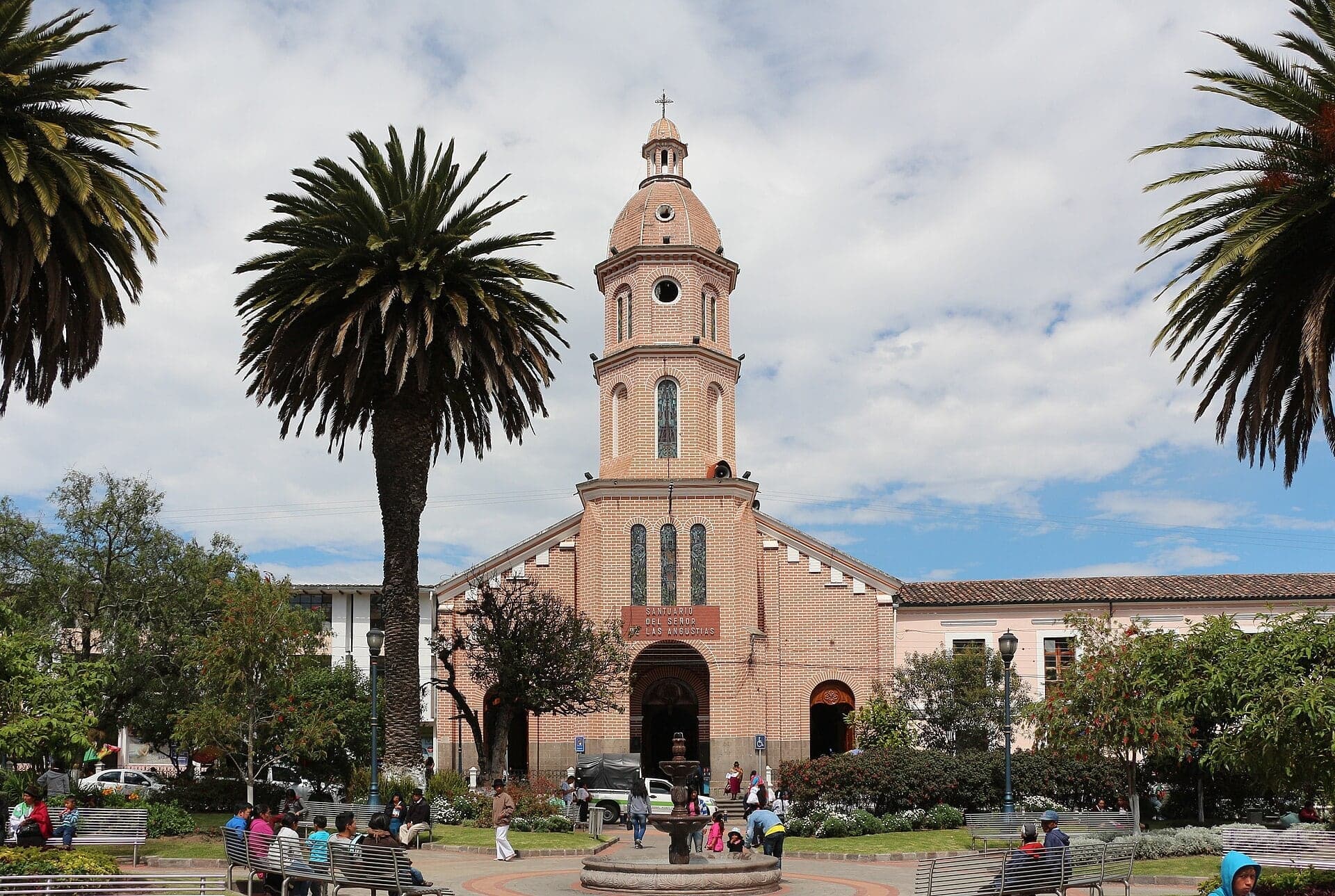
San Luis: Rebuilt After the Earthquake
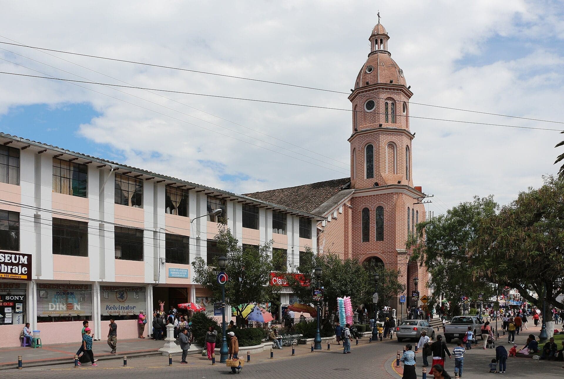
The parish church with its single central tower. San Luis, by local accounts, went up in the 1880s after the earthquake of 1868 destroyed the town.
- 6
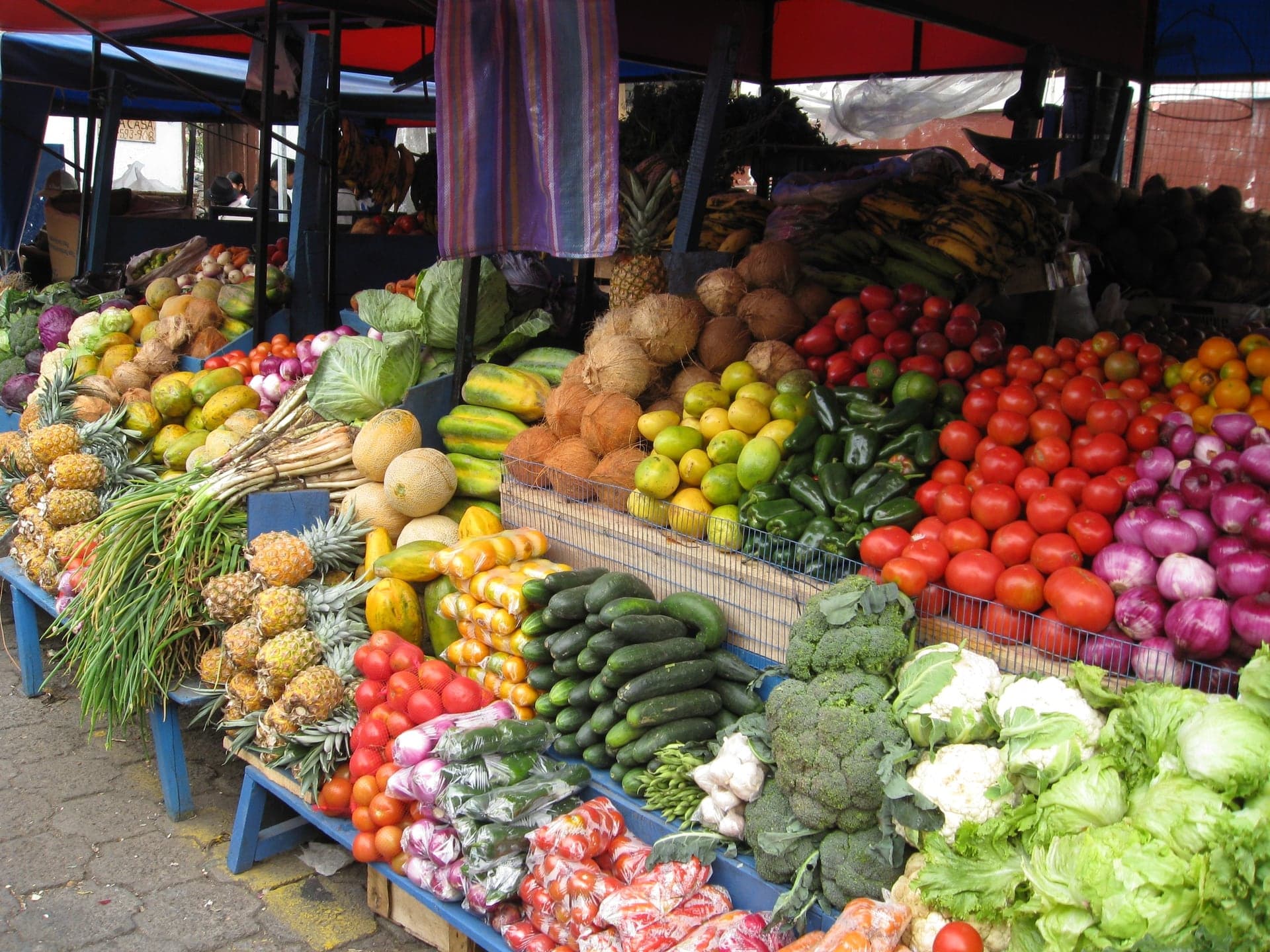
Old 24 de Mayo Blocks: Where the Food Market Stood
The blocks where the old food market stood. Here the fair traded cloth screens for wooden booths, and the food trade stayed until 2016.
- 7
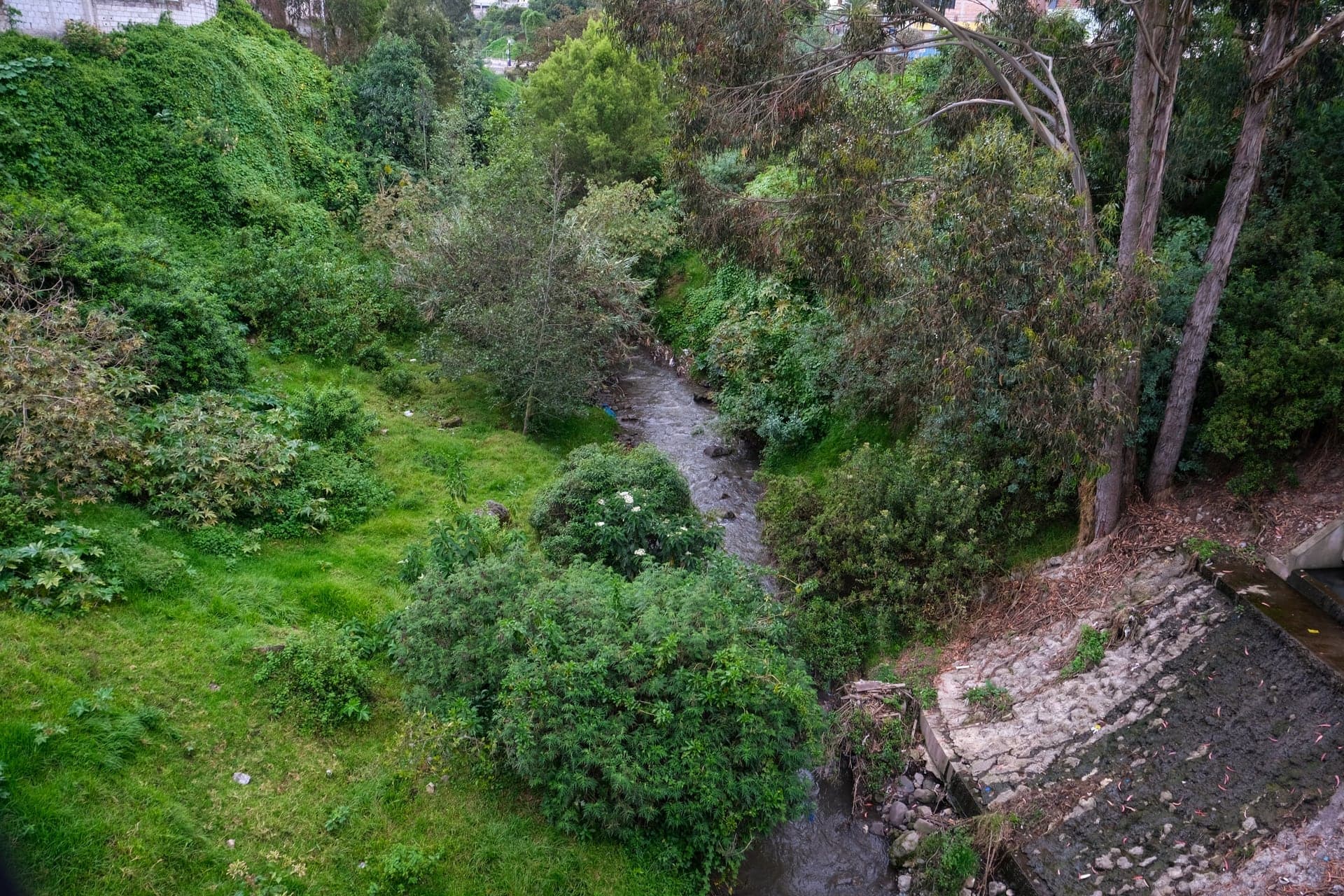
The Ravine at the Calderón Bridge: The Edge of Town
The wooded ravine that closes the old grid. The food market crossed it in 2016, onto the site of the old municipal stadium.
- 8
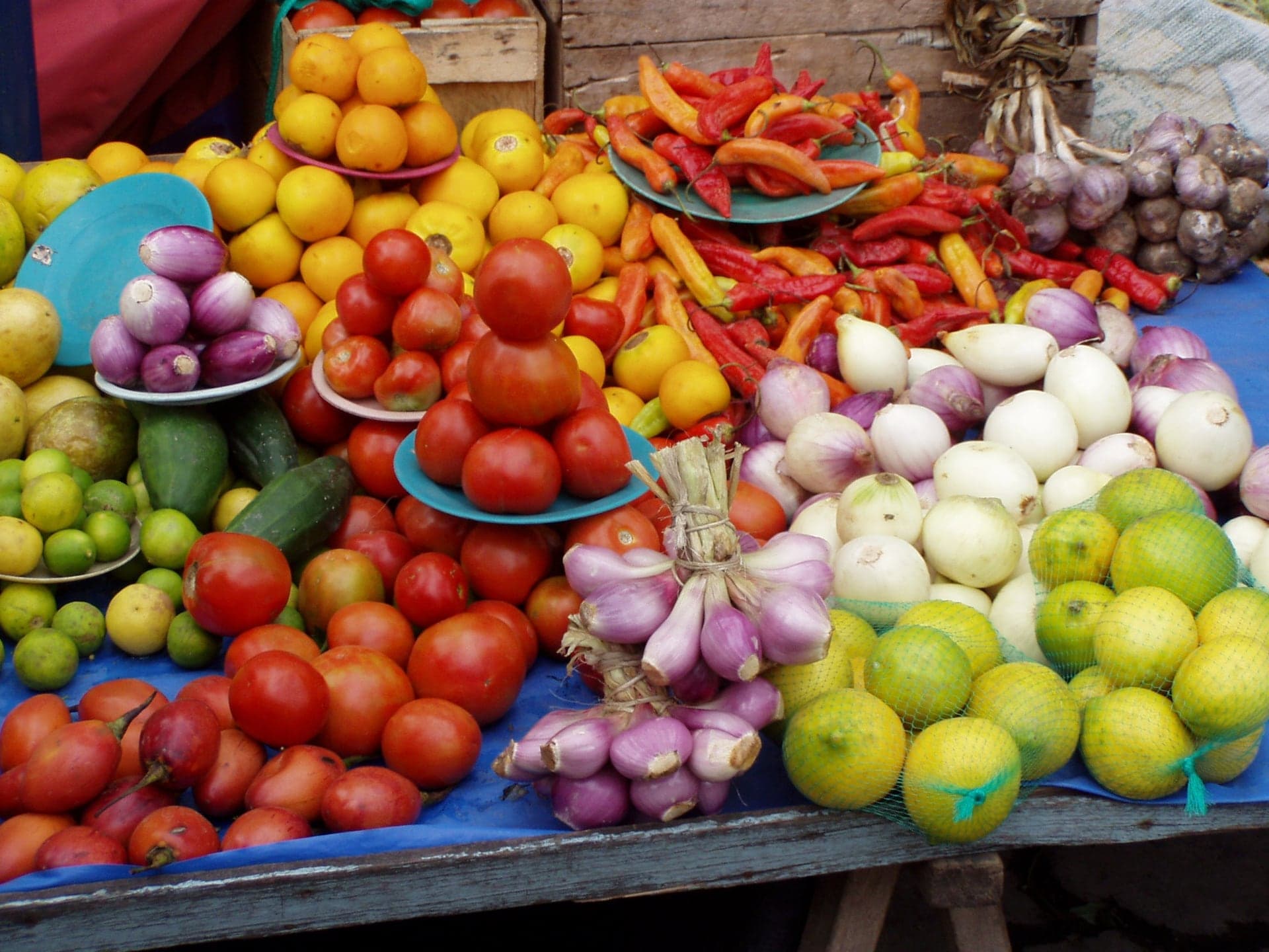
Mercado 24 de Mayo: The Market Across the Ravine
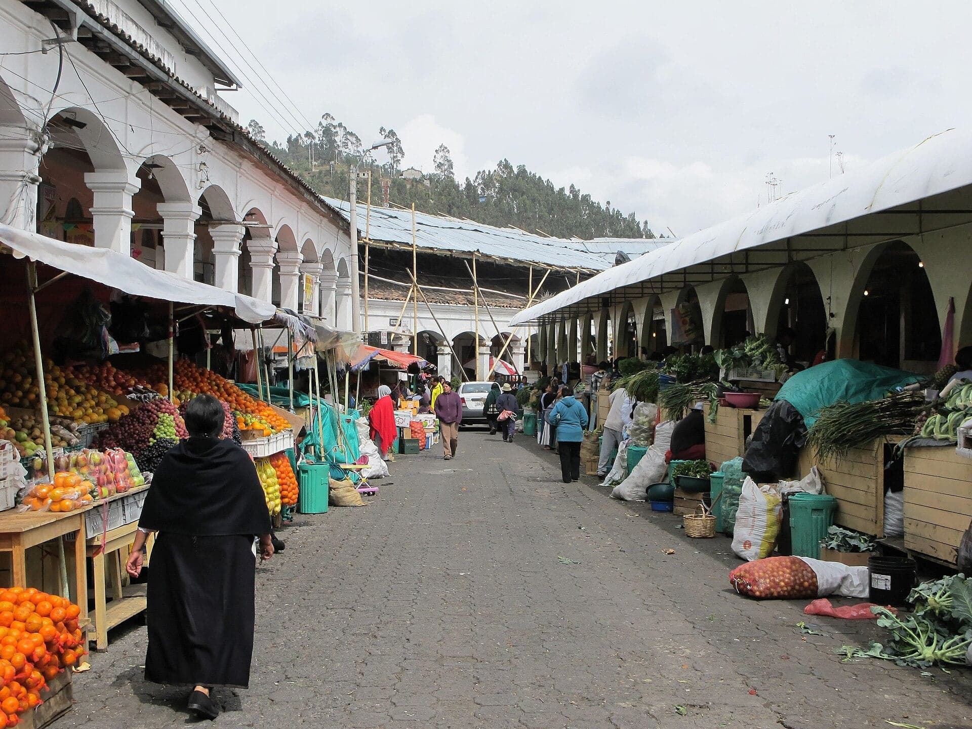
Otavalo's food market in its 2016 hall. Ecuador's tourism ministry named it the country's first gastronomic market in 2024.
Details
Best Time to Visit
Saturday morning for the full market, when the stalls spread from the Plaza de los Ponchos into the streets around it and down Calle Sucre; it is also the most crowded day. Wednesday is the second fair day. For a quieter walk, any weekday morning: the plaza is open every day, but many stalls are bare frames. Traders arrive from early morning and start packing up from about 16:00 on ordinary days. Finish around lunchtime to eat at the Mercado 24 de Mayo, which OpenStreetMap lists as open every day from 06:00 to 18:00 (checked 5 October 2026). Walk in daylight.
Pro Tips
- •Getting to the start: buses run frequently from Quito's northern bus terminal, Terminal Carcelén, to Otavalo, roughly two hours (check times and fares at the terminal; checked 5 October 2026). Otavalo's bus terminal is a few blocks from stop 1. By taxi, ask for the Plaza de los Ponchos by the tourist office at Quiroga and Modesto Jaramillo.
- •The craft market at the Plaza de los Ponchos is free and open every day; the plaza's listed hours were 07:00 to 16:00 when checked on 5 October 2026, with Saturday trade running later.
- •Weekday or Saturday, the walk works the same: every stop has something fixed to look at, from the concrete umbrellas to the churches and the ravine.
- •The Mercado 24 de Mayo at the end is free to enter and makes a natural lunch stop.
- •San Luis and El Jordán are working churches with no published visiting hours: look from the square, and step in only if the doors are open and no service is on.
Safety & Precautions
- •On Saturdays the plaza, Calle Sucre and the side streets are packed with stalls and people: keep valuables close, as pickpockets work crowded markets.
- •The market can close during national strikes or road blockades: in the national strike of September 2025, Otavalo's shops closed and the Plaza de los Ponchos stood empty of vendors. Check local news before you travel.
- •The last part of the walk follows Abdón Calderón and Luis Cisneros, one-way streets with buses, and crosses the Calderón bridge. Keep to the side of the road and the edge of the bridge.
- •The streets near the ravine are quieter and residential: walk them in daylight. The route never enters the ravine itself.
- •Otavalo sits at about 2,550 metres. The walk is almost flat, but take it slowly if you have just arrived from the coast.
Travel advisory: Exercise Increased Caution (Level 2).
Gallery
Related Reading
Go deeper on what you'll see, hear, and walk through.
Read the walk
The full story of Plaza de los Ponchos: The Market That Keeps Moving, in words. Prefer to listen? Play it narrated, from home or on location.
Introduction
Otavalo, in the Andes of northern Ecuador, is a market town. In the eighteen sixties an American diplomat, Friedrich Hassaurek, rode in from a nearby hacienda and found grass growing in its streets. "Stores there are but few," he wrote, "as the town has no commerce." Today Kichwa Otavalo weavers and traders sell the cloth of this valley across the Americas and Europe, and visitors come from all over the world to the market here.
That market has never stayed put. Over eight stops and about one point seven kilometres, just over a mile, in about an hour and ten minutes, you will follow it: from the square where the craft market is held today, down the street its Saturday stalls have filled, to the two Spanish squares where the town's historians say it began, past the blocks where the food market stood until twenty sixteen, and across a wooded ravine to the food market's new hall. The town sits at about two thousand five hundred and fifty metres, but the walk is almost flat.
Two people come back along the way: Hassaurek, the diplomat who thought the town had no commerce, and Tonny Zwollo, a young Dutch architect who redesigned the craft market's square in the early nineteen seventies.
And one thing to watch for: the market's roofs. A screen of cloth on a pole, a wooden booth, a concrete mushroom, a hall. Each one marks a move.
1. Plaza de los Ponchos: The Concrete Mushrooms
Welcome to Otavalo, and to the Plaza de los Ponchos. The town's tourist office is a few steps up the street toward Jaramillo, and the whole block across Quiroga street is the market.
Its official name is the Mercado Centenario, but everyone calls it the Plaza de los Ponchos. In the early nineteen seventies a young Dutch architect, Tonny Zwollo, redesigned this square as a market, replacing a children's playground, paid for by the Dutch government. The town's historians say the plaza came out of the struggle of the valley's Kichwa artisans to win a place of their own to sell. Zwollo gave the stalls roofs of concrete: umbrellas, each on a single stem. The stallholders call them hongos, mushrooms.
Look for them now. The concrete is often hidden under tarps tied over the top, so look low, at the stems and at the raised concrete platforms under the tables. It is one of the market's roofs; there are others ahead.
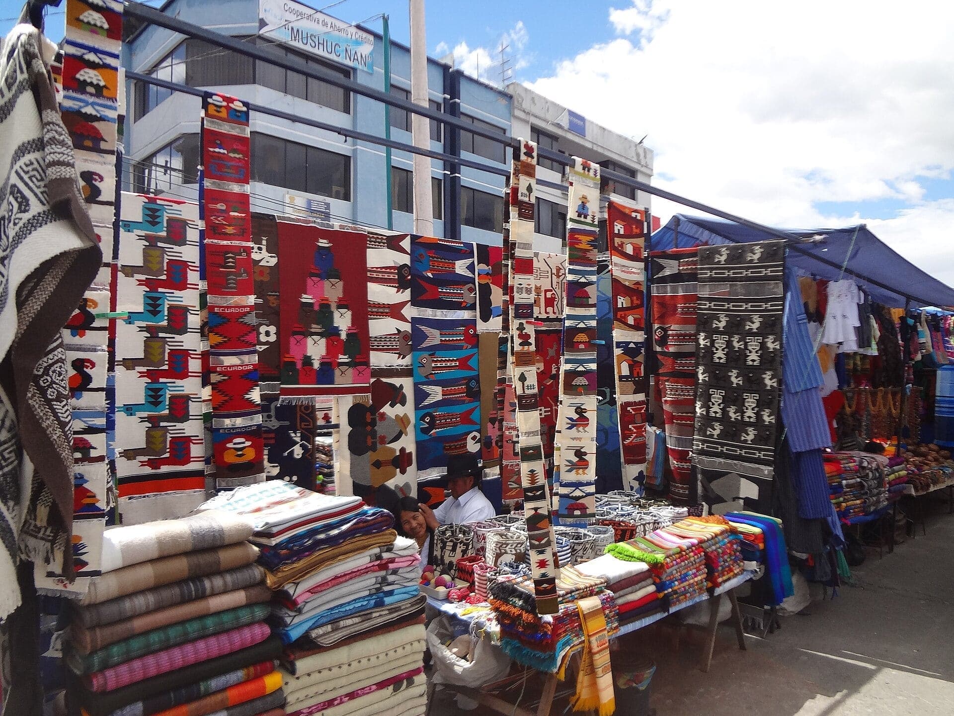
Now look at the tables. The people of this valley were known as weavers and traders before the Incas arrived, weaving cotton on the backstrap loom. The Spanish brought the treadle loom and sheep's wool. An anthropologist writing in the nineteen nineties described families who weave a couple of handspun wool ponchos a month on a backstrap loom, and others who turn out hundreds of acrylic shawls a day on electric looms. Both end up on tables like these. Much of the cloth is acrylic or cotton; the same anthropologist put that down to a shortage of wool.
The market is open every day. Wednesday is busier, and Saturday is the big day, when the stalls spill out of this block into the streets around it. On a quiet weekday many of the frames stand bare.
Follow the route along the edge of the stalls and down Calle Sucre. Next, the street the Saturday fair has filled.
2. Calle Sucre: The Saturday Street
Walk on down Calle Sucre and stop on the pavement, halfway along the block.
Look back up the street toward the stalls. On fair days the market does not stop at its square. In twenty fifteen, a study found the Saturday stalls running down this street and its neighbor as far as the old food market, a few blocks ahead. So this is the market's spine: the street that joins the craft square to the old Spanish grid.
Trading here is older than any of these streets. A Spanish record from the fifteen hundreds describes the mindalaes, the long-distance traders of this region, who went to Quito and to the fairs at Pasto, far to the north, and grew rich carrying cotton, coca and cloth from one place to another.
Then came a harder chapter. Under Spanish rule, the man granted Otavalo set up a weaving workshop, an obraje, that at its height worked up to five hundred men, and it passed to the Crown by the fifteen eighties. Later, many families were tied to the haciendas by debt, weaving and farming for them, until that servitude was outlawed in nineteen sixty-four.
What came next is in the shopfronts around you. Otavalo merchants travel through Ecuador, across Latin America, to North America and to Europe, selling cloth made here and elsewhere in the country. A study published in two thousand two found Otavalos living and working in over thirty countries on six continents.
The fair's day has moved too. Hassaurek, the American diplomat from the start of the walk, wrote that in the eighteen sixties the fairs here were held on Sundays: sellers squatting on the ground under little screens of baize or sackcloth, nailed to a frame on a pole. That is the market's first roof.
Follow the route on down Sucre and round to the old squares. Next, a stone church with two bell towers.
3. El Jordán: The Fair's Second Square
Walk on to the edge of the little square and stop there, across the street from the grey stone church with two bell towers.
This small garden is the Parque González Suárez, and according to the town's own historians it was the fair's second home. Before the market reached the square you started in, it was held here, in front of this church.
The church is El Jordán, dedicated to Our Lady of Montserrat. Look at its front. It is grey stone, built in the classical manner, with columns, a carved wooden door, statues standing in niches, and a bell tower rising at each side. From here the towers are steep above you; if you step a few paces back into the square, you can see them whole.
It looks old, but it is not colonial. Local accounts say the earlier church was ruined by earthquakes, and that this one went up slowly, from the nineteen twenties into the nineteen sixties. Hold on to that: the earthquakes come back at the next church.
For now, notice the arrangement, because you will see it again at the next square: an open garden, a church across one side, and room in between for a crowd.
Follow the route along the street to the town's main square. Next, a park with a great stone head at its center.
4. Parque Bolívar: The Fair's First Square
Walk on along the edge of the park and stop there, across the street from the long cream building with the clock. This is Parque Bolívar, the town's main square, and the town's historians name it as the market's earliest site. Picture the fair spread over this ground, with…
Full narration for this stop unlocks with the tour.
5. San Luis: Rebuilt After the Earthquake
Walk on to the middle of this side of the park and stop there, facing the church across the street. This is San Luis, the town's parish church, also known as the shrine of the Señor de las Angustias, the Lord of Anguish. Look at the materials: a front of brick and pink render,…
Full narration for this stop unlocks with the tour.
6. Old 24 de Mayo Blocks: Where the Food Market Stood
Walk on to the corner where the street runs out and stop there. Ahead and to your left, the old town ends at the trees of a ravine, and a bridge leads across; the walk crosses by the next one. These blocks were the market's third home. According to the town's historians, after…
Full narration for this stop unlocks with the tour.
7. The Ravine at the Calderón Bridge: The Edge of Town
Walk on to the near end of the bridge and stop there, at the side of the road and clear of the traffic. Below the bridge is the ravine, a wooded gully that closes the old town grid on this side. The streets you have walked are a neat Spanish grid, and this is where they stop:…
Full narration for this stop unlocks with the tour.
8. Mercado 24 de Mayo: The Market Across the Ravine
Walk on along the street to the market hall and stop there, beside it. This is the Mercado Veinticuatro de Mayo, the town's food market. As an institution it goes back to around nineteen hundred; the building dates from twenty sixteen, when the market left the blocks you passed…
Full narration for this stop unlocks with the tour.
- The Plaza de los Ponchos stalls piled with striped textiles, with Imbabura's peak over the rooftops: the walk in one frame — Paul from Hacketts Cove, Canada, CC BY 2.0 · source
- Plaza de los Ponchos — Arabsalam, CC BY 4.0 · source
- Otavalo Market — Paul from Hacketts Cove, Canada, CC BY 2.0 · source
- Otavalo — Marek_Grzywa, CC BY 3.0 · source
- Otavalo Market - Andes Mountains — David Adam Kess, CC BY-SA 3.0 · source
- El Jordán Church, Otavalo, Ecuador — Bernard Gagnon, CC BY-SA 4.0 · source
- Iglesia El Jordán — Arabsalam, CC BY-SA 4.0 · source
- Zentrale Plaza mit Rathaus — Arabsalam, CC BY-SA 4.0 · source
- Otavalo Artisan Market *( Town Square )* — David Adam Kess, CC BY-SA 3.0 · source
- San Luis Church, Otavalo, Ecuador — Bernard Gagnon, CC BY-SA 4.0 · source
- San Luis Church, Otavalo, Ecuador — Bernard Gagnon, CC BY-SA 4.0 · source
- City of Otavalo in Ecuador, Market for Food — Bbb-Commons (Wikivoyage user Bbb), CC BY-SA 3.0 · source
- title "Quebrada"; tags otavalo, town, ecuador, stream; geotag 0.233723, -78.264949 (Flickr places it in Otavalo, Imbabura) — Francisco Anzola, CC BY 2.0 · source
- title "Otavalo Food Market"; tags otavalo; no geotag — Chris Feser (feserc), CC BY 2.0 · source
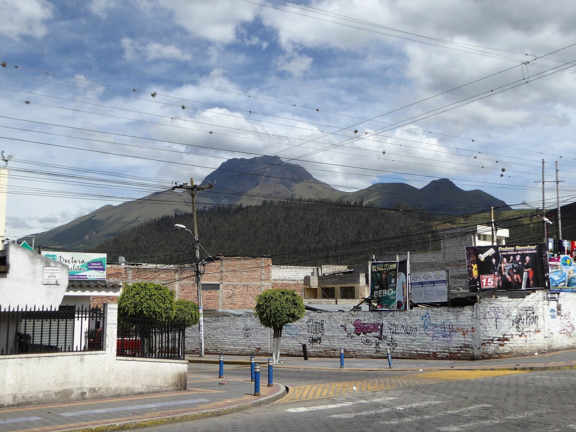
- Blick auf den Imbabura in Otavalo (view of Imbabura in Otavalo); category Otavalo — Arabsalam, CC BY-SA 4.0 · source
- Otavalo Market (categories Otavalo, Markets in Ecuador) — Dan from Brussels, Europe, CC BY-SA 2.0 · source
Images may be cropped or resized. Other photos via Unsplash and Pexels.