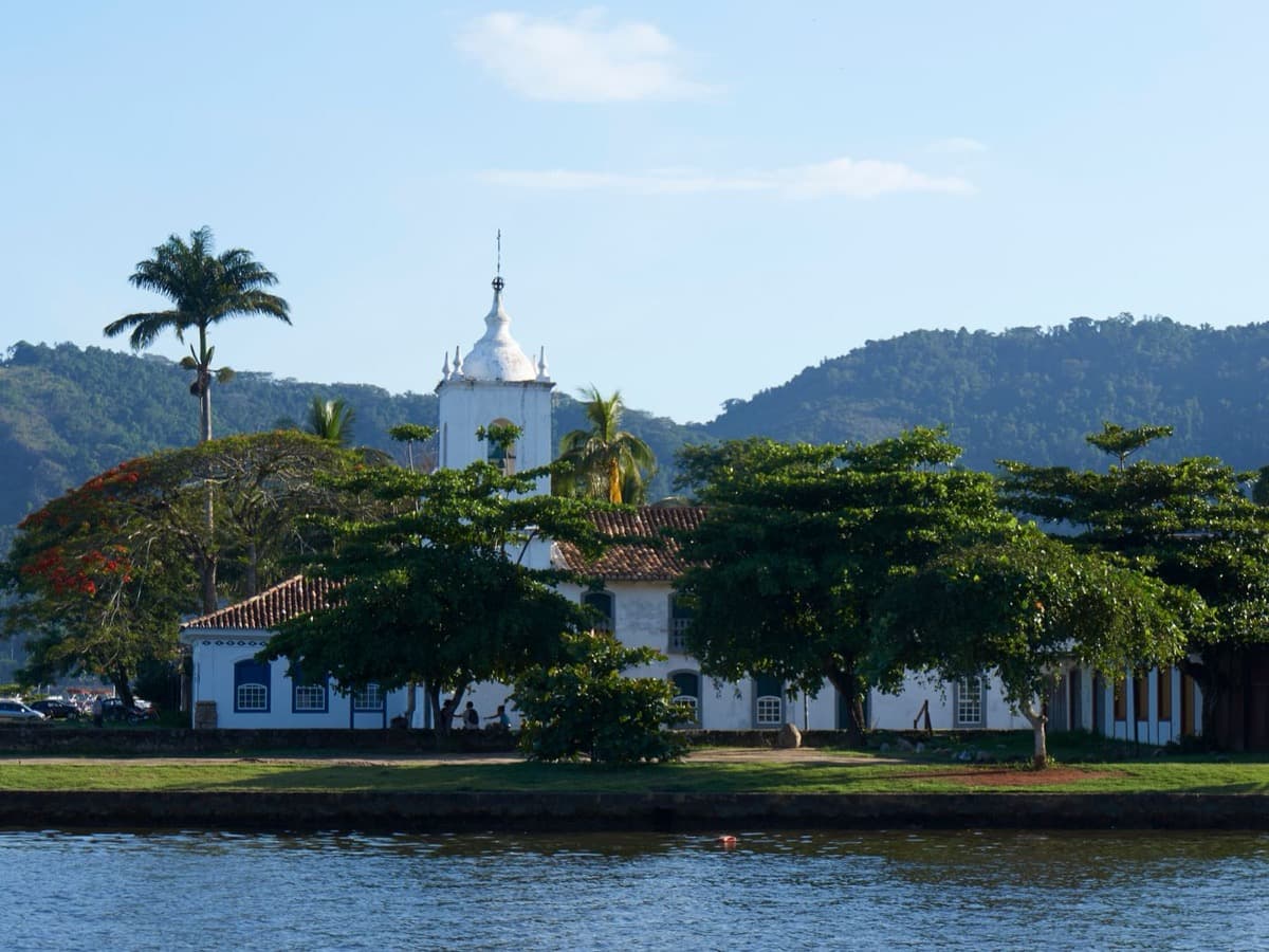
Paraty's postcard-perfect colonial grid is also a segregation map: four separate churches, four separate front doors, sorted by the color of your skin and your rank in a slave society. Walk them in order and the caste architecture under the whitewash becomes legible in stone.
Start · Igreja Matriz de Nossa Senhora dos Remedios: The Elite's Parish Church
DirectionsStops
- 1
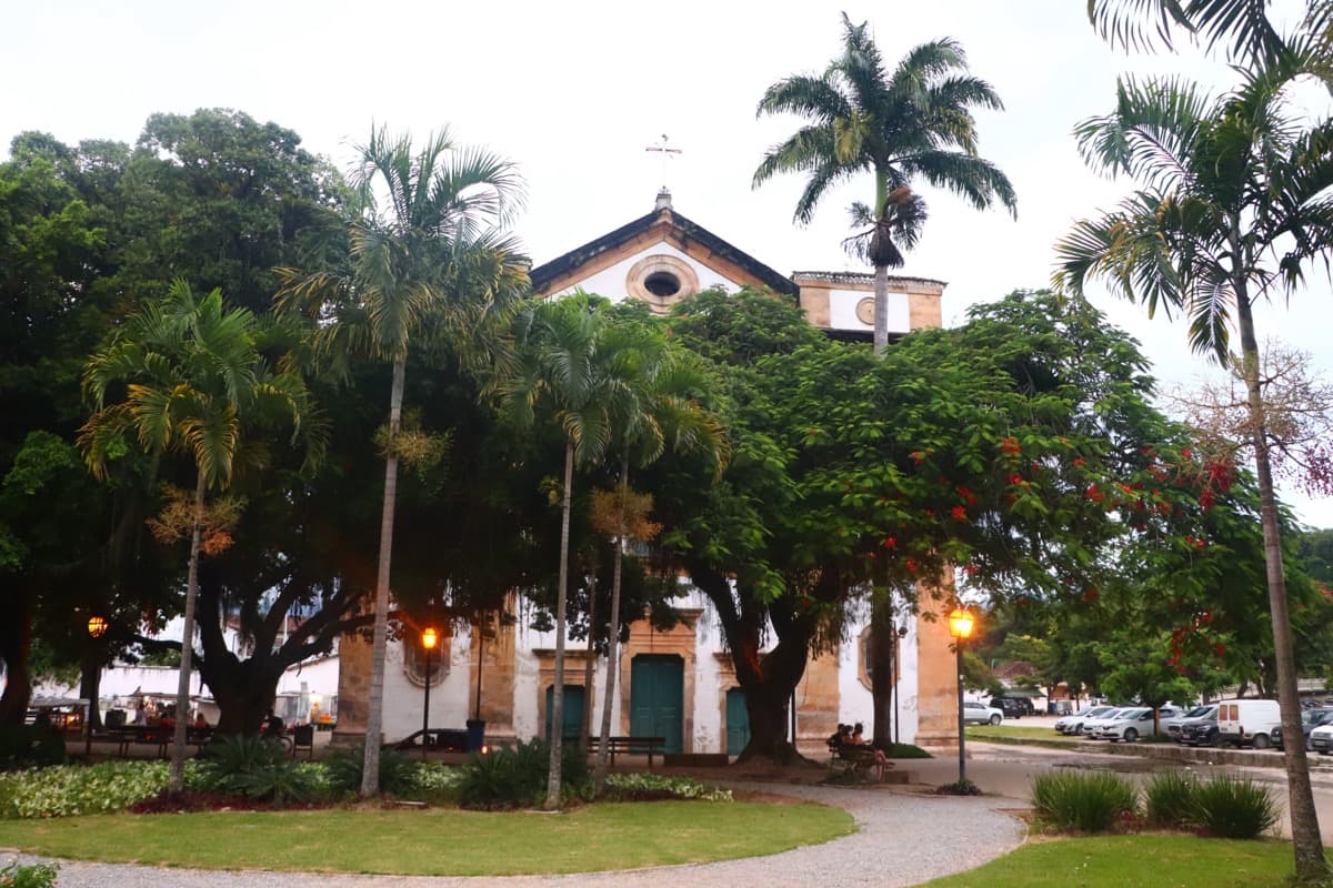
Igreja Matriz de Nossa Senhora dos Remedios: The Elite's Parish Church
The town's principal parish church, built for colonial Paraty's free white elite and the top rung of its caste order.
- 2
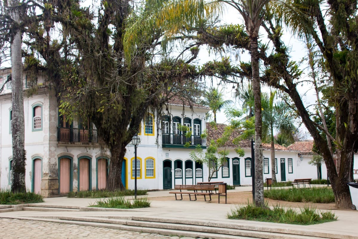
Praca da Matriz and the Colonial Sobrados
The central square and its whitewashed sobrados, the domestic heart of the UNESCO listed colonial grid, laced with tide washed streets.
- 3
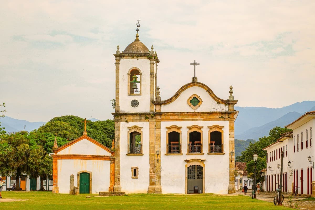
Igreja de Santa Rita de Cassia: The Freed Pardos' Church
Paraty's oldest surviving church, raised by the freed pardo brotherhood and now the waterfront face of the town.
- 4
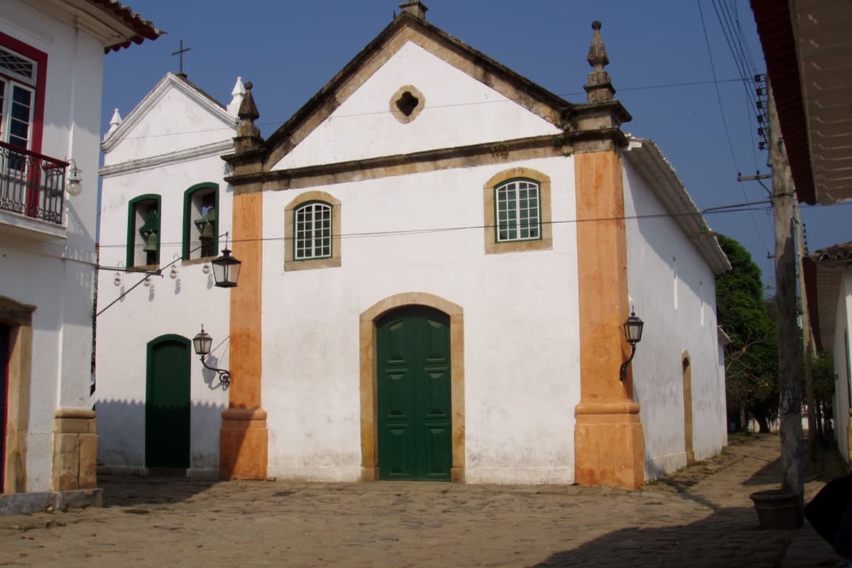
Igreja de Nossa Senhora do Rosario e Sao Benedito: The Black Brotherhood's Church
The plain church of the Black and enslaved brotherhood, the only one in Paraty with gilded altars.
- 5
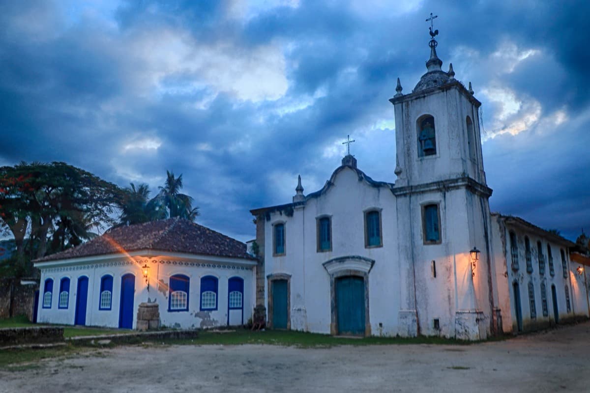
Igreja de Nossa Senhora das Dores: The Aristocracy's Separate Room
A delicate Empire era chapel founded by aristocratic women, the elite's separate room drawn after independence.
- 6
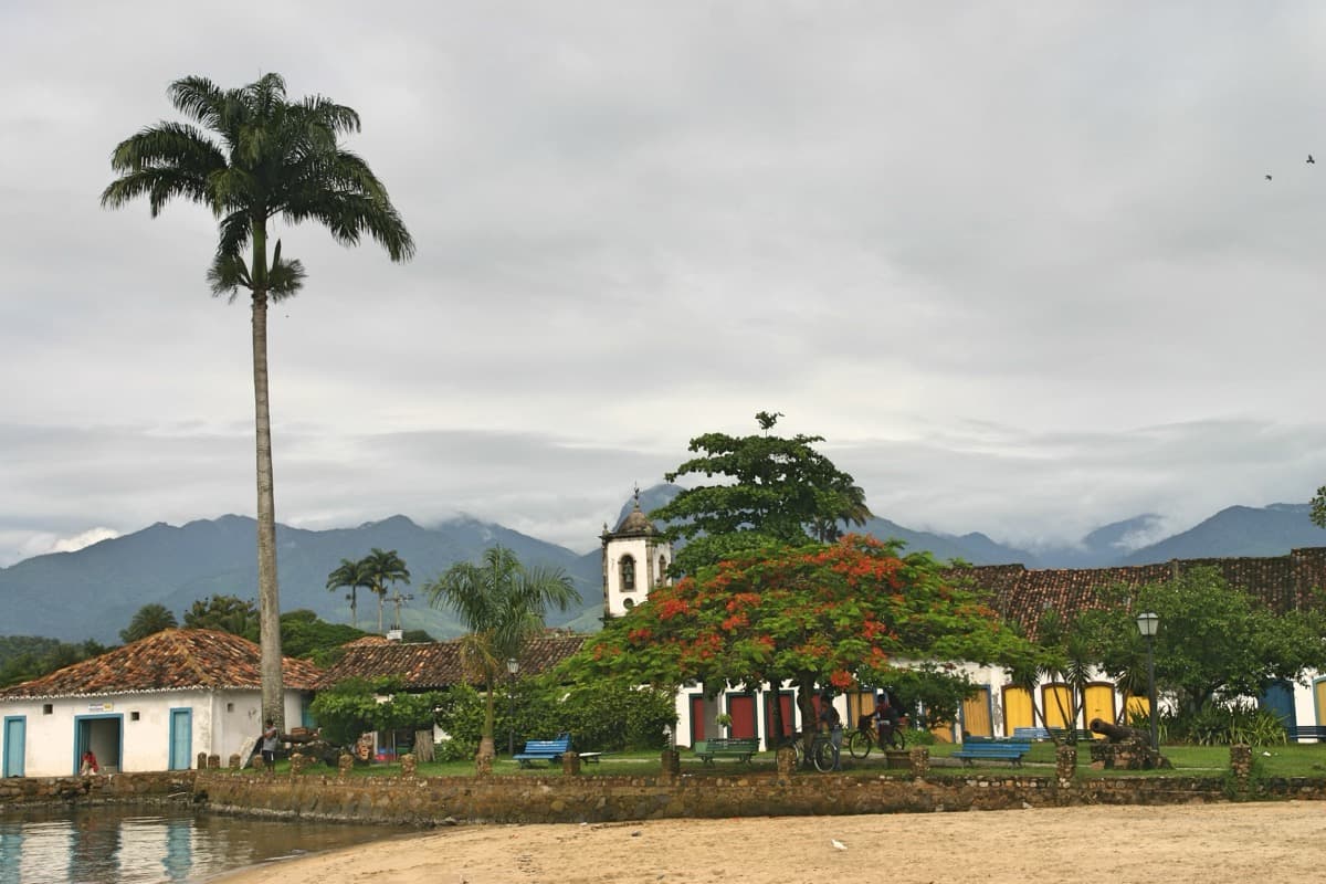
Forte Defensor Perpetuo: The View That Reads as One Plan
A hilltop fort and viewpoint over the bay where Paraty's scattered church towers finally read as one plan.
Details
Best Time to Visit
Come early morning or late afternoon, when the low sun warms the whitewash and the heat eases; midday can be fierce and bright. If you can, time your visit to a spring or full moon high tide to see seawater run through the cobbled streets, a signature of the town's design. Churches are generally open by day, while the museums inside Santa Rita and the fort keep more limited hours, so aim for late morning if you want to go inside.
Pro Tips
- •Wear shoes with grip. Paraty's cobbles are large, uneven, and slick, especially near the water and after rain.
- •Churches are free to view, but carry a little cash for the small museum fees at Santa Rita's sacred art museum and at the fort.
- •Check the tide table. At spring and full moon high tides parts of the historic center flood on purpose, which is beautiful but means wet feet.
- •Save the fort for last. It sits a short walk north across the river, so you can look back over the whole town from the rise once you have seen every church.
- •If a mass, festival, or Afro Brazilian celebration is happening, especially at the Rosary church, watch from the edge and keep quiet out of respect.
- •Take the stops in any order and skip freely. The four churches sit within a compact grid, and the walk works at whatever pace suits you.
Safety & Precautions
- •Paraty is hot and humid with strong tropical sun. Carry water, wear a hat and sunscreen, and rest in shade between stops.
- •Sudden heavy rain is common on this coast and turns the cobbles slippery and the streets tide prone. Move carefully and watch your footing.
- •These churches are active places of worship and living Afro Brazilian tradition. Dress modestly to enter, silence your phone, and do not photograph services or celebrations without clear permission.
- •Keep normal city awareness in the historic center, especially after dark. Stay on lit streets, keep valuables out of sight, and mind the uneven stones and the gentle climb up to the fort.
Travel advisory: Exercise Increased Caution (Level 2).
Gallery
Related Reading
Go deeper on what you'll see, hear, and walk through.
Overview
Best Self-Guided Walking Tours in Paraty (2026)
3 min
Overview
One Day in Paraty: A Walkable Colonial-Port Itinerary (2026)
5 min
Overview
Paraty Travel Guide: How Many Days, Getting There, When to Go (2026)
5 min
Thematic
Best Culture Walking Tours in Paraty (2026)
2 min
Thematic
What to Eat in Paraty: A Caicara and Cachaca Food Guide (2026)
4 min
Deep dive
Igreja Matriz de Nossa Senhora dos Remedios: The Church at the Center of Paraty's Caste Map
4 min
Deep dive
Santa Rita de Cássia: How Paraty's Most Photographed Church Was Built by the People Barred From the Main One
6 min
Read the walk
The full story of Historic Center: Four Churches, Four Castes, in words. Prefer to listen? Play it narrated, from home or on location.
Introduction
This walk has six stops among the churches and viewpoints of the colonial center of Paraty, on the coast of Brazil, and it reads the town as a map of who was allowed through which door. Plan for roughly ninety minutes at an easy pace, covering roughly two and a quarter kilometres over flat cobbles and one gentle rise at the end. Paraty is one of the best preserved colonial towns in Brazil, whitewashed and photogenic, its historic center inscribed by UNESCO in twenty nineteen as Paraty and Ilha Grande, Culture and Biodiversity. What the postcard does not say is that the beauty was built on a caste order. In the seventeen hundreds this was a slave society, and the town did not raise one church. It raised several, and which one you entered was decided by the color of your skin and your rank. There was a grand parish church for the free white population, a waterfront church founded by freed pardos, a plainer church built by the Black and enslaved brotherhood, and later a fashionable chapel where the aristocracy kept itself apart. Four separate front doors, sorted by race and status, all still standing and all still lovely. You will walk down that ladder rung by rung, then climb to a fort above the bay where the scattered church towers finally stand together in one view. Keep both truths in hand as you go: the loveliness is real, and so is the architecture of segregation underneath it. Take each stop at your own pace, and skip any that does not hold you. When you arrive at the Igreja Matriz de Nossa Senhora dos Remedios on the central square, begin with stop one.
1. Igreja Matriz de Nossa Senhora dos Remedios: The Elite's Parish Church
You are standing before the matriz, the principal parish church of Paraty, and the top rung of the order this walk descends. In the colonial town this was the church of the free white population. The record is blunt about it: some sources describe it as reserved for the richest and most powerful white families, while others frame it more simply as the parish church of the free white community. Either way, if your skin was dark or you were enslaved, you did not enter here. The story of the building runs across more than two centuries. The land was given in sixteen forty-six by Dona Maria Jacome de Melo, who attached one condition to her gift: that a chapel to Our Lady of Remedies be raised on it. A first chapel came down in sixteen sixty-eight. A larger stone and lime church was finished in seventeen twelve. By then the town had grown to around two thousand seven hundred souls, too many for the old walls, so a new temple was begun nearby in seventeen eighty-seven. It was completed only in eighteen seventy-three, with resources given, the record notes plainly, in kind and in slave labor by Geralda Maria da Silva. Look at the front. The style is neoclassical, sober and restrained, more civic than ecstatic, a building that announces authority rather than warmth. There are no gilded fireworks here. That plainness is a kind of statement. This was the establishment church, and it did not need to dazzle. Take a slow look at the square around it before you move, because the social order you will trace in stone begins right here, on the ground the powerful chose for themselves.
2. Praca da Matriz and the Colonial Sobrados
Stay in the open square in front of the matriz and let your eye widen from the church to the town around it. This is the heart of the historic center that UNESCO inscribed in twenty nineteen, and it holds one of the greatest concentrations of colonial architecture in Brazil. Look at the sobrados, the two story townhouses, whitewashed with doors and window frames painted in strong blues, yellows and reds. In the colonial economy this square was the domestic top of the social order. The wealthiest merchant and gold trade families lived in the finest houses within a few steps of this church, close to power, close to the sacraments they were allowed and others were not. Now look down at the street itself. The cobblestones are laid in a gentle concave curve, and that curve is not decoration. At the spring and full moon high tides, seawater is meant to run up these streets and then drain back out, flushing the town clean. It is one of the documented signatures of Paraty's design, a place built in conversation with the sea rather than walled against it. Stand here at the right tide and you can watch the water come into the streets as if the town were breathing. Hold the two readings together. This grid is genuinely beautiful, and it was also a sorting machine. The finest houses cluster by the elite church, and as you walk outward and downward toward the water and the edges, you will pass the churches of the people who were kept out of this square's inner circle. The map is under your feet. Follow it.
3. Igreja de Santa Rita de Cassia: The Freed Pardos' Church
This small waterfront church is the oldest surviving religious building in Paraty, founded on June thirtieth, seventeen twenty-two. It is also the second rung of the caste ladder. It was raised by the Irmandade de Santa Rita dos Pardos Libertos, the Brotherhood of Saint Rita of…
Full narration for this stop unlocks with the tour.
4. Igreja de Nossa Senhora do Rosario e Sao Benedito: The Black Brotherhood's Church
This is the plainest of Paraty's four churches, and it is the third rung down: the church of the Black and enslaved community. It was begun in seventeen twenty-five, at the request of two brothers, Manuel Ferreira dos Santos and Pedro, and it was built to serve enslaved people,…
Full narration for this stop unlocks with the tour.
5. Igreja de Nossa Senhora das Dores: The Aristocracy's Separate Room
This delicate chapel near the water is the fourth church, and it holds a twist in the story. It was founded in eighteen hundred, on the initiative of aristocratic women of the town, and it became a fashionable place of worship during the Brazilian Empire. Notice the date.…
Full narration for this stop unlocks with the tour.
6. Forte Defensor Perpetuo: The View That Reads as One Plan
You have climbed a little to reach this, and the climb is the point. This is Morro da Vila Velha, the rise north of the historic center, across the Pereque-Acu, and it carries the Forte Defensor Perpetuo. This hill saw the first Portuguese occupation of Paraty back in the…
Full narration for this stop unlocks with the tour.