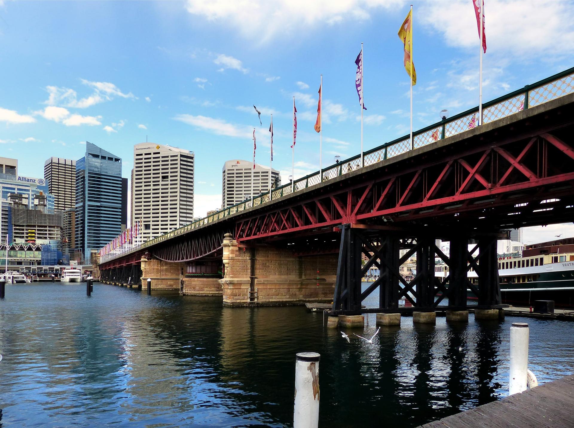
Cross Pyrmont Bridge's 1902 swing span, walk the west shore of Cockle Bay past the Maritime Museum's warships and the Tidal Cascades fountain, then Tumbalong Park, the Chinese Garden and Paddy's Markets, and up Dixon Street through Chinatown's gates.
Start · Pyrmont Bridge: The Bridge Sydney Nearly Lost
DirectionsStops
- 1
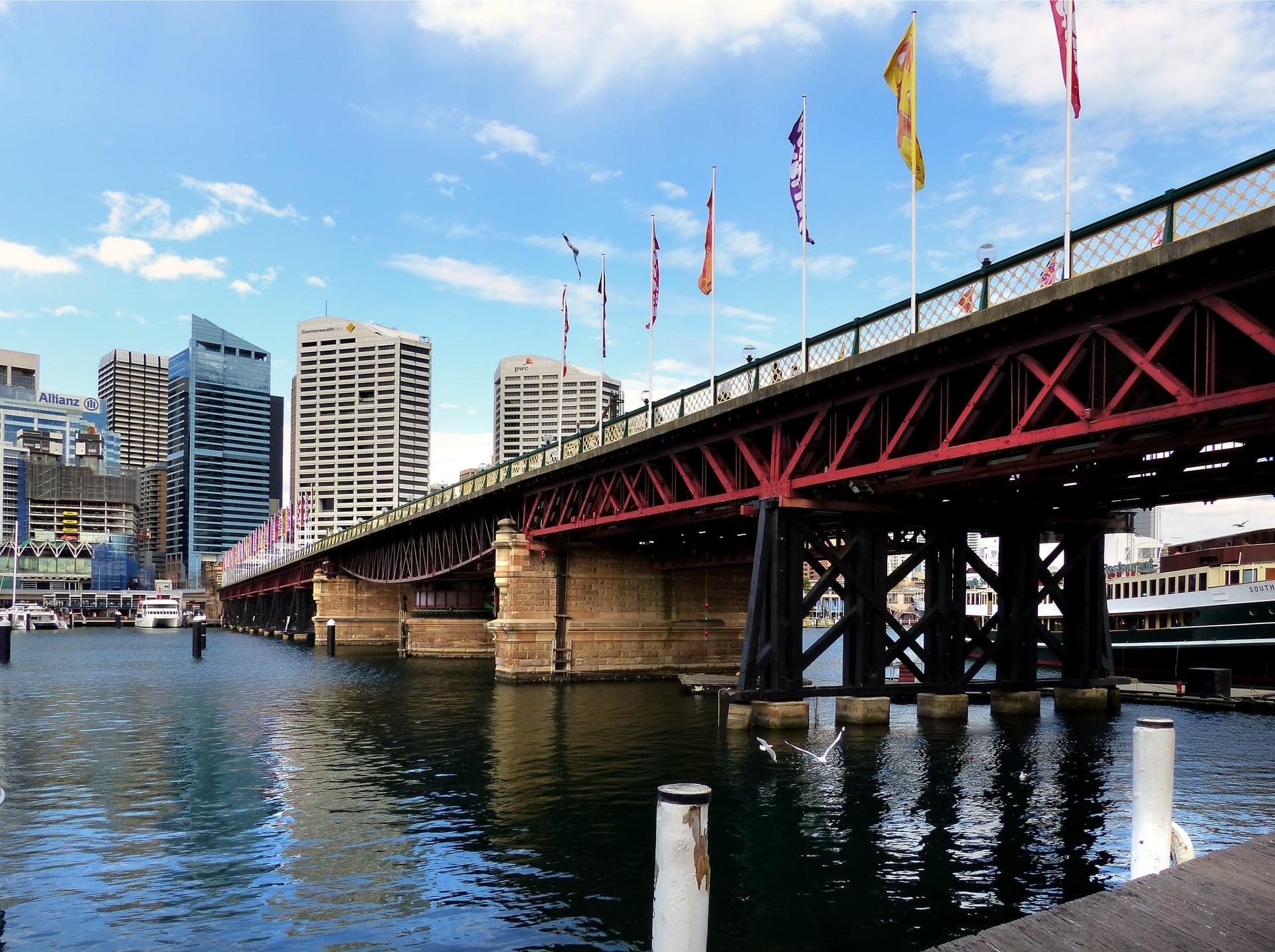
Pyrmont Bridge: The Bridge Sydney Nearly Lost
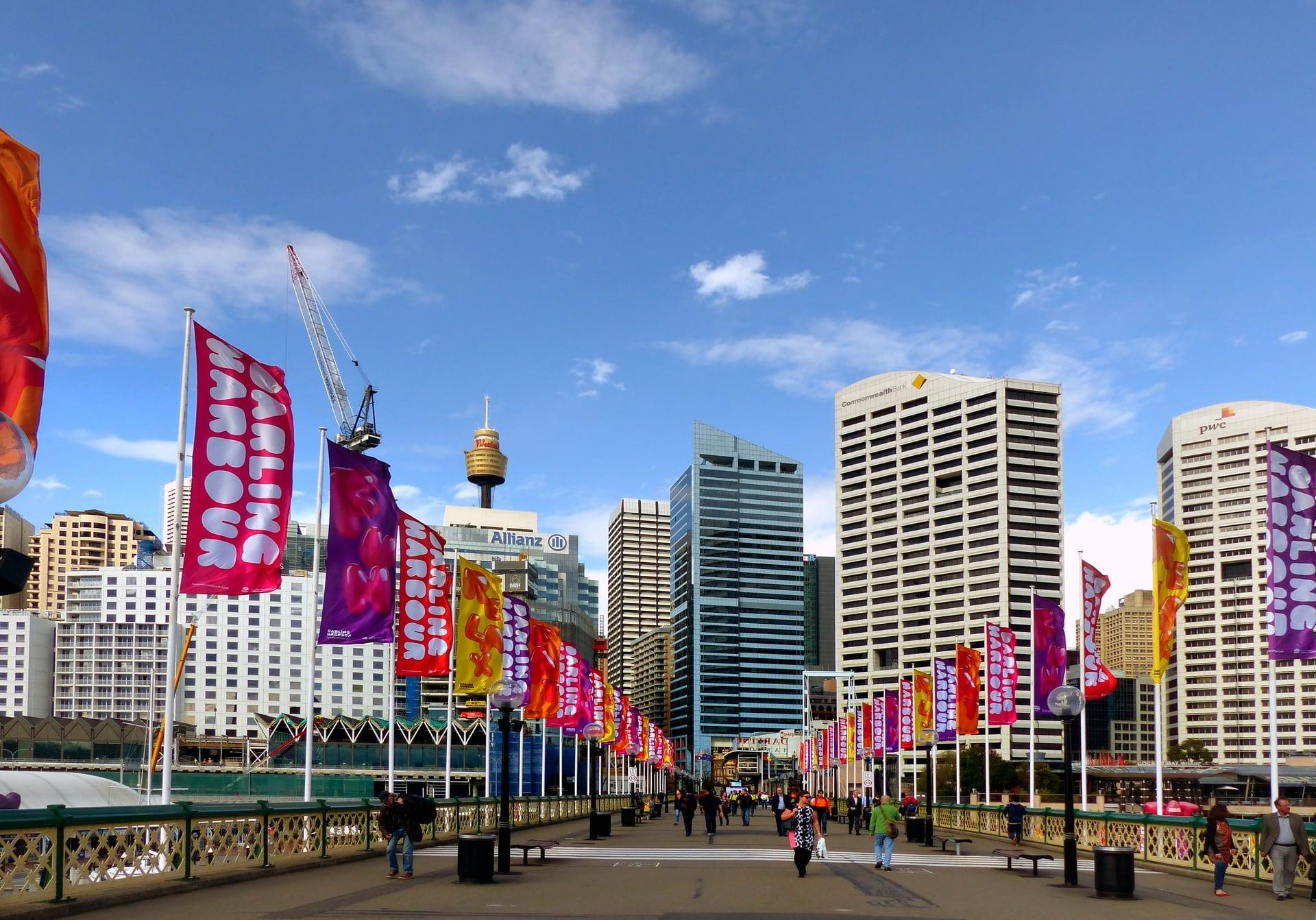
The bridge Sydney ordered torn down. Percy Allan's Pyrmont Bridge opened in 1902, closed to traffic in 1981 and was ordered demolished, then restored and reopened to walkers in 1988.
- 2
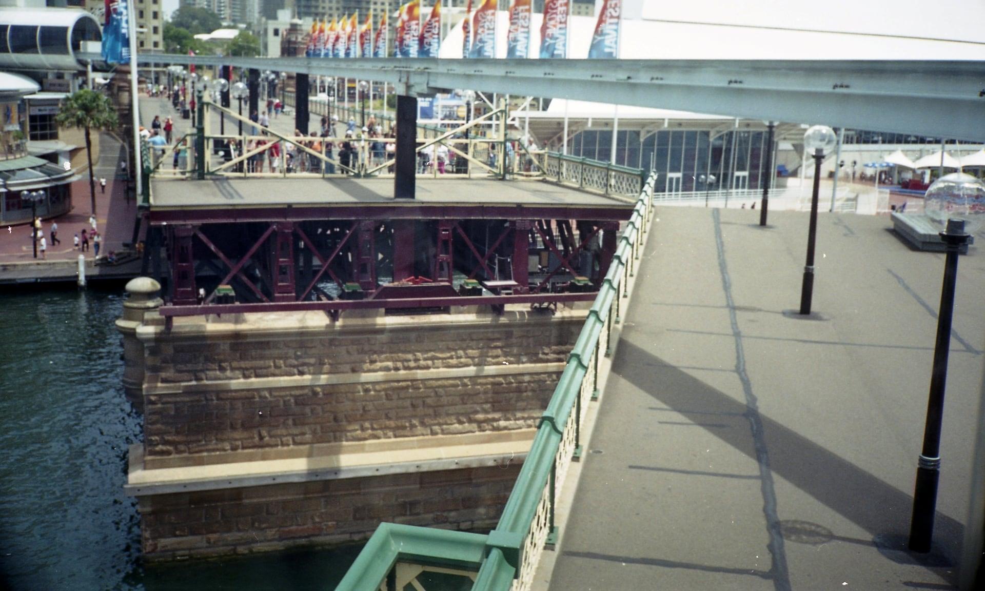
Swing Span: Turned by Tram Motors
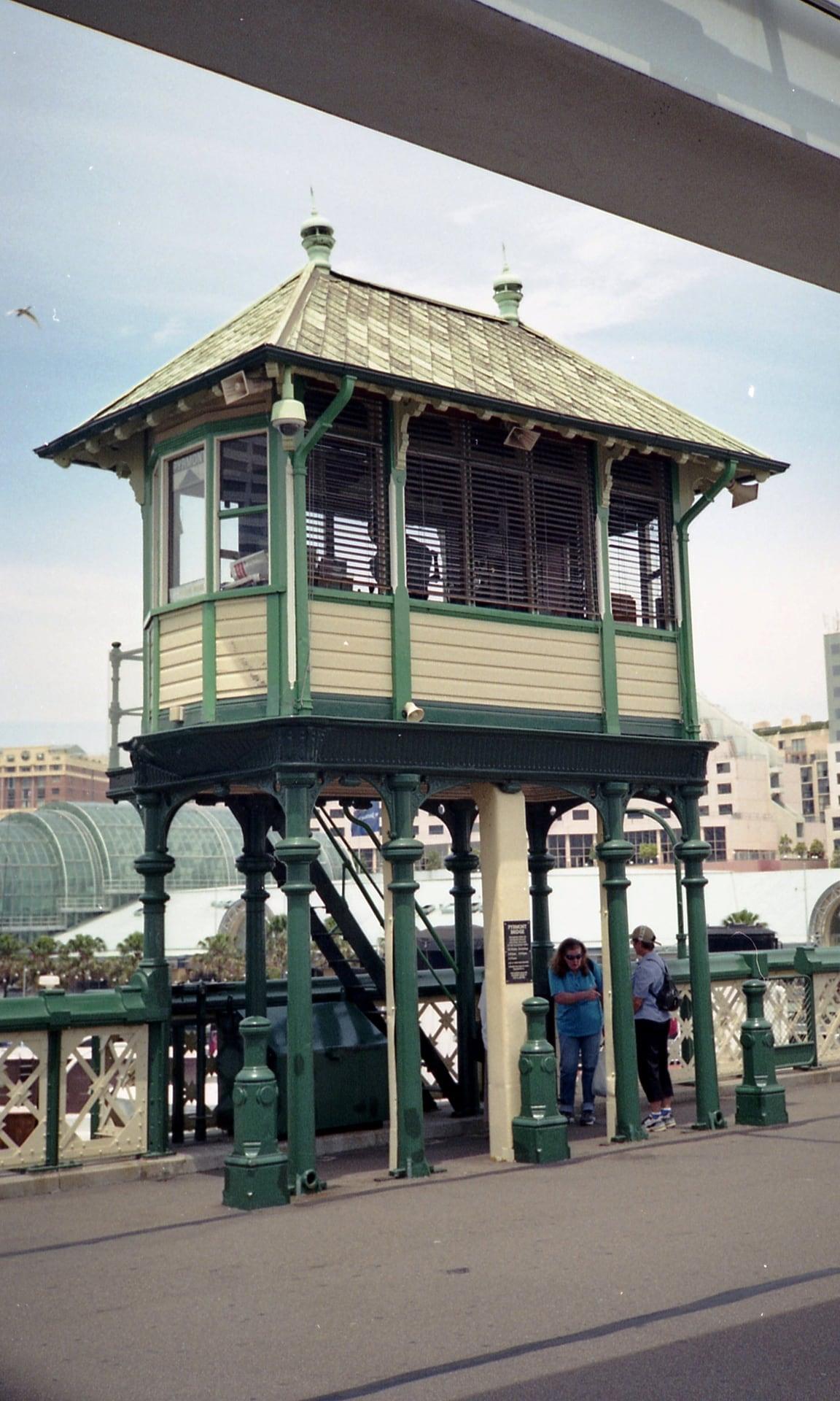
A steel span that still swings open. The 1902 swing span was turned by geared tram motors; on weekends and public holidays its gates close at 11, 12, 1 and 2 while it opens.
- 3
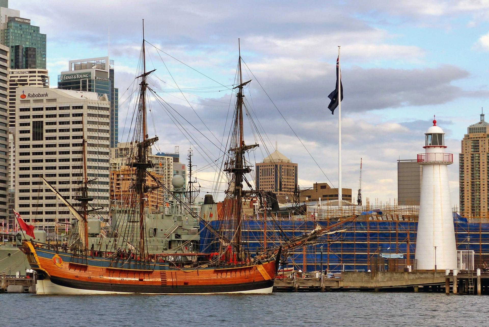
Maritime Museum: A Roof Built for Masts
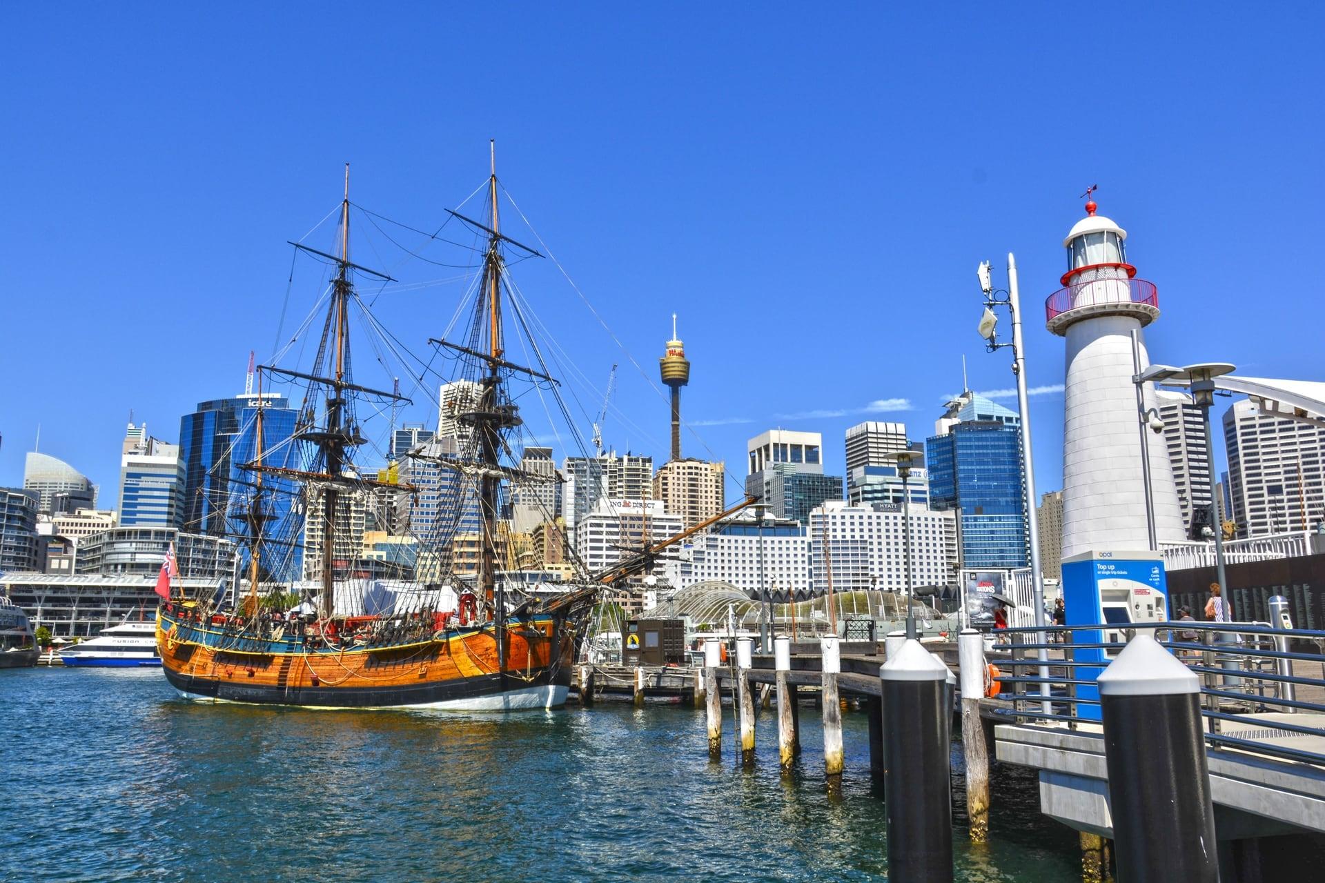
Warships moored at a museum's door. The Australian National Maritime Museum opened in 1991, its high walls and diving roof built for masts, with the destroyer Vampire and the submarine Onslow at its wharves.
- 4
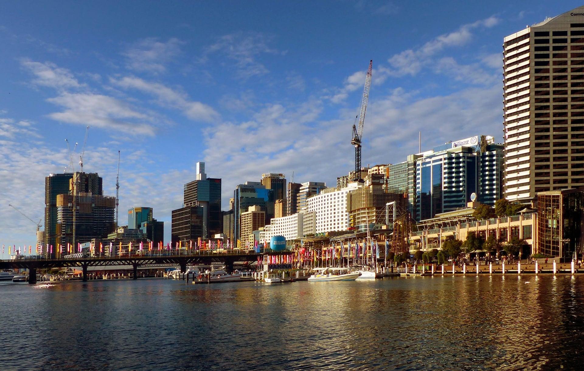
Cockle Bay: A Bay of Many Names
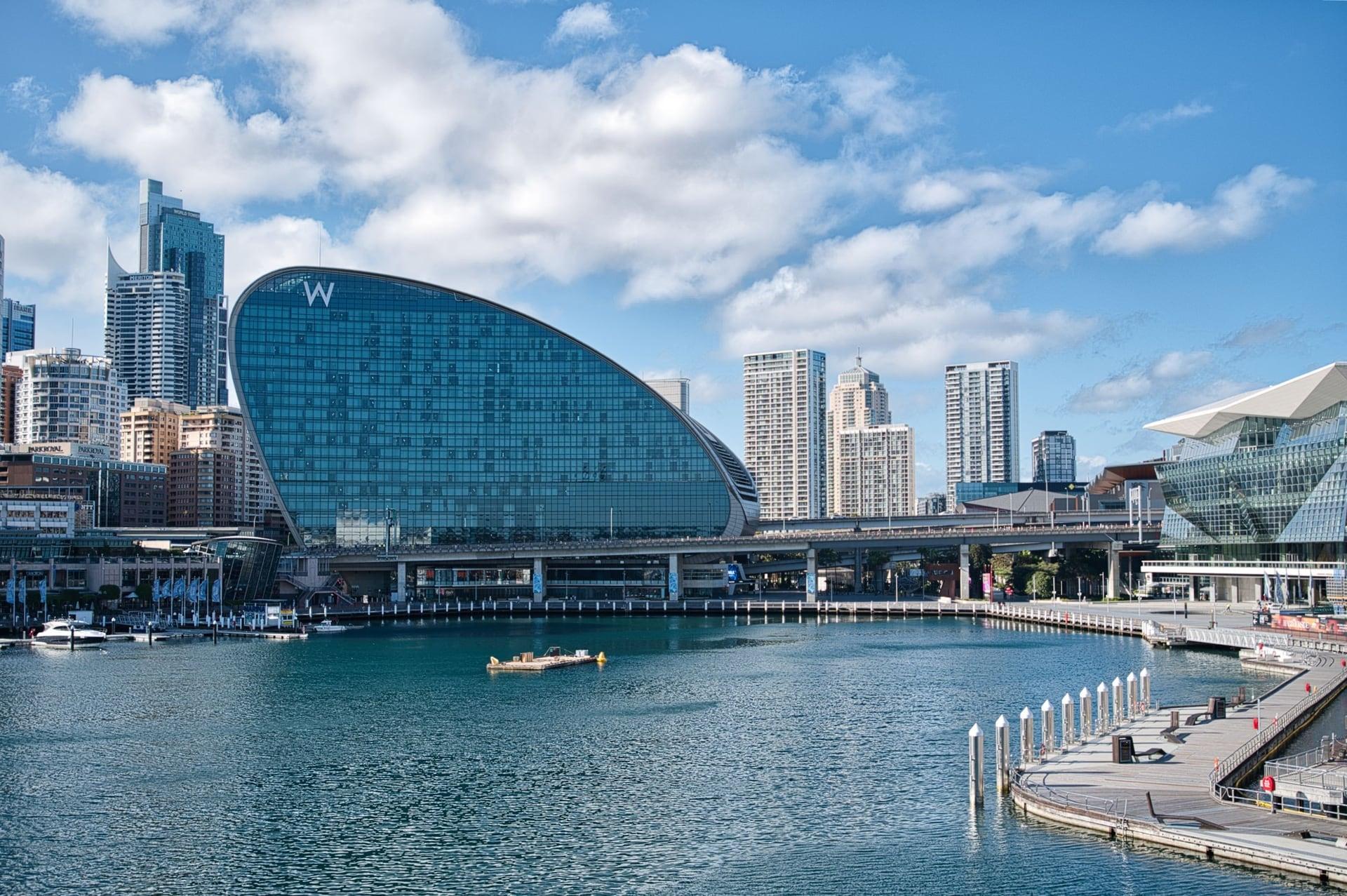
One bay that has had many names. Long Cove, then Cockle Bay for its heaps of shells, then Darling Harbour from 1826; the colony burned the shells for building lime.
- 5
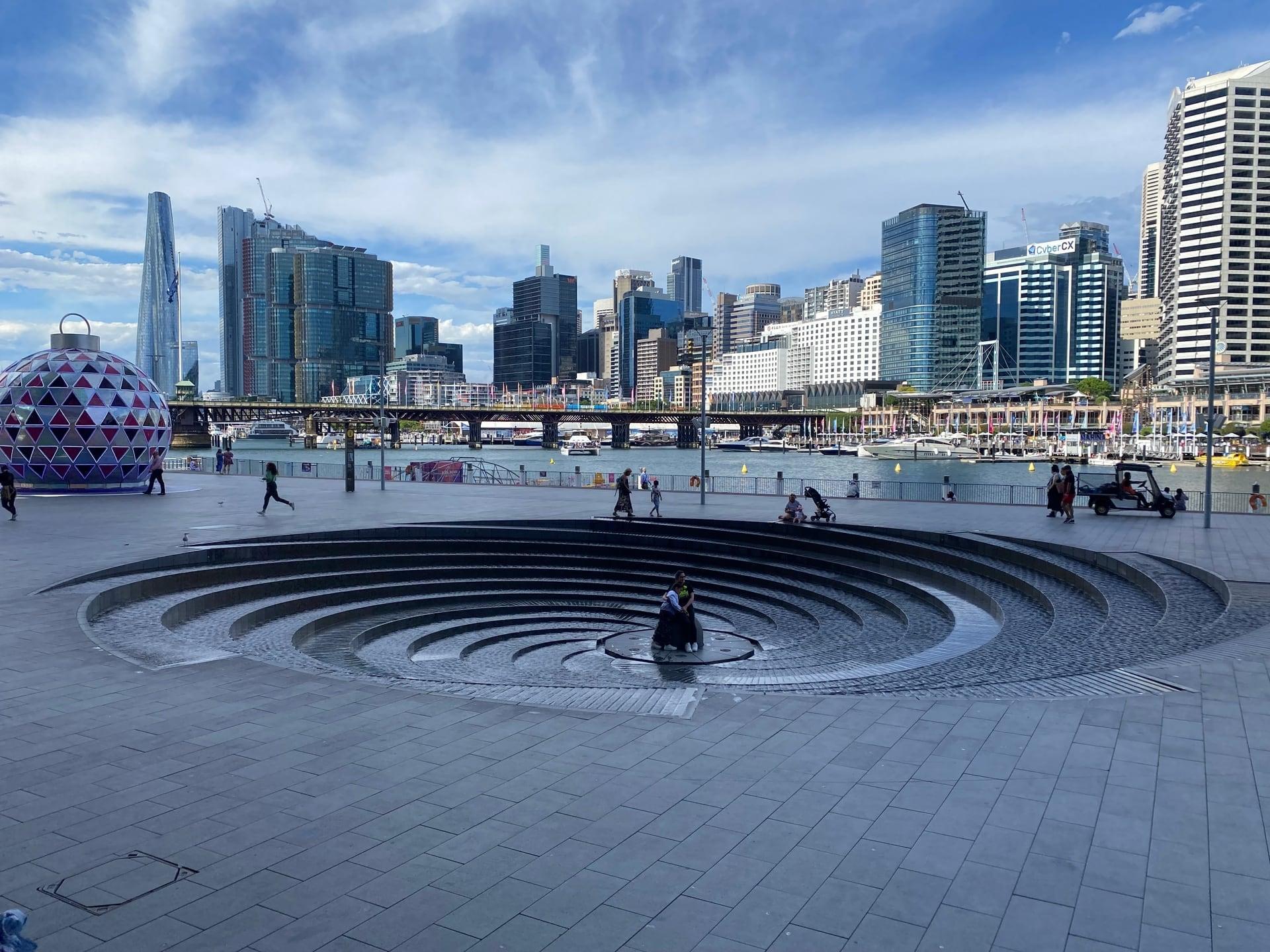
Tidal Cascades: Restless Water by Design
A fountain made from restless water. Robert Woodward's heritage-listed spiral of 1988 stands at today's head of the bay, beside the precinct that opened that year.
- 6
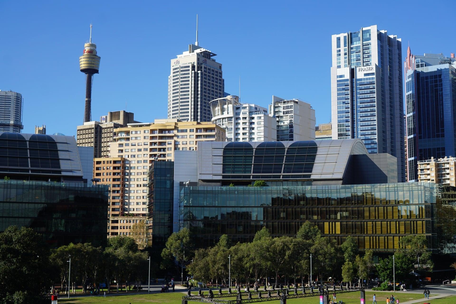
Tumbalong Park: Lawn on the Old Bay Floor
A park laid on the filled bay floor. Tumbalong Park carries the Aboriginal name set beside Darling Harbour, over ground once covered by railway goods yards.
- 7
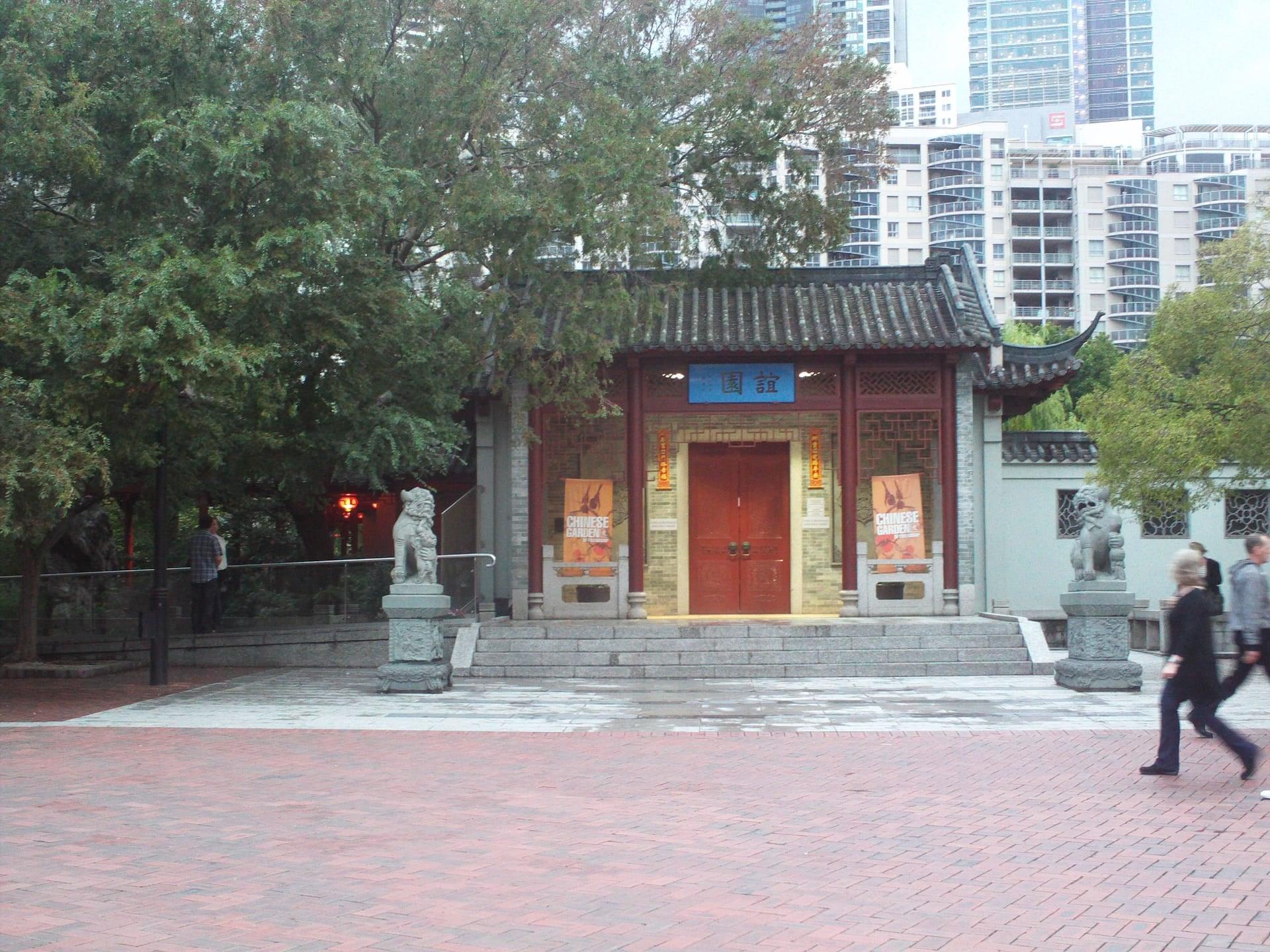
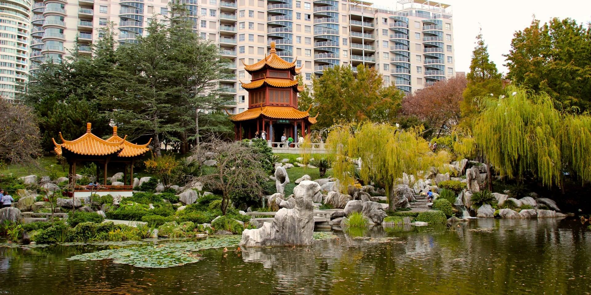
Chinese Garden of Friendship
A walled Cantonese garden from 1988. Opened at the start of the bicentenary as a sign of friendship between Sydney and Guangzhou; ticketed, with its gate and guardian lions free to see from the forecourt.
- 8
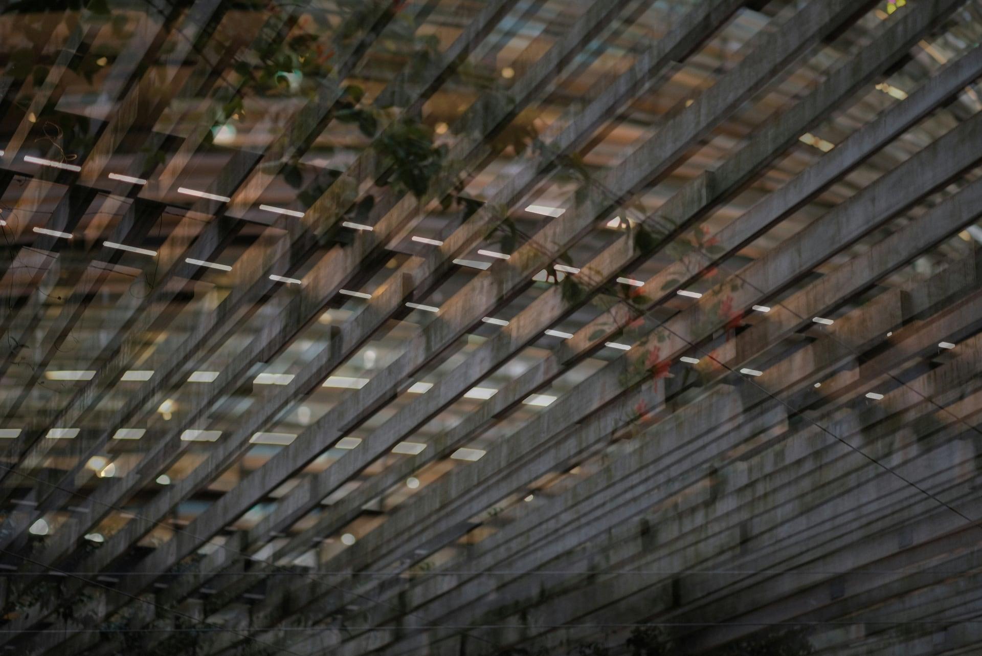
The Exchange: Timber Around a Drum
A round building wrapped in timber. The Exchange in Darling Square, with a City of Sydney library on two floors, near the marshy old head of Cockle Bay.
- 9
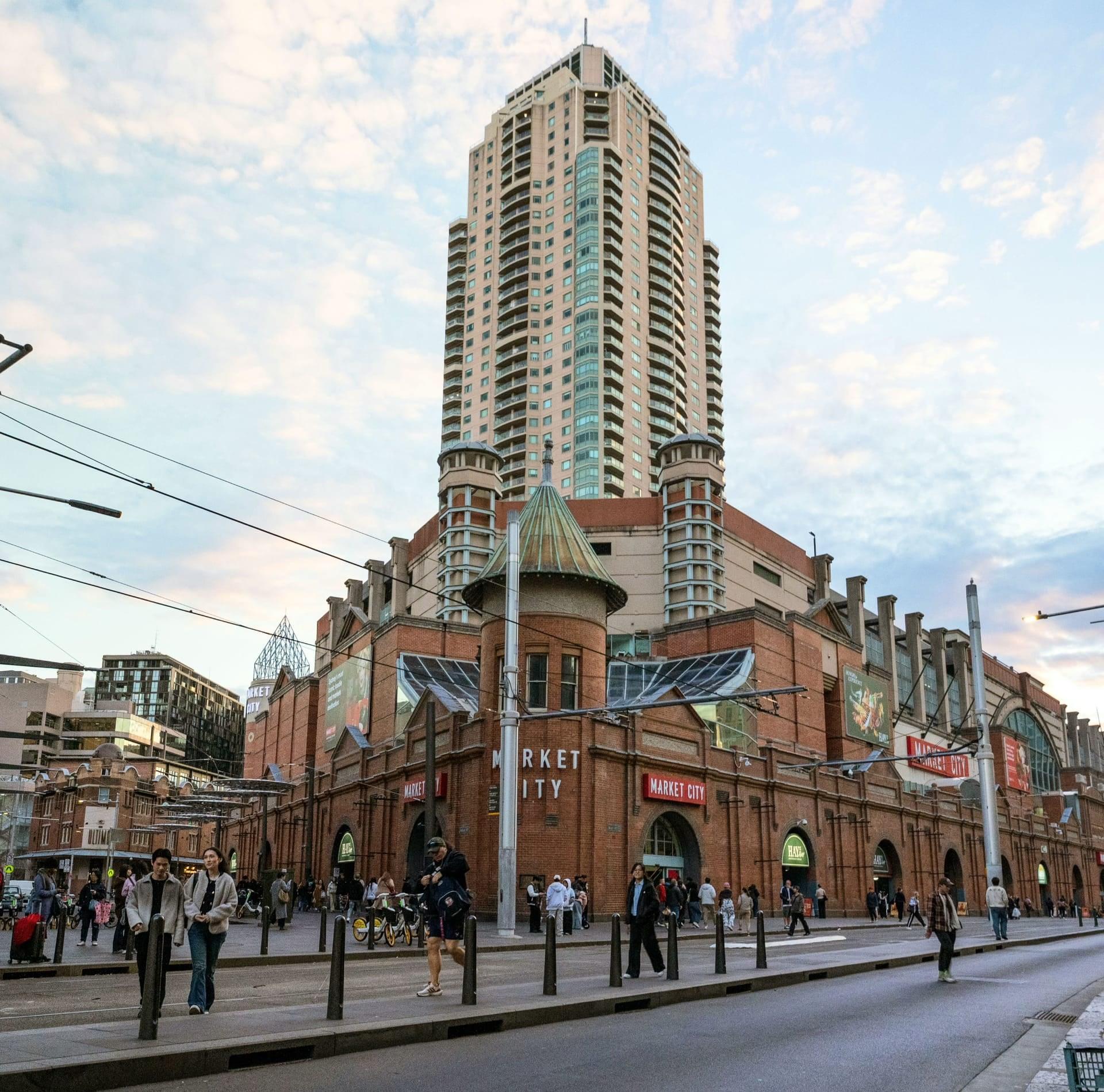
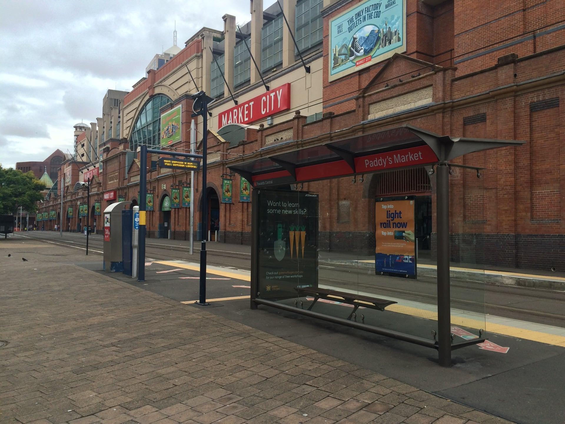
Paddy's Markets: The Markets Come to the Bay
The market front that came to the bay. Paddy's Markets' red-brick front of 1909 to 1910, kept when the halls behind it were rebuilt, on reclaimed ground at the old head of Cockle Bay; trading Wednesday to Sunday.
- 10
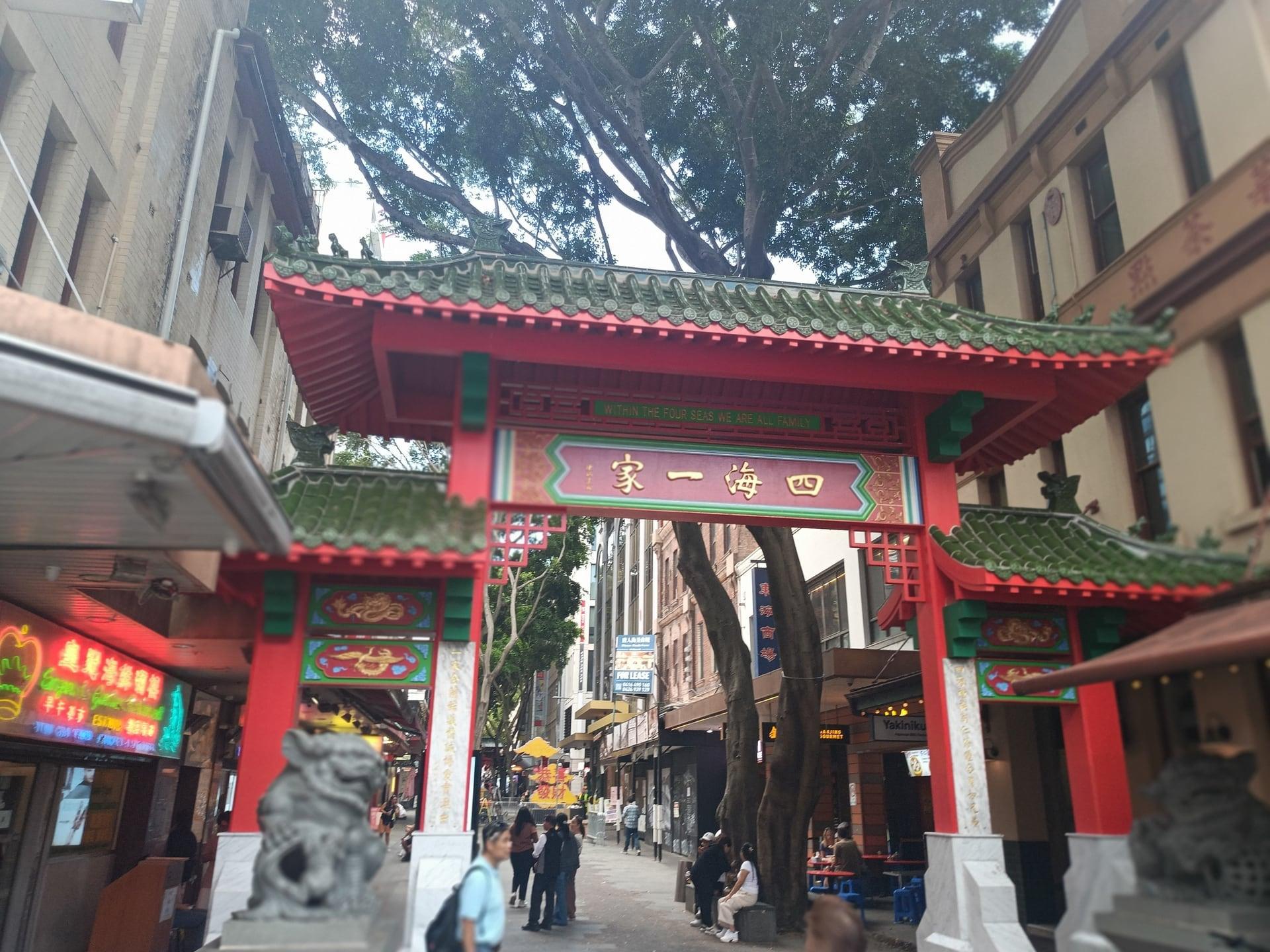
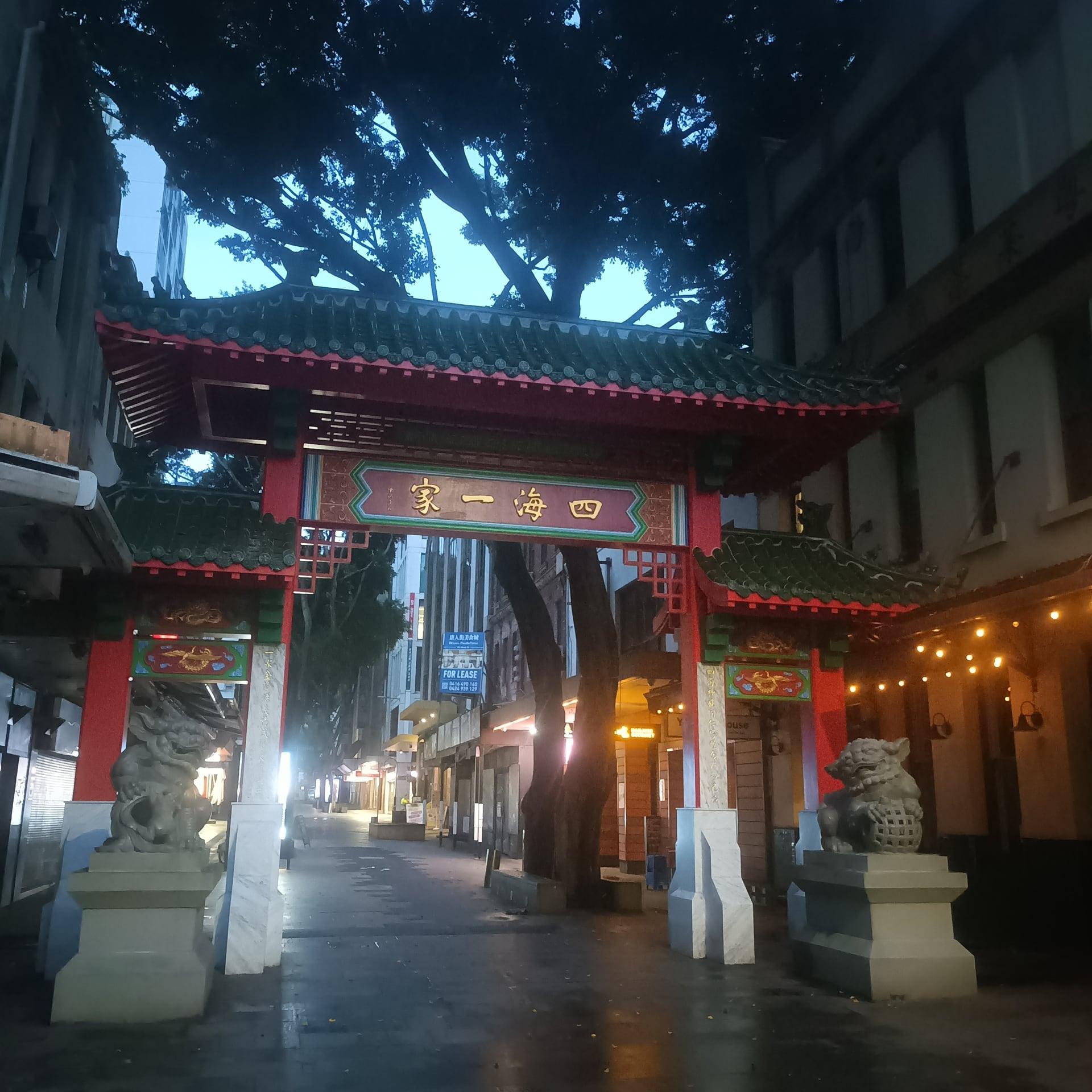
Dixon Street South Gate: Where the Bay Ended
Where the bay's water used to stop. Chinatown's south gate of 1980, designed by Henry Tsang and restored in 2025, stands near Sussex and Hay Streets, where Cockle Bay once reached.
- 11
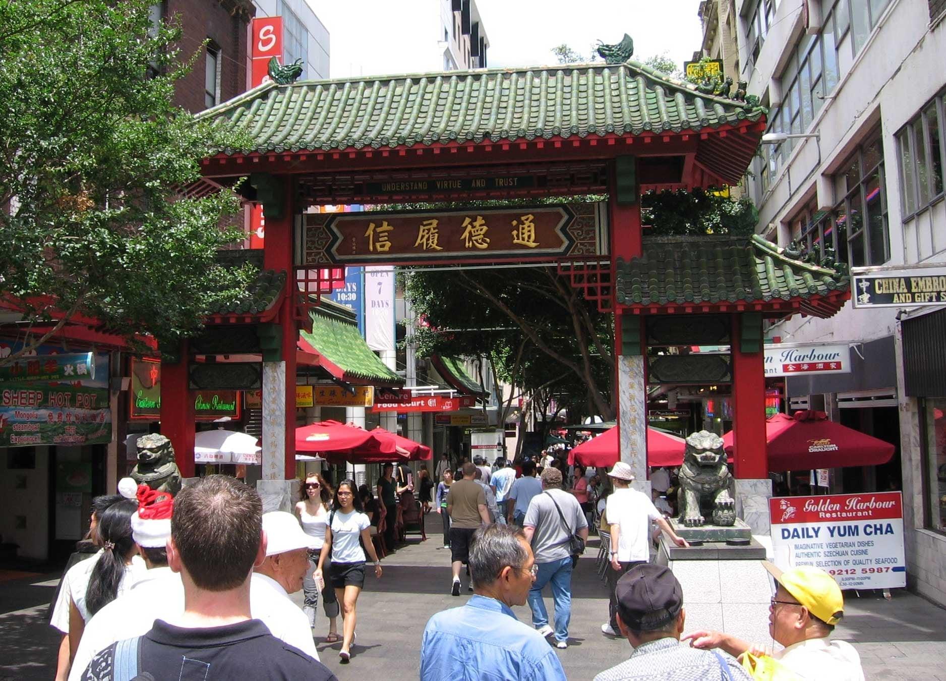
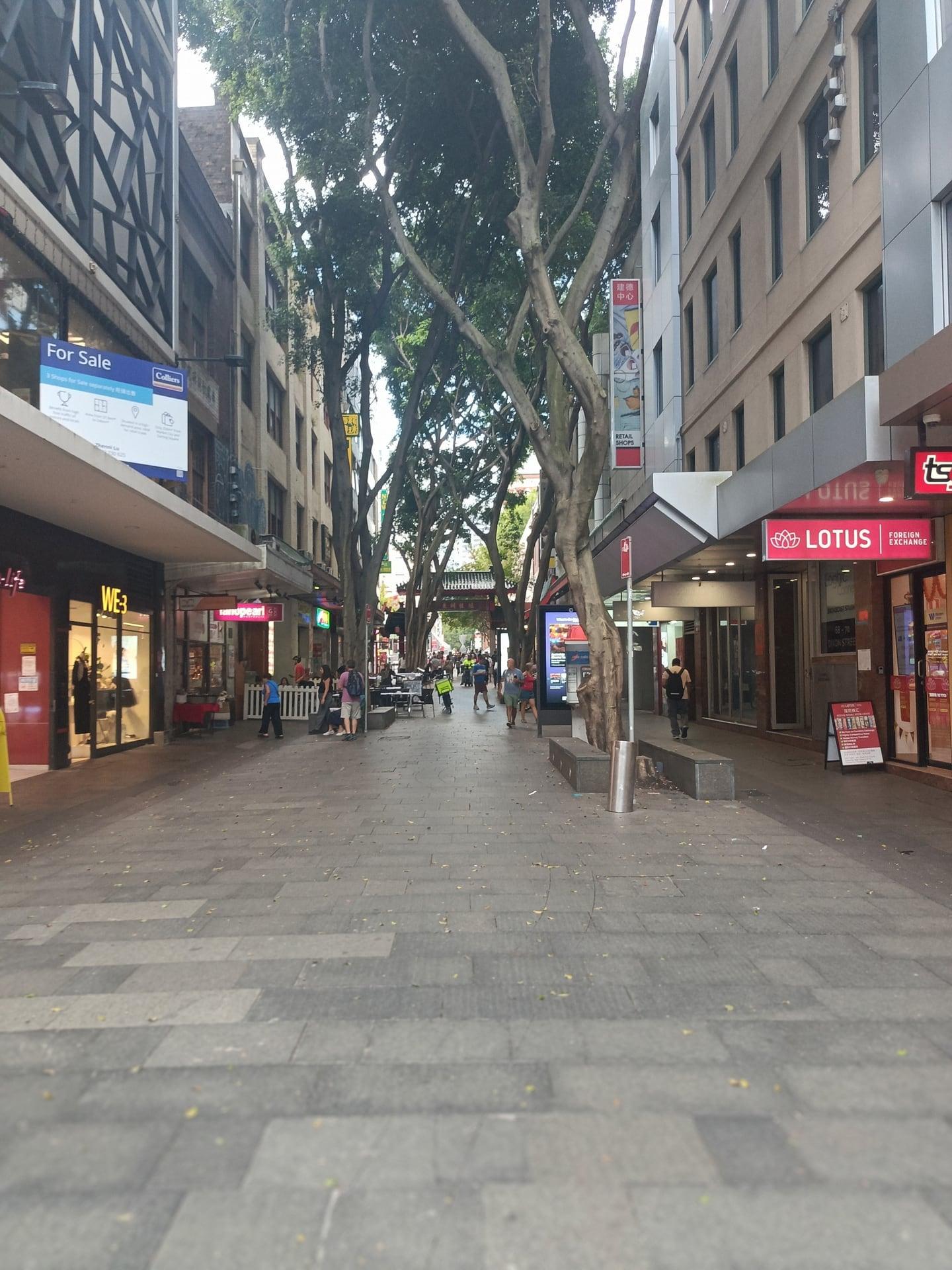
Dixon Street North Gate: Why Chinatown Is Here
Why Chinatown settled on this street. Chinatown moved from The Rocks to Campbell Street and then to Dixon Street, following the produce markets; the 1980 north gate frames the mall.
- 12
Chinese Ex-Services Monument
A quiet memorial to those who served. The Australian Chinese Ex-Services Monument, unveiled in 2003, honors Australians of Chinese heritage who served from the Boer War on.
Details
Best Time to Visit
Wednesday to Sunday, so Paddy's Markets is open (10:00 to 18:00), and between 10:00 and 17:00 if you want to go into the Chinese Garden. On a Saturday, Sunday or public holiday, be at stop 2 a few minutes before 11:00, noon, 13:00 or 14:00 to watch the swing span open. The first kilometer is open waterfront in full sun: in summer, go in the morning or late afternoon. Every stop is on lit public ground, so the walk works after dark, but the garden and the market are shut then. Sunset is about 19:30 in mid November and about 20:05 near 21 December (computed). Checked 10 November 2026.
Pro Tips
- •Start on Pyrmont Bridge at its city end. From Town Hall station, walk about 10 minutes west along Market Street, cross the footbridge, then take 34 steps or the escalator down.
- •If the Market Street footbridge is closed (it is due to be removed in the Cockle Bay redevelopment; no date announced, Checked 10 November 2026), walk down to the Cockle Bay waterfront promenade and take the 18 steps or the escalators up at the bridge's east end: about 950 m, 15 minutes, from Town Hall.
- •Our City Centre walk ends at Town Hall: walk it first, then come on down Market Street to the bridge, about 10 minutes.
- •Transport: Town Hall station (Sydney Trains) for the start. At the end, Town Hall station is about 600 m away, the Chinatown light rail stop (L2 Randwick and L3 Kingsford Lines) on George Street about 250 m, and Central about 800 m. The L1 Dulwich Hill Line stops Pyrmont Bay (the bridge's west end) and Paddy's Markets (beside stop 9) are on the route. Stop names from Transport for NSW stop guides; distances measured on the map. Checked 10 November 2026.
- •To watch the swing span turn, be at stop 2 a few minutes before 11:00, noon, 13:00 or 14:00 on a Saturday, Sunday or public holiday (darlingharbour.com). Checked 10 November 2026.
- •Chinese Garden of Friendship (stop 7): adults 12 AUD, children under 12 8 AUD; daily 10:00 to 17:00, closed Christmas Day and Good Friday. The forecourt, gate and lions are free. Checked 10 November 2026.
- •Australian National Maritime Museum (stop 3): adults 35 AUD (vessels and galleries) or 25 AUD (exhibitions only); daily 10:00 to 16:00 (last vessel boarding 15:10), closed 25 December; vessels close at 36 degrees. Access to the vessels may change until 28 November 2026 while the Navy Pavilion is installed; the Endeavour replica is berthed alongside Vampire. The forecourt and waterfront are free at all hours. Checked 10 November 2026.
- •Paddy's Markets (stop 9): Wednesday to Sunday 10:00 to 18:00, closed Monday and Tuesday; the 1909 to 1910 front is the stop on any day. Checked 10 November 2026.
Safety & Precautions
- •The route itself is flat with no steps, but the start is not step-free: from Market Street the footbridge over the Western Distributor lands on the bridge by 34 steps or an escalator. The other way up is from the Cockle Bay Wharf promenade at the water, by 18 steps or escalators at the bridge's east end. No lift is mapped. The Market Street footbridge is due to be removed in the Cockle Bay redevelopment (no date announced); if it is closed, use the waterfront way up. Mapped on OpenStreetMap; Checked 10 November 2026.
- •Pyrmont Bridge closes to walkers for a few minutes while the swing span opens: Saturdays, Sundays and public holidays at 11:00, noon, 13:00 and 14:00, and at other times for shipping (darlingharbour.com). Wait at the gates by stop 2. Checked 10 November 2026.
- •Pyrmont Bridge is under restoration (darlingharbour.com notices): expect work zones on the deck. Cyclists share the deck: keep to one side. Checked 10 November 2026.
- •Harbourside, on the west shore beside stop 4, is a building site until about mid-2027 (darlingharbour.com). The waterfront strip was open on current evidence (imagery and maps, no closure notice found) on 10 November 2026. If it is fenced, follow the signed detour or the path at the water's edge just south of the bridge; otherwise go back over the bridge. Checked 10 November 2026.
- •The L1 light rail runs along Hay Street at stops 9 and 10, close to the paved strip with no barrier. Trams are quiet: stay on the paved strip and the sidewalk, and never step onto the rails.
- •Crossings: Harbour Street by the zebra (no signals; traffic drives on the left, so look right first and wait for cars to stop), the mouth of Kimber Lane on the Hay Street sidewalk (watch for cars), Little Hay Street on Dixon Street (a raised crossing; cars may come through), and Goulburn Street at the signals.
- •Stop 12 is on a shared street where cars may pass at walking pace: stand by the steps at the street's edge, out of the lane.
- •Dixon Street (stops 10 to 12) is being upgraded by the City of Sydney until early 2027, with lighting work on the ceremonial gates planned for early 2027 (City of Sydney project page): expect barriers on the mall and possibly scaffolding on the gates. Checked 10 November 2026.
- •The Australian Chinese Ex-Services Monument is a war memorial and commemorations are held there: keep your voice low and do not climb on it.
- •The first kilometer is open waterfront with little shade: wear a hat, use sunscreen and carry water in summer.
- •GPS can drift under the bridge's first span (between stops 3 and 4), under the Western Distributor's road bridges (between stops 5 and 6) and under Pier Street (between stops 7 and 8), and among the taller buildings at stops 8 and 12. Every stop can also be played by tapping it.
Travel advisory: Exercise Normal Precautions (Level 1).
Gallery
Related Reading
Go deeper on what you'll see, hear, and walk through.
Read the walk
The full story of Darling Harbour and Chinatown: Where the Bay Used to End, in words. Prefer to listen? Play it narrated, from home or on location.
Introduction
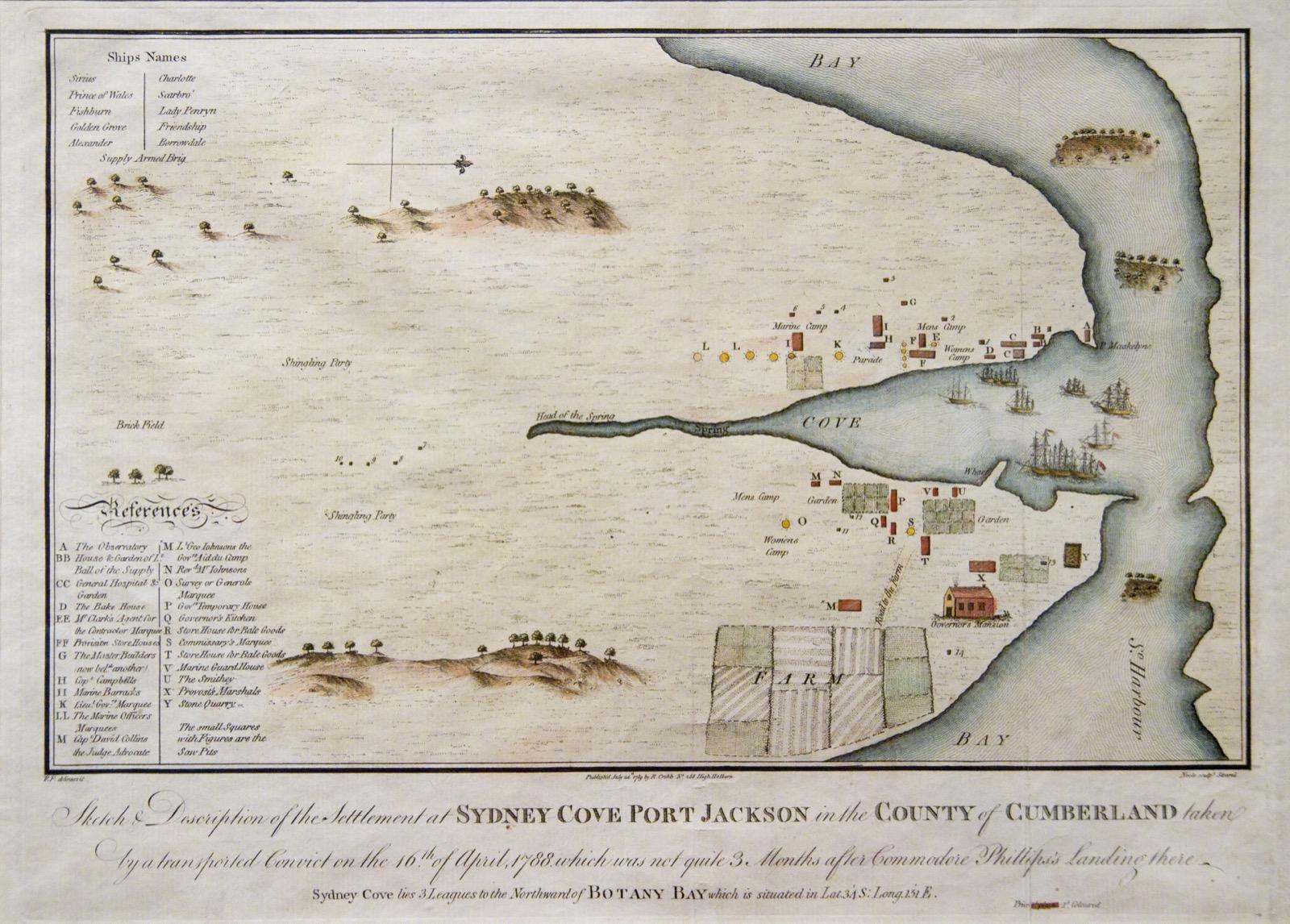
Sydney's Darling Harbour used to be longer. In seventeen eighty eight its head, Cockle Bay, reached back toward the corner of Sussex and Hay Streets, where Chinatown's south gate stands today. Since then it has been dammed, filled, laid with rail yards and markets, and in nineteen eighty eight made a waterfront park. This walk crosses the bay on its old swing bridge, follows the shore to where the water stops now, then crosses the filled ground to where it used to stop, at Chinatown's door.
There are twelve stops over about two point two kilometers, about a mile and a third, and it takes about an hour and a quarter. The walk itself is flat, with no steps. Getting to the start is not step-free: from Town Hall station, walk about ten minutes west along Market Street, over the footbridge across the Western Distributor and down thirty four steps or an escalator. If the footbridge is closed, take the steps or escalators up from the waterfront below.
On weekends and public holidays at eleven, twelve, one and two, the bridge closes for a few minutes while its span swings open: if the gates are shut, wait there, at stop two. You cross four streets in Haymarket; only Goulburn Street has signals. Paddy's Markets trades Wednesday to Sunday. The walk ends on Dixon Street in Chinatown, near Liverpool Street.
When you arrive at Pyrmont Bridge, begin with stop one.
1. Pyrmont Bridge: The Bridge Sydney Nearly Lost
This is Pyrmont Bridge. You are at its city end, where this walk begins. The timber deck runs out across the water ahead of you. Partway across, a steel section sits on its own pier with a small cabin raised above it: that is the swing span, and it is the next stop. Beyond it rises the folded metal roof of the Maritime Museum. With the span ahead, the open water on your left is Cockle Bay, the head of Darling Harbour.
This bridge opened in June nineteen oh two, replacing an older one from eighteen fifty seven, and it was built for work. Wool and other produce crossed it between the stores in Pyrmont and Ultimo, on the far shore, and the wharves on this side, and the city's traffic went out over it to the growing western suburbs. Its designer was Percy Allan, the engineer in chief of the state's public works department, who designed hundreds of bridges. Place Management New South Wales, the state agency that runs it today, gives its length as three hundred and sixty nine meters.
For seventy nine years it carried traffic. Then, in nineteen eighty one, it was closed to cars, and the government ordered it demolished. The order was revoked. In nineteen eighty four the state announced that the whole bay would be redeveloped in time for the bicentenary of nineteen eighty eight. The bridge was restored, with its swing span in working order, and in nineteen eighty eight it reopened for people on foot. A monorail ran across it for twenty five years; when the monorail closed in twenty thirteen, its track was taken off.
So the walk begins on something the city nearly lost. Cyclists share the deck, so keep to one side.
Follow the route out along the deck. Next is the swing span.
2. Swing Span: Turned by Tram Motors
Walk on along the deck to the gates where the steel span begins, and stop there, out of the cyclists' way.
If the gates are shut, you have arrived at the right moment: the span is about to turn. Stay here and watch. It takes a few minutes, and the gates open again when the span is back in line. On weekends and public holidays it swings at eleven, twelve, one and two, and at other times for ships.
Look at the two kinds of bridge in front of you. Where you are standing, the deck rests on timber trusses. The government insisted on local ironbark, a hard Australian timber, because iron and steel cost too much. Ahead, the part that moves is steel, balanced on a central pier. When it turns, it swings round on that pier and lets tall ships into the bay.
The heritage listing says that when it was built, this was one of the largest swing spans in the world, and one of the first swing bridges to be powered by electricity. Sydney was electrifying its trams just then. The power station at Ultimo stood nearby, and tram motors, with the right gearing, could turn the span. The listing says it could open or close in about forty five seconds. The raised cabin on the span is where it is worked from, and its managers say the old tram-style control handles inside have changed little since they were installed.
It is one of the oldest electric swing bridges still working; Place Management New South Wales, which runs it, calls it the oldest. By its estimate the span has opened more than six hundred thousand times.
Follow the route to the far end of the bridge, step off onto the museum's forecourt, and come back down along it to the water.
3. Maritime Museum: A Roof Built for Masts
You have come down the forecourt to the water. Walk on along the waterfront toward the gray warship, and stop there, with the museum's wall beside you and the bay on the other side.
This is the Australian National Maritime Museum. The museum and its ships are ticketed, open daily from ten to four; the details are on this stop's card. The forecourt and this waterfront are free at any hour, and the ships are easy to see from here.
Ahead, at the museum's wharves, the long gray ship is the destroyer Vampire, and the black hull beside it is the submarine Onslow, both retired from the navy. When the replica sailing ship Endeavour is in port, it berths alongside Vampire.
Now look up at the building. It was built from nineteen eighty six and opened in nineteen ninety one, part of the bay's remaking. Its walls are high and its roof dives in folds, and there is a reason: it was designed to make room for the masts of boats displayed inside.
Ships belong on this water. For much of the nineteenth century the bay was a working port for wheat, wool, coal and timber, and from the eighteen seventies wool above all. By nineteen hundred, dozens of wharves lined Darling Harbour. In the Depression of the nineteen thirties, casual wharf workers queued in the streets by the wharves for the chance of a few hours of backbreaking work, and those streets became known as the Hungry Mile. Today the ships at this shore are exhibits.
The path ahead leads only to the museum's gate. Turn back toward the bridge, and follow the route along the water and under the bridge. Next is the open bay.
4. Cockle Bay: A Bay of Many Names
Walk on along the promenade, with the water beside you, and stop where the whole bay opens up. The bridge is behind you now, and across the water stand the city's towers. The hoarding on the landward side is Harbourside, a shopping center being rebuilt; its managers expect it to be finished in mid twenty twenty seven.
This water has carried several names. The colony first called it Long Cove. The name that stuck was Cockle Bay, and the reason lay along these shores. According to the precinct's own history, the shores were littered with oyster shells and other shellfish remains, heaps built up over thousands of years. Those heaps are middens.
The colony saw a use for them. Its first bricks were poorly fired, and it had no lime for mortar, and the precinct's history calls the great shell middens of Cockle Bay the perfect source. The shells were burned for lime, and the lime went into the town's early buildings. In the colony's first years, the same history says, the only Europeans who came to these shores were the lime burners, and hungry convicts and settlers looking for mussels and other shellfish.
The City of Sydney's Aboriginal history pages say Gadigal country ran along the harbor's southern shore, from South Head to around Petersham, and that its waters gave oysters, mussels and cockles.
Then, in eighteen twenty six, the governor of the day gave the harbor his own surname, and that is the name on the maps: Darling Harbour. There is one more name, and you will meet it at the park.
Follow the route along the shore. Next is a fountain at the head of the bay.
5. Tidal Cascades: Restless Water by Design
Walk on to the round hollow cut into the ground, with water running down inside it, and stop at its rim. This is Tidal Cascades, a spiral fountain designed by the architect Robert Woodward and finished in nineteen eighty eight. Look down into it. The bowl is cut cleanly into…
Full narration for this stop unlocks with the tour.
6. Tumbalong Park: Lawn on the Old Bay Floor
Walk on down the boulevard to the edge of the big round lawn, and stop where a path leads off around it. Across the lawn, a curved white roof like a shell rises over a stage. This is Tumbalong Park. Tumbalong is the Aboriginal name for Darling Harbour. In two thousand and five…
Full narration for this stop unlocks with the tour.
7. Chinese Garden of Friendship
Walk on along the boulevard and stop where a paved forecourt opens off it. At the far end of the forecourt are a ceremonial gate, a flight of stairs and two stone lions guarding the door, and above the walls, the tiled roofs of pavilions. This is the Chinese Garden of…
Full narration for this stop unlocks with the tour.
8. The Exchange: Timber Around a Drum
Walk on under the overpass and stop beside the round building wrapped in pale strips of timber. This is The Exchange, the round centerpiece of Darling Square. Look at how it is made: around its floors, timber strips loop and overlap, so the whole building looks wound rather…
Full narration for this stop unlocks with the tour.
9. Paddy's Markets: The Markets Come to the Bay
Walk on along Hay Street on the paved strip, and stop when the long red brick front across the tracks is opposite you. Light rail trams run on these tracks, and they are quiet. Stay on the paved strip and keep off the rails. Across the tracks is Paddy's Markets. The brick…
Full narration for this stop unlocks with the tour.
10. Dixon Street South Gate: Where the Bay Ended
Walk on along Hay Street to the foot of Dixon Street, and stop by the ceremonial gate with its tiled roofs and its stone lions. Stay on the sidewalk: the light rail runs close by. Look a short way on along Hay Street, to the next corner. That is Sussex Street. The state…
Full narration for this stop unlocks with the tour.
11. Dixon Street North Gate: Why Chinatown Is Here
Walk on up the mall, under the second gate, and stop just before Goulburn Street. Now turn round to face the gate you just walked under, and its lions. This is the north gate, the outer face of Chinatown's other door. Its inscriptions, in English translation, read: Understand…
Full narration for this stop unlocks with the tour.
12. Chinese Ex-Services Monument
Walk on up Dixon Street, where cars share the street at walking pace. Stop beside the short flight of steps that leads down into a sunken court, where a slim column stands ringed by a spiral of thin rods. Stand by the steps, out of the lane. This is the Australian Chinese…
Full narration for this stop unlocks with the tour.