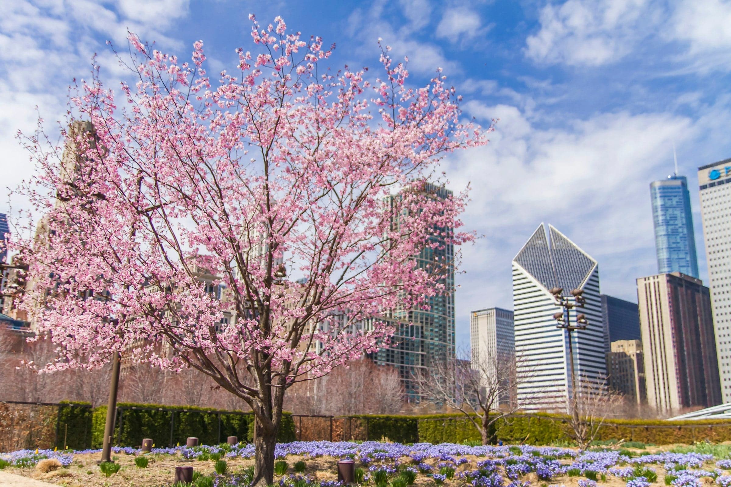
Walk Millennium Park and the lakefront from Michigan Avenue past Cloud Gate, Crown Fountain, Lurie Garden and Monroe Harbor to Buckingham Fountain, which stands where the 1909 Plan put a museum.
Start · Cultural Center: Michigan Avenue Was the Shore
DirectionsStops
- 1
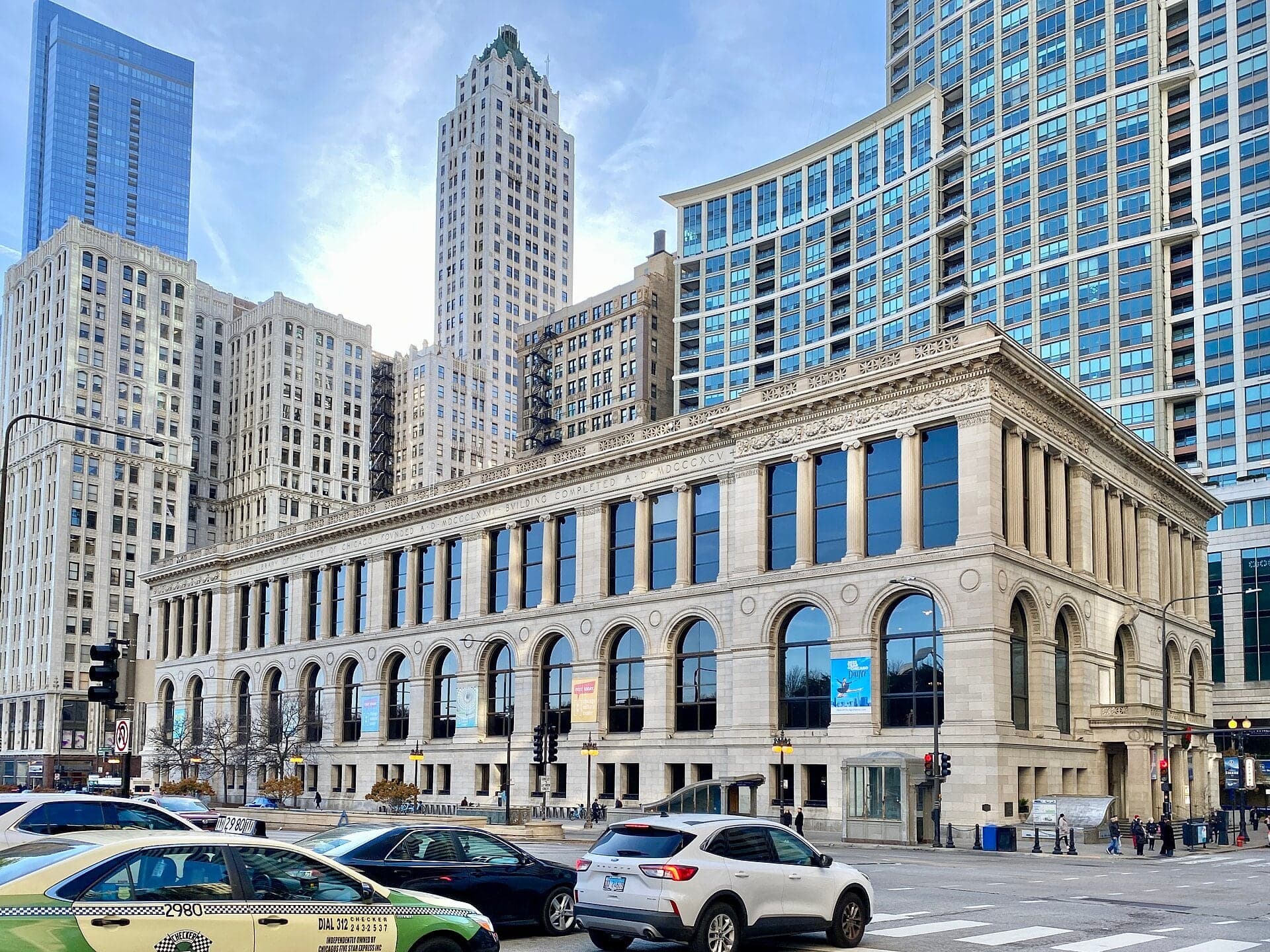
Cultural Center: Michigan Avenue Was the Shore
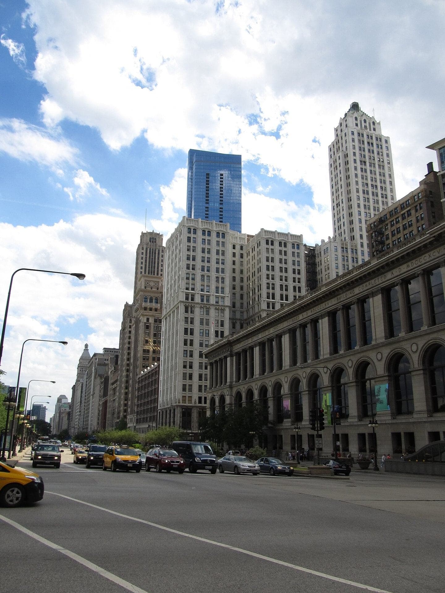
Michigan Avenue was the lake shore before the park existed. The Cultural Center's neighbors still face the open ground across the avenue.
- 2
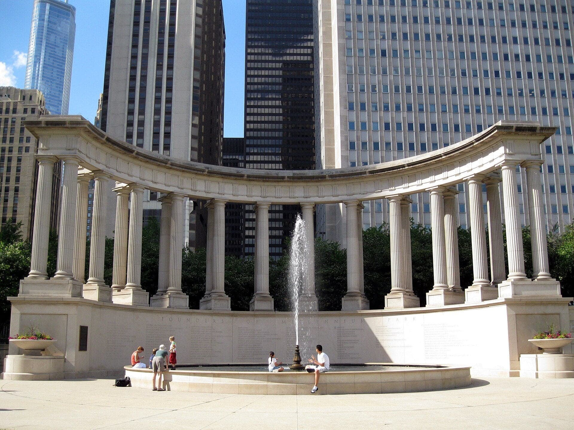
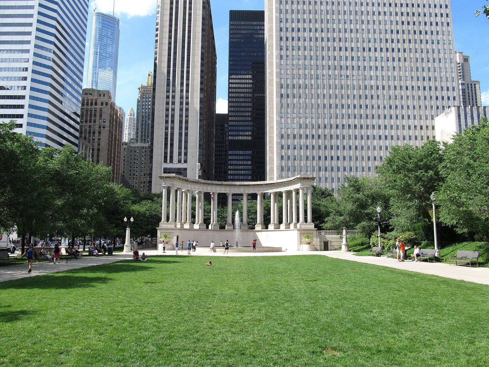
Wrigley Square: A Colonnade Built Twice
This colonnade copies one that stood here until 1953. The park around it is built over train tracks.
- 3
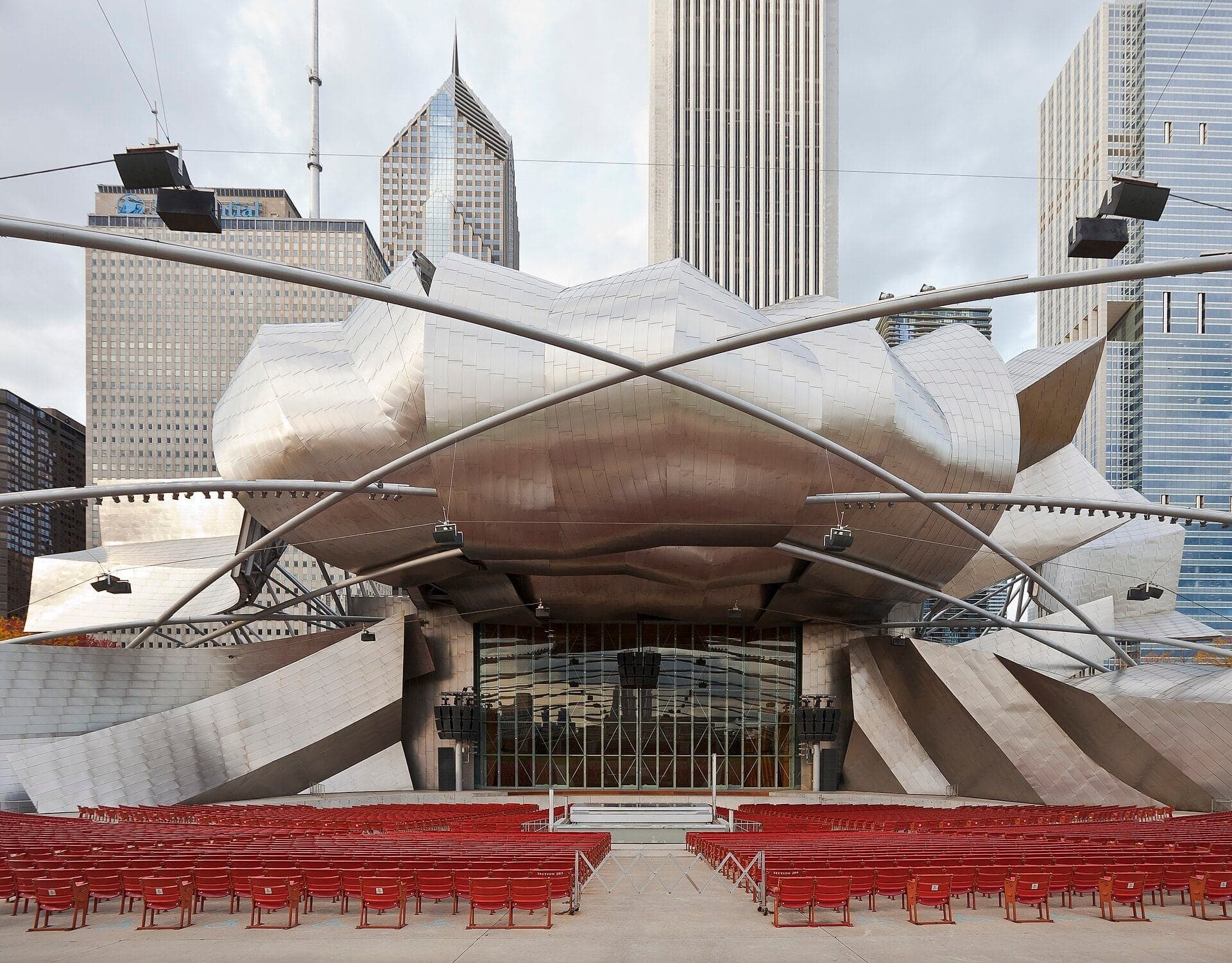
Pritzker Pavilion: The Sound Hangs on Steel
Gehry's stage faces a web of steel pipes. Its speakers hang from them. The ground beneath it is a roof over rail yards and garages.
- 4
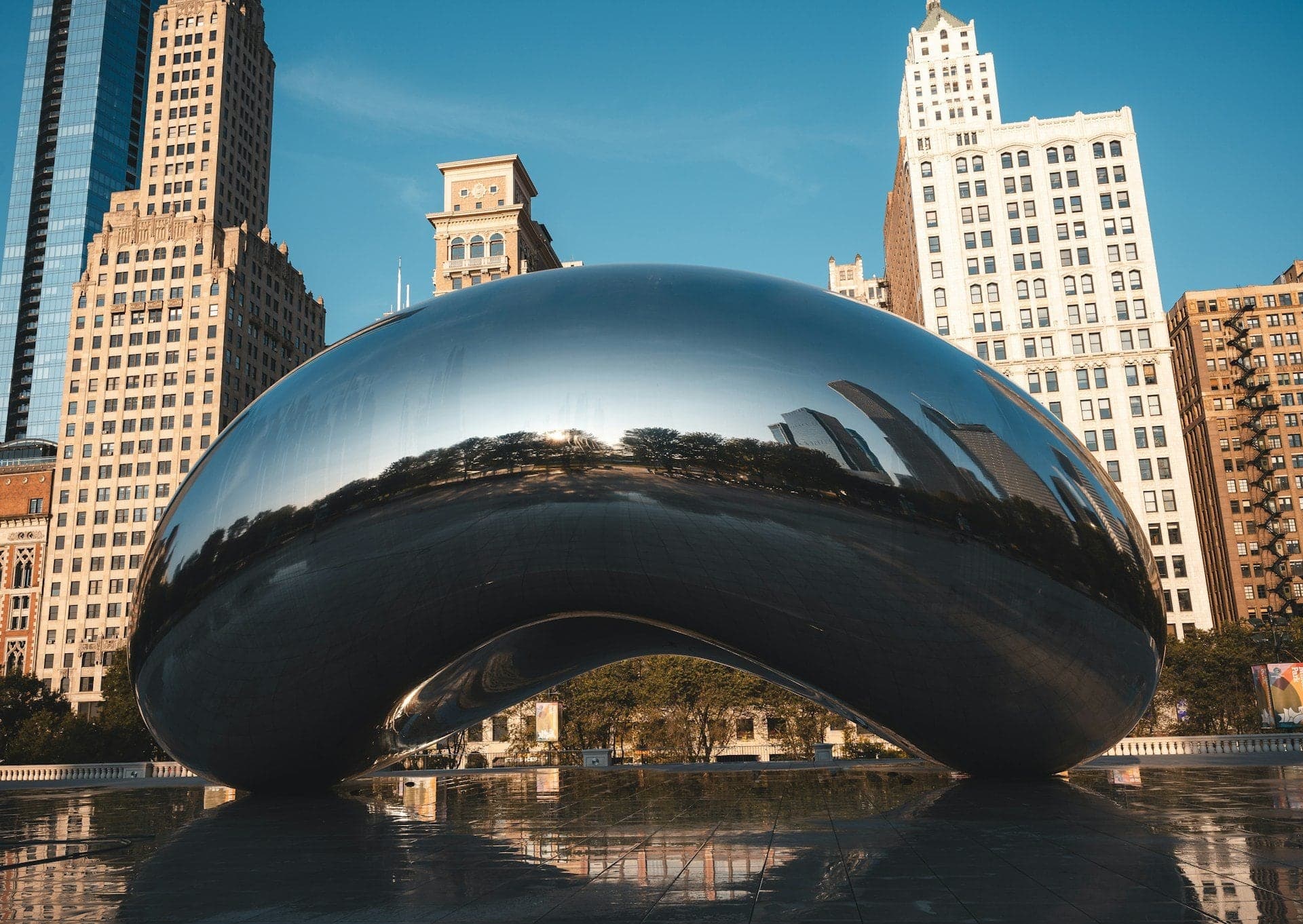
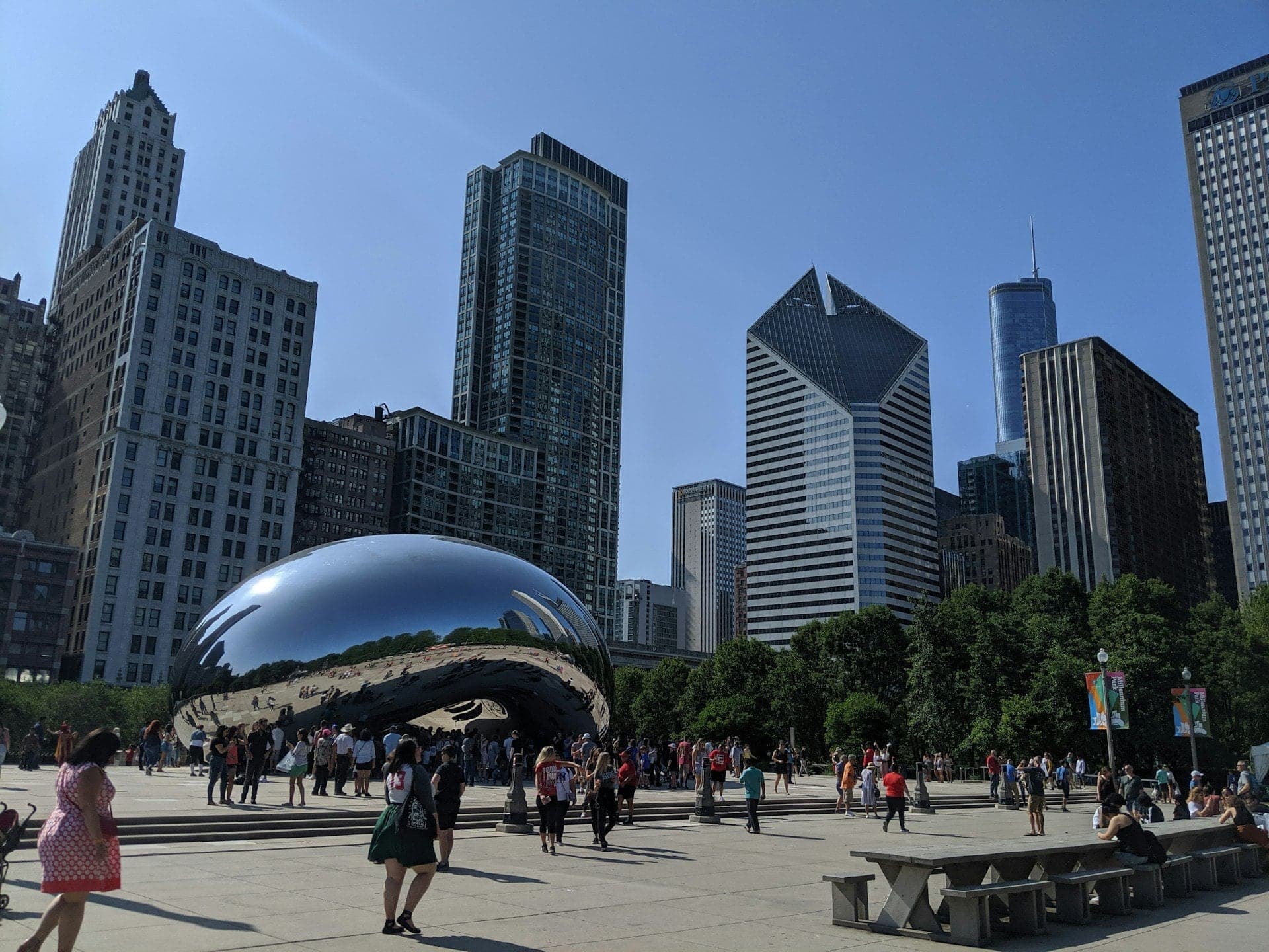
Cloud Gate: The Mirror Hung From Two Rings
Cloud Gate is 168 steel plates polished into one mirror. It hangs from two rings and is fixed at only one end.
- 5
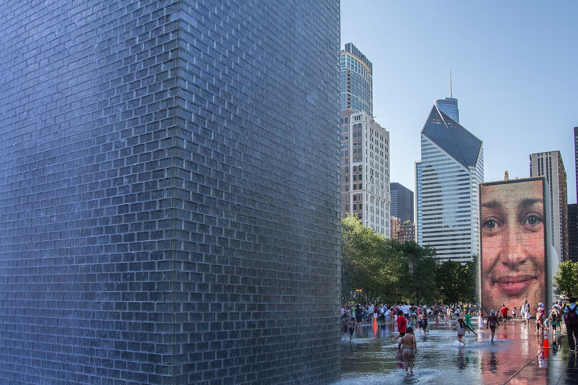
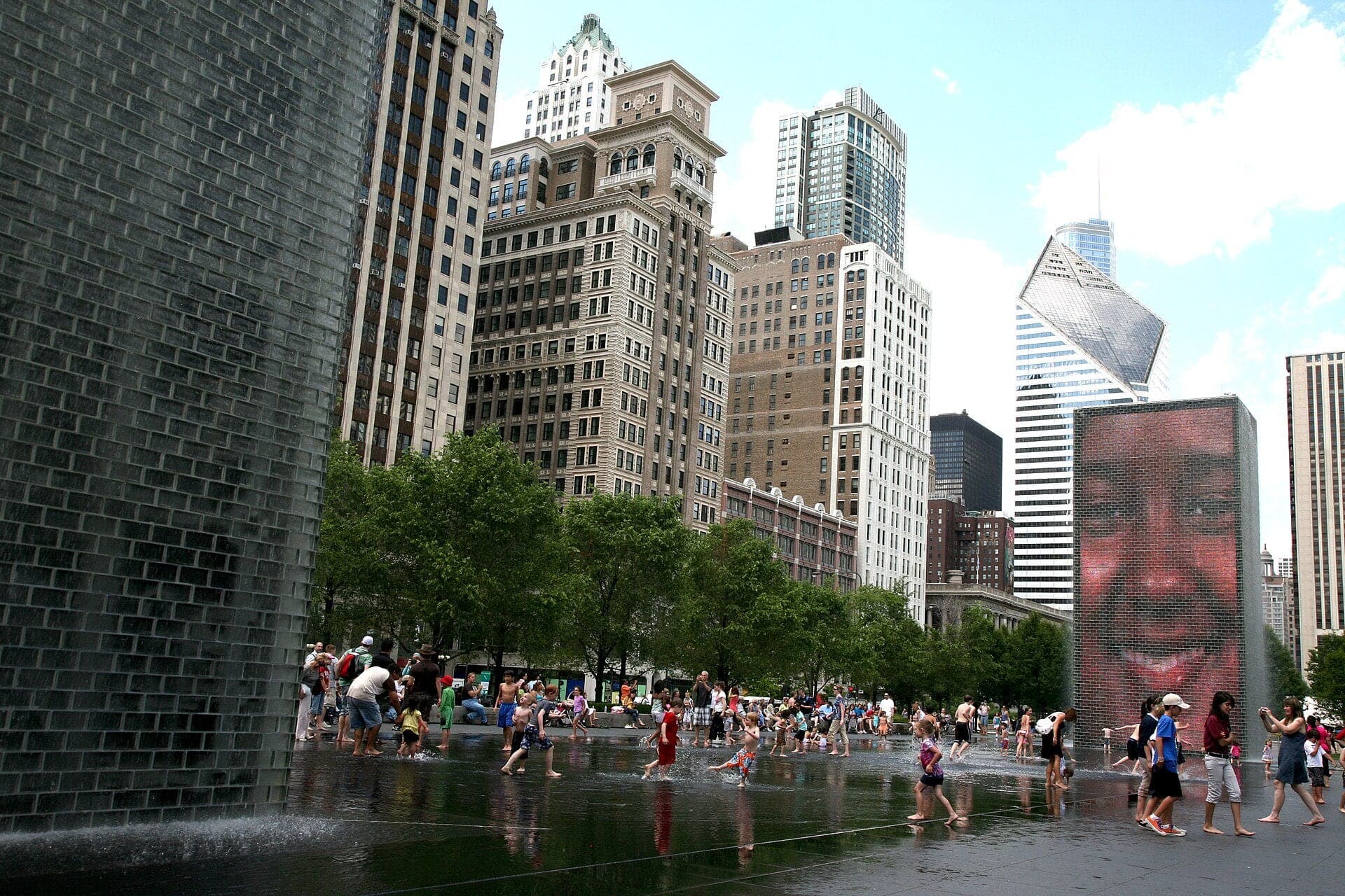
Crown Fountain: A Thousand Faces
Two fifty-foot glass towers show a thousand Chicagoans' faces. In season, water pours from their mouths.
- 6
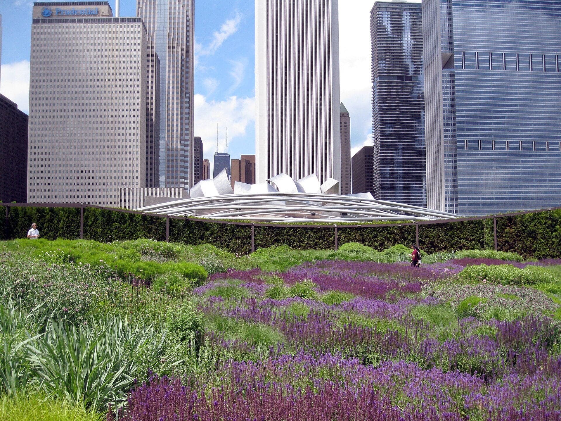
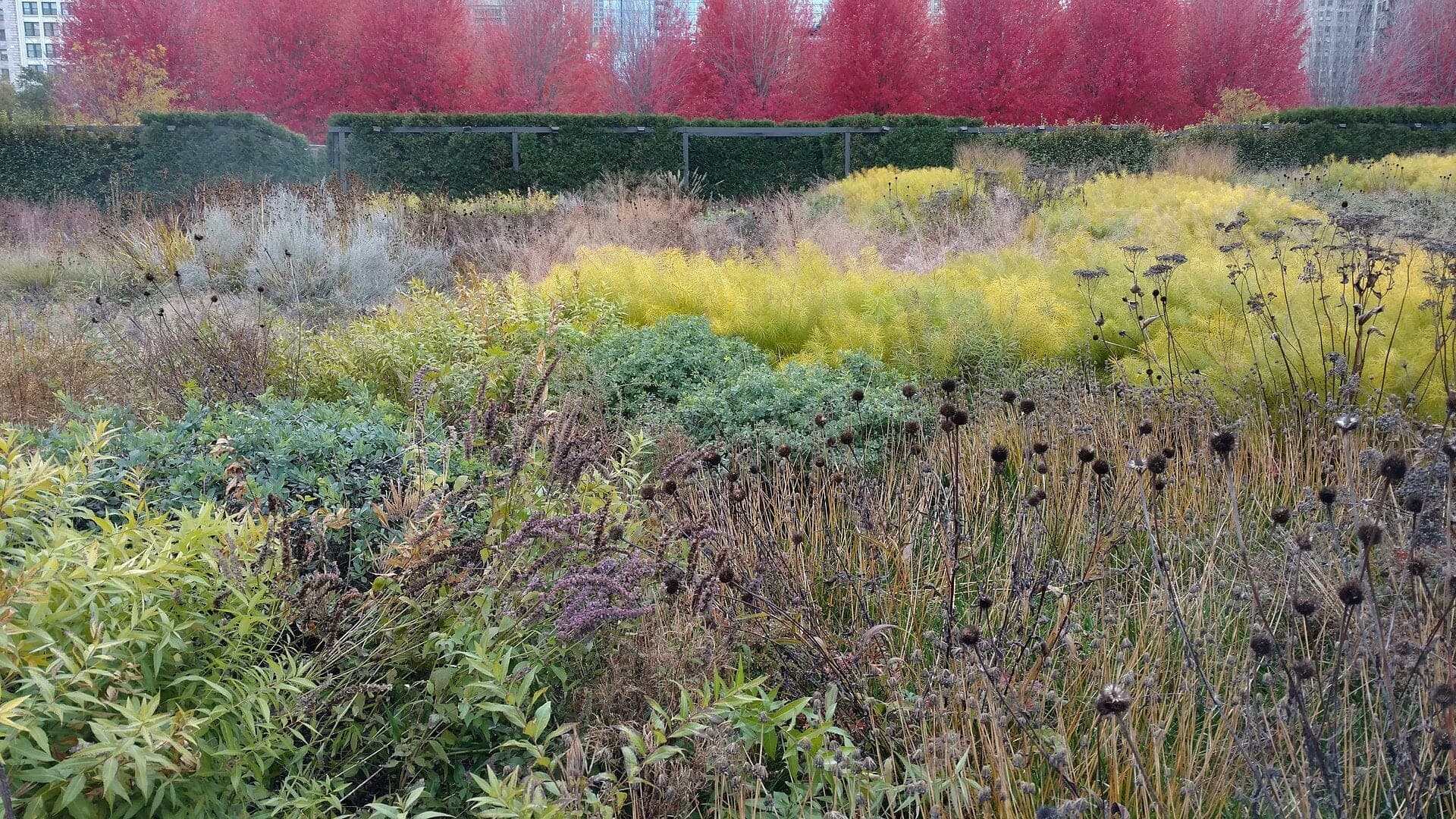
Lurie Garden: A Hedge Held Up by Steel
Lurie Garden is a roof garden behind a living wall. A boardwalk splits a dark bed from a bright one.
- 7
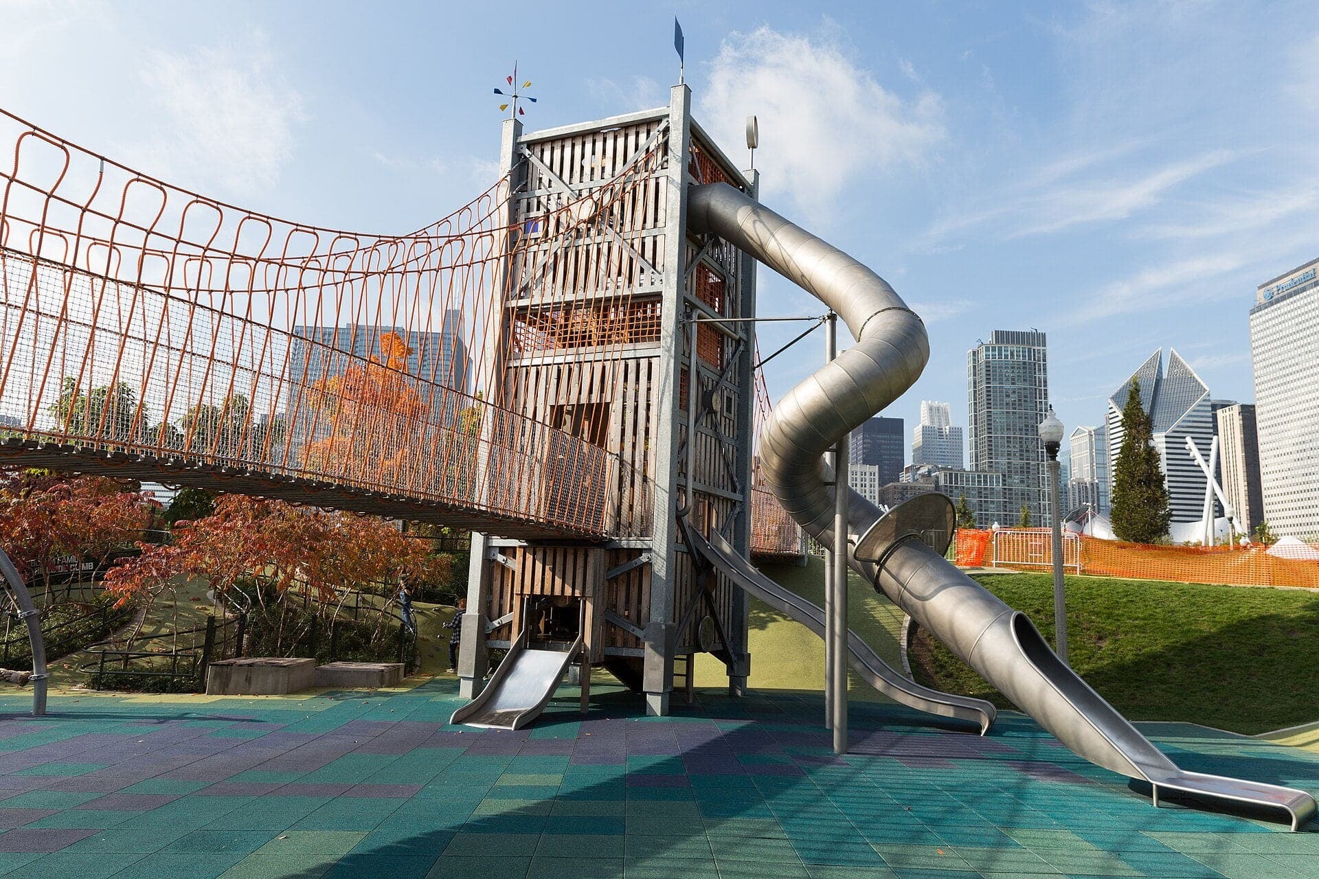
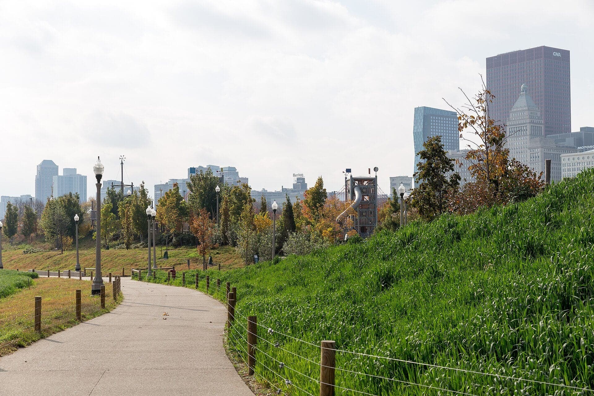
Maggie Daley Park: The Second Roof
Maggie Daley Park sits on a 1953 garage roof. New foam and waterproofing let its hills stand there.
- 8
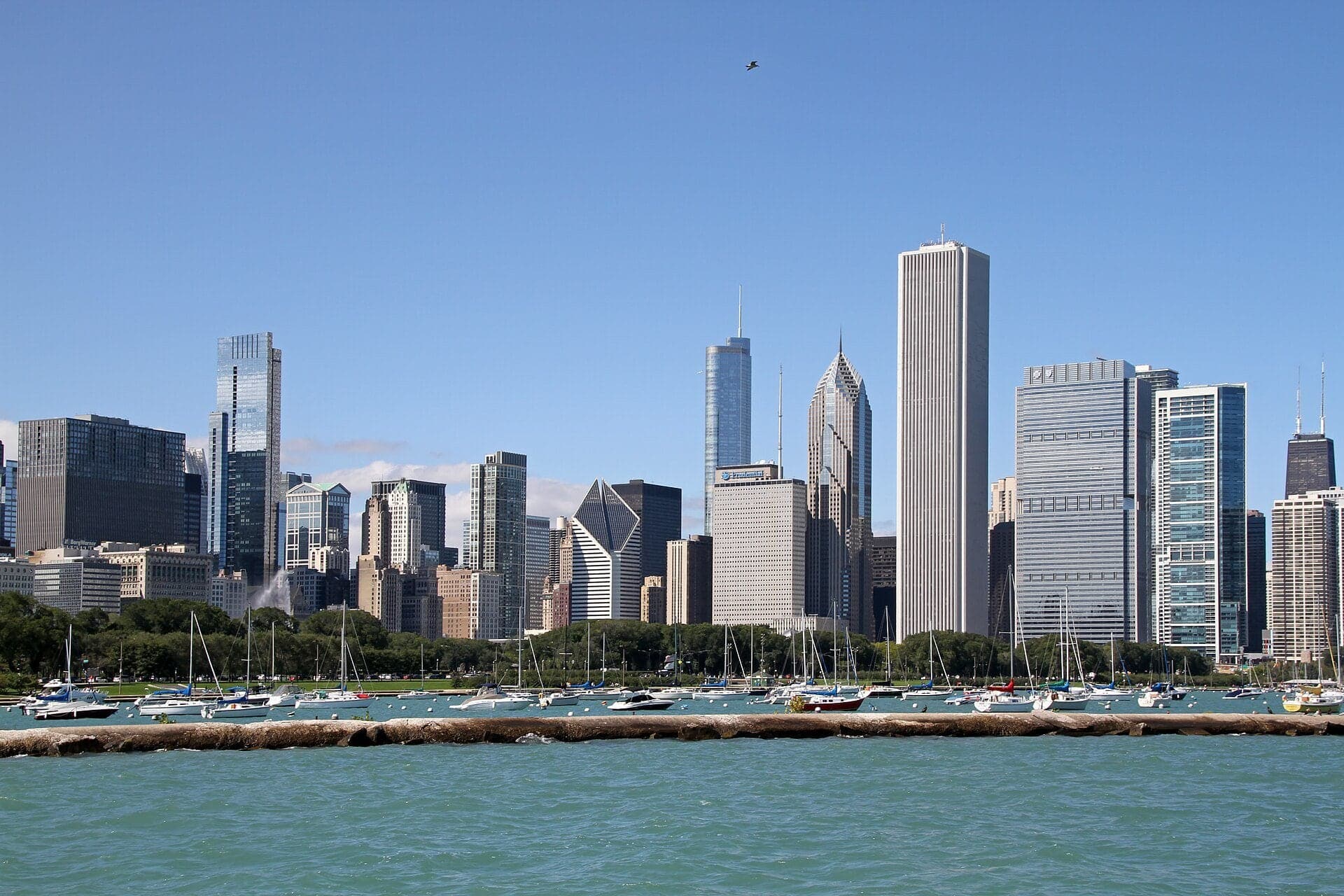
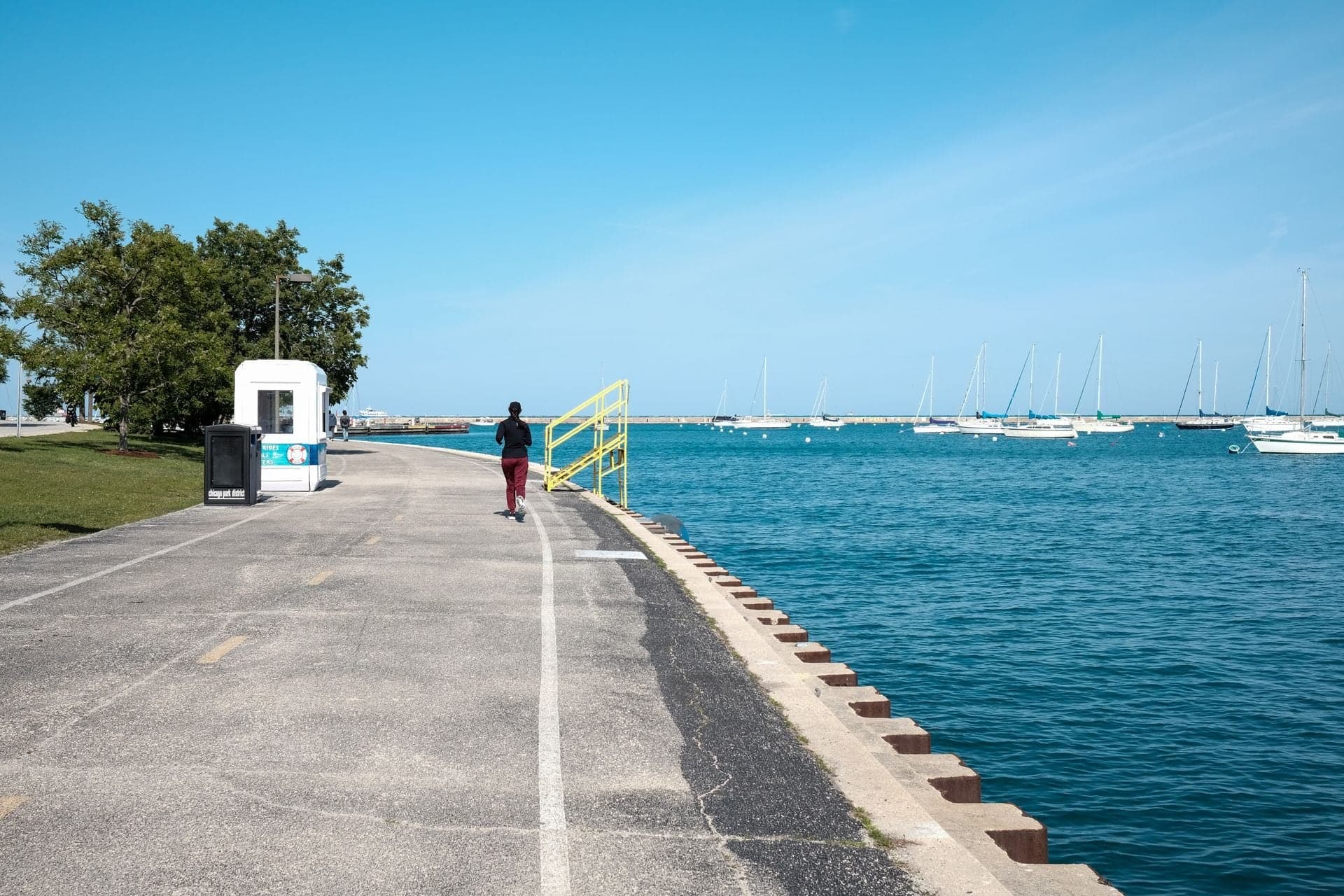
Monroe Harbor: The Edge of the Fill
The Plan drew a bigger harbor than this one. The stone edge underfoot belongs to the shore the city built in the 1920s.
- 9
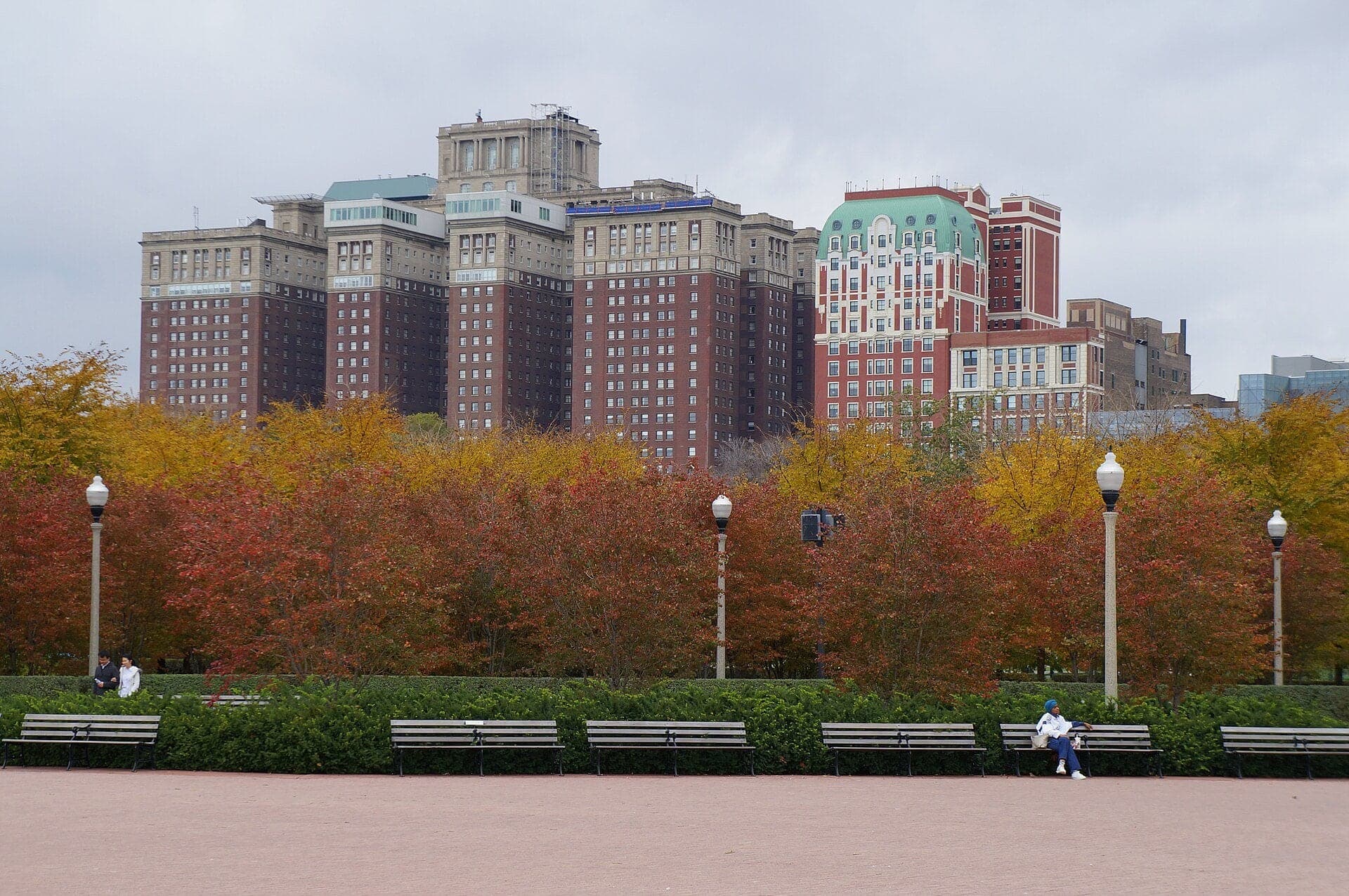
Jackson Drive Gap: A Wall Facing a Lawn
One gap in the trees looks back toward Michigan Avenue. A court made that view a rule.
- 10
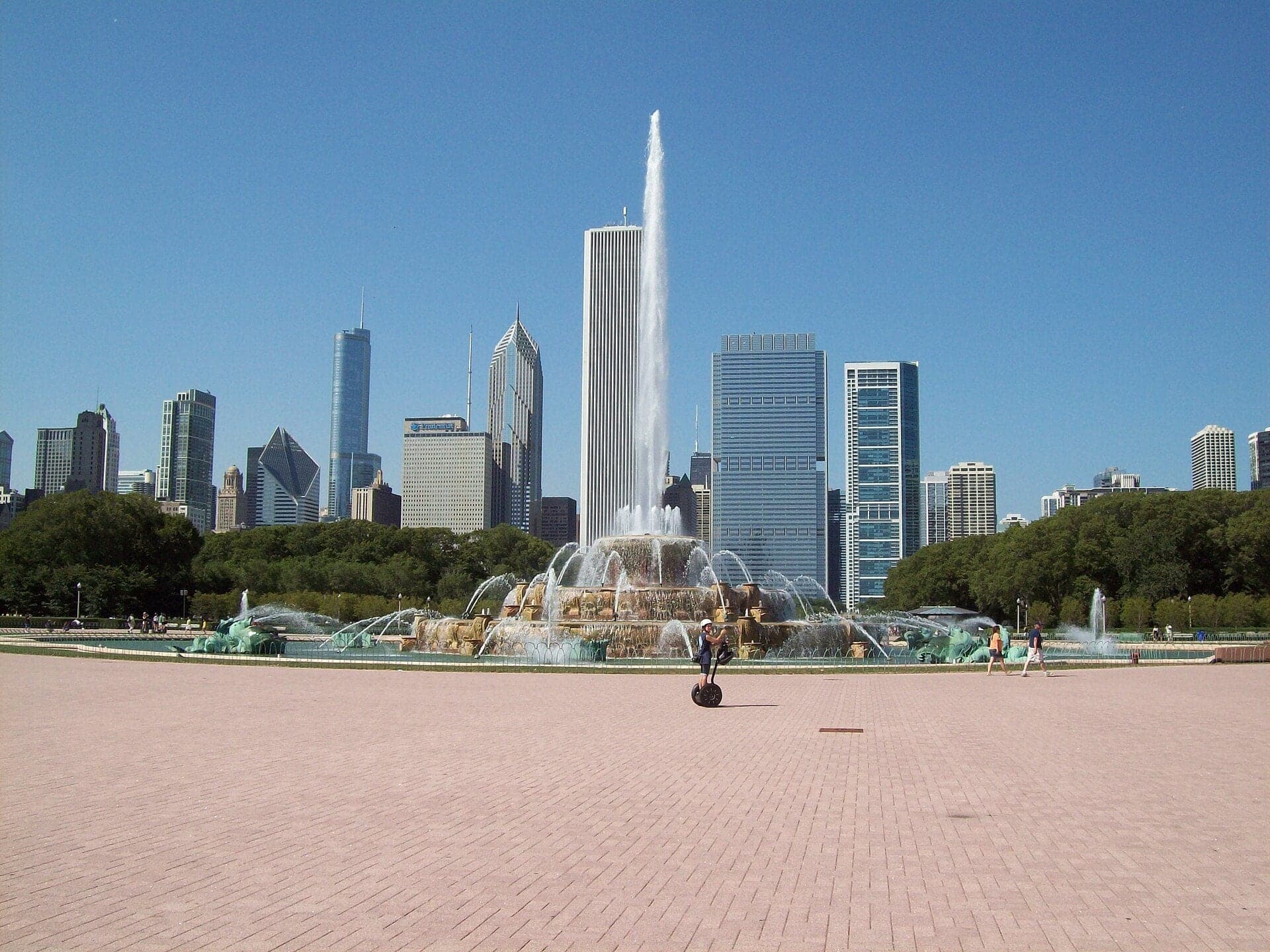
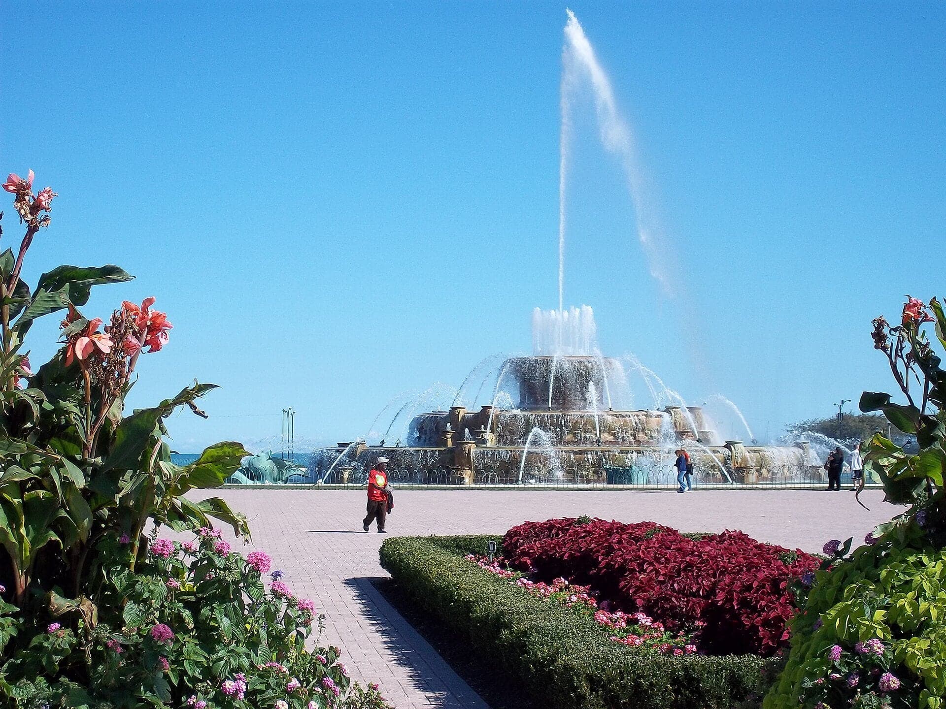
Buckingham Fountain: Where the Museum Was Meant to Stand
Buckingham Fountain stands where the 1909 Plan put a museum. It runs on its original 1927 pumps.
Details
Best Time to Visit
Early morning, from six when the park opens, or a weekday evening, avoids the crowds that fill Cloud Gate and Crown Fountain from ten to five. Late afternoon puts warm light on the Michigan Avenue wall and the lake. Spring to early fall is best for the fountains; in winter the faces still show, but the pool is dry.
Pro Tips
- •Millennium Park is free and open daily 6 a.m. to 11 p.m. From Friday to Sunday after 4 p.m., only the Michigan Avenue entrances at Washington and Madison are open, with a bag check (checked 4 October 2026).
- •The Chicago Cultural Center is free and open daily 10 a.m. to 5 p.m.; go in to see the Tiffany dome (checked 4 October 2026).
- •Crown Fountain's water ends on 13 October 2026 and returns in May; the faces stay on year-round (checked 4 October 2026).
- •Buckingham Fountain is open 8 a.m. to 11 p.m. through 31 October 2026, weather permitting; the hourly major water display will not run for the rest of the 2026 season (checked 4 October 2026, Park District).
- •Monroe Harbor's boats stay until 31 October. The only public restrooms in the park are in the lower-level building off the McCormick rink; the restrooms below the Pritzker Pavilion are closed for works (checked 4 October 2026).
- •Tips beyond the route: the Art Institute is across Monroe Drive from Lurie Garden, and the Field Museum and the Museum Campus are at the far south end of Grant Park.
Safety & Precautions
- •The Great Lawn and Pavilion are open for events only; stay on the path. The trellis is being renovated, so expect closures and construction material (checked 4 October 2026).
- •Lurie Garden's south walkway remained closed at last check; the garden can be seen from its edge (checked 4 October 2026).
- •The Lakefront Trail is being repaired one section at a time, starting at the south end, with work zones and signage; keep to the pedestrian lane and give way to cyclists (Park District alert, 15 September 2026).
- •Cross Columbus Drive and Lake Shore Drive only at the lights. Lake Shore Drive is very wide; allow a full signal.
- •Crown Fountain is a wading pool: expect splashing. Cloud Gate is crowded from 10 a.m. to 5 p.m.
- •Entrances may close when the park reaches capacity, and during concerts the venue is behind a security perimeter.
- •The city lists Wrigley Square as closing on 13 October 2026 (checked 4 October 2026, DCASE). If it is closed, the colonnade is still in view across Michigan Avenue from stop 1; follow the route on into the park.
Travel advisory: Exercise Normal Precautions (Level 1).
Gallery

Related Reading
Go deeper on what you'll see, hear, and walk through.
Overview
Best Self-Guided Walking Tours in Chicago (2026)
4 min
Overview
Chicago Travel Guide: How Many Days, Getting Around, When to Go (2026)
5 min
Overview
How to See Chicago: A City That Reads as a Structural System
7 min
Overview
One Day in Chicago: A Walkable Downtown Itinerary (2026)
5 min
Companion
The Lakefront: A Plan That Half-Worked
6 min
Deep dive
Buckingham Fountain: Where the Museum Was Meant to Stand
5 min
Read the walk
The full story of Millennium Park: The Museum the Plan Wanted Here, in words. Prefer to listen? Play it narrated, from home or on location.
Introduction
Chicago, in the United States, turns its best face to Lake Michigan, and most of that face is open ground, left empty on purpose. Between the tall buildings of Michigan Avenue and the water lies a long run of lawn, garden, mirror and fountain, and the city has fought over it for nearly two hundred years.
In nineteen oh nine, Daniel Burnham and Edward Bennett published the Plan of Chicago, and it did not leave Grant Park empty. It put a museum in the middle of it. Bennett comes back at the end, where he drew a fountain instead. A merchant named Aaron Montgomery Ward took the matter to court again and again, and the rulings he won are why the avenue still faces open ground. Kate Buckingham paid for the fountain and named it for her brother.
There are ten stops over a little over a mile, about two kilometres, and it takes around eighty minutes at an easy pace. You begin on Michigan Avenue, cross Millennium Park past a mirror, a fountain of faces and a roof garden, reach the lake, and turn south to Buckingham Fountain. It is all outdoors and all free. As you go, look at the ground. A good deal of it was water once, and part of it is a roof.
When you reach the Cultural Center, on the Michigan Avenue pavement, begin with stop one.
1. Cultural Center: Michigan Avenue Was the Shore
Welcome to Chicago's lakefront, and to the start of the walk. Take the pavement along Michigan Avenue beside the big stone building, the Chicago Cultural Center, and stop there. Now turn so the building is at your back and look across the avenue. That open ground is the park, and why it is open at all is what you are about to hear.
First, the building behind you. It opened in eighteen ninety-seven as Chicago's first central public library. Today it is the Cultural Center, free to enter, with a stained glass dome the city calls the largest Tiffany dome in the world. We stay outside, but it is worth stepping in.
Now the ground under your feet. Michigan Avenue was the lakeshore. In eighteen fifty-two the city let the Illinois Central Railroad bring its tracks along the lakefront, on trestles out in the water, and made it build a breakwater. Between the avenue and the trestles lay a strip of shallow water. After the Great Fire of eighteen seventy-one, rubble was dumped into it.
Maps of the eighteen thirties, used to sell the canal's lots, marked this shore as public ground, forever open, clear and free of buildings. Even the library behind you stands on ground an eighteen thirty-nine map called public ground, to remain vacant of buildings.
Look along the avenue. The buildings stand shoulder to shoulder on one side only. The city's landmarks commission calls it one of the world's most recognized one-sided streets.
One man took the fight over that view to court for twenty years: Aaron Montgomery Ward, a merchant whose mail-order warehouse looked onto it. The Plan of Chicago, published in nineteen oh nine, did not want Grant Park left empty, and at the last stop you will see what stands where it drew a museum.
Follow the route across Michigan Avenue at the lights. Next, a ring of columns.
2. Wrigley Square: A Colonnade Built Twice
Walk on to the half ring of paired columns, and stop there. This is the Millennium Monument, in Wrigley Square.
Look at the columns first. They stand in pairs, in a long curve, with open air between them. It is a colonnade, a row of columns with open air between them, and it frames the corner of the park at Michigan Avenue and Randolph Street.
It is also a copy. The Millennium Park Foundation calls it a nearly full-sized replica of a peristyle, a colonnade, that stood at this same corner from nineteen seventeen until nineteen fifty-three. So a ring of columns was lost, and then rebuilt where it had been, almost as large as before.
The Plan of Chicago loved colonnades. Its authors wrote that you only have to recall the peristyle at the World's Fair to understand the value of a colonnade next to fine buildings. They wanted that kind of grandeur for Grant Park.
Now the corner itself. This was the corner where the Plan had to bend. The northwest corner of Grant Park was occupied by the railroad, which the city did not control, so Burnham's ideal plan was bent to make room for the tracks. The eighteen fifty-two agreement had given that land to the Illinois Central for rail use only. Not until nineteen ninety-six did the city sue to regain control, and the Millennium Park Foundation was formed two years later.
Which brings up the thing to keep in mind for the next several stops. Under your feet are tracks. The park sits directly above the commuter rail station, and above underground garages and walkways. Everything you will cross from here to the far side of the park is a roof, with soil and gardens laid on top.
Follow the route on. Next, a stage under a web of steel.
3. Pritzker Pavilion: The Sound Hangs on Steel
Walk on to the path at the edge of the lawn, where the stage comes into view, and stop there. Stay on the path: the Great Lawn is closed except during concerts.
Orient yourself by the stage. That is the Jay Pritzker Pavilion, framed by ribbons of stainless steel, designed by Frank Gehry. Now look up and out over the lawn at the web of steel pipes spread across the sky. That is the trellis. If works screen part of it, that is repair work.
The trellis is not decoration. It is a frame for sound. A network of loudspeakers hangs from it, the first of its kind in the world, according to the Public Building Commission, so that sound carries across the lawn. Four thousand people sit in the fixed seats, and with the lawn the audience can top eleven thousand.
The Pavilion opened with the park, on the sixteenth of July, two thousand four, when the Grant Park Symphony Orchestra played the first concert. Ninety-two founders, each giving a million dollars or more, made that night possible.
The park itself was supposed to open in two thousand. It was planned to cost somewhere around a hundred and fifty million dollars, and it opened about four years late for roughly three times that. Public money and private donors paid for it.
The real marvel is the ground you stand on. This is the roof you learned about at the last stop. It caps a rail yard and two parking garages. Crews built over the tracks at night, when trains were not running. When cracks showed in the garage columns below, engineers recalculated the loads, allowing for the weight of the trees as they will be a hundred years from now.
Follow the route on. Next, a mirror.
4. Cloud Gate: The Mirror Hung From Two Rings
Walk on to the edge of the plaza where the whole sculpture stands before you, and stop there. This is Cloud Gate, by the artist Anish Kapoor, born in India and based in Britain. Everyone in Chicago calls it the Bean. Its real name, announced in two thousand four, is Cloud…
Full narration for this stop unlocks with the tour.
5. Crown Fountain: A Thousand Faces
Walk on to the edge of the pool, between the two glass towers, and stop there. This is Crown Fountain, by the artist Jaume Plensa, built with Krueck and Sexton Architects. Look at the two towers. Each one is about fifty feet tall, made of glass block, and each stands at one end…
Full narration for this stop unlocks with the tour.
6. Lurie Garden: A Hedge Held Up by Steel
Walk on to the edge of the garden, beside the pavement, and stop there. This is Lurie Garden. Look at the hedge first. It runs along two sides of the garden, taller than a person, clipped into a long wall, and it is held up by a framework of steel. The garden calls it the…
Full narration for this stop unlocks with the tour.
7. Maggie Daley Park: The Second Roof
Walk on along the pavement until the band of trees along the park's edge is beside you, and stop there. This is the edge of Maggie Daley Park. You cannot see much of it from here, and that is partly the point. What you can see is a wide, busy road and a screen of trees. Behind…
Full narration for this stop unlocks with the tour.
8. Monroe Harbor: The Edge of the Fill
Walk on along the quay until the boats and the water fill the view, and stop there. You are on the lake itself now, on a narrow stone edge, with the harbor in front and the park's trees behind. This is Monroe Harbor. In season, hundreds of boats hang on moorings, and two yacht…
Full narration for this stop unlocks with the tour.
9. Jackson Drive Gap: A Wall Facing a Lawn
Walk on along the promenade until you reach the one gap in the row of trees on the park side, a path climbing away from the water, and stop there. This is where Jackson Drive meets the lake. Turn toward the gap and look through it, along Jackson Drive and into Grant Park. In…
Full narration for this stop unlocks with the tour.
10. Buckingham Fountain: Where the Museum Was Meant to Stand
Walk on along the path with the fountain dead ahead, and stop there. This is Buckingham Fountain, and it stands on the answer to the first stop's question: what did the Plan want here? Look first at the fountain. Four basins of pink Georgia marble step up toward the center,…
Full narration for this stop unlocks with the tour.