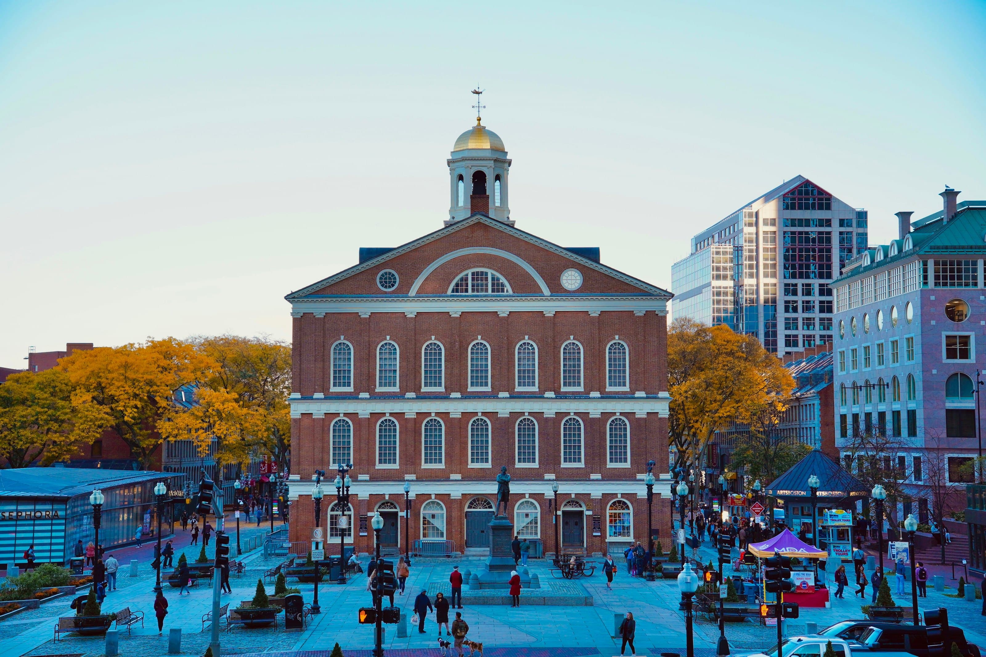
Walk the Freedom Trail's red line from Boston Common past the State House, Old South, the Old State House and Faneuil Hall, across the Greenway into the North End to Paul Revere's house, Old North Church and Copp's Hill.
Start · Boston Common: Where the Red Line Starts
DirectionsStops
- 1
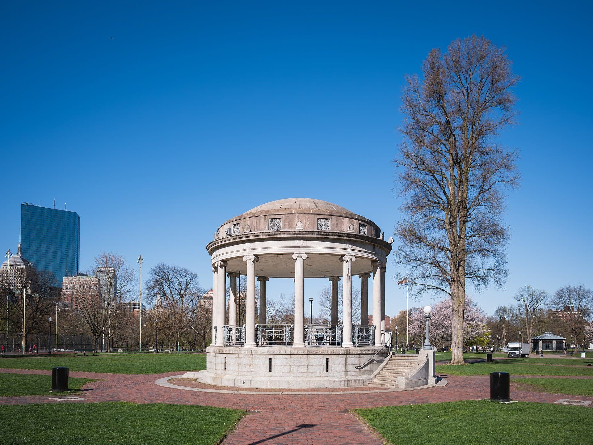
Boston Common: Where the Red Line Starts
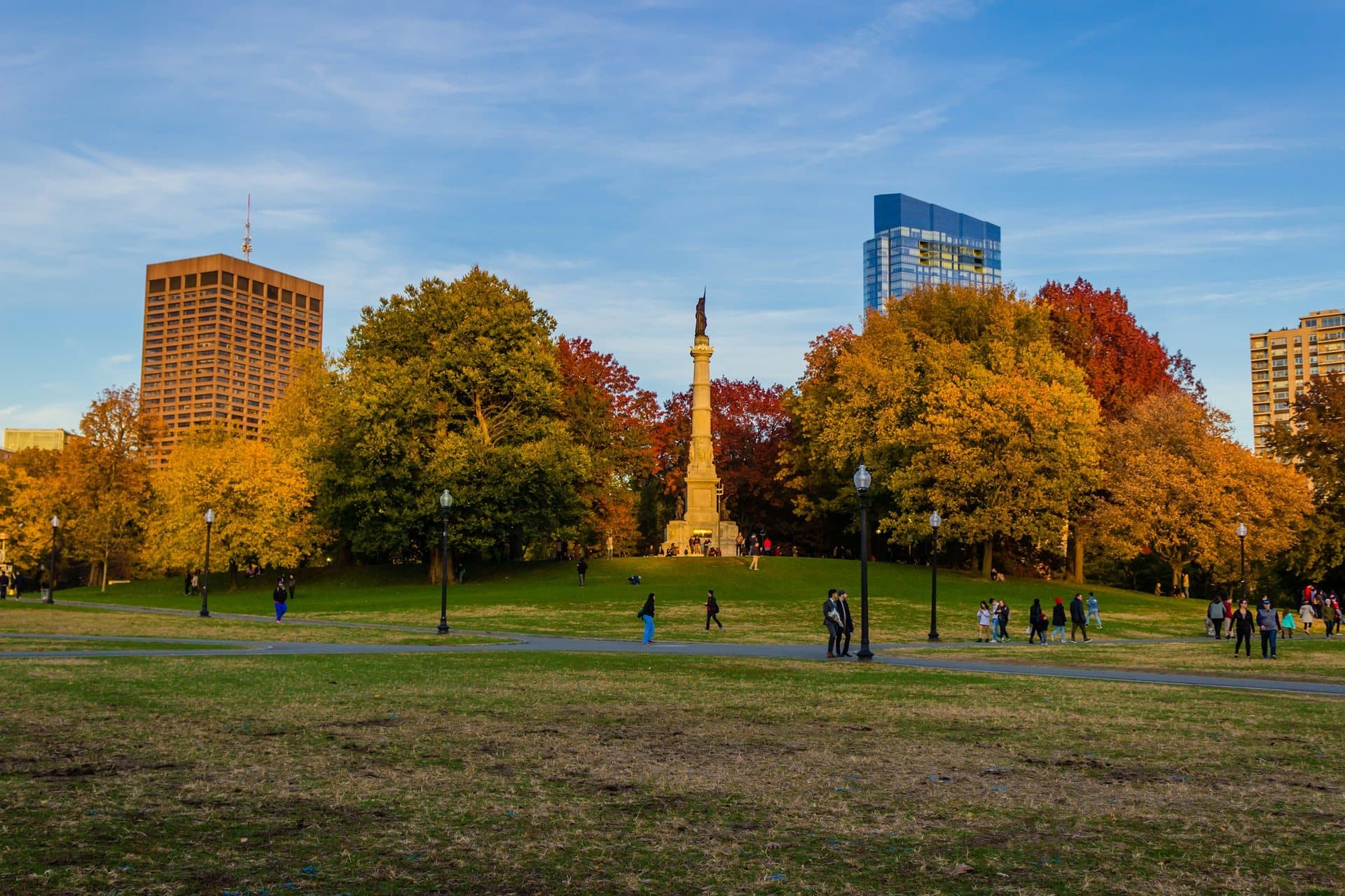
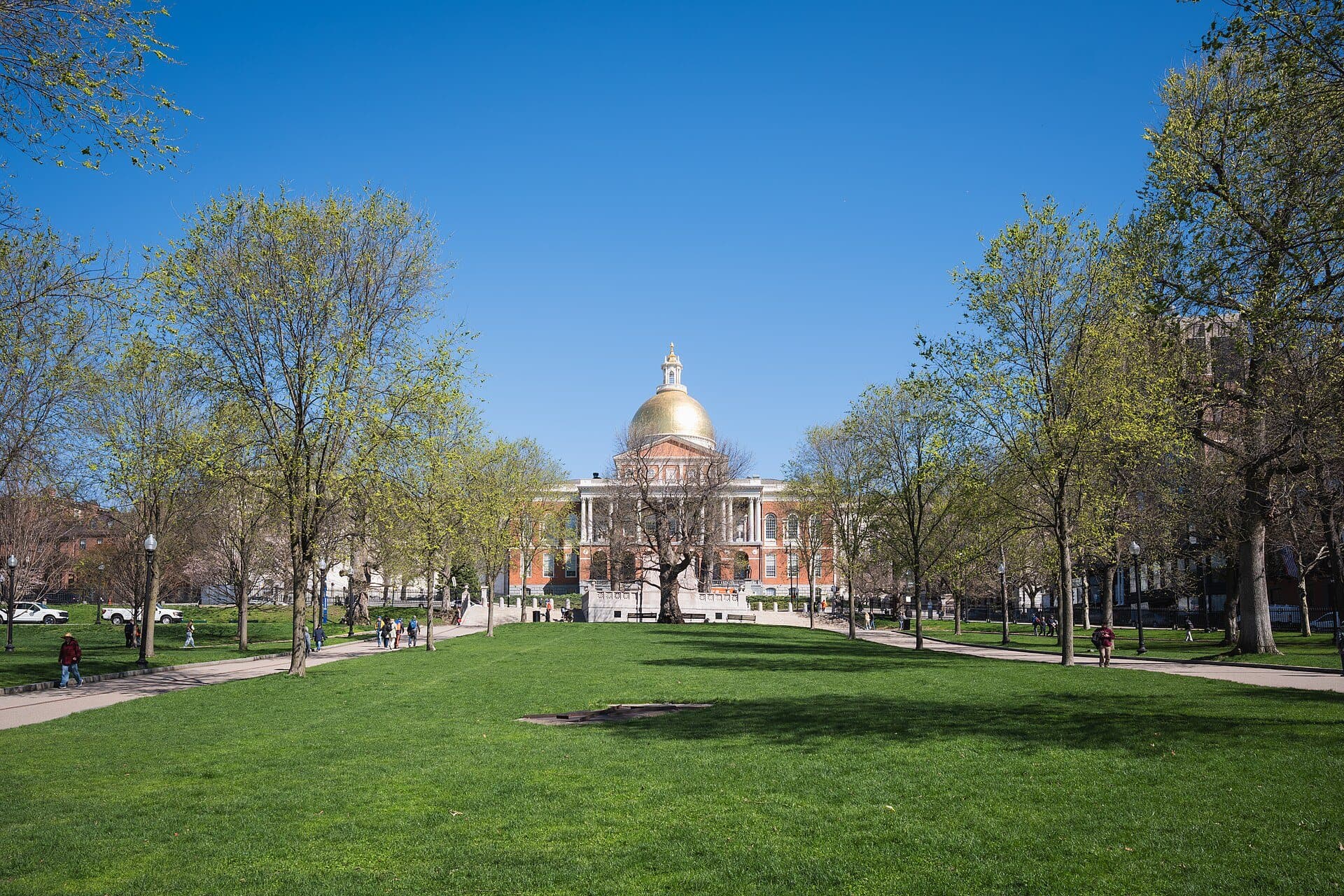
The Freedom Trail's red line starts on this common. The 1634 town common is the oldest public land on the walk, and the trail itself began as a 1951 newspaper column.
- 2
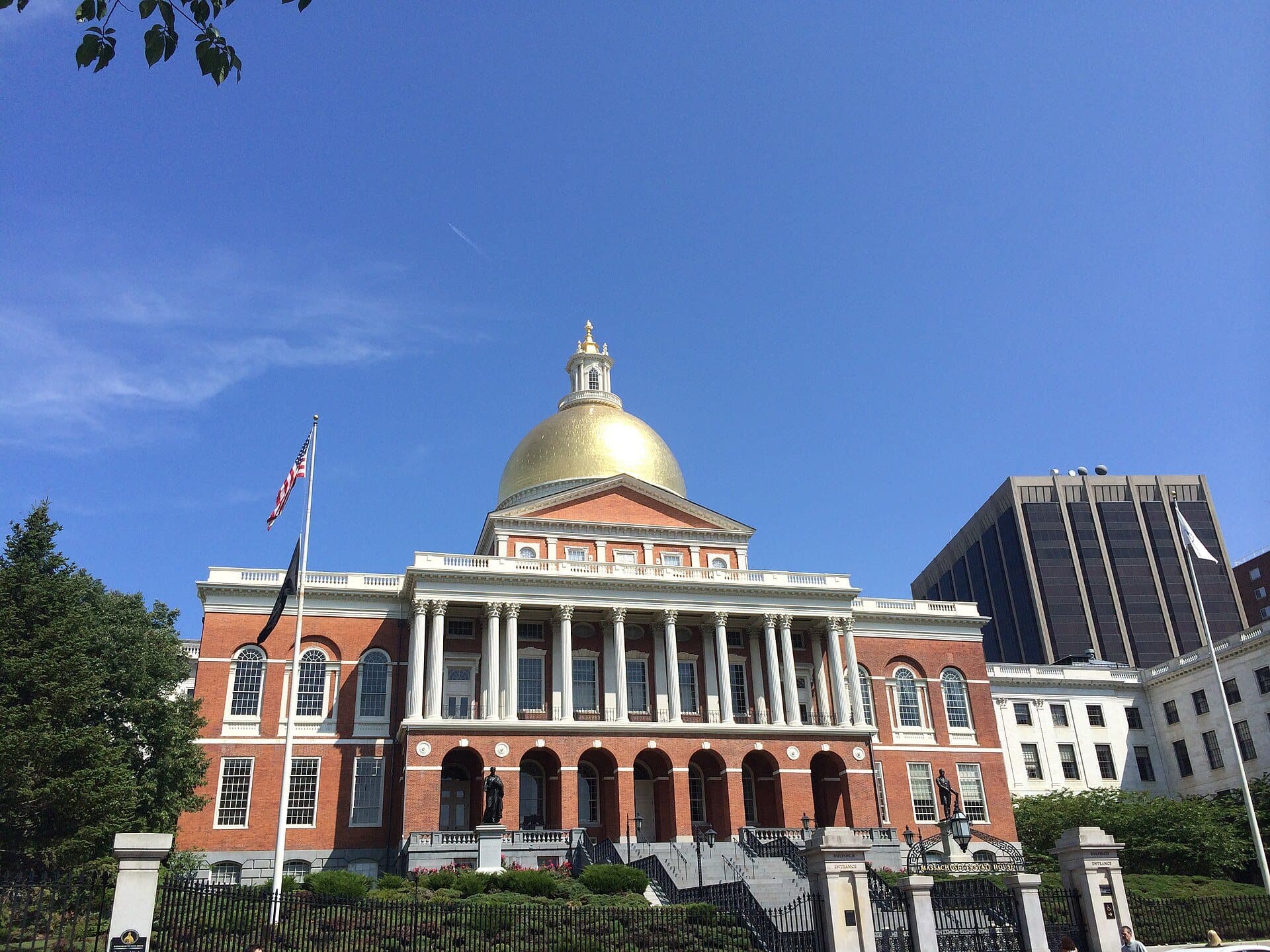
Massachusetts State House: A Dome in Three Skins
Bulfinch's State House rises across Beacon Street from the Common. Its dome went from bare wood to Revere's copper to gold leaf.
- 3
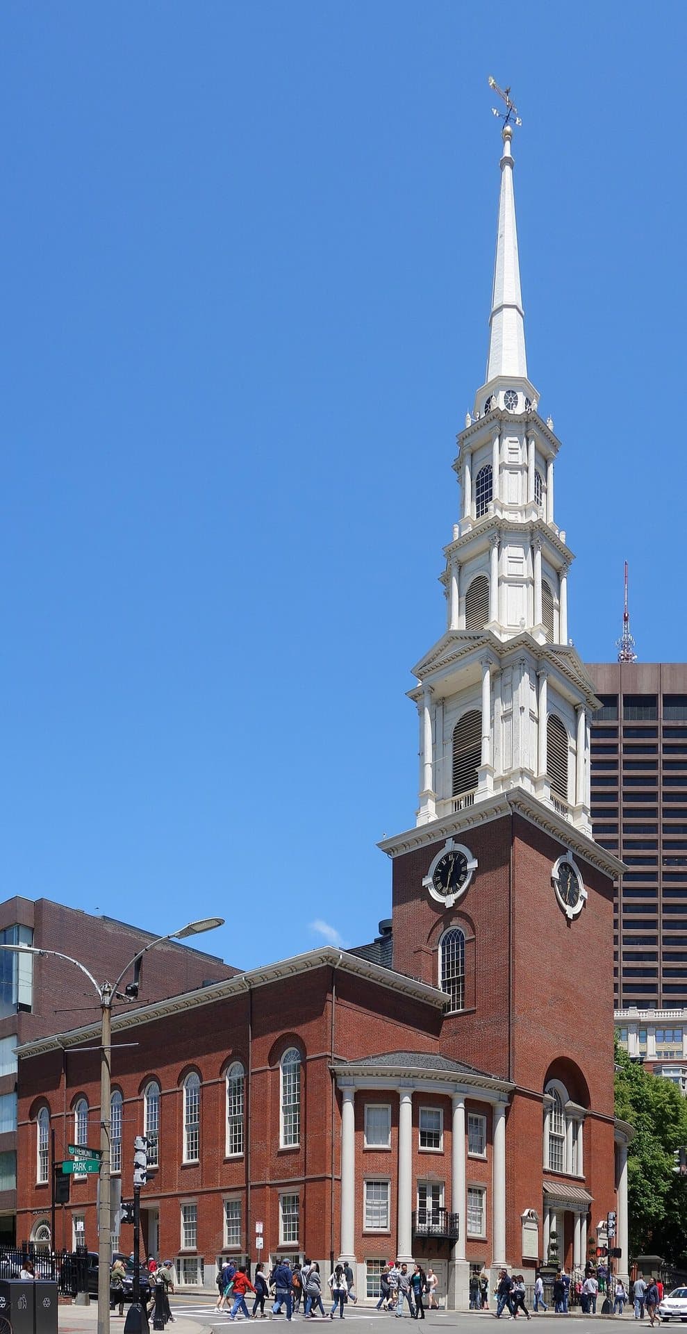
Park Street Church: Brick, White Wood and a Pulpit
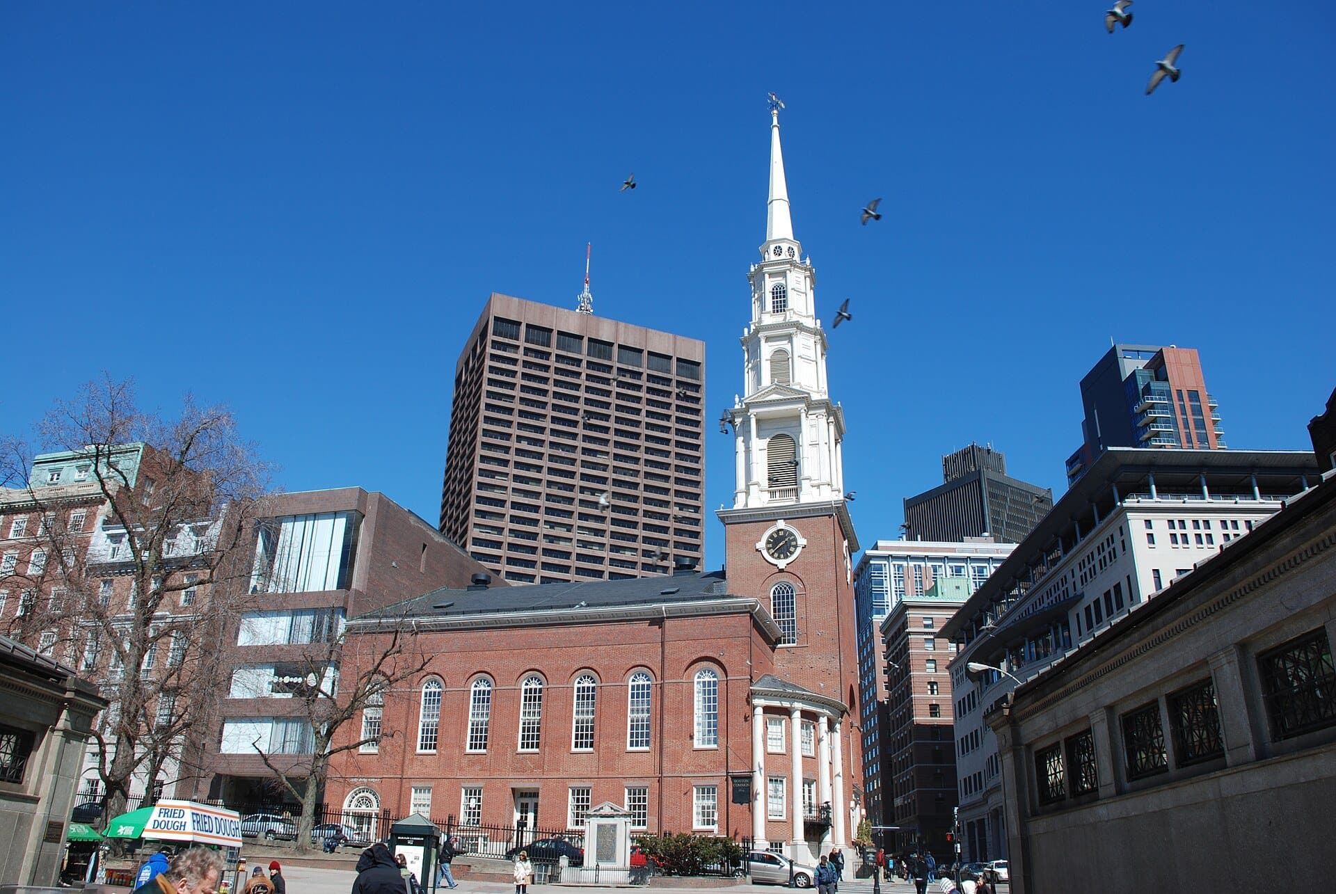
A white wooden steeple rises 217 feet over this corner. Garrison gave his first antislavery speech here in 1829, on the site of the old town granary.
- 4
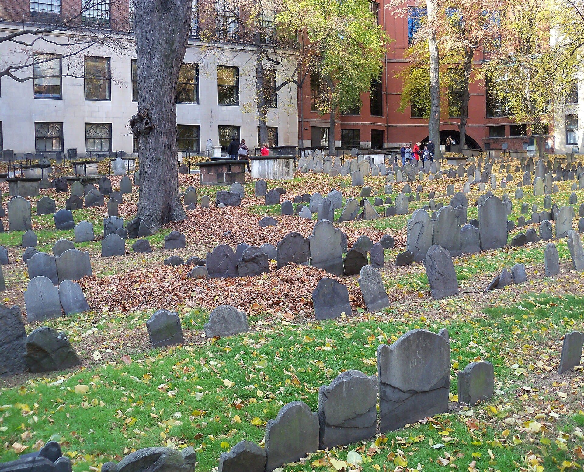
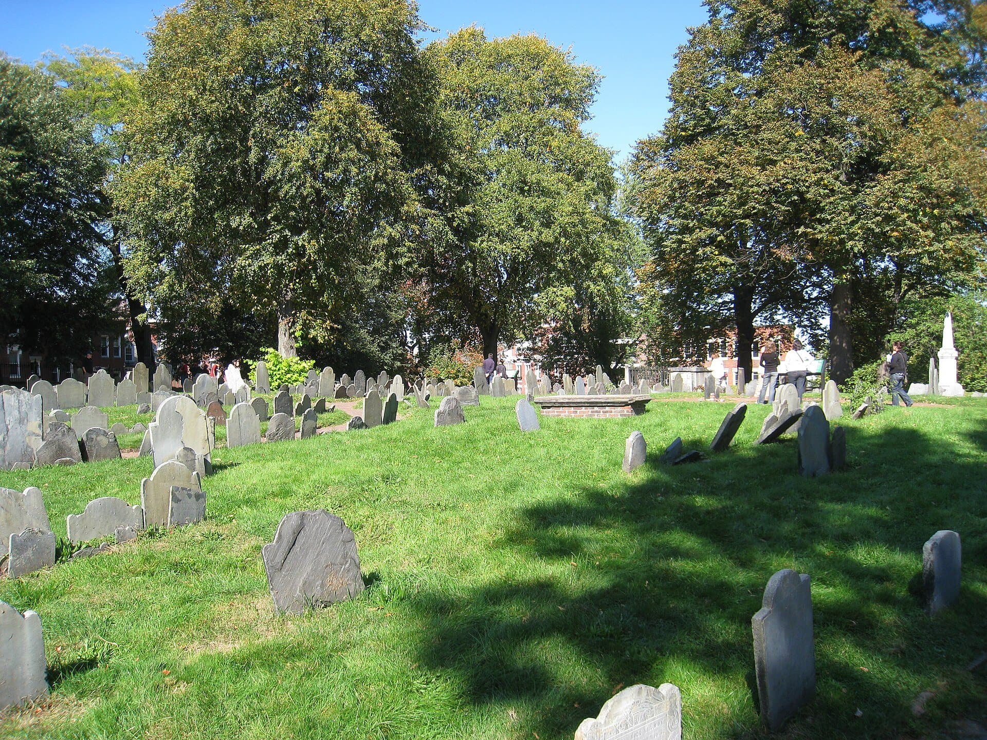
Granary Burying Ground: Stones in Tidy Rows
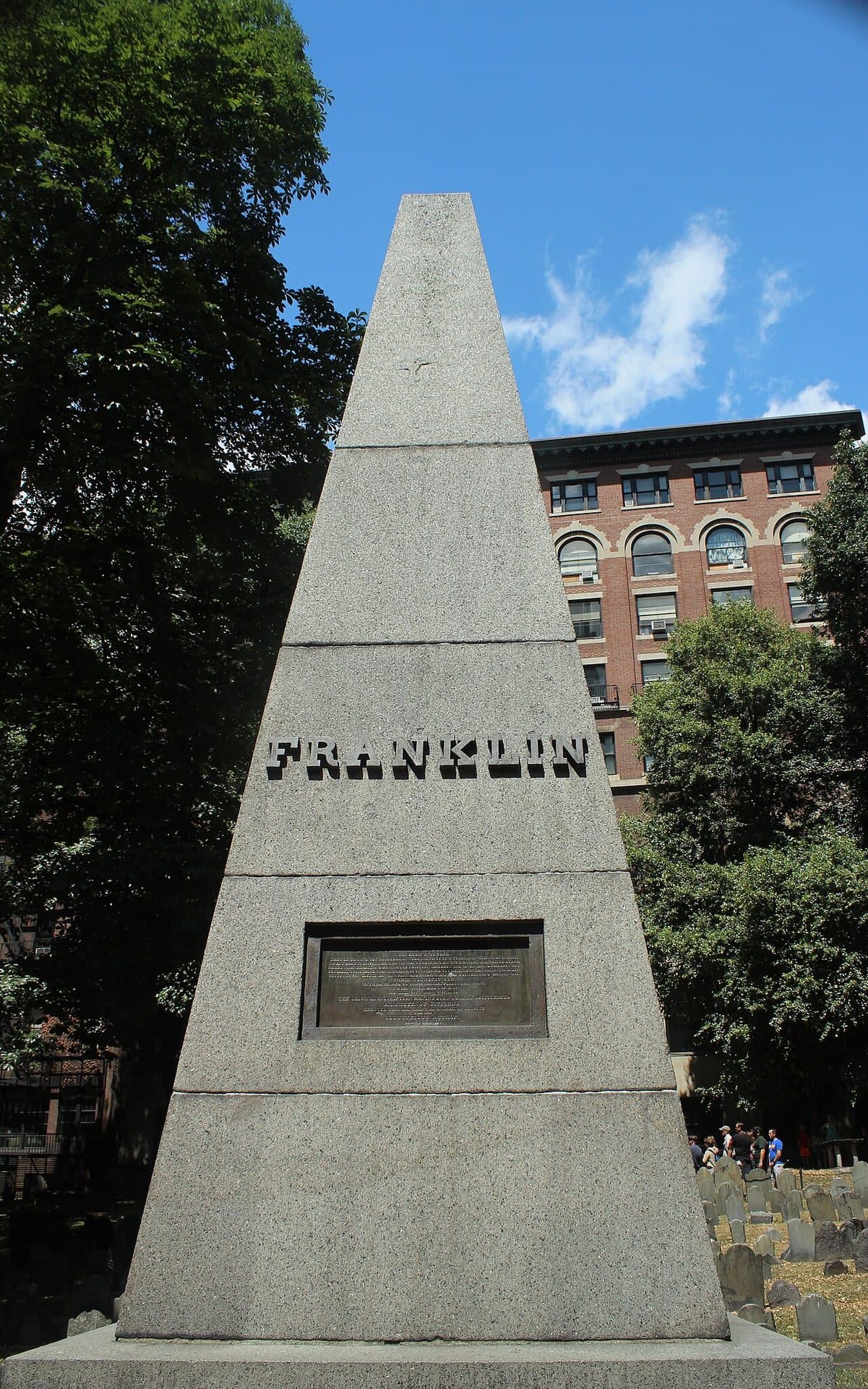
Three signers of the Declaration are buried in this ground. So do Paul Revere and the five Massacre dead, though many stones were moved into rows and no longer mark their graves.
- 5
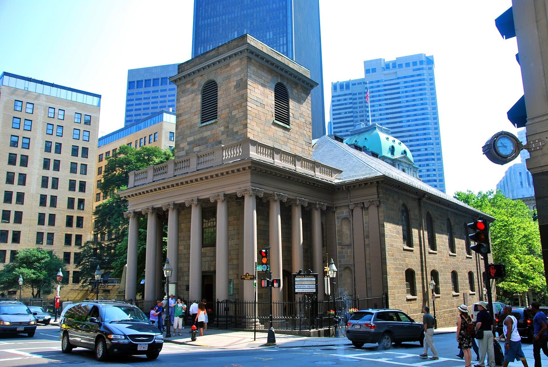
King's Chapel: A Granite Church Built Around a Wooden One
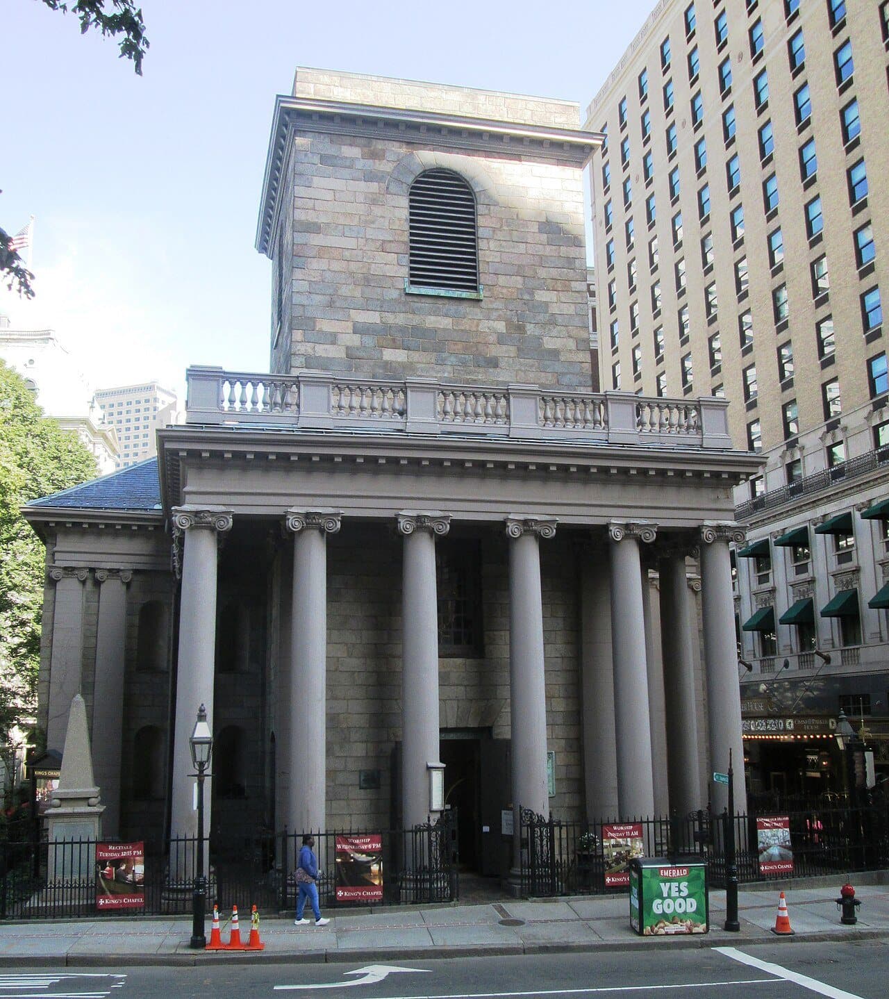
Boston's oldest surviving stone building was raised around a wooden chapel. Services carried on inside during construction, and Revere's firm recast its bell.
- 6
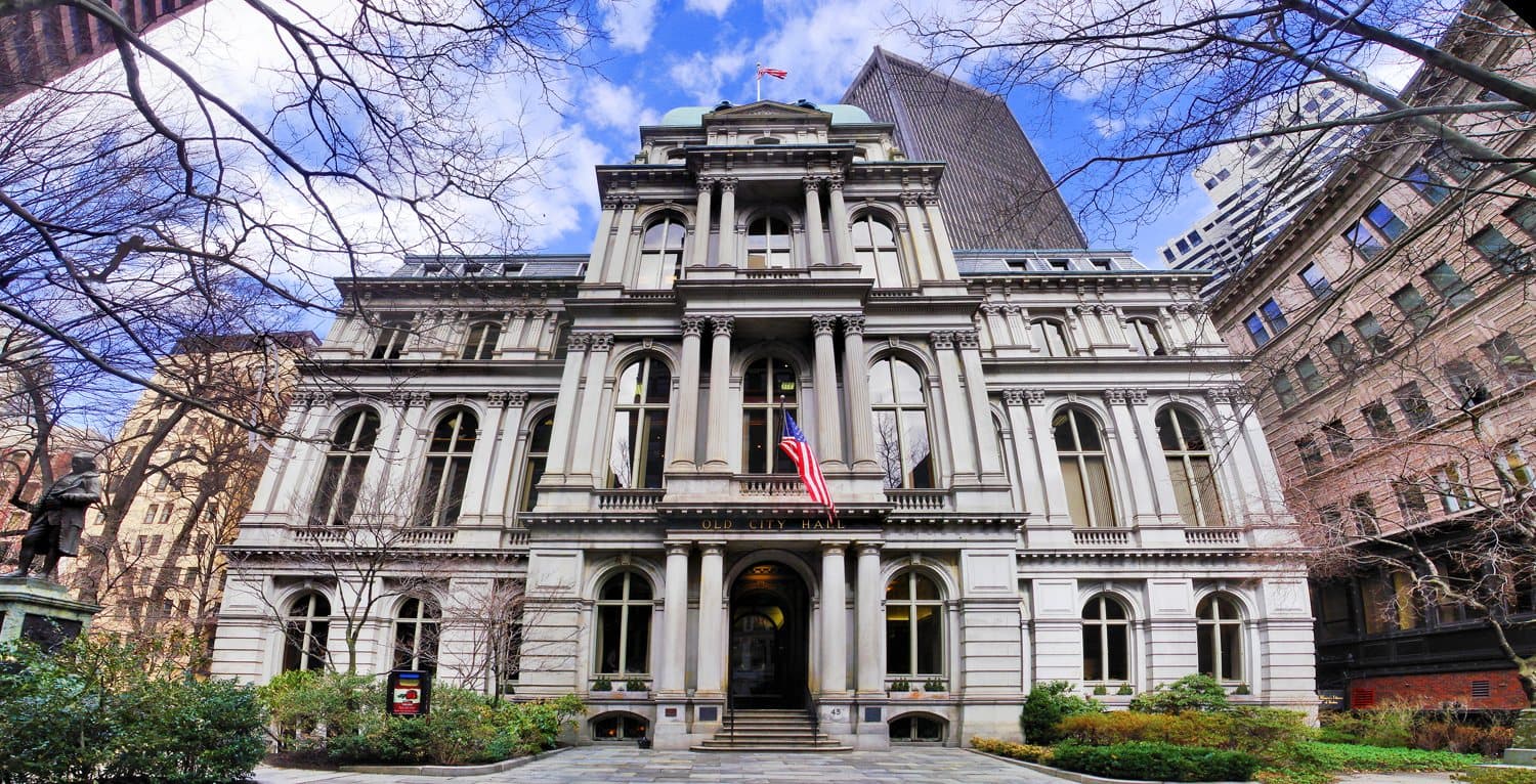
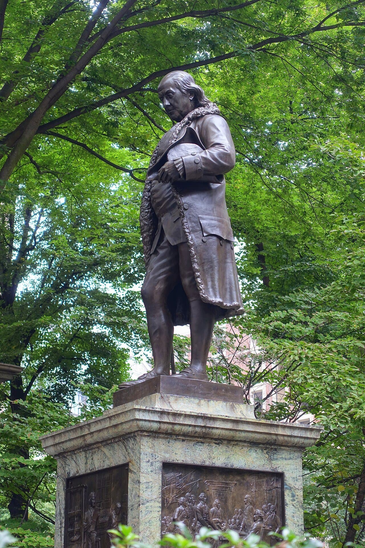
School Street: Old City Hall and Franklin
America's oldest public school once stood on this street. A bronze Franklin stands before the French-roofed Old City Hall of 1865.
- 7
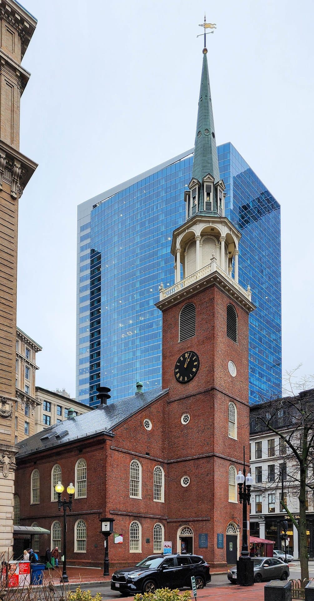
Old South Meeting House: Sold for Its Bricks
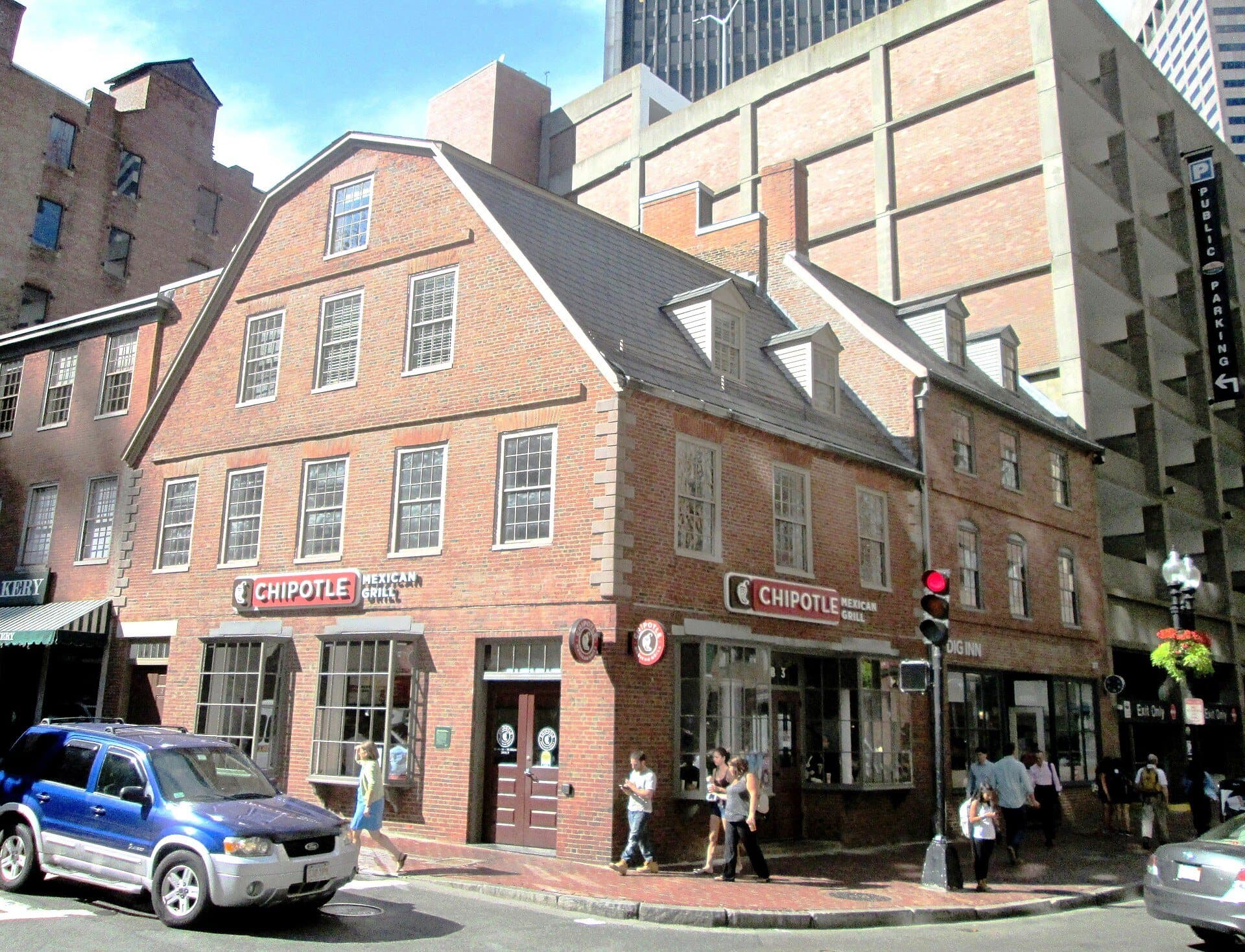
Old South Meeting House was once sold for its building materials. Twenty women helped save it in 1877, and across School Street stands the 1718 Old Corner Bookstore.
- 8
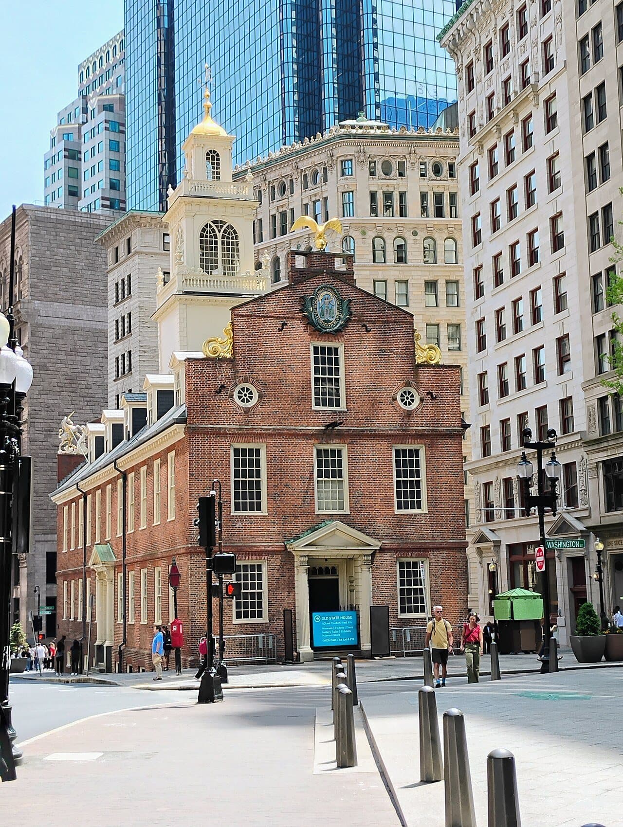
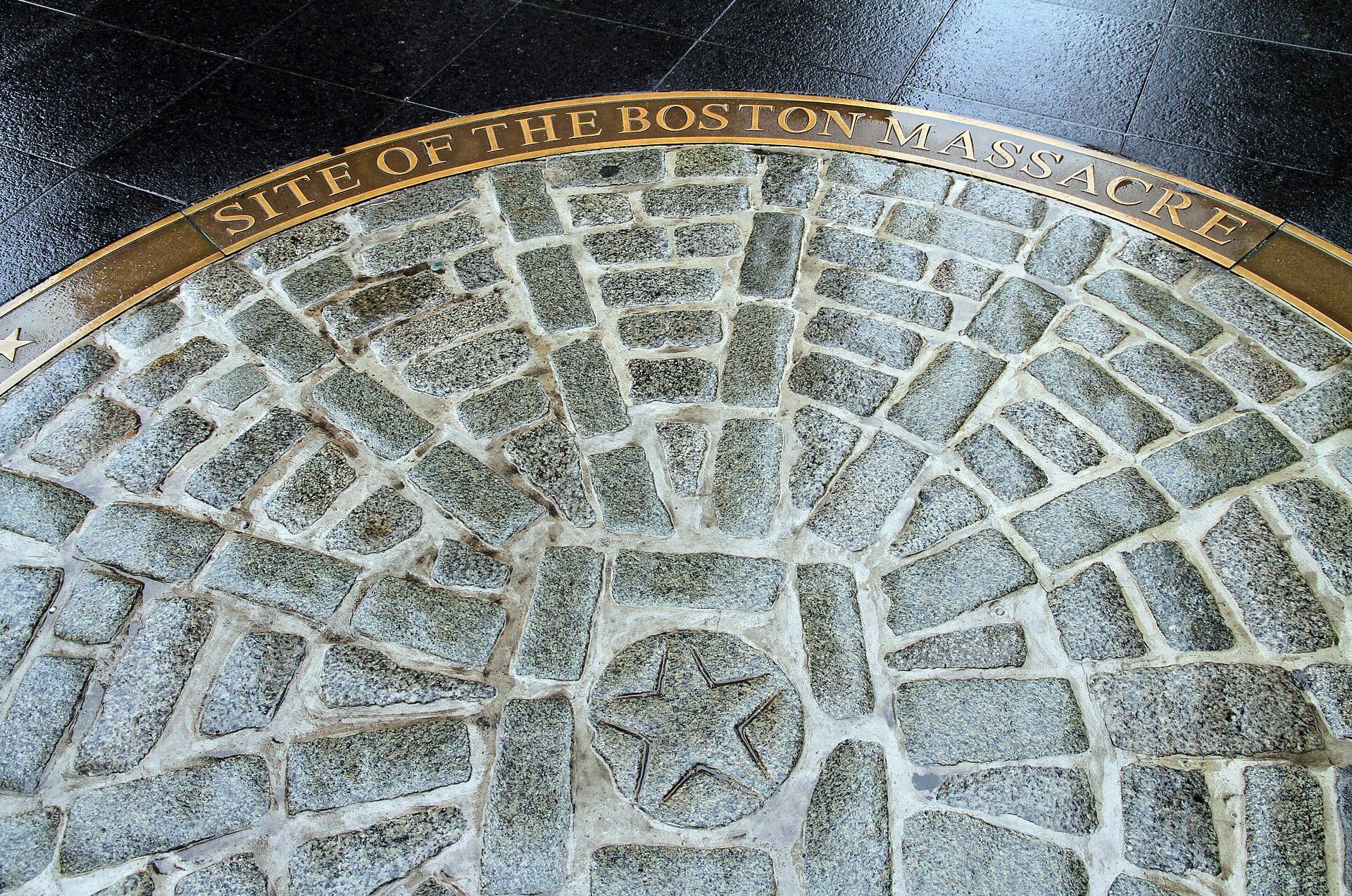
Old State House: The Balcony and the Massacre Ring
The Declaration was read to Boston from this balcony in 1776. The ring of cobblestones in the paving marks a spot close to where five men were shot.
- 9
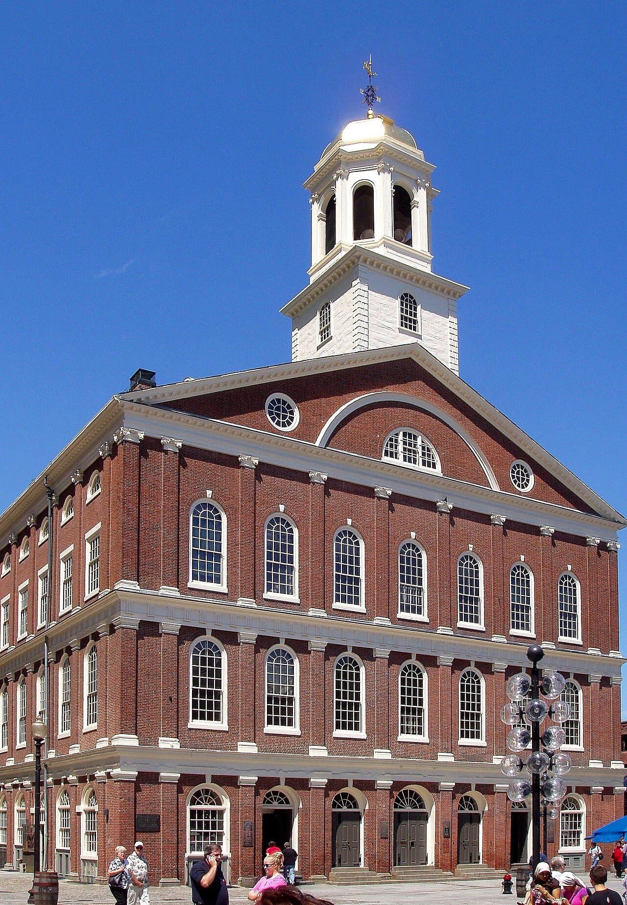
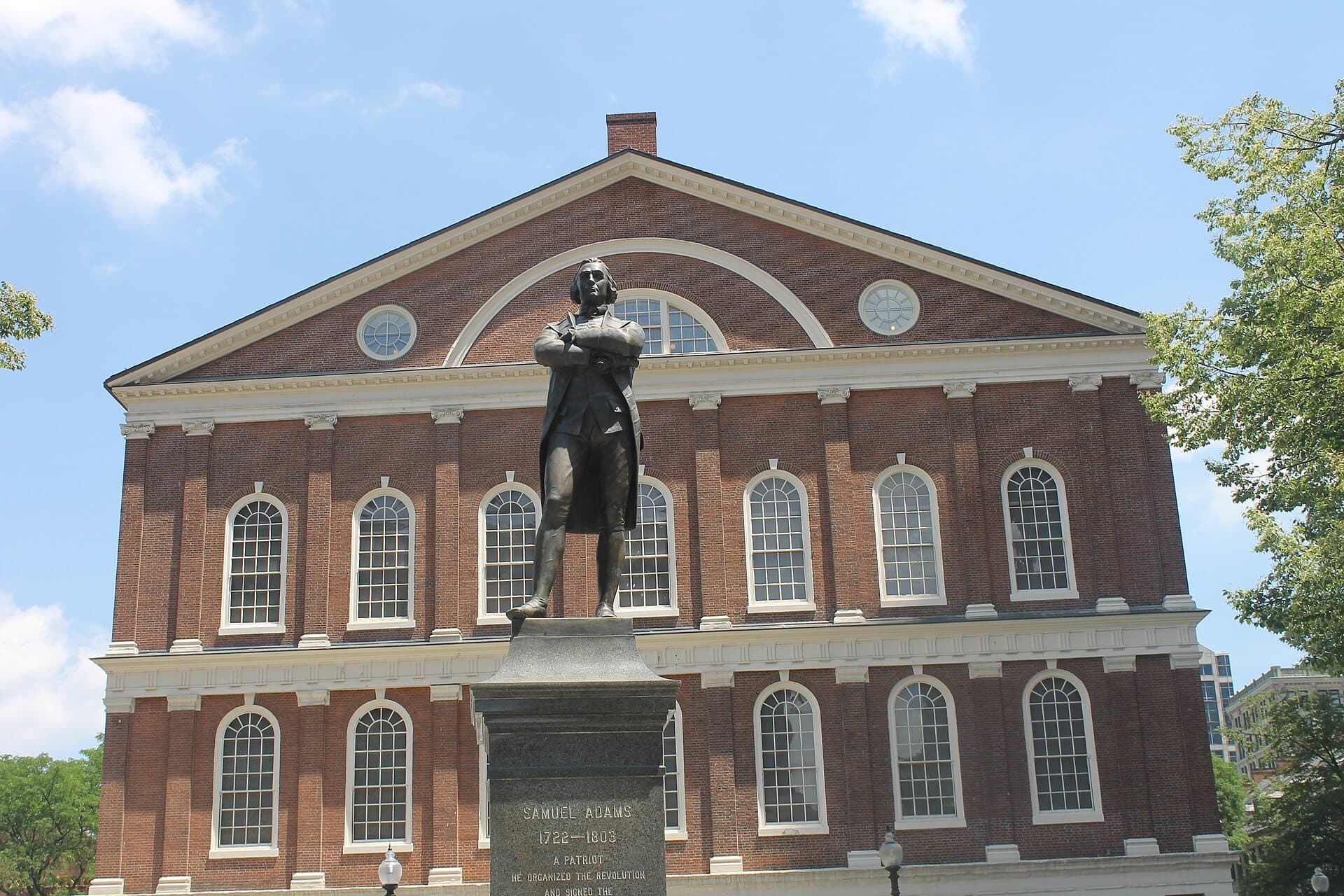
Faneuil Hall: Market Below, Meeting Hall Above
Faneuil Hall was built as a market with a meeting hall upstairs. Bulfinch doubled it, a gilded grasshopper tops it, and the Park Service says plainly how its donor made his money.
- 10
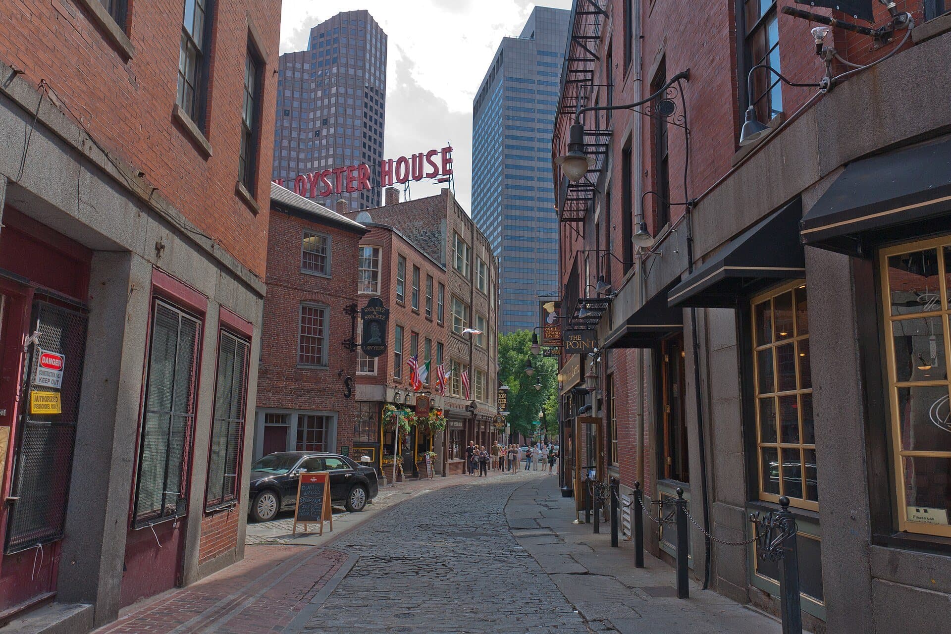
Blackstone Block and the Greenway: Where the Highway Stood
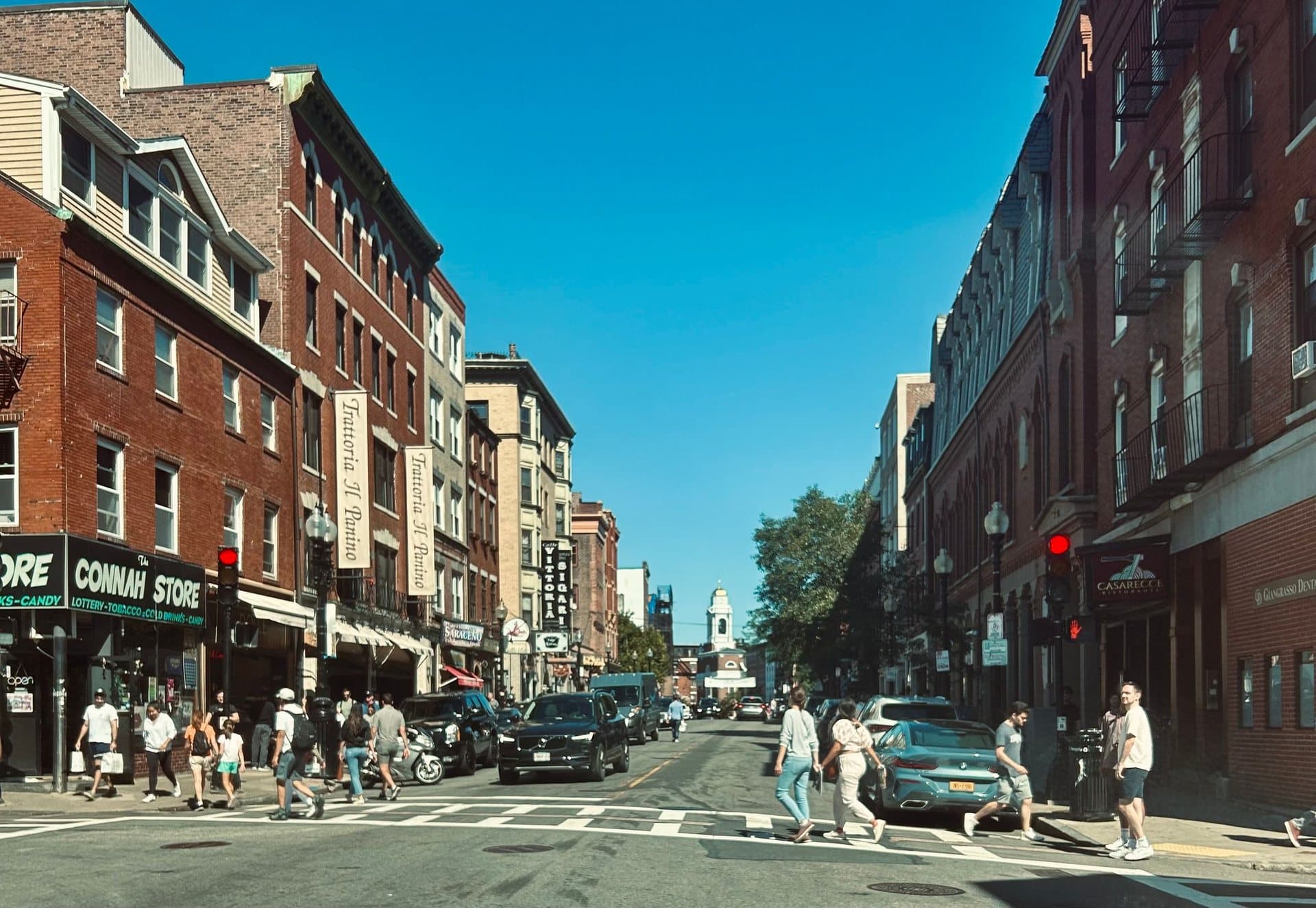
Boston's oldest surviving street pattern meets the park where a highway stood. The Blackstone Block's crooked lanes face the Rose Kennedy Greenway, built where the elevated Central Artery ran.
- 11
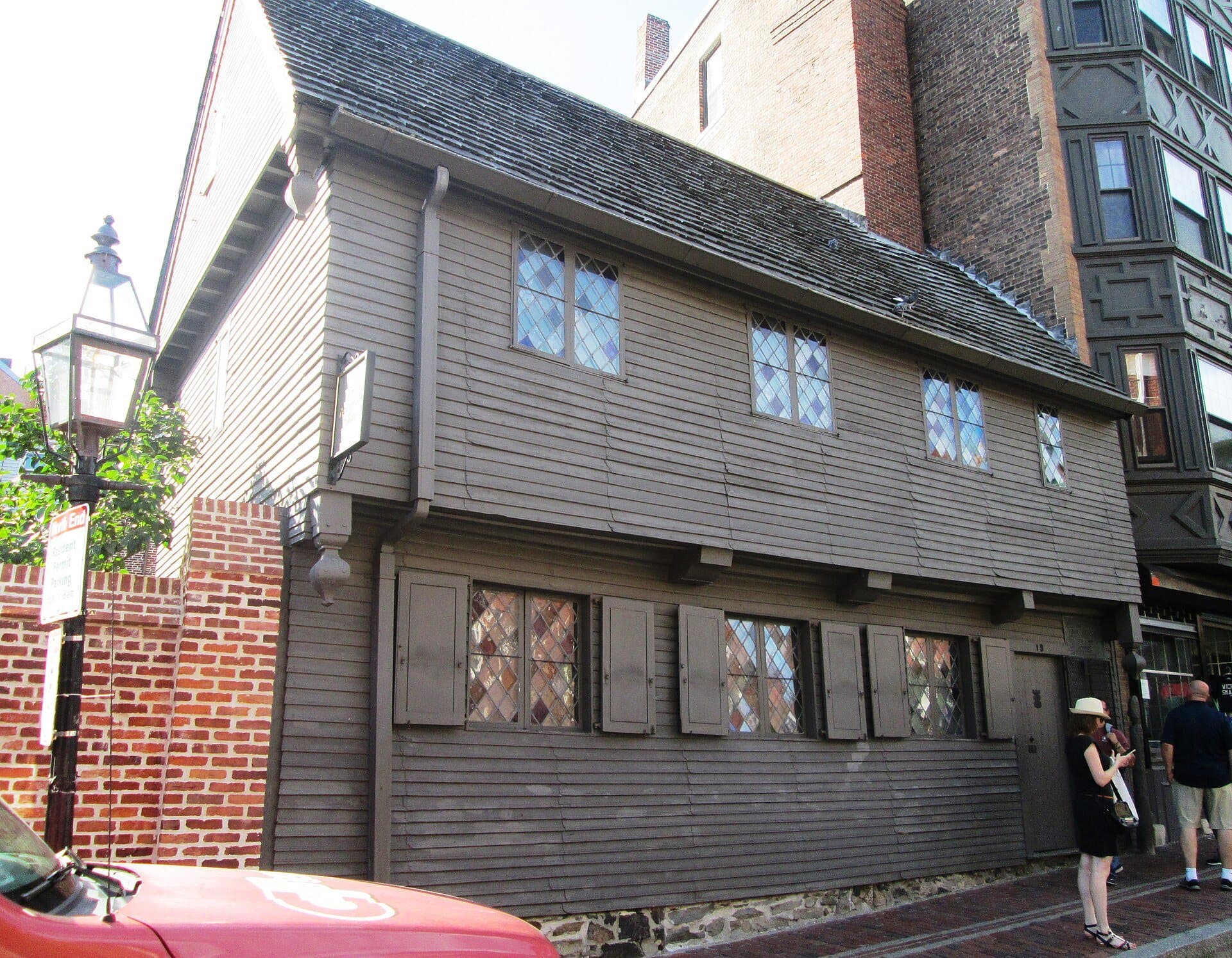
Paul Revere House: Timber Beside Brick
Downtown Boston's oldest building stands beside a brick house of 1711. Revere owned it for thirty years, and it was a tenement for a century before it became a museum.
- 12
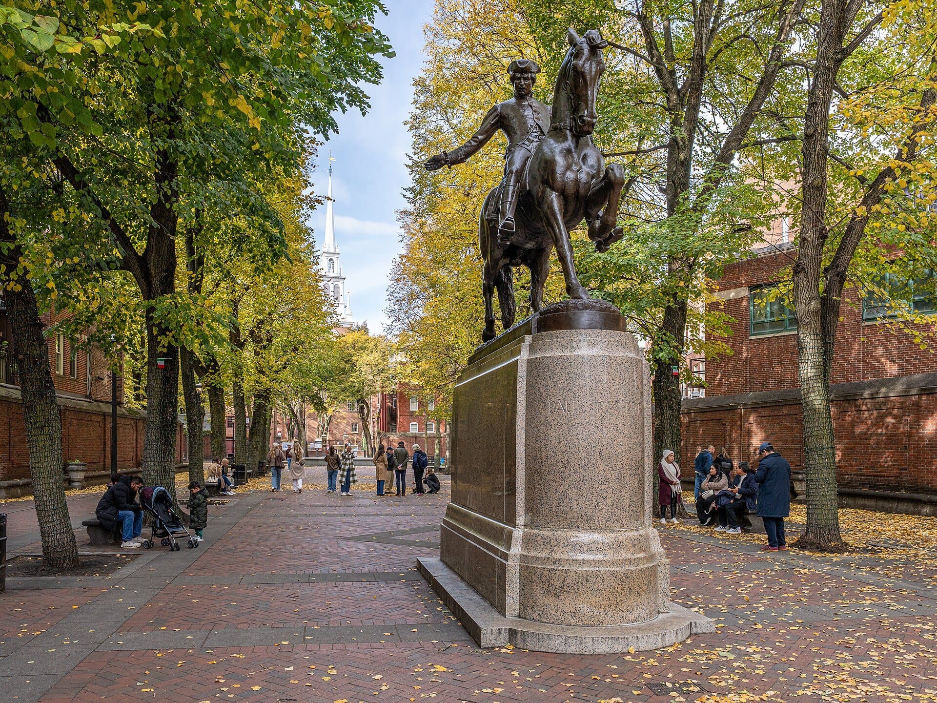
Paul Revere Mall: A Street Cleared for a View
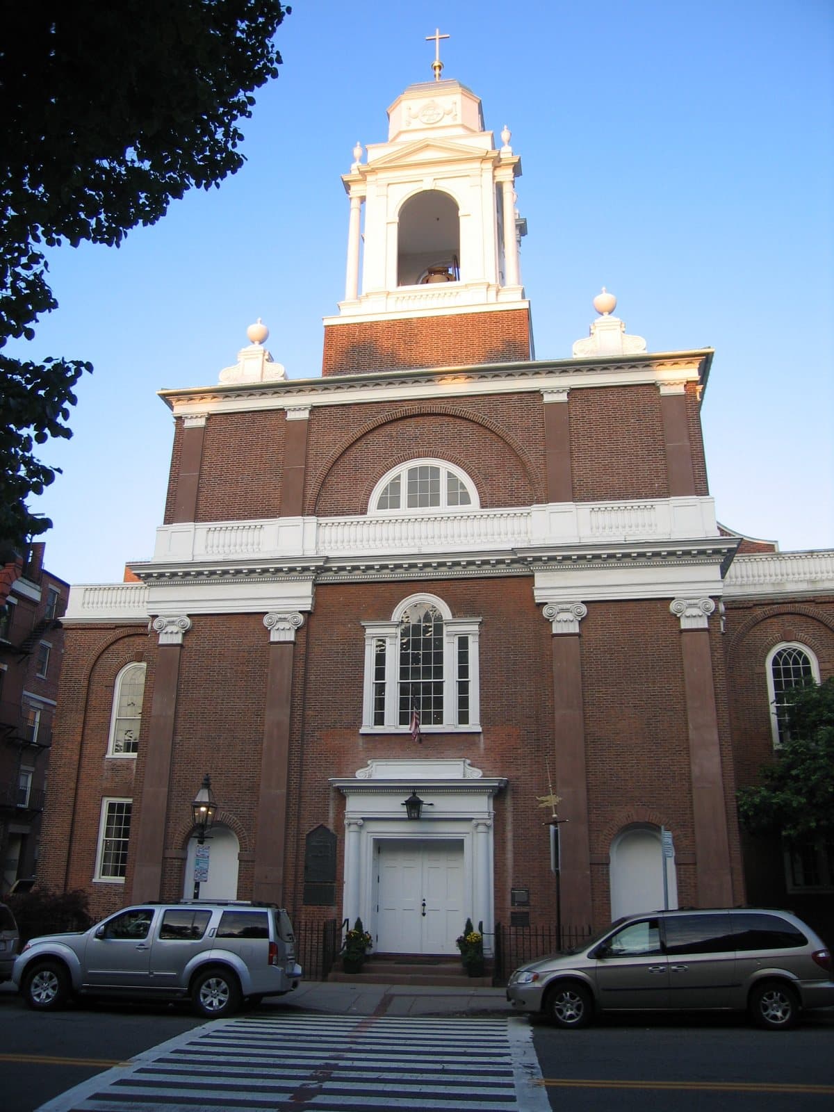
Tenements were cleared here in 1933 to frame a view. Revere rides in bronze toward the Old North steeple, and across Hanover Street stands Boston's only surviving Bulfinch church.
- 13
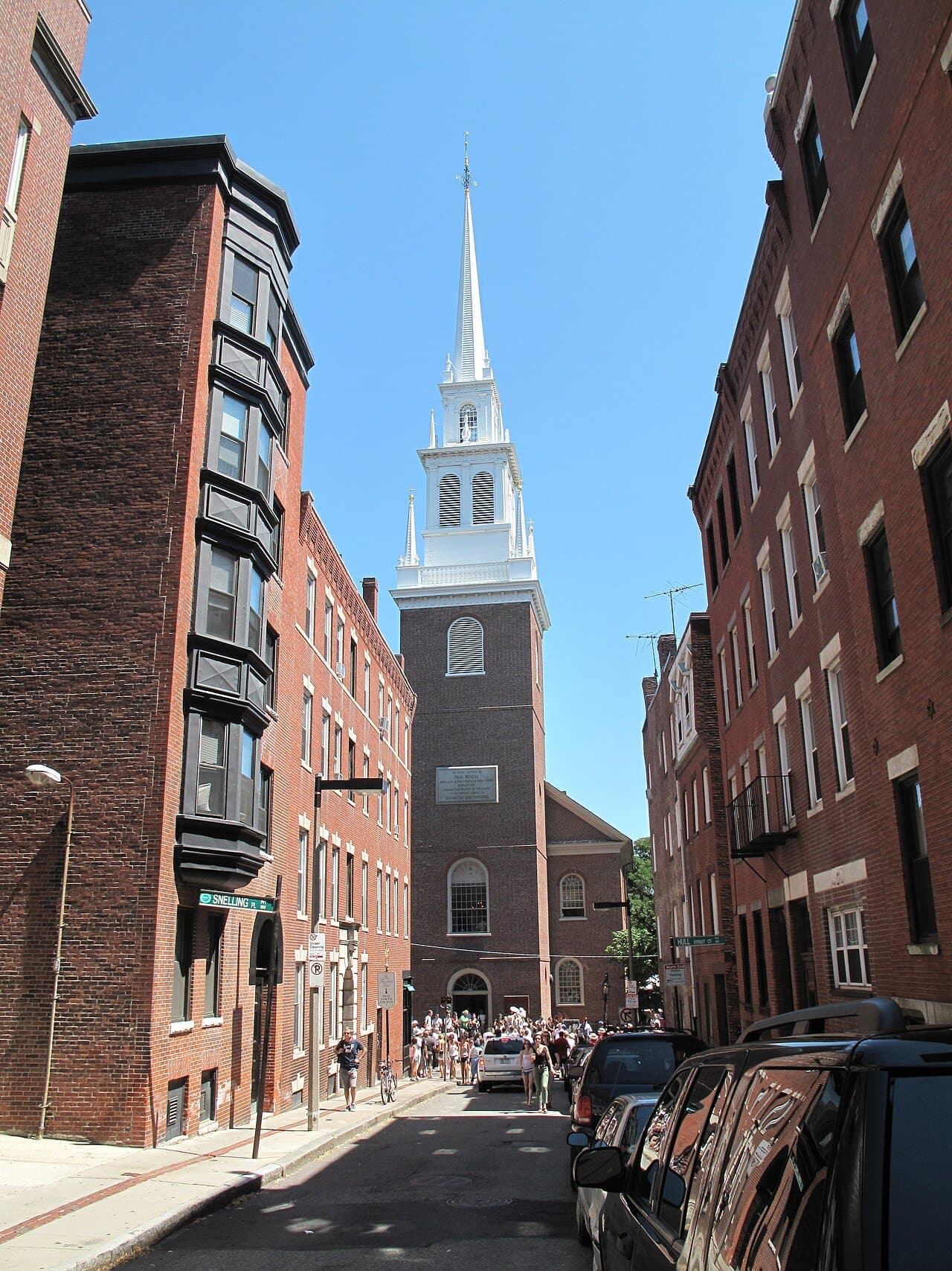
Old North Church: Two Lanterns and a Third Steeple
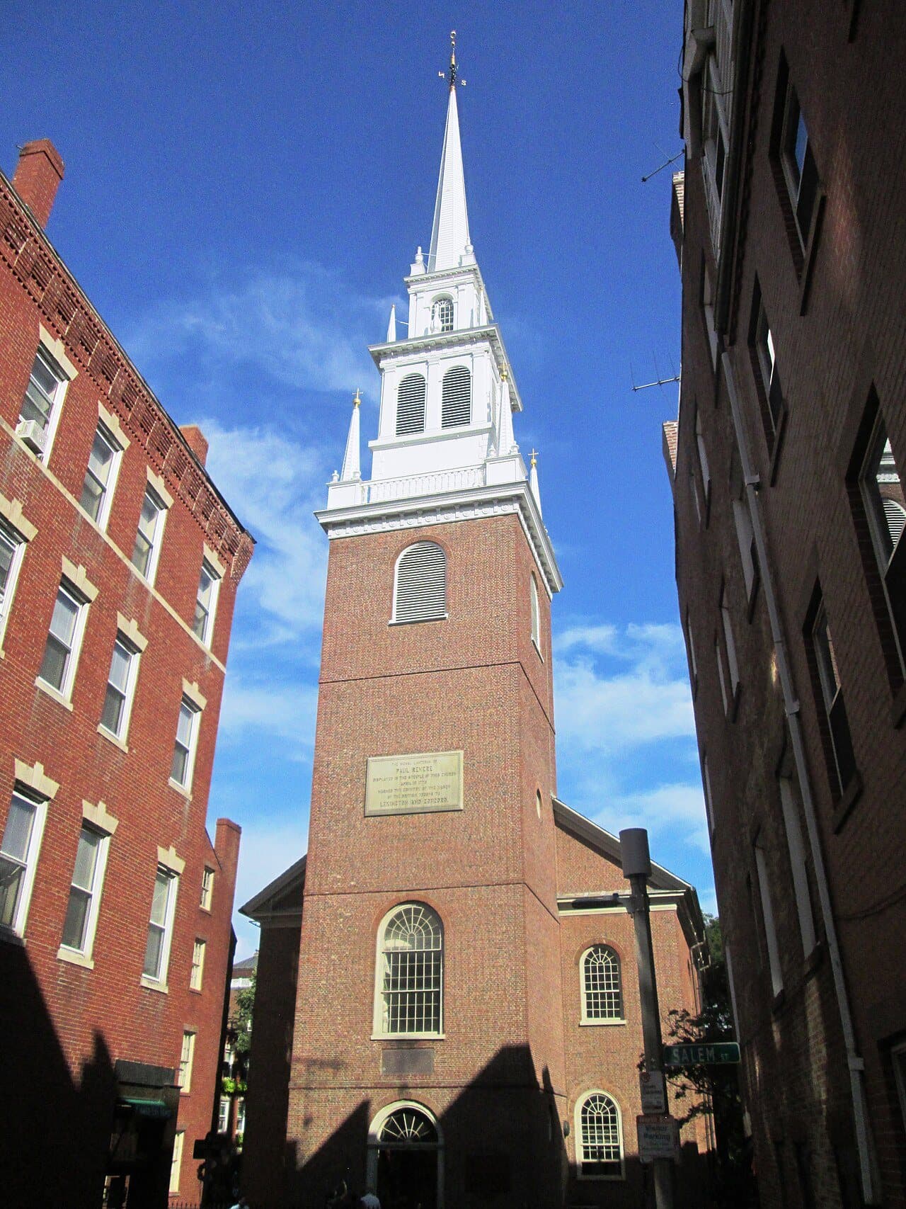
Two signal lights shone from this steeple in April 1775. They warned Charlestown, not Revere, and the steeple you see is a 1955 rebuild.
- 14
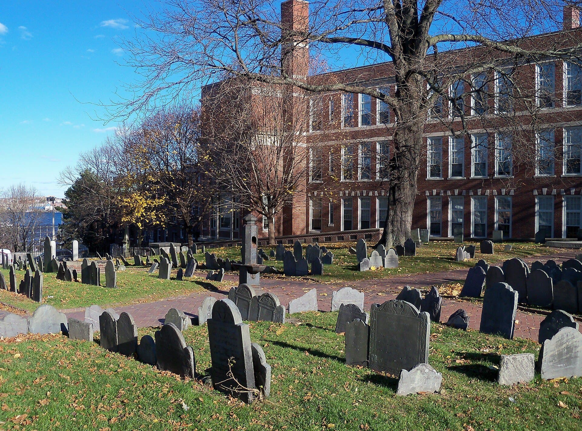
Copp's Hill Burying Ground: Where the Lantern Men Rest
British guns on this hilltop burying ground shelled Bunker Hill and Charlestown in 1775. The lantern men and Prince Hall are buried here, and the walk ends at the gate.
Details
Best Time to Visit
A weekday morning from about 10:00, when the ticketed sites open and the downtown sidewalks are quieter; Wednesday to Sunday if you want the free ranger talk in Faneuil Hall's Great Hall. Walk in daylight: the three burying grounds are open only from about 9:00 to 16:00. Fridays and Saturdays bring the Haymarket stalls to Blackstone Street, lively but crowded.
Pro Tips
- •Five sites on this walk are ticketed: King's Chapel, the Old South Meeting House, the Old State House, the Paul Revere House and the Old North Church. The Boston 250 Pass ($33) covers all five; it only pays off if you will visit at least four. Checked 4 October 2026.
- •The Old South Meeting House and the Old State House share one ticket ($18 adult), so buy it only if you will visit both on the same day. Checked 4 October 2026.
- •Faneuil Hall's Great Hall is free, with 15-minute National Park Service ranger talks Wednesday to Sunday at 10:30, 11:30, 12:30, 13:30, 14:30 and 15:30, unless the hall is closed for a city event. From 13 October 2026 the park's visitor center there closes on Mondays and Tuesdays. Checked 4 October 2026.
- •The Massachusetts State House is free to tour on weekdays, with a security check at the door; the Secretary of the Commonwealth takes tour reservations by phone at 617-727-3676. Checked 4 October 2026.
- •At Old North, the Bell Chamber add-on ($5 more, 25 minutes) climbs two sets of steep stairs; Revere joined the church's bell ringers at fifteen. Checked 4 October 2026.
- •Charlestown: the official Freedom Trail continues from the North End over the Charlestown Bridge, now the Bill Russell Bridge, to USS Constitution and the Bunker Hill Monument, adding about two hours. The ship is free, Tuesday to Sunday 10:00 to 18:00, with a security check; adults may be asked for photo ID. The 221-foot granite monument is free to climb (294 steps in a tight spiral, and it can close for weather); check the National Park Service site for climbing hours. Checked 4 October 2026.
- •If you want a guide for part of the day, the Freedom Trail Foundation's own walking tours start at the Boston Common Visitor Information Center, stop 1 ($17 adult). Checked 4 October 2026.
Safety & Precautions
- •Boston's brick sidewalks and old lanes are uneven; wear flat shoes with grip. Marshall Street, at stop 10, is a narrow paved lane with no sidewalks.
- •Stop 2 is reached by a short flight of steps from the Common up to Beacon Street; for a step-free way, use the Park Street Mall path along the Common's edge instead.
- •At stop 8 the Massacre ring sits in a pedestrian plaza between busy streets: stay on the plaza and cross State and Congress Streets only at the crossings.
- •Crossing Hanover Street at Fleet and North Bennet Streets, on the way to Paul Revere Mall, there is a marked crossing but no lights; take care.
- •The Granary, King's Chapel and Copp's Hill burying grounds are open only from about 9:00 to 16:00; outside those hours, see them through the fence. Inside, stay on the paths, because the old stones are fragile.
- •On Fridays and Saturdays the Haymarket crowds Blackstone Street near stop 10; step around the carts and watch for produce underfoot.
- •The path along Old North's side runs through the church grounds and may be closed outside visiting hours. If it is, go round by Unity Street, Tileston Street and Salem Street to Hull Street.
- •The brick Pierce/Hichborn House next to the Paul Revere House is closed until further notice (checked 4 October 2026).
Travel advisory: Exercise Normal Precautions (Level 1).
Gallery
Related Reading
Go deeper on what you'll see, hear, and walk through.
Overview
Best Self-Guided Walking Tours in Boston (2026)
4 min
Overview
Boston Travel Guide: How Many Days, Getting Around, When to Go (2026)
4 min
Overview
How to See Boston: A City of Lines
12 min
Overview
One Day in Boston: A Walkable Downtown Itinerary (2026)
8 min
Thematic
Best History Walking Tours in Boston (2026)
2 min

Thematic
What to Eat in Boston: A Food Guide (2026)
4 min
Companion
The Substrate and the Stack: How One Boston Neighborhood Held Four Cities in a Row
12 min
Companion
The Trail as an Argument: How a 1951 Newspaper Column Reorganized American Memory
13 min
Deep dive
St. Stephen's Church: One Building, Four Waves
8 min
Deep dive
The Old State House: One Building, Two Governments
7 min

Read
Boston vs New York: Which Should You Visit?
4 min
Read the walk
The full story of Freedom Trail: The Buildings Boston Refused to Lose, in words. Prefer to listen? Play it narrated, from home or on location.
Introduction
Boston, in Massachusetts, has spent nearly four hundred years deciding which of its old buildings to keep. In March nineteen fifty-one, a newspaper columnist named Bill Schofield, tired of hunting for historic sites that were never where he expected, asked the city for a few dollars and a bucket of paint to link them into one walk. That June the city put up signs on thirty street corners, and the Freedom Trail was born. The red line came seven years later.
Over fourteen stops and about a mile and a half, two and a half kilometers, this walk follows that line from Boston Common past the State House, two old churches and two burying grounds, the Old South Meeting House, the Old State House and Faneuil Hall. Then it crosses a park that used to be a highway into the North End, for Paul Revere's house, the Old North Church and Copp's Hill. Allow about two hours, more if you go inside. Five of the buildings charge for entry, and every stop works from the street.
Paul Revere turns up again and again, as a coppersmith, a bell maker, a print maker and a rider. So does the architect Charles Bulfinch. And at every old building, it is worth asking one question: who saved it, and when?
1. Boston Common: Where the Red Line Starts
Welcome to Boston Common, and to the start of the Freedom Trail. Find the small Visitor Information Center, where the trail's own guided tours begin, and stop beside it.
Look down for the red line. It starts beside the Visitor Center and runs about two and a half miles, all the way to Charlestown. Today most of it is red brick set into the sidewalk. It first went down in nineteen fifty-eight, as paint, seven years after that newspaper column. The columnist promised the walk would add to the personality of the city, and please the tourists. By nineteen fifty-three, forty thousand visitors were already following it.
Now look at the ground itself: a wide sloping lawn, old trees, paths crossing in every direction. This is the oldest public land on the walk. In sixteen thirty-four, the townspeople voted to tax every household to buy a settler's farm and turn it into a common for grazing. Cows grazed here until eighteen thirty. The town kept a whipping post, a pillory and stocks on this grass, and hanged people from a great elm. In seventeen seventy-five, more than a thousand British soldiers camped here.
One more thing lies under your feet. In the eighteen nineties, a plan to run a trolley line across the Common set off a public outcry. So the city went underground instead, and the country's first subway was dug under this corner of the Common. The small granite and glass entrances near the Park Street corner lead down to it.
Up toward that corner, a tall white steeple rises over the trees. Keep it in mind. First, the walk climbs to the gold dome at the top of the Common.
Follow the route up across the Common. Next, the State House.
2. Massachusetts State House: A Dome in Three Skins
Walk on up the path and the short flight of steps to the top of the Common, and stop on the sidewalk there, with the big bronze memorial at your back. Look across Beacon Street.
That red-brick front with the white columns and the gold dome is the Massachusetts State House. It was designed by Charles Bulfinch and finished in seventeen ninety-eight. Remember the name Bulfinch; his work comes back three more times on this walk. The land it stands on had been a cow pasture belonging to John Hancock.
Read the dome as three skins. It began as wood. In eighteen oh two, Paul Revere's firm, Paul Revere and Sons, wrapped it in copper to keep the water out. And in eighteen seventy-four it was covered in twenty-three karat gold leaf for the first time. Right at the top, on the little lantern, sits a gilded pine cone. It salutes the timber that built early New England, much of it from Maine, which was part of Massachusetts until eighteen twenty.
Revere was here at the very beginning, too. On the Fourth of July, seventeen ninety-five, he and Governor Samuel Adams laid the cornerstone. The stone was hauled up by fifteen white horses, one for each state in the Union at the time.
The building has grown since. The two white marble wings stretching out to either side of the brick front were finished in nineteen seventeen, and a yellow-brick extension hides behind. Bulfinch's red brick and white trim stayed at the center.
The bronze relief behind you is the Shaw Memorial, from eighteen ninety-seven, honoring a Civil War regiment of Black volunteers and their colonel. Our Beacon Hill walk begins there.
Follow the route back down along the edge of the Common. Next, the church with the white steeple.
3. Park Street Church: Brick, White Wood and a Pulpit
Walk on down to the corner of the Common and stop by the street, with the white steeple across Park Street.
This is Park Street Church, on this corner since eighteen oh nine. Look at how the steeple is built: tier on tier of white-painted wood, stacked on top of a red-brick church, two hundred and seventeen feet to the tip. For years it was the first landmark travelers saw as they came toward Boston.
Notice the recipe, because you will see it again: red brick for the walls, white-painted wood for the steeple, the columns and the trim. The Old South Meeting House and the Old North Church use the same two materials. It is the look of old Boston.
The church was organized as a Congregational church, in reaction to the Unitarians, and it gave the city a loud voice. In eighteen twenty-nine, the abolitionist William Lloyd Garrison gave his first antislavery speech here. The hymn called America was first sung here, too. And the church's bells still sound from that steeple twice a day.
Before the church, this corner held the town granary, a big storehouse for grain, moved here in seventeen thirty-seven. The burying ground next door took its name from it, and you are about to see it.
Follow the route across Park Street at the lights and along Tremont Street. Next, the Granary Burying Ground.
4. Granary Burying Ground: Stones in Tidy Rows
Walk on along Tremont Street and stop at the iron fence, with the burying ground on the other side. It is free and usually open from about nine to four; if the gate is open, you are welcome to step just inside.
Look first at the gateway on this street: heavy blocks of granite cut in an Egyptian style, with an iron fence along the wall, from about eighteen forty. Its designer also built the granite obelisk on Bunker Hill, across the river.
Now look at the stones. Thin, dark slate, many carved across the top with winged skulls and faces. There are about two thousand three hundred markers here, but more than five thousand people are buried, so most lie with no stone at all. And the stones are not where they started. In the eighteen hundreds they were straightened into neat rows, and many no longer stand over the person they name. A tidy picture laid over an untidy ground.
The burying ground was set out in sixteen sixty, and it took its name from the granary on the church corner you just left. Inside lie three signers of the Declaration of Independence: Samuel Adams, John Hancock and Robert Treat Paine. Paul Revere is here. So is Peter Faneuil, whose hall is a few stops ahead. And so are the five men killed in the Boston Massacre, among them Crispus Attucks, a dockworker of African and Indigenous descent and the first to fall. The tall granite obelisk in the middle, twenty-five feet high, marks the tomb of Benjamin Franklin's parents.
Keep those five Massacre victims in mind. Four stops from here, you reach the place where they died.
Follow the route along Tremont Street. Next, the grey granite church on the corner.
5. King's Chapel: A Granite Church Built Around a Wooden One
Walk on along Tremont Street to the corner with Beacon Street and stop there, looking across Tremont at the dark grey church. King's Chapel charges a small fee to go inside, and when its doors are open it is worth it, and the guided crypt tour is the part people remember. Price and hours are on this stop's card.
Look at the stone. This is Quincy granite, from boulders split by hand, and the church built from it between seventeen forty-nine and seventeen fifty-four is the oldest stone building still standing in Boston. Compare it with the red brick and white wood at Park Street. Here everything is grey, heavy and square: a squat tower with no spire at all, and a row of columns across the front.
How it was built is the story. The congregation, Boston's first Anglican church, founded in sixteen eighty-six, worshipped in a wooden chapel on this spot. The new granite church was built around the old wooden one, so services could carry on inside while the stone walls rose around them.
This was the King's church, and in seventeen seventy-six its Loyalist congregation left Boston. After the Revolution, those who remained formed the country's first Unitarian congregation.
Paul Revere turns up here too. The bell in that tower was made in England, cracked in eighteen fourteen, and recast by Revere's firm in eighteen sixteen. It still rings.
The small burying ground beside the church, behind the railing, is older still. Laid out in sixteen thirty, it is the oldest in Boston proper, and the colony's first governor lies there. It is free to enter, during the day.
Follow the route across Tremont Street at the lights and down School Street. Next, a bronze Benjamin Franklin.
6. School Street: Old City Hall and Franklin
Walk on down School Street and stop at the iron railing in front of the tall, pale granite building with the steep roof. In the forecourt stands a bronze Benjamin Franklin. The street is named for a school. Boston Latin School, founded in sixteen thirty-five and the oldest…
Full narration for this stop unlocks with the tour.
7. Old South Meeting House: Sold for Its Bricks
Walk on into the small plaza at the corner of School and Washington Streets and stop there. Two buildings matter here: the low brick corner building with the two-slope roof across School Street, and the brick meeting house with the white steeple across Washington Street. The Old…
Full narration for this stop unlocks with the tour.
8. Old State House: The Balcony and the Massacre Ring
Walk on into the open plaza at the end of the Old State House and stop by the ring of cobblestones in the paving. Stay on the plaza, out of the road, and turn to face the small brick building with the gold lion and the silver unicorn on its gable. It shares a ticket with Old…
Full narration for this stop unlocks with the tour.
9. Faneuil Hall: Market Below, Meeting Hall Above
Walk on into the square and stop where you can see the red-brick hall with the white cupola. At the very top sits a gilded copper grasshopper, the weathervane. Remember it: its maker also made the vane on the Old North Church, near the end of this walk. This is Faneuil Hall,…
Full narration for this stop unlocks with the tour.
10. Blackstone Block and the Greenway: Where the Highway Stood
Walk on up the narrow lane to where it meets Hanover Street, stop there, and look back down the lane you just walked up. This little knot of crooked lanes and low brick buildings is the Blackstone Block. In nineteen eighty-three it became a Boston Landmark, not for any one…
Full narration for this stop unlocks with the tour.
11. Paul Revere House: Timber Beside Brick
Walk on into North Square, the small cobbled square, stop on its paving, and turn to face the dark wooden house across the narrow street, with diamond-paned windows and an upper floor jutting out over the lower one. This is the Paul Revere House. It is ticketed, inexpensive and…
Full narration for this stop unlocks with the tour.
12. Paul Revere Mall: A Street Cleared for a View
Walk on through the opening in the brick wall into the long promenade, and stop just inside. Find the bronze rider, and beyond him, at the far end, a white steeple. The rider is Paul Revere. The steeple is the Old North Church. The view is the whole point of this place. It was…
Full narration for this stop unlocks with the tour.
13. Old North Church: Two Lanterns and a Third Steeple
Walk on past the church a few steps up Hull Street, then stop and turn round to face it. The tower is head-on: red brick, rising into a white wooden steeple in tiers, with a weathervane on top. Old North is ticketed and worth it. Price and hours are on this stop's card. Built…
Full narration for this stop unlocks with the tour.
14. Copp's Hill Burying Ground: Where the Lantern Men Rest
Walk on up Hull Street and stop at the gate of the burying ground, with the stones in view through the fence. It is free and usually open from about nine to four. The walk ends here. Look through the fence: slate headstones in straight rows on a terraced hilltop, under shade…
Full narration for this stop unlocks with the tour.