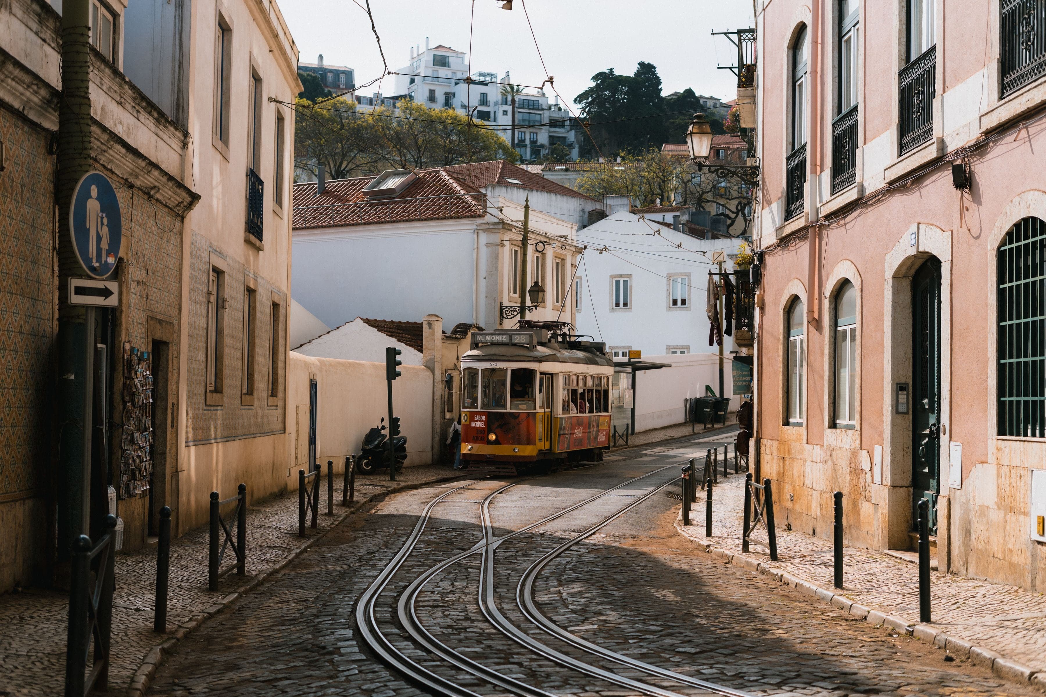
From the Botanical Garden's gate through Príncipe Real's garden, the São Pedro de Alcântara terrace and São Roque, down through the Bairro Alto's planned streets to the storm giant at the Miradouro de Santa Catarina.
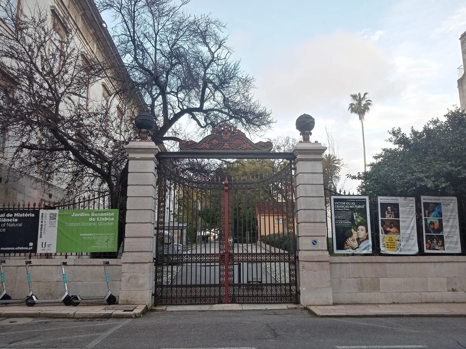
Start · Rua da Escola Politécnica: the Botanical Garden Gate
DirectionsStops
- 1
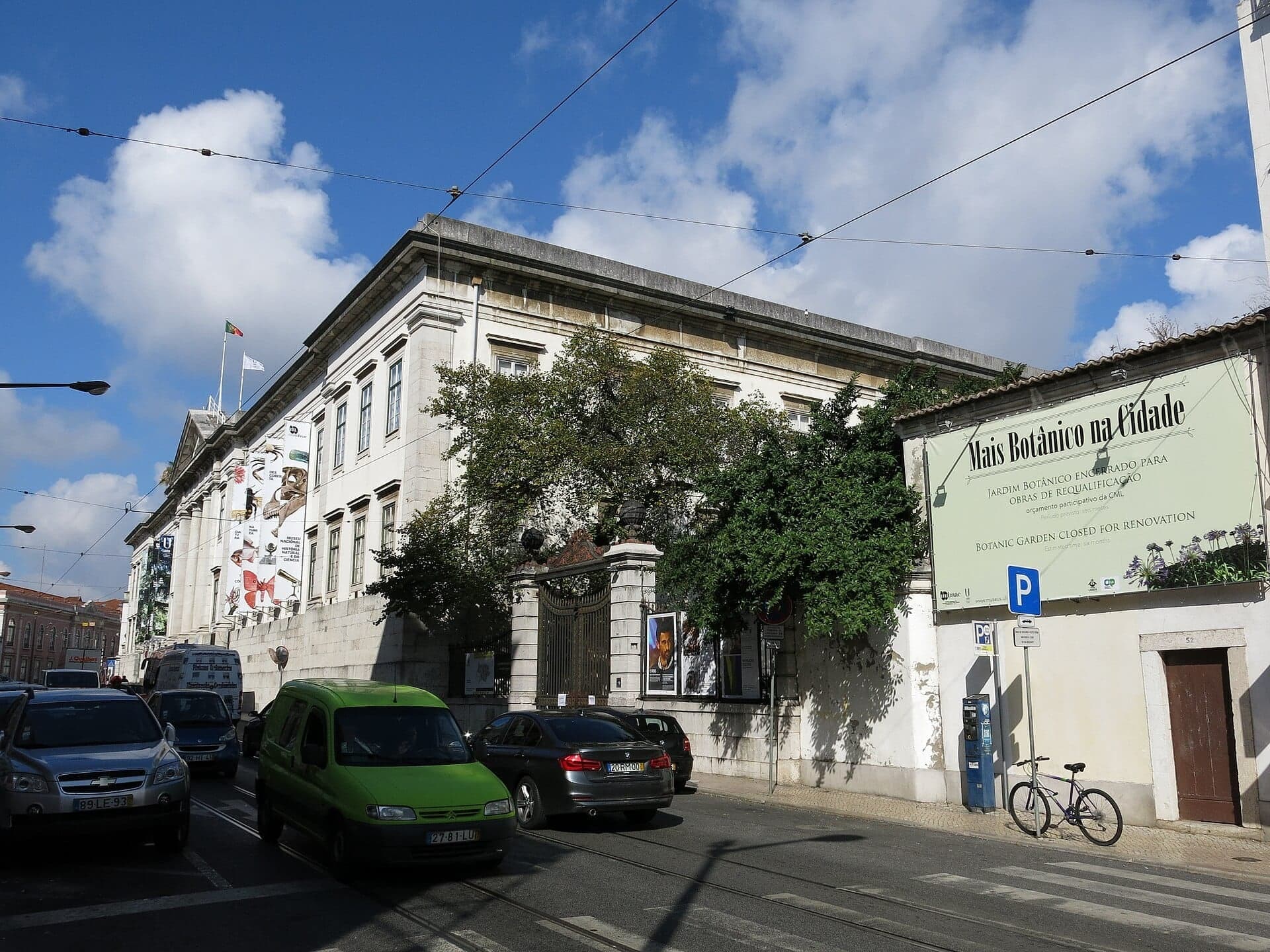
Rua da Escola Politécnica: the Botanical Garden Gate
A gate opens on four institutions. Jesuit novices, the king's young nobles, a polytechnic and a science faculty all held the site behind it, and the garden was made to teach.
- 2
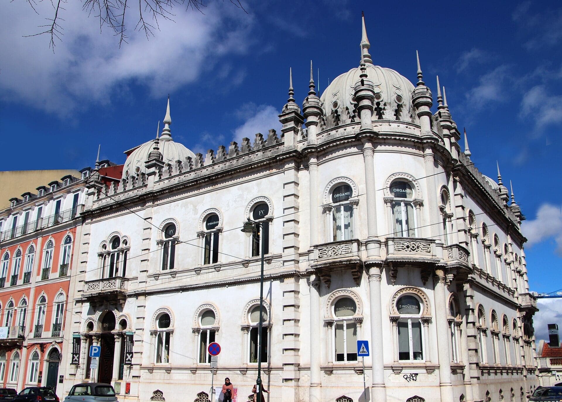
Príncipe Real: the Palacete Ribeiro da Cunha
A palace faces the garden. Neo-Moorish, it stands across the road, and beside you a huge fig shows the roots the state classified.
- 3
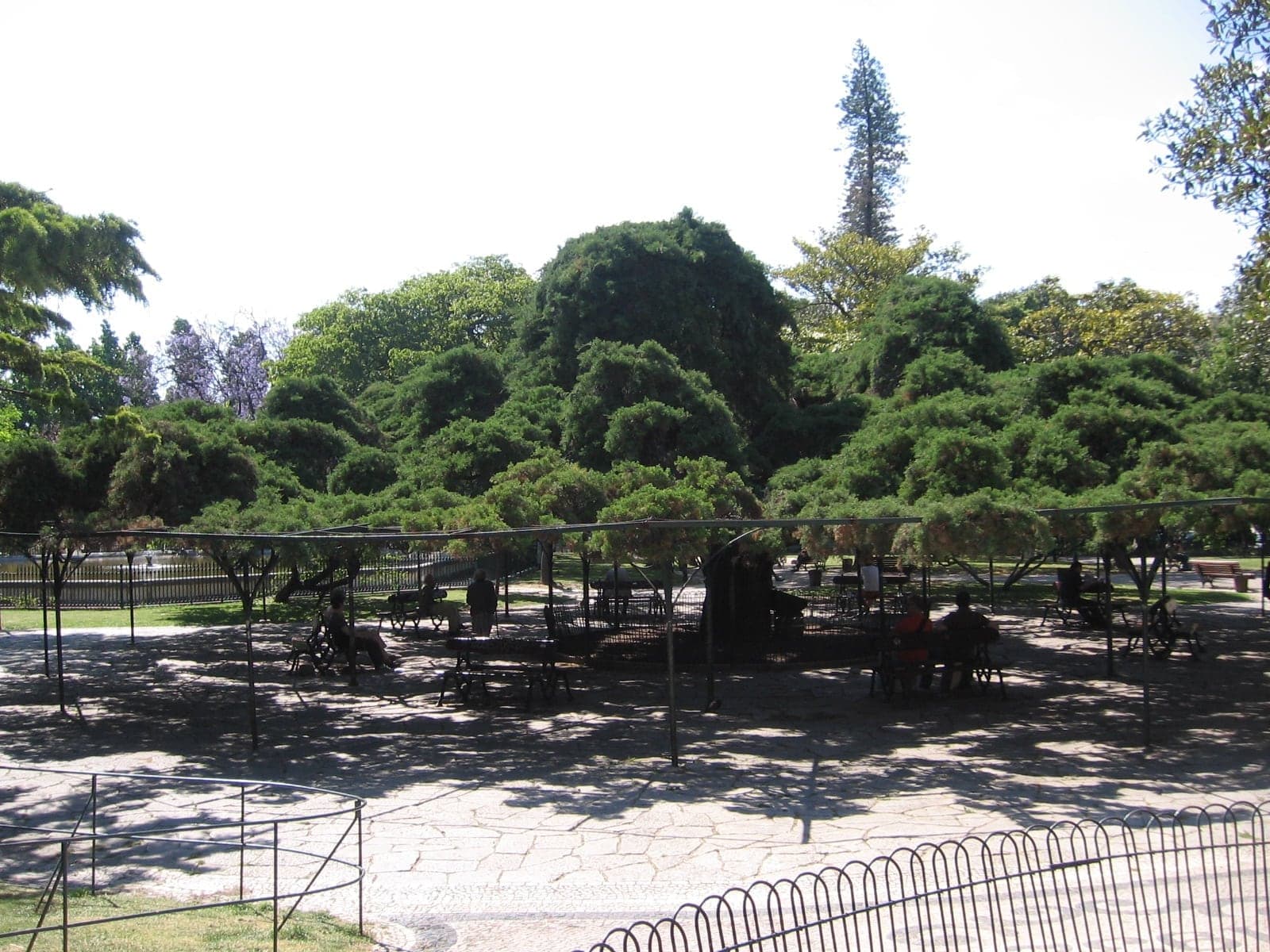
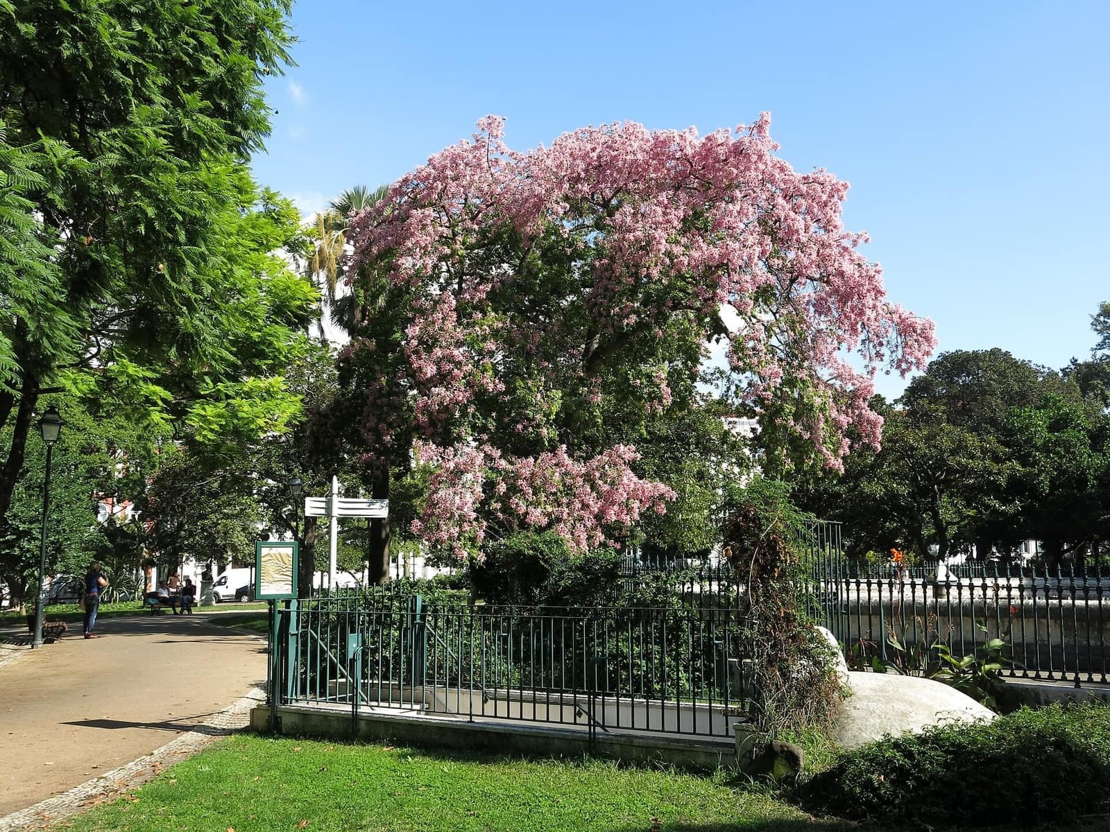
Príncipe Real: the Cedar That Is a Cypress
Everyone calls this cypress a cedar. A trained Mexican cypress, its branches rest on a metal frame, in a garden that followed a run of failed projects and carries a lake on a hidden reservoir.
- 4
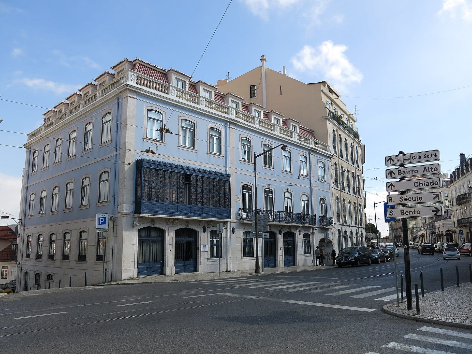
Rua Dom Pedro V: the Top Edge of the Grid
Tall fronts screen the quarter's edge. They date from the nineteenth century. Across the road, Rua da Rosa runs the whole quarter from end to end.
- 5
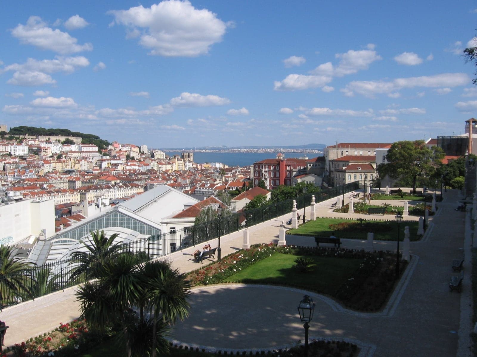
Jardim de São Pedro de Alcântara: the Upper Terrace
It began as a fountain platform. The terrace became a garden with a view across the valley to the castle.
- 6
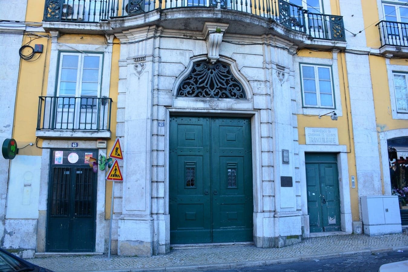
Palácio Ludovice: the King's Architect's Block
The king's architect built on a whole block. His own house breaks the narrow plot pattern of the quarter around it.
- 7
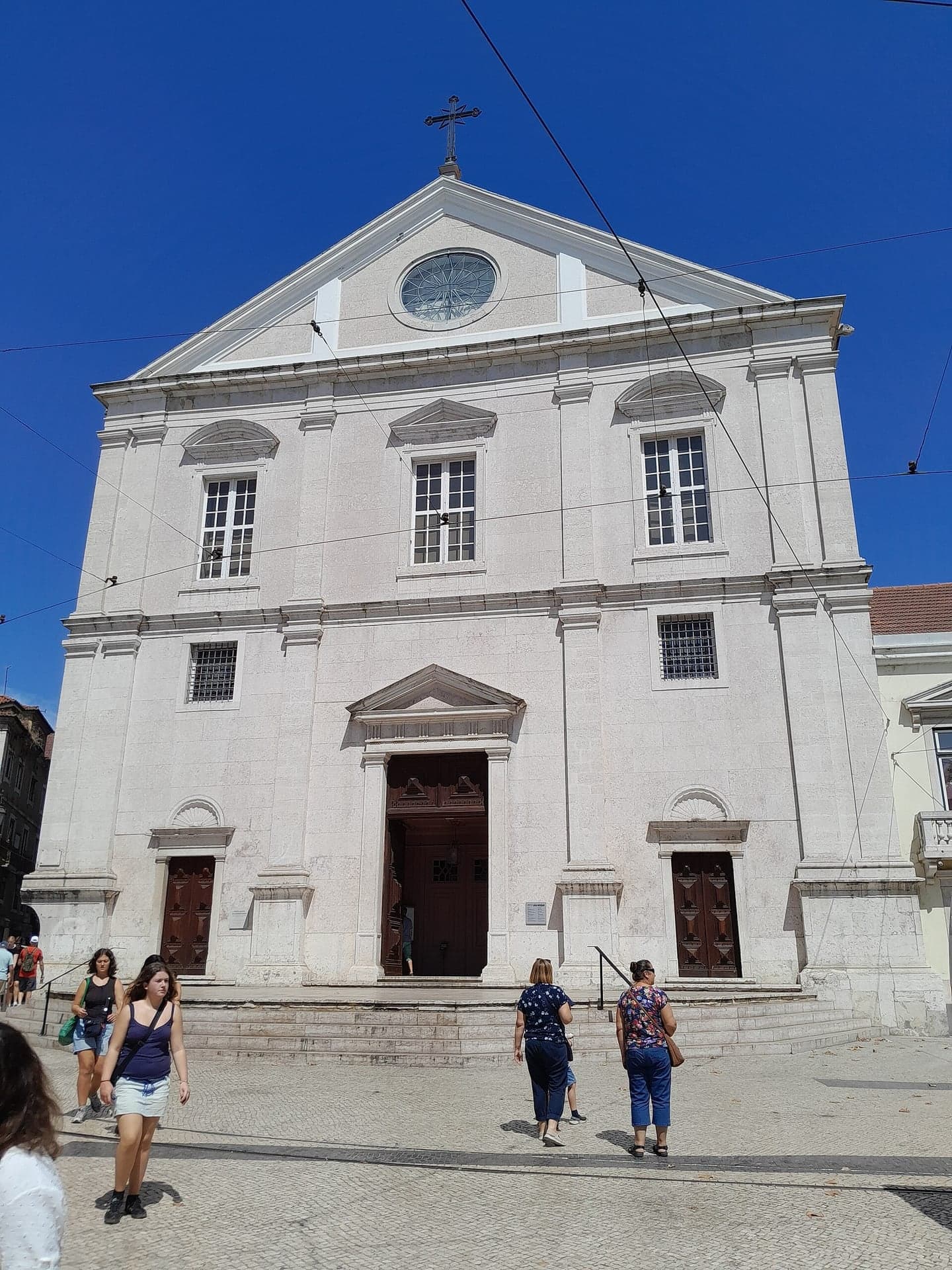
Igreja de São Roque: Plain on Purpose
The Jesuits chose a plain stone front. Their arrival here pulled the quarter's street plan toward them.
- 8
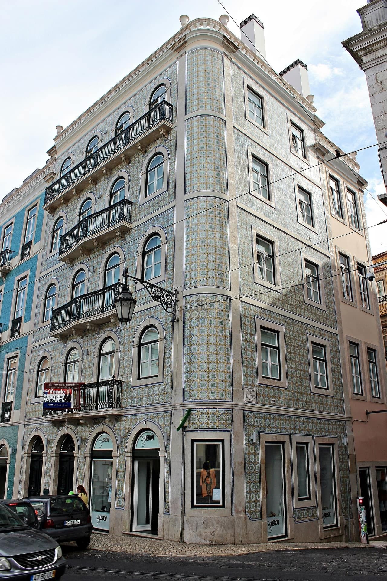
Travessa da Queimada: the Seam in the Grid
The quarter changes direction here. A deal of 1513 began it, and the second phase that followed the Jesuits starts here.
- 9
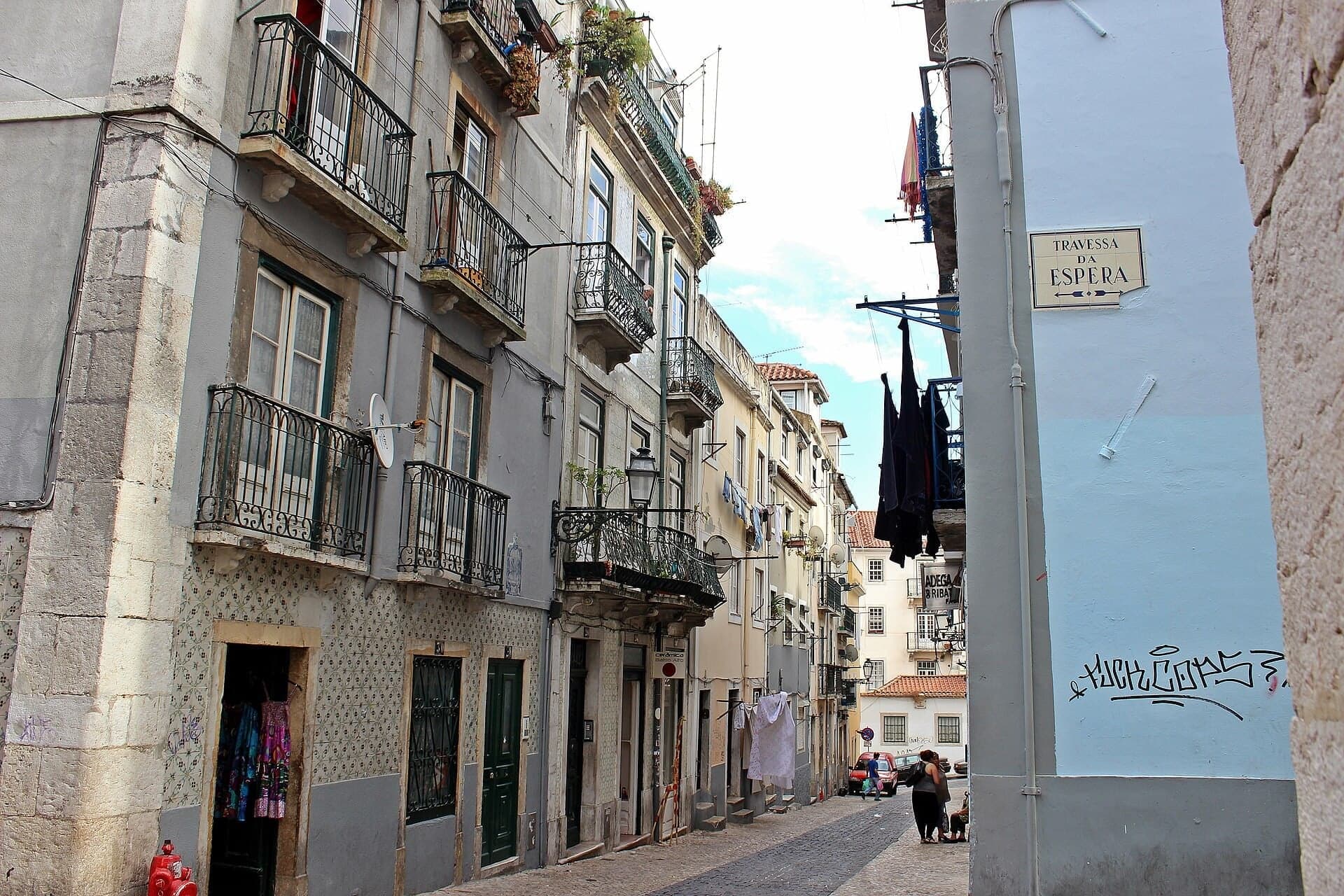
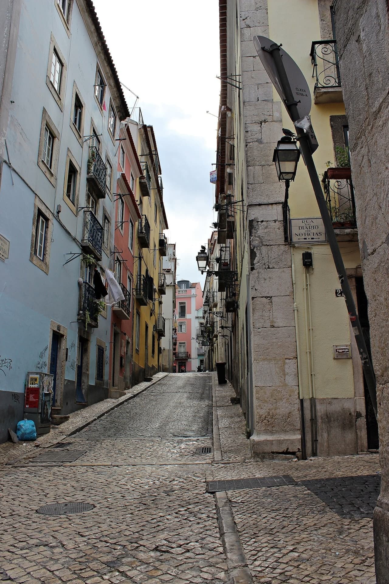
Rua do Diário de Notícias: the Paper's Street
A caulkers' street took a paper's name. The newspaper worked in this quarter for 76 years.
- 10
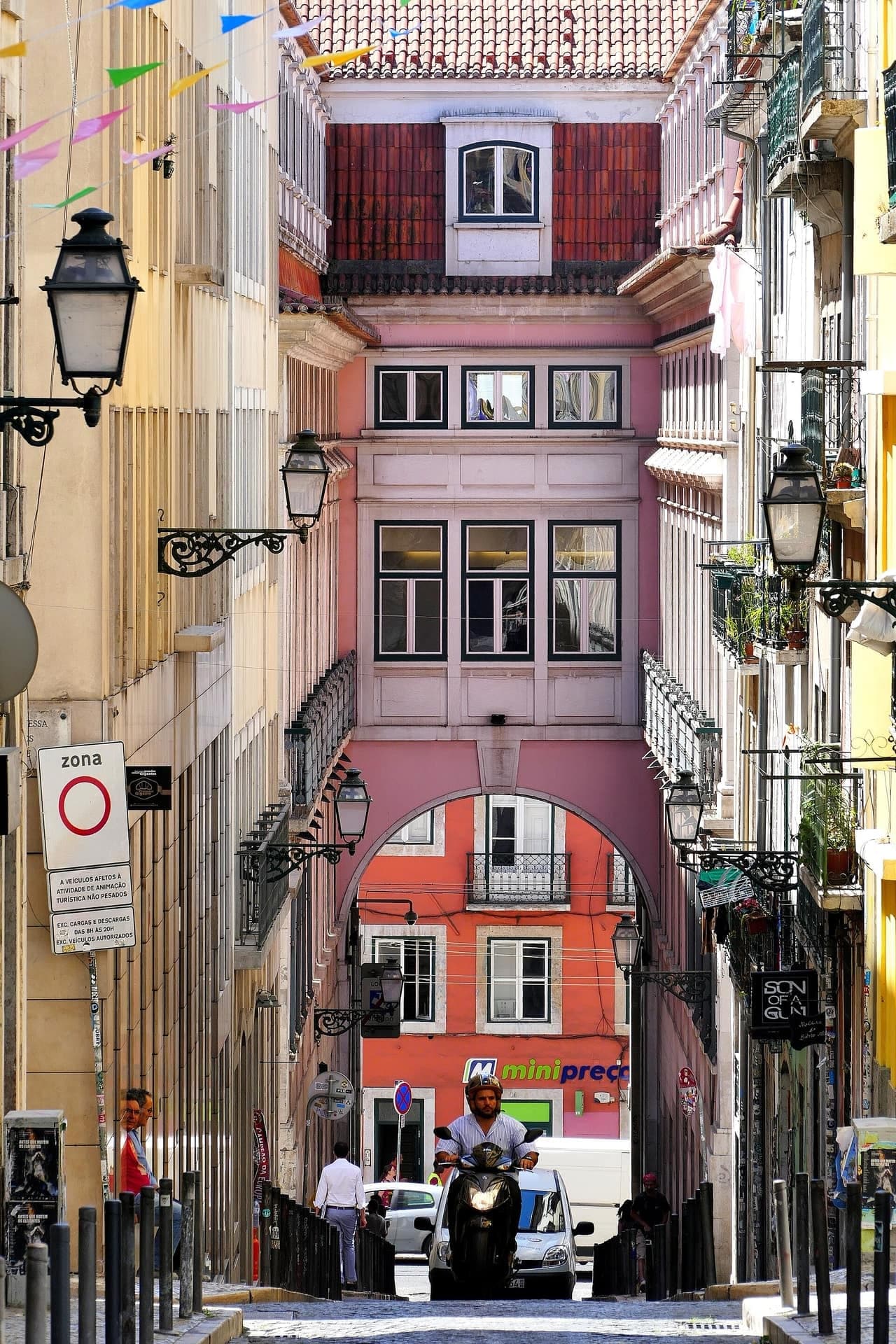
Rua da Rosa: How to Read a House
Long narrow plots shape these houses. The stair bay, the lopsided front and the sunlit top floor all come from them.
- 11
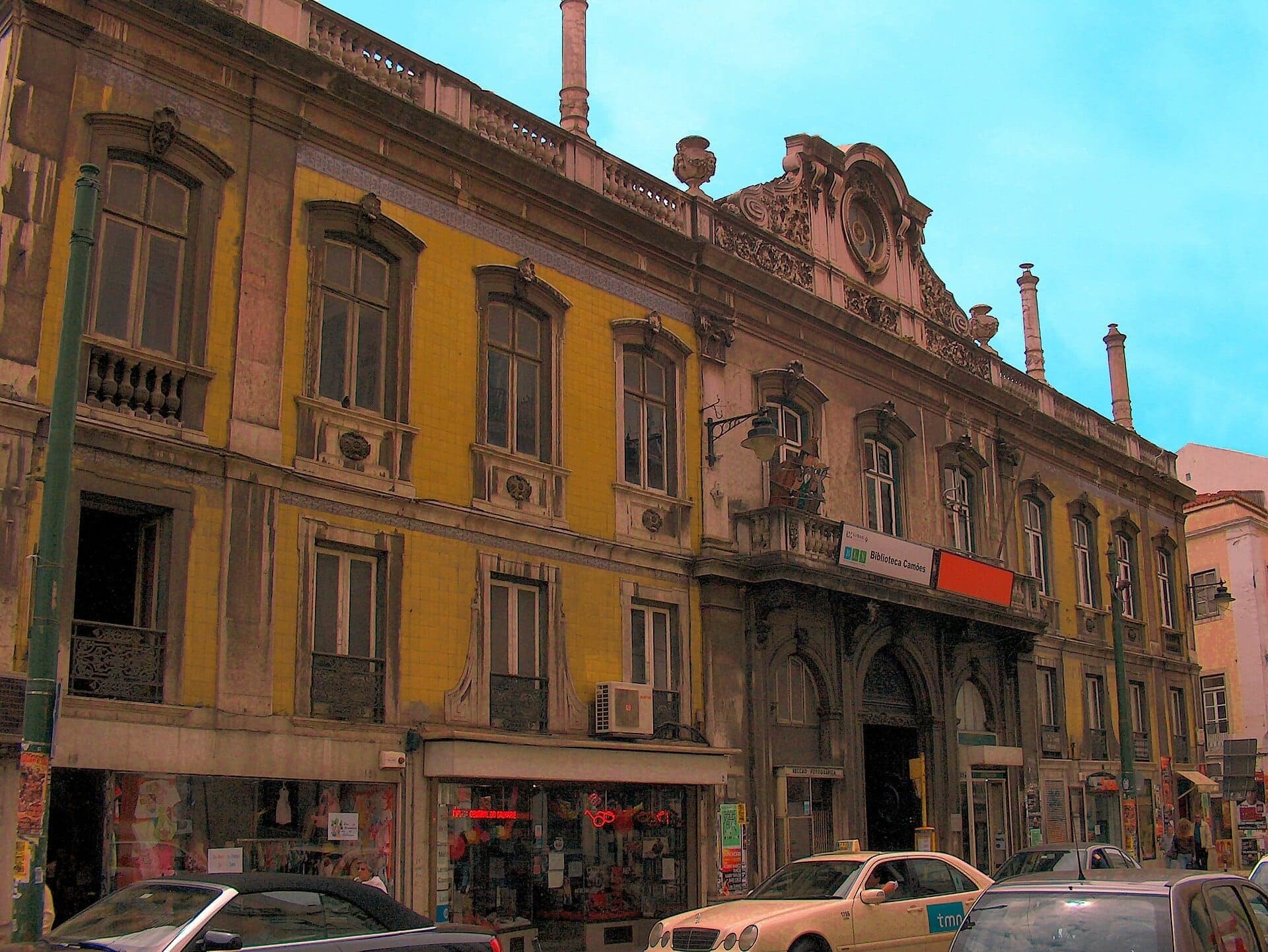
Largo do Calhariz: the Palace Razed in 1755
The 1755 earthquake razed this palace. The front you see today, Palácio Valada-Azambuja, rose after it.
- 12
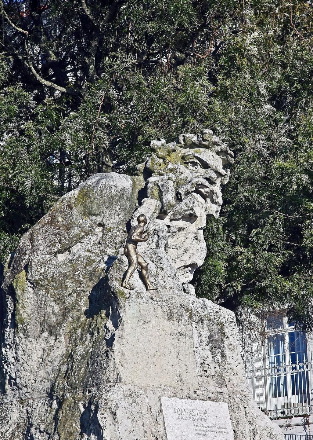
Miradouro de Santa Catarina: the Storm Giant
A storm giant stands above the Tagus. The fence around the terrace went up in 2019 after a neighborhood argument.
Details
Best Time to Visit
By day, when the Bairro Alto is quiet; it is loud at night and people live above the bars. Start by mid-morning on a Tuesday to Sunday to find São Roque's museum open, and avoid Mass at 12:30 if you want to step into the church. On a Saturday you can also catch the organic market in the Príncipe Real garden (around 07:00 to 14:00, by Visit Lisboa's listing) and the reservoir (listed Saturdays only). Santa Catarina draws a crowd at sunset and closes late at night. Checked 2 November 2026.
Pro Tips
- •Getting to the start: Rato Metro (Yellow line) is about 430 meters from the Botanical Garden's gate. The 24E tram's Rua da Escola Politécnica stop is about 60 meters away, though we could not confirm the 24E's current running with Carris. Checked 2 November 2026.
- •Getting away from the end: the 28E tram's Santa Catarina stop is about 180 meters from the terrace, and Baixa-Chiado Metro about 500 meters along Rua do Loreto. Checked 2 November 2026.
- •This walk uses no lifts. Lisbon's Glória, Bica, Lavra and Santa Justa lifts stopped carrying passengers in September 2025, and in early September 2026, the latest report we found, Carris gave no fixed date for reopening them all. Some official pages still tell visitors to ride the Glória: do not rely on them. Checked 2 November 2026.
- •Botanical Garden (stop 1): open daily except 25 December and 1 January, in winter 10:00 to 17:00, in summer 09:00 to 20:00, free on Sundays 10:00 to 13:00. It is not closed on Mondays, though the museum is. Checked 2 November 2026 at museus.ulisboa.pt.
- •Reservatório da Patriarcal (stop 3): the reservoir under the lake is run by the Museu da Água. Visit Lisboa lists it as open on Saturdays only, 10:00 to 17:30, last entry 17:00. We could not confirm this or the price with the operator, so check first. Checked 2 November 2026.
- •Museu de São Roque (stop 7): 8 EUR, or 12 EUR with Casa Ásia, Tuesday to Sunday 10:00 to 18:00. Checked 2 November 2026 at museusaoroque.scml.pt.
- •Lower terrace of São Pedro de Alcântara (stop 5): this walk stays on the upper terrace. Works on the lower platform's retaining wall were reported in May 2026 and we could not establish its state today. Go down only if the gates are open. Checked 2 November 2026.
- •Palacete Ribeiro da Cunha (stop 2): it has held shops since 2013, and the city approved a 50-room hotel project in July 2023, and a later report says the conversion is coming. Expect possible works, and we could not establish what is open inside today. Checked 2 November 2026.
- •Solar do Vinho do Porto (stop 6), Rua de São Pedro de Alcântara 39 to 49: the port wine institute's house, listed Monday to Friday 11:00 to 13:00 and 14:00 to 19:00. Checked 2 November 2026 at ivdp.pt.
Safety & Precautions
- •Tram crossings: between stops 1 and 2, stops 7 and 8, and stops 11 and 12, you cross both tracks of a tram line at a zebra with no lights (the 24E, the 24E and the 28E). Between stops 3 and 4 you cross the 24E at traffic lights, the only ones on the walk. Trams are quiet, so look both ways.
- •Rua da Rosa (stop 10): stop short of the street. Cars come up it toward you, and there is no marking where you cross its end on the way to stop 11.
- •Rua Luz Soriano (between stops 10 and 11) is the steepest street of the walk, narrow, with a narrow pavement, and its stone is slick when wet. Take it slowly. Cars pass close, coming from behind you. Walk in single file.
- •Rua Marechal Saldanha (between stops 11 and 12) drops on polished stone and is slick when wet. Take it slowly and keep to the wall side. Cars come from behind. Stairways lead off it: stay on the street.
- •Stops 1, 4 and 11 are close to tram tracks. Stand back from the curb. Near the end of the walk you also cross Rua de Santa Catarina with no marked control, so check for cars.
- •There are no flights of stairs on the route, but the lower streets are steep sett stone with narrow pavements, so it is not an easy route for wheelchairs or strollers.
- •Garden hours: we found no current official hours for the Príncipe Real or São Pedro de Alcântara gardens. Guides and older listings describe both as open day and night. If a gate is shut, walk the pavement around the square at Príncipe Real, and use the Rua de São Pedro de Alcântara pavement at the west gate for stops 5 and 6. Checked 2 November 2026.
- •Miradouro de Santa Catarina: the terrace has closed at night since 2019. We found no official hours: one 2026 guide gives 07:30 to 23:30, and an older listing 10:00 to 22:00. If it is shut, stay on Rua de Santa Catarina at the fence. Checked 2 November 2026.
- •The Bairro Alto is lived in and loud at night. Please keep your voice down, and stay out of doorways and courtyards.
Travel advisory: Exercise Normal Precautions (Level 1).
Gallery
Related Reading
Go deeper on what you'll see, hear, and walk through.
Read the walk
The full story of Bairro Alto and Príncipe Real: A Hill Planned Twice, in words. Prefer to listen? Play it narrated, from home or on location.
Introduction
Lisbon, the capital of Portugal, is built on hills, and this walk comes down one of them, from Príncipe Real's ridge through the Bairro Alto to a viewpoint over the river.
This hill was planned twice. Along the top, one grand project after another failed on the same ground, until a garden held, laid out over a water tank. Below it, a land deal of fifteen thirteen began a planned quarter of almost straight streets. The Jesuits' arrival turned that plan, and much later the newspapers moved in.
Three people come up: João Frederico Ludovice, the king's architect, who took a whole block for his house; Eduardo Coelho, a newspaper founder with a barefoot newsboy at his feet; and Luís de Camões, the poet whose storm giant waits at the end.
This is twelve stops over about one point eight kilometers, a little over a mile, in about seventy minutes. It stays high and close to level, never climbs more than a few meters at a time, then drops toward the river at the end, with no flights of stairs and no lifts. Two streets low down are steep and narrow, with cars, and you cross tram tracks four times; you will hear about each. The Botanical Garden and São Roque's museum are ticketed, and every stop works from the street. You begin at the Botanical Garden's gate on Rua da Escola Politécnica and finish at the Miradouro de Santa Catarina, above the Tagus.
1. Rua da Escola Politécnica: the Botanical Garden Gate
Welcome to Rua da Escola Politécnica, the road along the ridge where this walk begins. Stand at the wall side of the pavement, back from the road, because the twenty-four tram passes close. Find the gate of the Botanical Garden, with its drive running back behind it. The garden and the museum along that drive are ticketed, and the details are on this stop's card. This stop stays out here at the gate.
Read that drive as a list of tenants. Jesuit novices came first, in a novitiate on this site from sixteen oh nine until seventeen fifty-nine, the year the Jesuits were expelled. Next came the king's college for young nobles, from seventeen sixty-one. Then, from eighteen thirty-seven, the polytechnic school whose name is still on this street's sign, and after it the university's Faculty of Sciences.
The garden behind this gate belongs to the polytechnic years. The school wanted space for the natural and experimental sciences, so its garden was built to teach, and it opened in eighteen seventy-eight.
A hundred years later, in March nineteen seventy-eight, a fire destroyed much of the main building, along with its zoology collections. The last class was held in nineteen ninety-eight, the last research center left in two thousand two, and the site now holds the museum.
So this one plot has already had four tenants. Keep the Jesuits in mind, because they come back several times on this walk.
Follow the route along this pavement. You cross the road at a zebra with no lights, over both tracks of the twenty-four tram, so look both ways. A second zebra takes you into the garden at its corner.
2. Príncipe Real: the Palacete Ribeiro da Cunha
Walk on along the path from the corner, in among the huge fig trees with their roots standing out of the ground, and stop there.
This is the Jardim do Príncipe Real. The state has classified three of this garden's figs, and its decree gives the reason: their peculiar roots and trunks. The largest measures more than nine meters around the base and stands twenty-one meters tall. They were about a hundred and fifty years old in twenty eighteen. Follow the roots of the nearest one along the ground and you can see what the decree means.
The house this stop is about stands across the road, beyond the edge of the garden. Search the rooftops for four small domes, one at each corner, above stepped battlements and horseshoe arches. When the trees are in leaf they may hide much of it, so take what you can get between the branches.
That is the Palacete Ribeiro da Cunha, a fantasy of Moorish arches begun in eighteen seventy-seven for a wealthy capitalist of that name. When the state classified it a Monument of Public Interest in twenty nineteen, it described a house that came out of a society dominated by a moneyed commercial class.
Think about what that money was buying. A house facing a garden. Only a generation or so before, this same ground was still being leveled, and there was no garden to face. What stood here earlier is a long list, and you get it at the next tree.
Follow the route along the path, deeper into the garden. Next is a tree that everyone calls a cedar.
3. Príncipe Real: the Cedar That Is a Cypress
Walk on along the diagonal path until a wide, flat roof of branches spreads out beside you, held up on a metal frame, and stop there.
Everyone calls this a cedar. It is a cypress, a Mexican cypress the Portuguese named for Buçaco, from the mountains of Mexico and Central America. It is seven meters tall and about thirty meters across, its crown trained sideways into an arbor, its branches resting on that frame, so people sit under one tree as if under a roof. It was planted around the time the garden was made, in the eighteen sixties.
Now the ground, which had a bad run. By seventeen forty, a count's unfinished palace stood here in ruins, treated as the Bairro Alto's rubbish tip. It was sold to the Jesuits for a mission college, and the earthquake of seventeen fifty-five ended that. A new basilica held its first Mass here in seventeen fifty-six, and in seventeen seventy-one a great fire destroyed it. A royal treasury was begun here in seventeen eighty-nine, and in seventeen ninety-seven it was abandoned, with only two courses of stone above the ground.
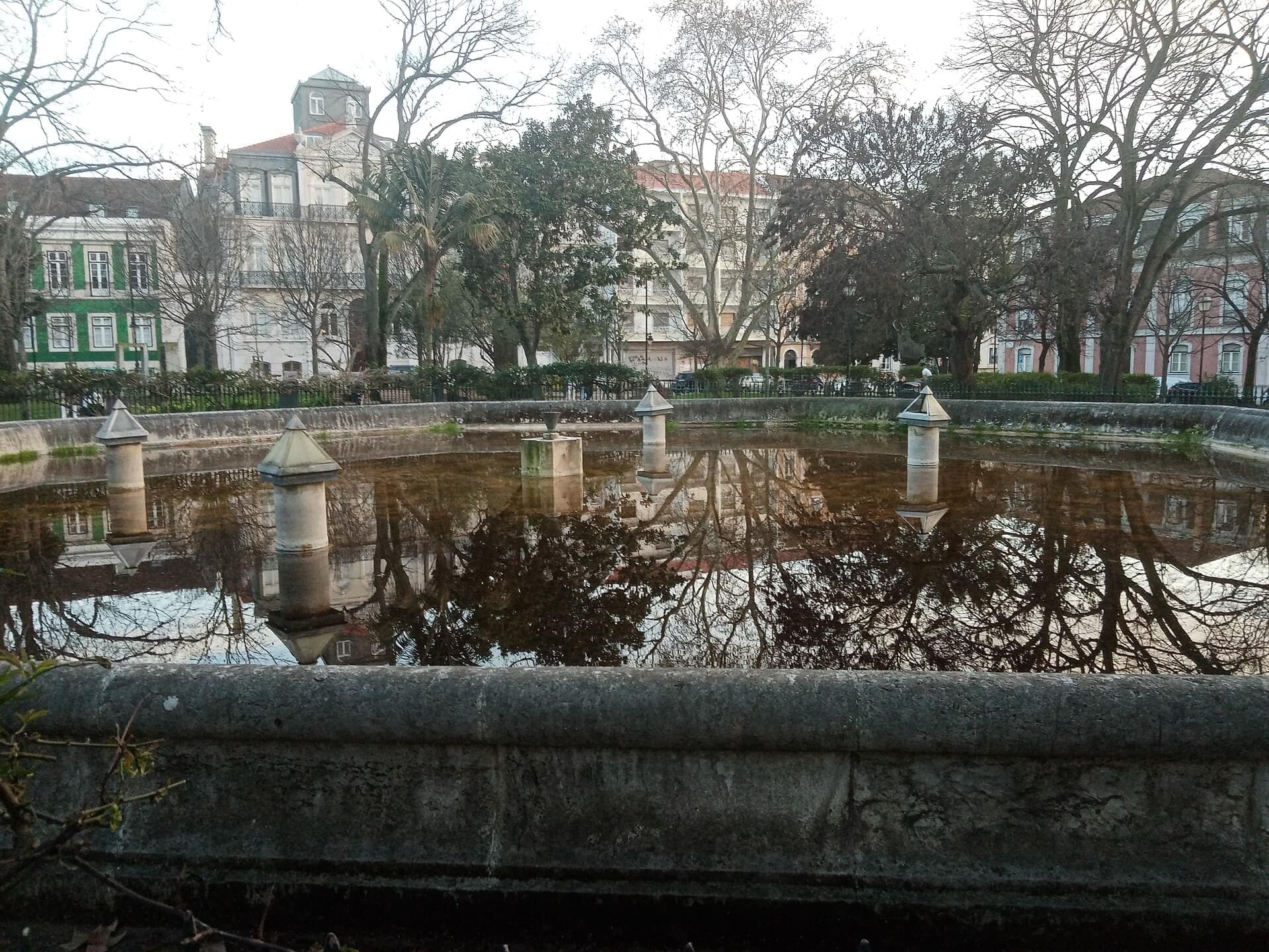
What finally held was this garden. Toward the middle of the garden is its eight-sided lake, which you may catch through the trunks. Under that lake, not under you, is a reservoir designed by a French engineer: an eight-sided chamber whose thirty-one pillars, each more than nine meters high, carry the tank. It was finished by eighteen sixty-four, and it fed public fountains, one of them on the terrace two stops from here. After all those palaces, the plan that held was a park on top of a water tank.
Follow the route across the garden to its far corner. A zebra takes you over the square's road, then you cross Rua Dom Pedro Quinto and the tracks of the twenty-four tram at the lights, the only traffic lights on this walk.
4. Rua Dom Pedro V: the Top Edge of the Grid
Walk on slowly along this pavement until a long, straight street opens up across the road and the tram tracks, running away downhill. The view only lines up for a few steps. Stop there, back from the curb, because the tram passes close.
That street is Rua da Rosa. It is the one street that runs through the whole quarter, from one end to the other, and you will meet it again from the inside. Through the tram wires, it looks like a line ruled across a map.
You have reached the top edge of the Bairro Alto, the High Quarter, a planned quarter begun in fifteen thirteen. But this edge is not fifteen thirteen. The first streets lay far down the slope, and this frontage came last.
Look along Rua Dom Pedro Quinto, signed with a Roman five, at its fronts, four and five floors of apartment houses. They are a nineteenth-century screen. When this road was straightened, these tall buildings went up along it, and they hid what lay behind: patios and one-story houses on a count's old lots, still half country.
Now feel the shape of the hill. This is a plateau, averaging about seventy-six meters up. Behind the buildings at your back, the ground drops away sharply. On the side you are looking at, it falls much more gently, and that is the side the streets run down, toward the river.
The ridge you have just walked was the place for palaces that failed. The slope below it was the place for a plan that worked, and that is where this walk is going.
Follow the route along this pavement. Next is a terrace with the valley spread out below it.
5. Jardim de São Pedro de Alcântara: the Upper Terrace
Walk on onto the terrace and go to the railing, where the city opens up across the valley. This is the Jardim de São Pedro de Alcântara. The railing gets crowded, and crowds draw pickpockets, so keep your bag closed and in front of you. On the far hill is the castle, its walls…
Full narration for this stop unlocks with the tour.
6. Palácio Ludovice: the King's Architect's Block
Carry on to the end of the garden path and stop there, back from the road. Look across the road at the big block with stone-framed windows and balconies. This is Palácio Ludovice. It was the home of João Frederico Ludovice, the architect of King John the Fifth, built in…
Full narration for this stop unlocks with the tour.
7. Igreja de São Roque: Plain on Purpose
Walk out into the open square, Largo Trindade Coelho, until you stand square on to a flat stone church front, well back from its flight of steps with an iron rail. This is the Igreja de São Roque, the church of Saint Roch. The museum beside it is ticketed. We found no charge for…
Full narration for this stop unlocks with the tour.
8. Travessa da Queimada: the Seam in the Grid
Walk on along the lane to the point where it crosses Rua do Diário de Notícias, and stop at the crossing. People live above these bars, quiet by day and loud at night, so keep your voice down and stay out of the doorways. Look up at what repeats here: stone blocks at the…
Full narration for this stop unlocks with the tour.
9. Rua do Diário de Notícias: the Paper's Street
Keep going down this street and stop at the next cross-lane. Look for the street sign: Rua do Diário de Notícias, Daily News Street. It was laid out in the fifteen thirties as Rua dos Calafates, Caulkers' Street, for the ship workers who tarred the planks of boats. Think back…
Full narration for this stop unlocks with the tour.
10. Rua da Rosa: How to Read a House
Walk on along the lane and stop just before it meets Rua da Rosa. Cars use that street, coming up from downhill, so stay out of the road. Step to the corner only to look along it, both ways. This is the street you looked down from the ridge. From up there it looked like a ruled…
Full narration for this stop unlocks with the tour.
11. Largo do Calhariz: the Palace Razed in 1755
Come down to the foot of the street, then along the square, Largo do Calhariz, as far as the striped crossing, and stop on this side of it, well back from the tracks, because trams pass close here. Across the two tracks is a long front with three round arches at street level.…
Full narration for this stop unlocks with the tour.
12. Miradouro de Santa Catarina: the Storm Giant
Walk on along the path onto the terrace and stop by the rough, dark figure of stone, half man and half rock, facing the river. If the terrace has shut for the night, stop at the fence on Rua de Santa Catarina, which keeps part of the view. This is the Miradouro de Santa…
Full narration for this stop unlocks with the tour.
- Formerly Instituto Dos Vinhos (Lissabon 2016) — Paul Arps from The Netherlands, CC BY 2.0 · source
- pt:Palácio Valada-Azambuja. Fachada do Palácio Valada-Azambuja, Lisboa, Portugal. — João Carvalho, CC BY-SA 3.0 · source
- (none) — Vitor Oliveira from Torres Vedras, PORTUGAL, CC BY-SA 2.0 · source
Images may be cropped or resized. Other photos via Unsplash and Pexels.