Ward's and Algonquin: The Island Village That Beat the Eviction
The bridge to Algonquin Island carries a single asphalt lane over a narrow channel, with a public path on the lake side and a low wooden rail on the city side. Stand on the bridge. Listen. There are no cars. There is no engine noise. You are standing at the edge of a residential village of roughly two hundred and fifty households, on Ward's Island to the east and Algonquin Island to the west, the only Canadian residential community to fight a municipal expropriation through three decades and win it in a court of legislature.
The fight began in 1953. The win came in 1993. Six decades of organising, court action, occupation, and political pressure stand between the two dates. The village is what those decades produced.
What was on the Islands before the fight
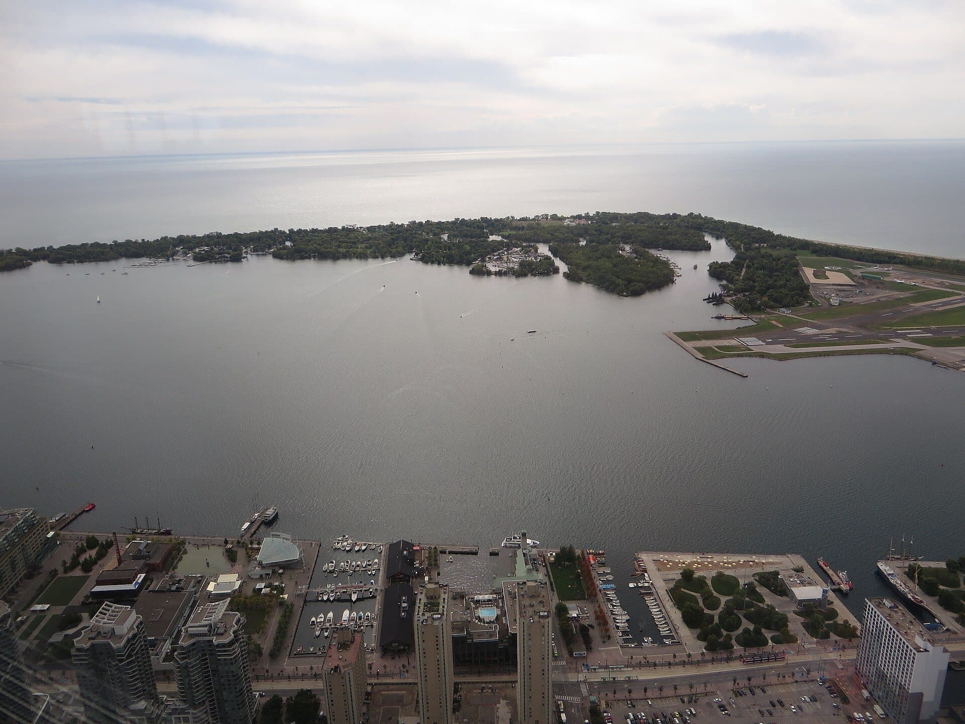
The Toronto Islands were Mississauga of the Credit territory used for fishing, hunting, and seasonal camps for centuries before the European city arrived. They were attached to the mainland as a peninsula extending east from the Don River until the storm of April 1858 opened the Eastern Gap and made them a true island chain. Through the late nineteenth and early twentieth centuries, the Islands developed as a working-class summer escape. By the 1920s, several thousand cottages had been built across Centre Island, Hanlan's Point, Ward's Island, and what would later be called Algonquin Island (originally a sandbar, formally created as a residential lot block in the 1930s by Toronto Harbour Commission landfill).
The cottages were on leased land. The land was owned originally by the City and after 1953 by Metropolitan Toronto, the upper-tier regional government created that year. Most cottages had been winterized by the 1930s and were occupied year-round. By the 1950s, the Islands were home to a community of roughly six hundred and fifty households, mostly working-class, mostly transit-dependent on the ferry service. Centre Island had a school, a church, two bowling alleys, and a small commercial strip. The community was not affluent. It was, by 1950s standards, a closely-knit working community on territory that the new Metro government had decided was an underused public asset.
The 1953 vote and what followed
The Metro Council established in 1953 was chaired by Frederick Gardiner, a Toronto lawyer and the architect of the postwar Metro expansion. Gardiner had a parks vision for the Islands. He wanted the residential cottages cleared and the entire archipelago turned into regional parkland, accessible to all of Metro's population by ferry. In 1956, Metro Council voted to expropriate every cottage on the Islands and clear the residential community.
The demolitions began with Centre Island and Hanlan's Point, the two largest residential clusters. Over four hundred cottages were demolished between 1956 and the end of the 1960s. Photographs in Sally Gibson's More Than an Island (1984), the standard chronicle of the community, document the empty foundations and the trucked-out building materials. Centre Island had been the largest residential cluster on the chain. By 1969 it was a public park.
The residents of Ward's Island and Algonquin Island, two smaller clusters on the eastern end, organised. They formed the Toronto Island Residential Community (the TIRC) in 1969. They lobbied. They sued. They occupied their cottages through eviction notices. They built a legal-aid network of Toronto lawyers willing to file motions on contingency. The litigation slowed the demolitions through the 1970s without stopping them.
July 28, 1980
On July 28, 1980, Metro Toronto sent a sheriff to the Algonquin Island bridge to enforce a fresh round of evictions. The residents met him at the bridge. They linked arms in front of their houses. The bridge is narrow. The sheriff could not get through. The eviction was halted.
The 1980 blockade is the photographed event in the community's archive. The press coverage was extensive. The Globe and Mail, the Toronto Star, the CBC's news service all carried the story over the following week. The political consequence was immediate: the Province of Ontario, then governed by Bill Davis's Progressive Conservative government, intervened to negotiate a stay on further evictions while a long-term resolution was worked out. The stay lasted thirteen years.
Through the 1980s, the community continued to live in the cottages under tenuous tenure. Metro did not concede the principle that the Islands should be cleared. The community did not concede the principle that they had a right to stay. Negotiations cycled through three premiers (Davis, then Frank Miller, then David Peterson) without reaching a settlement.
The 1993 act
The settlement came under the New Democratic government of Bob Rae, elected in 1990. The Minister of Municipal Affairs at the relevant moment was the riding MPP for Toronto-Riverdale, Marilyn Churley, who had been one of the lawyers active in the community's defence in the 1980s and brought intimate knowledge of the file to the legislature. The Toronto Islands Residential Community Stewardship Act (Statutes of Ontario, 1993, chapter 15) was passed in June 1993.
The act granted long-term land leases to the surviving households on Ward's and Algonquin, administered by the Toronto Island Community Trust, with tenure running to 2092. The evictions ended. The community was legal. Roughly two hundred and fifty households, of an original six hundred and fifty, survived to the legal recognition. The four hundred Centre Island and Hanlan's Point households that were cleared between 1956 and 1969 did not.
The act is the legal instrument that ended the fight. It is also a piece of unusual Canadian statute work, in that it grants the right to live on public land in perpetuity (or near enough; the leases run ninety-nine years from 1993) to a defined community in exchange for the community's stewardship of the surrounding parkland. The trust administers the land, collects the lease payments, and handles the transfer of leases when households change hands. The model has not been replicated in any other Canadian jurisdiction.
Why the community could not be cleared, when so many similar communities could be
The honest version of the answer is geography, time, and one specific 1980 confrontation. The Islands are physically separated from the mainland. The eviction force had to be ferried across, or to approach by boat, or to walk across the narrow bridge to Algonquin. The cost of moving sheriffs and bulldozers to a residential cluster of a hundred and fifty households on Algonquin and roughly the same on Ward's was higher per household than for any mainland eviction, and the community used that geography. The blockade at the Algonquin bridge worked because the bridge could not be widened on short notice. There was no flanking route.
Time matters because the political climate around urban renewal shifted dramatically between 1956 (when high-modernist clearance was the consensus position of every major North American city government) and 1980 (when Jane Jacobs's The Death and Life of Great American Cities had been in print for nineteen years and the consensus had reversed). The community survived because it outlasted the political model that had ordered its erasure. Metro Council in 1980 was no longer the same body, ideologically, that Metro Council in 1956 had been. The 1980 sheriff was enforcing a 1956 decision in a political climate that had stopped supporting it.
The specific 1980 confrontation matters because political will to enforce dissolves when the enforcement requires images of a sheriff stepping over residents' linked arms. The blockade was not a stunt. It was a precise reading of what the province would and would not let Metro do in front of cameras. The reading was correct.
What to look for
Walk slowly across the bridge from Centre Island to Algonquin Island. Stay on the public path. Do not photograph individual houses. Do not look into windows. The cottages on both sides of the path are private homes. Some have been in the same family since the eviction fight began in the 1950s. The lease registry at the Toronto Island Community Trust documents the continuous-family households; the press is welcome to see the registry; private photographs of private homes are not the form of access that the community has agreed to.
The houses are small. Most are single-storey. The construction is a mix of original 1920s and 1930s building stock and infill from the postwar years. The streetscape has no cars. The roads are gravel paths wide enough for the community's small electric utility carts and emergency vehicles. The trees are mature. The gardens are kept by the residents.
The Algonquin Island Bridge, where you came in, is the site of the 1980 blockade. There is no plaque. The community has not memorialised the moment with public signage; the memory lives in the community's archive at the Ward's Island community centre and in the published works that record it. Sally Gibson's More Than an Island (1984) is the standard. The Toronto Island Community Trust public records carry the supplementary material.
When you have finished walking the village, return west along the path and continue east a short distance to the Ward's Island ferry dock. The Ward's ferry will take you back to the Jack Layton terminal on the mainland. The same ticket covers your return. Keep walking quietly until you are off the residential paths.
The question the wider waterfront walk asks (who got to decide what the waterfront was for) has its sharpest answer here. At Ward's and Algonquin, the residents decided. They are the only community on the corridor of which that can be honestly said.
Explore Toronto with Roamer
Take these audio tours to experience the stories mentioned in this guide