Historic Center: The City of Kings, Rebuilt
105 min · 2.5 km · easy
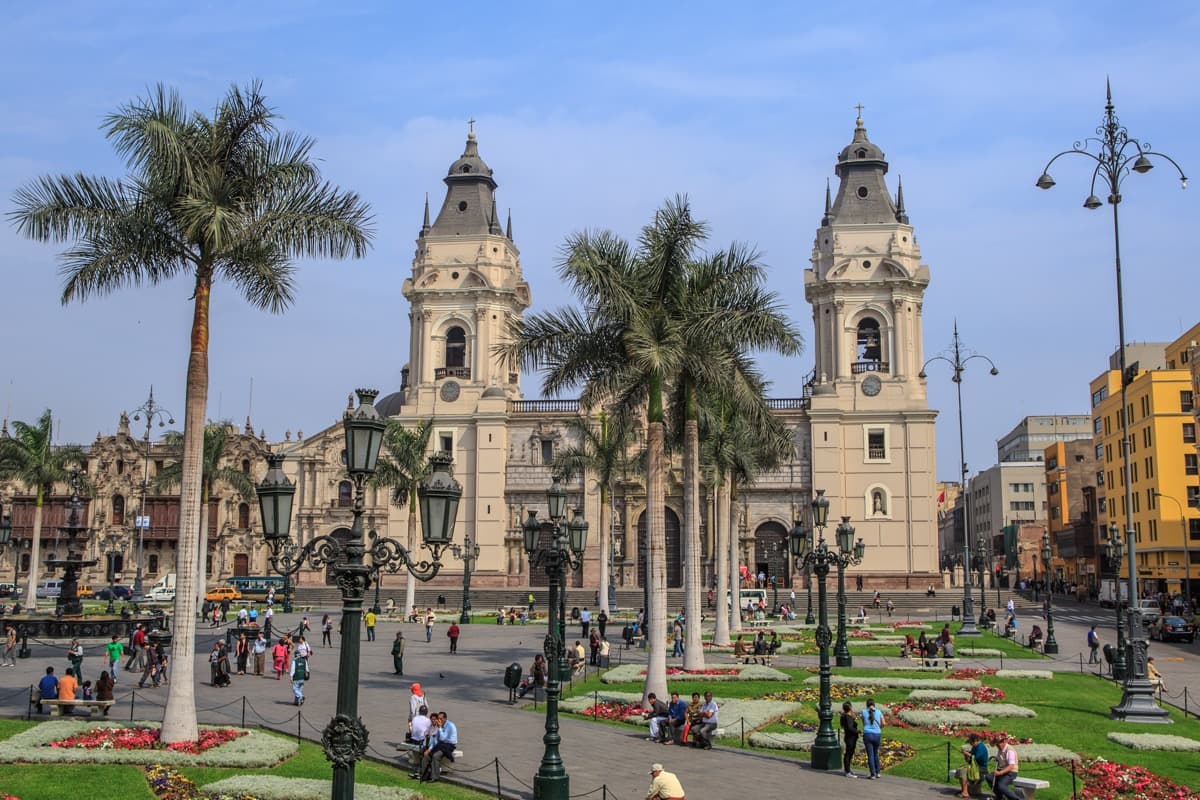
The first thing to understand about Lima is that it faces the wrong way. The historic center, the colonial heart with its Plaza Mayor, its Cathedral, and Pizarro's bones in the cathedral, sits several kilometers inland, about twelve from the port of Callao. The river runs through it, but the ocean is a separate fact, visible only from the cliffs of the modern neighborhoods to the west. For most of the city's existence, the colonial residents did not walk to the beach. The beach was for fishermen and laundresses. The capital looked east, toward the Andes and the silver.
That orientation is the founding constraint of the city and the explanation of almost everything about it.
Why Pizarro put it there
In January 1535 Francisco Pizarro founded Lima in the valley of the Rímac River, on the lands of a local lord, the curaca Taulichusco. The founding act is dated 18 January 1535. The town was laid out as a checkerboard of about 117 blocks, each about 125 metres a side, decades before the Crown wrote that pattern into law in 1573.
The site lay on a river that could supply fresh water, about twelve kilometers from the natural harbor at Callao. Pizarro called it Ciudad de los Reyes, the City of Kings, probably for the Three Kings of Epiphany: the search party that chose the site had set out on 6 January. The name Lima is older than the Spanish. It comes from an old word meaning "the one who speaks", the name of a pre-Inca oracle, and sixteenth-century documents call the river the río de Lima. The street grid Pizarro laid out is still the street grid of the historic center. Pizarro built the first Government Palace in 1536 on part of Taulichusco's buildings, and the President of Peru still works on that site, in a palace finished in 1938.
The logic was supply. Lima was the city the Pacific could feed. Every other identity it has taken on since is downstream of that fact.
The viceregal city
Hear a stop from this walk
Casa de Osambela: The Lesson of 1746
Until the middle of the eighteenth century, in UNESCO's words, Lima was the capital and most important city of the Spanish dominions in South America. The cathedral's first church opened in 1540; its two towers fell in the earthquake of 1746. The University of San Marcos, founded by royal decree on 12 May 1551, held its first classes in the Dominican convent of Santo Domingo. The Inquisition held about forty autos de fe in Lima between 1570 and 1820. Silver from Potosí, the great mountain mine in what is now Bolivia, was hauled overland to Lima and shipped north along the coast to Panama for the trans-Atlantic crossing.
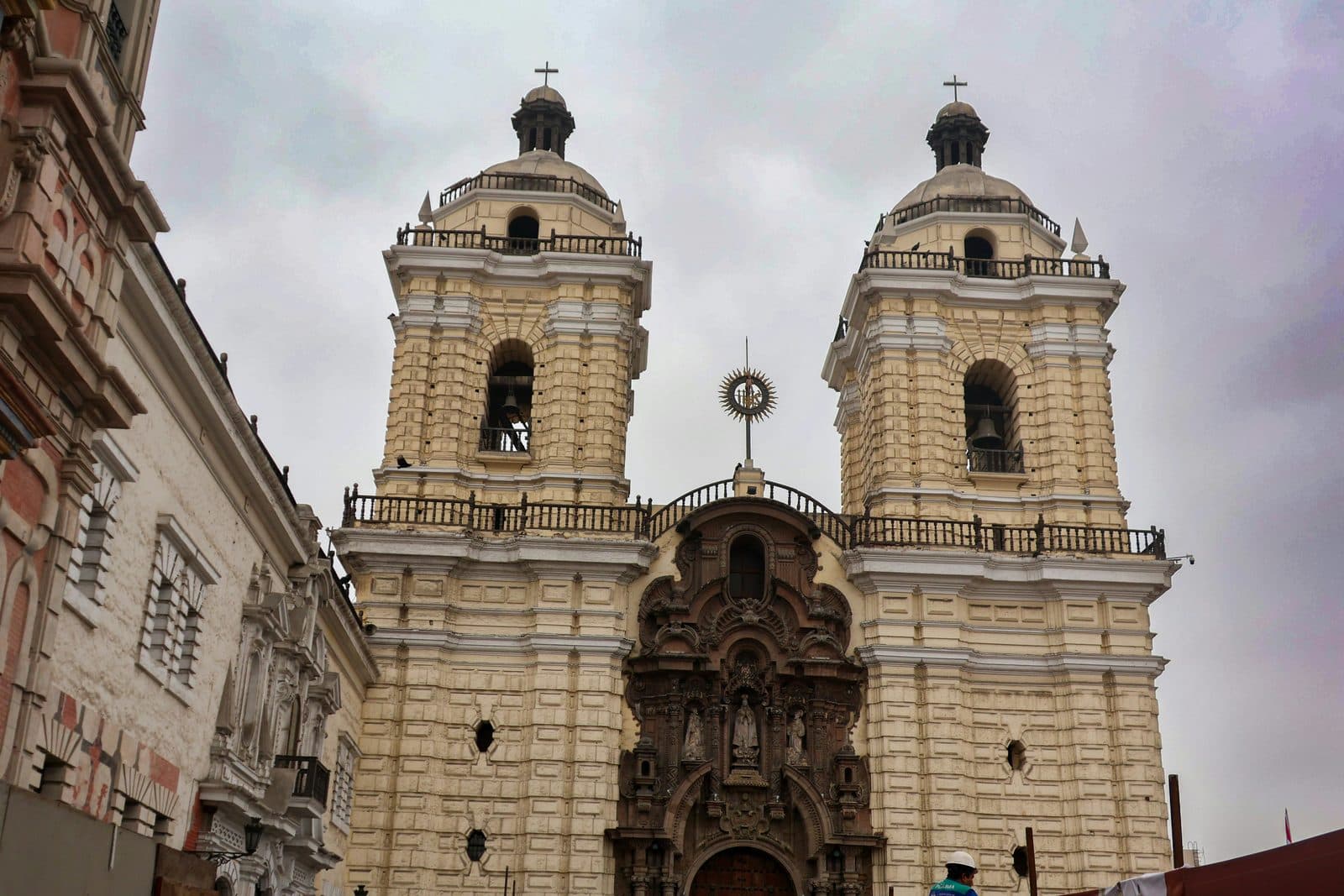
What viceregal Lima built, the earthquakes of 1687 and 1746 kept knocking down, and much of what looks colonial today was rebuilt. The carved stone front of La Merced, its stone brought down from a highland quarry by mule in 1697, is a twentieth-century reconstruction of the old one. The carved wooden balconies of the Archbishop's Palace are not colonial at all: the palace was finished in 1924, copying the 1730s Torre Tagle palace a few blocks away. Beneath San Francisco, catacombs hold the bones of tens of thousands of Limeños, buried there until the city cemetery opened in 1808. These are the signatures of a city that for most of its history saw itself as a Spanish capital that happened to be located in South America, and of a republic that later rebuilt the colony it wanted to remember.
The honest qualification: that self-conception was a fiction maintained by extraction. The viceregal economy ran on the labor of Andean and African workers who had no political voice and limited legal standing. The criollos, the American-born descendants of Spaniards, ran the colonial city. The mestizos, mixed-descent, did most of its skilled trades. The indigenous and African populations did its hardest labor. The grand façades and the gilded altarpieces are paid for by that hierarchy. A reading of Lima that does not see this misses the half of the city beneath the polish.
The break in 1821
On July 28, 1821, the Argentine general José de San Martín first proclaimed Peruvian independence in the Plaza Mayor. The Spanish forces had retreated to the highlands. The viceroyalty had ended in name. It took three more years and the Battle of Ayacucho in December 1824 to end it in fact, but the political center of gravity had shifted. Lima was now the capital of a republic instead of a viceroyalty. The Plaza Mayor became the Plaza de Armas. The Archbishop's Palace lost its monopoly on civic life. The grid stayed.
The nineteenth century reshaped Lima in fits. The Chincha Islands War in 1864 and the disastrous War of the Pacific from 1879 to 1883 left the country bankrupt and the capital partially occupied by Chilean forces. Plaza San Martín, the grand civic square inaugurated for the centennial of independence in 1921, dates from the recovery period that followed.
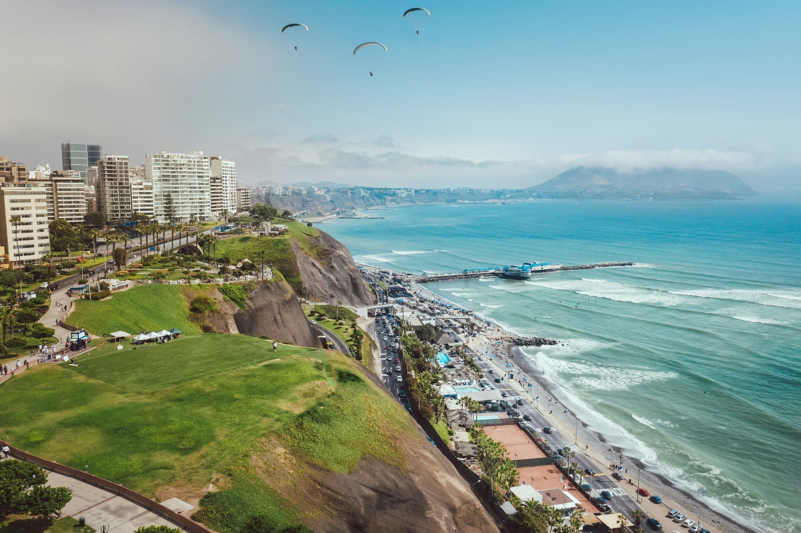
It was during the late nineteenth century that the coast finally became something other than fishermen's territory. Wealthy Lima families built summer houses on the cliffs at Chorrillos, Miraflores, and Barranco. In 1876 Barranco opened a wooden bridge, the Puente de los Suspiros, over the ravine whose path led down to the bathing houses on the beach. When Chilean troops set much of Barranco on fire in 1881, part of the bridge burned; it was repaired, and it is still there. The summer town those families built, and every way they found down the cliff to the sea, is what the Barranco walk reads today.
The coastal megacity
In 1940, Lima had a population of about six hundred thousand. By 2020, it had almost eleven million. The intervening eighty years are a demographic event. Migration from the Andean highlands, driven by rural poverty and intensified by the political violence of the 1980s and early 1990s, reshaped the city into a vast, sprawling, mostly informal coastal megacity. The historic center is now a sliver of the urban whole. Most Limeños live in neighborhoods that did not exist when their grandparents were born.
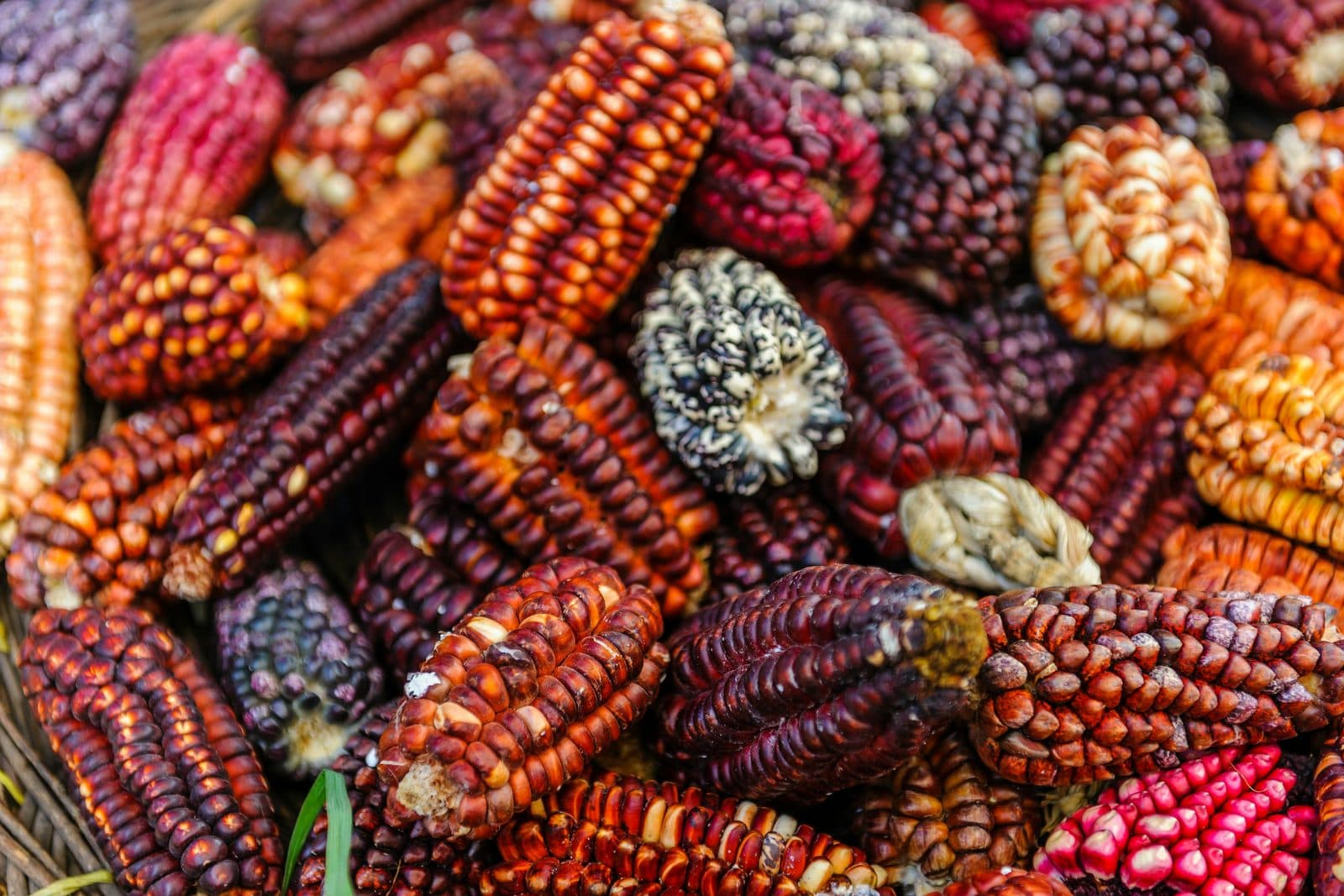
The food is the legible result. Criollo cuisine, the Lima-coastal cooking tradition, is built from the same logistical fact that founded the city. Ceviche works because the Humboldt Current that runs up the coast brings cold water and a Pacific fishery one of the densest in the world. The lime came with the Spanish; the chili came up from the rainforest; the cilantro is Mediterranean. The Chinese-Peruvian chifa tradition arrived with indentured laborers in the 1850s. The Japanese-Peruvian nikkei tradition arrived with immigrants in the 1890s. The Andean ingredients, potatoes, quinoa, aji amarillo, came down from the highlands with the migrants. The result is a hybrid coastal cuisine that the rest of the world only began to take seriously in the 2000s, and that you can eat for under five soles at any market.
How to walk the three tours
The Historic Center: The City of Kings, Rebuilt walk covers the colonial core in twelve stops and about 2.5 kilometres, roughly an hour and three quarters: from Plaza San Martín along the Jirón de la Unión to La Merced, Torre Tagle's balconies, San Francisco, the old Desamparados railway station, the Plaza Mayor, Santo Domingo and the Casa de Osambela. Its thesis is that the center is older than it looks and newer than it looks: a 1535 grid and a 1651 fountain, under fronts that the earthquakes and the 1920s rebuilt. The San Francisco catacombs are a guided, ticketed visit rather than a stop.
The Barranco: The Bridge of Sighs and the Way Down to the Sea walk covers what came next, in eleven stops and about 1.8 kilometres, roughly sixty-five minutes. It starts at the Museo de la Electricidad on Avenida Pedro de Osma, where the 1904 electric tram to the sea is remembered, and follows the summer town's ways down to the water: an English promenade on the cliff, a street that once ended at a water-driven funicular, the Bajada de Baños, the bridge, first opened in 1876 and partly burned in 1881, and La Ermita, whose present church of 1901 has been a restoration worksite since June 2026. It ends at the Mirador Catalina Recavarren, above cliffs of Ice Age river gravel up to about seventy metres high. Two museums, the Pedro de Osma, with viceregal art in a 1906 house, and MATE, for photography, are a short detour south.
The Miraflores: The Village That Walked to the Edge walk follows the district most visitors sleep in, in eleven stops and a little under three kilometres, about an hour and a half: from Parque Kennedy and its cats past the church, the town hall and the Tarata memorial, down Avenida Larco, opened as an avenue in 1941, to Larcomar in the cliff, then along the cliff-top parks to El Beso and the paraglider launch.
Together, the tours describe the founding logic and the long inversion. The colonial city kept its back to the sea. Five centuries later, the most desirable addresses in Lima are on the cliff.
The grey
One more thing to know. Lima sits on the Pacific coast at twelve degrees south latitude. It almost never rains. The Humboldt Current cools the air enough to produce a thick coastal fog, the garúa, that hangs over the city from roughly May through November and is responsible for the famous Lima grey. The fog is the reason the colonial city looked so brilliantly white when the sun came back in summer. It is also the reason that, for most of the year, you will walk through a softly muted, persistently overcast city that bears almost no resemblance to the postcard cliché of tropical South America. Bring a light jacket. Trust the grey. It is the city's true climate, and the architecture was designed for it.
Frequently asked questions
- How many self-guided walking tours are there in Lima?
- Roamer currently has 3 self-guided audio walking tours in Lima. Every tour is free to start: the introduction and first stop play in full, and every later stop plays a short preview before you decide to buy.
- How much does a self-guided walking tour in Lima cost?
- Each tour is free to preview and $4.99 for lifetime access. If you want more than one, a 7-day pass is $12.99 and a 30-day pass covering every tour is $19.99, which works out to well under a dollar a day.
- Can I do the Lima tours offline?
- Yes. Tours can be downloaded in advance in the Roamer app and played with no signal, which is useful when you are travelling without mobile data.
- How long are the Lima walking tours?
- They run from about 65 to 105 minutes, covering 1.8 to 2.9 km on foot, with up to 12 stops on the longest route. You set the pace and can pause any time.
Ready to experience it?
Historic Center: The City of Kings, Rebuilt
105 min · 2.5 km · easy
More from Lima
Explore more at your own pace.
Best Self-Guided Walking Tours in Lima (2026)
Lima Travel Guide: How Many Days, Getting Around, When to Go (2026)
One Day in Lima: A Coast-to-Colonial Itinerary (2026)
Best Culture Walking Tours in Lima (2026)
What to Eat in Lima: A Food Guide (2026)