To understand why Guadalajara looks the way it does, you have to understand that the city you walk through downtown is not the city the Spanish founded. It is the city that two twentieth-century governors built, on top of the colonial one, by ordering the demolition of blocks of older buildings to open the geometry that exists today.
The colonial template was simple. When the Spanish founded Guadalajara in 1542, after four failed attempts at other locations, they laid out a city according to the Laws of the Indies. A central plaza with the cathedral on one side and the government palace on another, then a grid of streets running outward, then the more important churches and convents at intersections in the grid. Every Spanish colonial city in Mexico followed this template. Mexico City, Puebla, Oaxaca, Mérida, Antigua. One central Zócalo, the cathedral as the spine of the town.
Guadalajara had that, for nearly four hundred years. The cathedral was consecrated in 1618. Construction had begun in 1561. The plaza in front of it, the Plaza de Armas, anchored the city's civic life. The Palacio de Gobierno, the seat of provincial then state government, faced it across the square. By the early nineteenth century, when Father Miguel Hidalgo took the city during the war of independence and signed the abolition of slavery inside the Palacio on the sixth of December, 1810, Guadalajara still had one central plaza and the Spanish template still held.
Then, slowly, the template was rejected.
The first wave: the 1950s
The decisive moment came under Governor Jesús González Gallo, who in 1950 ordered the demolition of an entire block of colonial buildings east of the cathedral. The block sat between the cathedral and the Teatro Degollado, a neoclassical theatre completed in 1866 during the French Intervention. The two buildings, separated by a block of older construction, did not have a visual connection. González Gallo wanted one.
The block came down. The space it left was paved into Plaza de la Liberación, sometimes called the Plaza of the Two Cups for the pair of large fountains at its east and west ends. The plaza opened the cathedral's east face directly to the theatre's west face, creating a grand visual corridor about three hundred metres long. The new plaza sat over an underground parking garage built into the void left by the demolitions, which is why the surface today is perfectly flat.
The decision was controversial then and remains contested. Preservationists argued, and still argue, that the block of demolished buildings represented an irreplaceable layer of colonial fabric. The state government argued, and the city's residents largely accepted, that the resulting plaza was a public good of greater value than the buildings it replaced.
The same decade, the Rotonda de los Jaliscienses Ilustres opened on the north side of the cathedral. Architect Vicente Mendiola designed it in 1952 as a circle of seventeen Doric columns, each over seven metres tall, topped by a ring that appears to float without a dome. Around the rotunda, bronze statues of Jalisco's most distinguished citizens stood in a small park. Beneath the floor, the actual bones of those citizens. The state was building both a monument and a mausoleum on the cathedral's north side at the same time it was opening the eastern arm of what was becoming a cross.
The first wave of the cross was complete by the mid-1950s. Cathedral in the centre. Plaza de Armas to the south, with the older bandstand. Plaza de la Liberación to the east. Plaza Guadalajara to the west. Rotonda to the north. Four arms around the cathedral, the cross-of-plazas pattern.
The second wave: the 1980s
Hear a stop from this walk
Hospicio Cabañas (UNESCO World Heritage Site)
The 1980s extended the cross outward. Governor Flavio Romero de Velasco, between 1978 and 1982, ordered the demolition of thirteen city blocks east of the Teatro Degollado to create the Plaza Tapatía, a five-hundred-metre pedestrian esplanade that runs east to the Hospicio Cabañas. The displaced residents and businesses numbered in the hundreds. The colonial buildings lost included structures dating to the eighteenth century.
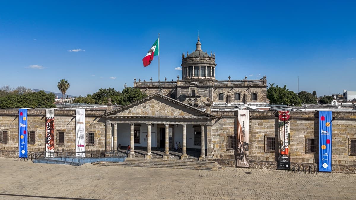
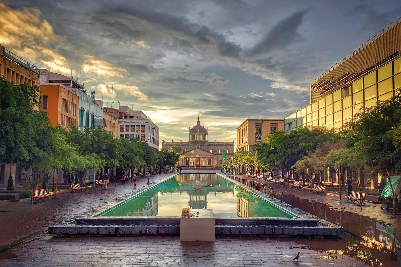
The argument for the demolition was the same as for the earlier one. The Hospicio Cabañas, the vast neoclassical orphanage designed by Manuel Tolsá and completed in stages between 1805 and 1845, holds José Clemente Orozco's mural cycle from 1938 and 1939, including El Hombre de Fuego on the chapel dome. UNESCO would inscribe the building as a World Heritage Site in 1997. The Plaza Tapatía was designed to give Orozco's masterpiece a five-hundred-metre processional approach, with the bronze Inmolación de Quetzalcóatl sculpture by Victor Manuel Contreras as its midpoint and the cathedral's east face as the view back.
What you walk today, then, is the result of two waves of clearance, separated by thirty years, each defended at the time as a public improvement. The cathedral sits at the cross's centre. The Plaza Tapatía extends east as a pedestrian boulevard about half a kilometre long, lined with arcades, fountains, and sculptures. The Mercado San Juan de Dios, designed by Alejandro Zohn and completed in 1958 as one of the largest indoor markets in Latin America, anchors the easternmost end.
What the cross means
Every Mexican city has a Zócalo. Guadalajara made the choice to have something else. The cross of plazas opens the cathedral on every side, surrounding the building rather than confronting it from one elevation. The geometry is, in one reading, more democratic than the colonial template, because the cathedral is no longer the single dominant building on a single dominant square. In another reading, it is more authoritarian, because the geometry was imposed by state power rather than allowed to develop organically.
Both readings are defensible. The cross of plazas is the largest pedestrian core of any Mexican city centre, a fact that gets used in tourism brochures, and the demolition that produced it is rarely mentioned. The colonial city it replaced is largely invisible now. Photographs of Plaza de la Liberación before 1950 show a dense block of low buildings where the open paving is today. Photographs of Plaza Tapatía before 1978 show eight hundred metres of nineteenth-century shopfronts.
The tour walks the cross in sequence. Rotonda first, then cathedral, then Plaza de Armas with the Palacio de Gobierno's Orozco-painted stairwell, then Plaza de la Liberación, then Teatro Degollado, then the long eastern arm of the Plaza Tapatía, then the Hospicio Cabañas and El Hombre de Fuego, then the Mercado San Juan de Dios at the eastern terminus. The walk is three kilometres on flat ground at roughly 1,560 metres altitude.
To walk it is to walk through the choices a series of state governments made about what the city should be, and what it was willing to destroy to become that thing. The geometry is grand. The cost was real. Both are present in the same pavement.
Mexico eSIM· 10% off with ROAMER10
Ready to experience it?
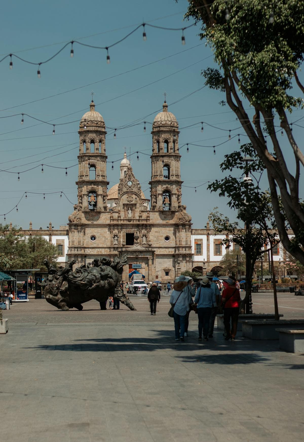
Guadalajara: A City Designed as a Cross
100 min · 3 km · easy
More from Guadalajara
Explore more at your own pace.
Best Self-Guided Walking Tours in Guadalajara (2026)
Guadalajara Travel Guide: How Many Days, Getting Around, When to Go (2026)
Mariachi, Tequila, and the Cross: How to See Guadalajara
One Day in Guadalajara: A Walkable Centro-to-Tlaquepaque Itinerary (2026)
What to Eat in Guadalajara: A Jalisco Food Guide (2026)