Capitol Hill survived as a residential neighborhood because the federal expansion stopped where it stopped. A useful way to read the Hill is to walk one block east of the Capitol, then look back.
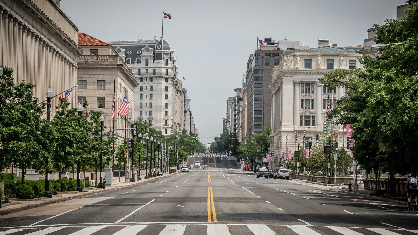
You are standing on First Street. The dome is behind you. The building immediately to your west is the Library of Congress Jefferson Building. The marble walls and the columned facades around you are the federal precinct. Now walk one more block east, past the Library of Congress, to Second Street. Look around. The buildings are now three stories tall, brick, with painted shutters and small front yards. A woman with a stroller is walking past. A bicycle is locked to a tree. Two congressional staffers in suits are walking the same sidewalk you are walking, headed to work.
You have crossed an invisible line. The federal precinct ends on First Street. East of First Street, Capitol Hill is a residential neighborhood. Eight thousand contributing buildings of rowhouse fabric, designated as a Historic District on the DC Inventory on June nineteenth, 1973, and listed on the National Register on August twenty-seventh, 1976. The buildings are old. Most of them were built between roughly 1860 and 1900. The neighborhood is older than that; the parish at Christ Church on G Street was incorporated in 1794, six years before the Capitol's first full session arrived in Washington.
The Capitol moved into a neighborhood that was already here. The neighborhood is still here. The reason it is still here is the most interesting story about Capitol Hill, and it is not visible in any single building. It is visible in the line at First Street.
The boundary that did not move
A historic district, in preservation language, is a defined geographic area whose buildings are protected as a group because the group matters more than any single structure. A contributing building is one that helps the district read as historic. The Capitol Hill Historic District is one of the largest residential historic districts in Washington. The boundary runs roughly from the Capitol grounds east to Twelfth Street, from H Street Northeast south to the Anacostia Freeway, with an irregular western edge that follows First Street and South Capitol Street around the federal core.
The boundary is the load-bearing fact. It is not arbitrary. The federal precinct on the Hill has expanded multiple times. The Library of Congress Jefferson Building, completed 1897, was the first major federal annex east of the Capitol. The Cannon House Office Building opened in 1908. The Longworth House Office Building opened in 1933. The Russell, Dirksen, and Hart Senate Office Buildings followed in 1909, 1958, and 1982. The James Madison Building of the Library of Congress opened in 1980. The federal footprint on the Hill grew steadily through the twentieth century. Most of that growth happened on the west side of First Street, the south side of Independence Avenue, and the north side of Constitution Avenue. The eastern half of the Hill stayed residential.
That outcome was not accidental. Through the 1950s and 1960s, federal planning bodies repeatedly proposed expanded federal-office construction east of First Street. The Capitol Hill Restoration Society, founded in 1955, organized opposition. The CHRS publishes a self-guided rowhouse map at chrs.org for residents and visitors; their archives, held at the Kiplinger Library of the Historical Society of Washington, DC, document the campaign across decades. The federal expansion did not stop because Congress decided the rowhouses were beautiful. It stopped because the residents organized, the preservation movement gathered legislative weight in the wake of the 1966 National Historic Preservation Act, and the District's historic-district designation in 1973 made further federal demolition politically expensive.
That is the architectural argument of the Hill. The decision to preserve the residential fabric is the most consequential single act of design in the neighborhood's twentieth century. The decision is written into the boundary line. It is the reason congressional staffers walk to work past 1880s rowhouses today.
Four civic temples, four institutional accidents
Hear a stop from this walk
Lincoln Park: Two Monuments Facing Each Other
The federal precinct on the Hill is anchored by four institutional buildings. Each is the result of a contingent decision that could have gone the other way.
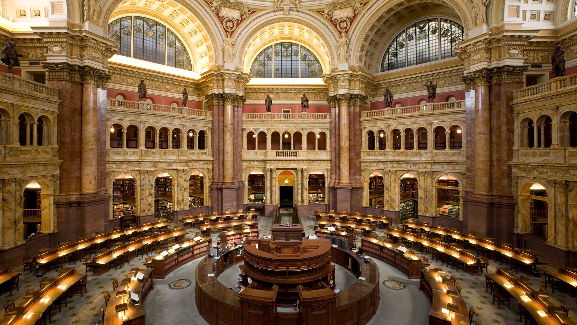
The Library of Congress Jefferson Building opened on November first, 1897. The building exists because the British burned the original Congressional library in the Capitol in 1814. In 1815, Thomas Jefferson sold Congress his personal library, six thousand four hundred and eighty-seven volumes, for twenty-three thousand nine hundred and fifty dollars. By the 1870s, the institution had outgrown the Capitol. In 1873, Congress ran a design competition. The winners were John L. Smithmeyer and Paul J. Pelz. Smithmeyer was dismissed in 1888. Pelz was dismissed in 1892. Edward Pearce Casey completed the building. The Library of Congress holds approximately one hundred and seventy-three million items today and is, by catalogue size, the largest library in the world. Three architects designed it.
The Supreme Court Building was dedicated on October thirteenth, 1935. The Supreme Court of the United States had been established in 1789. For the first one hundred and forty-six years of its existence, the most institutionalized of American institutions did not have its own architecture. It met inside the Capitol, in borrowed rooms. Chief Justice William Howard Taft lobbied Congress through the late 1920s for a dedicated building. Taft died in 1930. The architect was Cass Gilbert, engaged in 1929. Gilbert died on May seventeenth, 1934, a year before completion. His son, Cass Gilbert Junior, and his associate John R. Rockart brought the building in.
The Folger Shakespeare Library opened on April twenty-third, 1932. The architect was Paul Philippe Cret, with Alexander B. Trowbridge as consultant. Cret was born in France in 1876 and trained at the École des Beaux-Arts in Paris. Per the Folgerpedia entry A Monument to Shakespeare, the building is neoclassical on the exterior with Art Deco ornament in the window grilles and door panels. Cret's training was Beaux-Arts. The building is not. The library was founded by Henry Clay Folger, a Standard Oil executive who spent forty years assembling the largest private Shakespeare collection in the world. Folger laid the cornerstone in May 1930 and died two weeks later. His widow, Emily Jordan Folger, brought the project through to completion. The bas-relief panels on the East Capitol Street facade, carved by John Gregory, are at eye level. The Folger is the rare federal-scale institutional building that reads at residential scale.
The fourth civic temple is the Capitol itself. For this neighborhood, the Capitol is the lens, not the subject. The east plaza is the orientation point. After that, you walk away from it.
The market, the parish, the park
The institutions that hold the neighborhood together are not the civic temples. They are older and smaller.
Eastern Market on Seventh Street SE has operated as an institution since November of 1873. The architect was Adolf Cluss, a German immigrant who arrived in Washington in 1849 and built roughly ninety public buildings during his career. He designed Eastern Market in 1872 and 1873. The brick building with the round-arched windows is the only surviving example of DC's 1870s public-market system. On April thirtieth, 2007, a three-alarm fire heavily damaged the South Hall. The merchants moved to a temporary East Hall on the old Hine Junior High School grounds across the street. The outdoor weekend flea market never closed. The historic Cluss building reopened on June twenty-sixth, 2009. The institution operated continuously. The building was offline for two years and two months.
That distinction is the Hill's preferred way of measuring its own continuity. Institutions persist. Buildings are restored. The 2007 fire did not end the market.
Christ Church of Washington Parish, on G Street SE three blocks south of the Capitol, predates the federal city. The parish was incorporated in 1794 by an act of the Maryland General Assembly. The first worship services were held in a converted tobacco barn on this site in 1795. The current brick church was completed in 1807. Per the SAH Archipedia entry DC-01-CN40, this is the earliest structure in the original city of Washington built to serve an ecclesiastical purpose. The designer was Robert Alexander, a protégé of Benjamin Henry Latrobe. For most of the nineteenth and twentieth centuries the church was misattributed to Latrobe himself. Pamela Scott and Antoinette J. Lee, in their 1993 Oxford volume Buildings of the District of Columbia, gave the correct attribution to Alexander.
Thomas Jefferson, who lived at the President's House three quarters of a mile west, walked to this church to attend services. The historian Constance McLaughlin Green, in Washington: A History of the Capital, 1800-1950 (Princeton University Press, 1962), frames the Hill of those years as a boarding-house community for congressmen, with a few churches and a few private houses scattered through it.
The park named for Lincoln, six blocks east of the Capitol, holds the neighborhood's longest argument with itself. Congress designated Lincoln Square in 1867. Per the National Park Service Cultural Landscape inventory, this is the first site in the country to bear Abraham Lincoln's name. The Emancipation Memorial in the western half was sculpted by Thomas Ball and dedicated on April fourteenth, 1876, the eleventh anniversary of Lincoln's assassination. The monument was funded entirely by formerly enslaved people, beginning with five dollars from Charlotte Scott, a formerly enslaved woman from Virginia. Twenty thousand dollars in total, raised at a time when many donors earned a few dollars a month.
Frederick Douglass delivered the dedication address. Five days later, on April nineteenth, 1876, Douglass published a letter in the Washington National Republican extending the critique from Lincoln's person to the iconography of the monument itself. Per Kirk Savage's Monument Wars (UC Press, 2009), Douglass wrote: the negro here, though rising, is still on his knees and nude. What I want to see before I die is a monument representing the negro, not couchant on his knees like a four-footed animal, but erect on his feet like a man. The community that paid for the monument was the community whose most prominent representative critiqued its iconography on dedication day.
Ninety-eight years later, on July tenth, 1974, the Mary McLeod Bethune Memorial was unveiled at the eastern end of the park. Robert Berks sculpted it. The National Council of Negro Women, founded by Bethune in 1935, raised the funds. Per the National Park Service institutional record, the Bethune Memorial is the first statue erected on public land in Washington, DC to honor both an African American and a woman. At the 1974 dedication, the Emancipation Memorial was rotated to face east toward the new Bethune statue. The two monuments now face one another across the central walkway. The geometry is the argument.
The historic district was designated in 1973, one year before the Bethune Memorial went in. The Capitol Hill Restoration Society had been pushing the preservation case since 1955. The National Council of Negro Women had been pushing the Bethune case since the 1930s. Both fights ended in the same decade. Both produced what stands in the park today.
What the neighborhood actually is
The reason this neighborhood is interesting is not the four civic temples. It is the eight thousand rowhouses around them.
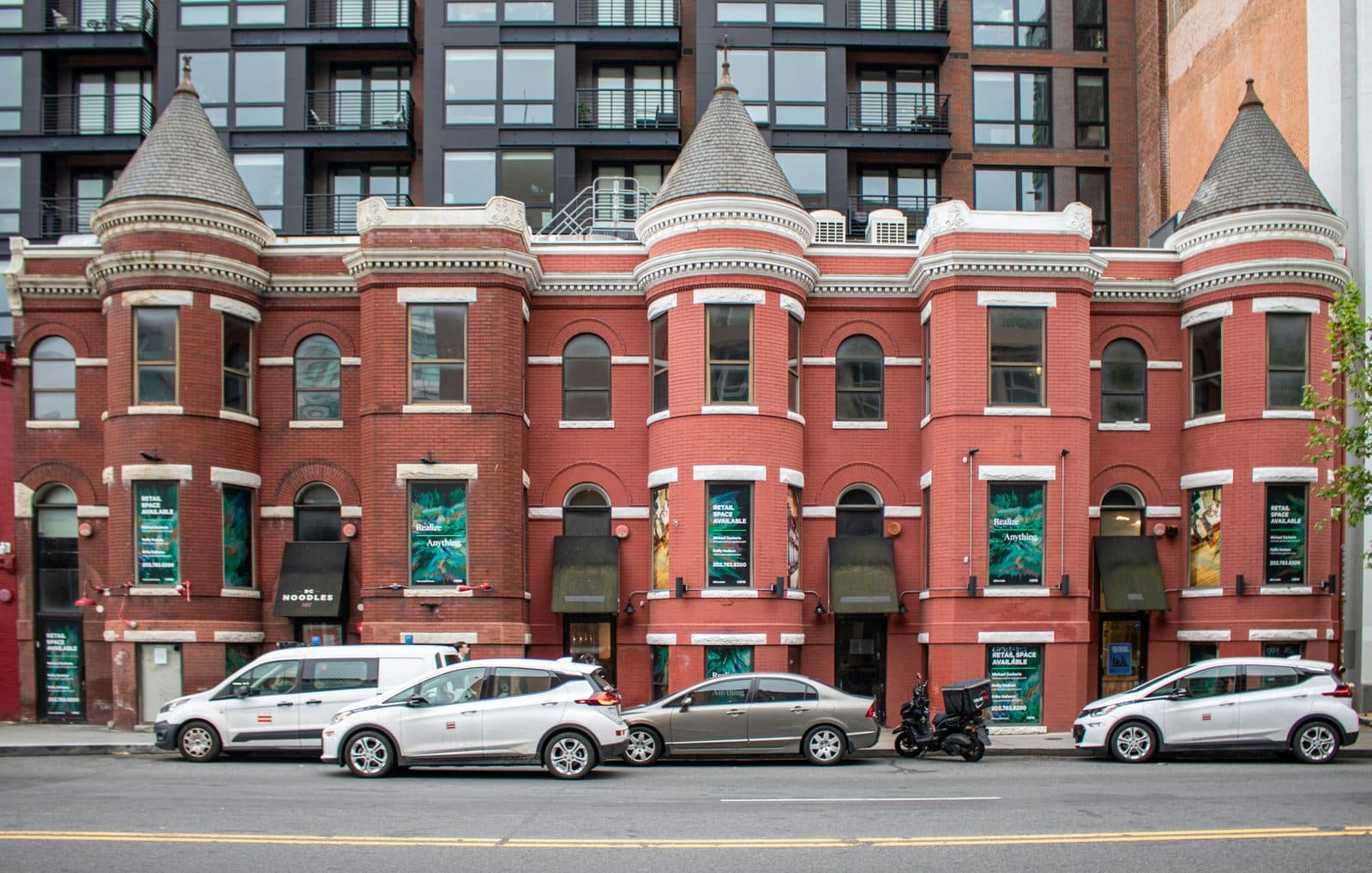
The rowhouse typology of Capitol Hill is the dominant residential pattern of nineteenth-century DC. A rowhouse is a single-family house sharing party walls with the houses on either side, set tight to the sidewalk, with a uniform setback and a common cornice line across the block. The Federal-period rowhouses, the Italianate rowhouses of the 1860s and 1870s, the Queen Anne rowhouses of the 1880s, the Richardsonian Romanesque rowhouses of the 1890s, and the brick-and-stone variants of the early 1900s are all visible if you walk between Christ Church and Lincoln Park along East Capitol Street and the adjacent side streets. The Capitol Hill Restoration Society's self-guided rowhouse map at chrs.org is the most useful single document for picking the styles apart.
Most of these houses are still privately owned residences. The neighborhood has the highest concentration of working federal staff residences in the country: congressional aides, Supreme Court clerks, federal agency staffers, lobbyists, journalists, advocacy professionals. They live next door to retired teachers and bartenders and small-business owners who have been in the neighborhood for forty years. The mix is the point. The rowhouses are not architecturally famous in the way the Capitol is famous. They are architecturally consistent in a way that almost no other major American city's residential fabric has remained consistent. The consistency is the result of the 1973 historic-district designation, the Capitol Hill Restoration Society's continuing presence, and the residents' willingness to argue about facade details at Advisory Neighborhood Commission meetings.
What you are seeing when you walk Capitol Hill is what survives when a residential neighborhood successfully refuses to be cleared for federal expansion. The federal precinct exists. So does the neighborhood. The boundary between them is on First Street. The line was held by people, not by the buildings themselves.
That fact is the closest thing to an argument the neighborhood makes about itself. The buildings are the architectural evidence. The community organizing is the cause. The line on the map is the result.
Ready to experience it?
Capitol Hill: The Neighborhood That Lives Beside Power
95 min · 4.14 km · moderate
More from Washington Dc
Explore more at your own pace.
Best Self-Guided Walking Tours in Washington, DC (2026)
One Day in Washington, DC: A Walkable Monuments-to-U-Street Itinerary (2026)
Washington, DC Travel Guide: How Many Days, Getting Around, When to Go (2026)
Best History Walking Tours in Washington, DC (2026)

What to Eat in Washington, DC: A Food Guide (2026)