Historic Center: Preserved by Catastrophe
105 min · 3.69 km · easy
Guatemala has had four capitals. The first was an alliance camp among the Kaqchikel Maya, abandoned when the alliance collapsed. The second was a valley settlement beneath a volcano, destroyed by a lahar in 1541. The third was Antigua, the city you are about to walk, capital for two hundred and thirty-three years. The fourth is Guatemala City, where the government moved after the earthquake of 1773.
That sequence is the easy part of the story. The hard part is what happened after the move. When the Captain General, the Archbishop, and the wealthy families relocated to a safer valley, they did not destroy what they were leaving. They simply stopped paying for it. The cathedrals, palaces, and convents they had spent two centuries building were not demolished. They were not modernised. They were not even reliably patched. They were left, and the people too poor to follow the capital stayed among them.
That is the central fact of Antigua, and it explains almost everything you will see.
The grid is older than the buildings
The Spanish founded their third capital on March tenth, 1543, and named it Santiago de los Caballeros de Guatemala. The street pattern they laid down that day, a Renaissance grid running roughly north-south and east-west with a plaza at the centre, is the same pattern the city has today. The Laws of the Indies prescribed it: cathedral on one side of the square, government palace on another, city hall on the third, commerce on the fourth. Every institution of colonial power arranged around one piece of open ground.
Most of the buildings around that plaza are not the originals. Earthquakes in 1565, 1717, 1751, and finally 1773 brought them down in rotation. The grid itself never moved. Streets that were laid out for Spanish horses still carry buses today. The geometry survived everything that stood on it.
The architects who learned to lose
Hear a stop from this walk
San Francisco: The Saint at the Tomb
In the century between the major earthquakes, the colonial city developed a building tradition the textbooks now call Barroco Antigueño, sometimes Earthquake Baroque. Neither name was used by the architects who actually built it. They were just trying to put up structures that would not fall down.
The central figures are a mestizo father-and-son pair: Joseph de Porres and his son Diego de Porres. Joseph became the first Master Architect of colonial Guatemala in 1687, a title created at the city's demand that builders pass an exam that included earthquake-resistant construction. Earthquake competence was the credential. Joseph trained Diego from childhood. Diego succeeded him in 1703 and shaped more of the city than any single individual. The dynasty ran for at least three generations.
Their signature is everywhere. The Mermaid Fountain at the centre of the plaza, carved in 1737, is Diego's. Capuchinas, with its circular tower of nuns' cells, is Diego's last major work. The cathedral's reconstruction after 1717, the Compañía de Jesús, the modifications at La Merced: Porres hands on all of them. The buildings that survived best are the ones whose architects had already learned, several earthquakes in, what would not.
The catastrophe that preserved
On July twenty-ninth, 1773, the Santa Marta earthquakes shattered the city. The colonial government declared Antigua uninhabitable and ordered the capital relocated to the Valle de la Ermita, the present site of Guatemala City. The wealthy left. The Captain General left. The Archbishop tried to stay and was forced out by royal decree in 1779.
What happened next is the part most travel writing misses. For almost two centuries, Antigua was a backwater. The population that had once reached sixty thousand collapsed and did not recover until the 1990s. The historian Christopher Lutz spent decades documenting who actually lived in the diminished city: indigenous families, mestizo artisans, the mixed-race majority that had become the demographic core of the city by the 1700s. They maintained the Semana Santa processions from 1543 forward, unbroken. They washed clothes at the public lavadero. They worked the cobblestones and the cracks.
Nobody, for the most part, demolished a ruined church to build a shopping centre, because there was no demand. Nobody paved the cobblestones, because there was no budget. Nobody modernised the grid, because there was no will. The colonial city survived because nobody had the money or the motive to replace it.
In 1979 UNESCO declared Antigua a World Heritage Site. The catastrophe that destroyed it is what preserved it.
How to read a wall
Once you know this, the visible city reorganises. The matching pattern is everywhere. A working parish church will be on the plaza-facing side of a structure. Behind it, an open-air ruin, sometimes ten metres tall, with grass growing where the nave used to be. The parish was rebuilt after 1773 because the congregation needed somewhere to pray. The ruin was not rebuilt because nobody had the money to put up a hundred-foot vault for a city of fifteen thousand people. So the two halves coexist. Front works, back is open to the sky.
Walls will have cracks. Some of those cracks are from 1773, some from 1976 when a magnitude 7.5 earthquake on the Motagua Fault killed twenty-three thousand people in Guatemala. Some are from last year. The city is still negotiating with the earth, and it always will be.
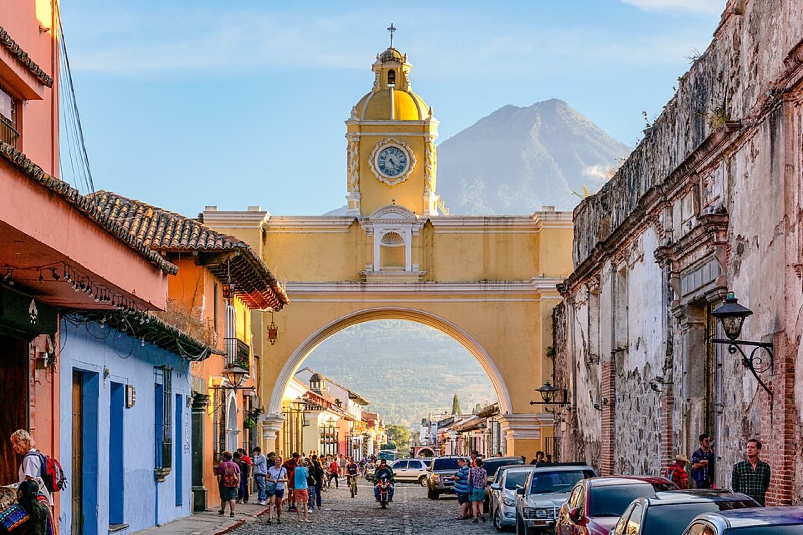
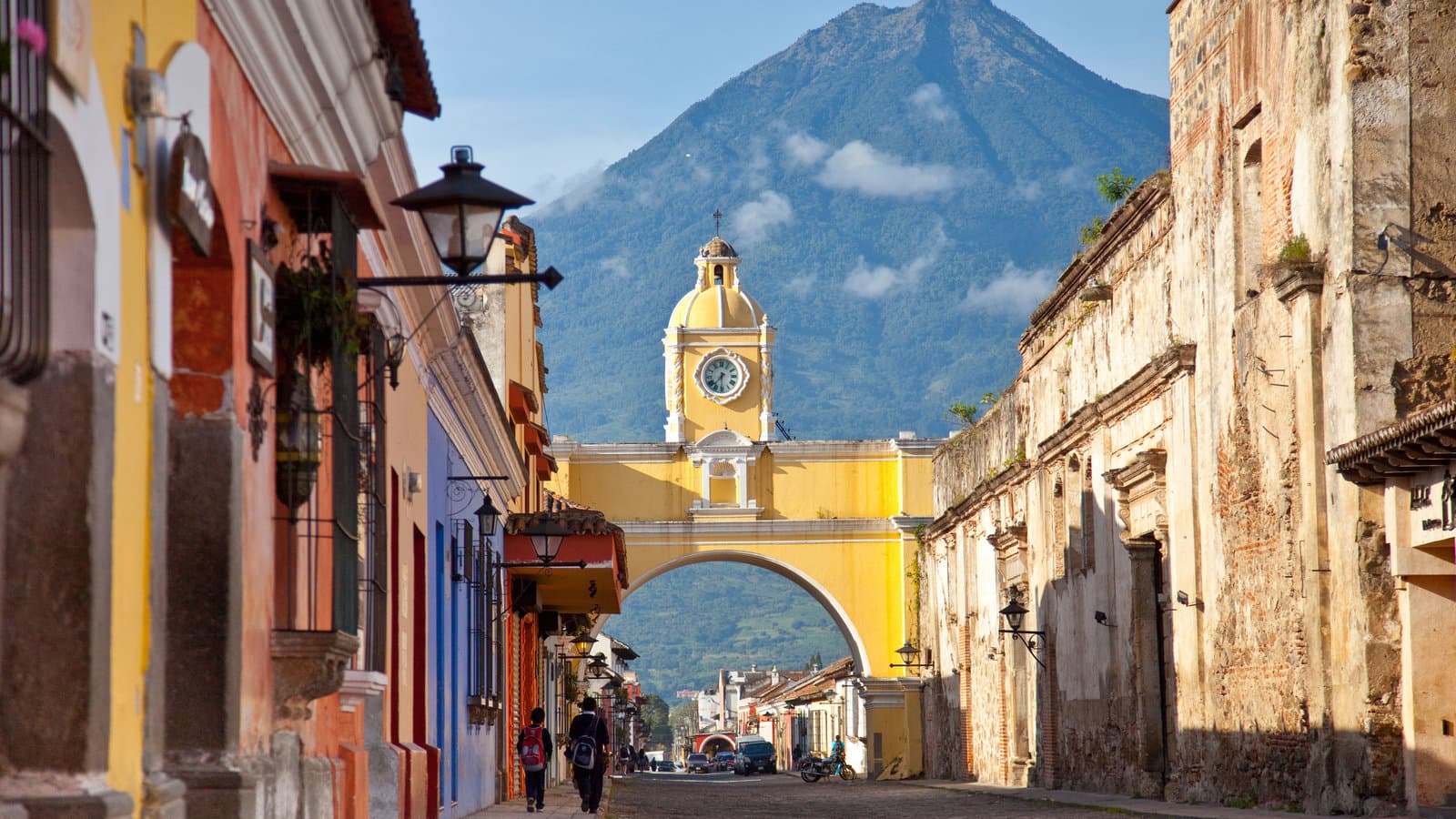
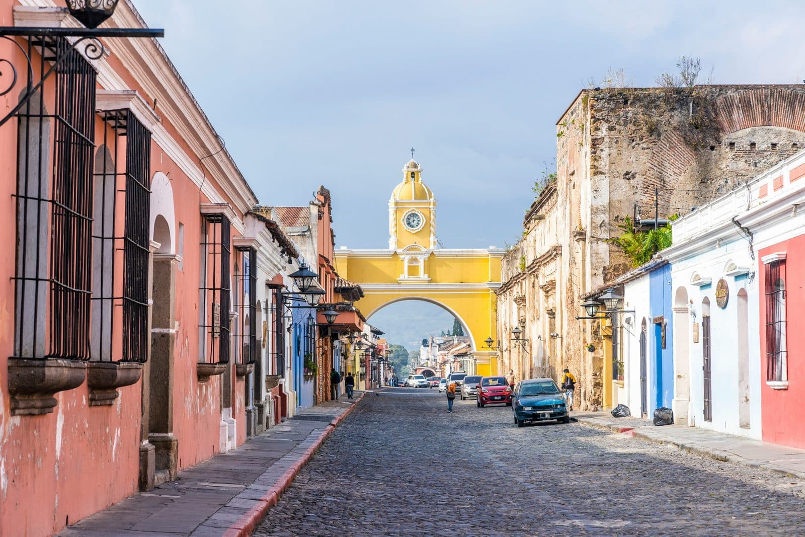
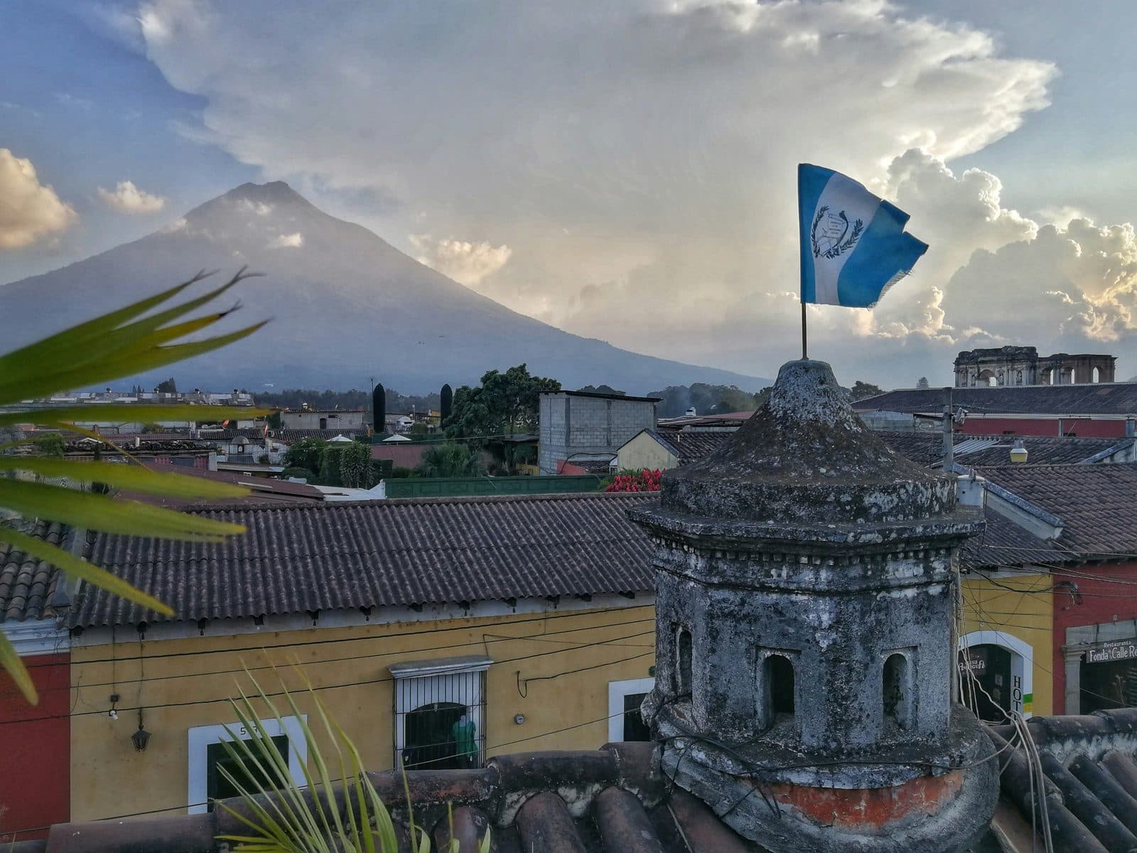
The cobblestones are uneven because they have not been relaid in a century, and you can feel them in your ankles. The yellow on the walls is repainted regularly. It is the city's signature shade. The arch on Fifth Avenue North is a skybridge built in 1694 so the cloistered nuns of the Convento de Santa Catalina could cross the street unseen. The clock at the top was added in the 1800s. The Volcán de Agua framed behind it, three thousand seven hundred and sixty-six metres of dormant stratovolcano, is what every Antigua postcard since the invention of postcards has used.
What the three tours give you
Antigua is small enough to walk in half a day and dense enough that you could spend a year on it. The three Roamer tours unbundle it into three theses.
The Historic Center tour walks the colonial spine and frames the city through the people who stayed: indigenous families, mestizo artisans, the Canary Islander who founded a hospital in 1658 and was canonised three hundred and thirty-five years later. The Architecture tour walks the same spine and treats it as a working laboratory of seismic engineering, with the Porres dynasty as the central characters. The Preserved by Catastrophe tour extends the loop to eleven stops and argues the case directly: poverty is what kept this city standing.
You can take any one and have the city. Taking all three is the difference between a postcard and a working understanding.
Power left Antigua in 1773. The people who could not afford to leave stayed, and that is why the colonial city is still here.
Frequently asked questions
- How many self-guided walking tours are there in Antigua?
- Roamer currently has 3 self-guided audio walking tours in Antigua. Every tour is free to start: the introduction and first stop play in full, and every later stop plays a short preview before you decide to buy.
- How much does a self-guided walking tour in Antigua cost?
- Each tour is free to preview and $4.99 for lifetime access. If you want more than one, a 7-day pass is $12.99 and a 30-day pass covering every tour is $19.99, which works out to well under a dollar a day.
- Can I do the Antigua tours offline?
- Yes. Tours can be downloaded in advance in the Roamer app and played with no signal, which is useful when you are travelling without mobile data.
- How long are the Antigua walking tours?
- They run about 90 to 120 minutes, covering 2.3 to 3.8 km on foot, with up to 11 stops on the longest route. You set the pace and can pause any time.
Ready to experience it?
Historic Center: Preserved by Catastrophe
105 min · 3.69 km · easy
More from Antigua
Explore more at your own pace.
Antigua Guatemala Travel Guide: How Many Days, Getting There, When to Go (2026)
Best Self-Guided Walking Tours in Antigua Guatemala (2026)
One Day in Antigua Guatemala: A Walkable Itinerary (2026)
What to Eat in Antigua Guatemala: A Food Guide (2026)
The People Who Stayed: A Companion to the Historic Center Walk