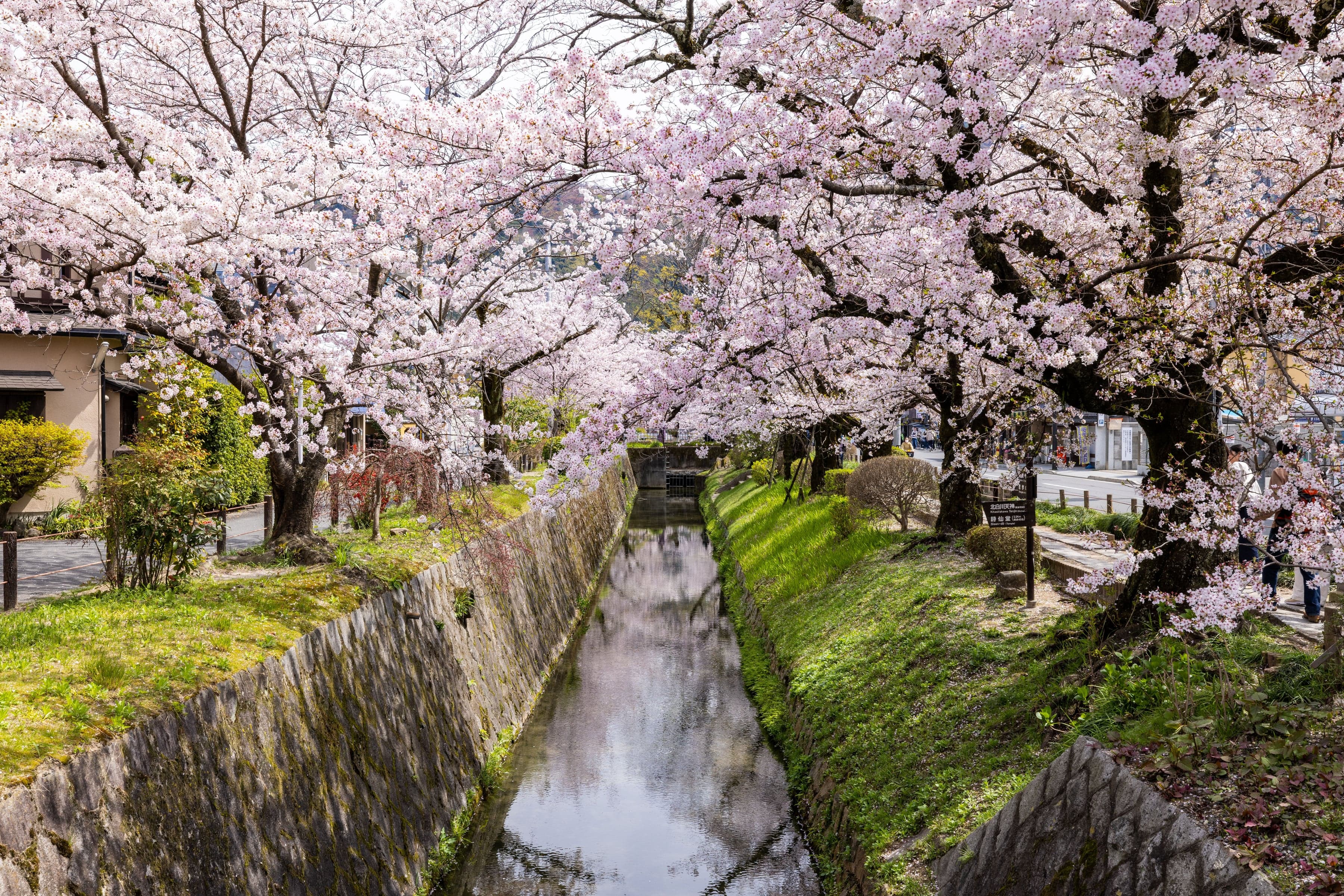
Walk upstream along the Lake Biwa Canal from Ginkaku-ji's gate past Honen-in's sand mounds, the Kansetsu cherries, Otoyo Shrine and Eikan-do to Nanzen-ji's great gate and its brick aqueduct.
Start · Ginkaku-ji: The Pavilion That Was Never Silver
DirectionsStops
- 1
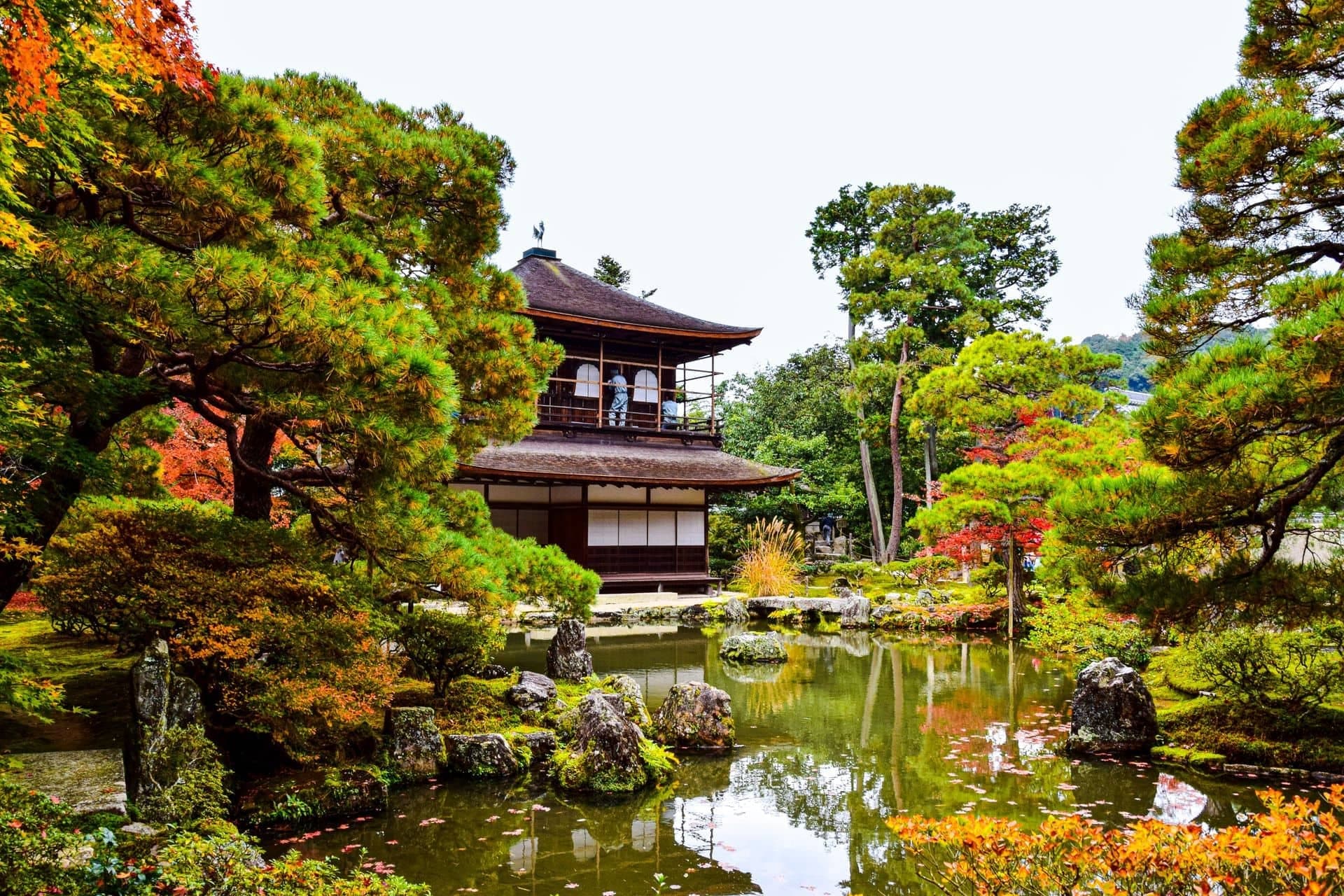
Ginkaku-ji: The Pavilion That Was Never Silver
Ginkaku-ji began as a retired shogun's mountain villa in 1482. Its famous pavilion was never covered in silver, and its sand cone is probably centuries younger.
- 2
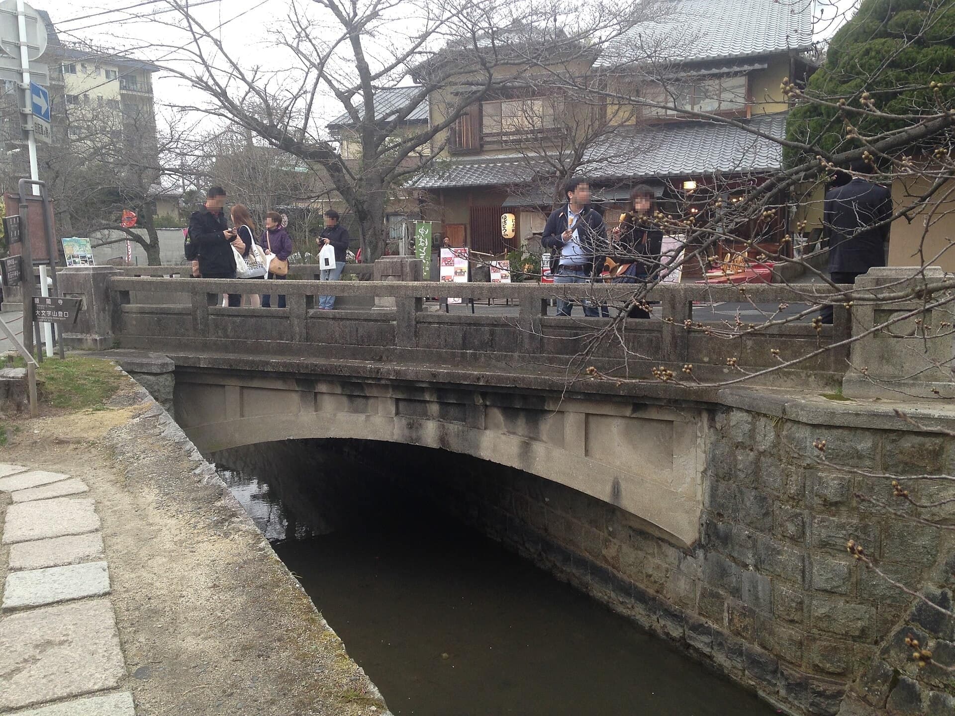
Ginkaku-ji Bridge: Walking Upstream
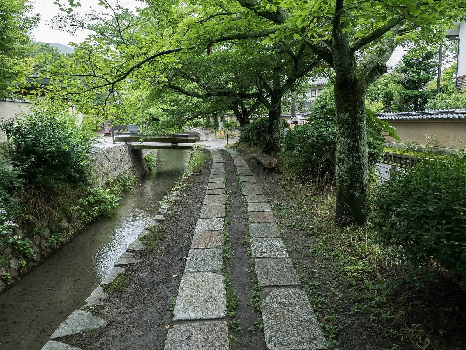
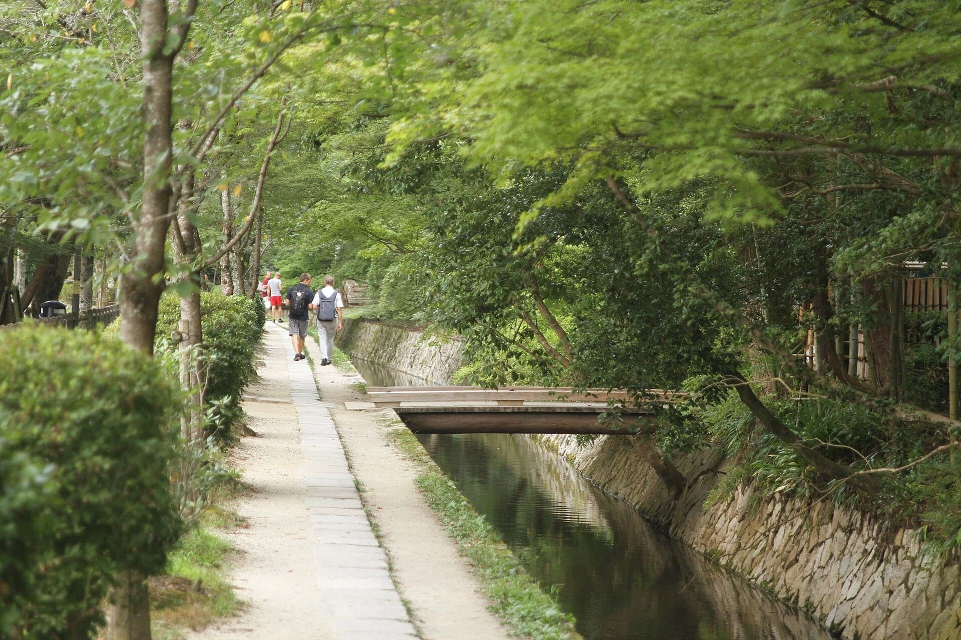
The Philosopher's Path starts here, where the canal bends away toward the city. The water here runs north, so the walk goes against the current.
- 3
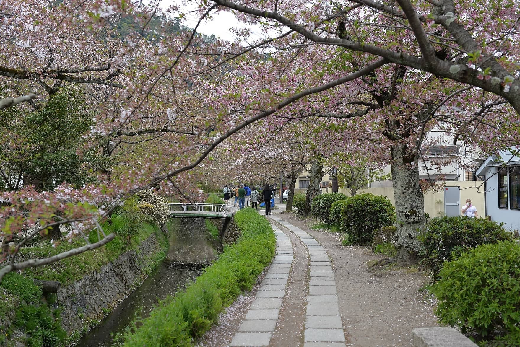
Lake Biwa Canal: The Factory Town That Never Was
Kyoto once planned water-wheel factories along this canal. Electricity made the plan obsolete, and the bank became a place to stroll.
- 4
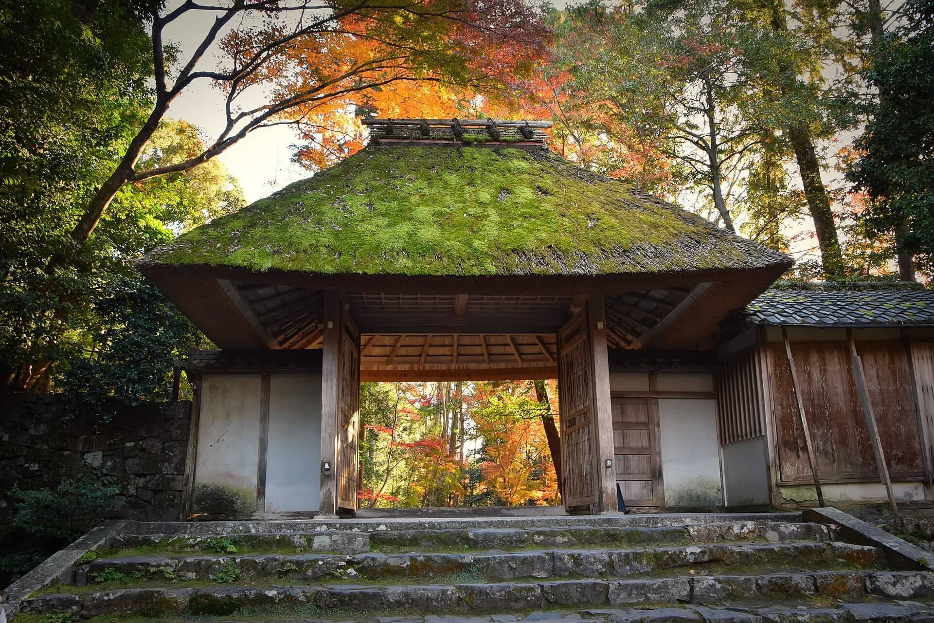
Honen-in: Sand That Stands for Water
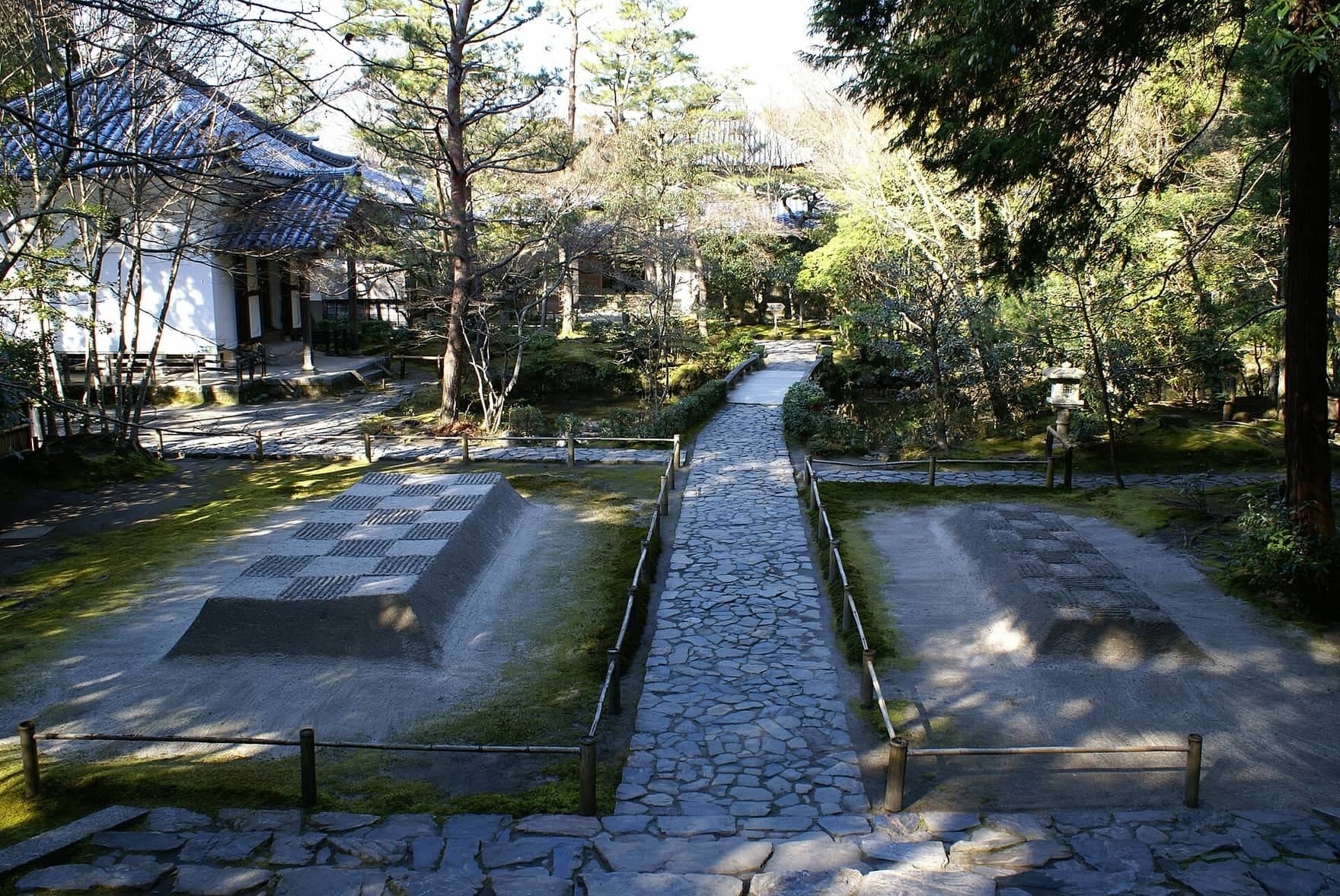
Honen-in's free grounds open behind a thatched gate. Just inside, two mounds of white sand stand for water that purifies those who pass between them.
- 5
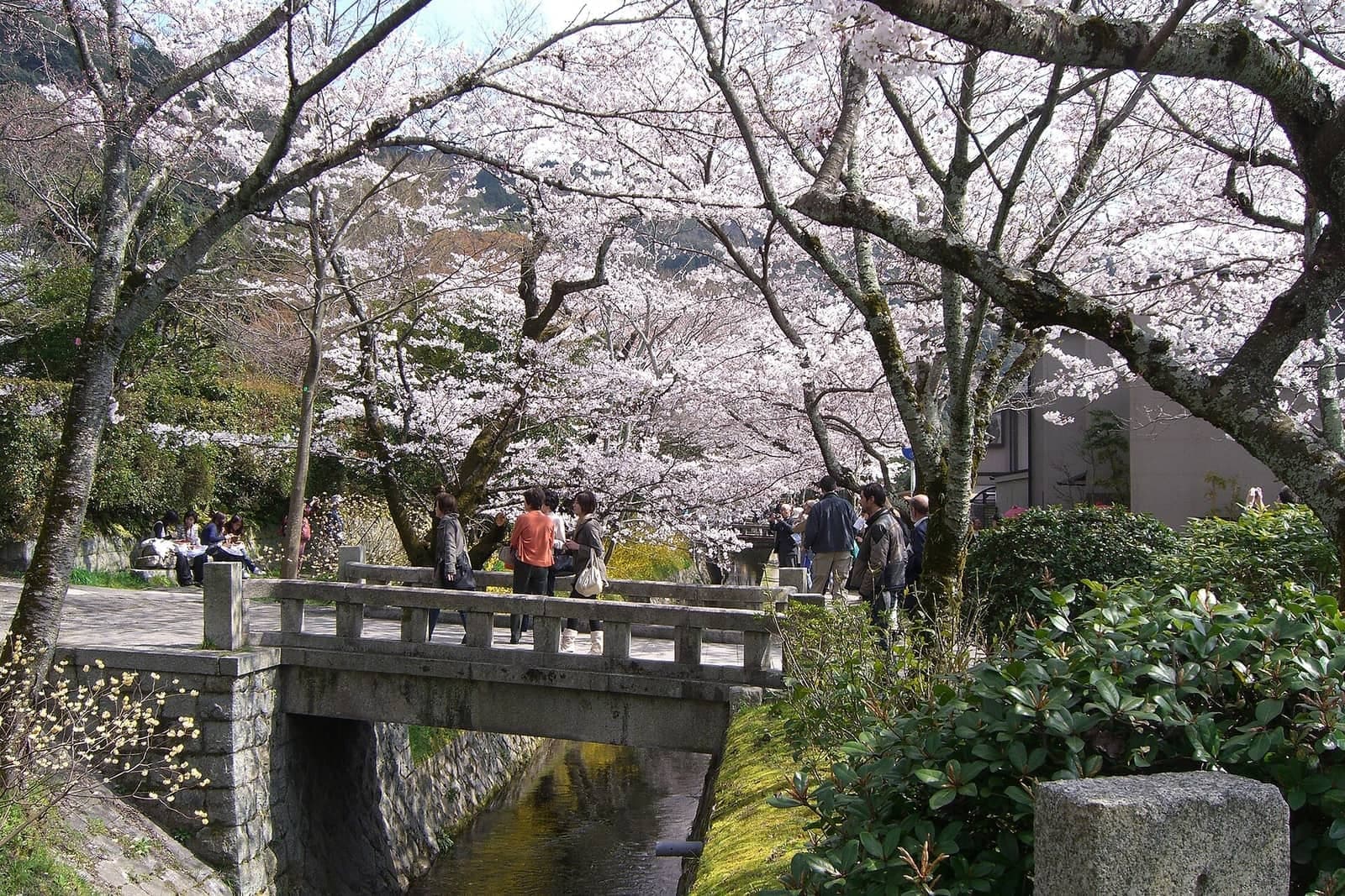
Kansetsu Cherries: A Painter's Gift
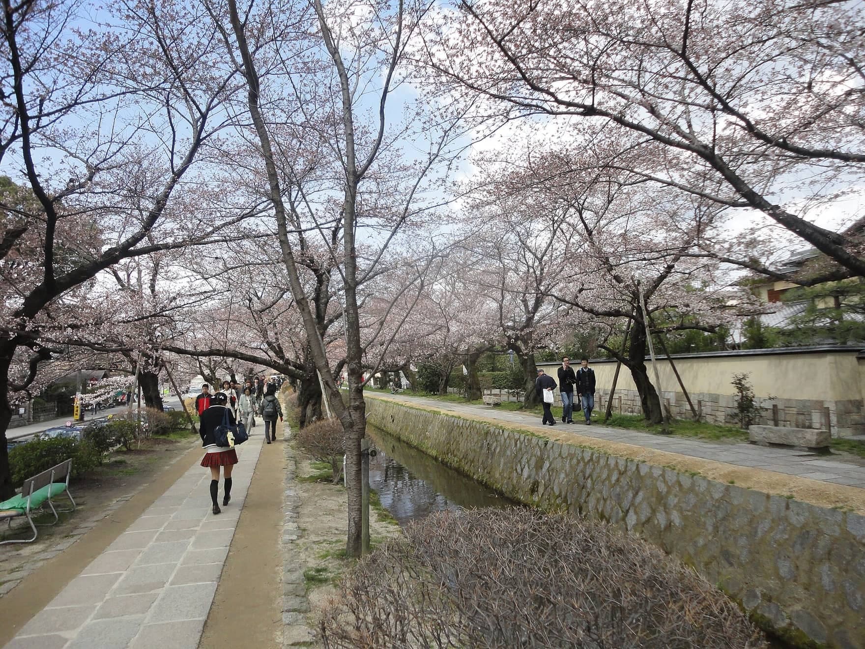
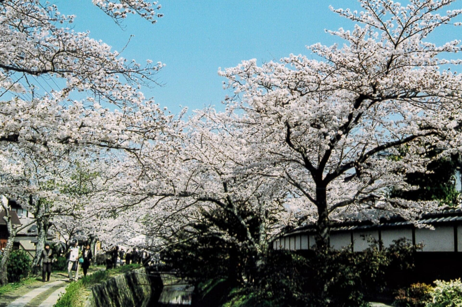
A painter planted young cherry trees along this canal in 1922. People still call them the Kansetsu cherries, and the path's name is said to come from a philosopher.
- 6
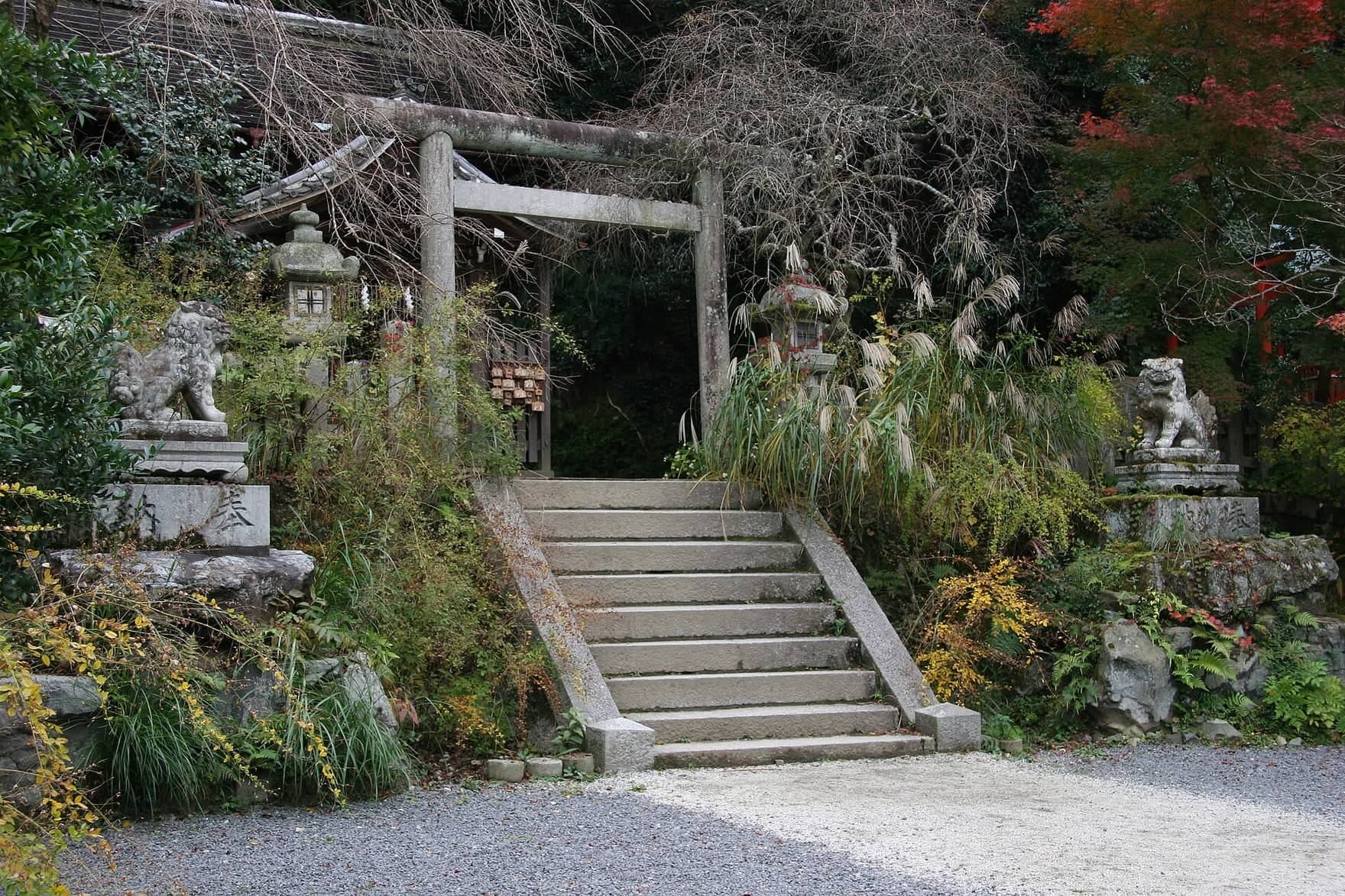
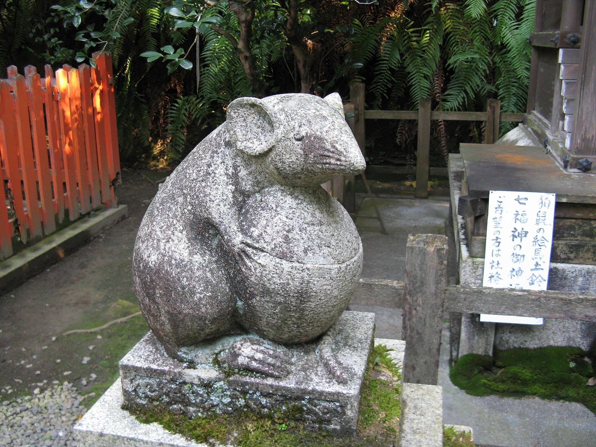
Otoyo Shrine: Guardian Mice
A lane leads from the path to Otoyo Shrine, founded in 887 by its own account. At one of its halls, the guardians are mice.
- 7
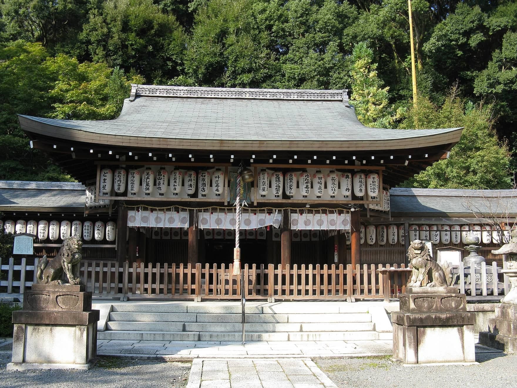
Nyakuoji: Where the Water Comes Out of the Hill
The Philosopher's Path ends by the bridge at Nyakuoji. Upstream, the canal emerges from brick tunnels of 1888 and 1890, now Important Cultural Properties.
- 8
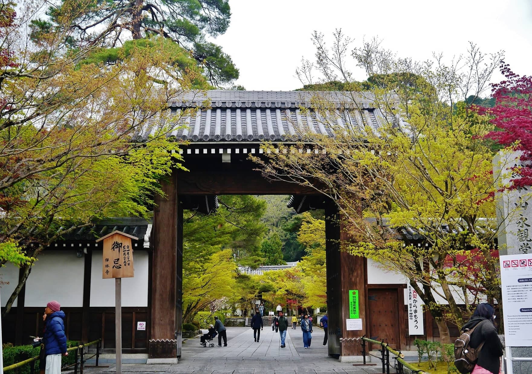
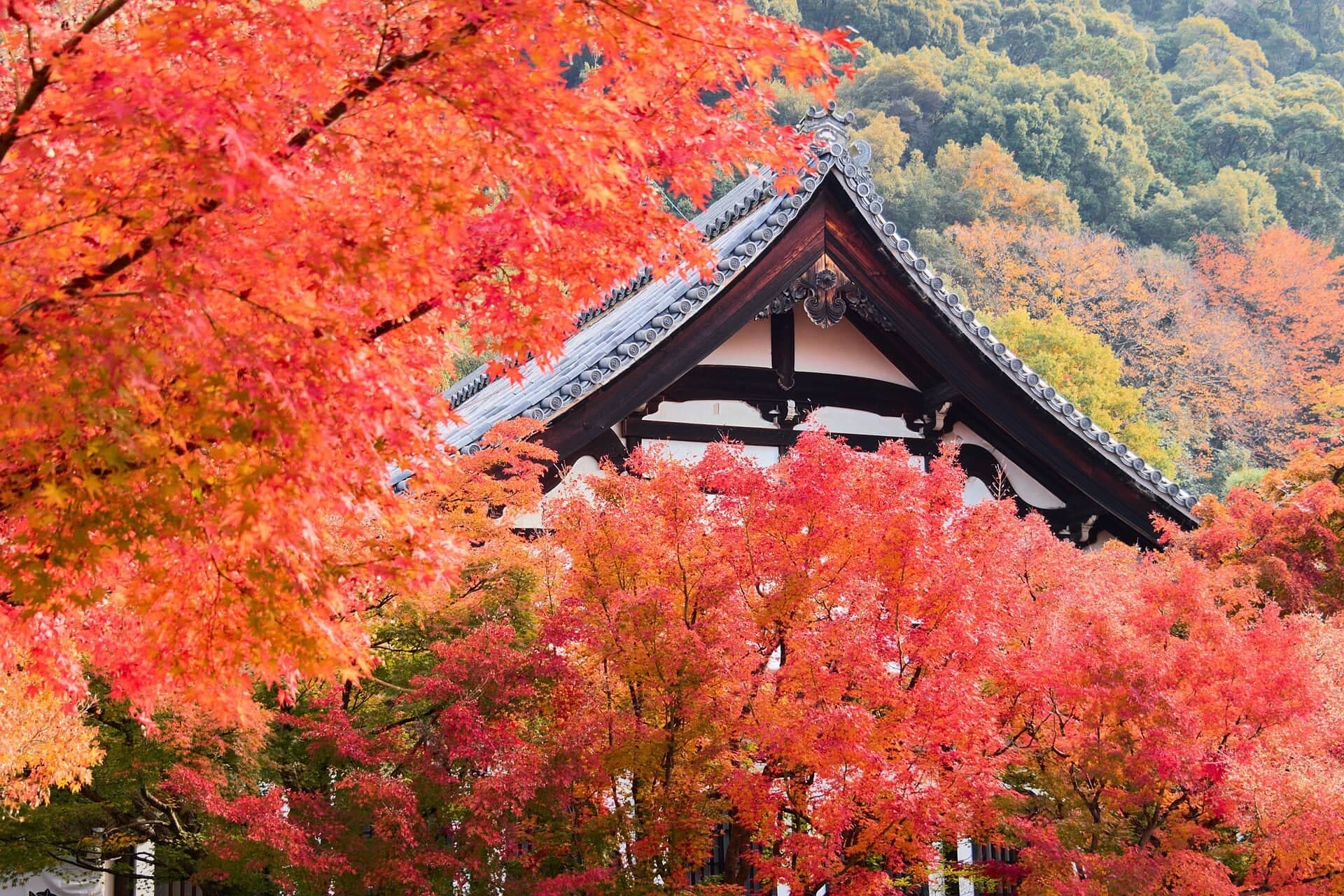
Eikan-do: The Buddha Who Looks Back
Eikan-do's treasure is a Buddha who looks back over his shoulder. The temple tells of a dawn in 1082 when the statue said, 'Eikan, you are slow.'
- 9
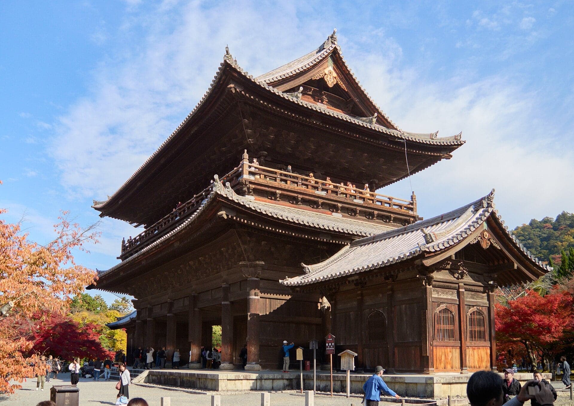
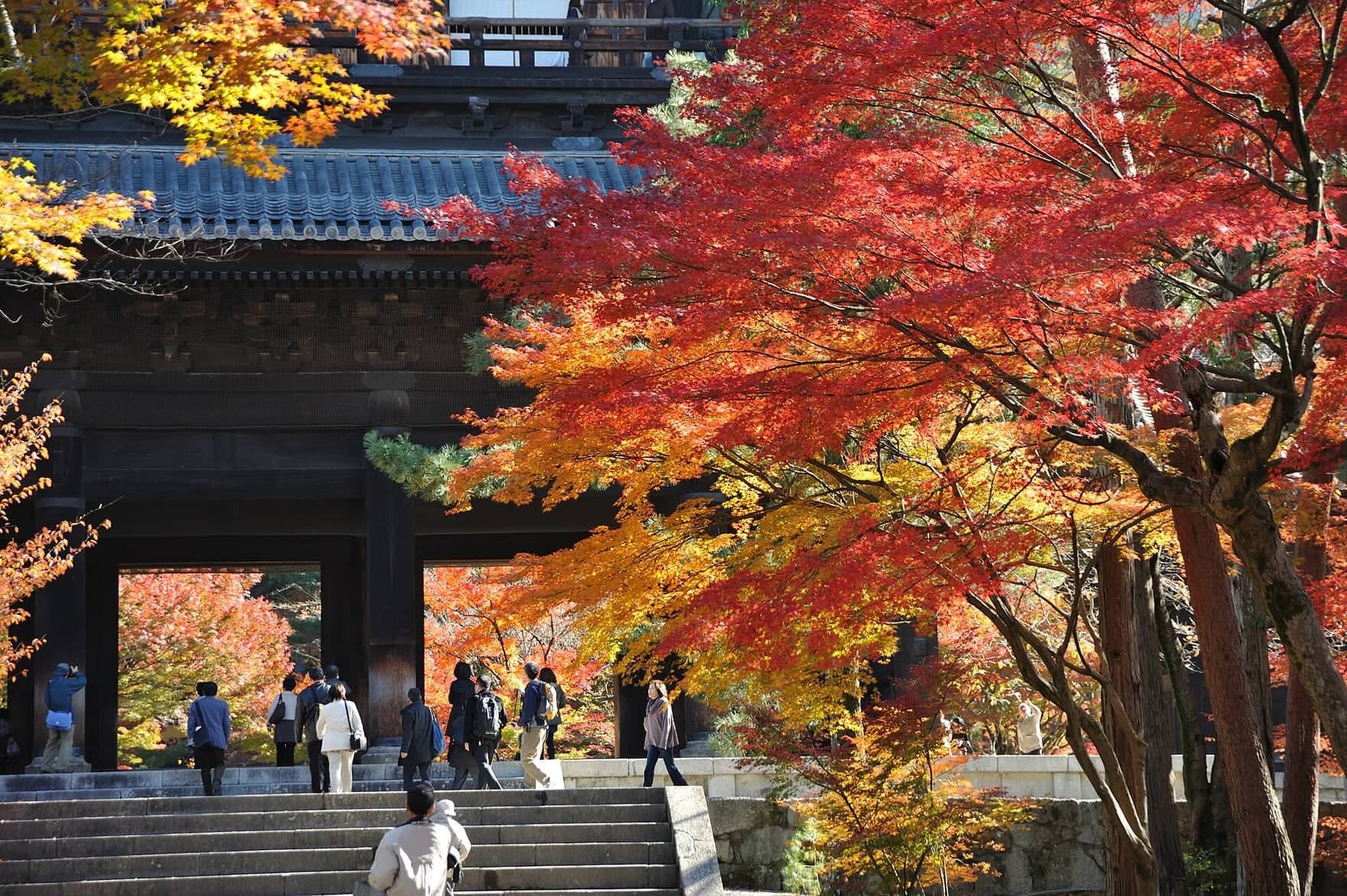
Nanzen-ji Sanmon: The Warlord's Gate
Nanzen-ji's great gate was rebuilt in 1628 by a grieving warlord. On the kabuki stage, an outlaw admires the view from its balcony.
- 10
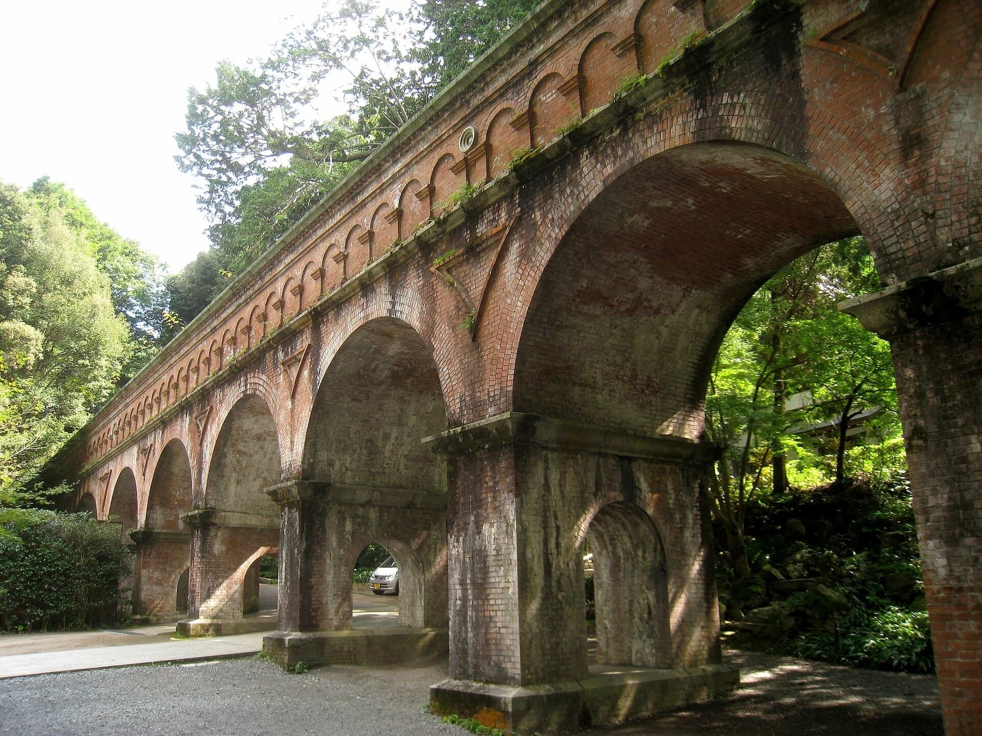
Suirokaku: The Aqueduct in the Temple
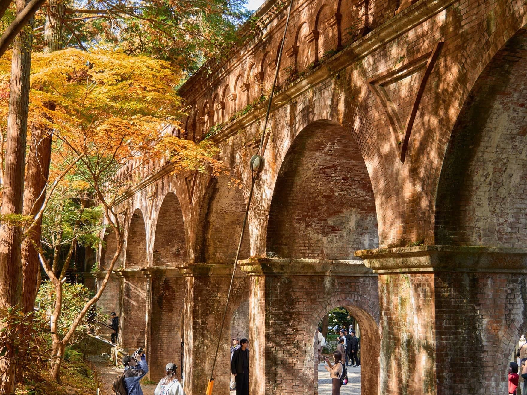
A brick aqueduct has carried the canal through Nanzen-ji since 1888. In 2025 it became one of Japan's National Treasures.
Details
Best Time to Visit
Start in the morning. Every gate on the route closes by late afternoon: Honen-in's grounds at 16:00, Eikan-do's last entry at 16:00, Ginkaku-ji at 17:00 (16:30 from December to February) and the Sanmon's reception at about 16:40. The cherries bloom in early April and the maples turn in November, the two busiest times; November also brings special openings and crowds at Eikan-do and Nanzen-ji. The canal path itself is open at all hours. Checked 16 October 2026.
Pro Tips
- •Begin at the gate of Ginkaku-ji, at the top of its souvenir lane. Ginkaku-ji opens at 8:30 (9:00 from December to February), every day of the year. City Bus to Ginkakuji-michi (nos. 5, 7, 32, 102, 203, 204) or Ginkakuji-mae (EX100, 105). Checked 16 October 2026.
- •Ginkaku-ji (stop 1) costs 1,000 JPY for adults since 1 April 2026, cash or Omairi Pay. The pavilion's interior is never open; the autumn special viewing (1 November to 5 December 2026) is guided in Japanese only and costs 2,000 JPY extra. Checked 16 October 2026.
- •Honen-in (stop 4): the grounds are free from 6:00 to 16:00; the hojo garden and paintings open only 1 to 7 April and 18 to 24 November, 800 JPY. Checked 16 October 2026.
- •Hakusasonso, the painter Hashimoto Kansetsu's villa and garden, is near the Ginkaku-ji end of the path: 10:00 to 17:00, adults 1,300 JPY; closed days not stated. Checked 16 October 2026.
- •Otoyo Shrine (stop 6) is free and a few minutes up the lane; its office is open 9:00 to 17:00 and dogs are welcome. Checked 16 October 2026.
- •Eikan-do (stop 8): 1,000 JPY, last entry 16:00. From 11 November to 6 December 2026 it is 1,500 JPY (same-day tickets only), and the night illumination (20 November to 6 December, 17:30 to 20:30, 1,000 JPY) is a separate entry. Checked 16 October 2026.
- •Nanzen-ji (stops 9 and 10): the grounds and the aqueduct are free; the Sanmon's upper floor and the Hojo garden are 600 JPY each, 8:40 to 17:00 (16:30 in winter), reception closing 20 minutes earlier. Nanzen-in is closed for roof works until spring 2027. Checked 16 October 2026.
- •After the last stop, the Keage Incline and the free Lake Biwa Canal Museum of Kyoto are a few minutes on: the museum is open 9:00 to 17:00 (entry until 16:30), closed Mondays (the next weekday if Monday is a holiday) and 29 December to 3 January. Checked 16 October 2026.
Safety & Precautions
- •Two gates on this route keep temple hours that are not published: the approach to Honen-in's gate (its grounds are open 6:00 to 16:00) and Nanzen-ji's north gate, Daijaku-mon, which the walk passes between stops 8 and 9. Walk in the morning or early afternoon; late in the day, stop 4 may have to be heard from the lane below. Checked 16 October 2026.
- •Between stops 7 and 9 the route follows narrow lanes, including Shishigatani-dori, with no pavements; cars, taxis and tour buses use them. Keep to the edge and walk in single file when traffic comes.
- •Kyoto City is trialling new surfaces on the Philosopher's Path; some sections may be under works in 2026 and 2027. Checked 16 October 2026.
- •The canal path is shared with residents and cyclists. Keep to one side, and keep children back from the canal edge.
- •Nanzen-ji asks visitors not to eat or drink anywhere in its grounds, and bans tripods, monopods and bicycles there; Eikan-do bans eating, smoking, pets, tripods and monopods anywhere in its grounds, and selfie sticks inside its halls. Checked 16 October 2026.
- •Temples and shrines are places of worship: keep voices low, and follow posted photography rules inside the halls.
- •Ginkaku-ji's upper garden has steps; wheelchair users can take a detour before the Sengetsusen bridge. Checked 16 October 2026.
- •Stay on the paths beneath the aqueduct; the route does not go onto its top.
Travel advisory: Exercise Normal Precautions (Level 1).
Gallery
Related Reading
Go deeper on what you'll see, hear, and walk through.
Read the walk
The full story of Philosopher's Path: From the Silver Pavilion to Nanzen-ji, in words. Prefer to listen? Play it narrated, from home or on location.
Introduction
Kyoto, Japan's capital for more than a thousand years, was left behind when the court and the capital moved to Tokyo. To bring the city back to life, Kyoto dug a canal from Lake Biwa, through the mountains to the east, and brought the lake's water into town.
This walk follows a branch of that canal along the foot of the eastern hills: the Philosopher's Path. The water was meant to drive factories. Instead, the bank became one of the city's quietest walks, lined with cherry trees and temples.
The water here runs the opposite way to Kyoto's rivers, from south to north, so you walk upstream the whole way: from the gate of Ginkaku-ji, the Silver Pavilion, to a brick aqueduct in the grounds of Nanzen-ji.
Three people stand behind what you will see. Ashikaga Yoshimasa, the retired shogun who built the Silver Pavilion. Hashimoto Kansetsu, the painter who planted cherry trees along the bank. And Tanabe Sakuro, the engineer who designed the canal.
The walk is ten stops over about three point one kilometers, just under two miles, and takes about ninety minutes, longer if you go inside. It is gentle, with one short climb to Honen-in and a few steps at Nanzen-ji. Ginkaku-ji and Eikan-do charge for entry, and so does the upper floor of Nanzen-ji's great gate, but every stop works from outside. It ends at the aqueduct, a short walk from Keage station.
1. Ginkaku-ji: The Pavilion That Was Never Silver
Welcome to Ginkaku-ji, the temple of the Silver Pavilion. Walk on up the lane to the temple's outer gate, and stop in front of it. Just inside, out of sight from here, the approach turns into a long fenced corridor.
Ginkaku-ji charges for entry, about one thousand yen. The details are on this stop's card.
The Silver Pavilion was never silver. The temple says the name Ginkaku-ji came into use much later, after sixteen hundred, as a pair to Kinkaku-ji, the Golden Pavilion across the city. Its official name is Jisho-ji.
It began as a private mountain villa. Ashikaga Yoshimasa became shogun, Japan's military ruler, at fifteen. Retired from that office, he began building here in fourteen eighty-two. His own Buddha hall followed in fourteen eighty-six, and the frame of the pavilion was raised in the spring of fourteen eighty-nine. He died early the next year, the temple says, without seeing it finished. By his will, the villa then became a Zen temple.
Only two of his buildings survive, the pavilion and his Buddha hall, and both are National Treasures.
Beyond that gate runs the approach. The temple calls it a prologue: a solemn, artificial space about fifty meters long, leading to the ticket desk, and probably first a boundary that also served for defense.
Inside, in front of the main hall, you will find terraces of heaped white sand and a flat-topped cone of sand. A popular story says the cone was a seat for waiting for the moon. The temple itself says neither sand form can go back to his time, and both were probably made centuries after his death.
So the pavilion was never silver, and the moon platform was not his. What is real is the pavilion he raised and the garden around it. Keep that sand in mind.
Follow the route back down the lane to the canal.
2. Ginkaku-ji Bridge: Walking Upstream
Walk on to the bridge over the canal, and stop beside the water where the path sets off along the bank.
This stone-lined channel is a branch of the Lake Biwa Canal. Lake Biwa lies beyond the mountains to the east. In the eighteen eighties Kyoto tunneled through those mountains to bring the lake's water into the city, for boats, for irrigation, for fighting fires and for power. Work began in eighteen eighty-five, and the first canal was finished in eighteen ninety.
This branch was completed in March of that year. It ran about eight kilometers along the foot of these hills, past Nanzen-ji and on across the city's rivers, carrying water for water power, irrigation and fire fighting. Here, at the end of the path, it bends away toward the city.
Now watch the water. Drop a leaf on it if you like, and see which way it goes. Kyoto's rivers run south. This water runs north. The canal was laid along the contour of the hills so that it could reach as wide an area as possible, and the city's own canal map puts it neatly: at first glance, it seems to climb toward higher ground.
That shapes the whole walk. The path runs from this end to Nyakuoji Shrine, about two kilometers to the south, and you will walk it against the current, upstream, all the way to where this water comes in: the brick aqueduct at the end of the walk.
The path is shared with the people who live along it, and with cyclists. Keep to one side when they pass.
Follow the route along the canal.
3. Lake Biwa Canal: The Factory Town That Never Was
Walk on along the canal, and stop where you have a clear view of the water, with the hills rising beyond the houses.
Now picture this bank lined with factories. That was the plan. Kyoto's governor meant to use this canal to turn water wheels, and the wheels to drive machinery, in an industrial district around Shishigatani, the hillside district this path runs into, and along this very path. A plan kept by the canal engineer's family, drawn up around eighteen eighty-seven, marks land just north of Nanzen-ji in red, as a factory site.
It never happened. The plan proved too expensive, and a better idea arrived. In eighteen eighty-eight the engineer, Tanabe Sakuro, and a colleague toured the United States, and the plan switched from water wheels to hydroelectric power. In eighteen ninety-one a power station at Keage, near the end of this walk, began sending out electricity. Kyoto City counts it as Japan's first hydroelectric power station. It powered the city's streetcars, and the railway that hauled boats over the hill.
Once power could travel along a wire, nobody needed to build a factory beside the water. This land stayed rice fields for a while, then filled with houses, and the canal became the quiet thread you are following now.
The water found other work. Part of it is still drawn off for the city's water supply. And the canal has residents of its own: the Genji fireflies of this path and the places where they live were made a natural monument of Kyoto City in nineteen eighty-four.
Keep watching the surface as you walk. The current is coming toward you.
Follow the route on along the canal. The next stop is a short way up a lane, at a temple gate.
4. Honen-in: Sand That Stands for Water
Walk on up the approach to Honen-in's thatched gate, and stop at the foot of the few steps that lead up to it. The grounds are free, and they open from six in the morning until four in the afternoon. If the gate is open, step through and stand still for a moment. If it is…
Full narration for this stop unlocks with the tour.
5. Kansetsu Cherries: A Painter's Gift
Walk on along the canal, and stop where the cherry trees lean out over the water. In nineteen twenty-two the painter Hashimoto Kansetsu planted young cherry trees along this canal, near Ginkaku-ji. His museum's records say so, and add that people call them the Kansetsu…
Full narration for this stop unlocks with the tour.
6. Otoyo Shrine: Guardian Mice
Walk on along the path, and stop where a lane turns off toward the hill. It leads to Otoyo Shrine. The shrine is a few minutes up that lane, it is free, and if you have the time it is worth the detour for its unusual guardians. At a small hall in the shrine's grounds, the…
Full narration for this stop unlocks with the tour.
7. Nyakuoji: Where the Water Comes Out of the Hill
Walk on to the end of the canal path, by the bridge at Nyakuoji, and stop where you can see the water coming down toward you from the hill. This is the end of the Philosopher's Path. Near this end stands a stone monument celebrating the path's opening. Look upstream, toward…
Full narration for this stop unlocks with the tour.
8. Eikan-do: The Buddha Who Looks Back
Walk on along the edge of the road to Eikan-do's gate, and stop by the stone carved with the temple's name, facing the gate and clear of the traffic. Eikan-do charges for entry, about one thousand yen, with last entry at four in the afternoon. The details are on this stop's…
Full narration for this stop unlocks with the tour.
9. Nanzen-ji Sanmon: The Warlord's Gate
Walk on toward the great wooden gate of Nanzen-ji, and stop while you are still far enough back to take in both of its roofs. The temple grounds are free. The upper floor of the gate costs about six hundred yen, and the details are on this stop's card. The temple asks visitors…
Full narration for this stop unlocks with the tour.
10. Suirokaku: The Aqueduct in the Temple
Walk on toward the brick arches, and stop beneath them. This is where the walk ends. This is the Suirokaku, an aqueduct of fourteen brick arches, completed in eighteen eighty-eight. Along its top runs the Lake Biwa Canal. It brings the water from Keage, just beyond the temple,…
Full narration for this stop unlocks with the tour.
- Jishō-ji (Ginkaku-ji), Kyoto, Japan. — Ka23 13, CC BY-SA 4.0 · source
- 哲学の道より望む銀閣寺橋 — そらみみ, CC BY-SA 3.0 · source
- 銀閣寺前 — kanesue, CC BY 3.0 · source
- The canal, that the path follows, is part of the Lake Biwa Canal which tunnels 20 kilometers through the mountains to Lake Biwa in nearby Sh — shankar s., CC BY 2.0 · source
- Philosopher's Walk in Kyoto, Japan — Big Ben in Japan from Kawasaki, Japan, CC BY-SA 2.0 · source
- 法然院の紅葉 — Raita Futo from Tokyo, Japan, CC BY 2.0 · source
- 白砂壇。法然院。京都市。 — Eric Salard, CC BY-SA 2.0 · source
- Cherry blossoms at "Tetsugaku no Michi" — Kirin7739, CC BY-SA 4.0 · source
- Otoyo Shrine — KimonBerlin, CC BY-SA 2.0 · source
- 大豊神社 狛ねずみ — KENPEI, CC BY-SA 3.0 · source
- 熊野若王子神社 — KENPEI, CC BY-SA 3.0 · source
- Nyakuojicho, Sakyo Ward, Kyoto, Kyoto Prefecture 606-8444, Japan — 米田賢一, CC BY 3.0 · source
- Main Gate of the Eikan-do Zenrin Temple, Kyoto, Kyoto Prefecture, Kinki Region, Japan — Zairon, CC BY-SA 4.0 · source
- Nanzenji temple 南禅寺 — Takeshi Kuboki from Amagasaki, Japan, CC BY 2.0 · source
Images may be cropped or resized. Other photos via Unsplash and Pexels.