Vancouver's postcard park is a colonial military reserve laid on top of three Coast Salish villages, a multi-ethnic squatter community, and a burial ground. The question of whose land it is has never been settled.
Start · Lost Lagoon: The Severed Tidal Edge
DirectionsStops
- 1
Lost Lagoon: The Severed Tidal Edge
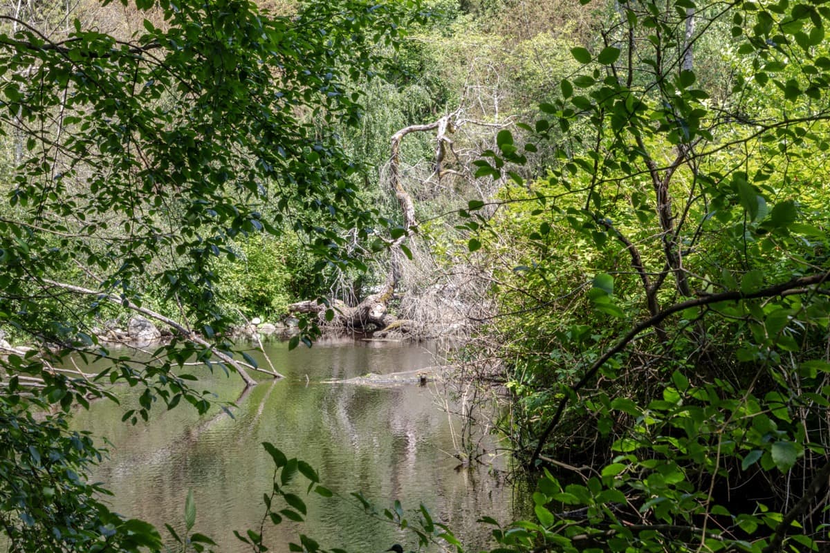
The lagoon was a tidal inlet of Coal Harbour until the 1916 Stanley Park Causeway road severed it. The seam between the city and the park.
- 2
Lord Stanley Statue: The Dedication and the Year
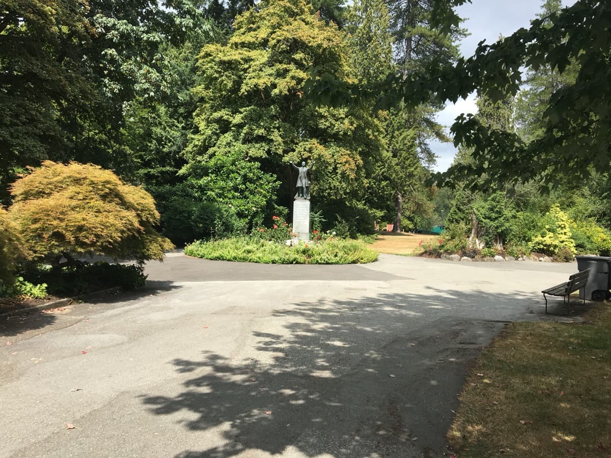
A 1960 Sydney March bronze inscribed with Lord Stanley's 1889 dedication line. The line was spoken one year after the park road was paved with a Coast Salish village midden.
- 3
Brockton Point: The Squatters' Ground
The multi-ethnic Brockton Point squatter community lived here from the 1860s. The Park Board's eviction project ran 1923 to 1958 and ended with the removal of Tim Cummings, the last surviving squatter.
- 4
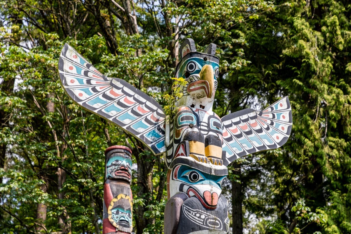
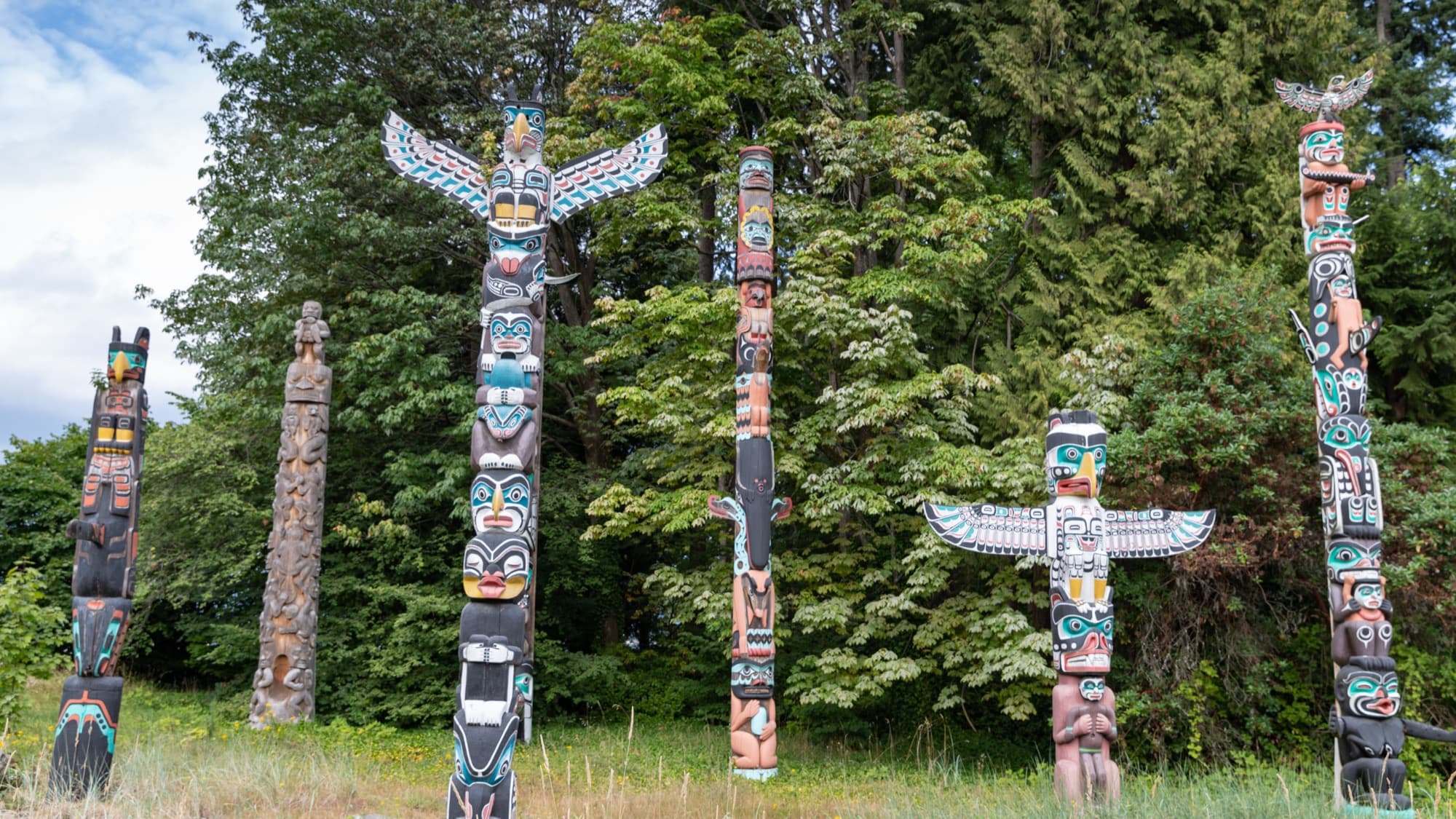
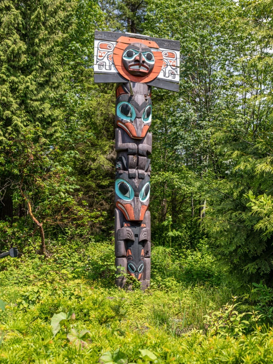
Brockton Point Totem Poles: A Collection, Not an Origin
The Park Board acquired the first poles in 1920 and a further four from Alert Bay in June 1924. The collection moved to its present location at Brockton Point in 1962, during the federal Potlatch Ban.
- 5
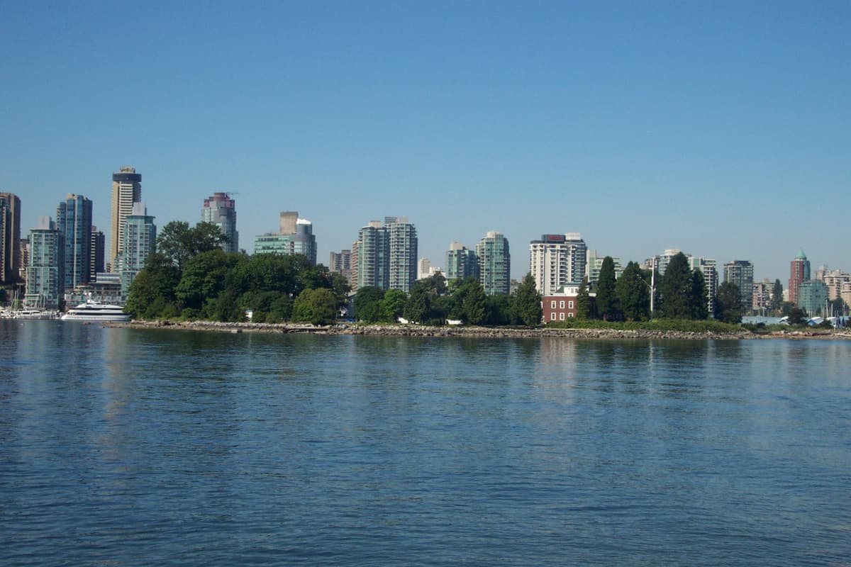
Deadman's Island: The Burial Ground Beneath the Navy
A Squamish burial ground used for centuries, then a settler smallpox quarantine 1888 to 1892, now the HMCS Discovery naval reserve. The seawall stop. Jimmy Cunningham named here.
- 6
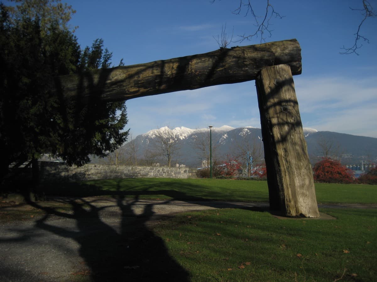
Lumberman's Arch: Xwáýx̱way
The lawn at Lumberman's Arch sits where the Coast Salish village of Xwáýx̱way stood. A longhouse here was recorded at 61 metres by 18 metres. Potlatches were held as late as 1875. Surveyors began clearing the site in 1887.
- 7
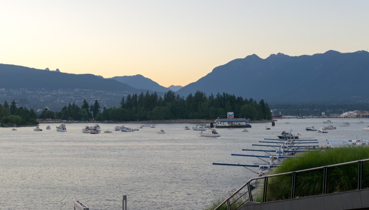
Coal Harbour: The Sen̓áḵw Sightline
The closing stop. The 2014 City of Vancouver unceded acknowledgment is named. Sen̓áḵw, the Squamish Nation's 11-tower urban development at Kits Point, is named as the present-tense answer in progress.
Details
Best Time to Visit
Year-round on paved interior paths and seawall. Weekday mid-morning, Tuesday through Thursday, ten to noon, is gentlest at the Brockton Point totem-pole stop where summer tour-bus traffic is heaviest from eleven to four. The Nine O'Clock Gun at Brockton Point fires daily at twenty-one hundred hours; the audio is not timed to that. Stop 8's Sen̓áḵw sightline is clearest on a bright day.
Pro Tips
- •The tour is paved end-to-end and walkable in any weather. The Pipeline Road segment between Stop 2 and Stop 3 is forested and sheltered; the seawall segments at Stops 4 through 8 are exposed to weather off Burrard Inlet
- •Public washrooms are at the Lost Lagoon Nature House near Stop 1 in summer, at the Brockton Pavilion near Stop 3, and at the Variety Kids Water Park near Stop 7 in summer
- •Vancouver bus 19 drops at the Stanley Park entrance near Stop 1 and at the Aquarium near Stop 7. Burrard SkyTrain station is a fifteen-minute walk from Stop 1
- •Deadman's Island at Stop 5 is the HMCS Discovery naval reserve and closed to public access. View only from the seawall opposite
- •Sen̓áḵw's visibility from Stop 8 depends on weather and phase of construction. The audio names the towers as present in that direction; visual confirmation is a bonus, not a requirement
- •Jean Barman's Stanley Park's Secret (Harbour Publishing, 2005) is the canonical community history for the Brockton squatters and the Coast Salish village sites referenced throughout this tour
Safety & Precautions
- •Stanley Park Causeway traffic above Stop 1 generates road noise at peak hours. Stand at the railing on the lagoon side, not the road side
- •Pipeline Road between Stops 2 and 3 is a paved interior road shared with park-bus traffic and cyclists. Use the shoulder; don't walk in the lane
- •The Brockton Point totem-pole circuit and the Lumberman's Arch lawn are sites with active Coast Salish cultural meaning. Do not touch the poles, do not climb on them, and do not photograph any visiting Indigenous community members without consent
- •The Nine O'Clock Gun fires daily at twenty-one hundred hours. The blast is loud at close range. Do not stand directly beside the enclosure at the top of the hour
- •The seawall path between Stops 4 and 8 is a shared pedestrian and cyclist corridor. Stay in the painted pedestrian lane and listen for bell signals from approaching bikes
Travel advisory: Exercise Normal Precautions (Level 1).
Gallery
Related Reading
Go deeper on what you'll see, hear, and walk through.
Overview
Best Self-Guided Walking Tours in Vancouver (2026)
4 min
Overview
One Day in Vancouver: A Walkable Downtown Itinerary (2026)
6 min
Overview
Vancouver Travel Guide: How Many Days, Getting Around, When to Go (2026)
5 min
Thematic
Best History Walking Tours in Vancouver (2026)
2 min
Thematic
Vancouver: The City Built on Erasure and Reclamation
5 min
Companion
Stanley Park: The Unceded Land Beneath the Postcard
4 min
Read the walk
The full story of Stanley Park: Whose Four Hundred Hectares?, in words. Prefer to listen? Play it narrated, from home or on location.
Introduction
Whose four hundred hectares is this? Hold the question. Don't answer yet.
Stanley Park, Vancouver, Canada. Four hundred and five hectares, about one thousand acres, the most-visited urban park in Canada, and the image most people in the world have when they hear the word Vancouver.
The peninsula was set aside as a federal-colonial military reserve in eighteen fifty-nine by an officer named Richard Clement Moody, twenty-seven years before the city of Vancouver existed. There were at least three Coast Salish villages on it. In eighteen eighty-eight, the year the park opened, work crews ground up a four-acre shell midden from one of those villages and used it to pave the park's first road. One year later, Lord Stanley of Preston, the Governor General of Canada, dedicated the park in the phrasing reproduced on the bronze the route passes in three hundred metres: to the use and enjoyment of peoples of all colours, creeds, and customs, for all time. Twenty-one words. Spoken one year after the road was paved with a village.
The argument is one sentence. The park is a colonial military reserve laid on top of three Coast Salish villages, a Black-Hawaiian-Portuguese-Indigenous squatter community, and a burial ground. The question of whose four hundred hectares it is has never been settled, only postponed.
Seven stops, about five point two five kilometres of paved path and seawall, ninety minutes including pauses. No fees, no ferry, year-round. When you arrive at the Lost Lagoon north causeway, begin with stop one.
1. Lost Lagoon: The Severed Tidal Edge
Welcome to your first stop. You are at the north causeway of Lost Lagoon. Stand at the railing.
The water in front of you used to be the sea. Until nineteen sixteen, the lagoon was a tidal inlet of Coal Harbour. Twice a day the Pacific came in and went out. Coast Salish families harvested clams along its edge. Then the Park Board built the Stanley Park Causeway, the road you can hear above and behind you, the approach to the Lions Gate Bridge. The causeway closed the lagoon off from the harbour. The salt water turned slowly to fresh water. The poet Pauline Johnson called it Lost Lagoon in nineteen ten, six years before it actually was lost, and the name stuck.
This is the seam. Behind you is the city. In front of you is the park. The road between them is a nineteen sixteen colonial-municipal decision that severed a tidal ecosystem to speed cars to a bridge.
Now read the question through this stop. The park did not turn its back on the sea. The sea was walled off. A named board, working for a named bridge project, made the decision, and the body of water you are standing next to is the consequence.
The Chronicler holds the broader frame. The peninsula was reserved by the Royal Engineers Columbia Detachment in eighteen fifty-nine, federally leased to the new City of Vancouver for one dollar a year in eighteen eighty-six, opened as a park on the twenty-seventh of September eighteen eighty-eight, and dedicated by Lord Stanley one year later. The causeway is one decision among many that shaped the park's edges.
Now walk two hundred metres south along the lagoon path to the bronze statue at the park entrance plaza. The man on the pedestal is Lord Stanley. I will meet you at his feet.
2. Lord Stanley Statue: The Dedication and the Year
You have arrived at the Lord Stanley statue, on the entrance plaza off Park Drive. Stand in front of the bronze. Read the inscription.
"To the use and enjoyment of peoples of all colours, creeds, and customs, for all time."
Twenty-one words. Spoken by Lord Stanley of Preston, the Governor General of Canada, on the twenty-ninth of October, eighteen eighty-nine, when he dedicated the park. The bronze itself is younger than the words. It was cast by the English sculptor Sydney March and unveiled here on the nineteenth of May, nineteen sixty, by another Governor General, Georges Vanier.
The dedication phrase reads, in eighteen eighty-nine, as expansive Victorian liberalism. Inclusive, openhanded, all peoples, all time. The line reads honestly only if you also know the year before.
In eighteen eighty-eight, the year the park opened, the city's road crews quarried a four-acre shell midden at Xwáýx̱way, a Coast Salish village a kilometre west of here, and used the ground-up shell as paving material for the park's first road. The midden had accumulated for an estimated three thousand years. The village was still inhabited. Potlatches had been held there as late as eighteen seventy-five. The midden was not discovered. It was used up.
Lord Stanley's line was spoken one year after the road was paved with the village.
The peer who spoke the words is not the villain of this tour. He was a Governor General in town for three days, dedicating a park whose ground work he had no hand in. The line on the bronze is not the lie. The space between the line and the year is where the contradiction lives. The Witness reads the year. The Chronicler reads the words. Both are documented.
Now walk northeast along Pipeline Road. About nine hundred and fifty metres through the forest. The next stop is Brockton Oval, the field where a multi-ethnic squatter community lived for almost a century.
3. Brockton Point: The Squatters' Ground
You have arrived at Brockton Point, near the Nine O'Clock Gun. Stand at the perimeter path. Look across the grass.
From the eighteen sixties to nineteen fifty-eight, a community of about a dozen families lived on the ground in front of you. Their cabins stood along the shoreline below the path, between the gun and the totem-pole grouping you will see at the next stop. The community was multi-ethnic. First Nations, Portuguese, Hawaiian, Black, Scottish, all on one stretch of foreshore.
The canonical record is the historian Jean Barman's two thousand and five book Stanley Park's Secret, Harbour Publishing, winner of the City of Vancouver Book Award. Among the named residents Barman documents: Sexwalia Kulkalem, a Squamish woman whose English neighbours called her Aunt Sally, who lived at Xwáýx̱way with her husband Howe Sound Jack until her death in nineteen twenty-three. Tomkins Brew, an Irish-born former police officer who took over an earlier house here in the eighteen seventies. Joe Silvey, Portuguese, known as Portuguese Joe. And Tim Cummings, born at Brockton Point in eighteen seventy-seven.
The land they lived on was federal Crown reserve, leased to the City of Vancouver in eighteen eighty-six for one dollar a year. The category of squatter was the city's word for them, applied after the lease. The families had been there first.
In nineteen twenty-three, the year Aunt Sally died, the federal government launched a court case to remove the remaining Brockton families. In nineteen twenty-five, the court ruled against them. Cabin burnings began in nineteen thirty-one. The Park Board burned them in stages. The last cabin standing was Tim Cummings's. The Parks Board removed him in nineteen fifty-eight. He was eighty-one. The thirty-five-year eviction project ended with one man.
The Brockton squatters did not share the park with the settlers. They were removed from it, by a named municipal body, with a court verdict and a fire schedule.
Now walk two hundred and twenty metres southwest. The next stop is the cluster of poles at the point.
4. Brockton Point Totem Poles: A Collection, Not an Origin
You have arrived at the totem-pole grouping at Brockton Point. Walk the paved circuit around them. These poles are most people's mental image of Stanley Park. The image is true to what is there. It is also incomplete. The poles are a collection, not an origin. None was carved…
Full narration for this stop unlocks with the tour.
5. Deadman's Island: The Burial Ground Beneath the Navy
You have arrived at the Deadman's Island viewpoint on the seawall. Stop at the railing. Look across the channel at the small wooded island, with the white naval buildings and the Canadian flag. Read it as three layers, in order. First layer. The island was a Squamish burial…
Full narration for this stop unlocks with the tour.
6. Lumberman's Arch: Xwáýx̱way
You have arrived at Lumberman's Arch. Walk onto the lawn under the wooden arch. Stop in the middle of the grass. The arch was built in nineteen fifty-two, named for the Pacific Northwest logging industry. It is the only thing on this lawn that announces itself. Everything else…
Full narration for this stop unlocks with the tour.
7. Coal Harbour: The Sen̓áḵw Sightline
You have arrived at the Coal Harbour seawall, looking south-southwest across Burrard Inlet. Stop at the railing. To your left, the downtown towers. To your right, the green span of the Lions Gate Bridge. Beyond the south-side bridge tower, behind the trees of Kits Point, you…
Full narration for this stop unlocks with the tour.