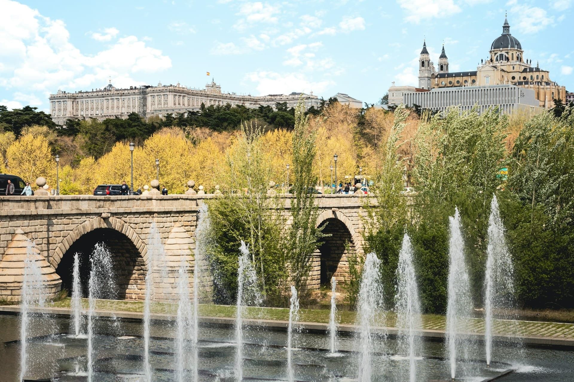
A flat riverside walk from Ribera's chapel across the 16th-century Puente de Segovia, down a pine promenade on the roof of the M-30 tunnels, past the Puente de Toledo and through Perrault's steel bridge to the Arganzuela park.
Start · Ermita de la Virgen del Puerto: The Riverside Chapel
DirectionsStops
- 1
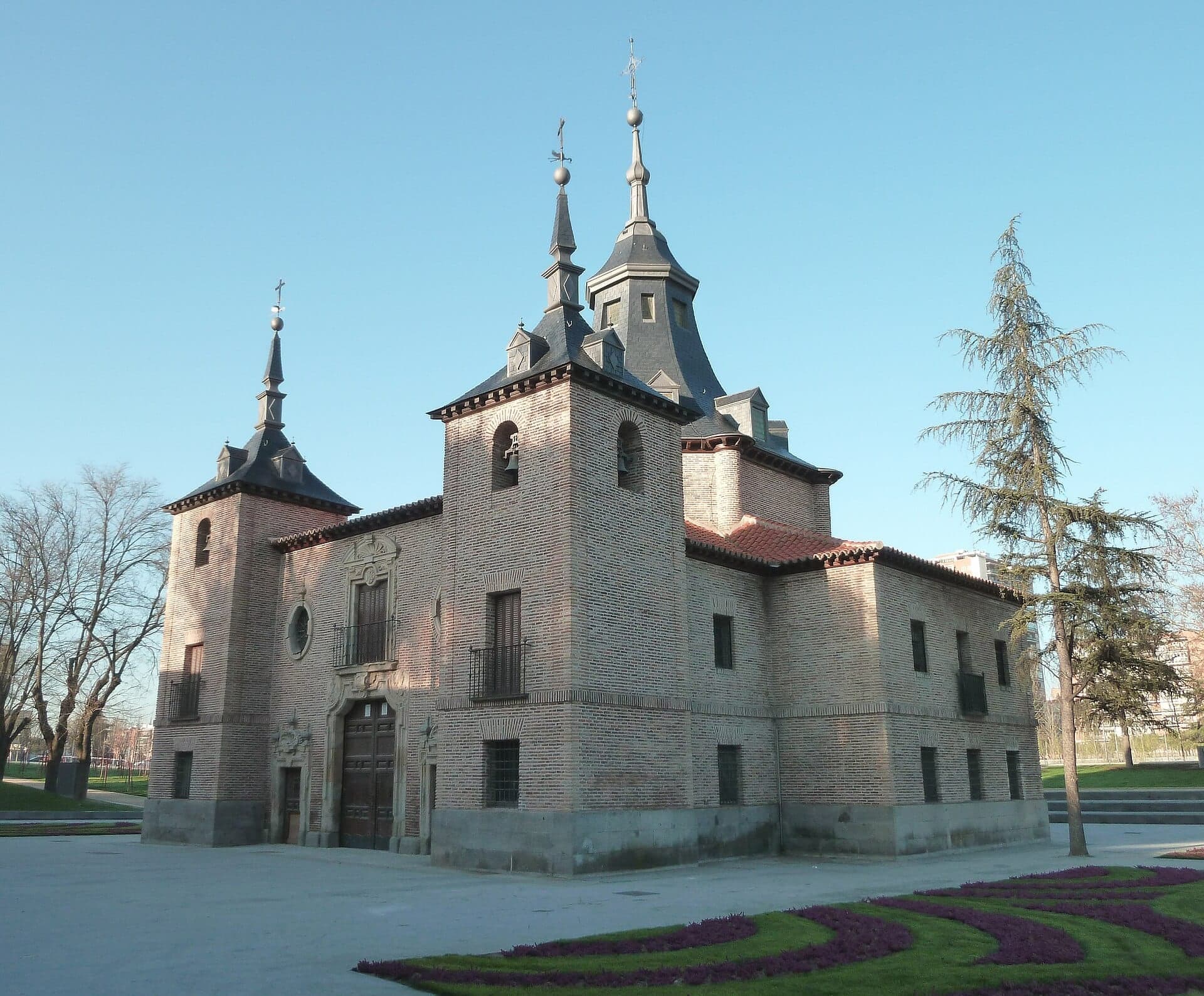
Ermita de la Virgen del Puerto: The Riverside Chapel
Pedro de Ribera's brick and slate riverside chapel, built 1716 to 1718 where the city met its river and restored in 1945.
- 2
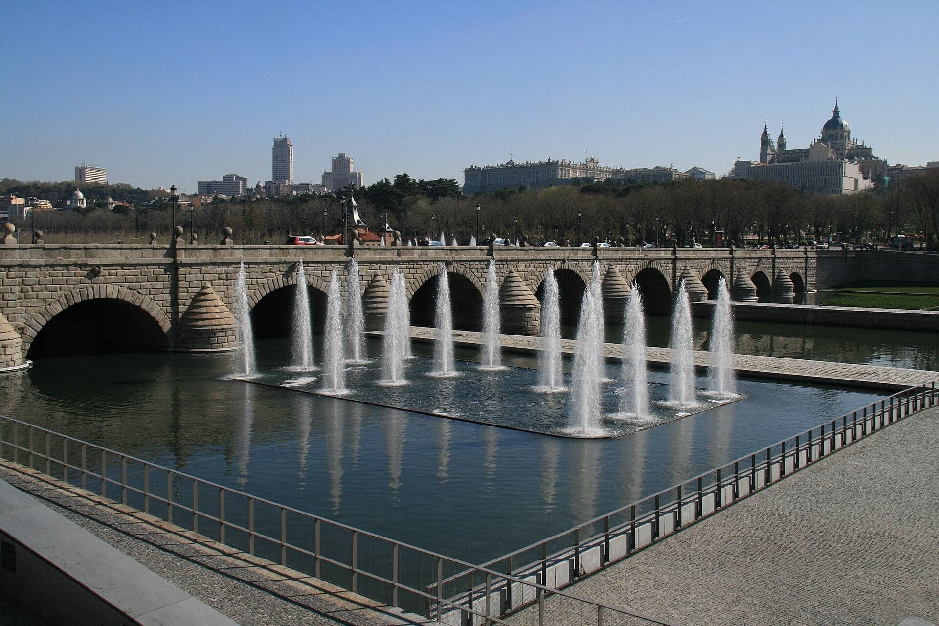
Puente de Segovia: Herrera's Level Bridge
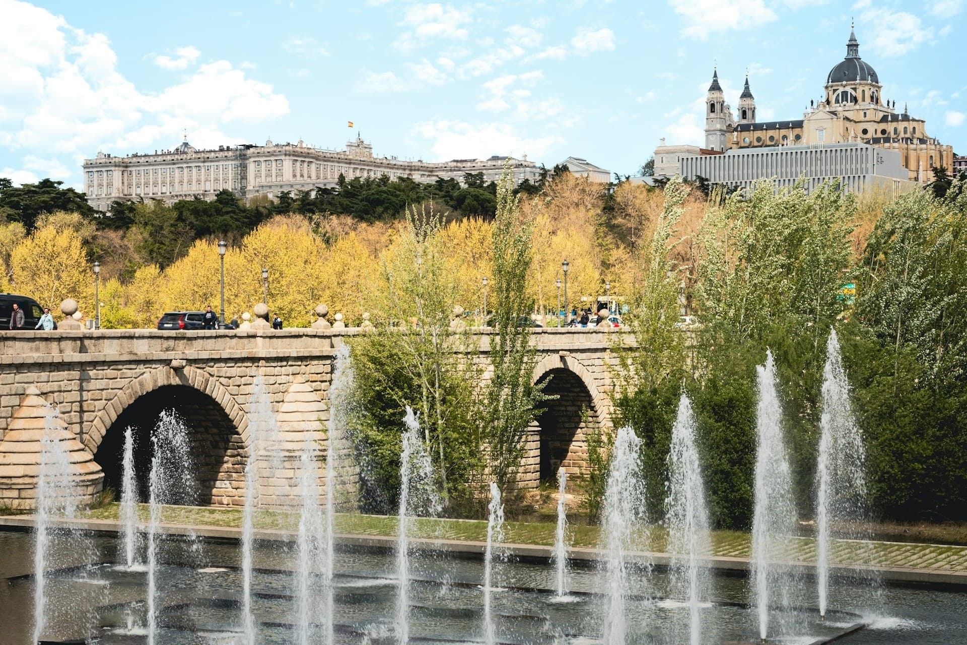
Madrid's oldest bridge on the road to Segovia, begun in 1574 and opened in 1584, with the palace ridge rising above it.
- 3
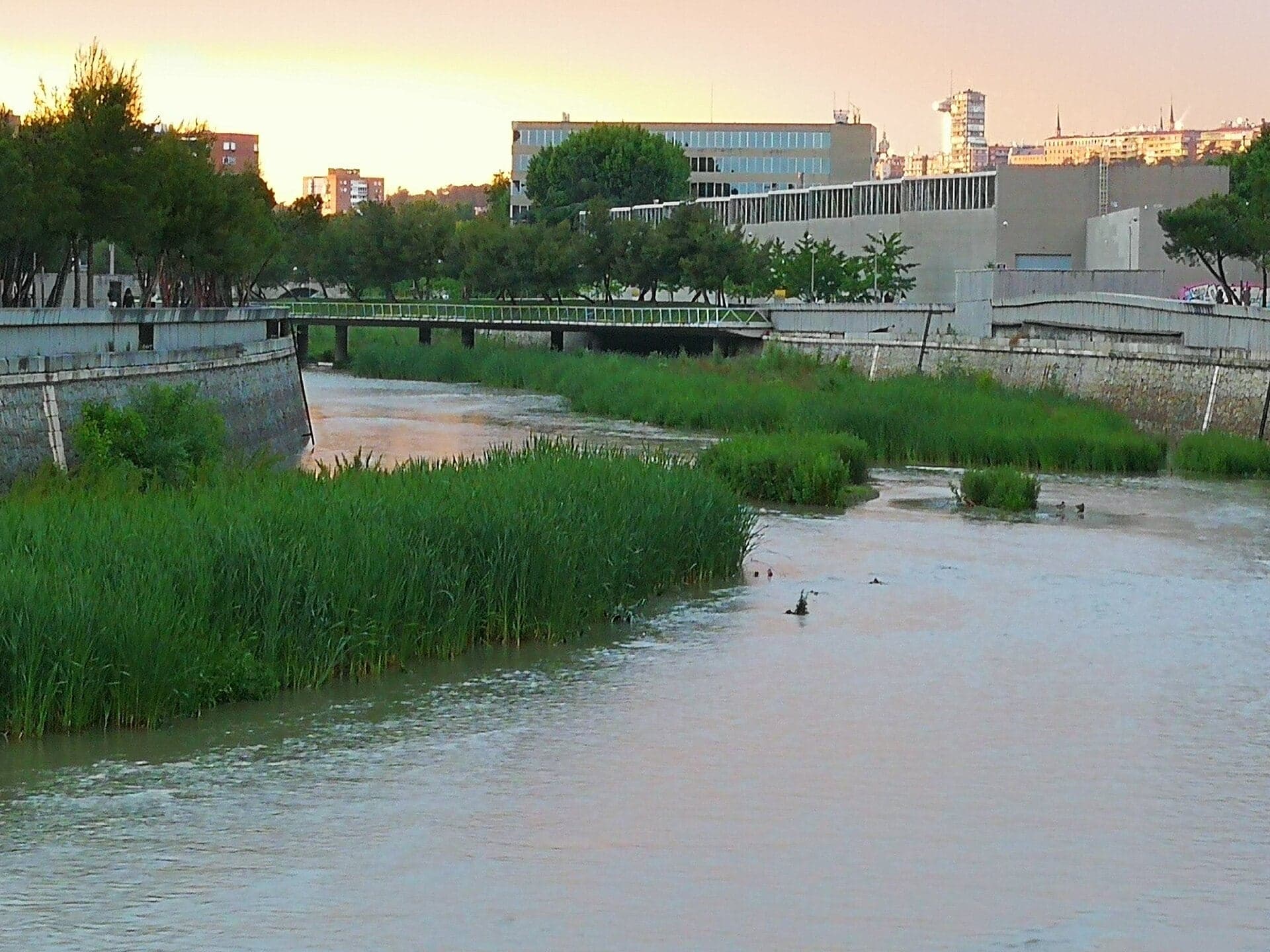
Fisac's Water Laboratory
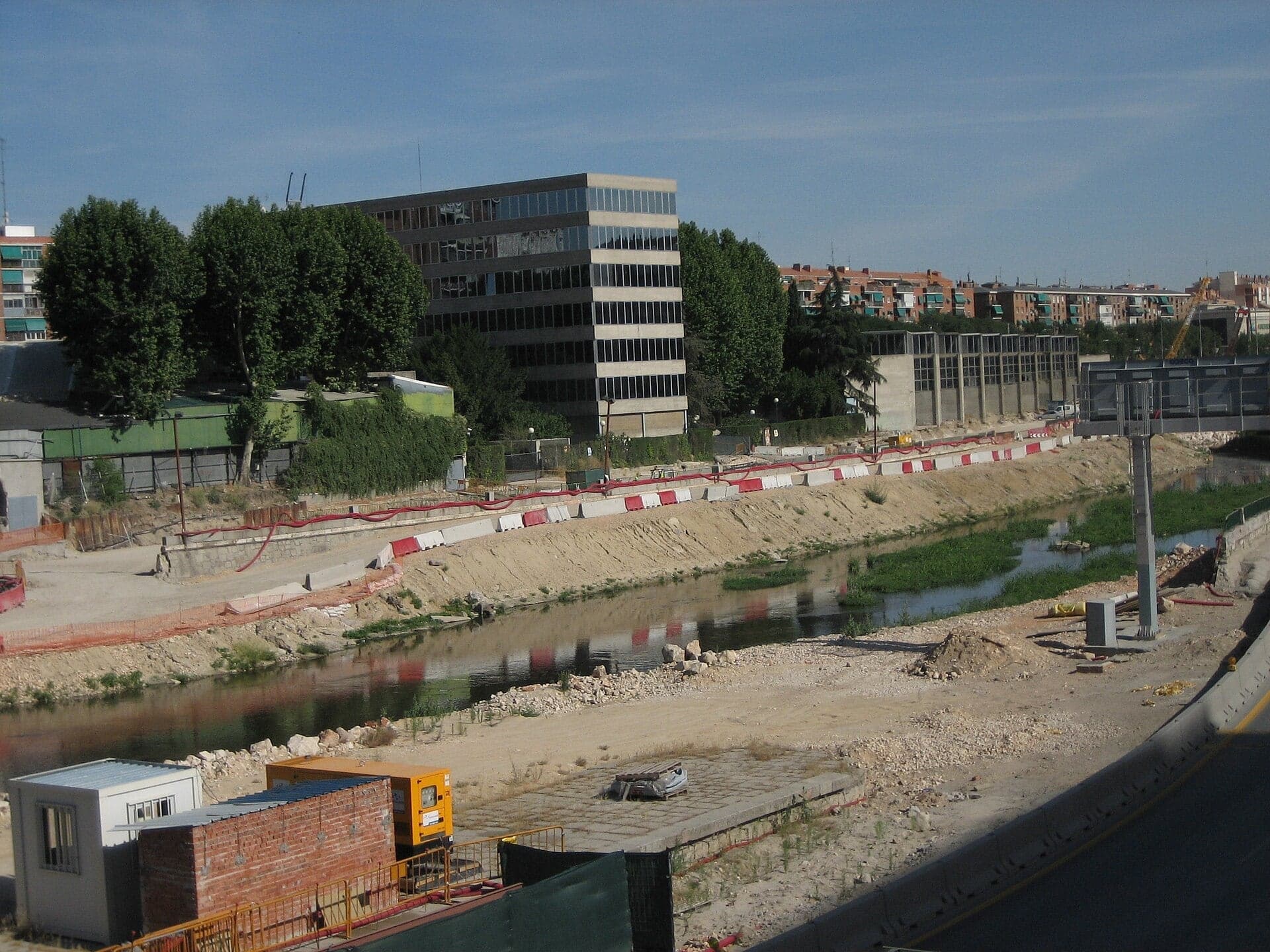
Across the river stands Miguel Fisac's concrete hydraulics laboratory of 1963, where engineers built scale models of rivers and dams.
- 4
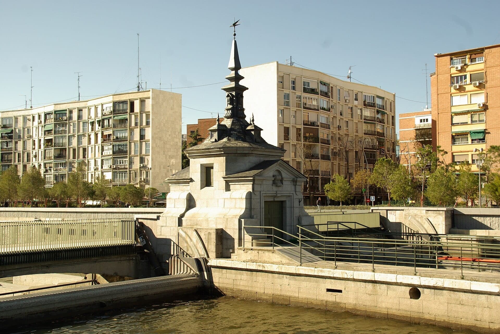
The Weirs: A River Let Loose
The weir where Madrid let its river loose in 2016, and the islands the Manzanares has built by itself since.
- 5
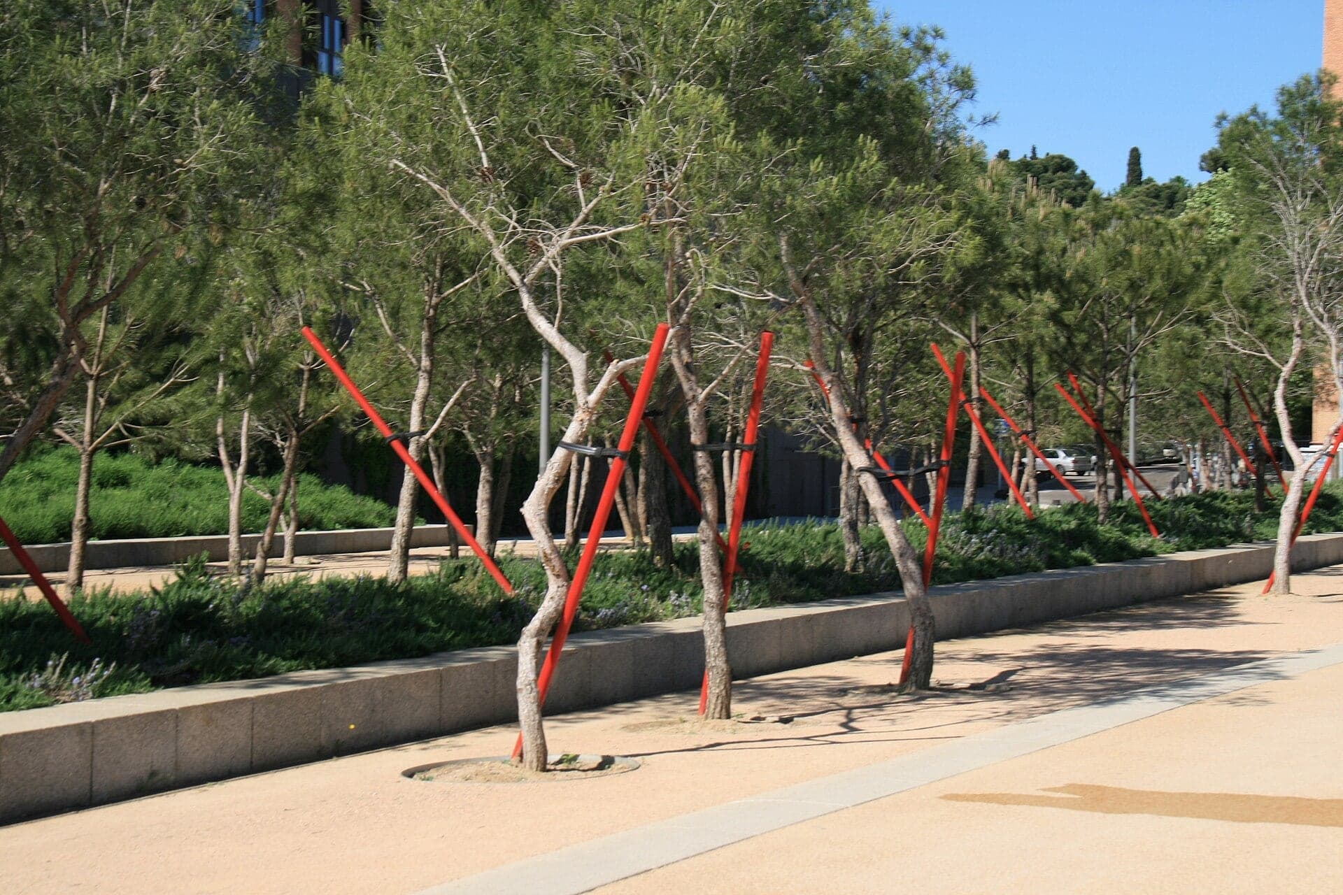
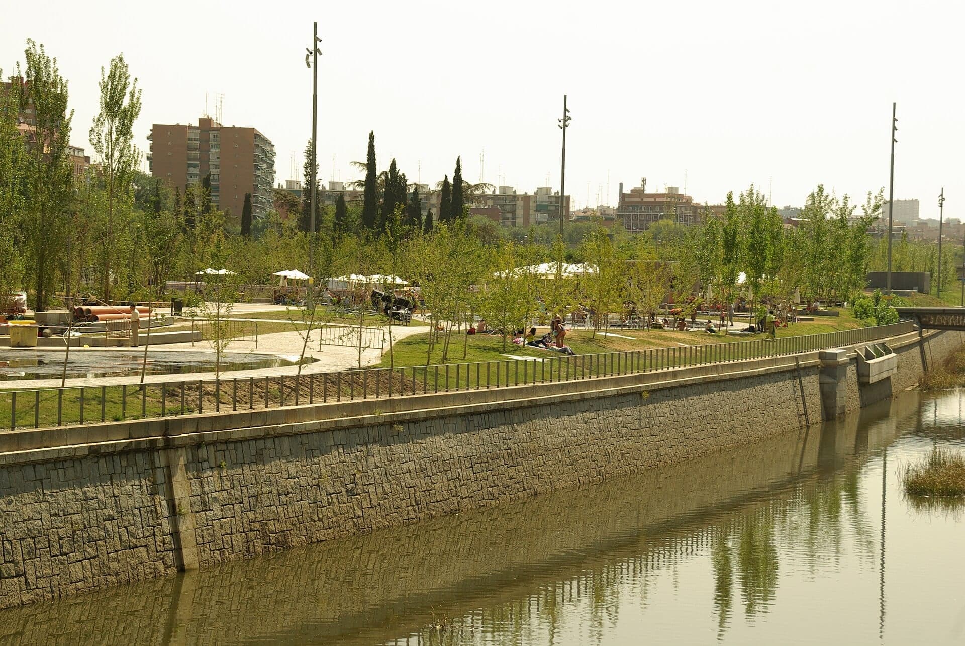
Salón de Pinos: Pines on a Motorway
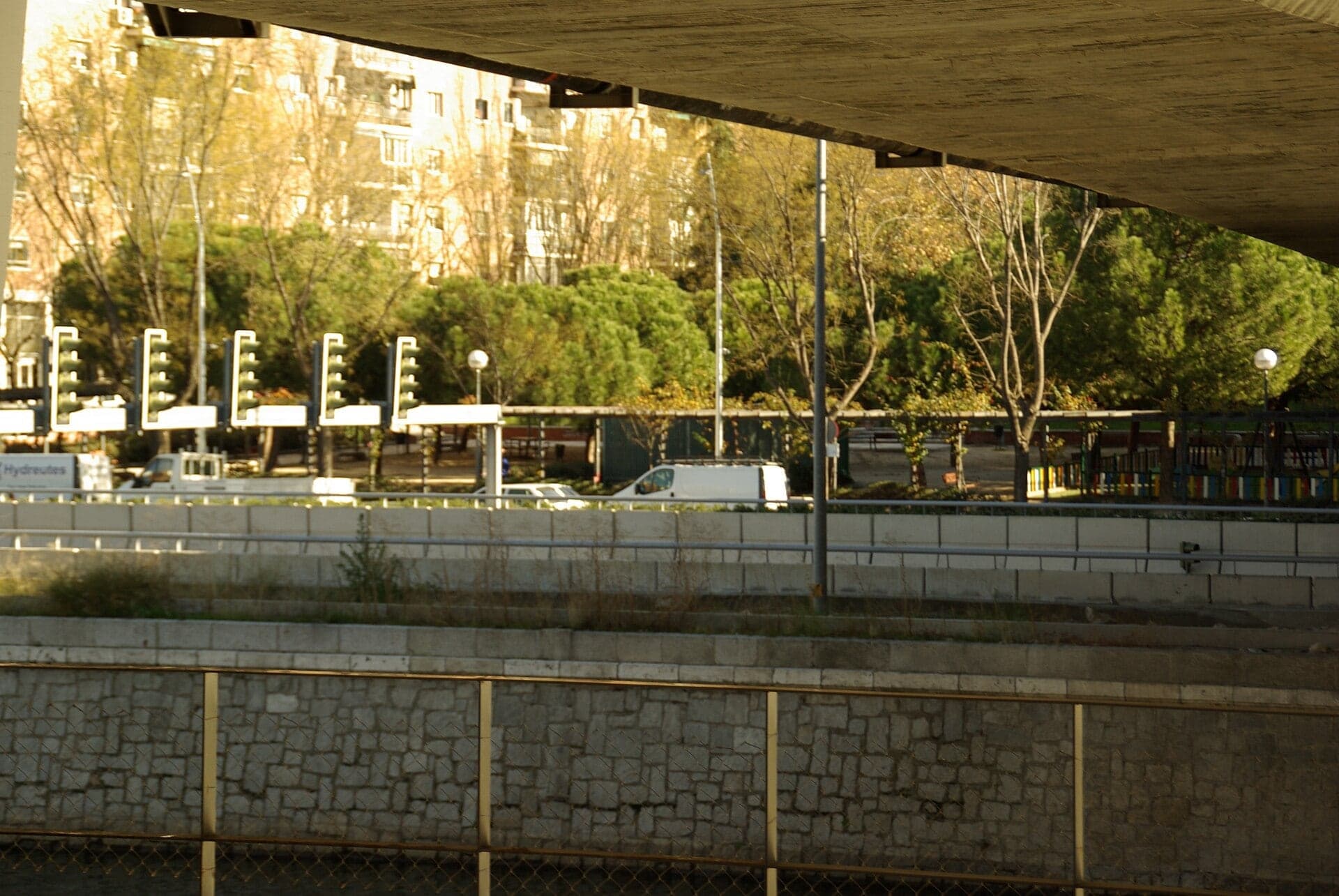
A promenade of pines planted on the roof of the M-30 tunnels, with the motorway running underneath.
- 6
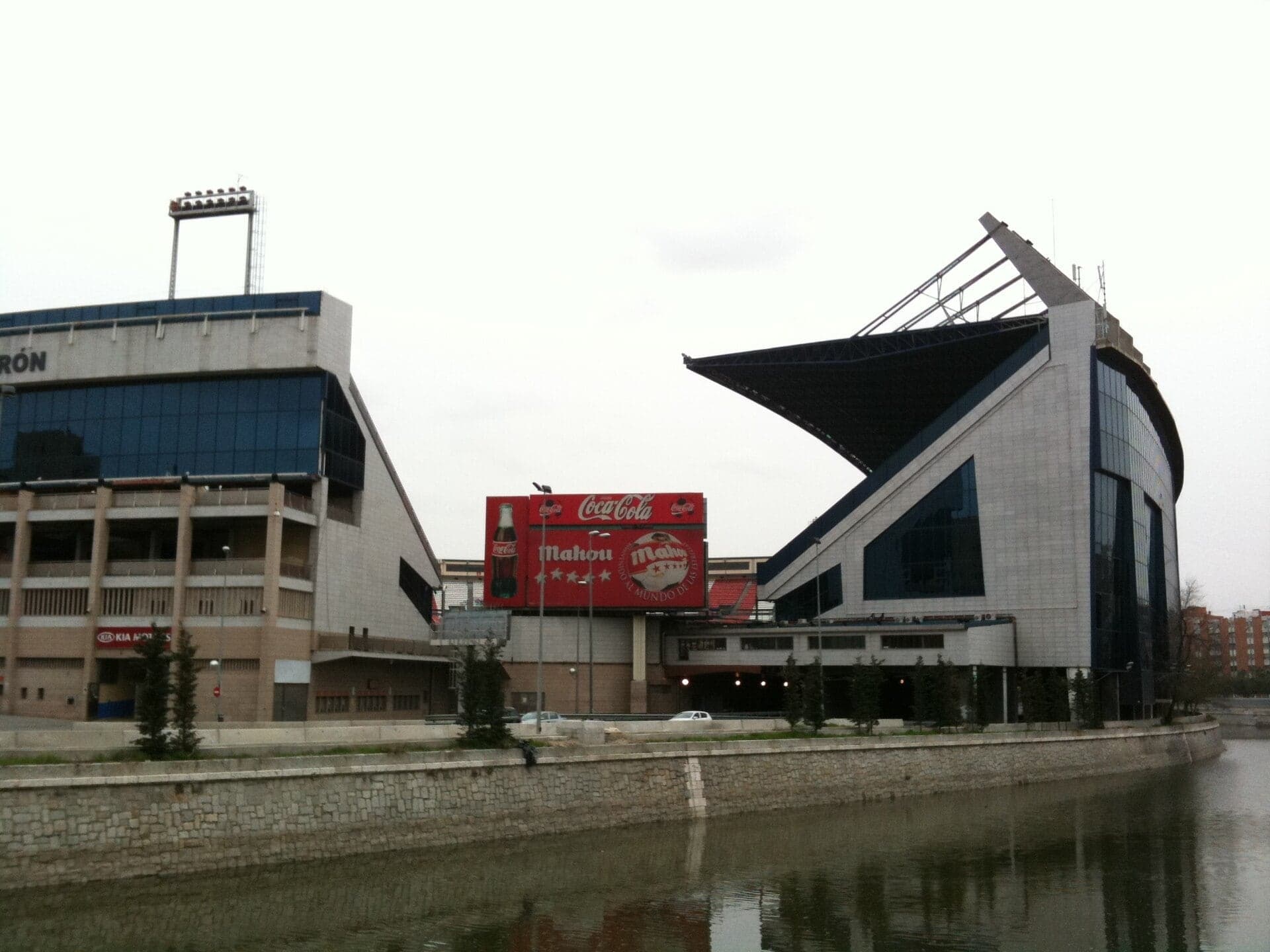
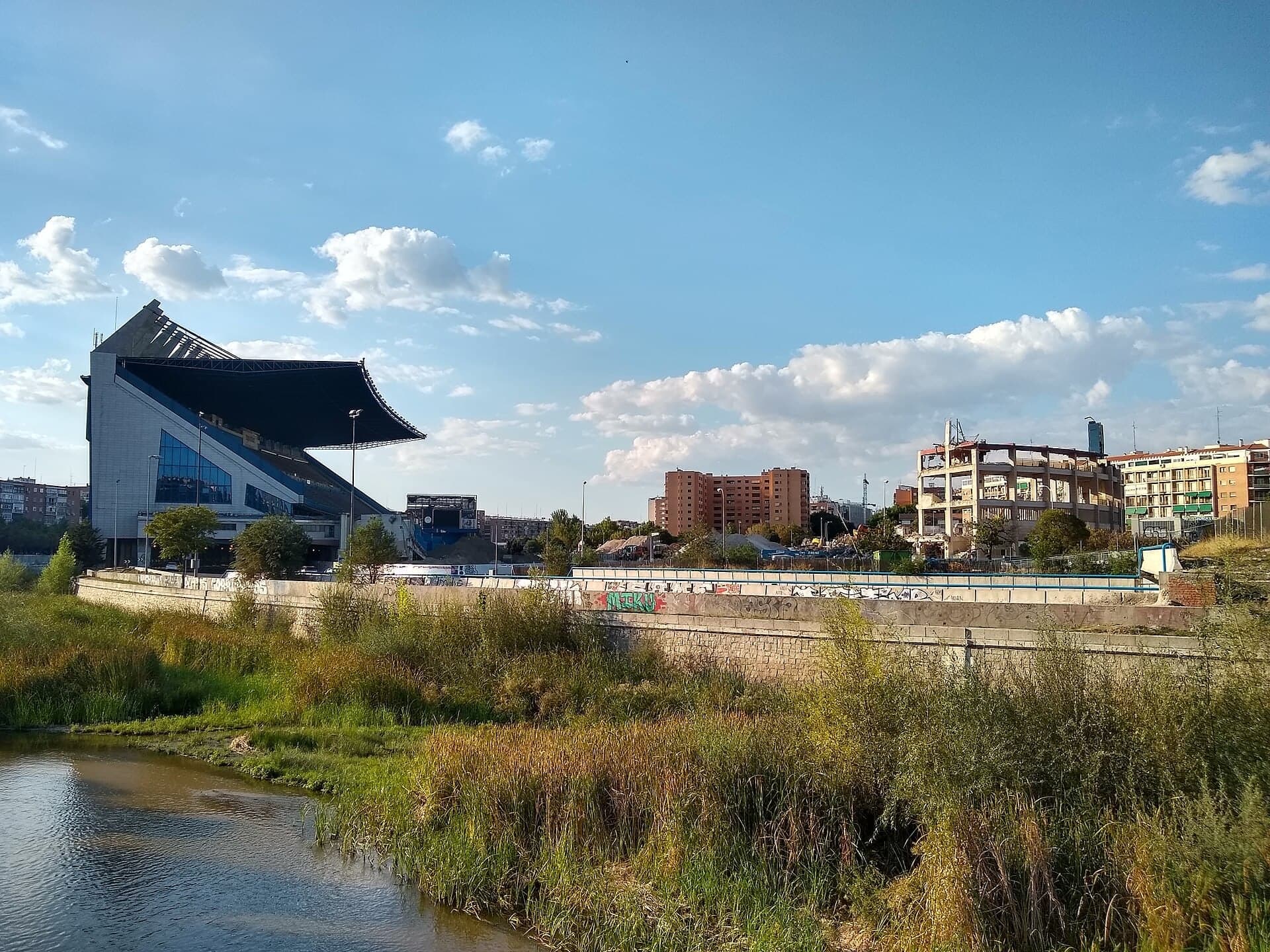
Parque Atlético de Madrid: The Stadium Over the Motorway
Across the bend stood Atlético de Madrid's stadium, built over the M-30; since December 2024 its pitch is a park.
- 7
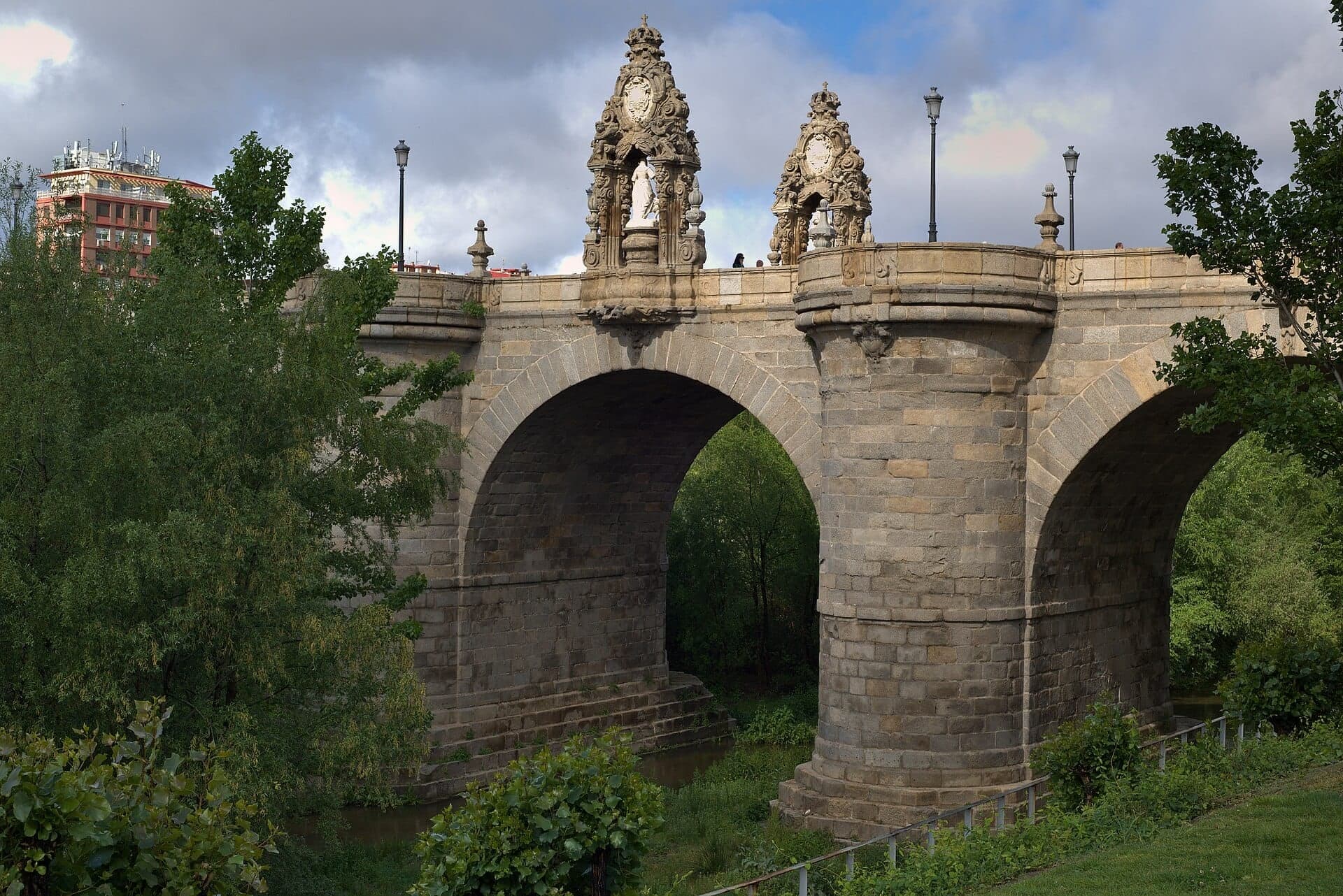
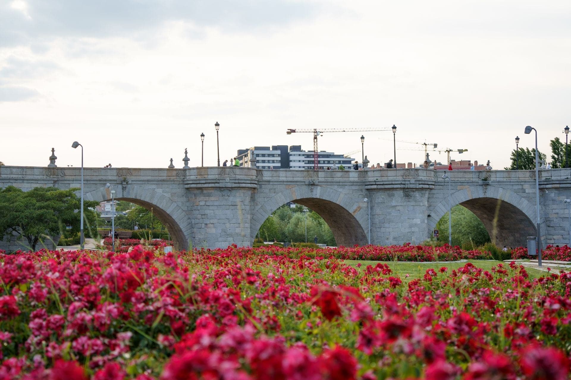
Puente de Toledo: Ribera's Bridge of Saints
Pedro de Ribera's Baroque granite bridge of the 1720s, with two shrines of Madrid's patron saints facing each other.
- 8
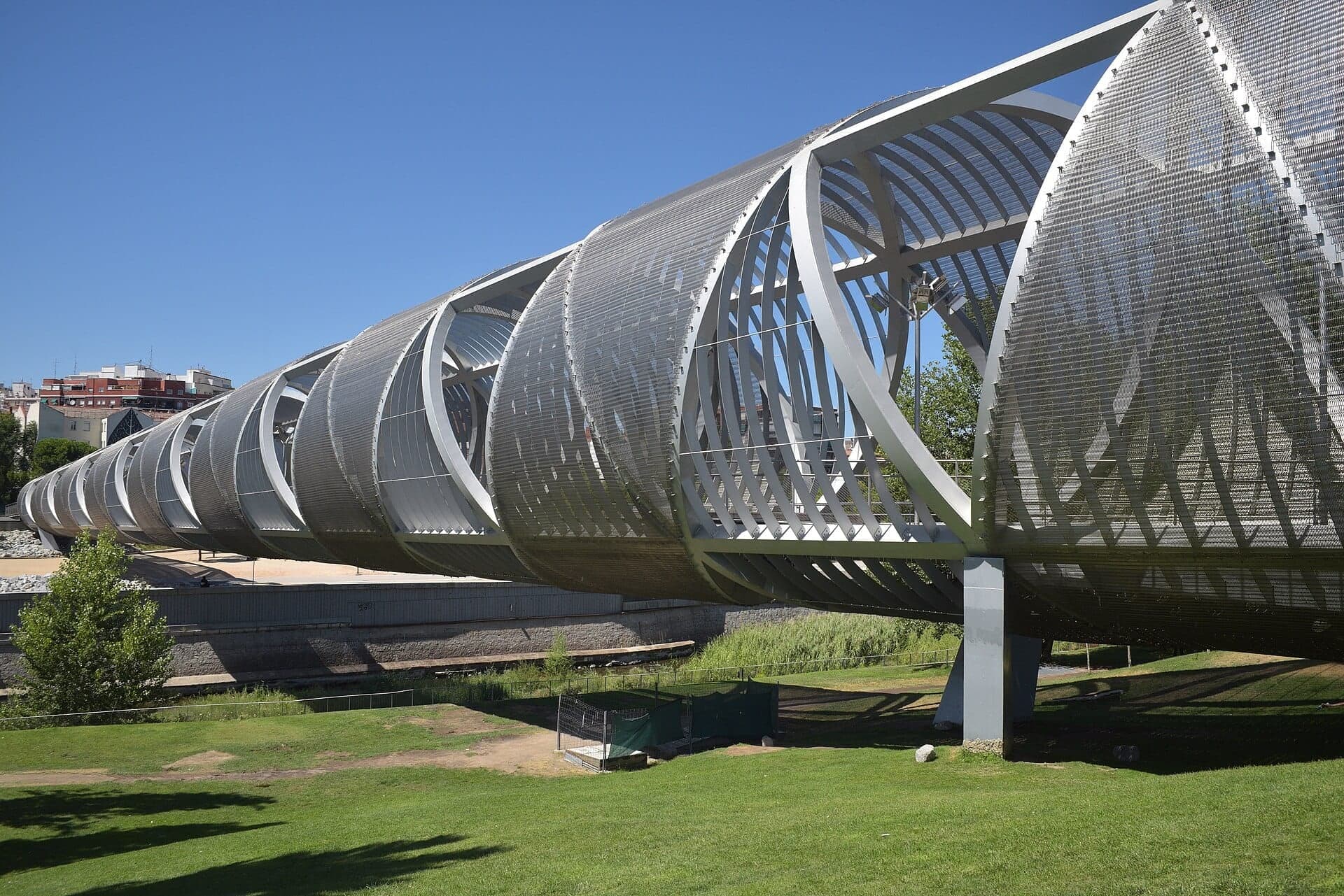
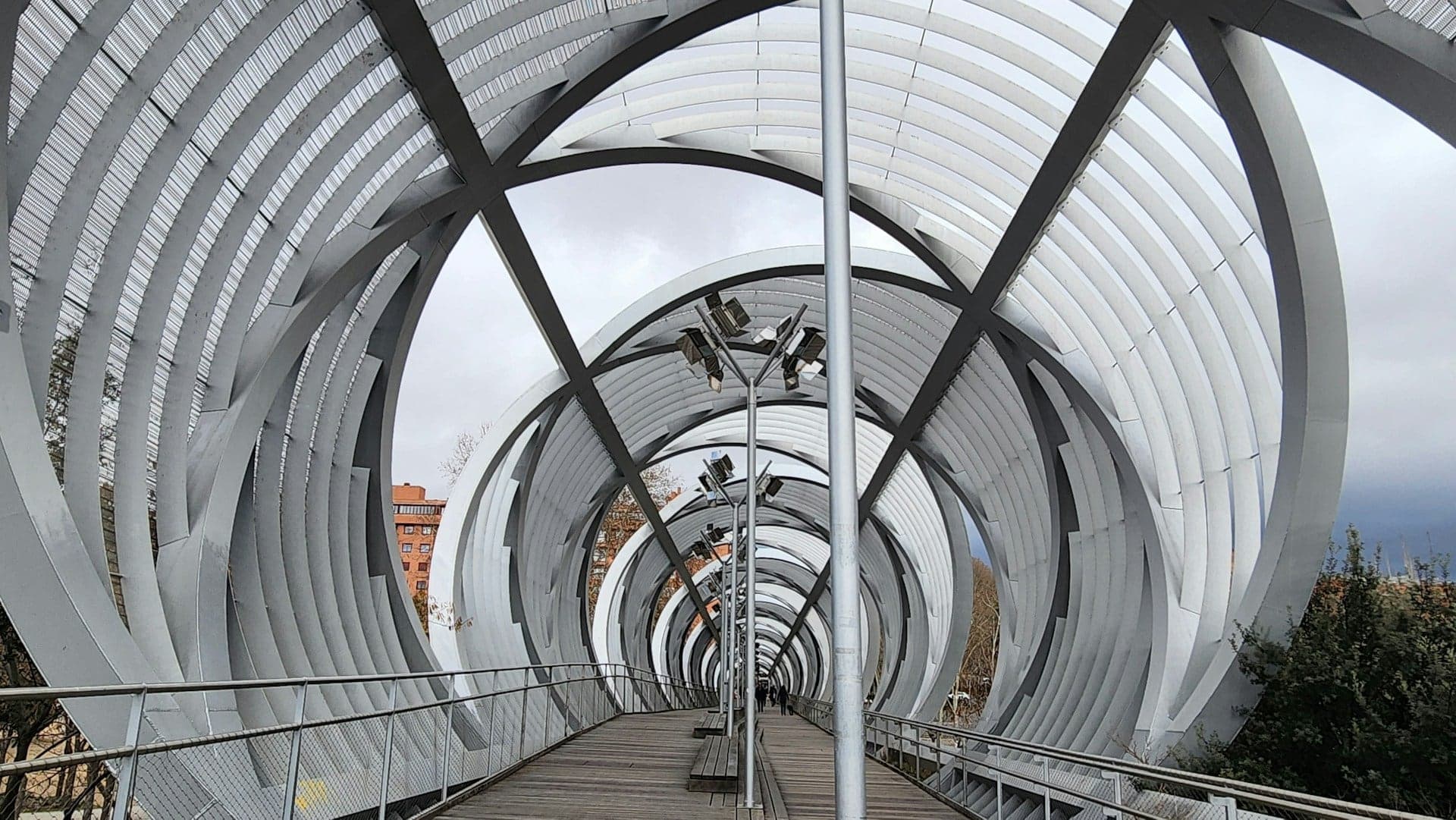
Arganzuela Footbridge: Perrault's Steel Cones
Dominique Perrault's steel footbridge of 2011, two offset cones wrapped in metal mesh, which the walk climbs through.
- 9
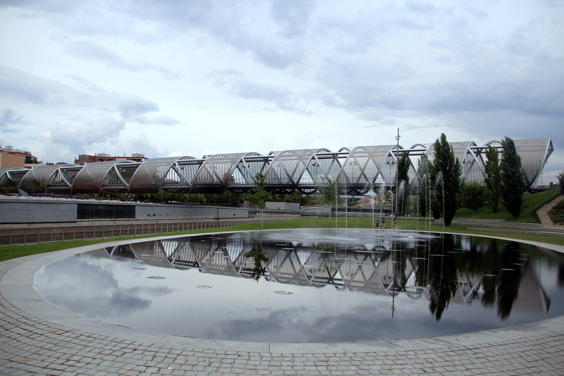
Playa urbana: A Beach Without a Sea
Madrid's summer-only fountain beach of three oval pools, jets and mist, in a park whose theme is water.
- 10
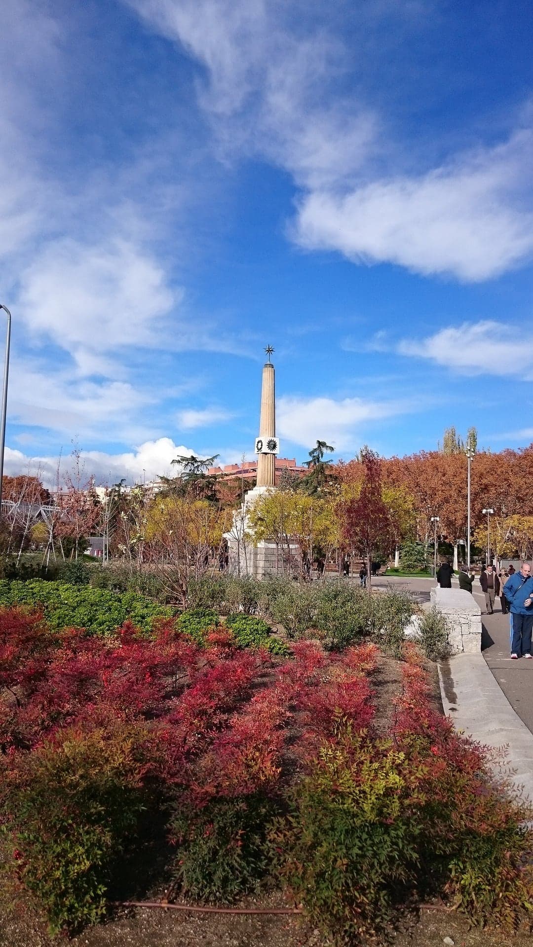
Fuente Castellana: The Fountain That Moved
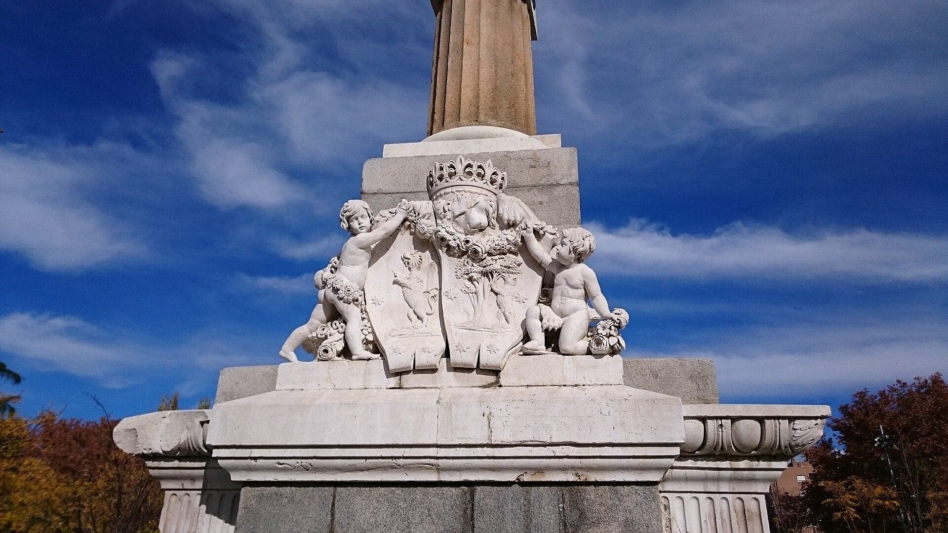
A royal fountain begun in 1833 for the three-year-old Isabel II, moved across Madrid and here since 1969.
Details
Best Time to Visit
Any day of the year, in daylight. Weekday mornings are quiet; weekends fill the promenade with families, runners and cyclists. Late afternoon sun lights the palace ridge above the Puente de Segovia (stop 2). In summer, walk early or late: shade is patchy and the Arganzuela end is open lawn. The Playa urbana's jets run only in summer, from 11am to 9pm in season; the opening date changes every year, so check esmadrid.com before a summer visit. Checked 14 October 2026.
Pro Tips
- •Getting to the start: Príncipe Pío (Metro lines 6, 10 and the Ramal, plus Cercanías trains) is about 650 metres north of the Ermita along the Paseo de la Virgen del Puerto or the riverside path; Puerta del Ángel (line 6) is about 450 metres west across the Puente de Segovia. Buses 25, 31, 33, 36, 39, 41, 50, 62, 65, 138, 158, C1 and C2 stop nearby. Checked 14 October 2026 at esmadrid.com.
- •Getting away from the end: Pirámides (Metro line 5, and Cercanías Pirámides) is about 650 to 700 metres north of the fountain on foot; the nearest step-free entrance, with a lift, is a little further. To leave halfway, Marqués de Vadillo (line 5) is at the south end of the Puente de Toledo (stop 7).
- •Ermita de la Virgen del Puerto (stop 1): usually closed except for services. Its own site lists Thursday 7pm exposition and 8pm Mass, Friday and Saturday 8pm, and Sunday 11am and 12 noon. Guided visits in Spanish on the last Sunday of each month at 1pm (a donation is asked) and on request by email. Checked 14 October 2026 at ermitavirgendelpuerto.es.
- •The only stairs are a flight of 21 steps down from the Puente de Segovia to the riverside on the way to stop 2. For a step-free route, stay on the promenade ramp beside the steps: it reaches the riverside a few metres from the stop. Perrault's bridge (after stop 8) is a ramp.
- •To stand on the Parque Atlético de Madrid lawn (stop 6), cross the river by a footbridge near the stop and come back over the next one: it adds roughly half a kilometre.
- •To keep going: the Matadero is about 1.3 kilometres, some 20 minutes, further downstream along the river, with Legazpi Metro beside it.
- •Playa urbana (stop 9): the pools, jets and mist run only in summer, from 11am to 9pm in season. Opening dates change every year: check esmadrid.com before a summer visit. Checked 14 October 2026 at esmadrid.com.
Safety & Precautions
- •The Madrid Río promenade is shared with cyclists, scooters and runners, mostly on one unmarked path. Keep to the river side, look before you step sideways, and step off the path at every stop, above all at stop 3, where you stand on the promenade itself: step to the river rail.
- •Between stops 1 and 2 you cross the Puente de Segovia's roadway at its west end, a wide, busy road. Use the traffic lights; there is an island in the middle.
- •The wooden decks of the weir footbridge (stop 4) and of Perrault's bridge (after stop 8) are slippery when wet.
- •Summer heat: shade is patchy along the promenade and the Arganzuela park end is open lawn. Carry water and avoid the middle of the day in July and August.
- •The park is lit and open at all hours, but the river paths are quiet after dark.
- •The promenade has many children's playgrounds, and the summer beach is full of children in swimwear: keep cameras away from them.
- •The Ermita (stop 1) is a place of worship; if a service is on, keep your voice down. The Paseo beside it carries heavy traffic.
Travel advisory: Exercise Increased Caution (Level 2).
Gallery
Related Reading
Go deeper on what you'll see, hear, and walk through.
Read the walk
The full story of Madrid Río: The City Gets Its River Back, in words. Prefer to listen? Play it narrated, from home or on location.
Introduction
Madrid, the capital of Spain, spent most of the last century with its back to its river. The Manzanares was walled in granite and held in still ponds behind weirs, and from the nineteen seventies a ring road, the M-thirty, ran along both banks. In the words of the park's project director, the motorway left the river isolated, inaccessible and invisible.
In two thousand three the city decided to put that motorway into tunnels. They opened in two thousand seven, and the park on top, Madrid Río, opened in April two thousand eleven. This walk follows the river through it,.
Three architects shape what you will see: Pedro de Ribera, a Baroque architect of Madrid, who built the chapel where we start and a bridge further on; Juan de Herrera, who redesigned the old bridge you will cross; and Dominique Perrault, whose steel bridge you will walk through.
The walk is ten stops over a little under three and a half kilometers, about two miles, and takes about an hour and a quarter. It is flat, downstream all the way, with one road crossing at traffic lights and one flight of steps with a ramp beside it. Nothing is ticketed. It begins at the Ermita de la Virgen del Puerto, ten minutes' walk from Príncipe Pío station, and ends at a royal fountain in the Arganzuela park, ten minutes from Pirámides Metro.
1. Ermita de la Virgen del Puerto: The Riverside Chapel
Welcome to the Ermita de la Virgen del Puerto, where this walk begins. Stand on the pavement where you can see the front of the little chapel: brick and stone, a balcony over the door, and two small square towers with slate spires. Ermita means a chapel, and this one belongs to the Virgin of the Port.
Pedro de Ribera built it between seventeen sixteen and seventeen eighteen for the Marquis of Vadillo, who ran the city for the king. The marquis had held the same post in Plasencia, and the Virgin of the Port, the patron of that town, was his devotion. In September seventeen eighteen her image was brought here in a solemn procession.
Why here? Because this was where the city came down to its river. The Manzanares is only a couple of minutes away, and this bank was the ground of the women who washed the city's laundry in it. The marquis also founded a school here for their children.
Now look at the materials. The spires are slate, in the old Madrid tradition, and the walls show bare brick and stone. The chapel was badly damaged in the Civil War and restored in nineteen forty-five. For part of the last century the towers were roofed in zinc; later restorers stripped the plaster from the walls to show the brick and stone again, and gave the towers back their slate. Round the back, the dome is shaped like an upturned bell.
The chapel opens mainly for Mass, in the evenings and on Sunday mornings; the times are in the tips.
Follow the route south along the pavement and over the old bridge, on its upstream side. At the far end, cross the road at the traffic lights, with an island in the middle, then take the steps down to the river, or the ramp just beside them. Next is that bridge, seen from below.
2. Puente de Segovia: Herrera's Level Bridge
At the foot of the steps, walk on a few meters along the riverside and stop. Turn to face upstream, toward the bridge you just crossed: nine round arches of granite, and above them, up on the ridge, a great dome and the top floors of a palace.
This is the Puente de Segovia, the oldest bridge in the city. It carried the road to Segovia, one of the main ways into the capital. King Philip the Second ordered it in fifteen seventy-four, to plans by his master of works. When that architect died in fifteen seventy-seven, the bridge had got no further than its foundations, and Juan de Herrera, the architect of El Escorial, took over.
Herrera changed one thing you can still see. The old plan was medieval: a road that sloped up to the middle and down again. Herrera made the road dead level, and the bridge opened to traffic in April fifteen eighty-four.
Now the detail. The piers were already in place, so the arches kept their different widths while the road above them ran flat. Look at the keystones, the wedge-shaped stones at the top of each arch. Away from the middle arch, each one sits a little further below the line of the top. That growing gap is the trace of the redesign.
After the Civil War an engineer widened the bridge to roughly three and a half times its width, splitting it and opening it out. Then, in the nineteen fifties, when the river was channeled, its piers were dug out and its arched faces restored to Herrera's design. A sixteenth-century face on a twentieth-century road.
Above it is the dome of the Almudena cathedral, and over the bridge rise the upper floors of the Royal Palace. Our Royal Palace walk tells their story from up there.
Follow the route down the riverside path. Next is a laboratory across the water.
3. Fisac's Water Laboratory
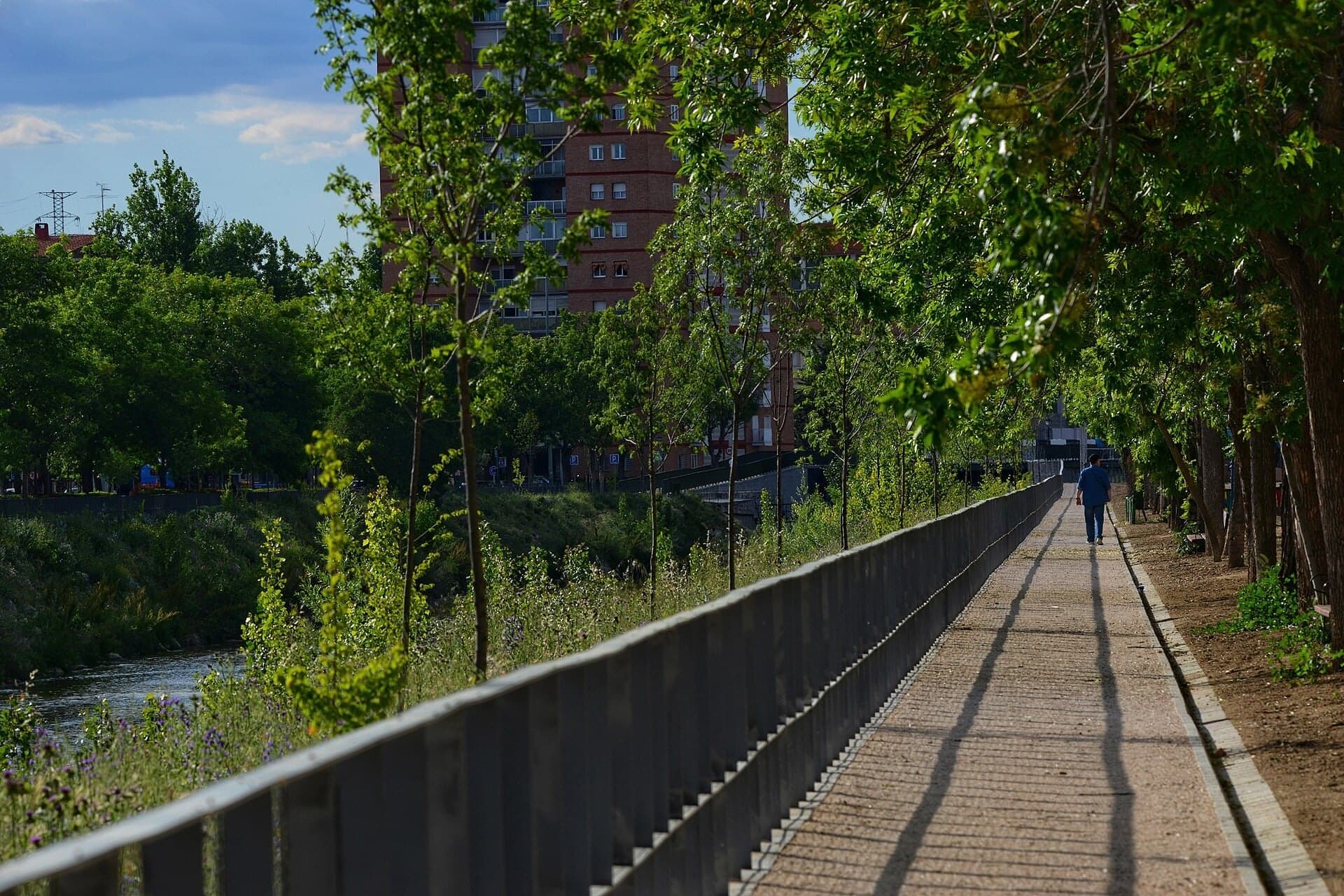
Walk on along the promenade and stop there, then step to the river rail, off the bike line: this path is shared with cyclists. Across the water, look through the trees for a long, low building of bare concrete.
That is a laboratory for water, designed by the architect Miguel Fisac and finished in nineteen sixty-three for Spain's Center for Hydrographic Studies. It is still a working government laboratory, closed to visitors, so this stop is a look across the river.
It came in two parts, joined only by a corridor on the first floor: an office block six floors high, and a long hall for models and water tanks, eighty meters by twenty-two. In that hall, engineers built scale models of rivers and dams.
Fisac built it all in concrete, inside and out, at a time when official buildings were going up in granite. He took care over the wooden boards that shaped the concrete, and their grain still shows on the walls.
For the hall's roof he designed precast concrete beams he called bones, for their likeness to the bones of animals. They spanned the hall, let in soft daylight for the tests, and carried off the rain. Leaks meant they were replaced in nineteen ninety-five, with the same rhythm kept inside. So the bones are gone; what you see from here is the concrete.
There is an irony here. Engineers studied rivers in that hall, beside a river that engineers had turned into a canal. At the next stop you will see what happened when they let it go.
Follow the route along the promenade. Next is a weir.
4. The Weirs: A River Let Loose
Stop where the wooden footbridge across the river begins, just off the bike path. The footbridge runs along a weir, a low barrier that holds the water back. The Manzanares once had woods along its banks and bars of sand in its bed. Then, between the nineteen twenties and the…
Full narration for this stop unlocks with the tour.
5. Salón de Pinos: Pines on a Motorway
Walk on past the bridge you just went under, and stop on the wide paved promenade among the pines, with that bridge behind you. You are standing on the roof of a motorway. The M-thirty that once ran along this bank now runs in tunnels under your feet, and this promenade of…
Full narration for this stop unlocks with the tour.
6. Parque Atlético de Madrid: The Stadium Over the Motorway
Walk on along the promenade and stop there. Look across the water, to your left and a little behind you: the ground over there was a football stadium. It opened on the second of October, nineteen sixty-six, as the Estadio Manzanares, named for this river. It became Atlético de…
Full narration for this stop unlocks with the tour.
7. Puente de Toledo: Ribera's Bridge of Saints
Walk on down into the gardens and stop at the foot of the path. The old stone bridge stands close by, about fifty meters away: granite arches, with two small stone pavilions over the middle. This is the Puente de Toledo, and it is Pedro de Ribera's, the architect of the chapel…
Full narration for this stop unlocks with the tour.
8. Arganzuela Footbridge: Perrault's Steel Cones
Walk on to the foot of the bridge's ramp and stop there, off to one side: bikes use this bridge too. Turn to face the bridge: it rises over the river in a coil of steel. This is the bridge of the Arganzuela park, designed by the architect Dominique Perrault with a team of…
Full narration for this stop unlocks with the tour.
9. Playa urbana: A Beach Without a Sea
Walk on along the path and stop there. Just ahead, to your right, between here and the river, is a paved and lawned strip: Madrid's beach. Madrid has no sea, and its river is no place for a swim, so Madrid Río built a beach without either. The Playa urbana is three oval pools,…
Full narration for this stop unlocks with the tour.
10. Fuente Castellana: The Fountain That Moved
Walk on along the path and stop there, with the tall stone column straight ahead of you. This is the Fuente Castellana, also called the Obelisk of Isabel the Second, or simply the Arganzuela obelisk. It began as a royal fountain. King Ferdinand the Seventh ordered it to…
Full narration for this stop unlocks with the tour.
- View of Ermita de la Virgen del Puerto (an hermitage) in Madrid (Spain). — Luis García (Zaqarbal), CC BY-SA 3.0 · source
- Ermita de la Virgen del Puerto, Madrid — Thomas Woodtli from Zürich, Switzerland, CC BY-SA 2.0 · source
- Surtidores - Madrid Río (Puente de Segovia) - Madrid — Tamorlan, CC BY-SA 3.0 · source
- Madrid Rio, park parallel to the Manzanares River next to the Cedex building by architect Miguel Fisac — María Sacristán, CC BY-SA 4.0 · source
- Madrid Río during the Works in 2006, CEDEX building by the architect Miguel Fisac — María Sacristán, CC BY-SA 4.0 · source
- ® MADRID P.L.M. ARGANZUELA REPRESA SAN ISIDRO — Concepcion AMAT ORTA…, CC BY 3.0 · source
- El nuevo contrato de conservación del río Manzanares, a su paso por el término municipal, tendrá como principal objetivo alcanzar las adecua — Diario de Madrid, CC BY 4.0 · source
- Tutores del Paseo de los Pinos — Tamorlan, CC BY-SA 3.0 · source
- MADRID P.L.M. ARGANZUELA PANORAMA PUENTE DE SAN ISIDRO (COMENTADA) — Concepcion AMAT ORTA…, CC BY 3.0 · source
- 2010-03-21 Estadio Vincente Calderon desde la otra orilla del rio Manzanares — Axel Schlaefer, CC BY-SA 3.0 · source
- Toledo Bridge, Madrid (Spain). — Javier Perez Montes, CC BY-SA 4.0 · source
- Perrault bridge, south part, Madrid (Spain). — Javier Perez Montes, CC BY-SA 4.0 · source
- "Urban Beach" at Madrid Rio Park along the Manzanares River in Madrid, Spain with the Pasarela Arganzuela bridge in the background — Fjmustak, CC BY-SA 4.0 · source
- ® S.D. (ES,EN) MADRID PARQUE DE LA ARGANZUELA-PLAYAS — Concepcion AMAT ORTA…, CC BY 3.0 · source
- Obelisco de la fuente Castellana, situado en el parque de la Arganzuela (Madrid Río) — Discasto, CC BY-SA 4.0 · source
- Obelisco de la fuente Castellana, situado en el parque de la Arganzuela (Madrid Río) — Discasto, CC BY-SA 4.0 · source
Images may be cropped or resized. Other photos via Unsplash and Pexels.