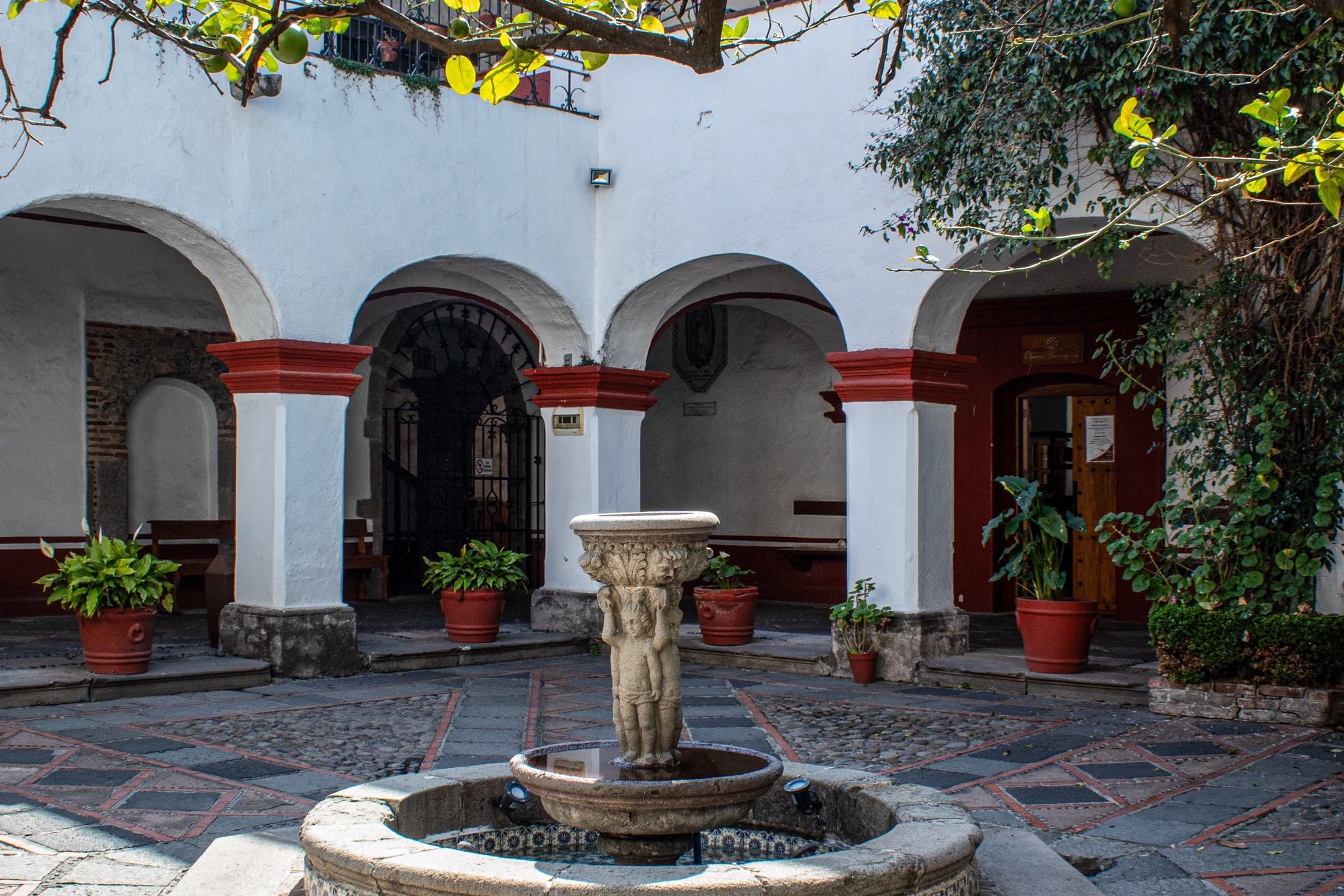
Walk San Ángel from the Obregón monument past El Carmen's tiled domes, the Casa del Risco, Plaza San Jacinto and its Saturday bazaar, and cobbled walled lanes to the Rivera-Kahlo studios and the San Ángel Inn.
Start · Obregón Monument: A Tower Built for an Arm
DirectionsStops
- 1
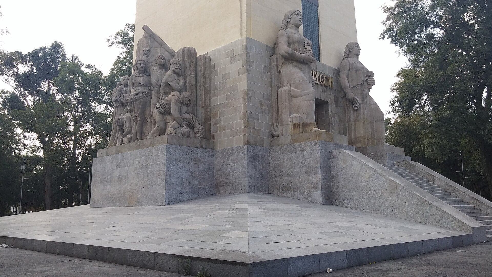
Obregón Monument: A Tower Built for an Arm
A monument built around a general's arm stands where he was shot. Álvaro Obregón, president-elect, was killed at the La Bombilla restaurant here in 1928.
- 2
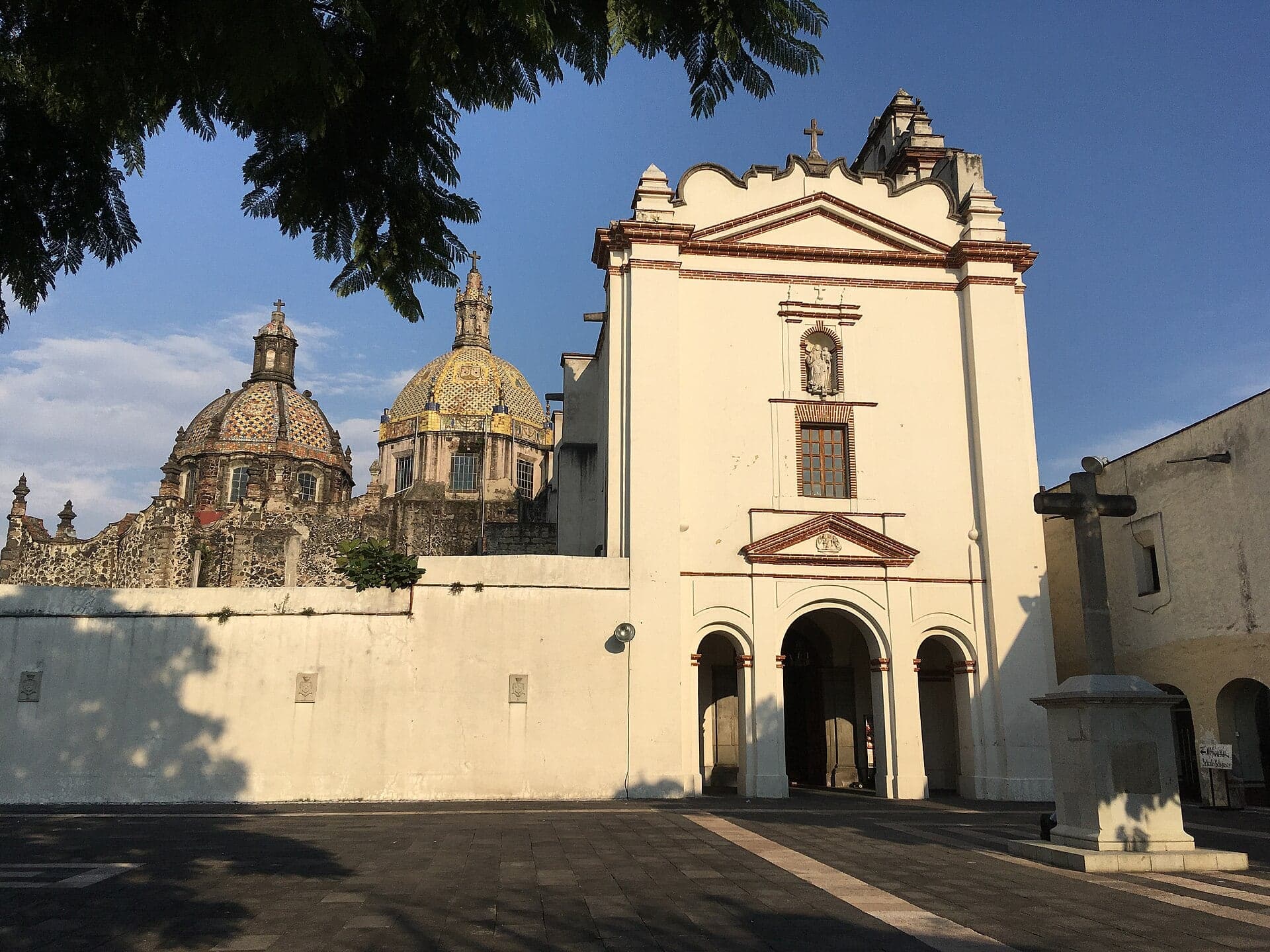
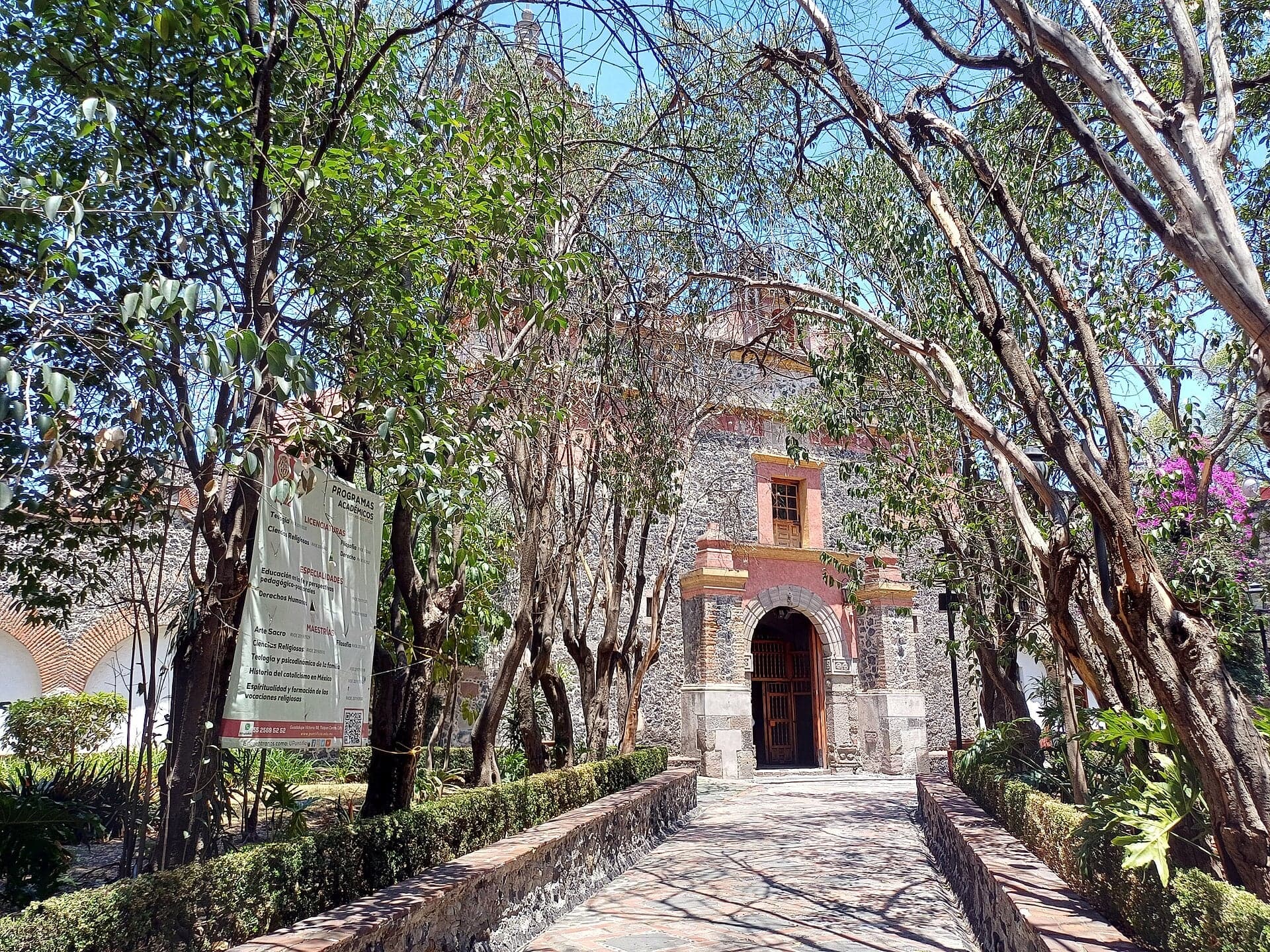
El Carmen: The College That Named the Village
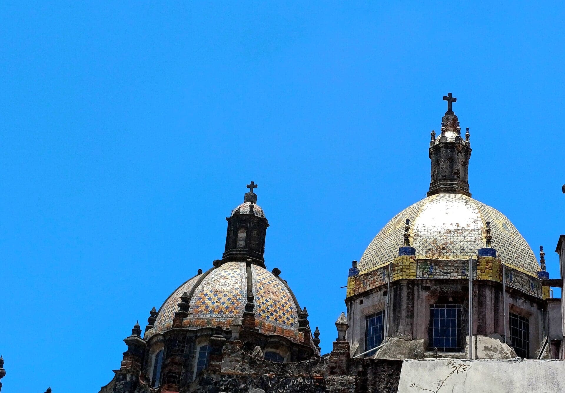
Carmelite friars built this college and the village took its name. Tiled domes, a church, and a museum with a crypt of mummies.
- 3
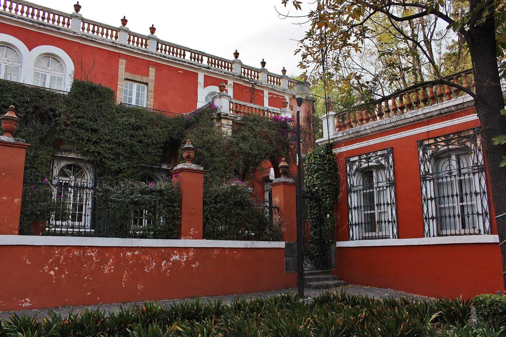
Plaza del Carmen: The Mint Family's House
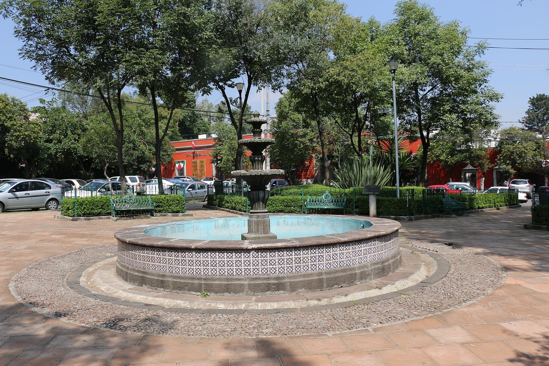
A small plaza with a mint family's entailed house at its head. The lane beside it is the Calle de la Amargura.
- 4
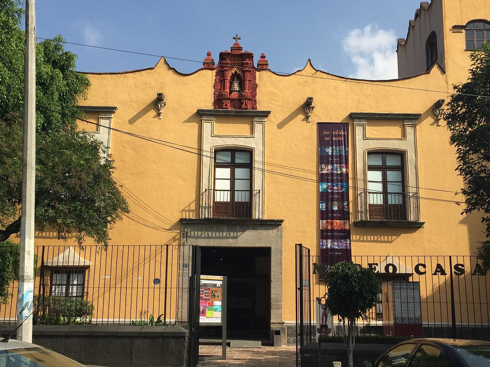
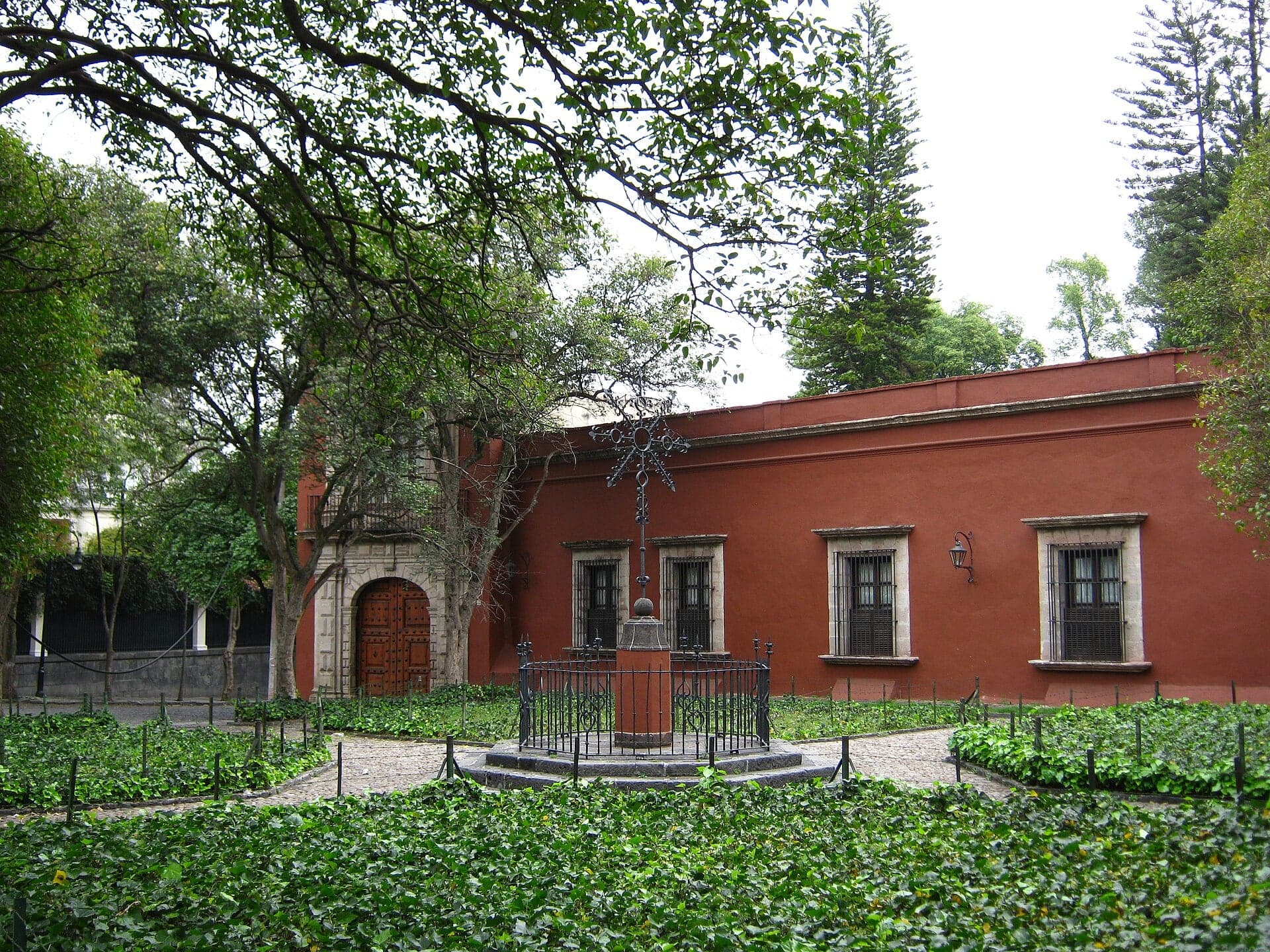
Casa del Risco: A Fountain of Broken China
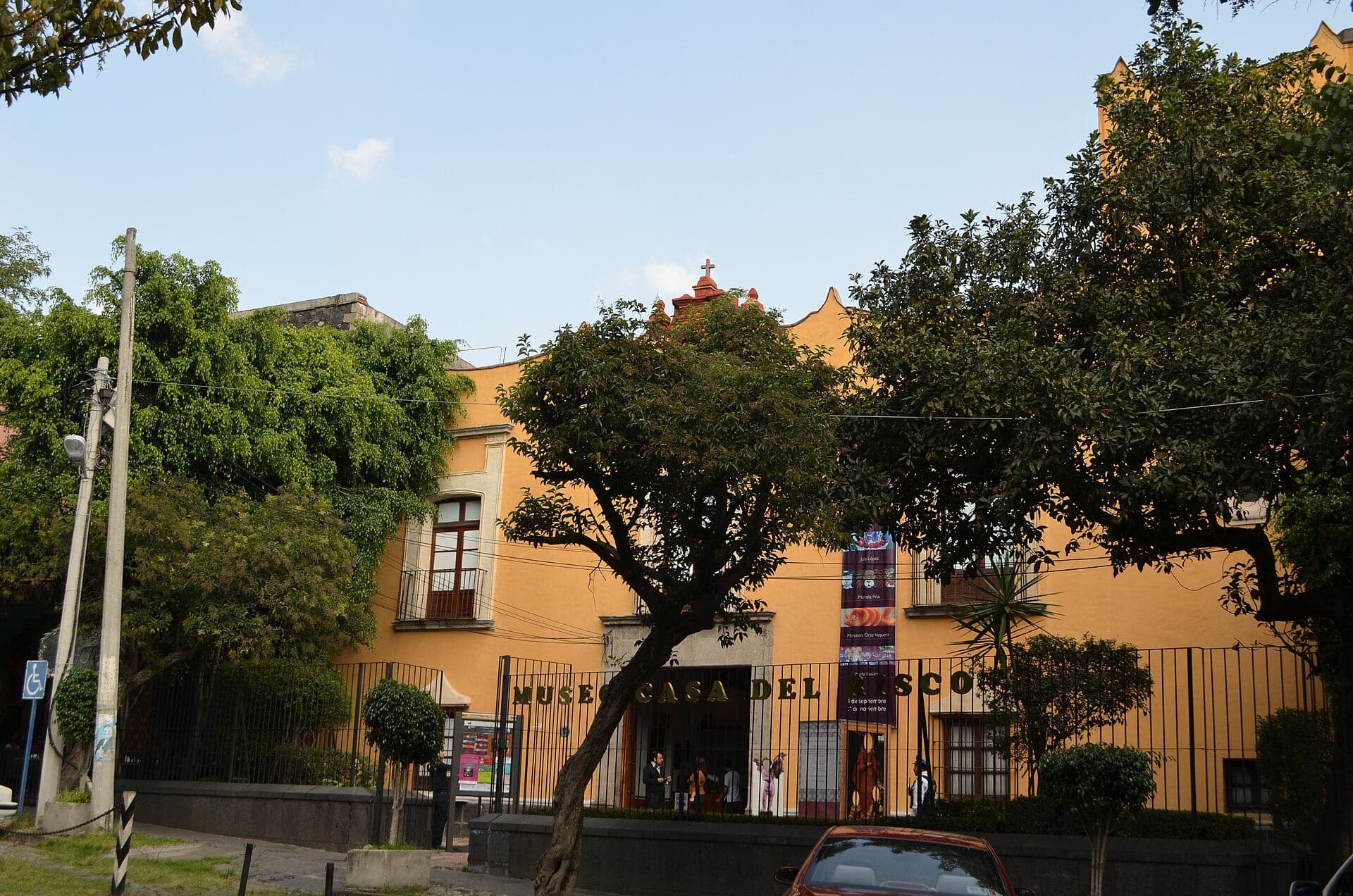
An eighteenth-century house hides a fountain made of broken porcelain. Usually free inside, it was a US Army headquarters in 1847.
- 5
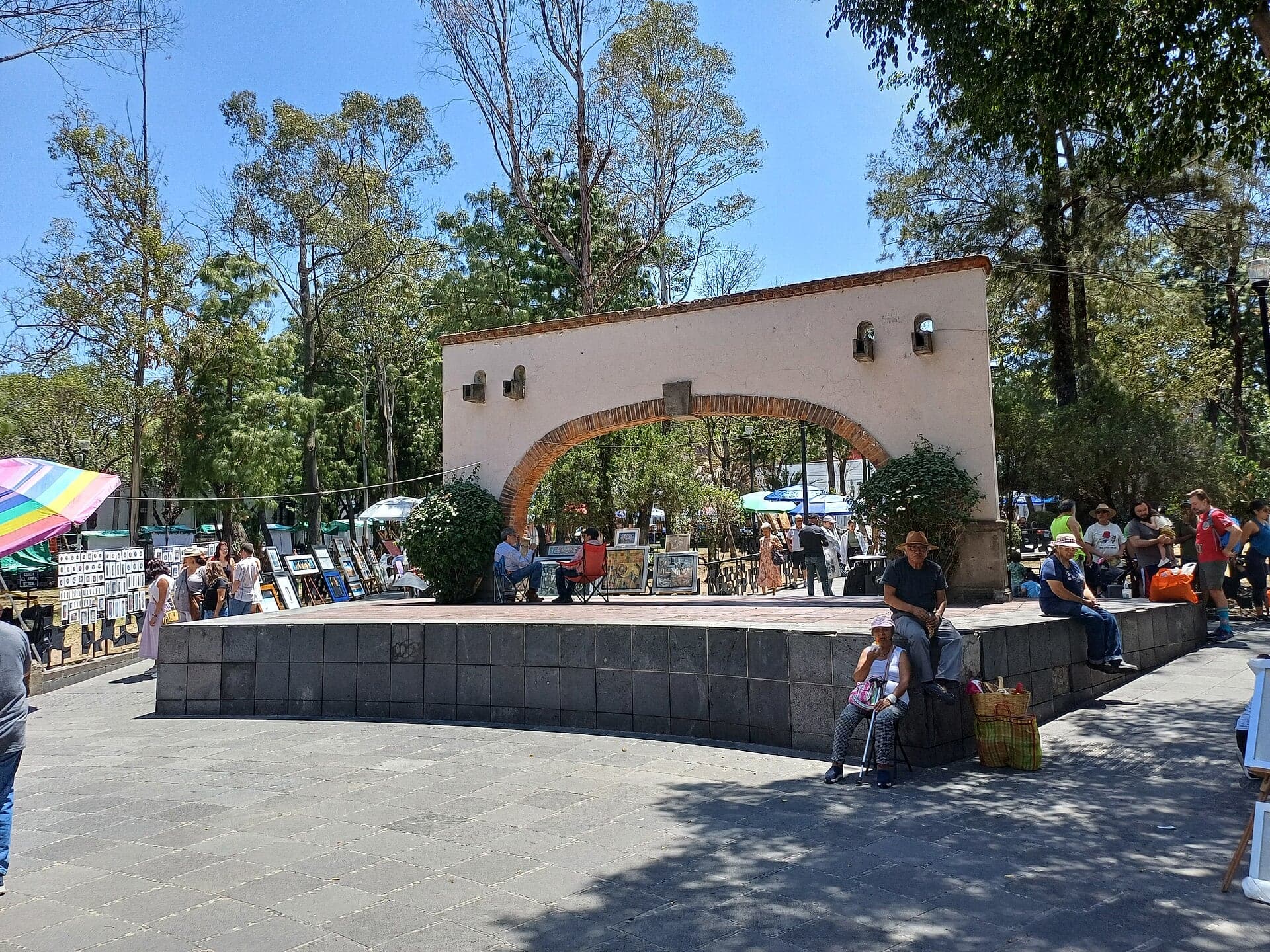
Plaza San Jacinto: Bazaar Day and Two Verdicts
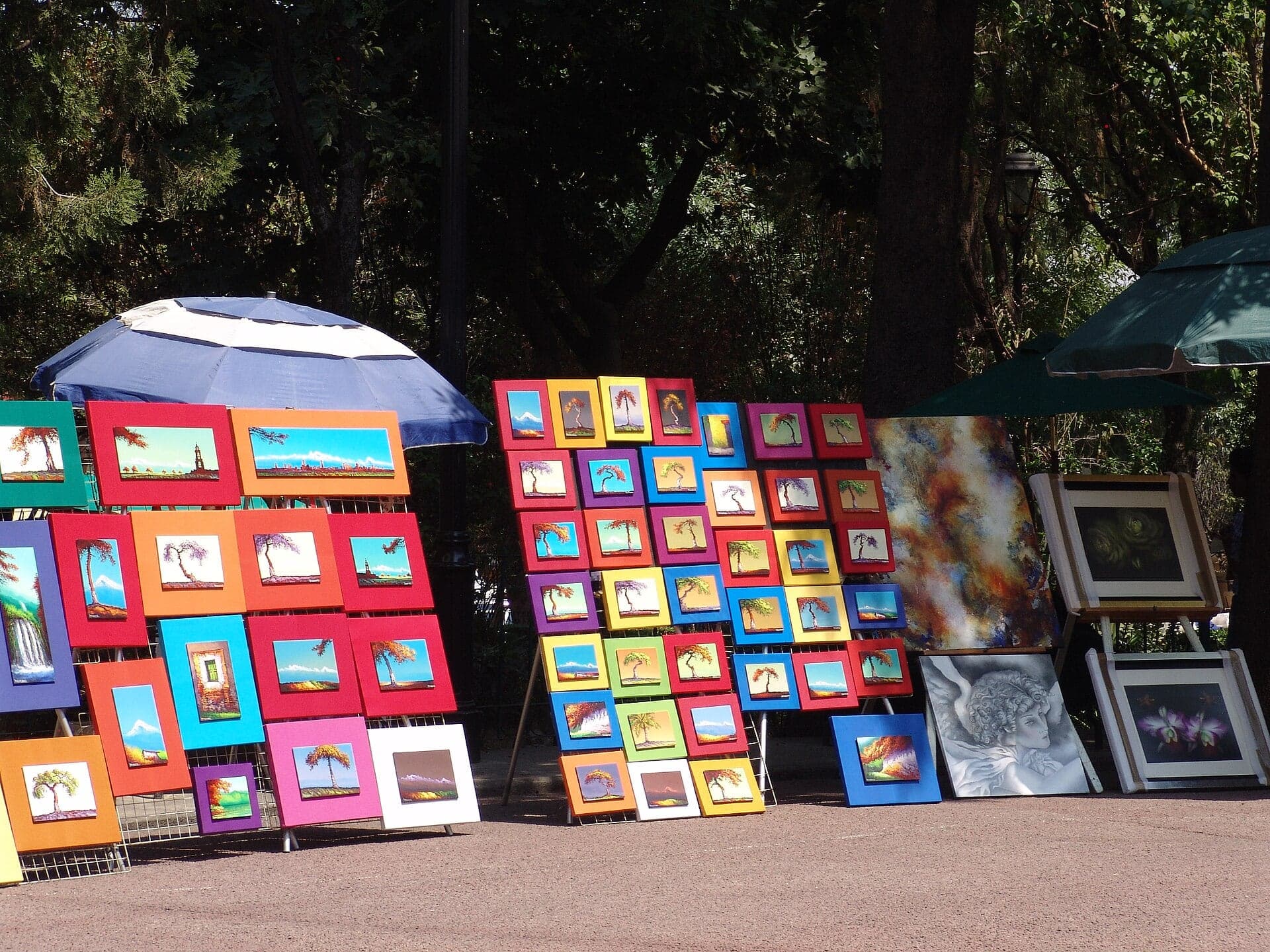
San Ángel's main plaza holds the Saturday bazaar and a memorial. Several soldiers of the San Patricio Battalion were hanged in San Ángel in 1847.
- 6
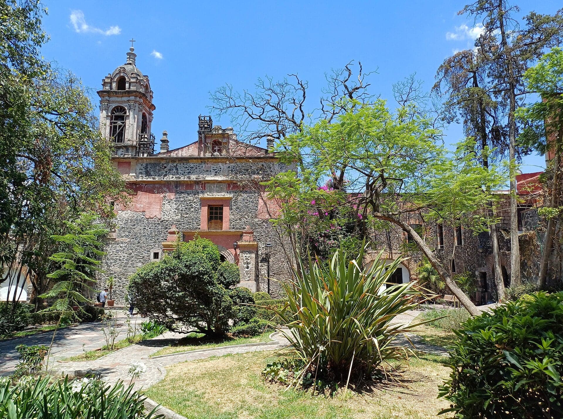
San Jacinto: The Village's First Name
The Dominican church that gave the village its first name. Its front faces a walled garden, away from the plaza.
- 7
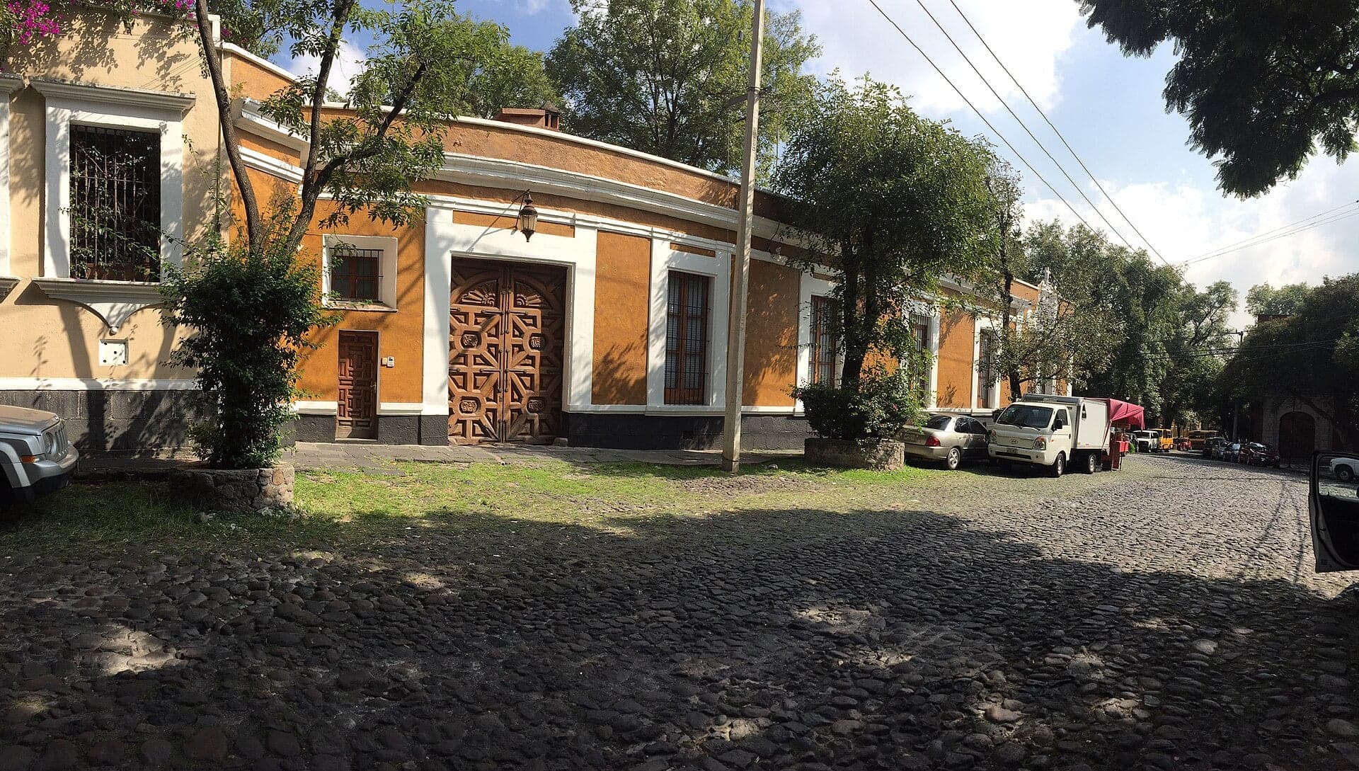
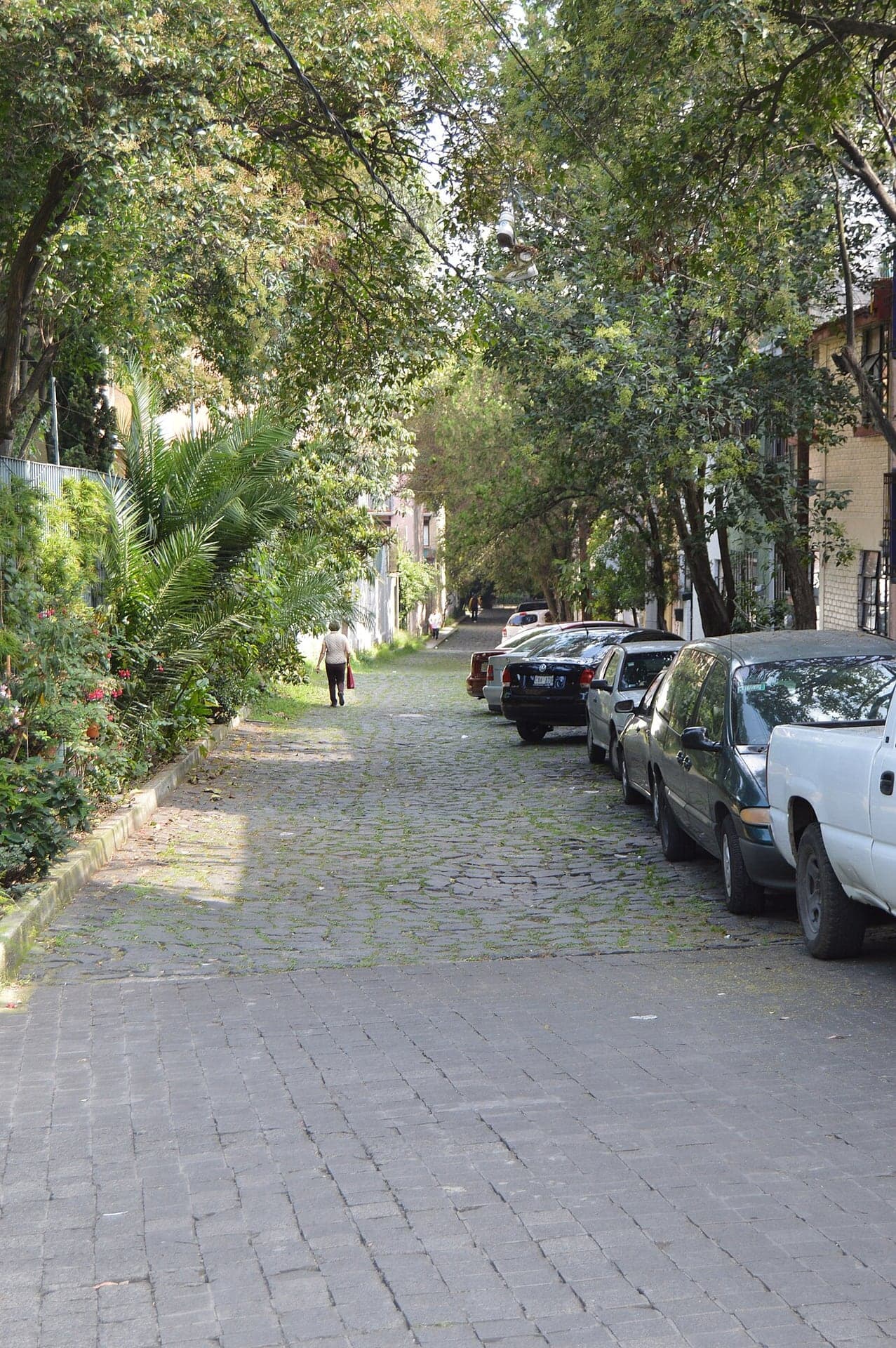
Calle Reina: Walls Around Hidden Gardens
A cobbled lane of high walls with the gardens hidden behind. Private homes, seen from the street.
- 8
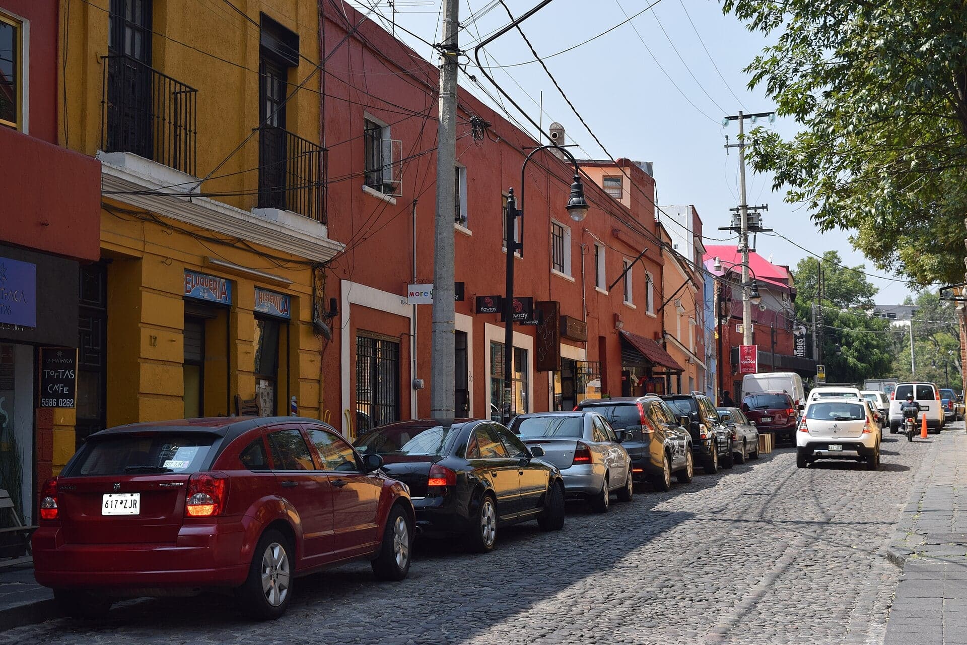
Callejón de la Cita: The Lane of the Rendezvous
The quietest lane on the walk carries an inviting name. The Callejón de la Cita, the Lane of the Rendezvous, meets cobbled Calle Lazcano here.
- 9
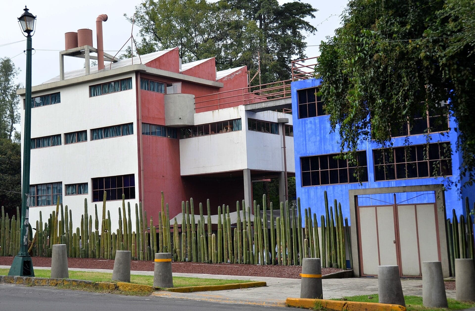
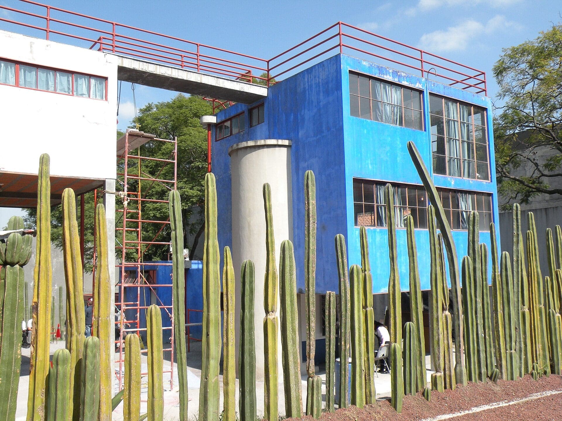
Rivera and Kahlo Studios: Two Concrete Boxes
Juan O'Gorman's concrete houses for Diego Rivera and Frida Kahlo. Built in 1931 to 1932, they are among the first functionalist buildings in Mexico.
- 10
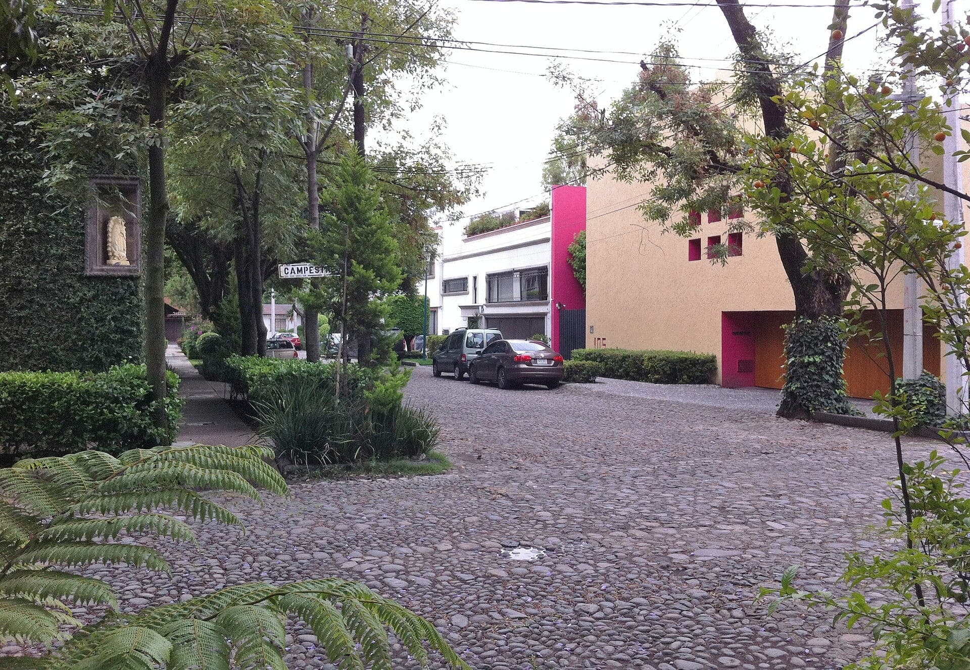
San Ángel Inn: An Orchard Grant of 1616
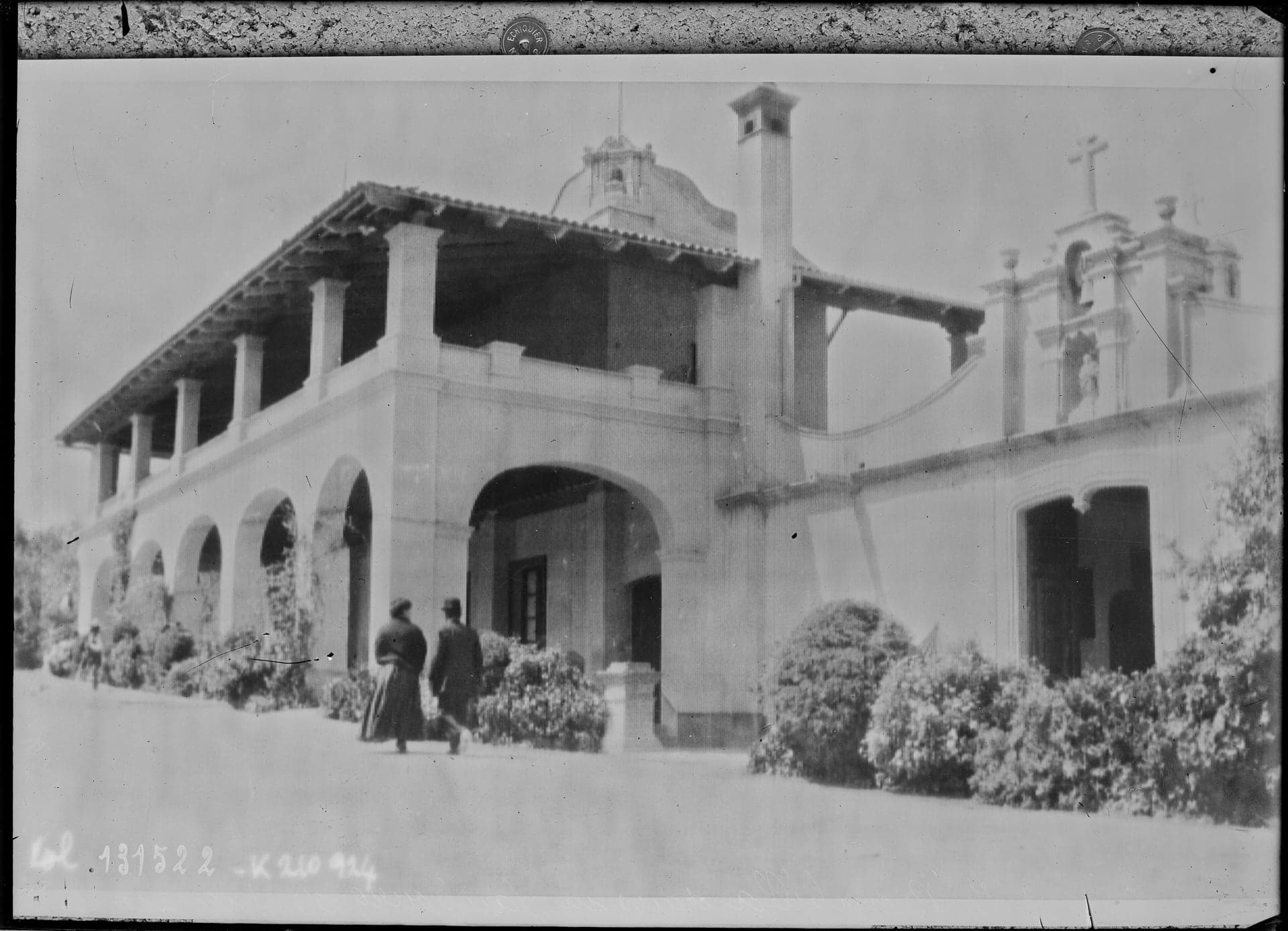
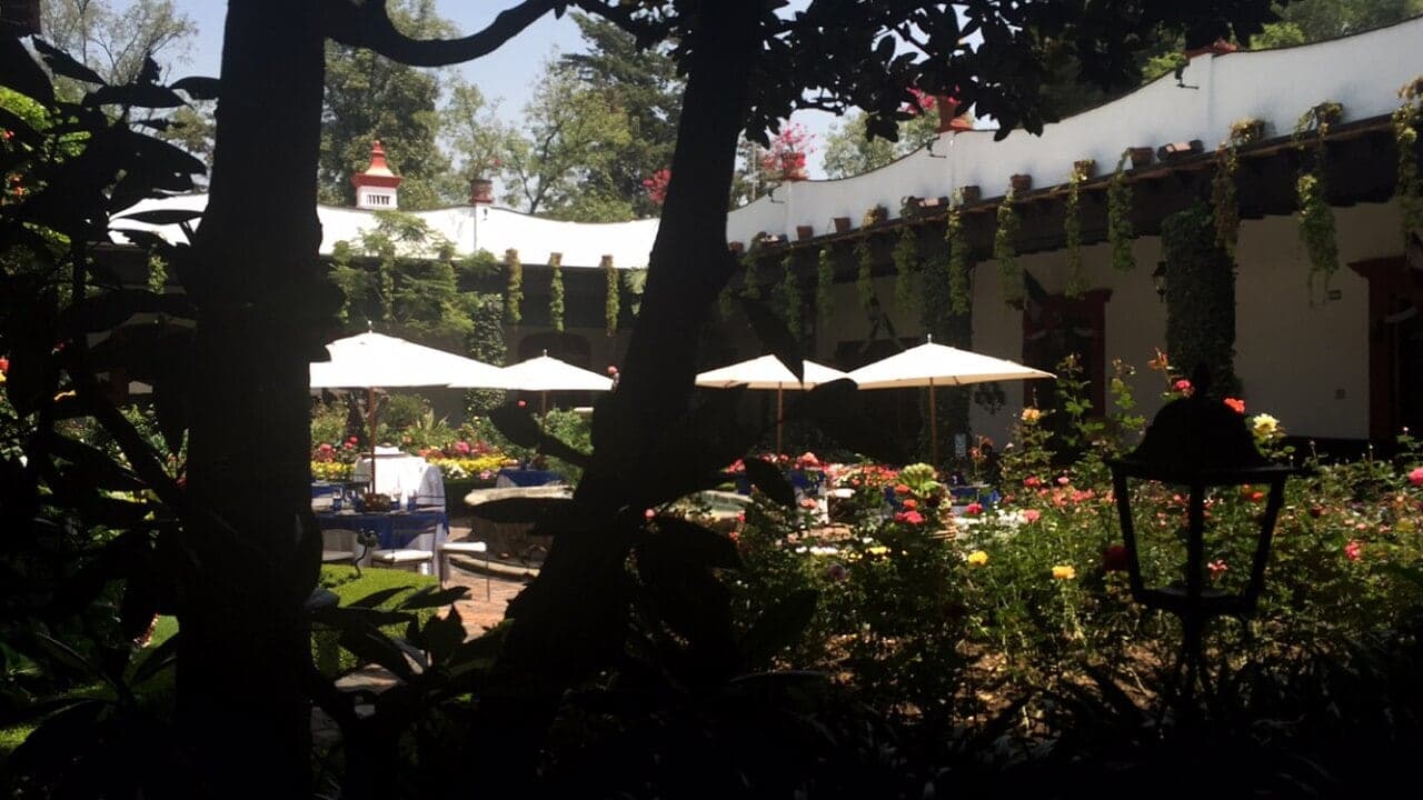
An old hacienda that became a hotel and then a restaurant. Its story runs from a 1616 orchard grant to the land division of 1880.
Details
Best Time to Visit
Saturday, starting around 10 am, when the Bazar del Sábado opens and the art market fills Plaza San Jacinto (expect crowds at stops 4 and 5). Tuesday to Friday is calmer and every museum is open. Sunday the Rivera-Kahlo studios are free for everyone and El Carmen is free for Mexican citizens. Avoid Mondays if you want to go inside: El Carmen, the Casa del Risco and the Rivera-Kahlo studios are all closed (checked 15 October 2026). Walk in daylight.
Pro Tips
- •To reach stop 1, take Metrobús Line 1 (Insurgentes) to La Bombilla station; the monument is a short walk into the park. Metro Barranca del Muerto (Line 7) is the nearest Metro.
- •Museo de El Carmen (INAH): Tuesday to Sunday 10:00 to 17:00, closed Monday; MXN 155 for foreign visitors, MXN 85 for Mexican visitors, Sundays free for Mexican citizens. Checked 15 October 2026.
- •Museo Casa Estudio Diego Rivera y Frida Kahlo (INBAL): Tuesday to Sunday 10:00 to 17:30, closed Monday; MXN 50, free on Sundays for everyone. Checked 15 October 2026.
- •The Casa del Risco is usually free, Tuesday to Sunday 10:00 to 17:00; its official site publishes no general hours, so check before you go (checked 15 October 2026). The fountain is in the courtyard, not visible from the street.
- •The Bazar del Sábado opens on Saturdays only, from 10:00 until 18:00 or 19:00 (sources differ; checked 15 October 2026).
- •Plaza de los Arcángeles, a small hidden square, is a short detour down Calle Árbol from the four-way corner at stop 7.
- •The walk ends at the San Ángel Inn, customers only. The nearest Metrobús is about 1.2 km away; a taxi or ride-hail from Altavista is easiest.
Safety & Precautions
- •Between stops 1 and 2 the route crosses Avenida Insurgentes at the La Bombilla junction, with free-flowing slip lanes; watch for turning traffic. Between stops 2 and 3 it follows Avenida Revolución for a short block, so keep to the pavement, and crosses it at the lights at Avenida de la Paz. Cross only at these junctions.
- •From stop 2 to stop 9 most lanes are rough cobblestones with narrow or no pavements, so you walk in the lane with occasional cars. The route has no steps but is not suitable for strollers or wheelchairs.
- •Avenida Altavista is crossed between stops 8 and 9, at the end of Leandro Valle, with no traffic signal: look both ways.
- •The walled lanes around stops 7 and 8 are very quiet. Walk them in daylight.
- •On Saturdays Plaza San Jacinto and the bazaar are crowded: keep phones and wallets secure.
- •El Carmen and San Jacinto are working churches: do not visit during mass.
- •Mexico City is about 2,240 m above sea level. On your first day, walk slowly and drink water.
- •On Mondays El Carmen's museum, the Casa del Risco and the Rivera-Kahlo studios are closed; every stop still works from the street.
Travel advisory: Exercise Increased Caution (Level 2).
Gallery
Read the walk
The full story of San Ángel: Carmelite Domes, Garden Walls and the O'Gorman Studios, in words. Prefer to listen? Play it narrated, from home or on location.
Introduction
San Ángel, in the south of Mexico City, the capital of Mexico, began as a village around two religious houses. The first friars here were Dominicans, and the place was called San Jacinto. Then, from sixteen fifteen, Carmelite friars built a college with tiled domes and a vast orchard, and the college's name, San Ángel, became the village's name. Its orchards and haciendas later became the walled properties of its cobbled lanes.
This walk starts where a man was shot at breakfast, and ends at two concrete houses that turned their backs on domes, tile and old stone. A few people return along the way: Álvaro Obregón, the revolutionary general killed here in nineteen twenty-eight; and the painters Diego Rivera and Frida Kahlo, with Juan O'Gorman, the architect who built their houses.
There are ten stops over about two point one kilometers, about a mile and a third, taking a little under an hour and a half, longer if you go inside the museums. Mexico City sits about two thousand two hundred and forty meters above sea level, so on a first day it pays to go slowly. Between stops, the high garden walls and the domes over the rooftops are part of the walk too. Saturday, bazaar day, is the liveliest; on Mondays the museums close.
The walk begins at stop one, the Obregón monument in Parque de la Bombilla, near the La Bombilla Metrobús station on Avenida Insurgentes.
1. Obregón Monument: A Tower Built for an Arm
Welcome to San Ángel, and to the first stop on this walk, in Parque de la Bombilla. Find a place on the park path with the tall stone monument in full view. The park is free and always open.
On the seventeenth of July, nineteen twenty-eight, a restaurant called La Bombilla stood on this ground. The guest was Álvaro Obregón, a general of the Mexican Revolution who had already served as president and had just won the election to be president again. Politicians from Guanajuato gave him a celebration breakfast here. A young man, José de León Toral, came up offering to sketch his portrait, and shot him.
In time, Toral was executed. A Capuchin nun known as Madre Conchita was given twenty years as the one who had urged him on. Mexico's human rights commission notes that doubts remained over whether anyone else planned it, and it sees the killing as the end of the age of the caudillos, the revolutionary strongmen. Can one shot close an era?
Now look at the monument: a tall stone tower with a stairway at its center and sculpted figures at its sides, by an architect and a sculptor of the day. The park opened in nineteen thirty-five, seven years after the killing. And the tower was built to hold something. The general had lost his right arm in nineteen fifteen, fighting the forces of Pancho Villa, and the arm was kept in formaldehyde. In nineteen eighty-nine his family took it away and had it cremated. A replica took its place. A monument raised around a relic, and the relic quietly gone: what is the monument for now?
Every seventeenth of July, the borough that carries Obregón's name holds a ceremony here.
Follow the route across Avenida Insurgentes at the big junction, watching for turning traffic, then along Avenida de la Paz and down a short side street to El Carmen.
2. El Carmen: The College That Named the Village
Walk on to cobbled Calle Monasterio, beside the old convent wall, and stop at its corner with Avenida Revolución.
This is El Carmen. Its museum, in the old college, charges a hundred and fifty-five pesos for foreign visitors and is closed on Mondays; it is run by Mexico's national institute of anthropology and history. The church is a working church, usually open, so keep quiet if a mass is on. The details are on this stop's card.
Look up over the walls for the domes, faced in glazed tile. From sixteen fifteen, Discalced Carmelite friars built this as the Colegio de San Ángelo Mártir, a college to train their priests. The man who designed it and ran the works was a friar, Andrés de San Miguel. The story goes that he had been a sailor, and took his vows after surviving a shipwreck.
Then the college renamed a village. The community here had been called San Jacinto Tenanitla. The college's name, San Ángel, replaced it, and it is the name on every sign around you.
The friars lived partly off their orchard, more than thirteen thousand fruit trees. Those orchards are now the neighborhood of Chimalistac, across Avenida Insurgentes. Inside, the cloisters were kept low and plain, as a sign of austerity, while one room keeps seventeenth-century tile work under a vault of crossed arches. In the crypt lie twelve mummified bodies, found in nineteen sixteen, friars and benefactors of the old convent.
The college became a museum and was declared a monument in nineteen thirty-two. Three years later a fire destroyed a chapel beside the church, with its paintings and gilded altarpieces.
Keep those tiled domes in mind. Near the end of the walk you will meet buildings that want nothing to do with them.
Follow the route up Revolución on the pavement to the lights, cross there, and walk on to a small plaza.
3. Plaza del Carmen: The Mint Family's House
Walk on past the end of Plaza del Carmen, along the short lane beyond it, and stop facing the large house at its head.
The plaza is free and open, and the house is private. It is known as the Casa del Mayorazgo de Fagoaga. A mayorazgo was an entailed estate: property bound to pass whole to a single heir, so that a family fortune could not be split up. The Fagoagas were a family tied to the Real Casa de Moneda, the royal mint of the colonial capital.
Think about what that means out here. This was a friars' village outside the city, with an orchard and two convents. Yet money made at the capital's mint was building houses in it. At the next stop you will see another, bought by an officer of the same mint. Why would the colonial elite want a second house in a village like this?
Look at the front of the house, at how little a wall like this lets you see of what lies behind it. That is a habit you will meet again and again in San Ángel.
The lane that leaves the plaza at the house is the Calle de la Amargura. The word amargura means bitterness, and the neighborhood tells sad stories about it. Which came first, do you think, the name or the stories?
Follow the route back along the lane, down the side of the plaza and along Madero to Plaza San Jacinto.
4. Casa del Risco: A Fountain of Broken China
Walk on along Calle San Jacinto and stop at the door of the Casa del Risco, on the plaza. This house is a museum, and entry is usually free, Tuesday to Sunday; it is closed on Mondays, so check before you go. The details are on this stop's card. Its treasure is in the…
Full narration for this stop unlocks with the tour.
5. Plaza San Jacinto: Bazaar Day and Two Verdicts
Walk on to the corner of the plaza where Calle San Jacinto meets Benito Juárez, and stop by the house of the Bazar del Sábado. The plaza is free and always open. The Bazar del Sábado, the Saturday bazaar, opens only on Saturdays, from ten until early evening, and it is free to…
Full narration for this stop unlocks with the tour.
6. San Jacinto: The Village's First Name
Walk on along Benito Juárez and stop at the gate of the churchyard garden, with the front of the church across it. This is the church of San Jacinto. It is a working church, free and usually open; if a mass is on, keep it to a look from the gate. The details are on this stop's…
Full narration for this stop unlocks with the tour.
7. Calle Reina: Walls Around Hidden Gardens
Walk on a little way up Calle Reina, past the corner where four cobbled lanes meet, and stop there. Nothing here is a museum or open to visitors. These are private homes, and the stop is the lane itself. Look down first. These are rough cobbles, uncut stones set into the…
Full narration for this stop unlocks with the tour.
8. Callejón de la Cita: The Lane of the Rendezvous
Walk on along Calle Lazcano and stop where a narrow lane, the Callejón de la Cita, joins it. This is the quietest part of the walk: a single lane of cobbles, high walls on both sides, and very little traffic. The lanes are public, and there is nothing to pay for. The name is a…
Full narration for this stop unlocks with the tour.
9. Rivera and Kahlo Studios: Two Concrete Boxes
Walk on up Calle Diego Rivera to where it forks, and stop by two boxy houses, one red and white, one blue. This is the house and studio museum of Diego Rivera and Frida Kahlo. General entry is fifty pesos, free on Sundays for everyone, and it is closed on Mondays; it is run by…
Full narration for this stop unlocks with the tour.
10. San Ángel Inn: An Orchard Grant of 1616
Walk on along Calle Diego Rivera and stop by the walls of the San Ángel Inn. This is a restaurant, for customers only, but its walls are on the street, and anyone can stop for a look, or go in for a drink. This one property holds the story of San Ángel. In sixteen sixteen a…
Full narration for this stop unlocks with the tour.
- Vista del Monumento a Álvaro Obregón desde la esquina norte. El Monumento se encuentra dentro del Parque de la Bombilla en la Colonia San Án — Matrodgian, CC BY-SA 4.0 · source
- This is a photo of a monument in Mexico, identified by ID — Santa Rosarios55, CC BY-SA 4.0 · source
- Ancient cross - Patio of the Church of the Virgin of El Carmen, San Angel - Mexico — José Luiz, CC BY-SA 4.0 · source
- Casa del Mayorazgo de Fagoaga en San Ángel — Mario Yaír TS, CC BY-SA 4.0 · source
- Esta fuente se encuentra en el centro de la Plaza del Carmen, la cual está ubicada, al norte con la calle Amargura; al sur con Francisco I. — Mariana Vspno, CC BY-SA 4.0 · source
- Fachada de la entrada al Museo Casa del Risco, también conocido como Centro Cultural Isidro Fabela frente a la Plaza San Jacinto en el centr — Karina Anaya, CC BY-SA 4.0 · source
- Zdjęcie przedstawia jedną z najważniejszych rezydencji znajdujących się w San Ángel, dzielnicy Miasta Meksyk. Aktualnie znajduje się tam muz — Karolala2, CC BY-SA 4.0 · source
- Plaza San Jacinto, San Ángel - Mexico — José Luiz, CC BY-SA 4.0 · source
- Fotografías del "Bazar del Sábado". Distrito Federal, Colonia San Ángel, Álvaro Obregón. — Inakiherrasti, CC BY-SA 3.0 · source
- San Jacinto, San Ángel - Mexico — José Luiz, CC BY-SA 4.0 · source
- San Jacinto, San Ángel - Mexico — José Luiz, CC BY-SA 4.0 · source
- Foto panorámica de la casa de los marqueses de la Selva Nevada, donde se puede observar los detalles de la arquitectura del periodo neoclási — Viriroldan, CC BY-SA 4.0 · source
- Placita en Juarez y Arbol — Carlos Perez Chavez, CC BY-SA 3.0 · source
- En la foto, se puede observar la típica calle empedrada de la zona, con sus coloridos locales que ofrecen diferentes productos y servicios. — Reginaesc, CC BY-SA 4.0 · source
- Esta es una calle de la colonia de San Ángel, misma que muestra el tipo de calles que se encuentran en la misma colonia; la mayoría son empe — Pama001, CC BY-SA 4.0 · source
- This is a photo of a monument in Mexico, identified by ID — CNOVIO, CC BY-SA 3.0 · source
- El Museo Casa Estudio Diego Rivera y Frida Kahlo tiene un muro de cactus desde la vista sobre la avenida Altavista, en la delegación Alvaro — Lirva Vallens, CC BY-SA 4.0 · source
- San Ángel Inn neighbourhood, in the south of Mexico City — Francisco Peláez, CC BY-SA 3.0 · source
- Vista del restaurante al aire libre que se encuentra en el patio interior de la hacienda San Ángel Inn. Este restaurante se encuentra poco d — Cristina Portella, CC BY-SA 4.0 · source
Images may be cropped or resized. Other photos via Unsplash and Pexels.